Netherlands Maps
to
4,199
5,130
5,520
197
5,129
1
2,838
1,984
307
1
179
6
68
3
3
3
2
5,124
9
7
2
1
427
174
89
78
47
5,130
5,130
5,130
104
58
20
14
13
Item Ships From: Netherlands
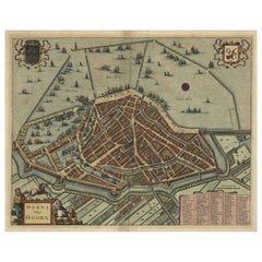
Original Antique Bird's Eye View Plan of Hoorn, The Netherlands by Blaeu, c.1700
Located in Langweer, NL
Antique map titled 'Horna vulgo Hoorn'.
Bird's eye view plan of Hoorn, The Netherlands. With title cartouche, coats of arms and key. From an atlas published by De Wit, ca. 1698-1...
Category
Early 1700s Antique Netherlands Maps
Materials
Paper
$897 Sale Price
20% Off
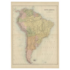
Antique Map of South America by A & C. Black, 1870
Located in Langweer, NL
Antique map titled 'South America'. Original antique map of Map of South America. This map originates from ‘Black's General Atlas of The World’. Published by A & C. Black, 1870.
Category
Late 19th Century Antique Netherlands Maps
Materials
Paper
$262 Sale Price
20% Off
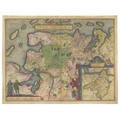
Map of East Frisian Islands & Northwestern Tip of Germany, Ostfriesland, c.1595
Located in Langweer, NL
Antique map titled 'Frisia Orientalis'. Beautiful map of east Frisian islands and the northwestern tip of Germany, Ostfriesland. With people in local costumes. Ornamented inset of the Eems estuary. Based on a manuscript map...
Category
16th Century Antique Netherlands Maps
Materials
Paper
$1,671 Sale Price
20% Off
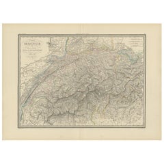
Antique Map of Switzerland by Lapie, 1842
Located in Langweer, NL
Antique map titled 'Carte de la Suisse ou Helvetie'. Map of Switzerland. This map originates from 'Atlas universel de géographie ancienne et moderne...
Category
Mid-19th Century Antique Netherlands Maps
Materials
Paper
$477 Sale Price
20% Off
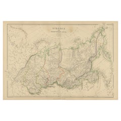
Antique Map of Siberia, Russia, 1859
Located in Langweer, NL
Antique map titled 'Siberia or Northern Asia'. Original antique map of Siberia or Northern Asia. This map originates from ‘The Imperial Atlas of Modern Geography’. Published by W. G....
Category
Mid-19th Century Antique Netherlands Maps
Materials
Paper
$238 Sale Price
20% Off
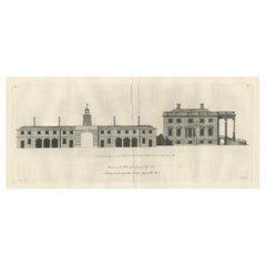
Antique Print of the Residence of Sir Gregory Page by Miller, c.1770
Located in Langweer, NL
Antique print titled 'Elevation of the Flank of Sir Gregory Page'. Architectural elevation of the residence of Sir Gregory Page.
Sir Gre...
Category
18th Century Antique Netherlands Maps
Materials
Paper
$716 Sale Price
20% Off
Cartographic Survey of Pontevedra, 1902: Crossroads of Galicia"
Located in Langweer, NL
This original old map of over 100 years old depicts the province of Pontevedra as it was in 1902. Pontevedra is located in the northwest of Spain, in the autonomous community of Galicia. This coastal province is bordered by the Atlantic Ocean to the west and Portugal to the south. It is a region known for its rugged coastline, which includes the famous Rías Baixas, a series of four estuarine inlets that are known for their scenic beauty, beaches, and seafood. The interior of the province is characterized by a hilly landscape that gradually rises from the coast to the interior.
Pontevedra's capital, which shares the same name, is renowned for its well-preserved old town, rich medieval history, and the iconic Sanctuary of the Pilgrim Virgin...
Category
Early 1900s Antique Netherlands Maps
Materials
Paper
$305 Sale Price
20% Off
Antique Map of South America by Reichard, 1820
By Thomas Kitchin
Located in Langweer, NL
Antique map titled 'Süd America'. Decorative antique map of South America with an inset map of Ecuador. Artists and Engravers: Published b...
Category
19th Century Antique Netherlands Maps
Materials
Paper
$83 Sale Price
20% Off
Striking Antique Map Centered on the Malay Peninsula
By Pieter Van Der Aa
Located in Langweer, NL
Antique map titled 'D'Indiaanze Landschappen Zeen en Eylanden, van Couchin af tot in de Moluccos (...)'. Striking map of the region from the Philippines and Formosa to India and the ...
Category
Early 18th Century Antique Netherlands Maps
Materials
Paper
$1,146 Sale Price
20% Off
Antique Map of Germany, the Netherlands, Bohemia, Bavaria and Switzerland, 1785
Located in Langweer, NL
Antique map titled 'Germany and the Netherlands from the latest authorities'. Depicts Germany, the Netherlands and the surrounding region including Bohemia, Bavaria, and Switzerland....
Category
18th Century Antique Netherlands Maps
Materials
Paper
$133 Sale Price
20% Off
Old Print of a Peasant of Hermannstadt 'Sibiu', Transylvania, 1804
Located in Langweer, NL
Old print of a peasant of the neighbourhood of Hermannstadt (Sibiu), Transylvania.
This print originates from 'The Costume of the Hereditary States of the House of Austria' by William Miller.
Artists and Engravers: Engraved by William Ellis.
Category
Early 1800s Antique Netherlands Maps
Materials
Paper
$248 Sale Price
20% Off
17th-Century Original Antique Map of Hunan and Hubei Provinces, China – by Blaeu
Located in Langweer, NL
Title: 17th-Century Antique Map of Hunan and Hubei Provinces, China – "Hvqvang" by Blaeu, Richly Detailed and Illustrated
Description: This beautiful 17th-century map of the regions that now comprise Hunan and Hubei Provinces, historically referred to as "Hvqvang," was created by Johannes Blaeu and published in 1655 as part of the *Novus Atlas Sinensis*. This map, drawn with input from Jesuit missionary Martino Martini, provides a meticulous representation of central China’s geography, capturing its rivers, towns, and mountainous terrain.
The Yangtze River (Changjiang) is prominently featured, emphasizing the region’s importance as a vital waterway for trade and transportation. Wuhan, now a modern metropolis, and Changsha, the capital of Hunan Province, were historically significant cities that appear on the map. The area is also notable for its fertile lands and contributions to China’s agricultural prosperity, particularly in rice and tea production.
The decorative cartouche in the lower-right corner features two figures in traditional Chinese attire standing amid bamboo, symbolizing the cultural and natural richness of the region. Blaeu’s map combines precision and artistry, with vibrant hand-coloring distinguishing boundaries and geographical features. The copperplate engraving ensures fine detail, making this map a remarkable historical artifact.
Condition: Near excellent. Clean impression with vivid hand-coloring. Wide margins with minor age-toning appropriate for its age.
Framing Tips: Use a neutral double mat and a gilt or dark wood frame to enhance the presentation. UV-protective glass is recommended to preserve the vivid hand-coloring and intricate engraving details.
Hunan and Hubei, historically referred to as "Hvqvang," are known for their strategic location along the Yangtze River and their cultural and economic significance in Chinese history. The region’s fertile lands have supported extensive rice cultivation, earning it the title of one of China’s "breadbaskets." Hubei, with Wuhan at its center, has long been a hub of transportation and trade, owing to the convergence of the Yangtze and Han Rivers. Hunan, with Changsha as its capital, is known for its rich cultural heritage and contributions to Chinese literature and art.
Important places in the region include Wuhan, an ancient trade center, and Changsha, known for its historical sites and cultural prominence. The Yangtze River, a key feature on the map, highlights the region’s historical importance as a major waterway for commerce and agriculture. Other notable features include Dongting Lake, a vital ecological and cultural landmark, and the surrounding mountainous areas that have shaped the region’s history and development.
Keywords: antique map of Hunan, Hubei map, Hvqvang map, Yangtze River map, 17th-century Chinese map...
Category
1650s Antique Netherlands Maps
Materials
Paper
Pl. 9 Antique Map of the Air Movement of the United States by Walker '1874'
Located in Langweer, NL
Antique map titled 'U.S. Signal Service chart, showing annual means of barometer and total movement of air with resultants from June 1872 to May 1873 inclusive. Compiled from data co...
Category
Late 19th Century Antique Netherlands Maps
Materials
Paper
$477 Sale Price
20% Off
Hand Colored Antique Map of the Department of Haute Loire, France
By Victor Levasseur
Located in Langweer, NL
Antique map titled 'Dept. de la Haute Loire'. Map of the French department of Haute Loire, France. This area of France is part of the Loire Valley wine growing...
Category
Mid-19th Century Antique Netherlands Maps
Materials
Paper
$324 Sale Price
20% Off
Large Antique County Map of North Wales, England
Located in Langweer, NL
Antique map titled 'A Map of North Wales from the best Authorities'. Original old county map of North Wales, England. Engraved by John Cary. Originates from 'New British Atlas' by Jo...
Category
Early 19th Century Antique Netherlands Maps
Materials
Paper
$171 Sale Price
20% Off
Huelva 1901: A Cartographic Presentation of Andalusia's Atlantic Frontier
Located in Langweer, NL
The map displays the province of Huelva, located in the southwestern part of the autonomous community of Andalusia in Spain, as of the year 1901. It outlines various geographic and m...
Category
Early 1900s Antique Netherlands Maps
Materials
Paper
$343 Sale Price
20% Off
Antique Map of the World by A. Vuillemin, 1854
By Victor Levasseur
Located in Langweer, NL
This map originates from ‘Atlas National de la France Illustré’. Published by A. Combette, Paris, 1854.
Category
Mid-19th Century Antique Netherlands Maps
Materials
Paper
$335 Sale Price
25% Off
Detailed Original Antique Map of the Region of Rome in Italy, c.1870
By Heinrich Kiepert
Located in Langweer, NL
Antique map titled 'Roma Urbs'. Old map of Italy, it shows three inset maps of the region of Rome. This map originates from 'Atlas Antiquus, twaalf k...
Category
19th Century Antique Netherlands Maps
Materials
Paper
Pavillon de la Grande Tuilerie – French Architectural Lithograph, La Brique
Located in Langweer, NL
Pavillon de la Grande Tuilerie – French Architectural Lithograph, La Brique
This striking antique architectural lithograph shows the pavilion of the Grande Tuilerie de Bourgogne (Mo...
Category
20th Century French Netherlands Maps
Materials
Paper
Antique Map of Germany by Balbi '1847'
Located in Langweer, NL
Antique map titled 'Allemagne'. Original antique map of Germany. This map originates from 'Abrégé de Géographie (..)' by Adrien Balbi. Published...
Category
Mid-19th Century Antique Netherlands Maps
Materials
Paper
$143 Sale Price
20% Off
Rare Old Map of the City of Stavoren, Friesland, the Netherlands, 1616
Located in Langweer, NL
Antique map titled 'Staveren'.
Old map of the city of Stavoren, Friesland. This map originates from 'Rerum Frisicarum Historia' by U. Emmius.
Artists and Engravers: Nicolaes ...
Category
1610s Antique Netherlands Maps
Materials
Paper
$811 Sale Price
20% Off
1692 Jacq. Peeters Map: East Indies, Indonesia, Japan, Philippines and Singapore
Located in Langweer, NL
1692 Jacques Peeters Map: East Indies, Indonesia & Japan with Unique Inset
This hand-colored map from 1692, created by Jacques Peeters, captures the islands of Indonesia, the Philippines, and features a unique inset of Japan.
It closely resembles Nicolas de Fer's map and is primarily based on Sanson's influential maps. The map meticulously details cities, smaller settlements, rivers, mountain chains, and forests, offering a comprehensive view of the region's geography.
The inset map of Japan stands out due to its distinctive shape and influences, reflecting different cartographic sources. Notable features include the marked equator and detailed latitude and longitude indications on the borders.
The map measures 6.5 inches in width by 5.5 inches in height and is in excellent condition, with a dark impression, slight toning, and a minor centerfold crease.
Keywords:
- East Indies map
- Indonesia historical map
- Philippines map...
Category
1690s Antique Netherlands Maps
Materials
Paper
$630 Sale Price
20% Off
Old Map of Ancient Times covering Egypt Towards Arabia and India to Java, c.1660
Located in Langweer, NL
Description: Antique map titled 'Erythraei Sive Rubri Maris Periplus olim ab arriano descriptus nunc vero ab abrah ortelio ex eodem delineatus'. Map of the Indian Ocean, or Erythraea...
Category
1660s Antique Netherlands Maps
Materials
Paper
$1,050 Sale Price
20% Off
Antique Coastal Map of West Sumatra 'Indonesia' by J. Mannevillette, 1745
Located in Langweer, NL
Antique map titled 'Carte de la côte occidentale de l'isle Sumatra depuis la ligne équinoctiale jusqu'au détroit de la Sonde'. Beautiful coastal map of We...
Category
Mid-18th Century Antique Netherlands Maps
Materials
Paper
$472 Sale Price
20% Off
Dutch Antique Map of the West Coast of Africa, to the Cape of Good Hope, 1747
Located in Langweer, NL
Antique map of the Coast of Africa titled 'Kaart van de West Kust van Afrika (..)'.
Map of the west coast of Africa, from 11 degrees south latitude to the Cape of Good Hope. This...
Category
1740s Antique Netherlands Maps
Materials
Paper
$371 Sale Price
20% Off
Beautiful Old Map of Spain and Portugal With Decorative Title Cartouche, ca.1740
Located in Langweer, NL
Antique map Spain titled 'L’Espagne dressée sur la Description qui en a eté faite par Rodrigo Mendez Sylva (..)'.
Beautiful map of Spain with dec...
Category
1740s Antique Netherlands Maps
Materials
Paper
$1,146 Sale Price
20% Off
Antique Map of the Middle East by Mortier, 1700
Located in Langweer, NL
Antique map titled 'Carte de la Situation du Paradis Terrestre (..)'. Detailed map of the Holy Land and the Middle East, centered on the Garden of Eden and including a large Cyprus. ...
Category
18th Century Antique Netherlands Maps
Materials
Paper
$229 Sale Price
20% Off
Antique Plan of Aigues-Mortes, France
Located in Langweer, NL
Antique map titled 'Plan d'Aiguesmortes et environs'. Original plan of the region of Aigues-Mortes, France. This map originates from 'Le Petit Atlas Maritime (..)' by J.N. Bellin. Pu...
Category
Mid-18th Century Antique Netherlands Maps
Materials
Paper
$324 Sale Price
20% Off
Antique Map of France by Lowry, '1852'
Located in Langweer, NL
Antique map titled 'France in Provinces'. Original map of France. This map originates from 'Lowry's Table Atlas constructed and engraved from the most recent Authorities' by J.W. Low...
Category
Mid-19th Century Antique Netherlands Maps
Materials
Paper
$95 Sale Price
20% Off
Large Title Cartouche and a View of Wilhermsdorf, Beieren, Germany, 1744
Located in Langweer, NL
Antique print titled 'Sauber und nach dem Leben gezeichnete Prospecten und Plans, von den wichtigsten der Holländisch-Ost-Indischen-Compagnie in Africa u: Asia (..)'. Frontispiece of...
Category
1740s Antique Netherlands Maps
Materials
Paper
$276 Sale Price
20% Off
Antique Map of the British Isles by H. Chatelain, 1719
By Henri-Abraham Chatelain
Located in Langweer, NL
Beautiful hand colored large format map of the British Isles, with large insets of the Eastern and Western Hemispheres and the coats of arms for Engl...
Category
Early 18th Century Antique Netherlands Maps
Materials
Paper
$716 Sale Price
20% Off
Detailed Map of Friesland, Groningen and Drenthe, The Netherlands, 1706
Located in Langweer, NL
Antique map tited 'Frisiae Dominium vernacule Friesland verdeeld met de hoofd-deelen van Oostergoo, Westergoo en Sevenwolden (..)'. Detailed map of Friesland, Groningen and Drenthe, ...
Category
18th Century Antique Netherlands Maps
Materials
Paper
$907 Sale Price
20% Off
Antique Map of the Eastern United States with Only the Northern Part of Florida
Located in Langweer, NL
Antique map titled 'Verein-Staaten von Nord-America mit Ausnahme Florida's und der Westlichen Territorien'. This map extends as far west as Louisiana and only includes the northern p...
Category
Mid-19th Century Antique Netherlands Maps
Materials
Paper
$783 Sale Price
20% Off
Rare Theodore Danckerts Map of the Lower Rhine and Moselle River Regions
Located in Langweer, NL
Original antique map titled 'Accuratissima Rheni Inferioris Mosae et Mosellae Tabula'. Rare Theodore Danckerts map of the Lower Rhine and Moselle River Regions. The map covers the lo...
Category
Early 18th Century Antique Netherlands Maps
Materials
Paper
$2,101 Sale Price
20% Off
A Catalonian Cartographic Depiction of Tarragona Province, 1901
Located in Langweer, NL
This image depicts a historical map of the province of Tarragona, which is in the northeastern part of Spain, within the autonomous community of Catalonia. The map is dated 1901, sug...
Category
Early 1900s European Antique Netherlands Maps
Materials
Paper
$292 Sale Price
50% Off
Great Antique Bird's-Eye View Plan of Brielle by Blaeu in The Netherlands, 1649
Located in Langweer, NL
Antique print, titled: 'Briela.'
Bird's-eye view plan of Brielle in The Netherlands. With key to locations and coats of arms. Text in Dutch on verso. This plan originates from the famous city Atlas: 'Toneel der Steeden' published by Joan Blaeu...
Category
1640s Antique Netherlands Maps
Materials
Paper
$1,193 Sale Price
20% Off
Antique Map of South America with inset of the Quito Highlands, Hand-Colored
Located in Langweer, NL
Antique map titled 'Zuid-Amerika'. Original antique map of South America including Brazil, Peru, Colombia, Ecuador, Venezuela, Guyana, Bolivia, Paraguay, Uruguay, Chile, Argentina. Inset map of the mountains of Quito. Published by Otto Petri...
Category
Mid-19th Century Antique Netherlands Maps
Materials
Paper
$171 Sale Price
20% Off
Original Old Map of Leeuwarden, European Cultural Capital 2018, Holland, 1649
Located in Langweer, NL
Antique print, titled: 'Leoverdia.'
This map shows Leoverdia (Leeuwarden). Bird's-eye view plan of Leeuwarden in The Netherlands, with key to locations and coats of arms. Text in...
Category
1640s Antique Netherlands Maps
Materials
Paper
$1,289 Sale Price
20% Off
Original Old China Map, From Korea and the Sea of Japan to Teypin Island, 1803
Located in Langweer, NL
Antique map titled 'China, Contains 15 Subject Provinces Including the 2 Islands of Hainan, Formosa and the Tributary Kingdoms of Corea, Tonkin'.
Old map depicting China, extendi...
Category
Early 1800s Antique Netherlands Maps
Materials
Paper
$525 Sale Price
20% Off
Antique Map of the Netherlands, Belgium and Luxembourg
Located in Langweer, NL
Antique map titled 'Carte des Royaumes Hollande et Belgique'. Attractive map of the Netherlands, Belgium and Luxembourg. This map originates fro...
Category
Mid-19th Century Antique Netherlands Maps
Materials
Paper
$114 Sale Price
20% Off
Beautiful Decorative Antique Map of the City of Dordrecht, the Netherlands, 1581
Located in Langweer, NL
Antique map titled 'Dordrecht'.
Map of the city of Dordrecht, the Netherlands. Bird's-eye plan view of the city, with many ships and two coats of arms in upper corners. This map ...
Category
16th Century Antique Netherlands Maps
Materials
Paper
$1,356 Sale Price
20% Off
Antique Map of Two Cities in the Province of Shanxi or Chensi, China, 1748
By Jacques-Nicolas Bellin
Located in Langweer, NL
Antique map China titled ‘Villes de la Province de Chensi’. Interesting set of two local town plans of ""Si-Ngan-Fu: Capitale."" and ""Tchang Lan, Ou...
Category
18th Century Antique Netherlands Maps
Materials
Paper
$296 Sale Price
20% Off
Antique Map of the French Province Maine, Showing Le Mans, Alencon Etc., Ca1640
Located in Langweer, NL
Antique map titled 'Le Maine'.
Old map of the province of Maine, France. It shows the cities of Le Mans, Alencon and others. This map originates from a composite atlas.
Artis...
Category
1640s Antique Netherlands Maps
Materials
Paper
$525 Sale Price
20% Off
Antique Map of Maine et Loire ‘France’ by V. Levasseur, 1854
Located in Langweer, NL
Antique map titled 'Dépt. de Maine et Loire'. Map of the French department of Maine et Loire, France. This area of France is part of the Loire Valley wine region, where nearly every ...
Category
Mid-19th Century Antique Netherlands Maps
Materials
Paper
$171 Sale Price
20% Off
Original Antique Map of the Region of Torneå 'Tornio' in Northern Finland, 1759
Located in Langweer, NL
Antique map titled 'Carte des Environs de Tornea'.
Original antique map of the region of Torneå (or Tornio), in northern Finland. This print originates from volume 19 of 'Histoir...
Category
1750s Antique Netherlands Maps
Materials
Paper
$305 Sale Price
20% Off
Girona 1902: Geographic and Infrastructural Map of Catalonia’s Northern Province
Located in Langweer, NL
The map provided is of the province of Girona (in Catalan, Girona), located in the northeast of Spain, within the autonomous community of Catalonia, as of the year 1902. Here are the...
Category
Early 1900s Antique Netherlands Maps
Materials
Paper
$372 Sale Price
20% Off
Antique Map of Africa with a Decorative Dedication to the Dauphin, 1717
Located in Langweer, NL
Antique map titled 'L'Afrique, Dressée Selon les Dernieres Relat. et Suivant les Nouvelles Decouvertes (..).'
This map is a reduced derivative of De Fer's wall map of Africa (1696-98) with its characteristic thickened west coast. Unusual islands appear in the Atlantic and Indian Oceans including a mythical second island of St. Helena. Monomotapa is shown in the south and the southwest coastline is distorted and there is an incorrect placement and shape of the Cape of Good Hope. In Central Africa is a paragraph concerning the origin of the Nile in Abyssinia, however, the two sub-equatorial Ptolemaic lakes are still shown on the map. The map is graced with a decorative dedication to the Dauphin and a title cartouche featuring lime kilns. The map was first published in 1700. This scarse map originates from: 'Introduction a la geographie - avec unde description historique sur toutes...
Category
18th Century Antique Netherlands Maps
Materials
Paper
$671 Sale Price
25% Off
Old Map of South East Asia Showing the Malay Archipelago, incl Borneo etc, 1922
Located in Langweer, NL
Antique map of South East Asia titled 'Malay Archipelago'.
Old map of South East Asia depicting the Malay Archipelago including Sumatra, Java...
Category
1920s Vintage Netherlands Maps
Materials
Paper
$181 Sale Price
20% Off
Old Dutch Map of Part of Syria and Phoenicia, 1773
Located in Langweer, NL
Antique print titled 'Gedeelte van Syriën en Phenicië'.
Old map of part of Syria and Phoenicia. Originates from the first Dutch editon of an interesting travel account of Norther...
Category
1770s Antique Netherlands Maps
Materials
Paper
$305 Sale Price
20% Off
Antique Map of Various Ports in France by Röder 'circa 1800'
Located in Langweer, NL
Antique print showing various ports in France. Including plans of St. Malo, Granville, Nantes, Dieppe, Bourdeauz, Gibraltar, Lorient, Boulogne sur Mer, Les Sables d'Olonne, Brest, Le Trèport, Antibes, La Ciotat...
Category
Early 19th Century Antique Netherlands Maps
Materials
Paper
$1,766 Sale Price
20% Off
Antique Map of the County of Devon by Overton, 1713
Located in Langweer, NL
Antique map titled 'Devoniae Descriptio - The Description of Devon Shire'. Map of the County of Devon, England. This map originates from the 1713 edition of the 'Overton Atlas'. Henry Overton only revised the Devon map...
Category
18th Century Antique Netherlands Maps
Materials
Paper
$276 Sale Price
20% Off
Antique Miniature Map of the Maluku Islands by Lasor a Varea, 1713
Located in Langweer, NL
Antique map titled 'Isole Molucche'. Rare miniature map of the Maluku Islands or the Moluccas, Indonesia. This map originates from 'Universus Terrarum Orbis...
Category
Early 18th Century Antique Netherlands Maps
Materials
Paper
$573 Sale Price
20% Off
Map of Friesland (La Frise), from a French Atlas - circa 1756
Located in Langweer, NL
Title: Map of Friesland (La Frise), from "Atlas Nouveau Portatif" (1756)
This is an 18th-century map of Friesland (Frise), a northern province of the Netherlands, engraved by *Georg...
Category
1750s Antique Netherlands Maps
Materials
Paper
Antique Map of the Region of Franche-Comté by Janssonius, circa 1650
Located in Langweer, NL
Antique map titled 'Burgundiae Comitatus Franche Comté'. Old map of the historical and former region of Franche-Comté, France. As a region, it encompasse...
Category
Mid-17th Century Antique Netherlands Maps
Materials
Paper
$573 Sale Price
20% Off
Antique Print of a House in Barbary, North Africa, 1773
Located in Langweer, NL
Antique print titled 'Gedeelte van een Huis in Barbarye (..)'. Old print depicting a view and two plans of a house in Barbary. Originates from the first Dutch editon of an interestin...
Category
18th Century Antique Netherlands Maps
Materials
Paper
$420 Sale Price
20% Off
Antique Map of the Region of Vermandois and Cappelle by Janssonius, circa 1650
By Johannes Janssonius
Located in Langweer, NL
Antique map of France titled 'Descriptio Veromanduorum - Gouvernement de la Cappelle'. Two detailed maps of France on one sheet. The Vermandois map is centered on the Oyse and Somme ...
Category
Mid-17th Century Antique Netherlands Maps
Materials
Paper
$382 Sale Price
20% Off
Early Antique Map of Gelderland and Overijssel in the Netherlands, c.1625
Located in Langweer, NL
Antique map titled 'Geldria et Transysulana'.
One of the earliest maps of Gelderland and Overijssel in the Netherlands, prepared by Gerard Mercator.
Artists and Engravers: Gerard...
Category
17th Century Antique Netherlands Maps
Materials
Paper
$619 Sale Price
20% Off
Blaeu Map of Ottoman Balkans – Walachia Bulgaria Romania, circa 1665
Located in Langweer, NL
Blaeu Map of Ottoman Balkans – Walachia Bulgaria Romania, circa 1665
This is an original hand-coloured antique map titled “Walachia, Servia, Bulgaria, Romania,” published by Joan Bl...
Category
17th Century Dutch Antique Netherlands Maps
Materials
Paper
Old Original Map of Russia in Europe, 1849
Located in Langweer, NL
Antique map titled 'Russia in Europe'.
Old map of Russia in Europe. This map originates from 'Sharpe's Corresponding Atlas (..)' by J. Sharpe.
Artists and Engravers: Published by Chapman and Hall.
Category
1840s Antique Netherlands Maps
Materials
Paper
$171 Sale Price
20% Off
Antique Map of Europe by Johnson, '1872'
Located in Langweer, NL
Antique map titled 'Johnson's Europe'. Original map of Europe. This map originates from 'Johnson's New Illustrated Family Atlas of the World' by A.J. Johnson. Published 1872.
Category
Late 19th Century Antique Netherlands Maps
Materials
Paper
$334 Sale Price
20% Off
Recently Viewed
View AllMore Ways To Browse
Flemish Cabinets 17th Century
Fox Figurine
Fox Hunt Plate
French Art Deco Rosewood Buffet
French Bulldog Gold
French Louis Xvi Enfilade
French Provincial Antique Dresser
French Provincial Furniture Antique Dresser
French Zinc Bar
Frog Figurine
Georgian Mahogany Longcase Clock
German Folding Trolley
Glass And Brass Fireplace Screen
Glass Nude Woman Sculpture
Glass Parrots
Glass Poodle
Gothic Corbel
Granite Pagoda
