Netherlands Maps
to
4,199
5,131
5,521
197
5,130
1
2,838
1,984
308
1
180
6
68
3
3
3
2
5,125
9
7
2
1
432
174
93
78
48
5,131
5,131
5,131
104
58
20
14
13
Item Ships From: Netherlands
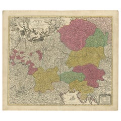
1720 Johann Baptist Homann Map of the Austrian Circle and Surrounding Regions
Located in Langweer, NL
"1720 Johann Baptist Homann Map of the Austrian Circle and Surrounding Regions"
Description of the Map:
This map, crafted by the renowned cartographer Johann Baptist Homann around...
Category
1720s Antique Netherlands Maps
Materials
Paper
$735 Sale Price
20% Off
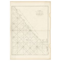
Antique Sea Chart of the Coast of Sumatra, Indonesia, circa 1775
Located in Langweer, NL
Antique map titled 'Carte de la Côte Occidentale de l'Isle Sumatra'. Sea chart of the part of the south-western coast of Sumatra with the Nassau (Nias) and Fortune isles.
Artists ...
Category
18th Century Antique Netherlands Maps
Materials
Paper
$515 Sale Price
20% Off
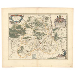
Circa 1659 Johannes Blaeu Map: Ducatus Silesiae Ligniciensis, Legnica Region
Located in Langweer, NL
Circa 1659 Johannes Blaeu Map: Ducatus Silesiae Ligniciensis, Legnica Region
This hand-colored map from circa 1659 by Johannes Blaeu, titled "Ducatus Silesiae Ligniciensis," depicts the region centered around Legnica (Lignitz) in southwestern Poland.
It extends to include the cities of Lublin, Jawor, and Lwówek Śląski.
The map features decorative elements such as a title cartouche adorned with a putto, garlands of fruit, and birds, and a distance scale cartouche that includes a hunter with his dogs.
This map is dedicated to Georgius Rodulfus, the Duke of Silesia, by Ionas Scultetus, reflecting the map's historical context and noble patronage.
It includes Spanish text on the verso, indicating publication between 1659 and 1672. Measuring 20.9 inches wide by 16.3 inches high, the map is in excellent condition with a sharp impression, full contemporary color, and a large watermark of the god Atlas. Minor details include a bit of printer's ink residue at the right and slight marginal soiling.
Keywords:
- Johannes Blaeu map
- Silesia historical map
- Legnica (Lignitz) map
- 17th-century Poland map...
Category
1650s Antique Netherlands Maps
Materials
Paper
$1,050 Sale Price
20% Off
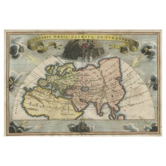
Veteris Orbis Climata – Ancient World Map after Strabo by Cellarius, 1731
Located in Langweer, NL
Veteris Orbis Climata – Ancient World Map after Strabo by Cellarius, 1731
This fascinating hand-colored antique map, titled Veteris Orbis Climata ex...
Category
1730s Antique Netherlands Maps
Materials
Paper
$429 Sale Price
20% Off
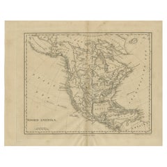
Antique Map of North America by Laarman, c.1860
Located in Langweer, NL
Antique map titled 'Noord Amerika'. Original antique map of North America. Published circa 1860. Artists and Engravers: Published by J.H. Laarman.
Artist: Published by J.H. Laarman.
...
Category
19th Century Antique Netherlands Maps
Materials
Paper
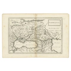
Antique Map of the Caucasus by Seale, 1799
Located in Langweer, NL
Antique map titled 'Sarmatia'. Old map of the Caucasus with the Caspian and Black Sea. Originates from 'Geographia Antiqua (..)'. Artists and Engravers: Richard William Seale (1703-1...
Category
18th Century Antique Netherlands Maps
Materials
Paper
$132 Sale Price
20% Off
Mid-19th Century Map of Australasia by Carl Flemming - 1855
Located in Langweer, NL
Title: "Mid-19th Century Map of Australasia by Carl Flemming - 1855"
Description: This original 1855 antique map from the Sohr-Berghaus Atlas, created by Carl Flemming, is a detaile...
Category
1850s Antique Netherlands Maps
Materials
Paper
$401 Sale Price
20% Off
Antique Map of the Tonkin River ‘Vietnam’ by J.N. Bellin, 1764
Located in Langweer, NL
One of the maps produced by Bellin for Prevost d'Exiles' influential travel book, ‘L'Histoire Generale des Voyages’. This map depicts part of Southeast Asia, most likely northern Vie...
Category
Mid-18th Century Antique Netherlands Maps
Materials
Paper
$233 Sale Price
20% Off
Rare Hand-Colored Map of of the Wine Region Burgundy in France by De Wit, c.1688
Located in Langweer, NL
Title: New Description of the Duchy of Burgundy - Frederik De Wit c. 1688
Description: This exquisite map of the Duchy of Burgundy, published after 1688, is a fascinating example of...
Category
1680s Antique Netherlands Maps
Materials
Paper
Antique Print of Cape or Cabo Verde, Africa, c.1750
By Jakob van der Schley
Located in Langweer, NL
Antique print titled 'Gezigt van Kabo Verde' and 'Zydelings Gezigt van Kabo Verde'. Old print of Cabo Verde with a double view of the island coast. Engraved...
Category
18th Century Antique Netherlands Maps
Materials
Paper
$152 Sale Price
20% Off
Antique Map of Spain and Portugal by Harris, 1802
Located in Langweer, NL
"Antique map titled 'Spain and Portugal'. Uncommon circular map of Spain and Portugal. Artists and Engravers: Published by J. Harris, 1802.
Artis...
Category
19th Century Antique Netherlands Maps
Materials
Paper
$79 Sale Price
20% Off
Antique Map of Central and East Java by Van den Bosch, 1818
Located in Langweer, NL
Antique map titled 'Kaart van de Keizers en Sultans Landen benevens de Strand Regentschappen op het Eiland Java'. Map of three central and easterly provinces of the island of Java. O...
Category
Early 19th Century Antique Netherlands Maps
Materials
Paper
$1,146 Sale Price
20% Off
Antique Map of the Region of Martigues, France
Located in Langweer, NL
Title: "Etang de Martigues et Environs: Antique Map of the Martigues Region, France"
Description: This antique map, titled "Etang de Martigue et Environs," offers a detailed view of...
Category
Mid-18th Century Antique Netherlands Maps
Materials
Paper
$324 Sale Price
20% Off
Antique Map of Westphalia, West Orientation
Located in Langweer, NL
Antique map titled 'Nova totius Westphaliae Descriptio'. Detailed map of Westphalia, Northern Germany. Oriented to the west. The area shown extends from Ha...
Category
Late 17th Century Antique Netherlands Maps
Materials
Paper
$592 Sale Price
20% Off
Map of the Provence in Southern France, Original Old Engraving by De Wit c. 1688
Located in Langweer, NL
Title: Provence Map - Hand-Colored 17th-Century Engraving by Frederik De Wit c. 1688
Description: This captivating map, "Gouvernement de Provence," depicts the Provence region of so...
Category
1680s Antique Netherlands Maps
Materials
Paper
Antique Map of the Region of Flanders in Belgium, 1737
Located in Langweer, NL
Untitled map of the region of Flanders, Belgium. This map originates from 'Nieuw en beknopt Kaart-Boekje vertoonende de XVII. Nederlandse Provintien (..)'.
Artists and Engravers: A...
Category
18th Century Antique Netherlands Maps
Materials
Paper
Alicante in a 1901 Antique Map: Maritime Gateway of Spain's Costa Blanca
Located in Langweer, NL
An original antique map of the province of Alicante, dated 1901. It is part of the atlas series by D. Benito Chias y Carbo, featuring cartographic elements.
Here are some characteri...
Category
Early 1900s Antique Netherlands Maps
Materials
Paper
$420 Sale Price
20% Off
Old Engraving of Antiquities found in a Bed of Chalk, Winchester, England, 1789
Located in Langweer, NL
Antique print titled 'Antiquities found in a bed of chalk, near Winchester, 1789'. Antique print depicting antiquities found near Winchester. Artists and Engravers: Made by J. Basire...
Category
18th Century Antique Netherlands Maps
Materials
Paper
$143 Sale Price
20% Off
Antique Map of the Region of Tokyo and Nagasaki in Japan, 1922
Located in Langweer, NL
Antique map of Japan titled 'Japan - Environs of Tokio & Nagasaki'. Old map of Japan, includes inset maps of Tokyo, Nagasaki and surroundings. This map or...
Category
20th Century Netherlands Maps
Materials
Paper
$171 Sale Price
20% Off
Rare 18th-Century Hand-Colored Map of Southeast Asia and the East Indies, 1748
Located in Langweer, NL
1748 Homann Map of Southeast Asia and East Indies by Homann Heirs
This original 1748 map, published by the renowned Homann Heirs, depicts Southeast Asia, the East Indies, and adjace...
Category
1740s Antique Netherlands Maps
Materials
Paper
Old Print with a View of the Cape of Good Hope and Table Bay, South Africa, 1750
Located in Langweer, NL
Antique print titled 'Gezigt van de Kaap de Goede-Hoop'.
Old print with a view of the Cape of Good Hope and Table Bay. Engraved by J. van Schley for a Du...
Category
1750s Antique Netherlands Maps
Materials
Paper
$181 Sale Price
20% Off
Antique Map of the Region of 'Île de France' by Janssonius, 1657
By Johannes Janssonius
Located in Langweer, NL
Antique map of France titled 'Ager Parisiensis vulgo l'Isle de France'. Old map of Paris and adjacent regions. This map originates from 'Atlas Novus, ...
Category
17th Century Antique Netherlands Maps
Materials
Paper
$405 Sale Price
20% Off
Original Antique Print of Mount Cinthus on the isle of Delos, Greece, 1688
Located in Langweer, NL
Antique print Greece titled 'Bergh Cinthus'. Old print of Mount Cinthus (birth place of Apollo), Delos, Greece. This print originates from 'Nauwkeurige Beschrijving der eilanden in de in de Archipel der Middellantsche Zee' by O. Dapper.
Mount Cynthus (Kýnthos) is located on the isle of Delos, part of the Greek Cyclades.
In Greek mythology, Leto gave birth to Apollo and Artemis...
Category
17th Century Antique Netherlands Maps
Materials
Paper
La Brique Architectural Print – Pharmacy & Gymnasium by Charles Chipiez, c.1900
Located in Langweer, NL
La Brique Architectural Print – Pharmacy & Gymnasium by Charles Chipiez, c.1900
This antique architectural lithograph presents a detailed view of the pharmacy and gymnasium at the É...
Category
20th Century French Netherlands Maps
Materials
Paper
Physical & Political Map of Switzerland: Late 18th Century - Mentelle Atlas
Located in Langweer, NL
Antique Map with Title: 'Carte Physique et Politique de la Suisse'
**Publication Details:**
- **Atlas Title:** Nouvel Atlas Universel de Géographie Ancienne et Moderne
- **Purpose:...
Category
1790s Antique Netherlands Maps
Materials
Paper
$506 Sale Price
20% Off
Rare 16th Century Original Handcolored Miniature Map of Java, Indonesia, 1616
Located in Langweer, NL
Very handsome original old coloured copper engraving by Bertius of the island of Java in the early days of the Dutch colonisation - at that time named The Dutch East Indies or nowada...
Category
1610s Antique Netherlands Maps
Materials
Paper
$467 Sale Price
20% Off
Antique Map of the Israel Township of Ohio by Titus '1871'
Located in Langweer, NL
Antique map titled 'Israel'. Original antique map of Israel, Ohio. This map originates from 'Atlas of Preble County Ohio' by C.O. Titus. Published 1871.
Category
Late 19th Century Antique Netherlands Maps
Materials
Paper
$238 Sale Price
20% Off
Stunning Hand-Colored Map of Languedoc in France by Frederik De Wit c. 1688
Located in Langweer, NL
Title: Stunning Hand-Colored Map of Languedoc by Frederik De Wit c. 1688
Description: This elegant 17th-century map, "Gouvernement General de Languedoc," beautifully illustrates the...
Category
1680s Antique Netherlands Maps
Materials
Paper
Antique Map of West Kalimantan (Schwaner Mountains), Borneo, Indonesia, 1900
Located in Langweer, NL
Antique map of West Kalimantan, Borneo. It shows the region of the Schwaner Mountains. This map originates from 'Atlas van Nederlandsch Oost- en West-Indië' by I. Dornseiffen.
Arti...
Category
20th Century Netherlands Maps
Materials
Paper
$315 Sale Price
20% Off
Antique Print of a Chestnut by Knoop, 1758
Located in Langweer, NL
Antique print of a chestnut. Originates from 'Pomologia' by J. H. Knoop.
Artists and Engravers: Published by Johann Hermann Knoop (c.1700-1769).
Condition: Good, general age-re...
Category
18th Century Antique Netherlands Maps
Materials
Paper
$315 Sale Price
20% Off
Antique Map of Africa and Arabia with Inset Map of Ethiopia and Eritrea, 1845
Located in Langweer, NL
Antique map titled 'Mittel- und Nord-Africa (östl. Theil) und Arabien'. This map depicts North and Central Africa and Arabia with an inset map of Habesch (Ethiopia and Eritrea).
Ar...
Category
19th Century Antique Netherlands Maps
Materials
Paper
$210 Sale Price
20% Off
Map of Denmark Proper & Jutland: Early 19th Century from the 1802 Tardieu Atlas
Located in Langweer, NL
Antique Map with Title: "Royaume de Danemarck: Deuxieme Carte. Danemarck Propre, le Jutland et les Isles"
Publication Details:
- **Atlas Title:** Nouvel Atlas Universel de Géograp...
Category
Early 1800s Antique Netherlands Maps
Materials
Paper
$420 Sale Price
20% Off
Old Map of the Empire of the Assyriens & the Tigres and Euphrates Rivers, 1683
Located in Langweer, NL
Antique map titled 'Empire des Assyriens' and 'Assyrie Chaldee et Mesopotamie selon les Anciens'.
Two maps on one sheet, the upper sheet showing the Empire of the Assyriens and the second showing the region of the Tigres and Euphrates Rivers. This map originates from Alain Manesson Mallet's 'Description de l 'Univers'.
Artists and engravers: Alain Manesson Mallet (1630–1706) was a French cartographer and engineer. He started his career as a soldier in the army of Louis XIV, became a Sergeant-Major in the artillery and an Inspector of Fortifications. He also served under the King of Portugal, before returning to France, and his appointment to the court of Louis XIV. His military engineering and mathematical background led to his position teaching mathematics at court. His major publications were Description de L'Univers (1683) in 5 volumes, and Les Travaux de Mars ou l'Art de la Guerre (1684) in 3 volumes.
His Description de L'Universe contains a wide variety of information, including star maps...
Category
1680s Antique Netherlands Maps
Materials
Paper
$267 Sale Price
20% Off
1882 Map of Sweden and Norway Highlighting Geographical and Political Features
Located in Langweer, NL
This 1882 map of Sweden and Norway, published by Blackie and Son as part of the 'Comprehensive Atlas and Geography of the World,' provides a detailed depiction of the Scandinavian Pe...
Category
1880s Antique Netherlands Maps
Materials
Paper
1882 Map of Belgium and The Netherlands Highlighting Geographical Details
Located in Langweer, NL
This 1882 map of Belgium and The Netherlands, published by Blackie and Son as part of the 'Comprehensive Atlas and Geography of the World,' offers a detailed representation of the tw...
Category
1880s Antique Netherlands Maps
Materials
Paper
$181 Sale Price
20% Off
Antique Map of Three Cities of China's Hubei and Hunan Provinces by Bellin
By Jacques-Nicolas Bellin
Located in Langweer, NL
Antique print titled 'Plans de Quelques villes de la province de Hou-Quang.' Three bird's-eye view plans of walled cities in what are now China's Hubei (Hou-Quang) and Hunan Province...
Category
Mid-18th Century Antique Netherlands Maps
Materials
Paper
$157 Sale Price
20% Off
1876 Antique Map of New York State with Niagara and Hudson River Insets
Located in Langweer, NL
Title: Detailed Map of New York State - 1876 by Samuel Augustus Mitchell Jr.
Description: This is a hand-colored map of the state of New York from 1876, created by Samuel Augustus ...
Category
1870s Antique Netherlands Maps
Materials
Paper
$210 Sale Price
20% Off
Antique Map of Russia in Europe by A & C, Black, 1870
Located in Langweer, NL
Antique map titled 'Russia in Europe'. Original antique map of Russia in Europe. This map originates from ‘Black's General Atlas of The World’. Published by A & C. Black, 1870.
Category
Late 19th Century Antique Netherlands Maps
Materials
Paper
$262 Sale Price
20% Off
1882 Map of Denmark, Schleswig, and Holstein Highlighting Geographical Details
Located in Langweer, NL
This 1882 map of Denmark, Schleswig, and Holstein, published by Blackie and Son as part of the 'Comprehensive Atlas and Geography of the World,' provides a detailed representation of...
Category
1880s Antique Netherlands Maps
Materials
Paper
Antique Map of Loire ‘France’ by V. Levasseur, 1854
Located in Langweer, NL
Antique map titled 'Dépt. de la Loire'. Map of the French department of Loire, France. This area of France is part of the Loire Valley wine growing region. The area includes 87 appel...
Category
Mid-19th Century Antique Netherlands Maps
Materials
Paper
$143 Sale Price
20% Off
Old Map of the French Department of Cantal, France
By Victor Levasseur
Located in Langweer, NL
Antique map titled 'Dépt. du Cantal'. Map of the French department of Cantal, France. This area of France is known for its production of Cantal, a firm cheese, named after the region...
Category
Mid-19th Century Antique Netherlands Maps
Materials
Paper
$324 Sale Price
20% Off
Antique Map of the Ancient Greek Colonization
Located in Langweer, NL
Antique map titled 'Map I containing the Western Division of the Grecian Colonies & Conquests'. Original antique map of the ancient Greek colonization. Frontispiece map of 'The Histo...
Category
Late 18th Century Antique Netherlands Maps
Materials
Paper
$171 Sale Price
20% Off
Rare Hand-Colored Map of Lyonnais Region in France by Frederik De Wit c. 1688
Located in Langweer, NL
Title: Rare Hand-Colored Map of Lyonnais Region by Frederik De Wit c. 1688
Description: This beautifully detailed map, "Gouvernement General du Lyonnois," showcases the Lyonnais reg...
Category
1680s Antique Netherlands Maps
Materials
Paper
Original Antique Map of England, Ireland, Scotland and Wales
Located in Langweer, NL
Antique map titled 'Les Isles Britanniques, ou sont les Royaumes d Angleterre (..)'. Detailed map of England, Ireland, Scotland and Wales, with French coast and part of the Netherlan...
Category
Early 18th Century Antique Netherlands Maps
Materials
Paper
$276 Sale Price
20% Off
Rare Map of Kildin Island in Russia Plus Engraving of Seal Hunting, 1614
Located in Langweer, NL
Insula Kilduyn. Orig. copper-engraving after details from J. H. van Linschoten's map taken from his account of the three expeditions undertaken by Willem Barents in 1594, in an attem...
Category
Early 17th Century Antique Netherlands Maps
Materials
Paper
$716 Sale Price
20% Off
Antique Plan of Duinkerke or Dunkirk in France by Guicciardini, 1612
Located in Langweer, NL
Antique map Duinkerke titled 'Duijnkerken'. Small plan of the city of Duinkerke/Dunkerque, France.
Artists and Engravers: Lodovico Guicciardini (1521-1589): an Italian merchant fr...
Category
17th Century Antique Netherlands Maps
Materials
Paper
$219 Sale Price
20% Off
Ancient Cartography of Britannia and Hibernia, Published in 1880
Located in Langweer, NL
This map depicts the geographical area of Great Britain and Ireland, labeled "BRITANNIA et HIBERNIA." It is a historical map, as indicated by the Latin titles and the classical names of regions and tribes.
In the main section of the map, Great Britain is depicted in fine detail, with topographical features such as mountains and rivers. The map is color-coded, to differentiate political or tribal boundaries. Various Roman place names are indicated, such as "Londinium" for London.
To the left of Great Britain is Ireland, referred to as "Hibernia," similarly detailed with its own topographical features and ancient...
Category
1880s Antique Netherlands Maps
Materials
Paper
$353 Sale Price
20% Off
Antique Costume Print of a Young Farmer from the Region of Obermais, South Tyrol
Located in Langweer, NL
Antique costume print titled 'Junger Bauer aus Obermais bei Meran, Südtirol'. Old print showing a young farmer from the region of Obermais, near Meran, South Tyrol...
Category
19th Century Antique Netherlands Maps
Materials
Paper
Antique Map of the Dutch Province of Gelderland, 1725
Located in Langweer, NL
Antique map titled 'Frisiae Haereditariae seu Trajectini Episcopatus Gelria?. Map of the province of Gelderland, the Netherlands. This map originates from 'Atlas Descriptio, secundum...
Category
18th Century Antique Netherlands Maps
Materials
Paper
$122 Sale Price
20% Off
Antique Map of France by Johnston (1909)
Located in Langweer, NL
Antique map titled 'France'. Original antique map of France. With inset maps of France in provinces, part of the Riviera and Corsica. This map or...
Category
Early 20th Century Netherlands Maps
Materials
Paper
$238 Sale Price
20% Off
Copper Engraving with a Panoramic View of Mexico City, 1754
Located in Langweer, NL
Antique print titled 'Nouveau Mexico'.
Copper engraving with a panoramic view of Mexico city. This print originates from 'Histoire générale des voyages, ou nouvelle collection de...
Category
1750s Antique Netherlands Maps
Materials
Paper
$525 Sale Price
20% Off
Antique Print of the Book of Hours by Gibb, 1890
Located in Langweer, NL
Antique print titled 'Book of Hours'. Chromolithographic plate originating from 'The Royal House of Stuart. Illustrated By a Series of Forty Plates in Co...
Category
19th Century Antique Netherlands Maps
Materials
Paper
$81 Sale Price
20% Off
1864 Johnson's Map of Virginia, Delaware, and Maryland with Fort Monroe Inset
Located in Langweer, NL
Title: 1864 Johnson's Map of Virginia, Delaware, and Maryland with Fort Monroe Inset
Description: This 1864 map titled "Johnson's Virginia, Delaware, and ...
Category
1860s Antique Netherlands Maps
Materials
Paper
$286 Sale Price
20% Off
Antique Map of Jefferson County 'Ohio' by Titus, 1871
Located in Langweer, NL
Antique map titled 'Jefferson'. Original antique map of Jefferson, Ohio. This map originates from 'Atlas of Preble County Ohio' by C.O. Titus. Published 1871.
Category
Late 19th Century Antique Netherlands Maps
Materials
Paper
$238 Sale Price
20% Off
Old Colourful Decorative Map of Turkey in Europe, 1846
Located in Langweer, NL
Antique map titled 'Turkey in Europe'. Old map of Turkey in Europe.
This map originates from 'A New Universal Atlas Containing Maps of the various Em...
Category
1840s Antique Netherlands Maps
Materials
Paper
$219 Sale Price
20% Off
1882 Map of the North Atlantic Ocean Showing Cable Tracks and Trade Winds
Located in Langweer, NL
This 1882 map of the North Atlantic Ocean, published by Blackie and Son as part of the 'Comprehensive Atlas and Geography of the World,' provides an intricate depiction of one of the...
Category
1880s Antique Netherlands Maps
Materials
Paper
Antique Plan of Meaco, Kyoto, Japan
Located in Langweer, NL
Antique map titled 'Plan de la Ville de Meaco - Platte-Grond van de Stad Miaco'. Detailed and unusual antique copper engraved plan of Kyoto, ancient named Meaco, when it was the capi...
Category
Mid-18th Century Antique Netherlands Maps
Materials
Paper
$362 Sale Price
20% Off
Decorative Antique Map of the Southern Part of South America, 1806
Located in Langweer, NL
Description: Antique map titled 'Paraguay, Chili, Terre Magellan?'
Decorative map of the southern part of South America by Robert de Vaugondy, revised and published by Delamarche. Source unknown, to be determined.
Artists and Engravers: Charles Francois Delamarche (1740-1817) founded the important and prolific Paris based Maison Delamarche map publishing firm in the late 18th century. A lawyer by trade Delamarche entered the map business with the acquisition from Jean-Baptiste Fortin of Robert de Vaugondy's map plates...
Category
Early 1800s Antique Netherlands Maps
Materials
Paper
$525 Sale Price
20% Off
Original 1859 Map of Asia from W.G. Blackie's Imperial Atlas of Modern Geography
Located in Langweer, NL
Antique map titled 'Asia'. Original antique map of Asia. This map originates from ‘The Imperial Atlas of Modern Geography’. Published by W. G. Blackie, 1859.
The "Classic Cartograph...
Category
Mid-19th Century Antique Netherlands Maps
Materials
Paper
$238 Sale Price
20% Off
Colorful Detailed Antique Map of Europe, Published in 1882
Located in Langweer, NL
"The Antique Map of Europe from 'The Comprehensive Atlas and Geography of the World,' published in 1882 by Blackie & Son, is a testament to meticulous cartography and scholarly preci...
Category
1880s Antique Netherlands Maps
Materials
Paper
$181 Sale Price
20% Off
Recently Viewed
View AllMore Ways To Browse
Flemish Cabinets 17th Century
Fox Figurine
Fox Hunt Plate
French Art Deco Rosewood Buffet
French Bulldog Gold
French Louis Xvi Enfilade
French Provincial Antique Dresser
French Provincial Furniture Antique Dresser
French Zinc Bar
Frog Figurine
Georgian Mahogany Longcase Clock
German Folding Trolley
Glass And Brass Fireplace Screen
Glass Nude Woman Sculpture
Glass Parrots
Glass Poodle
Gothic Corbel
Granite Pagoda
