Netherlands Maps
to
4,174
5,125
5,515
200
5,124
1
2,835
1,982
307
1
179
6
67
3
3
3
2
5,119
9
7
2
1
472
185
101
82
59
5,125
5,125
5,125
104
58
20
14
13
Item Ships From: Netherlands
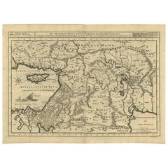
Antique Bible Map of the Middle East by A. Schut, 1743
Located in Langweer, NL
Antique map titled 'De Gelegentheyt van 't Paradys en 't Landt Canaan'. Dutch Bible map covering the region between the Mediterranean and the Persian Gulf, ...
Category
Mid-18th Century Antique Netherlands Maps
Materials
Paper
$525 Sale Price
20% Off
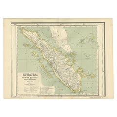
Antique Map of West Sumatra, Indonesia, 1900
Located in Langweer, NL
Antique map titled 'Sumatra, Bangka, Blitoeng en de Riouw-Archipel'. Old map of West Sumatra depicting the various islands and the Strait of Malacca. This map originates from 'Atlas ...
Category
20th Century Netherlands Maps
Materials
Paper
$276 Sale Price
20% Off
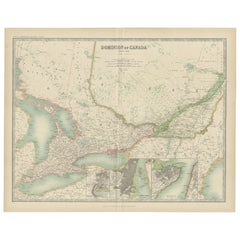
Antique Map of Canada by Johnston '1909'
Located in Langweer, NL
Antique map titled 'Dominion of Canada'. Original antique map of Canada. With inset maps of Niagara, Montreal, Quebec. This map originates from t...
Category
Early 20th Century Netherlands Maps
Materials
Paper
$238 Sale Price
20% Off
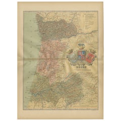
Douro: The River of Tradition and Wine in Portugal, 1903
Located in Langweer, NL
The uploaded image is a historical map of the Beira Baixa region in Portugal. The map details the topography, including mountain ranges and river systems, as well as the transportati...
Category
Early 1900s Antique Netherlands Maps
Materials
Paper
$276 Sale Price
20% Off
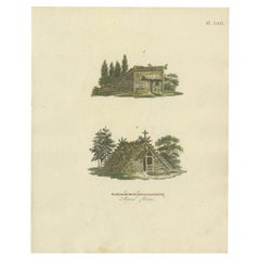
Antique Print of Garden Buildings from Garden Architecture by Van Laar, 1802
Located in Langweer, NL
Untitled print of garden architecture. It shows garden buildings. This print originates from 'Magazijn van tuin-sieraden'. The book is compiled by Gijs...
Category
19th Century Antique Netherlands Maps
Materials
Paper
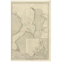
Antique Map of the British Islands to the White Sea by J. Imray
Located in Langweer, NL
Antique large nautical chart of the British Islands to the White Sea. With insets of Veshnyak Channel, Sosnovets and the Bay of Arkhangel. Published by James Irmay and Son, circa 1875.
Category
Late 19th Century Antique Netherlands Maps
Materials
Paper
Antique Map of the Empire of the Great Mogol and the Kingdom of Kachimere
Located in Langweer, NL
Antique map titled 'Genealogie des Empereurs Mogols depuis Tamberlan ou Tamerlan'. Two maps, a genealogical tree and three indigenous views of the Mogol Empire on one sheet with desc...
Category
Early 18th Century Antique Netherlands Maps
Materials
Paper
$553 Sale Price
20% Off
Antique Map of Turkey in Europe with Bulgaria by Johnston '1909'
Located in Langweer, NL
Antique map titled 'Turkey in Europe with Bulgaria'. Original antique map of Turkey in Europe with Bulgaria. With inset maps of The Bosporus & Constantinople, and Crete (or Candia). ...
Category
Early 20th Century Netherlands Maps
Materials
Paper
$238 Sale Price
20% Off
Old Original Antique German Map of North America, ca.1870
Located in Langweer, NL
Antique map titled 'Nord-America'.
Old map of North America. This map originates from 'H. Kiepert's Kleiner Atlas der Neueren Geographie für Schule und Haus'.
Artists and Engrave...
Category
1870s Antique Netherlands Maps
Materials
Paper
$467 Sale Price
20% Off
Detailed Orginal Antique Map of Bengal, India, c.1825
Located in Langweer, NL
Antique map titled 'No. 95 Bengale'. Detailed map of Bengal, Bangladesh. With text about the Ganges river. Originates from 'Atlas Universel' by P.M. Vand...
Category
19th Century Antique Netherlands Maps
Materials
Paper
$467 Sale Price
20% Off
Antique Map of Germany and Central Europe
Located in Langweer, NL
Antique map titled 'S. Imperium Romano-Germanicum oder Teutschland mit seinen angrantzenden Königreichen und Provincien'. Original antique map of Germany...
Category
Late 17th Century Antique Netherlands Maps
Materials
Paper
$1,050 Sale Price
20% Off
Antique Map of North America by Lapie '1842'
Located in Langweer, NL
Antique map titled 'Carte de l'Amérique septentrionale'. Map of North America, with an inset map of the Aleutian Islands. This map originates from 'Atlas universel de géographie anci...
Category
Mid-19th Century Antique Netherlands Maps
Materials
Paper
$573 Sale Price
20% Off
Antique Map of the Northeast of England by Mercator 'circa 1620'
Located in Langweer, NL
Antique map titled 'Eboracum Lincolnia, Derbia, Staffordia, Notinghamia, Lecestria, Rutlandia, et Norfolcia'. Decorative early map of the northeast of England, comprising the countie...
Category
Early 17th Century Antique Netherlands Maps
Materials
Paper
$525 Sale Price
20% Off
Antique German Map of India and Sri Lanka or Ceylon, 1902
By Meyer
Located in Langweer, NL
Antique map titled 'Ostindien.' (Map of India with an inset map of East-Bengal.) This attractive original old antique print / plate / map originates from 1885-1907 editions of a famous German encyclopedia: 'Meyers grosses Konversations-Lexikon.', published in Leipzig and Vienna. Meyers Konversations-Lexikon was a major German encyclopedia that existed in various editions from 1839 until 1984, when it merged with the Brockhaus encyclopedia. Several of the plates were also used in Dutch Encyclopedia's like Winkler Prins...
Category
20th Century Netherlands Maps
Materials
Paper
$65 Sale Price
20% Off
Rare Small Antique Map of Great Britain and Ireland
Located in Langweer, NL
Antique map titled 'La Grande Bretagne et Irlande'. Small antique map of Great Britain and Ireland. Source unknown, to be determined. Publ...
Category
Mid-18th Century Antique Netherlands Maps
Materials
Paper
$219 Sale Price
20% Off
Antique Map of Asia Showing Its Political Divisions, 1874
Located in Langweer, NL
Antique map titled 'Map of Asia showing its Gt. Political Divisions and also the various routes of Travel between London & India, China & Japan & c'. This map covers from the Arabian...
Category
19th Century Antique Netherlands Maps
Materials
Paper
$85 Sale Price
20% Off
Antique Print of the City of Rome, Italy by Münster, C.1580
Located in Langweer, NL
Antique print titled 'Abbildung der Statt Rom/wie sie von Romulo anfänge - Von Italia'. Woodcut of ancient Rome. This print originates from Munster's Cosmographia, one of the most in...
Category
16th Century Antique Netherlands Maps
Materials
Paper
$439 Sale Price
20% Off
Antique Map of Eure ‘France’ by V. Levasseur, 1854
By Victor Levasseur
Located in Langweer, NL
Antique map titled 'Dépt. de l'Eure'. Map of the French department of Eure, France. This region of France is home to Giverny, where impressionist Claude Monet’s home and garden can b...
Category
Mid-19th Century Antique Netherlands Maps
Materials
Paper
$171 Sale Price
20% Off
Antique Map of Part of Flanders 'Belgium' by F. de Wit 'circa 1680'
Located in Langweer, NL
Antique map titled 'Marchionatus Sacri Imperii et Dominii Mechelini Tabula'. Large folio size map of the region around Mechelen, Leuven, Brussels, Dendermonde and Antwerp. Published ...
Category
Late 17th Century Antique Netherlands Maps
Materials
Paper
$549 Sale Price
20% Off
Asia Minor – Antique Map of Natolia by Ortelius, Theatrum Orbis Terrarum c.1600
Located in Langweer, NL
Asia Minor – Antique Map of Natolia by Ortelius, Theatrum Orbis Terrarum c.1600
This beautifully hand-colored antique map titled Natoliae quae olim Asia Minor nova descriptio presen...
Category
Early 17th Century European Antique Netherlands Maps
Materials
Paper
$420 Sale Price
20% Off
Antique Map of Westergo, Friesland in the the Netherlands, by Tirion, 1744
By Isaak Tirion
Located in Langweer, NL
Antique map titled 'Westergo'. Original antique map of Westergo, part of the province of Friesland, the Netherlands. Published 1744.
Artists and Engravers: Isaak Tirion (1705 in U...
Category
18th Century Antique Netherlands Maps
Materials
Paper
$611 Sale Price
20% Off
Antique Print of the 'Buitenhof' in The Hague, The Netherlands, c.1770
By Georg Balthasar Probst
Located in Langweer, NL
Antique print titled 'Prospectus de Buyten Hof - Gezicht van het Buyten Hof tot Gravenhaghe'. Beautiful view of the Buitenhof, a square in The Hague, the Netherlands. This is an opti...
Category
18th Century Antique Netherlands Maps
Materials
Paper
$276 Sale Price
20% Off
Antique Map Showing the Division and Distribution of Reptiles by Johnston '1850'
Located in Langweer, NL
Antique map titled 'Geographical division and distribution of reptilia and ophidia. Original antique map showing the geographical division and distribution of reptiles and serpents. ...
Category
Mid-19th Century Antique Netherlands Maps
Materials
Paper
$191 Sale Price
20% Off
Antique Map of the Holy Land with Picture Frame Border
Located in Langweer, NL
Antique map titled 'Terre Sainte Suivant les Nouvelles Observations (..)'. Original old map of the Holy Land with the picture frame border. The term "Holy Land" usually refers to a t...
Category
Early 18th Century Antique Netherlands Maps
Materials
Paper
$840 Sale Price
20% Off
Antique Map of the County of Bentheim by Hondius, c.1630
Located in Langweer, NL
Antique map titled 'Comitatus Bentheimensis nova descriptio'. Engraved map of the County of Bentheim, showing Linge, Enschede, Bad Bentheim, Coevorden, Ne...
Category
17th Century Antique Netherlands Maps
Materials
Paper
$391 Sale Price
20% Off
Antique Print of Unterwalden, South of Lake Lucerne in Switzerland, 1654
Located in Langweer, NL
Antique print titled 'Underwaldia - Das Landt Underwalden'. View of the city of Unterwalden, the old name of a forest-canton of the Old Swiss Confederacy in central Switzerland, south of Lake Lucerne...
Category
17th Century Antique Netherlands Maps
Materials
Paper
$487 Sale Price
20% Off
Antique Map of Northern Germany, showing the area of Mecklenburg-Vorpommern
Located in Langweer, NL
Antique map titled 'Meklenburg Ducatus'. Attractive map of northern Germany, showing the area of Mecklenburg-Vorpommern. Published by J. Janssonius, circa 1630.
Jan Janssonius (als...
Category
Mid-17th Century Antique Netherlands Maps
Materials
Paper
$754 Sale Price
20% Off
Original Antique Engraving of the Quangguamiau Pagoda in China, 1665
Located in Langweer, NL
Antique print titled 'Pagoda Quangguamiau'. Old print depicting the 'Quangguamiau' pagoda, China. This print originates from 'Het gezantschap der Nee^rlandtsche Oost-Indische Compagn...
Category
17th Century Antique Netherlands Maps
Materials
Paper
Antique Map of the Region near Cologne, Germany
Located in Langweer, NL
Antique map titled 'Carte de la Belgique d'après Ferraris'. Original antique map of the region near Cologne, Germany. Cologne is the largest city of the German western state of North...
Category
Mid-19th Century Antique Netherlands Maps
Materials
Paper
$420 Sale Price
20% Off
Antique Map of the Caspian Sea, Uzbekistan, Northern Persia Etc, C.1735
Located in Langweer, NL
Antique map titled 'Nova Maris Caspii et Regions Usbeck (..).' Detailed map of Central Asia centered on the Caspian Sea, showing Uzbekistan to the east of ...
Category
18th Century Antique Netherlands Maps
Materials
Paper
$1,575 Sale Price
20% Off
Antique Map of the Mouth of the Amu Darya River by Reclus, 1881
Located in Langweer, NL
Antique map titled 'Bouches de L'Amou - Daria'. Original antique map showing the river mouth of the Amu Darya river in Central Asia. This original old antiqu...
Category
19th Century Antique Netherlands Maps
Materials
Paper
$85 Sale Price
20% Off
Antique Plan of Batavia, Nowadays Jakarta, Indonesia, 1780
Located in Langweer, NL
Antique map titled 'Plan der Stad en 't Kasteel Batavia'. A very rare late 18th century detailed plan of Batavia with an alpha-numeric key showing the main areas and buildings (only ...
Category
18th Century Antique Netherlands Maps
Materials
Paper
$1,764 Sale Price
20% Off
Antique Map of Chinese and Independent Tartary, Korea and Japan, 1806
Located in Langweer, NL
Antique map titled 'A New Map of Chinese & Independent Tartary'. Beautiful map of Chinese Tartary, Korea and Japan.
Artists and Engravers: John Cary (1755-1835) was a British car...
Category
19th Century Antique Netherlands Maps
Materials
Paper
$334 Sale Price
20% Off
Antique Map of the Gaspar Strait by Huddart, '1788'
Located in Langweer, NL
Antique map titled 'Sketch of the Straits of Gaspar'. Detailed sea chart of the Gaspar Strait, showing part of the Island of Banca on the east coast of Sumatra just to the south of S...
Category
Late 18th Century Antique Netherlands Maps
Materials
Paper
$793 Sale Price
30% Off
Antique Map of Africa by Lapie, 1842
Located in Langweer, NL
Antique map titled 'Carte d'Afrique'. Map of Africa. This map originates from 'Atlas universel de géographie ancienne et moderne (..)' by Pierre M. Lapie...
Category
Mid-19th Century Antique Netherlands Maps
Materials
Paper
$573 Sale Price
20% Off
Cartographic Elegance: The British Raj's India, 1882 Atlas by Blackie and Son
Located in Langweer, NL
These two maps are part of an 1882 atlas published by Blackie and Son, a notable publishing company in the 19th century known for their educational books and detailed atlases. The ma...
Category
1880s Antique Netherlands Maps
Materials
Paper
$420 Sale Price / set
20% Off
Untitled Print Lincoln Cathedral ii, Basire, 1791
Located in Langweer, NL
Antique print depicting the Lincoln Cathedral, or the Cathedral Church of the Blessed Virgin Mary of Lincoln. Artists and Engravers: Made by J. Basir...
Category
18th Century Antique Netherlands Maps
Materials
Paper
$143 Sale Price
20% Off
Antique Map centered on Nuremberg, Germany
Located in Langweer, NL
Antique map titled 'Territorium Norimbergense'. Beautiful map centered on Nuremberg, Germany. With decorative title cartouche and inset plan of the city. Published by W. Blaeu, circa...
Category
Mid-17th Century Antique Netherlands Maps
Materials
Paper
$1,146 Sale Price
20% Off
Antique Map of the World with Polar Projections by Keizer & de Lat, 1788
Located in Langweer, NL
Antique map titled 'Schuine Ronde Aard-Klooten (..)'. Interesting double hemisphere world map with polar projections. In North America, there is a...
Category
Late 18th Century Antique Netherlands Maps
Materials
Paper
$447 Sale Price
25% Off
Antique Map of Southern Syria by Fullarton & Co, circa 1860
Located in Langweer, NL
Antique map titled 'Syria south part'. Published by Fullarton & Co, Glasgow, circa 1860.
- Title: Syria South Part
- Publisher: Fullarton & Co, Glasgow
- Date of Publication: Circa ...
Category
Mid-19th Century English Antique Netherlands Maps
Materials
Paper
Antique Map of the World by Johnson, '1872'
Located in Langweer, NL
Antique map titled 'Johnson's World. Original world map. This map originates from 'Johnson's New Illustrated Family Atlas of the World' by A.J. John...
Category
Late 19th Century Antique Netherlands Maps
Materials
Paper
$447 Sale Price
25% Off
Hand Colored Antique Map of the Department of Eure-et-loir, France
By Victor Levasseur
Located in Langweer, NL
Antique map titled 'Dépt. d'Eure et Loir'. Map of the French department of Eure-et-Loir, France. This area is home to the famous Chartres Cathedral....
Category
Mid-19th Century Antique Netherlands Maps
Materials
Paper
$324 Sale Price
20% Off
Antique Map of France by Mortier 'c.1710'
Located in Langweer, NL
Antique map titled 'Gallia vetus ex C. Iulii Caesaris (..)'. Original antique map of France. Published by P. Mortier, c.1710.
Category
Early 18th Century Antique Netherlands Maps
Materials
Paper
$955 Sale Price
20% Off
Antique Map of the Western Part of the German Empire by Levasseur, '1875'
Located in Langweer, NL
Antique map titled 'Empire d'Allemagne (..)'. Large map of the western part of the German Empire. This map originates from 'Atlas de Géographie Moderne Physique et Politique' by A. L...
Category
Late 19th Century Antique Netherlands Maps
Materials
Paper
$238 Sale Price
50% Off
Antique Map of Denmark with the Danish Royal Crest, c.1730
By Homann Heirs
Located in Langweer, NL
Antique map titled 'Regni Daniae in quo sunt Ducatus Holsatia and Slesuicum Insulae Danicae Jutia, Scania Blekingia (..).' Map of Denmark and islands, part of Sweden and Germany, dra...
Category
18th Century Antique Netherlands Maps
Materials
Paper
$429 Sale Price
20% Off
Antique Map of Denmark with An Inset of Iceland, 1852
Located in Langweer, NL
Antique map titled 'Denemarken'. Map of Denmark, with a small inset map of Iceland. This map originates from 'School-Atlas van alle deelen der Aarde' by Otto Petri...
Category
19th Century Antique Netherlands Maps
Materials
Paper
$133 Sale Price
20% Off
Rare Hand-Colored Antique Map of Tartary, China and Korea, ca.1741
Located in Langweer, NL
Antique map titled 'A General Map of Eastern and Western Tatary, commonly call'd Tartary; drawn from the Particular Maps of the Jesuit Missionaries'.
Rare antique map of Tartary, C...
Category
1740s Antique Netherlands Maps
Materials
Paper
$2,626 Sale Price
20% Off
Antique Portrait of Frederik Hendrik, Prince of Orange, Etc Etc, 1749
Located in Langweer, NL
Antique portrait titled 'Frederik Hendrik, Prins van Oranje enz. enz. enz'.
Portrait of Frederick Henry, or Frederik Hendrik in Dutch (29 January 1584 – 14 March 1647). The sover...
Category
1740s Dutch Antique Netherlands Maps
Materials
Paper
Antique Map of the Northern Part of South America by J. Tallis, circa 1851
Located in Langweer, NL
A decorative and detailed mid-19th century map of the northern part of South America (including modern day Venezuela, Colombia, Ecuador, Guyana, Suriname and French Guiana) which was drawn and engraved by J. Rapkin (vignettes by H. Winkles & W. Lacey) and published in John Tallis & Co.'s The Illustrated Atlas (London & New York: circa 1851).
The Illustrated Atlas, published from 1849 onwards, was the last decorative world atlas. The 'Venezuela, New Granada...' map was typical of the many Fine ones which appeared in this work with its decorative border and attractive vignettes. Illustrated are views of Mount Chimborazo, Ecuador; the 'Fall of the Bagota' (Tequendama Falls, Colombia); Rheas and a prospect of Paramaribo Harbour (Dutch Guiana...
Category
Mid-19th Century English Antique Netherlands Maps
Materials
Paper
Small Original Antique Map of the Lower Alsace region, Germany
Located in Langweer, NL
Antique map titled 'Alsatia Inferior'. Small original antique map of the Lower Alsace region, Germany. This map originates from 'Atlas minor Gerardi Mercatoris a I. Hondio plurimis a...
Category
Early 17th Century Antique Netherlands Maps
Materials
Paper
$324 Sale Price
20% Off
Antique Map of the Holy Land by Schut, 1710
Located in Langweer, NL
Antique map of the Holy Land titled 'Het Beloofde Landt Canaan.' Very detailed and decorative map of the Holy Land embellished with sailing ships and com...
Category
18th Century Antique Netherlands Maps
Materials
Paper
$401 Sale Price
20% Off
Three Antique Maps on One Folio: Turkey, Northern Egypt, and Ancient Carthage
Located in Langweer, NL
The map consists of three distinct sections on a single folio sheet:
1. **Map of Turkey**:
- Orientation: The map is oriented with the east at the top, which is a common practic...
Category
16th Century Antique Netherlands Maps
Materials
Paper
Print of Various Ceremonies 'Marriage, Funeral, Baptism, Magic' of Finland, 1726
Located in Langweer, NL
Antique print titled 'Mariage des Lapons (..)'.
Old print of various ceremonies (marriage, funeral, baptism, magic) of Finland. This print originates from 'Ceremonies et costumes...
Category
1720s Antique Netherlands Maps
Materials
Paper
$324 Sale Price
20% Off
Antique Plan of the Castle & City of Batavia 'Jakarta' on Java, Indonesia, c1669
Located in Langweer, NL
Antique map Batavia titled 'Ware Affbeeldinge wegens het Casteel ende Stadt Batavia'.
Antique print of the castle and city of Batavia on the Island of Java'. Rare edition with En...
Category
1660s Antique Netherlands Maps
Materials
Paper
$1,193 Sale Price
20% Off
Antique Map of Cities of the Jiangsu Region in China, c.1760
By Jacques-Nicolas Bellin
Located in Langweer, NL
Antique map titled 'Plan de l' Enceinte de la Ville de Nan-King ou Kyang-Ning-Fou et plan de la ville de Su-Tcheou-Fou.' A map of the city of Nanking or Nanjing and a second map show...
Category
18th Century Antique Netherlands Maps
Materials
Paper
$191 Sale Price
20% Off
Hand Colored Antique Map of the department of Ardennes, France
By Victor Levasseur
Located in Langweer, NL
Antique map titled 'Dépt. des Ardennes'. Map of the French department of Ardennes, France. Part of France's important Champagne producing region. The whole is surrounded by elaborate...
Category
Mid-19th Century Antique Netherlands Maps
Materials
Paper
$324 Sale Price
20% Off
Original Antique Map of Asia
Located in Langweer, NL
Antique map titled 'l'Asie'. Original antique map of Asia. Engraved by André after Bonne. Published circa 1780.
Category
Late 18th Century Antique Netherlands Maps
Materials
Paper
$276 Sale Price
20% Off
Antique Print of the Provincial-Executive of Leeuwarden in The Netherlands, 1793
Located in Langweer, NL
Antique print titled 't'Kollegie der Gedeputeerde Staaten, te Leeuwarden'. Old print of the provincial-executive of Leeuwarden, Friesland. This print originates from 'Vaderlandsche g...
Category
18th Century Antique Netherlands Maps
Materials
Paper
La Brique Architectural Print – Bureau & Gatehouse by Edouard Lewicki, c.1900
Located in Langweer, NL
La Brique Architectural Print – Bureau & Gatehouse by Edouard Lewicki, c.1900
This striking antique architectural print features two charming structures: an architect’s office in Ho...
Category
20th Century French Netherlands Maps
Materials
Paper
Antique Map of Spain and Portugal by Tardieu, circa 1795
Located in Langweer, NL
The image is an antique map titled "Hispanie Betique et Lusitanie", which depicts the Iberian Peninsula during the Roman times, highlighting the provinces of Hispania Baetica (Betiqu...
Category
Late 18th Century Antique Netherlands Maps
Materials
Paper
$238 Sale Price
20% Off
Recently Viewed
View AllMore Ways To Browse
Flemish Cabinets 17th Century
Fox Figurine
Fox Hunt Plate
French Art Deco Rosewood Buffet
French Bulldog Gold
French Louis Xvi Enfilade
French Provincial Antique Dresser
French Provincial Furniture Antique Dresser
French Zinc Bar
Frog Figurine
Georgian Mahogany Longcase Clock
German Folding Trolley
Glass And Brass Fireplace Screen
Glass Nude Woman Sculpture
Glass Parrots
Glass Poodle
Gothic Corbel
Granite Pagoda
