Netherlands Maps
to
4,202
5,081
5,472
195
5,080
1
2,804
1,969
307
1
179
6
68
3
3
3
2
5,075
8
6
2
1
355
113
81
77
45
5,081
5,081
5,081
104
59
20
14
13
Item Ships From: Netherlands
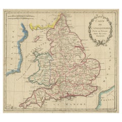
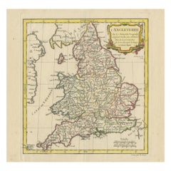
Antique Map of England, Also Showing Calais
Located in Langweer, NL
Antique map titled 'Carte de l'Angleterre pour le Voyage dans les trois Royaumes'. Original old map of England, also showing Calais. This map originates from 'Voyage dans les trois r...
Category
Late 18th Century Antique Netherlands Maps
Materials
Paper
$133 Sale Price
20% Off
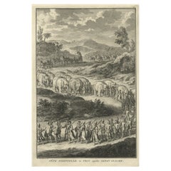
Print of the Solemn Celebration Sapan Giacche in Pegu, Burma 'Myanmar', 1725
Located in Langweer, NL
Antique print, titled: 'Fete Solennelle de Pegu appelee Sapan Giacche'
This plate shows the Solemn celebration called Sapan Giacche in Pegu or Bago, the capital of the Bago Regio...
Category
1720s Antique Netherlands Maps
Materials
Paper
$323 Sale Price
20% Off
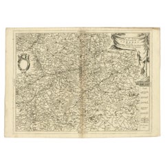
Detailed Antique Map of Western Belgium and Eastern France by Coronelli, 1690
By Vincenzo Coronelli
Located in Langweer, NL
Antique map titled 'Contado d'Hannonia (..)'. Map of western Belgium and eastern France, from south of Brussels (not shown) to Cambrai, France, generally centered around the towns of...
Category
17th Century Antique Netherlands Maps
Materials
Paper
$466 Sale Price
20% Off
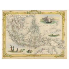
Decorative Antique Map of the Malay Archipelago or East Indies Island, 1851
Located in Langweer, NL
Antique map Indonesia titled 'Malay Archipelago, or East India Islands'. With vignettes of Victoria Mount, New Guinea, Nativaes of New Guinea an...
Category
1850s Antique Netherlands Maps
Materials
Paper
$1,046 Sale Price
20% Off
Original Antique Map of England with Decorative Cartouche
Located in Langweer, NL
Antique map titled 'l'Angleterre (..)'. Original antique map of England, with beautiful hand coloring and decorative cartouche. This map originates from 'Nouvel Atlas Portatif destin...
Category
Late 18th Century Antique Netherlands Maps
Materials
Paper
$275 Sale Price
20% Off
Antique Print with Charts of York's Bay and Surroundings
Located in Langweer, NL
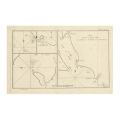
Antique map titled 'Côte depuis la Baye d'York (..)'. Charts of York's Bay, Haven of the Three Islands, St. David's Bay, and Elizabeth's Bay.
Published in an edition of John Hawk...
Category
Late 18th Century Antique Netherlands Maps
Materials
Paper
$418 Sale Price
20% Off
Antique Map of Italy with an Inset of Rome, 1812
Located in Langweer, NL
Antique map titled 'Italie Ancienne'.
Old map of ancient Italy, with an inset map of the region of Rome. This map originates from 'Atlas Supplementaire du Precis de la Geographie...
Category
19th Century Antique Netherlands Maps
Materials
Paper
$152 Sale Price
20% Off
Original Hand-Colored Antique Print of Various Apples, 1758
Located in Langweer, NL
Antique print depicting apple variaties including the Syden Hemmetje, Somer-Erveling, Suiker-Appel, Princes-Appel, Witte Bloem-Soete, Swaan-Appel, Roode Gulderling, Rode Herfst-Cabri...
Category
18th Century Antique Netherlands Maps
Materials
Paper
$164 Sale Price
20% Off
Antique Map of Denmark with Insets of Iceland and the Faroe Islands, c.1873
Located in Langweer, NL
Antique map titled 'Denemarken, Sleeswijk-Holstein en Lauenburg'. Old map depicting Denmark, with inset maps of Iceland and the Faroe Islands. This map originates from 'School-Atlas ...
Category
19th Century Antique Netherlands Maps
Materials
Paper
$152 Sale Price
20% Off
Antique Map of the United States ' South East ' by Johnston '1909'
Located in Langweer, NL
Antique map titled 'United States of North America'. Original antique map of United States of North America ( South East Sheet ). With in...
Category
Early 20th Century Netherlands Maps
Materials
Paper
$333 Sale Price
20% Off
Antique Map of the Region Between the Seine and Loire Rivers by Janssonius, 1657
Located in Langweer, NL
Antique map of France titled 'Gastinois et Senonois'. Regional map of central France, northeast of Orleans showing the area between the Seine and Loire Rivers. Includes Auxerre, Sens...
Category
17th Century Antique Netherlands Maps
Materials
Paper
$274 Sale Price
20% Off
Antique Print of the Battle of Camaret in the Nine Years War, Near Brest, France
Located in Langweer, NL
Antique print titled 'Plan of the Attack of Camaret Bay, on the Coast of Bretagne, thro which lies the Harbour of Brest'. Striking plan showing the details of the battle at the mouth of Cameret Bay. Includes a battle plan...
Category
Mid-18th Century Antique Netherlands Maps
Materials
Paper
$618 Sale Price
20% Off
Large Antique Map of France with Original Hand Coloring
Located in Langweer, NL
Antique map titled 'France in Provinces'. Beautiful antique map of France. Drawn and engraved for John Thomson's 'New General Atlas' published circa 1814.
Category
Early 19th Century Antique Netherlands Maps
Materials
Paper
$418 Sale Price
20% Off
Antique Map of Rome and Athens by Perthes, 1848
Located in Langweer, NL
Antique map titled 'Roma Vetus, Athenae, Urbs, Campus Trojae'. Old map of Rome, Athens and surroundings originating from 'Orbis Terrarum Antiquus in usum S...
Category
19th Century Antique Netherlands Maps
Materials
Paper
$94 Sale Price
20% Off
Old Original Handcoloured Map of the Former Province of Perche, France, ca.1640
Located in Langweer, NL
Antique map titled 'Perchensis Comitatus - La Perche compte'.
Old map of the former province of Perche, France. Until the French Revolution, Perche was bounded by four ancient te...
Category
1640s Antique Netherlands Maps
Materials
Paper
$685 Sale Price
20% Off
Antique Map of the Barbary Coast by Lapie, 1842
Located in Langweer, NL
Antique map titled 'Carte de la Barbarie contenant l'Empire de Maroc (..)'. Map of the Barbary Coast. This map originates from 'Atlas universel de géographie ancienne et moderne (..)...
Category
19th Century Antique Netherlands Maps
Materials
Paper
$232 Sale Price
20% Off
French Antique Map of Northern Africa and Libya, c.1840
Located in Langweer, NL
Antique map titled 'Marok, Alger et Tunis - Etat de Tripoli'. Map of Northern Africa and Libya. This map originates from 'Le globe Atlas classique Universel de géographie ancienne et...
Category
19th Century Antique Netherlands Maps
Materials
Paper
Antique Map of the British Isles by Lotter, 1764
Located in Langweer, NL
Antique map titled 'Le Grand Bretagne ou les Royaumes d'Angleterre et d'Ecosse'. Old engraved map of the British Isles (main islands United Kingdom & Ire...
Category
18th Century Antique Netherlands Maps
Materials
Paper
$318 Sale Price
20% Off
Antique Map of the Bay of Brusc, France
Located in Langweer, NL
Antique map titled 'Carte de la rade du Brusc'. Original map of the bay of Brusc, France. This map originates from 'Le Petit Atlas Maritime (..)' by J.N. Bellin. Published 1764.
...
Category
Mid-18th Century Antique Netherlands Maps
Materials
Paper
$323 Sale Price
20% Off
Antique Map of England and Wales, Also Showing the English Channel
Located in Langweer, NL
Antique map titled 'England and Wales'. Original antique map of England and Wales. Drawn and engraved by J. Dower. Originates from 'A General Descriptive Atlas Of The Earth, Containi...
Category
Mid-19th Century Antique Netherlands Maps
Materials
Paper
$142 Sale Price
20% Off
Original Hand-Colored Antique Print of Various Apples, 1758
Located in Langweer, NL
Antique print depicting apple variaties including the Rode Wijn-Appel, Geele Soete Silverling, Bellefleur, Oranje Appel, Bruindeling, Witte Renet, Groene Renet, Wildjes Appel (Reinet...
Category
18th Century Antique Netherlands Maps
Materials
Paper
$179 Sale Price
20% Off
Original Antique Map of the Duchy of Holstein
By Willem Blaeu
Located in Langweer, NL
Antique map titled 'Ducatus Holsatiae Nova Tabula'. Original old map of the Duchy of Holstein, the northernmost territory of the Holy Roman Empire, from the mid-17th Century. To the ...
Category
Mid-17th Century Antique Netherlands Maps
Materials
Paper
$1,046 Sale Price
20% Off
Small Steel Engraved Map of England
Located in Langweer, NL
Antique map titled 'England'. Original steel engraved map of England. Drawn by A. Arrowsmith, engraved by S. Hall. Published 1829 by Longman & Co, London.
Category
Mid-19th Century Antique Netherlands Maps
Materials
Paper
$123 Sale Price
20% Off
Steel Engraved Map of Ancient Britain
Located in Langweer, NL
Antique map titled 'Angleterre Ancienne'. Original old map of Ancient Britain. Source unknown, to be determined. Published circa 1880.
Category
Late 19th Century Antique Netherlands Maps
Materials
Paper
$114 Sale Price
20% Off
Antique Map of Russia in Europe, with Frame Style Border
Located in Langweer, NL
Antique map titled 'Russie d'Europe'. Attractive map of Russia in Europe, covers the European portions of Russia from the Arctic Sea south to the Black Sea and Caspian Sea. This map ...
Category
Mid-19th Century Antique Netherlands Maps
Materials
Paper
$123 Sale Price
20% Off
Original Antique County Map of Derbyshire, England
Located in Langweer, NL
Antique map titled 'Darbyshire'. Original antique map of the country of Derbyshire, England. Engraved by Robert Morden. Sold by Abel Swale, Awnsham and John Churchill...
Category
Late 17th Century Antique Netherlands Maps
Materials
Paper
$523 Sale Price
20% Off
Antique Map of the Netherlands, Belgium and Luxembourg
Located in Langweer, NL
Antique map titled 'Carte des Royaumes Hollande et Belgique'. Attractive map of the Netherlands, Belgium and Luxembourg. This map originates fro...
Category
Mid-19th Century Antique Netherlands Maps
Materials
Paper
$114 Sale Price
20% Off
Antique Map of Northern India 'British Indies', C.1880
Located in Langweer, NL
Plate 56 : 'Britsch-Indie, Noord.' (British Indies, North). This lithographed map originates from: 'Wereld-atlas voor Kantoor en Huiskamer' (transl: World Atlas for the office and li...
Category
19th Century Antique Netherlands Maps
Materials
Paper
$61 Sale Price
20% Off
Original Antique Map of England, Showing the Most Memorable Battles
Located in Langweer, NL
Antique map titled 'Carte d'Angleterre ou l'on fait observer les Batailes les plus Memorables de ce Royaume'. Original antique map of England, showing the most memorable battles. Thi...
Category
Early 18th Century Antique Netherlands Maps
Materials
Paper
$209 Sale Price
20% Off
Antique Map of the Coastline Between Calais and Estaples and Northern France
Located in Langweer, NL
Antique map titled 'Caletensium et Bononiensium Ditionis Accurata Delinatio [on sheet with] Veromanduorum Eorumque Confinium Exactissima Discriptio'. Two maps on a folio sheet. Calentensium covers the coastline between Calais and Estaples based in part on a four-sheet map by Nicolas de Nicolay...
Category
Early 17th Century Antique Netherlands Maps
Materials
Paper
$323 Sale Price
20% Off
Original Old & Rare View of the City of Workum, Friesland, The Netherlands, 1616
Located in Langweer, NL
Antique map titled 'Worcum'. This print depicts the city of Workum (Friesland, The Netherlands). With German captions. This print originates from 'Rerum Frisicarum Historia' publishe...
Category
1610s Antique Netherlands Maps
Materials
Paper
$399 Sale Price
20% Off
Antique Map of Holstein, Germany
Located in Langweer, NL
Antique map titled 'Holsatia Ducatus'. Original old map of Holstein, Germany. By Petrus Kaerius, published circa 1650. Pieter van den Keere (Latin: Petrus Kaerius 1571 – circa 1646) ...
Category
Mid-17th Century Antique Netherlands Maps
Materials
Paper
$361 Sale Price
20% Off
Antique Map of France with Inset showing the Northern Departments
Located in Langweer, NL
Antique map titled 'The Republic of France divided according to its 103 Departments'. Decorative map of France. Includes a large cartouche and an in...
Category
Late 18th Century Antique Netherlands Maps
Materials
Paper
$627 Sale Price
20% Off
Large Antique County Map of Warwickshire, England
Located in Langweer, NL
Antique map titled 'A Map of Warwickshire from the best Authorities'. Original old county map of Warwickshire, England. Engraved by John Cary. Originates from 'New British Atlas' by ...
Category
Early 19th Century Antique Netherlands Maps
Materials
Paper
$237 Sale Price
20% Off
Beautiful Lithograph of The Vulcano Gunung Lamongan, Java, Indonesia, c.1853
Located in Langweer, NL
Antique print titled 'G. Lamongan'. Beautiful lithograph of Gunung Lamongan. Gunung Lamongan or Mount Lamongan (1,651m - 5, 417 ft) is a small stratovolcano located between the massi...
Category
1850s Antique Netherlands Maps
Materials
Paper
$399 Sale Price
20% Off
Antique Map of Russia in Asia by Tallis, c.1851
Located in Langweer, NL
Antique map titled 'Russia in Asia'. Map of Russia in Asia. Showing vignettes of a polar hunting scene, Skorskarskoi Pagost, Troitsk and Kamchatkan Dogs. Originates from 'The Illustrated Atlas, And Modern History Of The World Geographical, Political, Commercial & Statistical, Edited By R. Montgomery Martin'. Published; John Tallis London, New York, Edinburgh & Dublin. 1851. Drawn and Engraved by J. Rapkin. Artists and Engravers: John Tallis (1817-1876) was a British map...
Category
19th Century Antique Netherlands Maps
Materials
Paper
Cross Erected in Memory of Queen Eleanor, Basire, 1791
Located in Langweer, NL
Antique print titled 'The Cross erected in memory of Queen Eleanor, near Northampton'. Antique print depicting the Eleanor cross near Northampton. Artists and Engravers: Made by J. B...
Category
18th Century Antique Netherlands Maps
Materials
Paper
$142 Sale Price
20% Off
Pl. VI Habitations Ouvrières a Laeken, Chabat, c.1900
Located in Langweer, NL
Antique print titled 'Habitations Ouvrières a Laeken pour les ouvriers de l'usine a gaz de la Ville de Bruxelles, Mr. V. Jamaer, Architecte'. This print depicts the design of a buidl...
Category
20th Century Netherlands Maps
Materials
Paper
$120 Sale Price
20% Off
French Antique Map of India with an Inset of Pondicherry, 1835
Located in Langweer, NL
Antique map India titled 'Presqu'ile de l'Inde en de ca du Gange'. Miniature map depicting India with an inset map of Pondicherry (Puducherry). This ...
Category
19th Century Antique Netherlands Maps
Materials
Paper
$152 Sale Price
20% Off
Original Antique Regional Map of France with Orleans, Auxerre and Montargis
By Johannes Janssonius
Located in Langweer, NL
Original antique map titled 'Gastinois et Senonois'. Beautiful regional map of France. With Corbeil in the north, Pont sur Seyne in the east, Auxerre in the south, and Orleans in the...
Category
Mid-17th Century Antique Netherlands Maps
Materials
Paper
$799 Sale Price
20% Off
Antique Map of China Including Korea and Taiwan by Vaugondy, 1749
Located in Langweer, NL
Antique map titled 'Empire de la Chine'. Beautiful map of China including Korea and Taiwan (Formosa). This map originates from 'Atlas Universel (..)' by Gilles Robert de Vaugondy, 17...
Category
Mid-18th Century Antique Netherlands Maps
Materials
Paper
$475 Sale Price
20% Off
Antique Map of the British Isles by Johnston '1909'
Located in Langweer, NL
Antique map titled 'The British Isles'. Original antique map of the British Isles. With inset maps of the Shetland Islands, Chanel Islands, and London. T...
Category
Early 20th Century Netherlands Maps
Materials
Paper
$237 Sale Price
20% Off
Antique Map of the Eastern Part of the World by Tirion, 1755
By Isaak Tirion
Located in Langweer, NL
Antique map titled 'Nieuwe Kaart van het Oostelykste Deel der Weereld, dienende tot Aanwyzing van de Scheepstogten der Nederlanderen naar Oostindië'. Australia (Nieuw Holland) shown ...
Category
Mid-18th Century Dutch Antique Netherlands Maps
Materials
Paper
$523 Sale Price
26% Off
Antique Map of the Region of Sarlat in France by Janssonius, 1657
By Johannes Janssonius
Located in Langweer, NL
Antique map of France titled 'Le Diocese de Sarlat dioccesis Sarlatensis'. Decorative map of the Sarlat region, part of the Dordogne department. This map originates from 'Atlas Novus...
Category
17th Century Antique Netherlands Maps
Materials
Paper
$523 Sale Price
20% Off
Small Antique World Map in Decorative Old Hand-Colouring, circa 1840
Located in Langweer, NL
Antique map titled 'Wereld Kaart'. Small and very decorative double hemisphere world map. Source unknown, to be determined. Published c.1840.
Artists and Engravers: Daniel Veelwaa...
Category
19th Century Antique Netherlands Maps
Materials
Paper
$209 Sale Price
20% Off
Antique Map of Europe by Levasseur 'c.1840'
Located in Langweer, NL
Antique map titled 'Europe'. Original antique map of Europe. Decorative map of the continent surrounded by allegorical vignettes. Engraved by Raimond Bonheur, father of the famous Fr...
Category
Mid-19th Century Antique Netherlands Maps
Materials
Paper
$475 Sale Price
20% Off
Antique Print of Ribbons of King James VI by Gibb, 1890
Located in Langweer, NL
Antique print titled 'Leading Strings of King James VI'. Chromolithographic plate originating from 'The Royal House of Stuart. Illustrated By a Series of Fort...
Category
19th Century Antique Netherlands Maps
Materials
Paper
$80 Sale Price
20% Off
Antique Map of the Region of Lampung, Sumatra, Indonesia, 1900
Located in Langweer, NL
Antique map of the region of Lampung, Sumatra. Also depicting part of Palembang and Java. This map originates from 'Atlas van Nederlandsch Oost- en West-Indië' by I. Dornseiffen.
A...
Category
20th Century Netherlands Maps
Materials
Paper
Antique Map of France from an Old Dutch School Atlas, 1852
Located in Langweer, NL
Antique map titled 'Frankrijk'. Map of France. This map originates from 'School-Atlas van alle deelen der Aarde' by Otto Petri. Artists and Engravers: Published by A. Baedeker (Otto ...
Category
19th Century Antique Netherlands Maps
Materials
Paper
$114 Sale Price
20% Off
Antique Map of Batavia, Dutch East Indies, Nowadays Jakarta, Indonesia, ca.1669
Located in Langweer, NL
Antique map titled 'Ware afbeeldinge wegens het Casteel ende Stadt Batavia gelegen opt groot Eylant Java Anno 1679. Plan de la Ville et du Chateau de Batavia en l'Isle de Iava. 1679....
Category
1660s Antique Netherlands Maps
Materials
Paper
$1,284 Sale Price
20% Off
Large, Original Antique Print of the Roman Tropaeum Alpium, Near Monaco, ca.1780
Located in Langweer, NL
Antique print titled 'Ruines du Monument de la Turbie, près de Monaco'. Large, original antique print of the Tropaeum Alpium, a Roman trophy (tropaeum) ce...
Category
1780s Antique Netherlands Maps
Materials
Paper
$437 Sale Price
20% Off
Hand Colored Antique Map of the Department of L'aisne, France
By Victor Levasseur
Located in Langweer, NL
Antique map titled 'Dépt. de l'Aisne'. Map of the French department of l'Aisne, France. The whole is surrounded by elaborate decorative engravings designed to illustrate both the nat...
Category
Mid-19th Century Antique Netherlands Maps
Materials
Paper
$323 Sale Price
20% Off
Antique Map of France by Migeon, 1880
Located in Langweer, NL
Antique map titled 'France Physique'. Old map of France. This map originates from 'Géographie Universelle Atlas-Migeon' by J. Migeon.
Artists and Engravers: Published by J. Migeon...
Category
19th Century Antique Netherlands Maps
Materials
Paper
$123 Sale Price
20% Off
Antique Map of the World by D'Urville '1853'
Located in Langweer, NL
Antique map titled 'Voyage Autour du Monde'. Original map of the world. This map originates from volume 1 of 'Voyage Autour du Monde' by Comte-Amiral Dumont D'Urville.
Category
Mid-19th Century Antique Netherlands Maps
Materials
Paper
$285 Sale Price
20% Off
Original Antique Map of Juan Fernandez by Van Schley, 1757
Located in Langweer, NL
Antique map titled 'Carte Particuliere de l'Isle de Juan Fernandez - Byzondere Kaart van 't Eiland Juan Fernandez'.
Map of the Chilean Juan Fernandez Island, topped by a view of it...
Category
18th Century Antique Netherlands Maps
Materials
Paper
$275 Sale Price
20% Off
Antique Map of the City of Zutphen by Guicciardini, 1613
Located in Langweer, NL
Antique map Zutphen titled 'Zutphen'. This map depicts the city of Zutphen, Gelderland, The Netherlands. Originates from 'Discrittione di tutti i Paesi Bassi'.
Artists and Engrav...
Category
17th Century Antique Netherlands Maps
Materials
Paper
$159 Sale Price
20% Off
Map of Amersfoort and Surroundings by Covens & Mortier, published in 1747
Located in Langweer, NL
Map of Amersfoort and Surroundings by Covens & Mortier, published in 1747
Hand-coloured copper engraving titled *Carte Particulière des Environs de Amersfoort*, created by Jean Cove...
Category
1740s Antique Netherlands Maps
Materials
Paper
$228 Sale Price
20% Off
Antique Costume Print of a Slovake from the Region of Košice, ca 1880
Located in Langweer, NL
Antique costume print titled 'Slovake aus der Gegend von Kaschau'. Old print showing a Slovake from the area of Košice. This print originates from 'Blätter für Kostümkunde'. The Slov...
Category
19th Century Antique Netherlands Maps
Materials
Paper
$209 Sale Price
20% Off
Antique Print of the Landing at Tanna Island by Cook, 1803
Located in Langweer, NL
Antique print New Hebrides titled 'Landing op het Eiland Tanna, een van de Nieuwe Hebriden'. Antique print depicting the landing at one of the islands of the New Hebrides, Vanuatu. O...
Category
19th Century Antique Netherlands Maps
Materials
Paper
$513 Sale Price
20% Off
Antique Map of North Africa and South Africa by Black, 1854
Located in Langweer, NL
Antique map titled 'Africa north part - Africa south part'. Old map of Africa showing the region of Morocco, Algeria and South Africa. This map orginates from 'General Atlas Of The W...
Category
19th Century Antique Netherlands Maps
Materials
Paper
$104 Sale Price
20% Off
Recently Viewed
View AllMore Ways To Browse
Flemish Cabinets 17th Century
Fox Figurine
Fox Hunt Plate
French Art Deco Rosewood Buffet
French Bulldog Gold
French Louis Xvi Enfilade
French Provincial Antique Dresser
French Provincial Furniture Antique Dresser
French Zinc Bar
Frog Figurine
Georgian Mahogany Longcase Clock
German Folding Trolley
Glass And Brass Fireplace Screen
Glass Nude Woman Sculpture
Glass Parrots
Glass Poodle
Gothic Corbel
Granite Pagoda
