Collectibles and Curiosities on Sale

to
5,461
1,375
6,849
41
41
350
168
91
80
65
50
41
40
35
26
24
17
15
10
8
7
5
3
2,708
2,344
1,797
82
540
697
282
112
30
79
124
69
147
129
89
64
29
4,941
1,187
604
279
237
1,284
499
451
279
261
6,931
6,927
6,927
104
55
21
18
13
Sale Items
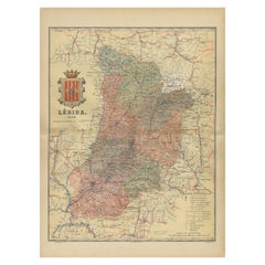
Lleida 1902: A Cartographic Perspective of Catalonia's Gateway to the Pyrenees
Located in Langweer, NL
The map for sale shows the province of Lleida, located in the western part of Catalonia, Spain, as of 1902. Here are the key features depicted on the map: - **Topography**: The map ...
Category

Antique Early 1900s Maps

Materials

Paper

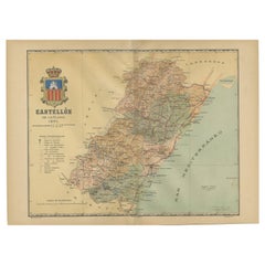
Castellón de la Plana 1901: A Cartographic Perspective of the Valencian Coast
Located in Langweer, NL
The authentic map depicts the province of Castellón de la Plana, often referred to simply as Castellón, situated in the eastern part of Spain in the Valencian Community, and the map ...
Category

Antique Early 1900s Maps

Materials

Paper

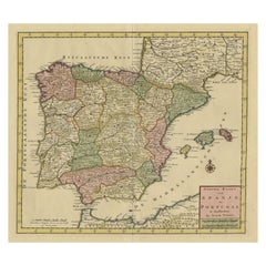
Detailed Old Map showing Spain and Portugal Incl. Majorca, Minorca & Ibiza, 1740
Located in Langweer, NL
Antique map titled 'Nieuwe Kaart van Spanje en Portugal.' Attractive detailed map showing Spain and Portugal. Including Majorca, Minorca and Ibiza. Title in block-style cartouche...
Category

Antique 1740s Maps

Materials

Paper

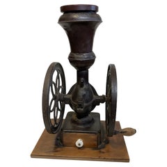
Landers, Frary & Clark Cast Iron Coffee Grinder/Mill
By Landers, Frary & Clark 1
Located in Guaynabo, PR
This a large and heavy Landers, Frary & Clark cast iron coffee grinder#20 1/2. It has a bell shaped nickel hopper with a flat wood lid and two...
Category

Antique Late 19th Century American American Classical Historical Memorab...

Materials

Iron, Nickel

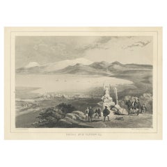
Antique Print of Hakodate from Telegraph Hill in Oshima, Hokkaido, Japan
Located in Langweer, NL
Antique print titled ‘Hakodadi from Telegraph Hill’. View of Hakodate, a city and port located in Oshima Subprefecture, Hokkaido, Japan. This print originates from 'Narrative of the ...
Category

Antique 19th Century Prints

Materials

Paper

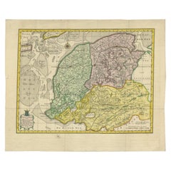
Antique Map of Friesland by Van Krevelt, 1787
Located in Langweer, NL
Antique map titled 'Nieuwe Kaart van Friesland behoorende tot het Vaderlandsch Woordenboek van Jacobus Kok'. Original antique map of the province of Friesland, the Netherlands. This ...
Category

Antique 18th Century Maps

Materials

Paper

Paul Louis Gastaud, Telephone Radio/ K7
By Paul-Louis Gastaud
Located in Marbella, ES
Paul Louis Gastaud (20th) Telephone Radio/ K7 Hi-Fi system embedded in an ABS phone Signed Measures: H 126 × Ø 41 cm Functional Excellent cond...
Category

Vintage 1970s French Musical Instruments

Materials

Plastic

1940s Art Deco Cigarette Lighter Aluminum Block Lift Arm
By Dunhill
Located in Chula Vista, CA
Art Deco Vintage 1940s Aluminum Block Lift Arm Side Wheel Cigarette Lighter 2.13 x 1 W x .63 Original unrestored vintage preowned condition. Selling as is untested. Refer to images....
Category

Vintage 1940s American Art Deco Tobacco Accessories

Materials

Aluminum

Decorative Faux Turtle Shell on Wrought Iron Stand
Located in Chicago, IL
A very sculptural resin tortoise (or turtle) shell, mounted on a tall black wrought iron stand. Hand-painted finish includes accents of copper and gold coloring. Shell measures: 28" ...
Category

Late 20th Century American Collectibles and Curiosities

Materials

Resin

Map of the Mozambique and Tanzania Coast & Inset Map of Anjouan Island, ca.1700
Located in Langweer, NL
Antique map titled 'Carte particuliere des Costes de l'Afrique'. Depicts the coasts of Mozambique and Tanzania. With an inset map of Anjouan Island. Artists and engravers: Pub...
Category

Antique Early 1700s Maps

Materials

Paper

Antique Victorian Hardwood Piano Stool with Decorative Base Height Adjustable
Located in West Sussex, Pulborough
We are delighted to offer for sale this stunning hand carved Victorian circa 1880 Piano stool with height adjustable top A very good looking and well-made piano stool, its quite w...
Category

Antique 1880s English Victorian Stools

Materials

Upholstery, Hardwood

Map of Kingdoms of Castile, León, Galicia, Asturias, Biscay and Navarre in Spain
Located in Langweer, NL
Antique map titled 'Partie Septentrionale de la Couronne de Castille (..)'. Decorative and highly detailed map of Northwestern Spain, including Gallicia...
Category

Antique Mid-18th Century Maps

Materials

Paper

Old Decorative Map of the West African Coast & St. Thomae Island, c.1600
Located in Langweer, NL
Antique map titled 'Guineae Nova Descriptio.' This very decorative map shows the West African coast from Senegal (the 'Rio Senega' is the Senegal River) to Cape Lopez on the Gulf...
Category

Antique Early 1600s Maps

Materials

Paper

Antique Map of Gelderland, Largest Province of The Netherlands, c.1870
Located in Langweer, NL
Antique map titled 'De Provincie Gelderland'. Map of the province of Gelderland, the Netherlands. This map originates from 'F. C. Brugsma's Atlas van het Koninkrijk der Nederland...
Category

Antique 19th Century Maps

Materials

Paper

View of the Salon and Dining Room of Wilton House in Salisbury, Wiltshire, 1717
Located in Langweer, NL
Antique print titled 'Section of the Salon, one end of the great dining room (..)'. View of the salon ('Single Cube Room') and great dining room of Wilton House, also known as th...
Category

Antique 1710s Architectural Models

Materials

Paper

Large Antique Map of Egypt and the Nile Delta by Wyld, 1854
Located in Langweer, NL
Antique map titled 'Lower Egypt and the adjacent desert, with a part of Palestine to which has been addes the nomenclature of the Roman age by L.S. de la Rochette'. Map of Egypt and ...
Category

Antique 19th Century Maps

Materials

Paper

Antique Print of a Swiss Guard for the Pope in The Vatican, 1850
Located in Langweer, NL
Description: Antique costume print titled 'Sergent Suisse de la Garde du Pape'. Old print depicting a Swiss sergeant of the Pope's guard. This print originates from 'Costumes Mod...
Category

Antique 1850s Prints

Materials

Paper

Military Costume of the Gothic Nations on the Western Coasts of the Baltic, 1815
Located in Langweer, NL
Antique print titled 'Military Costume of the Gothic Nations on the Western Coasts of the Baltic'. Old print of Baltic military costumes. Originates from 'The costume of the origin...
Category

Antique 1810s Prints

Materials

Paper

16th Century Prie-Dieu 'Praying Kneeler' Made of Walnut and Burl
Located in North Miami, FL
16th Century Italian Prie-dieu (Praying Kneeler) made of Italian walnut and burl wood.
Category

Antique 16th Century Italian Renaissance Cabinets

Materials

Wood, Walnut, Burl

Topographical and Administrative Cartography of Segovia in Spain, 1902
Located in Langweer, NL
An original old map of the province of Segovia from the year 1902. Segovia is a historic area located in the central part of Spain, northwest of Madrid. Known for its rich history, a...
Category

Antique Early 1900s Maps

Materials

Paper

Antique Map of the City of Goch by Blaeu, 1649
Located in Langweer, NL
Antique map titled 'Gochum vernacule Goch'. Old map of the city of Goch, Germany. This map originates from 'Novum Ac Magnum Theatrum Urbium Belgicæ Liberæ ac Foederatæ' by J. Blaeu. ...
Category

Antique 17th Century Maps

Materials

Paper

Antique Map of Victoria, or Port Phillip in Australia, ca. 1850
Located in Langweer, NL
This antique map, measuring approximately 12.7 x 10.0 inches, showcases Victoria, specifically centered around Melbourne, Australia. Crafted by John Tallis around 1850, this map is p...
Category

Antique Mid-19th Century European Maps

Materials

Paper

Antique Map of Africa by Homann Heirs, '1804'
Located in Langweer, NL
Antique map titled 'Charte von Africa'. Large, original antique map of Africa by Franz Ludwig Güssefeld. Published by Homann Heirs, 1804.
Category

Antique Early 19th Century Maps

Materials

Paper

Original Antique Map of the Province of Utrecht, the Netherlands, ca.1720
Located in Langweer, NL
Antique map titled ‘Tabula Nova Provinciae Ultrajectinae (..)’. Original antique map of the province of Utrecht, the Netherlands. It shows the region of Amsterdam, Utrecht, Gouda, ...
Category

Antique 1720s Maps

Materials

Paper

Early 19th Century Polish Brass Hanukkah Lamp Menorah
Located in New York, NY
Brass Hanukkah lamp Menorah, Poland, circa 1810. Cast in Bench form, on four feet. The backplate is cast and pierced featuring scrollwork. This lamp was made by the technique known as "sand casting". This process begins with a wooden mold that was carved out to create negative space, which in turn is used to make the inverse form or shape to be used for the casting of metal. The mold is pressed into fine sand mixed with clay, then removed, and molten brass poured into the impression. When a mold wears out, a casting from that mold is often used as the mold for the next generation. Those later lamps...
Category

Antique Early 19th Century Polish Religious Items

Materials

Brass

Scale Model Vintage Sterling Silver Mercedes 500 K, circa 1980
Located in Bath, GB
Beautifully executed along with it's original solid wooden plinth. Both the sterling silver label and the car have matching hallmarked for 925 silver and the Italian maker mark numbe...
Category

Vintage 1980s Italian Modern Models and Miniatures

Materials

Sterling Silver

Antique Map of Europe by Levasseur, '1875'
Located in Langweer, NL
Antique map titled 'Carte générale de l'Europe'. Large map of Europe. This map originates from 'Atlas de Géographie Moderne Physique et Politique' by A. Levasseur. Published 1875.
Category

Antique Late 19th Century Maps

Materials

Paper

Map of Sevilla Province, 1901: A Depiction of The Spanish Cultural Heartland
Located in Langweer, NL
The print for sale here depicts a historical map of the province of Sevilla (Seville) from the year 1901. Sevilla is located in the southern part of Spain and is part of the autonomo...
Category

Antique Early 1900s Maps

Materials

Paper

1640 Map of North Africa Nova Barbariae Descriptio or The Barbarian Coast
Located in Langweer, NL
1640 Antique Map of North Africa 'Nova Barbariae Descriptio' by Johannes Janssonius This antique map titled Nova Barbariae Descriptio*, published by Johannes Janssonius around 1640,...
Category

Antique 1640s Maps

Materials

Paper

An Art And Crafts Mezuzah Case, Israel 1948. Judaica
Located in New York, NY
An Art and crafts Mezuzah Case made in Israel in 1948. Early Israeli Mezuzah case on a shaped piece of wood covered in green velvet with a scroll encased...
Category

Vintage 1940s Israeli Mid-Century Modern Religious Items

Materials

Brass

Huesca 1901: A Geographic Overview of Aragon's Northern Frontier in Spain
Located in Langweer, NL
The map provided is of the province of Huesca, located in the northeastern part of Spain, within the autonomous community of Aragon, as of the year 1901. Here are some of the key fea...
Category

Antique Early 1900s Maps

Materials

Paper

Mid-century "Brilux" for Dunhill Brass Lift-Arm Table Lighter, Switzerland
By Dunhill
Located in Van Nuys, CA
This 1950s Brilux for Dunhill Swiss brass lift-arm table lighter combines timeless elegance with exceptional craftsmanship. Its solid brass body features a warm vintage patina, and t...
Category

Vintage 1950s Swiss Mid-Century Modern Tobacco Accessories

Materials

Brass

Original Copper Engraving of Koroni 'or Corone', Greece, 1688
Located in Langweer, NL
Antique print titled 'Das Aussehen der Stadt und Vestung Coron von der Seit des Auffgang'. Copper engraving of Koroni (or Corone), Greece. This print originates from 'Ruhm-belorb...
Category

Antique 1680s Maps

Materials

Paper

Antique Map of the Province of Navarre with the City of Pamplona, Spain
Located in Langweer, NL
Antique map titled 'Royaume de Navarre (..)'. Decorative map of the province Navarre (Spanish: Navarra) in Northern Spain centered on the city of Pamplona. Published by N. Sanson, 16...
Category

Antique Mid-17th Century Maps

Materials

Paper

19th Century Spanish Sporting Painting by E.Gioquinto, 1892
Located in West Palm Beach, FL
19th century Spanish sporting painting by E.Gioquinto, 1892, a finely painted gem of a hunter on a lake Measures: Oil on board 11.5" x 8.5" Giltwood frame 14" x 10".
Category

Antique 1890s Spanish Sporting Art Paintings

Materials

Wood, Giltwood

Antique Map of Northern India, Bengal, and Surrounding Regions by Tardieu, 1802
Located in Langweer, NL
This is an original antique map titled "Inde, Indostan Bengale &c. et Partie Septentrionale de la Presqu'isle en deça du Gange," depicting the northern part of the Indian subcontinen...
Category

Antique Early 1800s Maps

Materials

Paper

Antique Map of the Holy Land, Showing the Location of the Various Tribes
Located in Langweer, NL
Antique map titled 'Judaea seu Terra Sancta quae Hebraeorum sive Israelitarum (..)'. Map of The Holy Land, showing the location of the various tribes, in two kingdoms, Judah and Isra...
Category

Antique Early 18th Century Maps

Materials

Paper

Vintage 1950s Prop-Spinner
Located in San Francisco, CA
A Vintage Prop-Spinner from an early 1950s navy Neptune patrol plane.
Category

Vintage 1950s American Craftsman Aviation Objects

Materials

Steel

Vintage 1950s Prop-Spinner
$2,240 Sale Price
20% Off
Antique Map of the World in two sheets, 1852
Located in Langweer, NL
Antique map titled 'The World on Mercator's Projection'. Two individual sheets of the world. This map originates from 'Lowry's table Atlas constructed and engraved from the most rece...
Category

Antique Mid-19th Century Maps

Materials

Paper

Original Antique Map of Martinique Island In The West Indies by Bonne, circa1780
Located in Langweer, NL
Antique map titled 'Carte de l'Isle de la Martinique Colonie Francoise dans les Isles Antilles'. Detailed map of the French Island of Martinique. Many towns and harbours, anchor pl...
Category

Antique 18th Century Maps

Materials

Paper

Antique Map of Cordes Bay, Port Famine, Woods Bay and Surroundings
Located in Langweer, NL
Antique map titled 'Baye et Havre de Cordes (..)'. Four maps on the one sheet of; Cordes Bay, Port Famine, Woods Bay, Port Gallant, Fortescue Bay, Chile based on the voyage of John B...
Category

Antique Late 18th Century Maps

Materials

Paper

Set of Vintage "Schweizer" Lighter and Ashtray by Pagnossin, 1980s
By Pagnossin Ceramica
Located in Roma, IT
Set of Vintage Ceramic Lighter and Ashtray by Pagnossin Schweizer. Very good condition.
Category

Vintage 1980s German Art Nouveau Tobacco Accessories

Materials

Metal

Antique Metal Scroll Document Holder, circa 1900
Located in Miami, FL
Antique metal scroll document holder, circa 1900 Antique metal scroll holder, circa 1900. The cylindrical container with relief scenic repoussé work dec...
Category

20th Century French Tobacco Accessories

Materials

Metal

Vintage Bell Southwest Bell Trading Post Turquoise and Sterling Silver Ring
Located in Van Nuys, CA
Vintage Southwest style bell trading post ring with a sterling silver band and a large turquoise stone. Ring size 10.
Category

Vintage 1950s American Mid-Century Modern Collectible Jewelry

Materials

Sterling Silver

Set of Three Vintage Doll Head / Face Molds Steampunk
Located in San Diego, CA
Rare set of three vintage metal doll head / face molds, circa 1930s. The Industrial looking pieces are quite unique and make a great "Steampunk" decor item. Wonderful natural patina ...
Category

Antique Early 19th Century American Steampunk Historical Memorabilia

Materials

Metal

Lovely Victorian Boy Chasing a Cat Met Aneroid Barometer Painted Cast Iron
Located in West Sussex, Pulborough
We are delighted to offer for sale this Victorian boy chasing a cat cast iron aneroid barometer Dimensions: Height 27cm Width 23cm Depth 9.5c...
Category

Antique 19th Century English Victorian Scientific Instruments

Materials

Iron

Antique Map of the City of Assen in The Netherlands, 1865
Located in Langweer, NL
Drenthe - Gemeente Assen. (no 2, Stad). These scarse detailed maps of Dutch Towns originate from the 'Gemeente-atlas' of Jacob Kuyper. This atlas of all towns in the Netherlands was ...
Category

Antique 19th Century Maps

Materials

Paper

Rare Antique Map of Southwestern Europe and West Africa by V.M. Coronelli, 1692
By Vincenzo Coronelli
Located in Langweer, NL
Antique Globe Gore: Southwestern Europe and West Africa by Vincenzo Coronelli This exquisite, hand-colored globe gore by Vincenzo Coronelli, one of the most renowned 17th-century cartographers, represents Southwestern Europe and West Africa. A segment of Coronelli's monumental 42-inch terrestrial globe, this gore is a remarkable example of the artistry and geographical knowledge of the late 1600s. Covering France, the Iberian Peninsula, and all of Africa west of a line extending from Algeria to the Bight of Benin, it also includes the Canary Islands and Madeira. Coronelli’s globe gores are celebrated for their exceptional engraving and accuracy, and this piece is no exception. The coastline of Africa is depicted with remarkable precision for its time, reflecting the latest geographical knowledge of European explorers. In contrast, the interior of Africa—still a mystery to European mapmakers—features mythical elements such as fantastical mountain ranges and exotic fauna. Giraffes, elephants, lions, and mysterious giant birds populate the landscape, offering a glimpse into the imagination and curiosity of the era. One notable detail is the Gambia...
Category

Antique Late 17th Century Maps

Materials

Paper

Antique Map of Victoria ‘Australia’ by J. Tallis, circa 1855
Located in Langweer, NL
A highly decorative and finely engraved mid-19th century map of Victoria, Australia which appeared in John Tallis & co.'s The Illustrated Atlas (London...
Category

Antique Mid-19th Century Maps

Materials

Paper

Original 1882 Map of Arabia, Red Sea & Persian Gulf
Located in Langweer, NL
This print is a historically significant map titled "Arabia, the Red Sea, and the Persian Gulf," originally published in 1882 as part of the 'Comprehensive Atlas and Geography of the...
Category

Antique 1880s Maps

Materials

Paper

A Dutch Jewish Hospital Charity Container, Netherlands, Circa 1920
Located in New York, NY
A Dutch Jewish Hospital Charity Container from the Netherlands, circa 1920, is a unique Judaic historical artifact. This charity container was used to collect donations for a Jewish...
Category

Early 20th Century Dutch Religious Items

Materials

Tin

Christ, Brass and Colored Mirror, Italy, 1970s
Located in Palermo, IT
Christ, brass and colored mirror, Italy, 1970s. To hang on the wall. 60 cm high. The mirror is in shades of blue. Very beautiful and elegant. Purchas...
Category

Vintage 1970s Italian Religious Items

Materials

Brass

Mid-20th Century Israeli Shabbat Candle Holder by David Palombo
By David Palombo
Located in New York, NY
Shabbat candle holder crafted in brutalist style by David Palombo. Made for two candles, this uniquely shaped holder appears to be almost anthrop...
Category

Mid-20th Century Israeli Brutalist Religious Items

Materials

Iron

Rare Original Antique Ptolemy Map of Ceylon, Present Day Sri Lanka
Located in Langweer, NL
Original antique map titled 'Tab XII Asiae Taprobanam (..)'. For this map of Toprobana (Sri Lanka), Ptolemy drew on the accounts of travelers and sailors and though the information was secondhand and often inaccurate, it represented the most advanced account of the world's geography at that time. This map depicts the island with the typical misconceptions of the period with the enlarged island straddling the Equator and nearly divided by a ridge of mountains. A small part of India is incorrectly shown in the northeast corner of the map and a spurious coastline labeled Gangem fills the upper right corner. The stipple engraved sea contains an oriental ship...
Category

Antique Late 17th Century Maps

Materials

Paper

1930s French Large Tow Truck Toy in Red Metal
Located in Sofia, BG
Large toy tow truck made in red lacquered metal with nice details and opening compartments. France, circa 1930.
Category

Mid-20th Century French Toys and Dolls

Materials

Metal

Antique Map of North America Including the West Indies
Located in Langweer, NL
Original antique map titled 'Nord-America'. Old map of North America and the West Indies. Also showing British Overseas Territories and Hudson Bay. This map originates from Stiel...
Category

Antique Mid-19th Century Maps

Materials

Paper

Antique Map of the Brazil Railway Company, '1912'
Located in Langweer, NL
Antique map titled 'Brazil Railway Company'. This folding map is attached to the booklet titled 'The Brazil Railway Company'. It is a memorandum by A. H. A. Knox-Little, who was the ...
Category

Early 20th Century Maps

Materials

Paper

Antique Map of the Adriatic Sea and the Balkan by J. Janssonius, circa 1650
Located in Langweer, NL
Striking large-scale map of the Greater Balkans. Decorated with two large-scale cartouches, one showing two swordsman at odds with one another and the other ...
Category

Antique Mid-17th Century Maps

Materials

Paper

Original Old Map with Many Details Around Manilla in the Philippine Islands
By F. Valentijn
Located in Langweer, NL
Original antique map titled 'Carte du Canal des Iles Philippines (..) - Kaart van het Kanaal in de Filippynsche Eilanden (..)'. Striking and highly detailed chart of the Islands of the Philippines. Shows Islands, bays, reefs, soundings tracks of the Manila Galleon route, etc. Published 1724-1726 by Joannes van Braam...
Category

Antique Early 18th Century Maps

Materials

Paper

Antique Map of the Kamchatka Peninsula by Bellin, 1757
By J. Laurent
Located in Langweer, NL
Antique map titled 'Carte du Kamtchatka'. Antique map of the Kamchatka Peninsula. The map includes the island of Ouiakous Atch ou Anfinogen, Schoumctchou, and Sirinki ou Dilkon. Orig...
Category

Antique 18th Century Maps

Materials

Paper

Read More

Medal-Worthy Memorabilia from Epic Past Olympic Games

Get into the games! These items celebrate the events, athletes, host countries and sporting spirit.

Ahoy! You’ve Never Seen a Collection of Sailor Art and Kitsch Quite Like This

French trendsetter and serial collector Daniel Rozensztroch tells us about his obsession with objects related to seafaring men.

Pamela Shamshiri Shares the Secrets behind Her First-Ever Book and Its Effortlessly Cool Interiors

The sought-after designer worked with the team at Hoffman Creative to produce a monograph that beautifully showcases some of Studio Shamshiri's most inspiring projects.

Moroccan Artworks and Objects Take Center Stage in an Extraordinary Villa in Tangier

Italian writer and collector Umberto Pasti opens the doors to his remarkable cave of wonders in North Africa.

Montecito Has Drawn Royalty and Celebrities, and These Homes Are Proof of Its Allure

Hollywood A-listers, ex-pat aristocrats and art collectors and style setters of all stripes appreciate the allure of the coastal California hamlet — much on our minds after recent winter floods.

Whaam! Blam! Pow! — a New Book on Pop Art Packs a Punch

Publishing house Assouline and writer Julie Belcove have teamed up to trace the history of the genre, from Roy Lichtenstein, Andy Warhol and Yayoi Kusama to Mickalene Thomas and Jeff Koons.

What Makes a Gem-Encrusted Chess Set Worth $4 Million?

The world’s most opulent chess set, weighing in at 513 carats, is literally fit for a king and queen.

Tauba Auerbach’s Geometric Pop-Up Book Is Mighty Rare, Thanks to a Hurricane

This sculptural art book has an epic backstory of its own.
Recently Viewed

View All