Collectibles and Curiosities on Sale

  • The Design Lover's Sale

    Enjoy up to 60% off this marvelous selection of furniture, decor, fine jewelry, fashion and more.

    Terms & Conditions
to
3,850
1,548
5,339
78
69
573
219
153
103
94
61
50
42
40
40
15
13
12
8
8
6
4
3
1,754
1,464
2,121
147
477
866
426
62
31
81
115
82
237
154
166
89
52
3,006
1,443
749
352
263
1,482
568
479
293
284
5,486
5,460
5,481
54
53
21
18
18
Sale Items
Antique Map of Epirus 'Albania, Greece' by J. Janssonius, circa 1650
Located in Langweer, NL
This map covers the northwestern coast of Greece and part of present-day Albania. The map was drawn by Johannes Wilhelm Laurenberg, a mathematician and historian who produced several...
Category

Antique Mid-17th Century Maps

Materials

Paper

Cartographic Depiction of Flensburg and Surrounding Territories, Anno 1648
Located in Langweer, NL
Title: Landtcarte Vonn dem Ambte Flensborg, ohne Nordgoeßherde. Anno 1648. Description: This exquisitely detailed and old coloured map of Flensburg was crafted by the noted cartogr...
Category

Antique 1640s Maps

Materials

Paper

Antique Map of Italy from an Old French Atlas, 1842
Located in Langweer, NL
Antique map titled 'Carte de l'Italie'. Map of Italy. This map originates from 'Atlas universel de géographie ancienne et moderne (..)' by Pierre M. Lapie and Alexandre E. Lapie. A...
Category

Antique 19th Century Maps

Materials

Paper

Antique Map of the Region of Touraine by Janssonius 'circa 1650'
By Johannes Janssonius
Located in Langweer, NL
Antique map of France titled 'Touraine - Turonensis Ducatus'. Decorative map of the Touraine region, France. It shows the cities of Tours, Amboise and others. Published by J. Jansson...
Category

Antique Mid-17th Century Maps

Materials

Paper

Antique Engravings of Mauritius and Indonesia, incl de Banda Islands, c.1730
Located in Langweer, NL
Title on page: "Ins. de Cerno a. Nostatibus Mauritius Nominata [on sheet with] Gunnanappi Labetacq [and] Civitas Gammelamme [and] Rex Tubatus", Le Clerc, Jean This sheet includes fo...
Category

Antique 1730s Maps

Materials

Paper

Antique Map of the Mongol Empire, 1767
Located in Langweer, NL
Antique map titled 'The Moguls Empire divided into its principal governments'. Old map of India, Bangladesh, and parts of eastern China. Artists and Engravers: Published in the G...
Category

Antique 18th Century Maps

Materials

Paper

1970s Two-Strand Amber Colored Catalin Beaded Necklace
Located in Van Nuys, CA
This versatile necklace showcases two strands, with one strand twice the length of the other. It can be styled in two ways: worn double to create two strands of equal length or arran...
Category

Vintage 1970s Collectible Jewelry

Materials

Plastic

Antique Map of Northern Switzerland by Janssonius '1657'
By Johannes Janssonius
Located in Langweer, NL
Antique map 'Zurichgow et Basiliensis provincia'. Detailed map of northern Switzerland, including Zurich and Basel. This map originates from 'Atlas Novus, Sive Theatrum Orbis Orbis T...
Category

Antique Mid-17th Century Maps

Materials

Paper

Historical Map of Holstein - Copperplate Engraving by Matthias Seutter, ca. 1730
Located in Langweer, NL
Historical Map of Holstein - Copperplate Engraving by Matthias Seutter, ca. 1730 This impressive historical map, titled Holsatiae. Mappa universalis in suos ducatus nimirum Holsat...
Category

Antique 1730s Maps

Materials

Paper

Historic 1690 Map of Lorraine in France by Allard - Cities of Toul, Nancy, Metz
Located in Langweer, NL
Exactissima Lotharingia - A Rare 17th Century Map of Lorraine by Carel Allard This fascinating map of Lorraine, created by Carel Allard around 1690, is a stunning example of coppe...
Category

Antique 1690s Maps

Materials

Paper

Anglo-Indian Silver Belt Buckle with Red and Black Belts
Located in Hamilton, Ontario
This is a highly ornate and decorative old Anglo-Indian silver belt buckle with red and black ribbon belts. It dates to the early 20th centu...
Category

Early 20th Century Indian Anglo-Indian Collectible Jewelry

Materials

Silver

Rare Original Handcolored Miniature Map of Malaysia and Singapore, 1600
Located in Langweer, NL
Very handsome original old coloured copper engraving of Malaysia and Singapore, with parts of Sumatra, inc the island of Bangka and Bintam. Title of the map 'Description Malacca'. On...
Category

Antique Early 1600s Maps

Materials

Paper

Antique Print of a Vessel 'c.1850'
Located in Langweer, NL
Antique print titled Nave il Cesare l'Augusto'. Etching with hand coloring, published circa 1850. Signed Leveschi (?).
Category

Antique Mid-19th Century Prints

Materials

Paper

Original Antique Map Southeast of the Banda or Spice Islands, Indonesia, 1726
Located in Langweer, NL
Antique map titled 'Kaart van de Zuyd-Ooster Eylanden van Banda'. Map of the southeastern part of the Banda islands. This map originates from 'Oud en Nieuw Oost-Indiën' by F. Valen...
Category

Antique 1720s Maps

Materials

Paper

Vintage Inlay Carved Wood Cigarette Box Holder Dispenser with Ashtray and Mechan
Located in Van Nuys, CA
Vintage wooden cigarette box, cigarette holder, and ashtray with mechanical bird. simply push down the lever and a cigarette will be dispe...
Category

Vintage 1930s American Art Deco Tobacco Accessories

Materials

Wood

Collectible M&M's 80's display stand
Located in Taranto, IT
We present a 1980s collectible display from the M&M's brand. The item is in excellent conservative condition, no cosmetic or structural flaws to report, just slight and obvious sig...
Category

Vintage 1980s Italian Collectible Jewelry

Materials

Plastic

Antique Map of North and Central America by Migeon '1880'
By J. Migeon
Located in Langweer, NL
Antique map titled 'Amérique Septentrionale'. Old map of North and Central America. With a decorative vignette of the Niagara Falls. This map originates from 'Géographie Universelle ...
Category

Antique Late 19th Century French Maps

Materials

Paper

Antique Map of Siberia, Russia, 1859
Located in Langweer, NL
Antique map titled 'Siberia or Northern Asia'. Original antique map of Siberia or Northern Asia. This map originates from ‘The Imperial Atlas of Modern Geography’. Published by W. G....
Category

Antique Mid-19th Century Maps

Materials

Paper

Antique Bird's Eye-view Atjien or Atjeh in Aceh in Northern Sumatra, Indonesia
Located in Langweer, NL
Description: Antique print Indonesia titled 'Atsjien'. Bird's eye-view of the Town of Atjien on the northernmost point of Sumatra. This print originates from 'Oud en Nieuw Oost-Indië...
Category

Antique 1720s Maps

Materials

Paper

Antique Map of Doubs ‘France’ by V. Levasseur, 1854
By Victor Levasseur
Located in Langweer, NL
Antique map titled 'Dépt. du Doubs'. Map of the French department of Doubs, France. The whole is surrounded by elaborate decorative engravings designed to illustrate both the natural...
Category

Antique Mid-19th Century Maps

Materials

Paper

Handmade Silver and Enamel Bracelet Cuff
Located in Los Angeles, CA
Handmade silver and enamel bracelet cuff - wonderful detailing and colors - a must have for the bohemian styled person - a great stand alone piece or wit...
Category

20th Century Bohemian Collectible Jewelry

Materials

Silver, Enamel

Ettore Sottsass Twenty-Seven Woods for a Chinese Artificial Flower Vase A
By Ettore Sottsass, Design Gallery Milano
Located in Barcelona, Barcelona
Twenty-seven woods for a Chinese artificial flower vase A by Ettore Sottsass, edited by Design Gallery Milano, 1995. Limited edition of 12 signed and numered pieces, number 8 / 12. This piece has also been produced as a limited edition with a total of only 12 units. In good original condition, with minor wear consistent with age and use, preserving a beautiful patina. In 2005, two years before Sottsass’ death, a gold prototype was made and was an award for an international competition for students of design. This is the very same one that Sottsass holds in his portrait. Ettore Sottsass (14 September 1917-31 December 2007) was an Italian architect and designer of the late 20th century. His body of designs included furniture, jewelry, glass, lighting and office machine design. Sottsass was born on 14 September 1917 in Innsbruck, Austria, and grew up in Milan, where his father was an architect. In 1956, Ettore Sottsass began working as a design consultant for Olivetti, designing office equipment...
Category

1990s European Modern Vases

Materials

Brass

Attractive Hand-Tinted Antique Map of Japan, Published in 1752
Located in Langweer, NL
Nice decorative hand tinted map of Japan with the title (in French): Carte de L'Empire du Japon Bellin, 1752 This antique map is engraved with very attractive title cartouche. ...
Category

Antique 1750s Maps

Materials

Paper

Antique Map of Bavaria ‘Bayern, Germany’ by N. Visscher, circa 1700
Located in Langweer, NL
Antique map titled 'Bavariae pars inferior cum insertis et adjacentibus regionibus (..)'. Published circa 1700 in N. Visscher's World Atlas. The map "Bavariae pars inferior cum inse...
Category

Antique Early 18th Century Maps

Materials

Paper

Old Print from Capt. Cooks Travels with Boats and a Ship in the South Sea, 1803
Located in Langweer, NL
Antique print titled 'Gezigt van eenen grooten Ys-klomp drijvende in de Zuid-Zee 9. jan. 1773'. Antique print depicting boats and a ship near ice islands. Originates from 'Reizen...
Category

Antique Early 1800s Prints

Materials

Paper

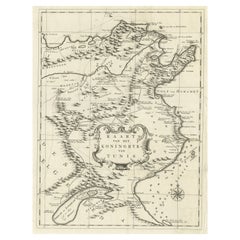
Antique Map of the Kingdom of Tunisia, Africa, 1773
Located in Langweer, NL
Antique map titled 'Kaart van het Koningryk van Tunis'. Old map of the Kingdom of Tunisia. Originates from the first Dutch editon of an interesting travel account of Northern Africa ...
Category

Antique 18th Century Maps

Materials

Paper

Antique Map of Western Africa with Vignettes of Cape Coast Castle etc, ca.1851
Located in Langweer, NL
Antique map titled ‘Western Africa’. Includes decorative vignettes titled Christiansborg, Cape Coast Castle, Sierra Leone and Bakel. Originates from 'The Illustrated Atlas, And Modern History Of The World Geographical, Political, Commercial & Statistical, Edited By R. Montgomery Martin'. Published; John Tallis London, New York, Edinburgh & Dublin. 1851. Drawn and Engraved by J. Rapkin. Artists and Engravers: John Tallis (1817-1876) was a British map...
Category

Antique 1850s Maps

Materials

Paper

Set of Vintage Italian Micro Mosaic Brooches, 1970s
Located in Esbjerg, DK
A set of lute/guitar brooches made in Venice Italy during the 1960s or 1970s. The micro mosaic consists of tiny pieces of colored glass. Set into gilt br...
Category

Vintage 1970s Italian Mid-Century Modern Collectible Jewelry

Materials

Glass

Antique Map of the City of Verdun by Merian, c.1650
Located in Langweer, NL
Antique map titled 'Verdun'. Orginal antique map of Verdun, a small city in the Meuse department in Grand Est in northeastern France. This map originates from 'Topographia Germaniae'...
Category

Antique 17th Century Maps

Materials

Paper

1920s American Educational Metal Pendulum Horse Toy design by Louis Petersen
Located in Haarlem, NL
This 1920s pendulum horse toy was originally designed by Louis C. Petersen. He was the Director of Manual Arts, State Normal University, Carbondale, Illinois. Since then many fathe...
Category

Early 20th Century American More Furniture and Collectibles

Materials

Iron

Antique Print of the Ophthalmology Hospital in Utrecht, the Netherlands, 1859
Located in Langweer, NL
Antique print titled 'Nederlandsch Gasthuis voor behoeftige en minvermogende ooglijders'. Lithograph of the Ooglijdersgasthuis in Utrecht, a former ophthalmology hospital. This print...
Category

Antique 19th Century Prints

Materials

Paper

Antique Map of the Palembang Area, c.1900
Located in Langweer, NL
Antique map titled 'Palembang.' This map shows the Palembang area on the Indonesian island of Sumatra. With legend. Source unknown, to be determined. Published circa 1900. Artists...
Category

Antique 19th Century Maps

Materials

Paper

Isle de Ladrones: Early 18th-Century Map of the Mariana Islands by F. Bernard
Located in Langweer, NL
Isle de Ladrones: Early 18th-Century Map of the Mariana Islands by F. Bernard This intriguing copper engraving depicts the *Isle de Ladrones*, now known as the Mariana Islands, situated in the western Pacific Ocean. The map was published around 1722 in Amsterdam by F. Bernard as part of the influential travel compilation *Recueil des voyages qui ont servi a ...*. The map offers a simplistic yet stylized portrayal of the island, emphasizing its rugged and mountainous terrain, dotted with sparse vegetation and hills. The term *Isle de Ladrones* (Islands of Thieves) was given by the Spanish explorer Ferdinand Magellan in 1521 during his circumnavigation of the globe, as his crew encountered thefts from the native Chamorro people. The name later changed to *Mariana Islands* when they were named after Queen...
Category

Antique 1720s Maps

Materials

Paper

Antique Map of France by Janssonius, c.1650
Located in Langweer, NL
Antique map titled 'Gallia Vetus'. Beautiful map of France based on Caesar's De Bello Gallico. In the columns to the left and right important tribes and people are described. Art...
Category

Antique 17th Century Maps

Materials

Paper

Large Minimalist MCM Brass Cross
Located in San Diego, CA
Large minimalist MCM brass cross, circa 1960s. The piece is in very good vintage condition and measures 12.25" high x 6.75" wide. Great minimalist lo...
Category

Mid-20th Century American Mid-Century Modern Religious Items

Materials

Brass

Antique Map of South East Asia, Australia and the Indian Ocean, 1726
By F. Valentijn
Located in Langweer, NL
Antique map titled 'Tabula Indiae Orientalis'. Beautiful detailed map of Australia, Southeast Asia and the Indian Ocean. The map features a fine depiction of the outlines of the western two-thirds of Australia, based on the discoveries of explorers working for the Dutch East India Company (the VOC). These include Willem Jansz's discoveries in the Gulf of Carpentaria in 1606; the encounters of Dirk...
Category

Antique Mid-18th Century Dutch Maps

Materials

Paper

Antique Map of the World in 12 Globe Gores by Scherer, 'circa 1702'
Located in Langweer, NL
Antique map titled 'Typus Totius Orbis Terraquei Geographice Delineatus, Et Ad Usum Globo Materiali Superinducendus'. Beautiful example of Scherer's map of the World, configured in 12 globe gores. California is shown as an island. Fascinating Northwest Passage...
Category

Antique Early 18th Century Maps

Materials

Paper

Old Map of the Great Lakes and Upper Mississippi Valley, Northern America, c1780
Located in Langweer, NL
Antique map titled 'Partie Occidentale du Canada'. A fine example of Rigobert Bonne and Guilleme Raynal's 1780 map of the Great Lakes and upper Mississippi Valley. A map of c...
Category

Antique 1780s Maps

Materials

Paper

Antique Trade Sign Gavel or Presentation Piece
Located in Los Angeles, CA
This gavel is in great condition and was a presentation piece. Copper plate on gavel reads as follows / Dated 1941 Presented By The Corona 20...
Category

Early 20th Century American Country Historical Memorabilia

Materials

Wood

Original Antique Map of the Channel Islands, Incl. Decorative Vignettes, 1851
Located in Langweer, NL
Antique map titled ‘Channel Islands’. Includes decorative vignettes titled St. Peters Port, Castle Cornet, Druidical altar near Lancresse, Mont Orgueil Castle and Jersey. Originates from 'The Illustrated Atlas, And Modern History Of The World Geographical, Political, Commercial & Statistical, Edited By R. Montgomery Martin'. Published; John Tallis London, New York, Edinburgh & Dublin. 1851. Drawn and Engraved by J. Rapkin. Artists and engravers: John Tallis (1817-1876) was a British map...
Category

Antique 1850s Maps

Materials

Paper

Antique Map of Africa Made after Hondius, circa 1655
Located in Langweer, NL
Antique map titled 'Africa Nova Tabula Auct Jud. Hondio'. Beautiful and rare paneled map of Africa, Based Upon Hondius' map. The first derivative of the map was issued separately by ...
Category

Antique Mid-17th Century Maps

Materials

Paper

Antique Map of the course of the Don & Voga rivers
Located in Langweer, NL
Antique map titled 'Chart of the Course of The Don & the Volga through the Region of The Kosaks'. SW Russia & Ukraine: interesting map showing the course of th...
Category

Antique Late 18th Century Maps

Materials

Paper

Ettore Sottsass Pink Ceramic Shiva Flower Vase, by BD Barcelona
By BD Barcelona Design, Ettore Sottsass
Located in Barcelona, Barcelona
Shiva ceramic flower vase designed by Ettore Sottsass, circa 1973, edited by BD in Barcelona. In good original condition with minor wear consistent with age and use preserving a bea...
Category

2010s Spanish Mid-Century Modern Vases

Materials

Ceramic

Antique Map of the West African Coast and the Cape Verde Islands, c.1680
Located in Langweer, NL
Antique map Africa titled 'Isles du Cap Verd Coste et Pays des Negres'. Antique map of the coast of Africa and the Cape Verde islands. Artists and...
Category

Antique 17th Century Maps

Materials

Paper

Military Costume of the Gothic Nations on the Western Coasts of the Baltic, 1815
Located in Langweer, NL
Antique print titled 'Military Costume of the Gothic Nations on the Western Coasts of the Baltic'. Old print of Baltic military costumes. Originates from 'The costume of the origin...
Category

Antique 1810s Prints

Materials

Paper

Antique Map of the Island of Borneo in Asia (Indonesia), 1726
Located in Langweer, NL
Antique map titled 'Kaart van het Eyland Borneo'. Early map of the island of Borneo. This map originates from 'Oud en Nieuw Oost-Indiën' by F. Valentijn. Artists and Engravers: Fran...
Category

Antique 18th Century Maps

Materials

Paper

Map of Queen Charlotte's, Carteret's, Simson's and Gower's Islands, Canada, 1773
Located in Langweer, NL
Antique map Canada titled 'Queen Charlotte's Islands'. Old map of Queen Charlotte's Islands, Canada. With an inset map of Carteret's, Simson's a...
Category

Antique 1770s Maps

Materials

Paper

Art Deco Pin Brooch Dove in Sterling Silver
Located in Esbjerg, DK
A stylized pin brooch in the shape of a dove. A classic symbol of love and peace. It is executed in 925/1000 sterling silver. Unknown Scandinavian maker circa 1930. Inscribed 925 to ...
Category

Vintage 1930s Scandinavian Art Deco Collectible Jewelry

Materials

Sterling Silver

Antique Map of the Indonesian and Philippine Archipelagos by R. de Vaugondy
Located in Langweer, NL
Striking and highly detailed map of the region from Sumatra and Malaca and Southern China to the Philipines, New Guinea and Northern Australia, centered on Borneo. Includes a large i...
Category

Antique Mid-18th Century Maps

Materials

Paper

19th C Original Painted Checkerboard Game Board
Located in Los Angeles, CA
19th C original painted checkerboard game board. Board has great Grungy paint. Great Pitina.
Category

20th Century American Folk Art Game Boards

Materials

Wood

Antique Print of a Wedding Ceremony in Japan, ca.1824
Located in Langweer, NL
Isaac Titsingh, Bijzonderheden van Japan. Het huwelijksprotocol uitgebeeld. This print is from a work of Titsingh, who had a long and successful career in Asia. It shows the cere...
Category

Antique 1820s Historical Memorabilia

Materials

Paper

Antique Map of France by Covens & Mortier, c.1730
Located in Langweer, NL
Antique map titled 'Nova regni Galliae (..) La France'. Old map of France with large decorative title cartouche. With great detail. Artists and Engravers: Pieter und David Mortie...
Category

Antique 18th Century Maps

Materials

Paper

The Astronomer Unique Historical Folk Art Painting Signed 1918
Located in South Burlington, VT
Unique Historical Work of Art Dated 1918 "L' Astronome (The Astronomer) by Fedinant Roybet. This is an original and one-of-a-kind artistic presentation- a superb pyrography incis...
Category

Early 20th Century French Scientific Instruments

Materials

Wood

Vintage Dress Form
Located in Pomona, CA
1950's dress form. Iron base with casters.
Category

Vintage 1950s American Architectural Models

Materials

Metal, Iron

Antique Map of New England and Eastern Canada by Homann Heirs, circa 1755
Located in Langweer, NL
Antique map titled 'Partie Orientale de la Nouvelle France ou du Canada (..)'. Original antique map of New England and Eastern Canada made a...
Category

Antique Mid-18th Century Maps

Materials

Paper

Antique Map of Germany of German in Roman Times, c.1660
Located in Langweer, NL
Antique map Germany titled 'Germaniae Veteris Typus'. Antique map probably by Blaeu or based on an earlier state by W. Blaeu. Minor differences shown in the cartouches. Top left ha...
Category

Antique 17th Century Maps

Materials

Paper

Hand Colored Antique Map of the Department of Doubs, France
By Victor Levasseur
Located in Langweer, NL
Antique map titled 'Dépt. du Doubs'. Map of the French department of Doubs, France. The whole is surrounded by elaborate decorative engravings designed to illustrate both the natural...
Category

Antique Mid-19th Century Maps

Materials

Paper

Antique Map of European Turkey and Greece by Lowry '1852'
Located in Langweer, NL
Antique map titled 'European Turkey and Greece with the Ionian Islands'. Original map of European Turkey and Greece. This map originates from 'Lowry's table Atlas constructed and eng...
Category

Antique Mid-19th Century Maps

Materials

Paper

Read More

Medal-Worthy Memorabilia from Epic Past Olympic Games

Get into the games! These items celebrate the events, athletes, host countries and sporting spirit.

Ahoy! You’ve Never Seen a Collection of Sailor Art and Kitsch Quite Like This

French trendsetter and serial collector Daniel Rozensztroch tells us about his obsession with objects related to seafaring men.

Pamela Shamshiri Shares the Secrets behind Her First-Ever Book and Its Effortlessly Cool Interiors

The sought-after designer worked with the team at Hoffman Creative to produce a monograph that beautifully showcases some of Studio Shamshiri's most inspiring projects.

Moroccan Artworks and Objects Take Center Stage in an Extraordinary Villa in Tangier

Italian writer and collector Umberto Pasti opens the doors to his remarkable cave of wonders in North Africa.

Montecito Has Drawn Royalty and Celebrities, and These Homes Are Proof of Its Allure

Hollywood A-listers, ex-pat aristocrats and art collectors and style setters of all stripes appreciate the allure of the coastal California hamlet — much on our minds after recent winter floods.

Whaam! Blam! Pow! — a New Book on Pop Art Packs a Punch

Publishing house Assouline and writer Julie Belcove have teamed up to trace the history of the genre, from Roy Lichtenstein, Andy Warhol and Yayoi Kusama to Mickalene Thomas and Jeff Koons.

The Sparkling Legacy of Tiffany & Co. Explained, One Jewel at a Time

A gorgeous new book celebrates — and memorializes — the iconic jeweler’s rich heritage.

What Makes a Gem-Encrusted Chess Set Worth $4 Million?

The world’s most opulent chess set, weighing in at 513 carats, is literally fit for a king and queen.

Recently Viewed

View All