Maps on Sale
to
4,185
18
4,208
1
3
2
2
1
1
1
1
2,325
1,651
232
1
130
12
1
66
1
3
4
2
4,199
10
8
7
7
165
51
41
37
32
4,209
4,209
4,209
104
55
18
12
11
Sale Items
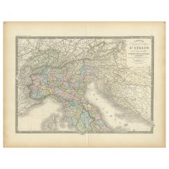
Antique Map of Northern Italy by Levasseur, 1875
Located in Langweer, NL
Antique map titled 'Carte l'Italie (..)'. Large map of Northern Italy. This map originates from 'Atlas de Géographie Moderne Physique et Politique' by A. Levasseur. Published 1875.
Category
Antique Late 19th Century Maps
Materials
Paper
$382 Sale Price
20% Off
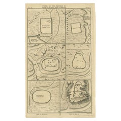
Antique Map of the Cities of the Qing Dynasty Provinces in China, 1738
Located in Langweer, NL
Antique print titled 'Cities of the Province of Kyang-si, Fo-kyen, Shan-Si & Yun-nan'. Old map depicting four walled cities of the Chinese Qing dynasty provinces Yunnan, Shanxi, Fuji...
Category
Antique 18th Century Maps
Materials
Paper
$248 Sale Price
20% Off
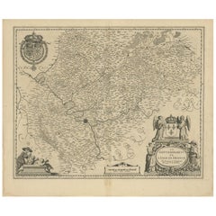
Antique Map of the Region of 'Île de France' by Janssonius, circa 1650
By Johannes Janssonius
Located in Langweer, NL
Antique map of France titled 'Le Gouvernement de L'Isle de France'. Paris is represented by a miniature plan of the city, making it distinct from the other towns of the region which ...
Category
Antique Mid-17th Century Maps
Materials
Paper
$429 Sale Price
20% Off
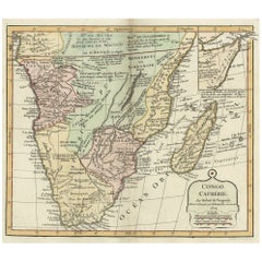
Decorative Antique Map of the Southern Part of Africa, 1806
Located in Langweer, NL
Antique map titled 'Congo, Cafrerie.'
Decorative map of the southern part of Africa by Robert de Vaugondy, revised and published by Delamarche. Source unknown, to be determined.
Artists and Engravers: Charles Francois Delamarche (1740-1817) founded the important and prolific Paris based Maison Delamarche map publishing firm in the late 18th century. A lawyer by trade Delamarche entered the map business with the acquisition from Jean-Baptiste Fortin of Robert de Vaugondy's map plates...
Category
Antique Early 1800s Maps
Materials
Paper
$534 Sale Price
20% Off
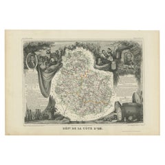
Antique Map of Côte d'Or ‘France’ by V. Levasseur, 1854
By Victor Levasseur
Located in Langweer, NL
Antique map titled 'Dépt. de la Côte d'Or'. Map of the French department of Cote D’Or, France. Part of France's Burgundy or Bourgogne wine region, a premier wine-growing region of Fr...
Category
Antique Mid-19th Century Maps
Materials
Paper
$143 Sale Price
20% Off
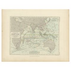
Antique Physical Chart of the Indian Ocean by Johnston, 1850
Located in Langweer, NL
Antique map titled 'Physical Chart of the Indian Ocean'. This map shows the temperature of the water, currents of the air and ocean, direction of the wind, districts of hurricanes, t...
Category
Antique 19th Century Maps
Materials
Paper
$124 Sale Price
20% Off
Antique Map of the Township of Ruinen, Drenthe in the Netherlands, circa 1865
Located in Langweer, NL
Drenthe: Gemeente Ruinen, Ansen, Bultinge, Oostering. These scarse detailed maps of Dutch Towns originate from the 'Gemeente-atlas' of Jacob Kuyper. This atlas of all towns in the Ne...
Category
Antique 19th Century Maps
Materials
Paper
$191 Sale Price
20% Off
Antique Map of Spain and Portugal by Mitchell, 1846
Located in Langweer, NL
Antique map titled 'Kingdom of Spain and Portugal'. Old map of Spain and Portugal, with an inset map of the region of Madrid. This map originates from 'A New Universal Atlas Containi...
Category
Antique 19th Century Maps
Materials
Paper
$123 Sale Price
20% Off
Antique Print of Batavia, Capital of the Dutch East Indies or Indonesia, '1726'
Located in Langweer, NL
Antique print Indonesia titled 'Batavia in 't Verschiet'. Large panoramic view on Batavia, present day Jakarta, Indonesia. Originates from 'Oud en Nieuw Oost-Indiën (..)' by François...
Category
Antique 18th Century Prints
Materials
Paper
$1,193 Sale Price
20% Off
Antique Map of Southern England and Wales by Zatta, 1784
Located in Langweer, NL
"Antique map titled 'Parte Meridionale dell' Inghilterra e del Pricipato di Galles'. Engraved map of the southern part of England and Wales, with title cartouche. Shows political and...
Category
Antique 18th Century Maps
Materials
Paper
$203 Sale Price
20% Off
Antique Map of Suffren Island by Cook, 1803
Located in Langweer, NL
Antique map Australia titled 'Gezigt van het Eil. Suffren'. Antique map of Suffren Island. Originates from 'Reizen Rondom de Waereld door James C...
Category
Antique 19th Century Maps
Materials
Paper
$171 Sale Price
20% Off
Antique Map of the Township of Franeker in Friesland, the Netherlands, 1865
Located in Langweer, NL
Friesland: Gemeente Franeker. These scarse detailed maps of Dutch Towns originate from the 'Gemeente-atlas' of Jacob Kuyper. This atlas of all towns in the Netherlands was published ...
Category
Antique 19th Century Maps
Materials
Paper
$210 Sale Price
20% Off
Large Antique County Map of Warwickshire, England
Located in Langweer, NL
Antique map titled 'A Map of Warwickshire from the best Authorities'. Original old county map of Warwickshire, England. Engraved by John Cary. Originates from 'New British Atlas' by ...
Category
Antique Early 19th Century Maps
Materials
Paper
$238 Sale Price
20% Off
Old Map of the French department of Tarn, France
By Victor Levasseur
Located in Langweer, NL
Antique map titled 'Dépt. du Tarn'. Map of the French department of Tarn, France. This area produces a variety of traditional wines, including Cahors, Mauzac, Loin de l’Oeil and Onde...
Category
Antique Mid-19th Century Maps
Materials
Paper
$324 Sale Price
20% Off
Antique Map of the Township of Emmen, Drenthe in The Netherlands, 1865
Located in Langweer, NL
Drenthe: Gemeente Emmen, Roswinkel, Werdinge, Zuidbarge. These scarse detailed maps of Dutch Towns originate from the 'Gemeente-atlas' of Jacob Kuyper. This atlas of all towns in the...
Category
Antique 19th Century Maps
Materials
Paper
$162 Sale Price
20% Off
Antique Map of Germany by T. Kitchin, circa 1770
Located in Langweer, NL
Antique map titled 'An Accurate Map of Germany (..) '. Drawn from the best Authorities by T.Kitchin Geogr." Rare edition, drawn and etched by Thomas Kitchin, published, circa 1770.
Category
Antique Mid-18th Century Maps
Materials
Paper
$229 Sale Price
20% Off
Antique Map of the region of Lennep, Blankenburg and Dortmund, Germany
Located in Langweer, NL
Antique map titled 'Berge Ducatus Marck Comitatus'. Original antique map of the region of Lennep, Blankenburg and Dortmund, Germany. Published by Hondius, circa 1644.
Category
Antique Mid-17th Century Maps
Materials
Paper
$651 Sale Price
30% Off
Antique Map op Siberia and Chinese Tartary with original hand coloring, 1732
Located in Langweer, NL
Antique map titled 'Nieuwe Kaart van Tartarie na de alderlaatste ontdekking int ligt gebragt'. Map op Siberia and Chinese tartary. In the north Novaya Zemlya curls back to attach its...
Category
Antique Mid-18th Century Maps
Materials
Paper
$764 Sale Price
20% Off
Antique Map of Russia in Asia from An Old German Atlas, 1845
By Meyer
Located in Langweer, NL
Antique map titled 'Asiatisches Russland'. This map depicts Russia in Asia and originates from 'Meyers Handatlas'.
Artists and Engravers: Engraved and published by 'Bibliographis...
Category
Antique 19th Century Maps
Materials
Paper
$85 Sale Price
20% Off
Antique Map of the Westphalia region of Germany
Located in Langweer, NL
Antique map titled 'Circulus Westphaliae (..)'. Original old map of the Westphalia region, Germany. Published by Justus Danckerts, circa 1696.
Justus Danckerts I (11 November 1635 ...
Category
Antique Late 17th Century Maps
Materials
Paper
$658 Sale Price
20% Off
Antique Map of the Kanton Luzerne 'Switzerland' by Homann Heirs, 1763
Located in Langweer, NL
Antique map titled 'Canton Lucern (..)'. Fine decorative copper plate engraved antique map of the Canton of Lucerne in Central Switzerland with pictorial cartouche in top right corne...
Category
Antique Mid-18th Century Maps
Materials
Paper
$467 Sale Price
20% Off
Antique Genealogy Chart of the House of Wurttemberg in Germany, 1732
Located in Langweer, NL
Antique print titled 'Genealogie de la Maison de Wirtemberg (..)'. Genealogy of the House Wurttemberg. This print orginates from 'Atlas Historique'.
The House of Württemberg is a...
Category
Antique 18th Century Prints
Materials
Paper
$248 Sale Price
20% Off
Antique Map of the Pacific Ocean by Rienzi, 1836
Located in Langweer, NL
Antique map titled 'Mélanésie'. Map of the Pacific ocean around Australia, including Java, Timor, the Solomon Islands and New Zealand. This print or...
Category
Antique 19th Century Maps
Materials
Paper
$94 Sale Price
20% Off
Antique Map of Wuxi and Huzhou in China, 1746
Located in Langweer, NL
Antique map titled 'Vusihyen. Hu Chew Fu'. Plans of Wuxi and Huzhou, China. Originates from Prévost's 'Histoire générale des voyages'.
Artists and Engravers: Antoine François Prévo...
Category
Antique 18th Century Maps
Materials
Paper
$143 Sale Price
20% Off
Antique Map of New Jersey, Delaware and Maryland by Johnson, 1872
Located in Langweer, NL
Antique map titled 'Johnson's New Jersey (..). Two maps on one sheet showing New Jersey, Delaware and Maryland. With inset map of the district of Columbia...
Category
Antique Late 19th Century Maps
Materials
Paper
$286 Sale Price
20% Off
Rare Engravings of Council of War in Bantam and Javanese Local Traders, 1614
Located in Langweer, NL
One leaf with an engraving on each site and text in old Dutch. One side shows the War Council of the locals in Bantam and the other side show some vegetables traders of Bantam.
B...
Category
Antique Early 17th Century Maps
Materials
Paper
$429 Sale Price
20% Off
Antique Map of Asia by Dussy, 1778
Located in Langweer, NL
Antique map of Asia titled 'Indostan presqu'isles de l'Inde, Chine, Tartarie Independante'. Depicting South-East Asia including Hindustan, India an...
Category
Antique Late 18th Century French Maps
Materials
Paper
$210 Sale Price
20% Off
Antique Map of Northern China and Far Eastern Russia Around the Amur River, 1754
Located in Langweer, NL
Antique map titled 'Carte De La Tartarie Orientale (..)'. A map for this far eastern portion of what is present day northern China and far eastern Russia...
Category
Antique 1750s Maps
Materials
Paper
$477 Sale Price
20% Off
Antique Map of South Australia by Tallis, 1851
By Thomas Kitchin
Located in Langweer, NL
Antique map Australia titled 'Part of South Australia'. Decorative map of part of South Australia, surrounded by illustrations of Adelaide, natives on a catamaran, an Australian dog and a nymphicus bird illustrated. Originates from 'The Illustrated Atlas, And Modern History Of The World Geographical, Political, Commercial & Statistical, Edited By R. Montgomery Martin'. Published; John Tallis London, New York, Edinburgh & Dublin. 1851. Drawn and Engraved by J. Rapkin. Artists and Engravers: John Tallis (1817-1876) was a British map...
Category
Antique 19th Century Maps
Materials
Paper
$214 Sale Price
20% Off
Antique Map of the Region of Utingeradeel by Meijer & Schaafsma, 1906
Located in Langweer, NL
Antique map titled 'Gemeente Friesland. Gemeente Utingeradeel'. This map illustrates part of Friesland (The Netherlands) depicting Akkrum, Terkaple, Lekkerterp, Oldeboorn and more. Published by Tresling & Co, Amsterdam.
Artists and Engravers: Tresling and Co., Dutch Lithographers...
Category
20th Century Maps
Materials
Paper
$83 Sale Price
20% Off
Antique Map of New South Wales by Johnston, '1909'
Located in Langweer, NL
Antique map titled 'South Australia, New South Wales, Victoria and Queensland'. Original antique map of New South Wales. With inset map of Cape York Pe...
Category
Early 20th Century Maps
Materials
Paper
$238 Sale Price
20% Off
Antique Plan of the City of Damietta Egypt by C. Niebuhr, 1774
Located in Langweer, NL
Antique print titled 'Grundris der Stadt Damiât'. This print originates from 'Reisebeschreibung nach Arabien und andern umliegenden Ländern' by C. Niebuhr, 1774.
Category
Antique Late 18th Century Prints
Materials
Paper
$171 Sale Price
20% Off
Antique Map of Asia by Brué '1820'
Located in Langweer, NL
Antique map titled 'Carte de l'Asie'. Original antique map of Asia. A blind stamp near the title reads 'Carte Encyprotipe'. This map originates fro...
Category
Antique Early 19th Century Maps
Materials
Paper
$620 Sale Price
20% Off
Antique Map of Delfland, Schieland and Islands of Zuid-Holland, the Netherlands
Located in Langweer, NL
Antique map titled 'Delflandia, Schielandia, et Insulae (..)'. Original antique map of Delfland, Schieland and islands of Zuid-Holland, the Netherlands. The 'Zuid-Hollandse Eilanden'...
Category
Antique Mid-17th Century Maps
Materials
Paper
$658 Sale Price
20% Off
Antique Map of Tartary and Northeast Asia with Hand Coloring
Located in Langweer, NL
Antique map titled 'Carte de la Tartarie Occidentale'. An interesting map of Tartary and northeast Asia, from Lake Baykal, Partie du Siberia in the north, Pays des Kalkas at the cent...
Category
Antique Mid-18th Century Maps
Materials
Paper
$267 Sale Price
20% Off
Antique Map of the Region of Winschoten, Groningen in The Netherlands, 1862
Located in Langweer, NL
Groningen: Gemeente Arrondisement Winschoten. These scarse detailed maps of Dutch Towns originate from the 'Gemeente atlas van de Provincie Groningen in 62 kaarten.' by C. Fehse. Thi...
Category
Antique 19th Century Maps
Materials
Paper
$181 Sale Price
20% Off
Original Antique Engraving of Kannur 'or Cannanore', Kerala, India, 1726
Located in Langweer, NL
Antique print, titled: 'Cananor' - This is a print of a view of Kannur (or Cannanore), Kerala, India. From the monumental: "Oud en Nieuw Oost-Indiën ..." ...
Category
Antique 1720s Maps
Materials
Paper
$525 Sale Price
20% Off
Large Antique County Map of Cumberland, England
Located in Langweer, NL
Antique map titled 'A Map of Cumberland from the best Authorities'. Original old county map of Cumberland, England. Engraved by John Cary. Originates...
Category
Antique Early 19th Century Maps
Materials
Paper
$152 Sale Price
20% Off
Antique Map of the Eastern Part of Germany, with Parts of Poland and Slovakia
Located in Langweer, NL
Antique map titled 'A New Map of the Circle of Upper Saxony: with the Duchy of Silesi and Lusatia, from the latest authorities'. Clear and accurate map of what is now the eastern par...
Category
Antique Early 19th Century Maps
Materials
Paper
$420 Sale Price
20% Off
Antique Map of the Gambia River by J. Van Schley, circa 1750
Located in Langweer, NL
"Carte de la Riviere de Gambra ou Gambie. Depuis son Embouchure Jusqu a Eropina". Orig. copper-engraving after Capt. J. Leach's map of the region from 1732. With ornamental title cartouche and Dutch...
Category
Antique Mid-18th Century Maps
Materials
Paper
$348 Sale Price
20% Off
Antique Map of Zaltbommel in the Netherlands, by Guicciardini, 1613
Located in Langweer, NL
Antique print titled 'Civitas Bommelia (..)'. Beautiful plan of Zaltbommel, Gelderland (the Netherlands). This map originates from 'Discrittione di tutti i Paesi Bassi' by L. Guiccia...
Category
Antique 17th Century Maps
Materials
Paper
$362 Sale Price
20% Off
Antique Print with Coastal Views of Kamchatka in The Russian Far East, c.1784
Located in Langweer, NL
Antique print titled 'Views of the Coast of Kamtschatka (..)'. Print with coastal views of Kamchatka including volcanoes. Originates from an edition of Cook's Voyages.
Artists and ...
Category
Antique 18th Century Prints
Materials
Paper
$305 Sale Price
20% Off
Antique Map of the Niederrhein region, Germany
Located in Langweer, NL
Antique map titled 'Circulus Electorum Rheni sive Rhenanus Inferior (..)'. Original antique map of the Niederrhein region, Germany. By F. de Wit, circa 1690.
Frederick de Wit (1629-...
Category
Antique Late 17th Century Maps
Materials
Paper
$429 Sale Price
20% Off
American Election Map and 1960 Presidential Fact Sheet, Published 1960
Located in Langweer, NL
Title: “The 50 United States of America”
Subject: United States, Presidential Elections
Date: 1960 (dated)
Color: Printed Color
Size: 24.9 x 17.9 inches (63.2 x 45.5 cm)
This colorful map of the United States was drawn by Lorin Thompson and published by the General Foods Corporation. The map has an unusual coloring style with symbols of American history including past presidents, Native Americans, important buildings (White House, Statue of Liberty, Alamo), agriculture, industry, and more. Includes inset maps of Hawaii and Alaska with small American flags...
Category
Vintage 1960s Posters
Materials
Paper
$573 Sale Price
20% Off
Original Antique Map of Northern India
Located in Langweer, NL
Antique map titled 'India. Northern Part'. Original antique map of Northern India. Drawn and engraved by J. Archer. Publishes by H.G. Collins, ci...
Category
Antique Mid-19th Century Maps
Materials
Paper
$324 Sale Price
20% Off
Old Print of Standia, a Greek Island 'Heraklion, Crete, Greece, Balkans', 1688
Located in Langweer, NL
Antique print Greece titled 'Het Eilant Standia'. Old print of the island Standia, near Crete, Greece. This print originates from 'Nauwkeurige Bes...
Category
Antique 17th Century Prints
Materials
Paper
$276 Sale Price
20% Off
Antique Map of Asia by Delamarche, 1826
Located in Langweer, NL
Vaugondy's map plates and copyrights and later addes many plates from other sources as well. Charles Delamarche eventually passed control of the firm to his son Felix Delamarche (18t...
Category
Antique 19th Century Maps
Materials
Paper
$229 Sale Price
20% Off
Bay of Arguin, West Coast of Africa from Cape Blanco to Tanit, Africa, 1747
Located in Langweer, NL
Antique map titled 'Carte De La Coste Occidentale D'Afrique (..)
Kaart van de Westkust van Afrika (..)'. Original antique map of the western coast of Africa. Shows the area aroun...
Category
Antique 1740s Maps
Materials
Paper
$276 Sale Price
20% Off
Antique Map of Australia by Lowry, 1852
Located in Langweer, NL
Antique map titled 'Australia'. Two individual sheets of Australia. This map originates from 'Lowry's table Atlas constructed and engraved from the most recent authorities' by J.W. L...
Category
Antique Mid-19th Century Maps
Materials
Paper
$191 Sale Price / set
20% Off
Antique Map of China and Japan by Johnson, 1872
Located in Langweer, NL
Antique map titled 'Johnson's China and Japan'. Map of China and Japan, with an inset map of the vicinity of Canton and Hong Kong. This map originates from 'Johnson's New Illustrated...
Category
Antique Late 19th Century Maps
Materials
Paper
$286 Sale Price
20% Off
Antique Print of Zeus at Olympia by Knight, 1835
Located in Langweer, NL
Antique print titled 'The Jupiter of Phidias'. Old print of a statue of Zeus at Olympia by Phidias, as imagined by engraver John Jackson. This print ori...
Category
Antique 19th Century Prints
Materials
Paper
$69 Sale Price
20% Off
Antique Map Dedicated to British Merchants Trading to North America, ca.1746
Located in Langweer, NL
Description: Antique map titled 'A New Chart of the Coast of New England, Nova Scotia, New France or Canada, with the islands of Newfoundland, Capte Breton, St John's (..)'. Map stre...
Category
Antique 1740s Maps
Materials
Paper
$811 Sale Price
20% Off
Old Copper Engraving of the City of Kajutsiu in China, 1668
By Johannes Nieuhof
Located in Langweer, NL
Antique print China titled ‘Kajutsiu'. This plate shows a view on the Chinese city of Kajutsiu. This print originates from the Latin edition of Nie...
Category
Antique 17th Century Prints
Materials
Paper
$324 Sale Price
20% Off
Antique Print of Büdingenin Germany by Braun & Hogenberg, 1617
Located in Langweer, NL
Antique map titled 'Bingen'. Bird's eye-view of Büdingen, Germany. The view shows a city surrounded by vineyards and well fortified with walls and moats. On the right is the castle w...
Category
Antique 17th Century Prints
Materials
Paper
$276 Sale Price
20% Off
Old Engraving of Volcano Piton de la Fournaise on Reunion Island, c.1750
By Jakob van der Schley
Located in Langweer, NL
Antique print titled 'Eiland van St. Filippus, of van Fuego, met zyn vuurberg'. Old print of Piton de la Fournaise, a shield volcano on the eastern side of Reunion island...
Category
Antique 18th Century Prints
Materials
Paper
$229 Sale Price
20% Off
Detailed Antique Map of Santa Domingo, Puerto Rico, Eastern Bahamas, ca. 1780
Located in Langweer, NL
Description: Antique map titled 'L'Isle De St. Domingue, et celle De Porto-Rico.'
Detailed map of Santa Domingo, Puerto Rico, etc. Includes substanti...
Category
Antique 1780s Maps
Materials
Paper
$668 Sale Price
20% Off
Large Antique Map of the Netherlands with Original Hand Coloring
Located in Langweer, NL
Original antique map titled 'Belgica Foederata complectens septem Provincias Ducatum Geldriae (..)". Large map of the Netherlands. Title a...
Category
Antique Mid-18th Century Maps
Materials
Paper
$783 Sale Price
20% Off
Antique Map of Manipa, Nusa-Laut, Saparua & Haruku 'Indonesia' by F. Valentijn
Located in Langweer, NL
Four maps of islands and two figures in native dress. The islands are: Manipa, Nusa-Laut (Noessa-Laoet), Saparua (Honimoa) and Haruku (Oma). These islands...
Category
Antique Early 18th Century Maps
Materials
Paper
$811 Sale Price
20% Off
Antique Map of Ijlst , Friesland in the Netherlands, 1865
Located in Langweer, NL
Friesland: Gemeente IjJlst. These scarse detailed maps of Dutch Towns originate from the 'Gemeente-atlas' of Jacob Kuyper. This atlas of all towns in the Netherlands was published fr...
Category
Antique 19th Century Maps
Materials
Paper
$181 Sale Price
20% Off
Antique Print of a Lock of Hair by Gibb, 1890
Located in Langweer, NL
Antique print titled 'Lock of Hair of Mary Queen of Scots - Lock of Hair of King Charles I'. Chromolithographic plate originating from 'The Royal House of...
Category
Antique 19th Century Prints
Materials
Paper
$81 Sale Price
20% Off
Recently Viewed
View AllMore Ways To Browse
Statutes And Sculptures
Swedish Gustavian Glass Cabinet
Swiss Chalet Chairs
Tea Cup Art Nouveau
Tea Cup Holder
Teak Buddha
Teak Gentlemans
Thomasville Hollywood Regency
Thomire Clock
Three Legged Vessel
Three Tier Serving Trays
Tibet Earring
Tibetan Antique Cabinet
Tiffany And Co China
Tiffany Blue Rims
Tiffany Sterling Ice Tea Spoons
Torchiere Sculpture
Tortoise Christian Dior
