Maps on Sale
to
4,213
18
4,236
1
3
2
2
1
1
1
1
2,336
1,669
231
1
129
12
1
66
1
3
4
2
4,227
10
8
7
7
127
35
32
29
27
4,237
4,237
4,237
104
56
18
13
11
Sale Items
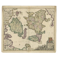
Antique Map of Denmark with Details of Fortresses, Cities, Towns Etc, c.1680
Located in Langweer, NL
Antique map of Denmark titled 'Insularum Danicarum ut Zee-Landiae, Fioniae, Langelandiae, Lalandiae Falstriae, Fembriae, Monae (..)'. This map depicts the main Danish Islands and a s...
Category
Antique 17th Century Maps
Materials
Paper
$713 Sale Price
20% Off
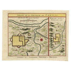
Antique Hand-Coloured Map of Cities in the Province of Shanxi in China, 1749
Located in Langweer, NL
Antique print titled 'Villes de la Province de Chensi - Steden van 't Landschap Shensi of Shansi'. Interesting set of two local town plans of ""Si-Ngan-Fu: Capitale."" and ""Tchang L...
Category
Antique 18th Century Maps
Materials
Paper
$333 Sale Price
20% Off
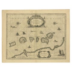
Antique Map of the Moluccas in Indonesia by Janssonius, C.1650
By Johannes Janssonius
Located in Langweer, NL
Antique map titled 'Insularum Moluccarum Nova Descriptio.' Old map of the Moluccas. The famous Spice Islands, the cornerstone of the Dutch trading ...
Category
Antique 17th Century Maps
Materials
Paper
$532 Sale Price
20% Off
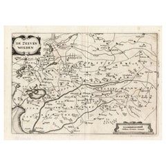
Antique Map of the Region of Zevenwouden in Friesland, The Netherlands, 1635
Located in Langweer, NL
Antique map titled 'De Zeeven Wolden'. Map of the region of Zevenwouden (or Zevenwolden) in Friesland, the Netherlands. This region include the villages of Langweer, Echtenerbrug, Le...
Category
Antique 17th Century Maps
Materials
Paper
$333 Sale Price
20% Off
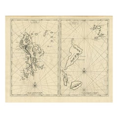
Antique Map of Sangir Island and the Talaud Islands by Valentijn, 1726
Located in Langweer, NL
Antique map titled 'Het Eyland Sangir & De Talautse Eylanden'. Two maps on one sheet. To the left, a map of Sangir Island, Indonesia. To the right, a map of the Talaud Islands, Indon...
Category
Antique 18th Century Maps
Materials
Paper
$494 Sale Price
20% Off
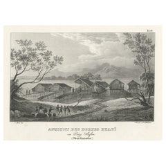
Original Lithograph with a Scene of a Village and Harbour in New Guinea, c.1836
Located in Langweer, NL
Antique print titled 'Ansicht des Dorfes Kuauï'. Im Dory Hafen.
Old print with a scene of a village and harbour in New Guinea. This print originates from 'Entdeckungs, Reise der Franzosischen Corvette Astrolabe Unternomen auf Befehl Konig Karls...
Category
Antique 1830s Prints
Materials
Paper
$342 Sale Price
20% Off
1859 Vintage Map of Holland and Belgium: Blackie's Imperial Geographic Insight
Located in Langweer, NL
The "Antique Map of Holland and Belgium" from 'The Imperial Atlas of Modern Geography', published by W. G. Blackie in 1859, is a significant hi...
Category
Antique Mid-19th Century Maps
Materials
Paper
$237 Sale Price
20% Off
Antique Map of Belgium and Luxembourg by Homann Heirs, 1747
Located in Langweer, NL
Antique map titled 'Belgium Catholicum seu Decem provinciae Germaniae Inferioris cum confiniis Germaniae sup. et Francia (..).' Detailed map of Belgium and Luxembourg showing parts o...
Category
Antique 18th Century Maps
Materials
Paper
$428 Sale Price
20% Off
Antique Map of Europe by Lapie, 1842
Located in Langweer, NL
Antique map titled 'Carte de l'Europe'. Map of Europe. This map originates from 'Atlas universel de géographie ancienne et moderne (..)' by Pierre M. Lapie and Alexandre E. Lapie. Pi...
Category
Antique Mid-19th Century Maps
Materials
Paper
$475 Sale Price
20% Off
Antique Map of the German Empire by Johnston, '1909'
Located in Langweer, NL
Antique map titled 'Empire of Germany'. Original antique map of the German Empire. With inset maps of Berlin and Potsdam. This map originates from the ‘R...
Category
Early 20th Century Maps
Materials
Paper
$237 Sale Price
20% Off
Antique Map of France by T. Bowen, 1785
Located in Langweer, NL
Decorative antique map of France titled 'A new and accurate map of France, Drawn from the latest Authorities by T. Bowen'. Engraved for Moore’s new and complete collection of Voyages...
Category
Antique Late 18th Century Maps
Materials
Paper
$152 Sale Price
20% Off
Antique Map of the Chinese Empire and Japan, '1875'
Located in Langweer, NL
Antique map titled 'Carte générale de l'Empire Chinois et du Japon'. Large map of the Chinese Empire and Japan. This map originates from 'Atlas de Géographie Moderne Physique et Poli...
Category
Antique Late 19th Century Maps
Materials
Paper
$380 Sale Price
20% Off
Antique Map of the Seventeen Provinces of Netherlands, Belgium, Luxembourg, 1748
By Homann Heirs
Located in Langweer, NL
Antique map titled 'Belgii Universi seu Inferioris Germaniae quam XVII Provinciae (..)'.
Map of the Seventeen Provinces after Tobias Meier, published by Homann's Heirs in 1748. The...
Category
Antique 18th Century Maps
Materials
Paper
$437 Sale Price
20% Off
Original Antique Map of Central Asia by Smith, 1808
Located in Langweer, NL
Antique map titled 'Central Asia'. Old map of central Asia originating from 'Smith's New General Atlas Containing Distinct Maps Of all the Principal Empires, Kingdoms, & States Throu...
Category
Antique 19th Century Maps
Materials
Paper
$228 Sale Price
20% Off
Antique Map of the Caribbean Island of St Kitts, ca.1750
Located in Langweer, NL
Description: Antique map titled 'Carte de l'Isle St. Christophe pour Servir a l'Histoire Genle. des Voyages.'
Detailed map of the Island of St. Kitts, showing the Parishes, towns, ...
Category
Antique 1750s Maps
Materials
Paper
$685 Sale Price
20% Off
Antique Map of Eastern Brazil, 1849
Located in Langweer, NL
Antique map titled 'Eastern Brazil'. Old map of Eastern Brazil. This map originates from 'Sharpe's Corresponding Atlas (..)' by J. Sharpe.
Artists and Engravers: Published by Chap...
Category
Antique 19th Century Maps
Materials
Paper
$304 Sale Price
20% Off
Antique Map of Bohemia in the Present-Day Chech Repubic, 1730
Located in Langweer, NL
Antique map titled 'Nieuwe Kaart van t Koninkryk Bohemen t Hertogdom Silesien markgraafschap Moravien (Moravia) en Lusatien' (Lusatia). Map of Bohemia (Czech Republic) with the surro...
Category
Antique 18th Century Maps
Materials
Paper
$523 Sale Price
20% Off
Antique Engraving of a Bird's-Eye Plan of Nagapattinam or Negapatam, India, 1672
Located in Langweer, NL
Antique map titled 'Negapatam.'
Bird's-eye plan of Nagapattinam or Negapatam, India. This map originates from 'Naauwkeurige Beschryvinge van Malabar en Choromandel…en het machtige ...
Category
Antique 1670s Maps
Materials
Paper
$323 Sale Price
20% Off
Pl. 35 Antique Chart of the US Taxation, 1874
Located in Langweer, NL
Antique chart titled 'Map showing the degree of taxation per capita imposed by state, county or municipal authority, within the fiscal year nearest the c...
Category
Antique Late 19th Century Maps
Materials
Paper
$475 Sale Price
20% Off
Detailed Antique Map Showing Mansfeld in Saxony-Anhalt, Germany, ca.1750
Located in Langweer, NL
Description: Antique map titled 'Die Grafschaft Mansfeld Konigl. Preuss. Churfurstl. Sachsischen Antheils mit allen darinnen befindlichen Stadten Dorfschaften.'
Detailed map show...
Category
Antique 1750s Maps
Materials
Paper
$437 Sale Price
20% Off
Old Copperplate Engraving of Fort St. James on the Gambra River, Africa, c.1760
Located in Langweer, NL
Plan de l’Isle James sur la Gambra en 1732 (…).
Copperplate engraving/etching on Hand laid (Verge) paper.
Sheet size: 19,7 x 26,7 cm. Image size: 13,8 x 19,8 cm.
From vol. 3 o...
Category
Antique 1760s Maps
Materials
Paper
$152 Sale Price
20% Off
Antique Map of France by Zannoni, 1765
Located in Langweer, NL
Antique map titled 'La France divisée en ses LVIII Provinces (..)'. Beautiful old map of France. This map originates from 'Atlas Historique de la France Ancienne et Moderne' by M. Ri...
Category
Antique 18th Century Maps
Materials
Paper
$494 Sale Price
20% Off
Beautiful Antique Map of Madagascar, The Comoros Islands & Reunion Island, 1667
Located in Langweer, NL
Antique map titled 'Isle d'Auphine, communement Nommée par les Europeens Madagascar, et St. Laurens, et par les Habitans du pays Madecase'.
Beautiful map of Madagascar...
Category
Antique 1660s Maps
Materials
Paper
$865 Sale Price
20% Off
Antique Map of the Region of Le Mans 'France' by Blaeu, circa 1640
By Willem Blaeu
Located in Langweer, NL
Antique Map: Cenomanorum Galliae regionis typus vulgo le Mans – Blaeu, circa 1640
This beautifully engraved and hand-colored map depicts the historical province of Maine in northw...
Category
Antique Mid-17th Century Maps
Materials
Paper
$475 Sale Price
20% Off
Four Physical Maps of the World on One Sheet , 1872
Located in Langweer, NL
Four physical maps of the world on one sheet. The upper map shows lowlands, highlands and highest lands. The other maps show world's races, ocean current and volcanoes, and magnetic ...
Category
Antique Late 19th Century Maps
Materials
Paper
$333 Sale Price
20% Off
Antique Map of France under the Reign of Francois II, 1765
Located in Langweer, NL
Antique map France titled 'La Bretagne et le Cté de Penthièvre (..)'. Beautiful old map of France. This map originates from 'Atlas Historique de la France Ancienne et Moderne' by M. ...
Category
Antique 18th Century Maps
Materials
Paper
$140 Sale Price
20% Off
Copper Engraved Map of Tierra del Fuego and the Strait of Magellan, c1780
Located in Langweer, NL
Antique map titled 'Extremite Meridionale de l'Amerique.'
Copper engraved map of Tierra del Fuego and the Strait of Magellan with five detailed insets of the region showing soundings, anchorages, etc. Engraved by Andre. This map originates from 'Atlas de Toutes les Parties Connues du Globe Terrestre'.
Artists and Engravers: Rigobert Bonne (1727-1795 ) was one of the most important cartographers of the late 18th century. In 1773 he succeeded Jacques Bellin as Royal Cartographer to France in the office of the Hydrographer at the Depôt de la Marine. Working in his official capacity Bonne compiled some of the most detailed and accurate maps of the period. Bonne's work represents an important step in the evolution of the cartographic ideology away from the decorative work of the 17th and early 18th century towards a more detail oriented and practical aesthetic. With regard to the rendering of terrain Bonne maps...
Category
Antique 1780s Maps
Materials
Paper
$342 Sale Price
20% Off
Antique Map of Maine et Loire ‘France’ by V. Levasseur, 1854
Located in Langweer, NL
Antique map titled 'Dépt. de Maine et Loire'. Map of the French department of Maine et Loire, France. This area of France is part of the Loire Valley wine region, where nearly every ...
Category
Antique Mid-19th Century Maps
Materials
Paper
$171 Sale Price
20% Off
Antique Print of the Stables of Lathom House in Lancashire, England, c.1770
Located in Langweer, NL
Antique print titled 'Elevation of the Stables at Lathom Hall'. Elevation of the stables at Lathom House, Lancashire.
Lathom House was a large c...
Category
Antique 18th Century Prints
Materials
Paper
$589 Sale Price
20% Off
Antique Map of West Africa by R. Bonne, 1780
Located in Langweer, NL
Antique map titled 'Partie Occidentale De L'Ancien Continent Depuis Lisbonne Jusqua La Riviere De Sierra Leona Avec L'Isle de Madere, les Isles Canaries et celles Du Cap Verd'. Parts...
Category
Antique Late 18th Century French Maps
Materials
Paper
$171 Sale Price
20% Off
Old Handcolored Print of an Inhabitant of the Lowlands of Moravia, 1804
Located in Langweer, NL
Old print of an inhabitant of the Lowlands of Moravia.
Moravia, traditional region in central Europe that served as the centre of a major medieval kingdom, known as Great Moravia, before it was incorporated into the kingdom of Bohemia in the 11th century. In the 20th century Moravia became part of the modern state of Czechoslovakia and subsequently of the Czech Republic. The region is bounded by Bohemia on the west and northwest, by Silesia on the northeast, by Slovakia on the east, and by Lower Austria on the south.
This print originates from 'The Costume of the Hereditary States of the House of Austria' by William Miller.
Artists and engravers: Engraved by William Ellis.
Category
Antique Early 1800s Prints
Materials
Paper
$228 Sale Price
20% Off
German Antique Map of the Indian Oceaan, Meyers, 1895
Located in Langweer, NL
This attractive original old antique print / plate / map originates from 1885-1907 editions of a famous German encyclopedia: 'Meyers grosses Konversations-Lexikon.', published in Leipzig and Vienna. Meyers Konversations-Lexikon was a major German encyclopedia that existed in various editions from 1839 until 1984, when it merged with the Brockhaus encyclopedia. Several of the plates were also used in Dutch Encyclopedia's like Winkler Prins...
Category
Antique 19th Century Maps
Materials
Paper
$80 Sale Price
20% Off
Early Antique Map of the Dutch Provinces of Friesland and Groningen, 1604
Located in Langweer, NL
Antique map titled 'Frisiae Occidentalis.'
This attractive map shows the Dutch Provinces of Friesland and Groningen. Embellished with strapwork tit...
Category
Antique Early 1600s Maps
Materials
Paper
$999 Sale Price
25% Off
Antique Hand-Colored Map of Northern Portugal, 1756
Located in Langweer, NL
Antique map Portugal titled 'Parte Sepentrional del Reyno de Portugal'.
Antique map of Northern Portugal. This map originates from 'Atlas Port...
Category
Antique 1750s Maps
Materials
Paper
$171 Sale Price
20% Off
The Iron Duke of Alva of Spain Planning the Atrocities Against the Dutch, c.1680
Located in Langweer, NL
Antique print titled ‘Afbeeldinge van de Spaansche Bloedraad in den Jaare 1567 door den Hartog van Alva aangestelt’.
The Duke of Alva and his entourage seated at a table planning...
Category
Antique 1680s Prints
Materials
Paper
$532 Sale Price
20% Off
Rare Antique Map of Asia with Cartouche Depicting an Elephant, 1753
Located in Langweer, NL
Antique map titled 'Asia.' Original antique map of Asia. With a small cartouche depicting an elephant. Map by Daniel de la Feuille. This very rare old antique copperplate engraved pr...
Category
Antique 18th Century Maps
Materials
Paper
$333 Sale Price
20% Off
Antique Map of the Province of Friesland in The Netherlands, 1718
Located in Langweer, NL
Antique map titled 'Frisiae Dominium vernacule Friesland (..)'.
Original antique map of Friesland, the Netherlands. Originates from 'Uitbeelding van de Heerlijkheid van Friesland...
Category
Antique 18th Century Maps
Materials
Paper
$713 Sale Price
20% Off
Antique Map of Cities of the Province of Shanxi in China, 1749
By Jacques-Nicolas Bellin
Located in Langweer, NL
Antique print titled: 'Lan-Tcheou ou Lan-Chew dan la province Chensi; Can Tcheou ou Kan-Chew dan la province de Chensi; Tchin-Ywe-Fou ou Chin-Ywen-Fu dans la province de Koei-Tcheou ...
Category
Antique 18th Century Maps
Materials
Paper
$237 Sale Price
20% Off
Antique Map of Chili by Montanus, circa 1671
By Arnoldus Montanus
Located in Langweer, NL
Antique map titled 'Chili'. A very attractive map covering the known coastal region of Chile. The Andes are shown prominently, with two live volcanoes in the vicinity of Villarrica. ...
Category
Antique Mid-17th Century Maps
Materials
Paper
$570 Sale Price
20% Off
Antique Map of the Region of Franche-Comté by Janssonius, circa 1650
Located in Langweer, NL
Antique map titled 'Burgundiae Comitatus Franche Comté'. Old map of the historical and former region of Franche-Comté, France. As a region, it encompasse...
Category
Antique Mid-17th Century Maps
Materials
Paper
$570 Sale Price
20% Off
Old Coloure Map of North & Central Italy & Corsica with an Inset of Rome, c.1860
Located in Langweer, NL
Antique map titled 'North & Central Italy and the Island of Corsica'.
Old map of North and Central Italy, and the island of Corsica. With an inset map of the region of Rome. Orig...
Category
Antique 1860s Maps
Materials
Paper
$275 Sale Price
20% Off
Antique Map of Bangka Island, Indonesia, 1885
Located in Langweer, NL
Antique map titled 'Kaart van het Eiland Banka. Old map of Bangka Island, or Banka. This map originates from 'Atlas der Nederlandsche bezittingen in Oost-Indië naar de nieuwste bronn...
Category
Antique 19th Century Maps
Materials
Paper
$333 Sale Price
20% Off
Antique Map of Denmark by Moll 'circa 1730'
By Herman Moll
Located in Langweer, NL
Antique map titled 'Denmark, agreeable to Modern History'. Uncommon map of Denmark by Herman Moll, published, circa 1730.
Category
Antique Mid-18th Century Maps
Materials
Paper
$333 Sale Price
20% Off
Antique Map of Flanders by Keizer & de Lat, 1788
Located in Langweer, NL
Antique map titled 'Nouvelle Carte du Comté de Flandre'. Uncommon original antique map of Flanders, Belgium. This map originates from 'Nieuwe Natuur- Geschied- en Handelkundige Zak- ...
Category
Antique Late 18th Century Maps
Materials
Paper
$333 Sale Price
20% Off
Antique Map of Choromandel, Golconda and Orixa, Malabar, India, 1744
By Philip Baldaeus
Located in Langweer, NL
Antique map titled 'Regionum Choromandel, Golconda (..).' Handsome map of Choromandel, Golconda and Orixa, published in 'The True and Exact Description of the Most Celebrated East - ...
Category
Antique 18th Century Maps
Materials
Paper
$1,094 Sale Price
20% Off
Antique Map of the Country Inhabited by the Samoyedic and Khanty People '1768'
Located in Langweer, NL
Antique map titled 'Carte des Païs Habités par les Samojedes et Ostiacs'. Original antique map of the country inhabited by the Samoyedic and Khanty (Ostyak) peoples. Engraved by J.N....
Category
Antique Mid-18th Century Maps
Materials
Paper
$190 Sale Price
20% Off
Scandinavia & Baltic Map – Antique by G. & L. Valk, incl. Sweden, Finland, c1700
Located in Langweer, NL
Scandinavia & Baltic Map – Antique by G. & L. Valk, incl. Sweden, Finland, 1700
Antique map titled 'Sueciae Magnae, totius orbis regni antiquissimi (..)' by Gerard and Leonard Valk....
Category
Antique Late 17th Century Dutch Maps
Materials
Paper
$618 Sale Price
20% Off
German Antique Map of Australia, Meyers, 1885
Located in Langweer, NL
Australien.' (Map of Australia. With inset maps of the large cities and Tasmania.) This attractive original old antique print / plate / map originate...
Category
Antique 19th Century Maps
Materials
Paper
$76 Sale Price
20% Off
Antique Chromolithograph Depicting Native Malays, Incl Dayaks of Borneo, 1882
Located in Langweer, NL
Antique print titled 'Malay Race'. Depicts 1. Saghai Dyak N.E. Coast. 2. Loondoo Dyak. S.W. Coast. Natives of Java- 3. Priest. 4. Lady. 5. Gentleman.
Antique chromolithograph...
Category
Antique 1880s Prints
Materials
Paper
$342 Sale Price
20% Off
Antique Map of the Netherlands by N. Visscher, 1684
Located in Langweer, NL
Antique map titled 'Comitatus Hollandiae Tabula Pluribus Locis Recens Emendata a Nicolao I. Visschero'. West to the top. Lower left inset of the Wadden Islands, Texel, Vlieland, Ters...
Category
Antique Late 17th Century Maps
Materials
Paper
$1,046 Sale Price
20% Off
Framed Scene of the Alteration of Amsterdam, Dam square, The Netherlands, c.1720
Located in Langweer, NL
Antique print titled 'd'Afbeelding hoe men de Magistraet en Geestelykheyt der stadt Amsterdam heeft uytgeleydt en t'scheep gebraght den 26 May 1578'.
Scene of the Alteration of Amsterdam on the Dam square...
Category
Antique 1720s Prints
Materials
Paper
$513 Sale Price
20% Off
Antique Map of Oostergo, Part of Friesland, the Netherlands. Published in 1744
Located in Langweer, NL
Antique map titled 'Oostergo'. Original antique map of Oostergo, part of the province of Friesland, the Netherlands. Published 1744.
Artists and Engravers: Isaak Tirion (1705 in U...
Category
Antique 1740s Maps
Materials
Paper
$561 Sale Price
20% Off
Old Map of the East Coast of Honshu with an Inset, Japan, c.1785
Located in Langweer, NL
Antique map titled ‘Part of Japan or Nippon'.
View of the Coast of Japan when we first saw it: The Hill a bearing West 3 miles distant. London Published by Allexer Hogg at the Kings Arms...
Category
Antique 1780s Maps
Materials
Paper
$209 Sale Price
20% Off
Old Map of the Alsace 'Elzas' Region with Lotharingen 'Lorraine', France, c1650
Located in Langweer, NL
Antique map titled 'Alsatia superior cum Suntgoia et Brisgoia'.
Old map of the Alsace (or Elzas) region with Lotharingen (Lorraine), Strassburg, Freiburg, Basel etc. Source unkno...
Category
Antique 1650s Maps
Materials
Paper
$418 Sale Price
20% Off
Original Old Map of Leeuwarden, European Cultural Capital 2018, Holland, 1649
Located in Langweer, NL
Antique print, titled: 'Leoverdia.'
This map shows Leoverdia (Leeuwarden). Bird's-eye view plan of Leeuwarden in The Netherlands, with key to locations and coats of arms. Text in...
Category
Antique 1640s Maps
Materials
Paper
$1,284 Sale Price
20% Off
Decorative Antique Map of the Berry Region, France, 1657
Located in Langweer, NL
Antique map of France titled 'Bituricum Ducatus - Duche de Berri'.
Decorative map of the Berry region, France. Berry is a region located in the center of France. It was a provinc...
Category
Antique 1650s Maps
Materials
Paper
$532 Sale Price
20% Off
Antique Map of the Region of Beauvais by Hondius, circa 1630
Located in Langweer, NL
Antique map titled 'Beauvaisis - Comitatus Belovacium'. Old map of the region of Beauvais, France. This map originates from a composite atlas and is signed by J. Hondius.
Category
Antique Mid-17th Century Maps
Materials
Paper
$475 Sale Price
20% Off
Antique Map of Denmark, Original and Decorative, c.1846
Located in Langweer, NL
Antique map titled 'Denmark'. Old map of Denmark. This map originates from 'A New Universal Atlas Containing Maps of the various Empires, Kingdoms, States and Republics Of The World ...
Category
Antique 19th Century Maps
Materials
Paper
$190 Sale Price
20% Off
Interesting Antique Map of Tartary and Northeast Asia, 1749
Located in Langweer, NL
Condition: Good, given age. Original folds, as issued. Some small water stains above image and top-right. Please study scan carefully.
Category
Antique 1740s Maps
Materials
Paper
$275 Sale Price
20% Off
Original Antique Map of the City of Stavoren, Friesland, The Netherlands, 1649
Located in Langweer, NL
Antique map titled 'Staveren'. Original antique map of the city of Stavoren, Friesland, The Netherlands. This map originates from 'Toonneel der Steden van de Vereenighde Nederlanden'...
Category
Antique 1640s Maps
Materials
Paper
$1,094 Sale Price
20% Off
Recently Viewed
View AllMore Ways To Browse
Statutes And Sculptures
Swedish Gustavian Glass Cabinet
Swiss Chalet Chairs
Tea Cup Art Nouveau
Tea Cup Holder
Teak Buddha
Teak Gentlemans
Thomasville Hollywood Regency
Thomire Clock
Three Legged Vessel
Three Tier Serving Trays
Tibet Earring
Tibetan Antique Cabinet
Tiffany And Co China
Tiffany Blue Rims
Tiffany Sterling Ice Tea Spoons
Torchiere Sculpture
Tortoise Christian Dior
