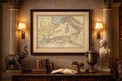
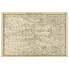
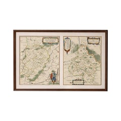
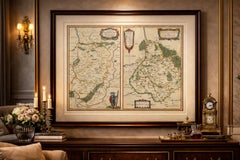
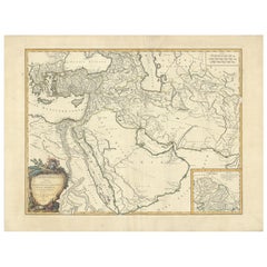
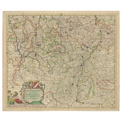
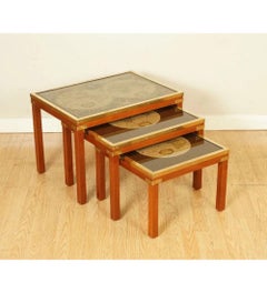
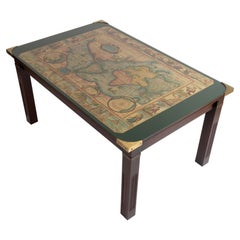
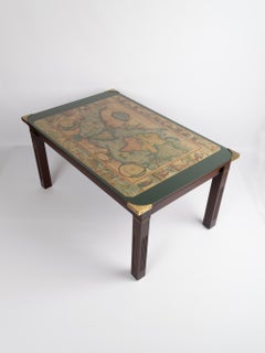
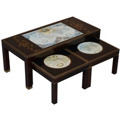
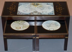
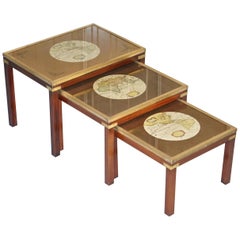
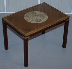
Napoleonic Wars: Germany Allied Military Campaign Map by Ausfeld, 1814
Located in Langweer, NL
Title: Napoleonic Wars - Allied Campaign Map Germany 1814 Ausfeld Military Description: This rare
Antique Early 19th Century German Maps
Paper
Napoleonic Wars: Germany Allied Military Campaign Map by Ausfeld, 1814
Located in Langweer, NL
Title: Napoleonic Wars - Allied Campaign Map Germany 1814 Ausfeld Military Description: This rare
Paper
Detailed 1720s Map – Siege of Douay and Lines of Circumvallation, France
Located in Langweer, NL
batteries. The map shows a classic early 18th-century military cartography style, focusing on topography and
Paper
Detailed 1729 Battle Map – Allied Army Camp at Denain France, 1712 Siege
Located in Langweer, NL
detailed troop arrangements and fortifications. Such maps were used for both military education and
Paper
Attack Plan of Douay Fortress, France, 1710 Siege – Brussels c.1720 Map
Located in Langweer, NL
Attack Plan of Douay Fortress, France, 1710 Siege – Brussels c.1720 Map This engraved military map
Paper
Original Normandy Map by Frederick de Wit, 1705, with Inset of Channel Islands
Located in Langweer, NL
, Dutch cartographer, 18th century map of France, antique coastal maps, collectible military maps, La
Paper
Map of Ardennes France with Sedan and Military History by Vuillemin, c.1850
Located in Langweer, NL
Map of Ardennes France with Sedan and Military History by Vuillemin, 19th c Description: This
Paper
$648Sale Price|20% Off
Original Map of the Military Situation After the Dutch Blockade of Antwerp, 1648
Located in Langweer, NL
Antique map titled 'Tabula Castelli ad Sandflitam (..)'. This map depicts the complex military
Paper
Vintage World Map Mirror Based on the Original by Johnson 1882 Military Campaign
Located in West Sussex, Pulborough
We are delighted to offer for sale this lovely Antique style pictorial plan map of the globe based
Mirror
Hungary, Transylvania & Dalmatia Map, Antique Hand-Colored Map, 1859
Located in Langweer, NL
, Austrian Empire provinces, Central Europe map, historical Hungary, Kingdom of Hungary, military frontier
Paper
Indian Territory Map 1888 – Rand McNally Antique Lithograph
Located in Langweer, NL
Indian Territory Map 1888 – Rand McNally Antique Lithograph This antique 1888 map of Indian
Paper
Antique Map Guadeloupe & Marie Galante, Rigobert Bonne Caribbean Chart c1780
Located in Langweer, NL
essential for navigation, trade, and military planning. Today, Bonne’s maps are sought after for their
Paper
1888 Idaho Map – The Gem State’s Railroads, Mining Camps & Counties
Located in Langweer, NL
population growth. The map also marks military posts and Native American lands, including the Fort Hall
Paper
Antique Map of Prussia & Mecklenburg, Hand Colored, Blackie, circa 1859
Located in Langweer, NL
, military cartography, and 19th-century European maps. Condition report: Good antique condition. Light
Paper
European Russia Map with Saint Petersburg Inset – Nieuwe Hand-Atlas, 1876
Located in Langweer, NL
waterways to Russian trade, military movement, and communication. Inset maps deepen the context: one
Paper
Frontiers of France and Italy – Duke of Berwick Campaigns Map, 1707–1712
Located in Langweer, NL
the map’s analytical and military purpose rather than decorative intent. A distinctive red line runs
Paper
Antique Map of Alexander the Great's Empire & Campaigns, de Vaugondy, 1753
Located in Langweer, NL
Antique Map of Alexander the Great's Empire & Campaigns, de Vaugondy, 1753 This rare and elegantly
Paper
Antique Map of Lotharingia (Lorraine) by Danckerts, c. 1700 – Hand-Colored
Located in Langweer, NL
Antique Map of Lotharingia (Lorraine) by Theodorus Danckerts circa 1700 Hand-Colored This
Paper
Morocco, Algeria and Tunis, Antique Map of North Africa, Blackie, 1882
Located in Langweer, NL
military expeditions. 3. **Cultural Significance**: Maps like this one represent the knowledge and
Paper
Oriental Realms: A Detailed Map of Persia, Afghanistan, and Beloochistan, 1882
Located in Langweer, NL
military history. This map would have been a crucial resource for explorers, traders, and imperial
Paper
Map of Saintonge and Aunis with Cognac and Rochefort, France - 1665 Original
Located in Langweer, NL
Rochefort and Saintes appear as strategic centers of military and trade activity. The map also depicts the
Paper
$1,778Sale Price|40% Off
Map of Constantinople, Bosphorus, the Coasts of Greece and the Archipelago, 1785
Located in Langweer, NL
military zones. Keywords for this map: Pierre François Tardieu, Constantinople, Bosphorus, Thrace, Ottoman
Paper
Christophe Stouvenel "US Army" 2019
By Christophe Stouvenel
Located in Saint Ouen, FR
US ARMY 2020 Stencil on 1881 military geography atlas maps (military map of the United States
Glue, Ink, Mixed Media
$638Sale Price|20% Off
Hand-colored Nautical Chart: St. George's Channel and the Irish Sea, 1744
Located in Langweer, NL
"**: This significant work, spanning 1744-1777, included maps depicting military actions during the War of
Paper
Mid Century 'World Map' Military Campaign Coffee Table, C.1960, France
By Maison Jansen
Located in London, GB
Vintage World Map Military Campaign coffee table France, circa 1960. Verre églomisé map image with
Brass
Nest of Coffee & Side Tables Military Campaign with World Maps
Located in Pulborough, GB
We are delighted to offer for sale this stunning campaign decorative world map nest of tables. A
Brass
Original Georgian / Regency Military Campaign Desk with Large Map Drawer
Located in West Sussex, Pulborough
Military campaign desk with large top map drawer A very well made piece in fine mahogany with all the
Hardwood
Early Folk Art American Two Sided Framed Military Drawing with Map
Located in Savannah, GA
dignitary drawn on one side and a perspective drawing and a map of islands on the other. The perspective
Glass, Wood, Paper
Vintage Coffee & Side Table Nest of Tables Military Campaign with World Maps
Located in West Sussex, Pulborough
We are delighted to offer for sale this lovely nest of three side tables with world maps detailing
Brass
Stunning Coffee & Side Table Nest of Tables Military Campaign with World Maps
Located in West Sussex, Pulborough
We are delighted to offer this stunning campaign decorative world map nest of tables. Each table
Hardwood
$1,312Sale Price / set|30% Off
Stunning Coffee and Side Table Nest of Tables Military Campaign with World Maps
Located in West Sussex, Pulborough
We are delighted to offer for sale this stunning nest of vintage military campaign tables to
Hardwood
Rare Lovely Coffee & Side Table Nest of Tables Military Campaign with World Maps
Located in West Sussex, Pulborough
We are delighted to offer for sale this lovely nest of three side tables with world maps detailing
Brass
Cambridge map original vintage poster by Kerry Lee
By Kerry Lee
Located in London, GB
encourage rail travel around the country. Kerry Lee produced war maps and military education images of
Lithograph
Original U.S. Military 1944 Propaganda Poster: In Mein Kampf...without a fight!
Located in Spokane, WA
World War II history. Distributed weekly by the Army Information Branch, these maps kept military
Offset
Original map of the Belgian Congo illustrated by James Thiriar in 1954
Located in PARIS, FR
designer, known mainly for his drawings of military uniforms. Map - Colony - Africa Congo - Ruanda
Linen, Paper, Lithograph
Original Vintage British Army Recruitment Poster Boys Regiment Regular Army
Located in London, GB
military four-wheel-drive vehicle map reading and operating a radio with a plane flying overhead and tanks
Paper
General Dwight D. Eisenhower
By Albert Al Hirschfeld
Located in Fort Washington, PA
General Dwight D. Eisenhower in military uniform saluting before a map of Germany during World War II
Paper, Ink, Gouache, Graphite
Dublin original vintage British Railways poster by Kerry Lee
By Kerry Lee
Located in London, GB
rail travel around the country. Kerry Lee produced war maps and military education images of aircraft
Lithograph
$1,669Sale Price|40% Off
Leeuwarden Friesland City View – Antique Engraving by Jollain, c.1670
Located in Langweer, NL
urban layout, canals, churches, and military fortifications. The map includes an explanatory legend at
Paper
French Military Green Leather Circular Carrying Case for Rolled Documents
Located in Petaluma, CA
This is a great French military green leather case for rolled documents, artwork or maps. It has a
Leather
Unavailable|$900
"Carigara" - Abstract Oil Painting
By Robert Reynolds
Located in New Haven, CT
military maps, guiding the suggestion of boats onward toward their destination.
Oil
Unavailable|$4,000
"Limon" - Abstract Oil Painting
By Robert Reynolds
Located in New Haven, CT
inspiration from military maps. Red lines depict the impression of a path, guiding soldiers through an unknown
Oil
Unavailable|$900
"Typhoon" - Abstract Oil Painting
By Robert Reynolds
Located in New Haven, CT
by symbols used in military maps, which are almost hard to distinguish in the chaos of the storm
Oil
Unavailable|$900
"Typhoon 2" - Abstract Oil Painting
By Robert Reynolds
Located in New Haven, CT
by symbols used in military maps, which are almost hard to distinguish in the chaos of the storm
Oil
"Tanahmerah Bay, New Guinea" - Abstract Drypoint Etching
By Robert Reynolds
Located in New Haven, CT
Guinea" is a drypoint etching inspired by military maps created during the WWII invasions of New
Drypoint
Unavailable|$5,700
"Typhoon, November 1944" - Abstract Oil Painting
By Robert Reynolds
Located in New Haven, CT
are inspired by symbols used in military maps, which are almost hard to distinguish in the chaos of
Oil
Unavailable|$9,000
"November 11, 1944" - Abstract Oil Painting
By Robert Reynolds
Located in New Haven, CT
by military maps, the painting suggests an aerial view of a land mass and the converging lines
Oil
Unavailable|$18,000
French Military Officer With Map And Binoculars
By Étienne Prosper Berne-Bellecour
Located in Mexico, MX
Oil on Panel. by french Painter E. Berne- Bellecour
Panel
Unavailable|$544
Map of military campaign - Maurits of Nassau by Balthasars - Engraving - 17th c.
Located in Zeeland, Noord-Brabant
stippled depiction of the military campaign done by his Excellence Maurits of Nassau with the army of the
Engraving
Unavailable|$1,500
Historic British Map of Fort Washington
By William Faden
Located in New York, NY
Faden published over 350 known maps, atlases, and military plans. Faden had a particular interest in the
Engraving
Portrait of the Maire of Piedicavallo by Domenico Del Pino (Genoa, 1793 -1851)
By Domenico Del Pino
Located in London, GB
in the army as a professional player of military maps and fortified buildings. A large number of
Unavailable|$1,319
Original Vintage Propaganda Poster Combattants Indochine French Corps Indochina
Located in London, GB
three men - an air force pilot with an army soldier and a navy sailor - in military uniform with a map
Paper
Unavailable|$1,950
Vicinity of Flemington
By Julius Bien
Located in Florham Park, NJ
Survey atlases and military field maps. He was also the first president of the National Lithographers
Lithograph
Unavailable|$4,100
Bergen, Hudson, and Essex
By Julius Bien
Located in Florham Park, NJ
Survey atlases and military field maps. He was also the first president of the National Lithographers
Lithograph
Unavailable|$2,400
Egg Harbor and Vicinity (New Jersey)
By Julius Bien
Located in Florham Park, NJ
Survey atlases and military field maps. He was also the first president of the National Lithographers
Lithograph
Unavailable|$2,800
Monmouth Shore
By Julius Bien
Located in Florham Park, NJ
Survey atlases and military field maps. He was also the first president of the National Lithographers
Lithograph
1865 Military Map Showing the Marches of the U.S. Forces under W. T. Sherman
Located in Colorado Springs, CO
This is an 1865 issue of “Military Map Showing the Marches of the United States Forces under the
Paper
1862 Lloyd's New Military Map of the Border & Southern States
Located in Colorado Springs, CO
This hanging military wall map of the eastern half of United States was published by H.H. Lloyd
Paper