
Pull Down School Maps

North America Vintage Map Pull-Down Wall Chart Poster Countrycore Print

North America Vintage Map Pull-Down Wall Chart Poster Countrycore Print

Located in Berghuelen, DE

A traditional vintage pull-down school map illustrating North America, published by Westermann

Category

Late 20th Century German Country Prints

Materials

Canvas, Wood, Paper

Vintage Rollable Map Southeast Asia China Japan Wall Chart

Vintage Rollable Map Southeast Asia China Japan Wall Chart

Located in Berghuelen, DE

A classical pull-down school map showing the popular region of Southeast Asia with China and Japan

Category

Late 20th Century German Country Prints

Materials

Canvas, Wood, Paper

Vintage Map Wall Chart Countries of North America Rollable Mural Poster

Vintage Map Wall Chart Countries of North America Rollable Mural Poster

Located in Berghuelen, DE

The vintage pull-down school map illustrates the countries / states of North America. Published by

Category

Late 20th Century German Country Prints

Materials

Canvas, Wood, Paper

Vintage Rollable Map Wall Chart South America Brasilia and Neighbour States

Vintage Rollable Map Wall Chart South America Brasilia and Neighbour States

Located in Berghuelen, DE

A classical pull-down school map showing South America with Brasilia and its neighbor states

Category

Mid-20th Century German Country Prints

Materials

Canvas, Wood, Paper

Middle East Saudia Arabia Israel India Map Rollable Mural Vintage Wall Chart

Middle East Saudia Arabia Israel India Map Rollable Mural Vintage Wall Chart

Located in Berghuelen, DE

The pull-down school map is depicting the region of the Middle East (Turkey, Israel, Egypt, Saudi

Category

Late 20th Century German Country Prints

Materials

Canvas, Wood, Paper

Antique New York Wall Map by Westermann

Antique New York Wall Map by Westermann

$644

H 47.25 in W 35.44 in D 0.4 in

Antique New York Wall Map by Westermann

By Westermann

Located in Stockbridge, GB

Antique New York Map By Westermann A rare early school pull down wall map of New York. The map

Category

Mid-20th Century British Schoolhouse Posters

Materials

Canvas, Wood

Antique Vintage Australia Wall Map By W & A K Johnston

Antique Vintage Australia Wall Map By W & A K Johnston

$440 / item

H 37.41 in W 51.19 in D 0.4 in

Antique Vintage Australia Wall Map By W & A K Johnston

By W. & A.K. Johnston

Located in Stockbridge, GB

Vintage Australia Wall Map By W & A K Johnston A vintage school pull down wall map of Australia

Category

Mid-20th Century British Schoolhouse Posters

Materials

Canvas, Wood

Recent Sales

1967 School Map of England

1967 School Map of England

Sold

H 48 in W 3 in D 3.5 in

1967 School Map of England

Located in Tarrytown, NY

1967 Pull down school map of England.

Category

Vintage 1960s Maps

Materials

Paper

1968 Ancient World School Map

1968 Ancient World School Map

Sold

H 48 in W 3 in D 3.5 in

1968 Ancient World School Map

Located in Tarrytown, NY

Pull down school map of the ancient world made, in Chicago in the 1960s.

Category

Vintage 1960s Maps

Materials

Paper

Vintage Educational Pull Down Chart Jung Koch Quentell School Map, Germany, 1968

Vintage Educational Pull Down Chart Jung Koch Quentell School Map, Germany, 1968

By Gottlieb von Koch 1, Lehrmittelverlag Hagemann, Dr. Friedrich Quentell

Located in Kirchlengern, DE

Vintage pull down chart Original vintage school chart, by Jung-Koch Quentell Paperprint on

Category

Mid-20th Century German Mid-Century Modern Prints

Materials

Linen, Wood

Vintage Educational Pull Down Chart Jung Koch Quentell School Map, Germany, 1968

Vintage Educational Pull Down Chart Jung Koch Quentell School Map, Germany, 1968

By Gottlieb von Koch 1, Lehrmittelverlag Hagemann, Dr. Friedrich Quentell

Located in Kirchlengern, DE

Vintage pull down chart Original vintage school chart, by Jung-Koch Quentell Paperprint

Category

Mid-20th Century German Mid-Century Modern Decorative Art

Materials

Linen

1950s Economic European Pull Down School Map

1950s Economic European Pull Down School Map

Located in Tarrytown, NY

1950s economic European pull down school map.

Category

Vintage 1950s Maps

Materials

Paper

Vintage Pull-Down School Map Germany Wall Chart Poster Print

Vintage Pull-Down School Map Germany Wall Chart Poster Print

Located in Berghuelen, DE

A classical rollable vintage wall chart illustrating a map of Germany (Federal Republic of Germany

Category

Mid-20th Century German Country Prints

Materials

Wood, Paper, Canvas

Antique Paris Wall Map by Westermann

Antique Paris Wall Map by Westermann

Sold

H 36.23 in W 46.86 in D 0.4 in

Antique Paris Wall Map by Westermann

By Westermann

Located in Stockbridge, GB

Antique Paris Map By Westermann A rare early school pull down wall map of Paris. The map shows

Category

Mid-20th Century British Schoolhouse Posters

Materials

Canvas, Wood

School Maps
School Maps

School Maps

Sold

H 66.15 in W 52.37 in D 3.94 in

School Maps

Located in Llandudno, Conwy

A pair of large pull down school maps of North and South America. Original back board with

Category

Early 20th Century English Maps

School Chart or Pull Down Map of Geography of the Netherlands, 1950s

School Chart or Pull Down Map of Geography of the Netherlands, 1950s

Located in Hemiksem, VAN

A beautiful old school map of the Netherlands, painted on linen. The map shows the 3 different

Category

Vintage 1950s Belgian Mid-Century Modern Maps

Materials

Linen, Paint

Get Updated with New Arrivals
Save "Pull Down School Maps", and we’ll notify you when there are new listings in this category.

Pull Down School Maps For Sale on 1stDibs

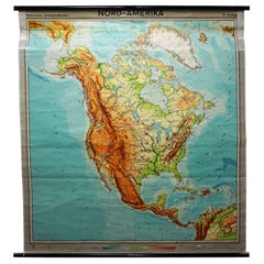
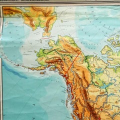
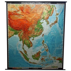
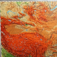
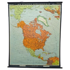
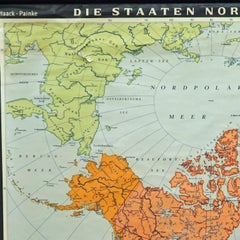
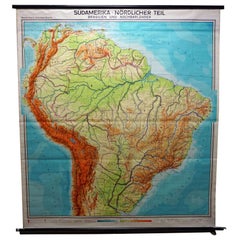
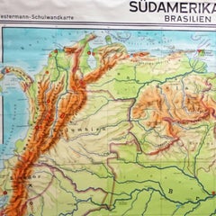
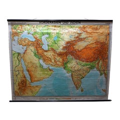
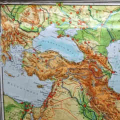
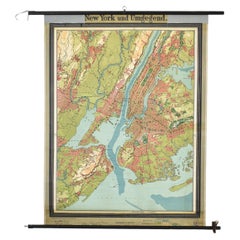
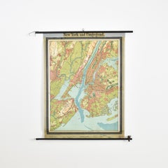
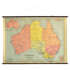
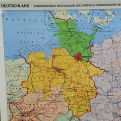
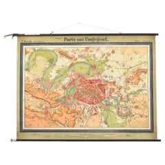
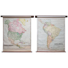
At 1stDibs, there are several options of pull down school maps available for sale. The range of distinct pull down school maps — often made from paper, wood and fabric — can elevate any home. Pull down school maps have been produced for many years, with earlier versions available from the 19th Century and newer variations made as recently as the 20th Century. There are many kinds of pull down school maps to choose from, but at 1stDibs, mid-century modern, Hollywood Regency and industrial pull down school maps are of considerable interest. There have been many well-made pull down school maps over the years, but those made by
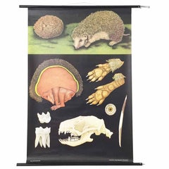
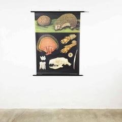
 Jung Koch Quentell, Lehrmittelverlag Hagemann and 
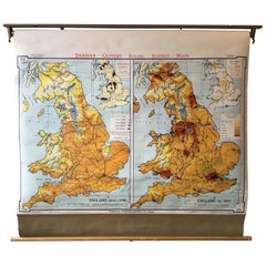
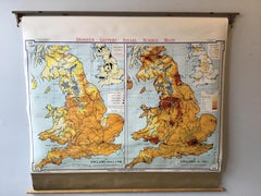
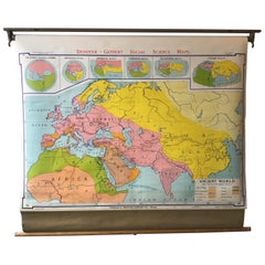
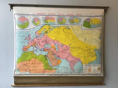
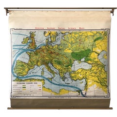
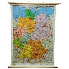
Denoyer-Geppert are often thought to be among the most beautiful.

How Much are Pull Down School Maps?

Pull down school maps can differ in price owing to various characteristics — the average selling price at 1stDibs is $380, while the lowest priced sells for $180 and the highest can go for as much as $2,213.