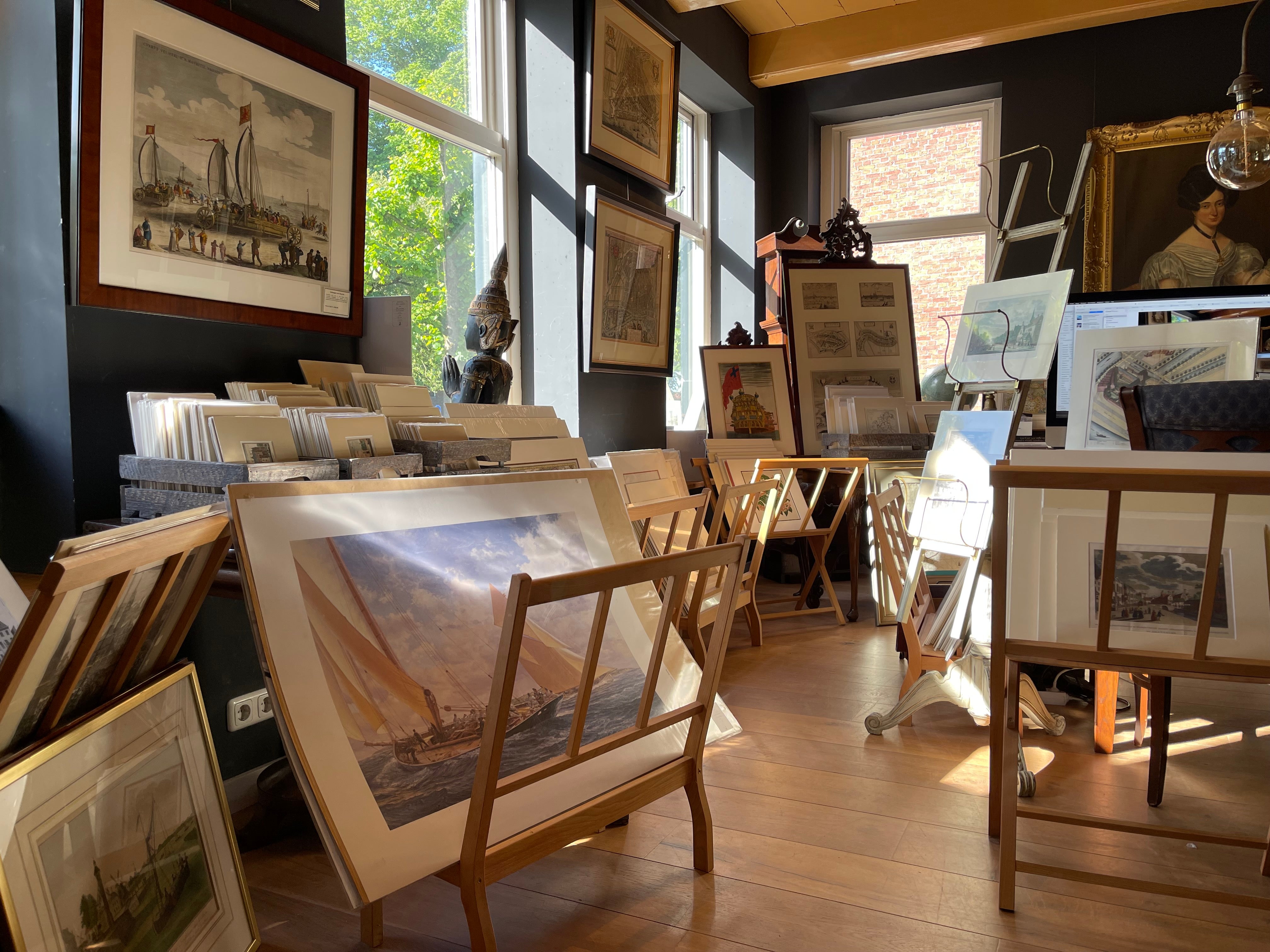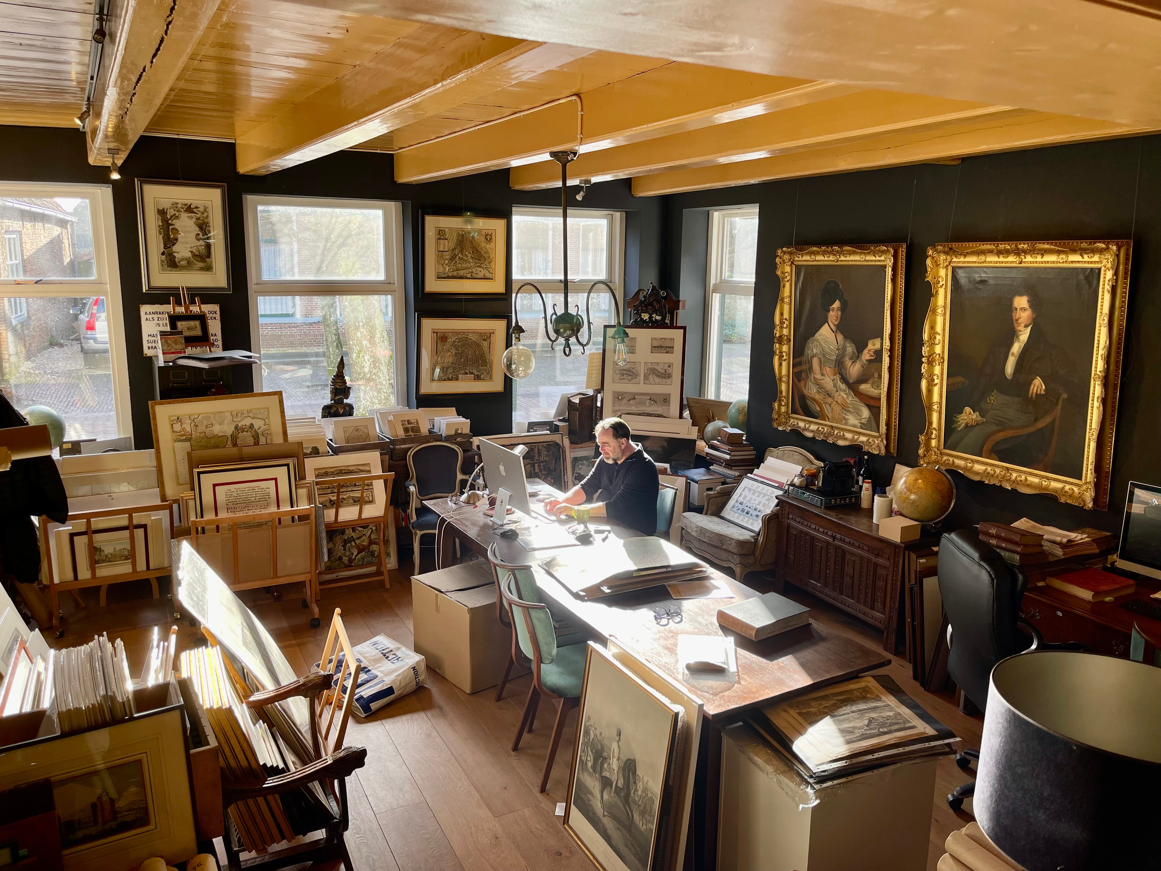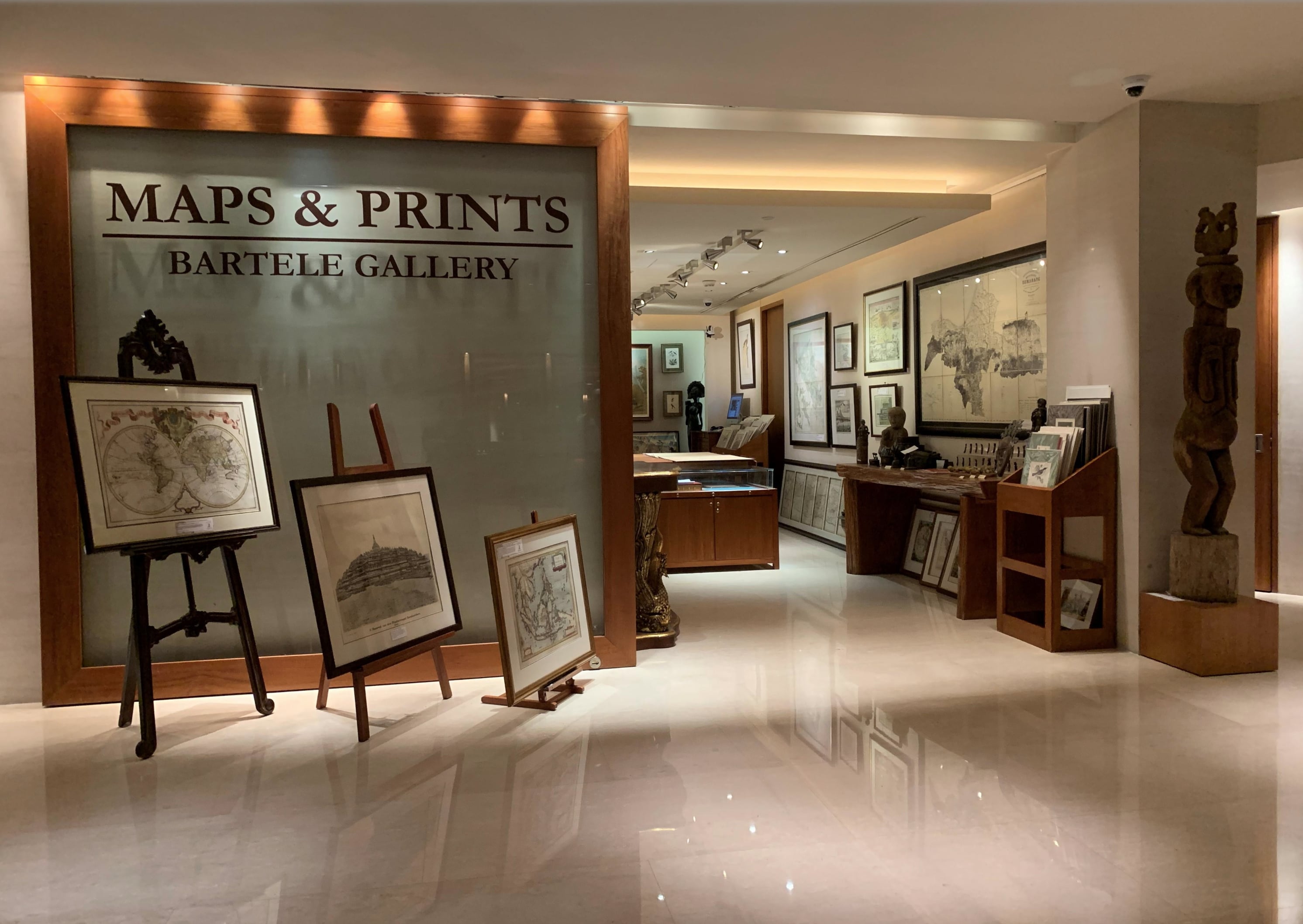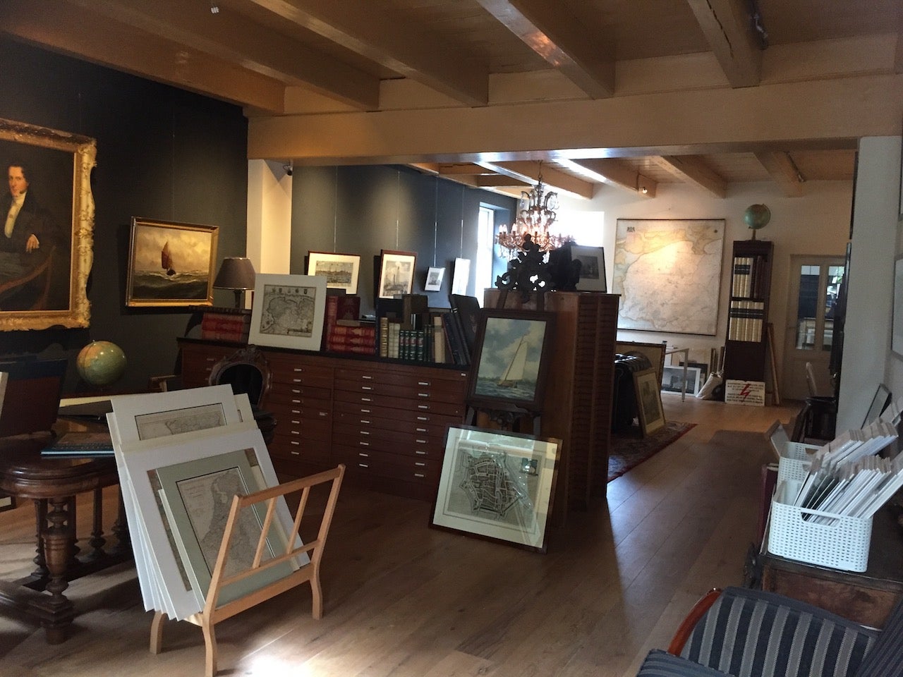
About Bartele Gallery
Bartele Gallery offers a wide range of antique maps, prints and rare books. Our extensive collection of antique maps covers every part of the world. Whilst cartography holds a special place in our collection, we also offer thousands of antique prints covering fields of interest as diverse as architecture, natural history, religion, ethnology and many more. Bartele Gallery is managed by Bartele Santema, in 2009 he founded the first gallery in Indonesia. This gallery is located in the Kempinski Hotel Jakarta and supported by curator Dr. David Parry, who wrote 'The Cartogra...Read More
Established in 20091stDibs seller since 2017
Featured Pieces
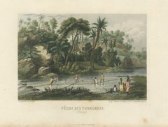
Original Antique Print of Yuracaré Fishing in Peru by Dureau, c.1840
Located in Langweer, NL
Original Antique Print of Yuracaré Fishing in Peru by Dureau, c.1840
Description:
An original antique hand-coloured lithograph titled "Pêche des Yuracarès (Pérou)", depicting member...
Category
Antique Mid-19th Century French Prints
Materials
Paper
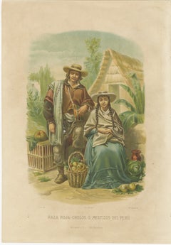
Original Antique Costume Print of Peruvian Mestizos, "Raza Roja", c.1880
Located in Langweer, NL
Title: Original Antique Costume Print of Peruvian Mestizos, "Raza Roja", c.1880
Description:
An original antique chromolithograph titled "Raza Roja – Cholos ó Mestizos del Perú", de...
Category
Antique Late 19th Century Spanish Prints
Materials
Paper
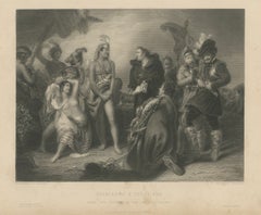
Original Antique Engraving of Spaniards & Peruvians after H.P. Briggs, c.1827
Located in Langweer, NL
Title: Original Antique Engraving of Spaniards & Peruvians after H.P. Briggs, c.1827
Description:
An original antique steel engraving titled "Spaniards & Peruvians", engraved by W. ...
Category
Antique Early 19th Century British Prints
Materials
Paper
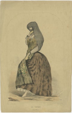
Original Antique Costume Print "La Tapada" of Lima, Peru by A.A. Bonnaffé, 1855
Located in Langweer, NL
Original Antique Costume Print "La Tapada" of Lima, Peru by A.A. Bonnaffé, 1855
Description:
An original antique lithograph titled "La Tapada", depicting one of the most distinctive...
Category
Antique Mid-19th Century Peruvian Prints
Materials
Paper
Original Antique Devotional Print of Christ of Guamantanga, Peru, 1779
Located in Langweer, NL
Original Antique Devotional Print of Christ of Guamantanga, Peru, 1779
Description:
An original antique devotional copperplate engraving with fine original hand colouring, published...
Category
Antique 18th Century Peruvian Prints
Materials
Paper

Antique Map of Lima Peru by Isaak Tirion – City Plan with Fortifications, 1769
Located in Langweer, NL
Antique Map of Lima, Peru by Isaak Tirion, 1769
Description:
Original antique copperplate engraved city plan of Lima, Peru, published in Amsterdam in 1769 by the Dutch cartographer ...
Category
Antique Mid-18th Century British Prints
Materials
Paper

Antique Map of Peru and the Amazon by Herman Moll with Galapagos, c.1709
Located in Langweer, NL
Antique Map of Peru and the Amazon by Herman Moll with Galapagos, c.1709
Description:
A rare original antique copperplate engraved map of Peru and the Amazon region, engraved by the...
Category
Antique Early 18th Century British Prints
Materials
Paper

Antique Map of France by Alexandre Vuillemin – Road Map c.1850
Located in Langweer, NL
Title (max. 80 characters)
Antique Map of France by Alexandre Vuillemin – Road Map c.1850
Description
A finely engraved antique map of France, published by Alexandre Vuillemin in ...
Category
Antique Mid-19th Century French Maps
Materials
Paper

Original Antique Print of Henri IV Equestrian Portrait by F. Roy, circa 1860
Located in Langweer, NL
Original Antique Print of Henri IV Equestrian Portrait by F. Roy, circa 1860
Description:
A handsome original antique French costume print depicting King Henri IV of France on horse...
Category
Antique 1860s French Prints
Materials
Paper

Original Antique Print of Louis XIII on Horseback by F. Roy, circa 1860
Located in Langweer, NL
Original Antique Print of Louis XIII on Horseback by F. Roy, circa 1860
Description:
A graceful original antique French costume print depicting King Louis XIII of France on horsebac...
Category
Antique 1860s French Prints
Materials
Paper

Original Antique Print of Henri II, Captain of the Chevau-légers, c.1860
Located in Langweer, NL
Title: Original Antique Print of Henri II on Horseback as Captain of the Chevau-légers by F. Roy, circa 1860
Description:
A beautiful original antique French costume print depicting...
Category
Antique 1860s French Prints
Materials
Paper

Original Antique Print of Louis XII Entering Genoa on Horseback by F. Roy, 1860
Located in Langweer, NL
Title: Original Antique Print of Louis XII Entering Genoa on Horseback by F. Roy, circa 1860
Description:
A handsome original antique French costume print depicting King Louis XII o...
Category
Antique 1860s French Prints
Materials
Paper

More About Bartele Gallery