Maps
to
4,254
5,435
240
5,680
3
76
35
18
13
6
5
4
4
4
3
1
1
2,972
2,235
473
3
288
34
9
126
8
36
9
2
5
4
3
2
5,593
122
55
34
32
713
331
217
146
140
5,683
5,683
5,683
104
63
28
24
16
Maps For Sale
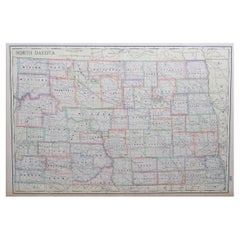
Large Original Antique Map of North Dakota, USA, circa 1900
Located in St Annes, Lancashire
Fabulous map of North Dakota
Original color
Engraved and printed by the George F. Cram Company, Indianapolis.
Published, circa 1900
Unframed
Free shi...
Category
1890s American Antique Maps
Materials
Paper
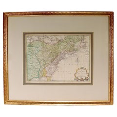
New Map of North America from the Latest Discoveries, 1763
Located in Philadelphia, PA
A fine antique 18th century map of the North American seaboard.
Entitled "A New Map of North America from the Latest Discoveries 1763".
By the Cartographer/Engraver - John Spil...
Category
Mid-18th Century English Georgian Antique Maps
Materials
Paper
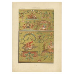
Pl. 91 Antique Print of Decorative Art in the 18th Century by Racinet, 1869
Located in Langweer, NL
Old print of decorative art in the 18th century. This print originates from 'L'Ornement polychrome'. A beautiful work containing about 2000 patterns of all the styles of Art old and ...
Category
19th Century Antique Maps
Materials
Paper
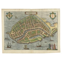
Antique Map of the City of Dordrecht by Braun & Hogenberg, c.1581
Located in Langweer, NL
Antique map titled 'Dordrecht'. Map of the city of Dordrecht, the Netherlands. Bird's-eye plan view of the city, with many ships and two coats of arms in upper corners. This map orig...
Category
16th Century Antique Maps
Materials
Paper
$402 Sale Price
20% Off
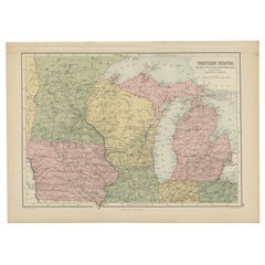
Antique Map of Western States, Michigan, Wisconsin, Iowa by A & C. Black, 1870
Located in Langweer, NL
Antique map titled 'Western States, Michigan, Wisconsin, Minnesota, Iowa with portions of Illinois & Indiana'. Original antique map of Western States, Michigan, Wisconsin, Minnesota,...
Category
Late 19th Century Antique Maps
Materials
Paper
$167 Sale Price
20% Off
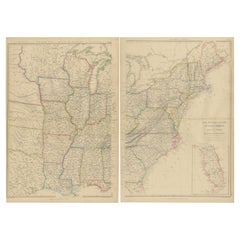
Set of 2 Antique Maps of the United States by W. G. Blackie, 1859
Located in Langweer, NL
Antique map titled 'The United States of North America, Atlantic States and Valley of the Mississippi'. Original antique map of the United States of North America, Atlantic States an...
Category
Mid-19th Century Antique Maps
Materials
Paper
$383 Sale Price / set
20% Off
Antique Map of Moldova to Thessaly and from the Adriatic to the Black Sea, 1880
Located in Langweer, NL
Antique map titled 'Turquie d'Europe'.
Map of the european parts of Turkey. The map covers from Moldova to Thessaly and from the Adriatic to the Black Sea. Greece and the island ...
Category
1880s Antique Maps
Materials
Paper
$134 Sale Price
20% Off
Antique Print of a Ruin of the Kew Gardens in London, England, c.1785
Located in Langweer, NL
Antique print titled 'Ruin de Kew vuë par le Nord'.
Copper engraving of a ruin of the Kew gardens. This print originates from 'Jardins Anglo-Chinois à la Mode' by Georg Louis le Rouge. Artists and Engravers: The work of Le Rouge is considered the most important engraved work concerning the history of European gardens during the 18th century.
Kew Gardens is a botanic garden in southwest London that houses the "largest and most diverse botanical and mycological collections in the world". Founded in 1840, from the exotic garden at Kew Park, its living collections includes some of the 27,000 taxa curated by Royal Botanic Gardens, Kew, while the herbarium, one of the largest in the world, has over 8.5 million preserved plant...
Category
18th Century Antique Maps
Materials
Paper
$364 Sale Price
20% Off
World Globe With Wooden Foot, and Brass 20th Century
Located in Mombuey, Zamora
Beautiful and elegant ball of the world to decorate any studio, living room or bedroom, it is small, with the base about 26 cm high and 10 wide.
Category
20th Century Italian Other Maps
Materials
Brass
$669 Sale Price
20% Off
Antique Map of Britain in Roman Times
Located in Langweer, NL
Antique map titled 'Britannia Romana collected from Ptolemy (..)'. Map of Britain in Roman times drawn from several sources, including the works of Ptolemy and The Itinerary of the E...
Category
Early 19th Century Antique Maps
Materials
Paper
$470 Sale Price
20% Off
Antique Map of Egypt with Detailed Inset of the Nile Delta, ca. 1799
Located in Langweer, NL
Antique Map of Egypt with Detailed Inset of the Nile Delta, ca. 1799
This finely engraved antique map titled Carte Physique et Politique de l’Égypte presents a detailed and scientif...
Category
Early 1800s French Antique Maps
Materials
Paper
Large Antique County Map of Wiltshire, England, 1805
Located in Langweer, NL
Antique map titled 'A Map of Wiltshire from the best Authorities'. Original old county map of Wiltshire, England. Engraved by John Cary. Originates from 'New British Atlas' by John S...
Category
Early 19th Century Antique Maps
Materials
Paper
$220 Sale Price
20% Off
Antique Plan of Philippeville in Wallonia, Belgium, 1769
Located in Langweer, NL
Antique map titled 'Philippe-Ville'. Plan of Philippeville in Wallonia, Belgium. This print originates from volume 3 of 'Les Delices des Pays-Bas ou description geographique et histo...
Category
18th Century Antique Maps
Materials
Paper
$115 Sale Price
20% Off
Large Antique County Map of Leicestershire, England, 1805
Located in Langweer, NL
Explore Leicestershire's Past: Antique Map by John Cary
Step into the history of Leicestershire, England, with this original old county map engraved by the renowned cartographer Joh...
Category
Early 19th Century Antique Maps
Materials
Paper
$220 Sale Price
20% Off
Antique Print of Moscow During the Fire of Moscow in Napoleon Wars, Russia, 1845
Located in Langweer, NL
Antique print titled 'Moscau am 20 September'. Original antique print of Moscow, during the Fire of Moscow, 1812. This print originates from 'Der Feldzug von 1812' by Friedrich Stege...
Category
19th Century Antique Maps
Materials
Paper
$134 Sale Price
20% Off
Antique Print of Büdingenin Germany by Braun & Hogenberg, 1617
Located in Langweer, NL
Antique map titled 'Bingen'. Bird's eye-view of Büdingen, Germany. The view shows a city surrounded by vineyards and well fortified with walls and moats. On the right is the castle w...
Category
17th Century Antique Maps
Materials
Paper
$278 Sale Price
20% Off
Antique Map of Australia, New Zealand and Oceania by F. von Stülpnagel, 1850
Located in Langweer, NL
Antique map titled 'Australien und Polynesien in Mercators Projection'. A map of Australia, New Zealand and Oceania. This includes Fiji, Tahiti and several other island groups in the...
Category
Mid-19th Century Antique Maps
Materials
Paper
$184 Sale Price
30% Off
Old Map of Arabian Peninsula and Canaan, Highlighting Biblical Territories, 1750
Located in Langweer, NL
This antique map, titled "Terre de Chanaan ou Terre Promise a Abraham," is a finely detailed copper-engraved map created around 1750 by Delamarche in Paris, based on earlier works by...
Category
1750s French Antique Maps
Materials
Paper
Antique Map of the City of Jerusalem by N. Visscher, 1702
Located in Langweer, NL
Antique map titled 'Die Heylige en Wytvermaerde stadt Jerusalem Eerst Genaemt Salem, Genesis 14 vers 18'. This map originates from 'Biblia. Ouden ende Nieuwen Testaments (..)'. Publi...
Category
Early 18th Century Antique Maps
Materials
Paper
$3,309 Sale Price
20% Off
Large Antique County Map of Hertfordshire, England
Located in Langweer, NL
Antique map titled 'A Map of Hartfordshire from the best Authorities'. Original old county map of Hertfordshire, England. Engraved by John Cary. Originates from 'New British Atlas' b...
Category
Early 19th Century Antique Maps
Materials
Paper
$268 Sale Price
20% Off
Large Antique County Map of the West Riding of Yorkshire 'South Part', England
Located in Langweer, NL
Antique map titled 'A Map of the South Part of the West Riding of Yorkshire from the best Authorities'. Original old county map of the south part of the West Riding of Yorkshire, Eng...
Category
Early 19th Century Antique Maps
Materials
Paper
$268 Sale Price
20% Off
Antique Map of China and Korea incl Formosa and Hainan, by Janssonius, ca.1650
Located in Langweer, NL
Antique map titled 'Imperii Sinarum Nova Descriptio'. Beautiful map of China and Korea, much detail troughout the map. Including the Islands of Formosa (Taiwan) and Hainan. The Great...
Category
17th Century Antique Maps
Materials
Paper
$2,830 Sale Price
20% Off
Antique Map of Deventer in the Netherlands, 1691
Located in Langweer, NL
Plate 'Devendr.' (Plan of the fortified city of Deventer, The Netherlands.) This attractive original old antique print / plate originates from: 'Aus...
Category
17th Century Antique Maps
Materials
Paper
$124 Sale Price
20% Off
Antique Map of China by Larousse, 1897
Located in Langweer, NL
Sheet: Front: 'Chine.' (China map). Verso: 'China.' (China views, nature, animals, costume). This rare early lithographic print originates from: 'Nouveau Lar...
Category
19th Century Antique Maps
Materials
Paper
$50 Sale Price
50% Off
Detailed Map of New Zealand Showing the Route of Capt. Cook's First Voyage, 1803
Located in Langweer, NL
Antique map New Zealand titled 'De Rivier de Theems en Mercurius Baai in Nieuw Zeeland'. Detailed map of New Zealand showing the route of Capta...
Category
19th Century Antique Maps
Materials
Paper
$623 Sale Price
20% Off
Antique Map of the Night Skies of the Northern and Southern Hemispheres, 1880
Located in Langweer, NL
Antique world map titled 'Planisphère en Céleste'.
This map depicts the night skies of both the northern and southern hemispheres. This map originates from 'Géographie Universell...
Category
1880s Antique Maps
Materials
Paper
$278 Sale Price
20% Off
Spectacular View of the Siege of Jerusalem by King Nebuchadnezzar, ca.1730
Located in Langweer, NL
Antique print titled 'Belegering van Jerusalem door Nebucadnezar (..)'.
This original antique print shows the siege of Jerusalem by King Nebucha...
Category
1730s Antique Maps
Materials
Paper
$518 Sale Price
20% Off
Original and Decorative Antique Engraved Map of Finland and Sweden, ca.1720
Located in Langweer, NL
Antique map titled 'Ducatus Uplandiae cum Westmanniae Sudermanniae (..)'
This map shows parts of Finland and Sweden. Originally published by Frederick de Wit in the late 1600's. ...
Category
1720s Antique Maps
Materials
Paper
$1,391 Sale Price
20% Off
Large Antique County Map of Northumberland, England
Located in Langweer, NL
Antique map titled 'A Map of Northumberland from the best Authorities'. Original old county map of Northumberland, England. Engraved by John Cary. Originates from 'New British Atlas'...
Category
Early 19th Century Antique Maps
Materials
Paper
$230 Sale Price
20% Off
Antique Map of South America by Philip & Son, 1875
Located in Langweer, NL
Antique map titled 'South America'. Old map of South America. Source unknown, to be determined.
Artists and Engravers: George Philip (1800–1882) was a cartographer, map publisher...
Category
19th Century Antique Maps
Materials
Paper
$57 Sale Price
20% Off
Map of Australia, New Zealand, Part of China, Japan and Southeast Asia, 1857
Located in Langweer, NL
German Antique map titled 'Australien'. Map of Australia, New Zealand, part of China, Japan and Southeast Asia. In the upper right is a bit of the California coast by San Francisco. ...
Category
19th Century Antique Maps
Materials
Paper
$671 Sale Price
20% Off
German Antique Map of Australia and New Zealand, 1857
Located in Langweer, NL
Antique map Australia titled 'Festland von Australien und benachbarte Inseln'. Detailed map of Australia and New Zealand, including excellent det...
Category
19th Century Antique Maps
Materials
Paper
$239 Sale Price
20% Off
Large Antique County Map of Huntingdonshire, England
Located in Langweer, NL
Antique map titled 'A Map of Huntingdonshire from the best Authorities'. Original old county map of Huntingdonshire, England. Engraved by John Cary. Originates from 'New British Atla...
Category
Early 19th Century Antique Maps
Materials
Paper
$220 Sale Price
20% Off
Antique Map of the Holy Land by Keur, 1748
Located in Langweer, NL
Antique Map Holy Land titled 'De Gelegentheyd van t'Paradys ende t'Landt Canaan, Mitsgaders d'eerst bewoonde Landen der Patriarchen'. Includes five decorative vignettes, including No...
Category
18th Century Antique Maps
Materials
Paper
$333 Sale Price
20% Off
Antique Map of the Balkans with Coat of Arms
Located in Langweer, NL
Antique map titled 'Tavola Nuova di Schiavonia'. Ruscelli's map of the Balkans, with a coat of arms. The mountains are represented, river systems are shown in detail, and cities, towns and ports denoted throughout this 16th century map. A number of islands in the Adriatic Sea are also shown. This map originates from 'Espositione & introduttioni universali di Gir. Ruscelli sopra tutta la Geografia di Tolomeo (..)' published by Girolamo Ruscelli, 1561.
Girolamo Ruscelli (1500-1566) was a cartographer, humanist, and scholar from Tuscany. Ruscelli was a prominent writer and editor in his time, writing about a wide variety of topics including the works of Giovanni Boccaccio and Francesco Petrarch, Italian language, Italian poetry, medicine, alchemy, and militia. One of his most notable works was a translation of Ptolemy...
Category
16th Century Antique Maps
Materials
Paper
$422 Sale Price
20% Off
Beautiful Antique Map of the French Coast, from St. Valeri to Dieppe, 1720
Located in Langweer, NL
Antique map France titled 'Les Embouchures de la Somme et de Bresle Riv. ou est St. Valeri, Eu et Dieppe'.
Beautiful map of the French coast, fr...
Category
1720s Antique Maps
Materials
Paper
$857 Sale Price
35% Off
Antique Print of Liège / Luik in Belgium by Braun & Hogenberg, 1575
Located in Langweer, NL
Antique print titled 'Leodium'. View of Liège / Luik, Belgium with surrounding hills and the city wall. With text explaining the origins of Liège, a cartouche expressing thanks to th...
Category
16th Century Antique Maps
Materials
Paper
$1,285 Sale Price
20% Off
Original Antique Ptolemaic Map of the Region of Thailand and Malaysia
Located in Langweer, NL
Antique map titled 'Tabula Asiae XI'. Based on the interpretations of Solinus and Munster, this Ptolemaic map covers the region roughly of Thailand and Malaysia. An oddly shaped (Mal...
Category
16th Century Antique Maps
Materials
Paper
$546 Sale Price
20% Off
Antique Map of North and East Asia, 1751
Located in Langweer, NL
Map 2: 'Carte des parties nord et est de L'Asie'. (Map of the Northern parts and East Asia.) Five maps on one sheet, showing California, Alaska and Siberia, Korea and Japan. South to...
Category
18th Century Antique Maps
Materials
Paper
Antique French Map of Hungary with Decorative Title Cartouche, c.1730
Located in Langweer, NL
Antique map titled 'La Hongrie suivant les Nouvelles Observations (..)'. Antique map of Hungary with decorative title cartouche. Artists and Engravers: ...
Category
18th Century Antique Maps
Materials
Paper
$364 Sale Price
20% Off
Antique Print of the Porcelain Pagoda in Nanjing, China, 1736
Located in Langweer, NL
Antique print titled 'La Tour de Porcelaine, Arc de Triomphe'. Old print depicting the Porcelain Pagoda in the Chinese city of Nanjing. It no longer ...
Category
18th Century Antique Maps
Materials
Paper
Antique Print of Cairo and Joseph's Well in Egypt, 1698
Located in Langweer, NL
Untitled antique print with a view of the city of Cairo in Egypt and Joseph's Well in Cairo. This print originates from 'Reizen van Cornelis de Bruyn, door de vermaardste deelen van ...
Category
17th Century Antique Maps
Materials
Paper
$163 Sale Price
20% Off
Large Antique County Map of Durham, England
Located in Langweer, NL
Antique map titled 'A Map of Durham from the best Authorities'. Original old county map of Durham, England. Engraved by John Cary. Originates from 'New ...
Category
Early 19th Century Antique Maps
Materials
Paper
$249 Sale Price
20% Off
Rare Antique Print of the Famous Westminster Abbey, London, England, C.1800
Located in Langweer, NL
Antique print titled 'An ancient View of St. James's (..)'. Old print of Westminster, the old Westminster Abbey in the centre, with St James's Palace on the right.
Westminster Abb...
Category
18th Century Antique Maps
Materials
Paper
$402 Sale Price
20% Off
Antique Map of the Pyrenees Orientales 'France' by V. Levasseur, 1854
Located in Langweer, NL
Antique map titled 'Dépt. des Pyréneés Orles'. Map of the French department of Pyrenees Orientales, France. This area is a well-known wine producing region. A wide variety of wines c...
Category
Mid-19th Century Antique Maps
Materials
Paper
$191 Sale Price
20% Off
Original Copper Engraving with View of the Palace and Chinese Emperor, ca.1700
Located in Langweer, NL
Title: "The Station used by the great Mandaryns Staetsie der groote Mandarijns / The Station used by the great Mandaryns Staetsie der groote Mandarijns. 1665.
The richly illustrat...
Category
Early 1700s Antique Maps
Materials
Paper
$230 Sale Price
20% Off
Antique Print of a Section of the Kew Gardens, London, England, c.1785
Located in Langweer, NL
Antique print titled 'Coupe sur la longueur d'une partie de la Galerie des Antiques dans les jardins de Kew'.
Copper engraving showing a section of the Royal Botanic...
Category
18th Century Antique Maps
Materials
Paper
$345 Sale Price
20% Off
Antique Map of The Harbour of Acapulco in Mexico, 1749
Located in Langweer, NL
Description: Antique map titled 'Plan van de Haven van Acapulco (..) - Plan du Port d'Acapulco (..)'. Original antique map of the Port of Acapulco on the coast of Mexico in the South...
Category
1740s Antique Maps
Materials
Paper
$345 Sale Price
20% Off
Antique Print of Various Apples by Knoop, 1758
Located in Langweer, NL
Antique print depicting apple variaties including the Soete Erveling, Winter Striepeling, Blanke Pepping, Soete Son-Appel, Witte Soete Jopen, Princesse Noble, Soete Robbert, Grauwe R...
Category
18th Century Antique Maps
Materials
Paper
$287 Sale Price
25% Off
Antique Map of Portugal by Nolin '1704'
Located in Langweer, NL
Antique map titled 'Le Royaume de Porutgal divisé en cinq grandes Provinces (..)'. Rare and very decorative map of Portugal. It shows the territory of ...
Category
Early 18th Century Antique Maps
Materials
Paper
$815 Sale Price
20% Off
Antique Map of St. Louis and Chicago
Located in Langweer, NL
Antique map titled 'The City of St. Louis Missouri - The City of Chicago Illinois'. Dual map on single page showing St. Louis and Chicago. Finely produ...
Category
Mid-19th Century Antique Maps
Materials
Paper
$143 Sale Price
20% Off
Rare Map of South America of Chili, La Plata, Paraguay, Brazil, Peru, c.1775
Located in Langweer, NL
Antique map titled 'South America agreeable to the most approved maps and charts'.
Rare map of South America depicting Chili, La Plata, Paraguay, Brazil, ...
Category
1770s Antique Maps
Materials
Paper
$518 Sale Price
20% Off
Antique Map of Groningen with Contemporary Hand Coloring
Located in Langweer, NL
Antique map titled 'Tabulae dominii Groeningae quae et complecititur maximam partem Dreniae Emendata a F. de Wit'. Original antique map of the province of Groningen, the Netherlands....
Category
Late 17th Century Antique Maps
Materials
Paper
$633 Sale Price
20% Off
Antique Map of the Yenisei River in Siberia, Russia, 1768
By Prevost
Located in Langweer, NL
Antique map titled 'Carte des Bras du Jenisei (..)'. Map of the Yenisei River and surroundings, Siberia. This print originates from volume 18 of 'Histoire generale des voyages (..)' ...
Category
18th Century Antique Maps
Materials
Paper
$268 Sale Price
20% Off
Original Antique Sea Chart of the Coastline from England to Gibraltar, ca.1700
Located in Langweer, NL
Antique map titled 'A Chart of the Sea-Coast from England to the Streights.'
Original antique map showing the European coastline from the South of England (and North of France) to ...
Category
Early 1700s Antique Maps
Materials
Paper
$911 Sale Price
20% Off
Original Hand-coloured Antique Map of Pomerania by Sanson '1684'
Located in Langweer, NL
Antique map titled 'Le Duche de Pomeranie divise en ses Principales Parties (..)'. Large map of Pomerania. Pomerania is a historical region on the southern shore of the Baltic Sea in...
Category
Late 17th Century Antique Maps
Materials
Paper
$911 Sale Price
20% Off
Large Antique County Map of Cambridgeshire, England
Located in Langweer, NL
Antique map titled 'A Map of Cambridgeshire from the best Authorities'. Original old county map of Cambridgeshire, England. Engraved by John Cary. Originates from 'New British Atlas'...
Category
Early 19th Century Antique Maps
Materials
Paper
$220 Sale Price
20% Off
Antique Map of England and Wales, with References to the Counties
Located in Langweer, NL
Antique map titled 'England and Wales'. Original antique map of England and Wales, with references to the counties. Source unknown, to be determined. Published circa 1820.
Category
Early 19th Century Antique Maps
Materials
Paper
$134 Sale Price
20% Off
Large Antique Map of Gaul, or France in Ancient Roman Times, circa 1760
Located in Langweer, NL
Original antique map titled 'Gallia Antiqua ex Aevi Romani Monumentis (..)'. Large map of Gaul, or France in ancient Roman times, showing Roman provinces. Inset bottom left a detaile...
Category
Mid-18th Century French Antique Maps
Materials
Paper
$450 Sale Price
20% Off
Antique Map of Harlingen, Harbour City in the Netherlands, 1691
Located in Langweer, NL
Plate 'Harlingen.' (Plan of the city of Harlingen, The Netherlands.) This attractive original old antique print / plate originates from: 'Ausführliche und grundrichtige Beschreibung ...
Category
17th Century Antique Maps
Materials
Paper
$134 Sale Price
20% Off
Recently Viewed
View AllMore Ways To Browse
Antique Wellington Chests
Antonio Cassi Ramelli
Archimede Seguso Birds
Art Deco Coasters
Art Deco Footballer
Art Deco Music Cabinet
Art Deco Waterfall Bedroom Furniture
Art Deco Waterfall Bedroom
Art Deco Whisky
Art Foulard
Art Nouveau Sunflower
Arts And Crafts Silver Coffee Pot
Asian Pink Bowl
Avesn Vase
Baccarat Carafe
Bakelite Bird
Bakelite Cocktail Picks
Bamboo Ikebana Vase
