Maps
to
4,241
5,461
195
5,661
3
75
35
18
14
6
5
5
4
4
3
1
1
2,929
2,257
475
3
290
34
10
126
10
37
9
2
5
4
3
3
5,574
123
55
34
32
749
332
219
154
148
5,664
5,664
5,664
104
59
28
21
15
Maps For Sale
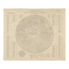
Visible Side of the Moon Map – Detailed Lunar Crater Chart, Published in 1858
Located in Langweer, NL
Visible Side of the Moon Map – Detailed Lunar Crater Chart 1858
This fascinating antique print shows the visible side of the moon with incredible precision and detail. It depicts th...
Category
Mid-19th Century German Antique Maps
Materials
Paper
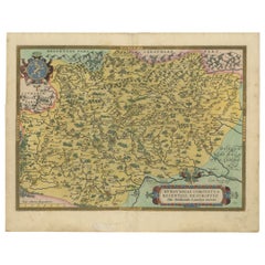
1579 Ornate Map of Burgundy County by Ferdinand de Lannoy
Located in Langweer, NL
1579 Ornate Map of Burgundy County by Ferdinand de Lannoy
Description of the Map:
This is a beautifully detailed map of the Burgundy region, titled "Bvrgvndiae Comitatus Recentiss....
Category
16th Century Antique Maps
Materials
Paper
$935 Sale Price
20% Off
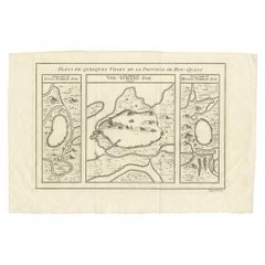
Antique Map of Three Cities of China's Hubei and Hunan Provinces by Bellin
Located in Langweer, NL
Antique print titled 'Plans de Quelques villes de la province de Hou-Quang.' Three bird's-eye view plans of walled cities in what are now China's Hubei (Hou-Quang) and Hunan Province...
Category
Mid-18th Century Antique Maps
Materials
Paper
$155 Sale Price
20% Off
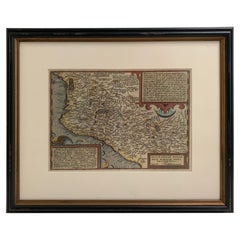
1608 Hispaniae Novae Sive Magnae Vera Descriptio Framed Mexico Map
Located in Stamford, CT
1608 Hispaniae Novae Sive Magnae Vera Descriptio Framed Mexico Map. As found custom black wooden frame/ matting.
This map is based on the work of Abraham Ortelius as is an example o...
Category
Early 1600s Mexican Spanish Colonial Antique Maps
Materials
Glass, Wood, Paper
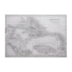
Large Original Antique Map of The West Indies by Sidney Hall, 1847
Located in St Annes, Lancashire
Great map of The West Indies
Drawn and engraved by Sidney Hall
Steel engraving
Original colour outline
Published by A & C Black. 1847
Unframed
Free shipping.
Category
1840s Scottish Antique Maps
Materials
Paper
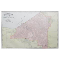
Original Antique City Plan of Cleveland, Ohio, USA, circa 1900
Located in St Annes, Lancashire
Fabulous colorful map of Cleveland
Original color
By Rand, McNally & Co.
Published, circa 1900
Unframed
Free shipping.
Category
1890s American Antique Maps
Materials
Paper
Large Antique Map of the City of Bremen and Surroundings, Germany
Located in Langweer, NL
Original antique map titled 'Prospect und Grundris der Keiserl Freyen Reichs und Ansee Stadt Bremen (..)'. This is a superb chart of the city of Bremen and the surrounding small villages with particular emphasis on the many rivers and canals...
Category
Early 18th Century Antique Maps
Materials
Paper
$1,275 Sale Price
20% Off
Veteris Orbis Climata – Ancient World Map after Strabo by Cellarius, 1731
Located in Langweer, NL
Veteris Orbis Climata – Ancient World Map after Strabo by Cellarius, 1731
This fascinating hand-colored antique map, titled Veteris Orbis Climata ex...
Category
1730s Antique Maps
Materials
Paper
$425 Sale Price
20% Off
Large Original Antique Map of Arizona, Usa, C.1900
Located in St Annes, Lancashire
Fabulous map of Arizona
Original color.
Engraved and printed by the George F. Cram Company, Indianapolis.
Published, C.1900.
Unframed.
Free shipping.
Category
1890s American Antique Maps
Materials
Paper
1826 Antigo Impero Messicano Mexico Hand Colored Framed Map
Located in Stamford, CT
1826 Antigo Impero Messicano Mexico Hand Colored Framed Map. As found black wood frame.
Category
1820s Mexican Spanish Colonial Antique Maps
Materials
Glass, Wood, Paper
Antique Map of the Israel Township of Ohio by Titus '1871'
Located in Langweer, NL
Antique map titled 'Israel'. Original antique map of Israel, Ohio. This map originates from 'Atlas of Preble County Ohio' by C.O. Titus. Published 1871.
Category
Late 19th Century Antique Maps
Materials
Paper
$236 Sale Price
20% Off
Large Original Antique Map of The Falkland Islands. 1894
Located in St Annes, Lancashire
Superb Antique map of The Falkland Islands
Published Edward Stanford, Charing Cross, London 1894
Original colour
Good condition
Unframed.
Free shipping
Category
1890s English Antique Maps
Materials
Paper
1882 Antique Map of the Indian Archipelago Showing Southeast Asia in Detail
Located in Langweer, NL
This 1882 map of the Indian Archipelago, published by Blackie and Son as part of the 'Comprehensive Atlas and Geography of the World,' provides a detailed depiction of the maritime r...
Category
1880s Antique Maps
Materials
Paper
Antique Map of the Caucasus by Seale, 1799
Located in Langweer, NL
Antique map titled 'Sarmatia'. Old map of the Caucasus with the Caspian and Black Sea. Originates from 'Geographia Antiqua (..)'. Artists and Engravers: Richard William Seale (1703-1...
Category
18th Century Antique Maps
Materials
Paper
$131 Sale Price
20% Off
Antique Map of Russia in Europe by A & C, Black, 1870
Located in Langweer, NL
Antique map titled 'Russia in Europe'. Original antique map of Russia in Europe. This map originates from ‘Black's General Atlas of The World’. Published by A & C. Black, 1870.
Category
Late 19th Century Antique Maps
Materials
Paper
$259 Sale Price
20% Off
Highly Decorative Map of The Eastern Mediterranean and The Middle East, ca.1700
Located in Langweer, NL
Antique map titled 'Byzondere Kaart van de Landen Daar de Apostelen Het Evangelium Gepredikt Hebben (..).'
Highly decorative map of the eastern Mediterranean...
Category
Early 1700s Antique Maps
Materials
Paper
$897 Sale Price
20% Off
1902 Murcia: A Cartographic Snapshot of Spain's Southeastern Province
Located in Langweer, NL
The map represents the province of Murcia, Spain, as it was in 1902. Here's an overview of its characteristics:
- **Geography**: It displays the varied terrain of Murcia, from the c...
Category
Early 1900s Antique Maps
Materials
Paper
$321 Sale Price
20% Off
Rare Engraved City Plan of Nuremberg, Bavaria by Christoph Weigel, 1718
Located in Langweer, NL
Title: Rare Engraved City Plan of Nuremberg, Bavaria by Christoph Weigel, 1718
Description:
This detailed city plan of Nuremberg, Bavaria was crafted by Christoph Weigel in 1718 an...
Category
1710s Antique Maps
Materials
Paper
Antique Map of the Region of Flanders in Belgium, 1737
Located in Langweer, NL
Untitled map of the region of Flanders, Belgium. This map originates from 'Nieuw en beknopt Kaart-Boekje vertoonende de XVII. Nederlandse Provintien (..)'.
Artists and Engravers: A...
Category
18th Century Antique Maps
Materials
Paper
Large Original Vintage Map of The Pacific Islands Including Hawaii
Located in St Annes, Lancashire
Great map of The Pacific Islands
Unframed
Original color
By John Bartholomew and Co. Edinburgh Geographical Institute
Published, circa 1...
Category
1920s British Vintage Maps
Materials
Paper
Large 19th Century Map of France
Located in Pease pottage, West Sussex
Large 19th Century Map of France.
Remarkable condition, with a pleasing age worn patina.
Recently framed.
France Circa 1874.
Category
Late 19th Century French Antique Maps
Materials
Linen, Paper
Old Map of the Empire of the Assyriens & the Tigres and Euphrates Rivers, 1683
Located in Langweer, NL
Antique map titled 'Empire des Assyriens' and 'Assyrie Chaldee et Mesopotamie selon les Anciens'.
Two maps on one sheet, the upper sheet showing the Empire of the Assyriens and the second showing the region of the Tigres and Euphrates Rivers. This map originates from Alain Manesson Mallet's 'Description de l 'Univers'.
Artists and engravers: Alain Manesson Mallet (1630–1706) was a French cartographer and engineer. He started his career as a soldier in the army of Louis XIV, became a Sergeant-Major in the artillery and an Inspector of Fortifications. He also served under the King of Portugal, before returning to France, and his appointment to the court of Louis XIV. His military engineering and mathematical background led to his position teaching mathematics at court. His major publications were Description de L'Univers (1683) in 5 volumes, and Les Travaux de Mars ou l'Art de la Guerre (1684) in 3 volumes.
His Description de L'Universe contains a wide variety of information, including star maps...
Category
1680s Antique Maps
Materials
Paper
$264 Sale Price
20% Off
1692 Jacq. Peeters Map: East Indies, Indonesia, Japan, Philippines and Singapore
Located in Langweer, NL
1692 Jacques Peeters Map: East Indies, Indonesia & Japan with Unique Inset
This hand-colored map from 1692, created by Jacques Peeters, captures the islands of Indonesia, the Philippines, and features a unique inset of Japan.
It closely resembles Nicolas de Fer's map and is primarily based on Sanson's influential maps. The map meticulously details cities, smaller settlements, rivers, mountain chains, and forests, offering a comprehensive view of the region's geography.
The inset map of Japan stands out due to its distinctive shape and influences, reflecting different cartographic sources. Notable features include the marked equator and detailed latitude and longitude indications on the borders.
The map measures 6.5 inches in width by 5.5 inches in height and is in excellent condition, with a dark impression, slight toning, and a minor centerfold crease.
Keywords:
- East Indies map
- Indonesia historical map
- Philippines map...
Category
1690s Antique Maps
Materials
Paper
$623 Sale Price
20% Off
Old Map of Ancient Assyria Divided into Syria, Mesopotamia, Babylonia & Assyria
Located in Langweer, NL
This map, "Assyria vetus diuisa in Syriam, Messopotamiam, Babyloniam, et Assyriam", by Pierre Mortier, is a late 17th-century depiction of the historical Middle East.
Title: Ancie...
Category
Early 1700s Antique Maps
Materials
Paper
La Brique Architectural Print – Pharmacy & Gymnasium by Charles Chipiez, c.1900
Located in Langweer, NL
La Brique Architectural Print – Pharmacy & Gymnasium by Charles Chipiez, c.1900
This antique architectural lithograph presents a detailed view of the pharmacy and gymnasium at the É...
Category
20th Century French Maps
Materials
Paper
Antique Map of the Region of Aigues-Mortes and Camargue, France
Located in Langweer, NL
Antique map titled 'Environs d'Aiguemortes de Peccais &a et la petite Camargue'. Original map of the region of Aigues-Mortes and Camargue, France. This map originates from 'Le Petit ...
Category
Mid-18th Century Antique Maps
Materials
Paper
$321 Sale Price
20% Off
1698 Mercator Ptolemaic Map of Asia East of the Ganges
Located in Langweer, NL
**Catalogue Description:**
**Title:** Tab. XI. Asiae, comprehendens Indiam extra Gangem.
**Description:**
This is an exquisite Ptolemaic map depicting Asia east of the Ganges, ti...
Category
1680s Antique Maps
Materials
Paper
$888 Sale Price
20% Off
Original Antique Print of Mount Cinthus on the isle of Delos, Greece, 1688
Located in Langweer, NL
Antique print Greece titled 'Bergh Cinthus'. Old print of Mount Cinthus (birth place of Apollo), Delos, Greece. This print originates from 'Nauwkeurige Beschrijving der eilanden in de in de Archipel der Middellantsche Zee' by O. Dapper.
Mount Cynthus (Kýnthos) is located on the isle of Delos, part of the Greek Cyclades.
In Greek mythology, Leto gave birth to Apollo and Artemis...
Category
17th Century Antique Maps
Materials
Paper
Map of Saint Helena Island: Early 18th-Century Copper Engraving by F. Bernard
Located in Langweer, NL
Map of Saint Helena Island: Early 18th-Century Copper Engraving by F. Bernard
This rare and beautifully detailed copper engraving of Saint Helena Island dates from around 1722 and...
Category
1720s Antique Maps
Materials
Paper
$141 Sale Price
20% Off
Antique Map of Granada Spain – Hand-Coloured Tassin Engraving 1651
Located in Langweer, NL
Antique Map of Granada Spain – Hand-Coloured Tassin Engraving 1651
This beautiful hand-coloured engraved map depicts the historic Kingdom of Granada in southern Spain, created by th...
Category
Mid-17th Century French Antique Maps
Materials
Paper
Imperial Frontiers: A 19th Century Map of Southern Russia and the Caucasus, 1882
Located in Langweer, NL
This map, sourced from the comprehensive 1882 atlas by Blackie & Son, delineates the southern part of Russia and the Caucasus region, reflecting the geopolitical contours and topogra...
Category
1880s Antique Maps
Materials
Paper
$302 Sale Price
20% Off
Antique Map of France by Johnston (1909)
Located in Langweer, NL
Antique map titled 'France'. Original antique map of France. With inset maps of France in provinces, part of the Riviera and Corsica. This map or...
Category
Early 20th Century Maps
Materials
Paper
$236 Sale Price
20% Off
Original Steel Engraved Map of French Colonies in America, 1854
Located in Langweer, NL
Antique map titled 'Colonies Francaises (en Amerique)'. Detailed map bordered by vignettes showing local animals, produce and activities of the various French Colonies in America. Th...
Category
Mid-19th Century Antique Maps
Materials
Paper
$302 Sale Price
20% Off
Huge Europe and Asia Vintage Wall Map
Located in San Diego, CA
A huge Europe and Asia vintage wall map, circa 1950s. The map is in fair vintage condition and measures 78"W x 73"H". #2863
Category
Mid-20th Century American Maps
Materials
Paper
$380 Sale Price
20% Off
Original Antique Map of the American State of Louisiana, 1903
Located in St Annes, Lancashire
Antique map of Louisiana
Published By A & C Black. 1903
Original colour
Good condition
Unframed.
Free shipping
Category
Early 1900s English Antique Maps
Materials
Paper
Antique Costume Print of a Young Farmer from the Region of Obermais, South Tyrol
Located in Langweer, NL
Antique costume print titled 'Junger Bauer aus Obermais bei Meran, Südtirol'. Old print showing a young farmer from the region of Obermais, near Meran, South Tyrol...
Category
19th Century Antique Maps
Materials
Paper
Antique Print of Hakodate from Telegraph Hill in Oshima, Hokkaido, Japan
Located in Langweer, NL
Antique print titled ‘Hakodadi from Telegraph Hill’. View of Hakodate, a city and port located in Oshima Subprefecture, Hokkaido, Japan. This print originates from 'Narrative of the ...
Category
19th Century Antique Maps
Materials
Paper
$207 Sale Price
20% Off
Antique Map of the Dutch Province of Gelderland, 1725
Located in Langweer, NL
Antique map titled 'Frisiae Haereditariae seu Trajectini Episcopatus Gelria?. Map of the province of Gelderland, the Netherlands. This map originates from 'Atlas Descriptio, secundum...
Category
18th Century Antique Maps
Materials
Paper
$120 Sale Price
20% Off
Antique Map of the Netherlands and IJmuiden by Beekman & Schuiling, 1927
Located in Langweer, NL
Two maps on one sheet titled 'Nederland Landbouwkaart' and 'Nederland Groote Verkeerswegen'. With an inset map of the harbour of IJmuiden (The Netherlands). This map originates from ...
Category
20th Century Maps
Materials
Paper
$61 Sale Price
20% Off
Victorian Visions of the New World: A Detailed Tallis Map of North America, 1851
Located in Langweer, NL
The map presented here is an intricate example from the series of maps produced by John Tallis & Company. Tallis maps are known for their detailed and elaborate style, often includin...
Category
1850s Antique Maps
Materials
Paper
$340 Sale Price
20% Off
Original 1859 Map of Asia from W.G. Blackie's Imperial Atlas of Modern Geography
Located in Langweer, NL
Antique map titled 'Asia'. Original antique map of Asia. This map originates from ‘The Imperial Atlas of Modern Geography’. Published by W. G. Blackie, 1859.
The "Classic Cartograph...
Category
Mid-19th Century Antique Maps
Materials
Paper
$236 Sale Price
20% Off
Original Antique City Plan of Kansas City, USA. 1894
Located in St Annes, Lancashire
Fabulous colorful map of Kansas City
Original color
By Rand, McNally & Co.
Published, 1894
Unframed
Slightly reduced bottom margin.
Free shipping.
Category
1890s American Antique Maps
Materials
Paper
Original Antique Map or City Plan of Madrid, Spain. Circa 1835
Located in St Annes, Lancashire
Nice map of Madrid
Drawn and engraved by J.Dower
Published by Orr & Smith. C.1835
Unframed.
Free shipping
Category
1830s English Antique Maps
Materials
Paper
Isle de Ladrones: Early 18th-Century Map of the Mariana Islands by F. Bernard
Located in Langweer, NL
Isle de Ladrones: Early 18th-Century Map of the Mariana Islands by F. Bernard
This intriguing copper engraving depicts the *Isle de Ladrones*, now known as the Mariana Islands, situated in the western Pacific Ocean. The map was published around 1722 in Amsterdam by F. Bernard as part of the influential travel compilation *Recueil des voyages qui ont servi a ...*. The map offers a simplistic yet stylized portrayal of the island, emphasizing its rugged and mountainous terrain, dotted with sparse vegetation and hills.
The term *Isle de Ladrones* (Islands of Thieves) was given by the Spanish explorer Ferdinand Magellan in 1521 during his circumnavigation of the globe, as his crew encountered thefts from the native Chamorro people. The name later changed to *Mariana Islands* when they were named after Queen...
Category
1720s Antique Maps
Materials
Paper
$141 Sale Price
20% Off
Old Colourful Decorative Map of Turkey in Europe, 1846
Located in Langweer, NL
Antique map titled 'Turkey in Europe'. Old map of Turkey in Europe.
This map originates from 'A New Universal Atlas Containing Maps of the various Em...
Category
1840s Antique Maps
Materials
Paper
$217 Sale Price
20% Off
Antique Map of the Northern Hemisphere, 1782
Located in Langweer, NL
Antique map titled 'Hémisphère Septentrional pour voir plus distinctement les Terres Arctiques (..)'.
Map of the Northern Hemisphere, originall...
Category
1780s Antique Maps
Materials
Paper
$1,417 Sale Price
20% Off
Antique Bird's Eye View of Scheveningen Near The Hague, the Netherlands, 1730
Located in Langweer, NL
Antique print titled 'Afbeeldinge van Schevelinge in den Jaare 1729'.
Bird's eye view of Scheveningen near The Hague / Den Haag, the Netherlands. This print originates from 'Beschr...
Category
1730s Antique Maps
Materials
Paper
$1,275 Sale Price
20% Off
Antique Map of the Region of Martigues, France
Located in Langweer, NL
Title: "Etang de Martigues et Environs: Antique Map of the Martigues Region, France"
Description: This antique map, titled "Etang de Martigue et Environs," offers a detailed view of...
Category
Mid-18th Century Antique Maps
Materials
Paper
$321 Sale Price
20% Off
Original Old Composite of Several Maps of the Ancient World on One Sheet, 1880
Located in Langweer, NL
This original antique map is from Karl Spruner von Merz's "Atlas Antiquus", later edited by Theodorus Menke. The map is a detailed depiction of the ancient world. The atlas it comes ...
Category
1880s Antique Maps
Materials
Paper
$349 Sale Price
20% Off
18th Century Antique Engraving of the Southern Hemisphere by G. de L'Isle
Located in Langweer, NL
Antique map titled 'Hemisphere Meridional pour voir plus distinctement Les Terres Australes'. Hemispherical map of the southern hemisphere centered on ...
Category
Late 18th Century Antique Maps
Materials
Paper
Original Antique Map of The Eastern Hemisphere by Dower, circa 1835
Located in St Annes, Lancashire
Nice map of the Eastern Hemisphere
Drawn and engraved by J.Dower
Published by Orr & Smith. C.1835
Unframed.
Free shipping
Category
1830s English Antique Maps
Materials
Paper
Original Antique Map of The Western Hemisphere by Dower, circa 1835
Located in St Annes, Lancashire
Nice map of the Western Hemisphere
Drawn and engraved by J.Dower
Published by Orr & Smith. C.1835
Unframed.
Free shipping
Category
1830s English Antique Maps
Materials
Paper
Fine Engraving Depicting an Officer's Mess in the Low Countries, 'Holland', 1754
Located in Langweer, NL
Title on Page (Dutch and French): CORPS DE GARDE van Hollandsche Officiers / Corps de Garde des Officiers Hollandois". Amst., 1754.
Fine engraving depicting an officer's mess by J. Punt and P. Tanjé after a painting by C. Troost, with coat of arms engraved in lower margin and dedication to G. Braamcamp ("beminnaar der schilderkonst").
Waiting room with reading, smoking and card playing officers. Right, one of them studies a map of the Netherlands. On the wall a coat of arms with the Dutch lion. At the bottom of the margin the coat of arms and an assignment to Gerrit Braamcamp, who had the original painting in his collection.
Cornelis Troost...
Category
1750s Antique Maps
Materials
Paper
$425 Sale Price
20% Off
Antique Print of a Garden Layout from Garden Architecture by Van Laar, 1802
Located in Langweer, NL
Untitled plan of a design for a country landscape garden. This print originates from 'Magazijn van tuin-sieraden'. The book is compiled by Gijsbert van Laar, providing a survey - chi...
Category
19th Century Antique Maps
Materials
Paper
Original Antique Map of Africa by Dower, circa 1835
Located in St Annes, Lancashire
Nice map of Africa
Drawn and engraved by J.Dower
Published by Orr & Smith. C.1835
Unframed.
Free shipping
Category
1830s English Antique Maps
Materials
Paper
Original Antique Map of Tasmania, Australia by Dower, circa 1835
Located in St Annes, Lancashire
Nice map of Tasmania
Drawn and engraved by J.Dower
Published by Orr & Smith. C.1835
Unframed.
Free shipping
Category
1830s English Antique Maps
Materials
Paper
Original Antique Map of India by Dower, circa 1835
Located in St Annes, Lancashire
Nice map of India
Drawn and engraved by J.Dower
Published by Orr & Smith. C.1835
Unframed.
Free shipping
Category
1830s English Antique Maps
Materials
Paper
Antique Map of the Berchtesgaden Region by Scherer, 1699
Located in Langweer, NL
Antique map titled 'Principat et praepositura Berchtesgadensis (..).' Detailed uncommon map of the Berchtesgaden region in southern Bavaria, Germany. Source unknown, to be determined...
Category
17th Century Antique Maps
Materials
Paper
$212 Sale Price
20% Off
Original Map of the Kingdom of Bohemia, with Silesia, Moravia and Lusatia, 1804
Located in Langweer, NL
Antique map titled 'The Kingdom of Bohemia with the Duchy of Silesia and the Marquisates of Moravia and Lusatia.'
Map of the Kingdom of Bohemia, with Silesia, Moravia and Lusatia...
Category
Early 1800s Antique Maps
Materials
Paper
Original Antique Map of the American State of Massachusetts, 1903
Located in St Annes, Lancashire
Antique map of Vermont and New Hampshire
Published By A & C Black. 1903
Original colour
Good condition
Unframed.
Free shipping
Category
Early 1900s English Antique Maps
Materials
Paper
Recently Viewed
View AllMore Ways To Browse
Antique Wellington Chests
Antonio Cassi Ramelli
Archimede Seguso Birds
Art Deco Coasters
Art Deco Footballer
Art Deco Music Cabinet
Art Deco Waterfall Bedroom Furniture
Art Deco Waterfall Bedroom
Art Deco Whisky
Art Foulard
Art Nouveau Sunflower
Arts And Crafts Silver Coffee Pot
Asian Pink Bowl
Avesn Vase
Baccarat Carafe
Bakelite Bird
Bakelite Cocktail Picks
Bamboo Ikebana Vase
