Maps
to
4,251
5,432
240
5,677
3
76
35
18
13
6
5
4
4
4
3
1
1
2,971
2,233
473
3
288
34
9
126
8
36
9
2
5
4
3
2
5,590
122
55
34
32
716
331
217
146
140
5,680
5,680
5,680
104
63
28
24
16
Maps For Sale
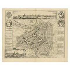
Beautiful Antique Map with Views of Dendermonde, Belgium, 1735
Located in Langweer, NL
Antique map titled 'Teneramonda vulgo Dendermonde'. Beautiful map with views of Dendermonde, Belgium. This map originates from 'Flandria illustrata, sive provinciae ac comitatus huju...
Category
18th Century Antique Maps
Materials
Paper
$623 Sale Price
20% Off
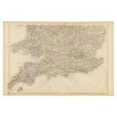
Colorful Detailed Antique Map of England and Wales (South Part), 1882
Located in Langweer, NL
Embark on a Journey Through the Southern Part of 'England and Wales' with this Exquisite Antique Map! This map provides a vivid portrayal of the captivating landscapes and cultural h...
Category
1880s Antique Maps
Materials
Paper
$163 Sale Price
20% Off
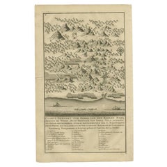
Antique Print of the Road Between Semarang and Kartosuro, Java, 1726
Located in Langweer, NL
Antique print titled 'Caarte Gemaakt ter Ordre van den Edelen Heer Herman de Wilde ..... Van de weg tusschen Samarang en Cartasoera.' This print shows a map of the road between Semar...
Category
18th Century Antique Maps
Materials
Paper
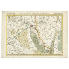
Map of Amersfoort and Surroundings by Covens & Mortier, published in 1747
Located in Langweer, NL
Map of Amersfoort and Surroundings by Covens & Mortier, published in 1747
Hand-coloured copper engraving titled *Carte Particulière des Environs de Amersfoort*, created by Jean Cove...
Category
1740s Antique Maps
Materials
Paper
$230 Sale Price
20% Off
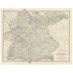
Antique Map of South-Western Germany by A.K. Johnston, 1865
Located in Langweer, NL
Antique map titled 'South-Western Germany'. This map originates from the ‘Royal Atlas of Modern Geography’ by Alexander Keith Johnston. Published by William Blackwood and Sons, Edinb...
Category
Mid-19th Century Antique Maps
Materials
Paper
$239 Sale Price
20% Off
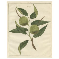
Antique Print of a Chestnut by Knoop, 1758
Located in Langweer, NL
Antique print of a chestnut. Originates from 'Pomologia' by J. H. Knoop.
Artists and Engravers: Published by Johann Hermann Knoop (c.1700-1769).
Condition: Good, general age-re...
Category
18th Century Antique Maps
Materials
Paper
$316 Sale Price
20% Off
Antique Map of the Island of Borneo by W. G. Blackie, 1859
Located in Langweer, NL
Antique map titled 'The Island of Borneo'. Original antique map of the Island of Borneo. This map originates from ‘The Imperial Atlas of Modern Geography’. Published by W. G. Blackie...
Category
Mid-19th Century Antique Maps
Materials
Paper
$191 Sale Price
20% Off
Antique Map of the Township of Coevorden in The Netherlands, 1865
Located in Langweer, NL
Drenthe - Gemeente Coevorden, Padhuis, Wijnhars. These scarse detailed maps of Dutch Towns originate from the 'Gemeente-atlas' of Jacob Kuyper. This atlas of all towns in the Netherl...
Category
19th Century Antique Maps
Materials
Paper
$143 Sale Price
20% Off
Map of Languedoc-Roussillon and Provence in France and Piedmont in Italy, c1680
Located in Langweer, NL
Title: Antique map titled 'La basse Partie du Gouvernement de Languedoc, environne des Frontiers des Gouverns de Provence, de Dauphine de Lyonnais et de Guienne et Gascogne ; Les Fro...
Category
1680s Antique Maps
Materials
Paper
$2,638 Sale Price
20% Off
Antique Map of the Region involved in the Conquest of Cyrus the Great
Located in Langweer, NL
Antique map titled 'Tabula Itineris Decies Mille (..)'. This historical map illustrates the region involved in the conquest of Cyrus the Great (558-528 BC), the founder of the Persia...
Category
Mid-17th Century Antique Maps
Materials
Paper
$661 Sale Price
20% Off
Original Antique Map of The World by Thomas Clerk, 1817
Located in St Annes, Lancashire
Great map of The Eastern and Western Hemispheres
On 2 sheets
Copper-plate engraving
Drawn and engraved by Thomas Clerk, Edinburgh.
Published by Mackenzie And Dent, 1817
...
Category
1810s English Antique Maps
Materials
Paper
Antique Map of Turkey and Greece, 1852
Located in Langweer, NL
Antique map titled 'Europisch Turkije en Griekenland'. Map of Turkey in Europe and Greece. This map originates from 'School-Atlas van alle deelen der Aar...
Category
19th Century Antique Maps
Materials
Paper
$115 Sale Price
20% Off
Antique Political Map of the Japanese Empire, 1922
Located in Langweer, NL
Antique map of Japan titled 'Japanese Empire - Political Map'. Old map of Japan depicting Japan, Korea and surroundings. This map originates from 'The Ti...
Category
20th Century Maps
Materials
Paper
Rare Original 16th Century Antique Map of Greece, 1598
Located in Langweer, NL
Beautiful and rare antique map of Greece with Albania, Mecedonia, Romania, Dalmatia and the peninsula of Salento to the Golf of Taranto. Also clearly shown the islands of the Aegaian...
Category
16th Century Antique Maps
Materials
Paper
$345 Sale Price
20% Off
Original Antique Map of the Maluku Islands or Moluccas, Indonesia
Located in Langweer, NL
Antique map titled 'Carte Particuliere des Isles Moluques'. This map depicts the islands of Herij, Ternate, Tidor, Pottebackers, Timor, Machian and Bachian. The Moluccan islands were...
Category
Mid-18th Century Antique Maps
Materials
Paper
$105 Sale Price
20% Off
Large Original Antique Map of Alaska, USA, C.1900
Located in St Annes, Lancashire
Fabulous map of Alaska
Original color
Engraved and printed by the George F. Cram Company, Indianapolis.
Published, C.1900
Unframed
Free shipping.
Category
1890s American Antique Maps
Materials
Paper
Antique Plan of Grave, The Netherlands, Showing the Siege of Grave in 1602
Located in Langweer, NL
Antique map titled 'Die Stat Grave' Bird's eye view plan of Grave, The Netherlands, Holland. Showing the siege of Grave in the year 1602 by Prince Maurits of The Netherlands. Source ...
Category
16th Century Antique Maps
Materials
Paper
$422 Sale Price
20% Off
Antique Map of India and the Gulf of Bengal by Mallet, c.1686
Located in Langweer, NL
Antique map titled ?Partie Orientale de la Terre Ferme de l'Inde Moderne. Small map of India and the Gulf of Bengal. This map originates from a German edition of 'Description de l' Univers'.
Artists and Engravers: Alain Manesson Mallet (1630-1706) was a French cartographer and engineer. He started his career as a soldier in the army of Louis XIV, became a Sergeant-Major in the artillery and an Inspector of Fortifications. He also served under the King of Portugal, before returning to France, and his appointment to the court of Louis XIV. His military engineering and mathematical background led to his position teaching mathematics at court. His 'Description de L'Universe' contains a wide variety of information, including star maps...
Category
17th Century Antique Maps
Materials
Paper
$335 Sale Price
20% Off
Antique Map of the Island of Djerba by Coronelli '1691'
Located in Langweer, NL
Antique map titled 'Isola e Castello di Gerbi'. Original antique map of the Island of Djerba, Tunisia, in Africa. Includes an inset of the Djerba Castle in upper right. This map orig...
Category
Late 17th Century Antique Maps
Materials
Paper
$335 Sale Price
20% Off
Antique Map of the Township of Dwingelo in The Netherlands, 1865
Located in Langweer, NL
Drenthe: Gemeente Dwingelo, Eemster, Lhee. These scarse detailed maps of Dutch Towns originate from the 'Gemeente-atlas' of Jacob Kuyper. This atlas of all towns in the Netherlands w...
Category
19th Century Antique Maps
Materials
Paper
$163 Sale Price
20% Off
Antique Map of Asia Minor with Cyprus, Syria and Turkey and the Black Sea, 1747
Located in Langweer, NL
Antique map Middle East titled 'A New and accurate map of Anatolia or Asia Minor, with Syria and such other provinces of the Turkish Empire (.....
Category
18th Century Antique Maps
Materials
Paper
$431 Sale Price
20% Off
Old Map of Cardiganshire by Lewis 1844 – Aberystwyth Cardigan Tregaron Lampeter
Located in Langweer, NL
Old Map of Cardiganshire by Samuel Lewis 1844 – Aberystwyth Cardigan Tregaron Lampeter
This antique 1844 map of Cardiganshire was drawn and engraved ...
Category
1840s Antique Maps
Materials
Paper
$230 Sale Price
20% Off
Old Map of Radnorshire 1844 – Presteigne Rhayader Knighton Llandrindod Wells
Located in Langweer, NL
Old Map of Radnorshire by Samuel Lewis 1844 – Presteigne Rhayader Knighton Llandrindod Wells
Description: This original 1844 map of Radnorshire was engraved for Samuel Lewis’ Topographical Dictionary of Wales. It features key locations such as Presteigne, Rhayader, Knighton, Llandrindod Wells, and New Radnor. Hand-colored borders outline the county’s administrative divisions, and the map includes topographical shading, roads, rivers, and a decorative compass rose. A union reference key is clearly listed in the lower left.
Condition:
The map is in good condition with light toning and wide margins. The engraved lines remain crisp and the hand coloring is clear and unfaded. No tears or stains are present, with only minor age-related marks on the edges.
Framing suggestions:
Pair with an acid-free mat in cream or soft beige to match the aged tone of the paper. A dark wood or antique gold frame will enhance the historical feel. UV-protective glass is recommended. This piece is ideal for framing in a study, office, or heritage-themed space.
Keywords:
Radnorshire map 1844 Samuel Lewis antique...
Category
1840s Antique Maps
Materials
Paper
$230 Sale Price
20% Off
Old Map of Montgomeryshire by 1844 – Welshpool Llanidloes Newtown Machynlleth
Located in Langweer, NL
Title: Old Map of Montgomeryshire by Samuel Lewis 1844 – Welshpool Llanidloes Newtown Machynlleth
Description: This 1844 map of Montgomeryshire was engraved for Samuel Lewis’ Topographical Dictionary of Wales. It highlights principal towns such as Welshpool, Llanidloes, Newtown, and Machynlleth, with rivers, roads, and hill shading showing the region's terrain. The hand-colored borders mark the administrative divisions, and a decorative compass rose and union reference chart are included.
Condition:
The map is in good condition with light age toning and wide clean margins. The engraving is clear and the original hand coloring remains vibrant. No tears or major imperfections are present.
Framing suggestions:
An acid-free mat in ivory or soft beige will complement the aged paper tone. A dark wood, black, or antique gold frame will suit the historic style. UV-protective glass is recommended to preserve the colors. A beautiful display piece for those with ties to mid-Wales or an interest in antique cartography.
Keywords:
Montgomeryshire map 1844 Samuel Lewis antique...
Category
1840s Antique Maps
Materials
Paper
$230 Sale Price
20% Off
Old Map of Merionethshire by Lewis, 1844: Barmouth, Bala, Harlech, Dolgelley
Located in Langweer, NL
Old Map of Merionethshire by Samuel Lewis 1844 – Barmouth Bala Harlech Dolgelley
Description: This finely engraved hand-colored map of Merionethshire was published in 1844 for Samu...
Category
1840s Antique Maps
Materials
Paper
$230 Sale Price
20% Off
Map of Carmarthenshire 1844 – Carmarthen Llandeilo Llanelli Laugharne Llandovery
Located in Langweer, NL
Title: Old Map of Carmarthenshire by Samuel Lewis 1844 – Carmarthen Llandeilo Llanelli Laugharne Llandovery
Description: This detailed 1844 map of Carmarthenshire was drawn and engraved for Samuel Lewis’ Topographical Dictionary of Wales. It highlights major towns such as Carmarthen, Llandeilo, Llanelli, Laugharne, and Llandovery. The county's roads, rivers, and hilly terrain are finely engraved and shaded, while original hand coloring outlines the administrative divisions. The map includes a compass rose and a reference to the seven unions within the county.
Condition:
The map is in very good antique condition with minimal age toning and wide clean margins. The engraving is crisp and the hand coloring remains bright and accurate. There are no tears or major defects.
Framing suggestions:
A cream or soft beige acid-free mat will complement the aged paper and hand coloring. Frame in dark wood, antique gold, or a muted black to highlight the historical character. Use UV-protective glass to preserve the colors. Suitable for traditional interiors, libraries, or as a heritage gift.
Keywords:
Carmarthenshire map 1844 Samuel Lewis antique...
Category
1840s Antique Maps
Materials
Paper
$230 Sale Price
20% Off
Old Map of Glamorganshire by Lewis 1844 – Swansea Cardiff Merthyr Tydfil Neath
Located in Langweer, NL
Title: Old Map of Glamorganshire by Samuel Lewis 1844 – Swansea Cardiff Merthyr Tydfil Neath
Description: This detailed map of Glamorganshire was published in 1844 for Samuel Lewis’ Topographical Dictionary of Wales. It showcases major towns such as Swansea, Cardiff, Merthyr Tydfil, Neath, and Bridgend. The map features original hand coloring that outlines the county borders and includes shaded topographical elements to show the landscape. A decorative compass rose and a reference to the seven unions add both style and historical context.
Condition:
The map is in good antique condition with minor age toning and clean margins. The engraving remains sharp and the original colors are clear and unfaded. No major damage or repairs are visible.
Framing suggestions:
Use a soft cream or ivory acid-free mat to match the natural tone of the paper. Choose a dark wood, antique gold, or black frame with a soft patina to enhance the historical feel. UV-protective glass is recommended to preserve the colors. This map is ideal for a home office, study, or as a thoughtful gift for those with Welsh heritage.
Keywords:
Glamorganshire map 1844 Samuel Lewis antique...
Category
1840s Antique Maps
Materials
Paper
$230 Sale Price
20% Off
Old Map of Carnarvonshire 1844 – Caernarfon Bangor Pwllheli Beaumaris Bay
Located in Langweer, NL
Title: Old Map of Carnarvonshire by Samuel Lewis 1844 – Caernarfon Bangor Pwllheli Beaumaris Bay
Description: This antique map of Carnarvonshire was published in 1844 for Samuel Lewis’ Topographical Dictionary of Wales. It features major towns and landmarks including Caernarfon, Bangor, Pwllheli, and the scenic Beaumaris Bay. The map shows shaded terrain, rivers, and coastal outlines, with hand-colored borders dividing the county’s various unions. A decorative compass rose and a reference key add historical detail and charm.
Condition:
The map is in very good condition with some light age toning and clean margins. The engraved lines are sharp and the original hand coloring remains bright and clear. There are no visible tears or major imperfections.
Framing suggestions:
Use an ivory, cream, or light tan acid-free mat to complement the aged paper and colored borders. Choose a frame in dark wood, black with a soft finish, or antique gold to enhance the historical appeal. UV-protective glass is recommended. A striking piece for a study, hallway, or as a gift for those with North Welsh heritage or an interest in vintage maps.
Keywords:
Carnarvonshire map 1844 Samuel Lewis antique...
Category
1840s Antique Maps
Materials
Paper
$230 Sale Price
20% Off
Old Map of Anglesey 1844 – Beaumaris Holyhead Llanerchymedd Amlwch Llangefni
Located in Langweer, NL
Title: Old Map of Anglesey by Samuel Lewis 1844 – Beaumaris Holyhead Llanerchymedd Amlwch Llangefni
Description: This antique 1844 map of Anglesey was drawn and engraved for Samuel ...
Category
1840s Antique Maps
Materials
Paper
$211 Sale Price
20% Off
Antique Map of Scandinavia by T. Jefferys, circa 1750
Located in Langweer, NL
Antique map titled 'Sweden, Denmark, Norway & Finland'. An original mid-18th century copper engraved antique map of Scandinavia by Thomas Jefferys....
Category
Mid-18th Century Antique Maps
Materials
Paper
$182 Sale Price
20% Off
Antique Map of the African Continent with Inset of the Nile River Delta, c.1870
Located in Langweer, NL
Antique map titled 'Africa'. Old map of the African continent. This map originates from 'H. Kiepert's Kleiner Atlas der Neueren Geographie für Schule...
Category
19th Century Antique Maps
Materials
Paper
$306 Sale Price
20% Off
Rare Map of Kildin Island in Russia Plus Engraving of Seal Hunting, 1614
Located in Langweer, NL
Insula Kilduyn. Orig. copper-engraving after details from J. H. van Linschoten's map taken from his account of the three expeditions undertaken by Willem Barents in 1594, in an attem...
Category
Early 17th Century Antique Maps
Materials
Paper
$719 Sale Price
20% Off
Antique Map of Batavia 'Jakarta', Indonesia by Montanus, circa 1669
Located in Langweer, NL
Antique map Batavia titled 'Ware Affbeeldinge wegens het Casteel ende Stadt Batavia'. Antique print of the castle and city of Batavia on the Island of Java'. Rare edition with Englis...
Category
17th Century Antique Maps
Materials
Paper
$1,199 Sale Price
20% Off
Antique Decorative French Map of Java, Indonesia, 1718
Located in Langweer, NL
Antique map of Java titled 'Carte de l'Ile de Java: Partie Occidentale, Partie Orientale, Dressee tout Nouvellement (..)'.
Decorative large format map...
Category
18th Century Antique Maps
Materials
Paper
$2,542 Sale Price
20% Off
Antique Map of Cordes Bay, Port Famine, Woods Bay and Surroundings
Located in Langweer, NL
Antique map titled 'Baye et Havre de Cordes (..)'. Four maps on the one sheet of; Cordes Bay, Port Famine, Woods Bay, Port Gallant, Fortescue Bay, Chile based on the voyage of John B...
Category
Late 18th Century Antique Maps
Materials
Paper
$316 Sale Price
20% Off
Antique Plan of Batavia and the Castle in the Dutch East Indies, 1763
Located in Langweer, NL
Antique map titled 'Grundriss von der Stadt und dem Schlosse Batavia.' Plan of the city and the castle of Batavia in the Dutch East Indies / Indonesia. From 'Algemeine Welthistorie (...
Category
18th Century Antique Maps
Materials
Paper
$374 Sale Price
20% Off
Old Copper Engraving of the City of Kajutsiu in China, 1668
Located in Langweer, NL
Antique print China titled ‘Kajutsiu'. This plate shows a view on the Chinese city of Kajutsiu. This print originates from the Latin edition of Nie...
Category
17th Century Antique Maps
Materials
Paper
$326 Sale Price
20% Off
Antique Map of the Sanaga River, Senegal, 1747
Located in Langweer, NL
Antique map titled 'Cours De La Riviere De Sanaga Ou Senegal (..) - Kaart van den Loop der Riviere Sanaga (..)'. Attractive double map of the Sanaga River, Senegal, Africa. This map ...
Category
18th Century Antique Maps
Materials
Paper
$326 Sale Price
20% Off
Original Antique Hand- Map of Africa by Allard '1697'
Located in Langweer, NL
Antique map titled 'Novissima et Perfectissima Africae (..)'. Beautiful large map of Africa. This is the 3rd state of the map, with climate notation add...
Category
Late 17th Century Antique Maps
Materials
Paper
$1,169 Sale Price
35% Off
Antique Engravings of Mauritius and Indonesia, incl de Banda Islands, c.1730
Located in Langweer, NL
Title on page: "Ins. de Cerno a. Nostatibus Mauritius Nominata [on sheet with] Gunnanappi Labetacq [and] Civitas Gammelamme [and] Rex Tubatus", Le Clerc, Jean
This sheet includes fo...
Category
1730s Antique Maps
Materials
Paper
$527 Sale Price
20% Off
Rare Antique Miniature Map of Pakistan, India and Cambaia, ca.1616
Located in Langweer, NL
Old 17th century miniature antique map of 'Cambaia' , from the 1616 edition of Jadocus Hondius Atlas by Petrus Bertius.
Original copperplate engraving with hand coloring.
Carto...
Category
17th Century Antique Maps
Materials
Paper
$374 Sale Price
20% Off
Antique Map of Sumatra, Indonesia 'c.1780'
Located in Langweer, NL
Antique map titled 'Neue Karte von der Insel Sumatra'. Extremely rare map of Sumatra, Indonesia. Published circa 1780.
Category
Late 18th Century Antique Maps
Materials
Paper
$2,518 Sale Price
40% Off
Antique Map of the United Kingdom and Ireland, c.1873
Located in Langweer, NL
Antique map titled 'Groot Brittanje en Ierland'. Old map depicting the United Kingdom and Ireland, with inset maps of London and factory districts of the UK. This map originates from...
Category
19th Century Antique Maps
Materials
Paper
$119 Sale Price
20% Off
Antique Map of the British Isles by Delamarche, 1806
Located in Langweer, NL
Antique map titled 'Les Isles Britanniques.' Decorative map of the British Isles by Robert de Vaugondy, revised and published by Delamarche. Source unkno...
Category
19th Century Antique Maps
Materials
Paper
$143 Sale Price
20% Off
Antique Map of Mauritania, Massaesylia, Numidia, Tunisia, Cyrenaica & Marmarica
Located in Langweer, NL
Three maps on one sheet showing Mauritania, Massaesylia, Numidia, Tunisia, Cyrenaica and Marmarica (ancient Libya). This map originates from 'Schul-Atlas für die alte Erdbeschreibung...
Category
Early 19th Century Antique Maps
Materials
Paper
$345 Sale Price
20% Off
Antique Print of Batavia Castle in Nowadays Jakarta, Indonesia, circa 1770
Located in Langweer, NL
Antique print titled 'Vue a Batavie du côte de la Courtine du Château - Prospect zu Batavia längst der Courtine des Castels'. Scarce view of Batavia Castle, present day Djakarta, Ind...
Category
18th Century Antique Maps
Materials
Paper
$527 Sale Price
20% Off
Floor Model Terrestrial Globe Made in Germany by Dietrich Reimer Kiepert as is
By Dietrich Reimers 1, Heinrich Kiepert
Located in New York, NY
Impressive floor model globe Made in Germany Heinrich Kiepert, Dietrich Reimer c late 19th C / Early 20 C. The large ( 22" Dia. ) globe fits into the reeded oak column base, on a s...
Category
Late 19th Century German Victorian Antique Maps
Materials
Metal
Antique Map of the City of Rio de Janeiro by Balbi '1847'
Located in Langweer, NL
Antique map titled 'Rio de Janeiro'. Original antique map of the city of Rio de Janeiro, Brazil. This map originates from 'Abrégé de Géographie (..)' by Adrien Balbi. Published 1847.
Category
Mid-19th Century Antique Maps
Materials
Paper
Pl. LXXX Maison Rue de la Faisanderie Paris, Chabat, c.1900
Located in Langweer, NL
Antique print titled 'Maison Rue de la Faisanderie Paris, Mr. Sellier de Gisors Architecte'. This print depicts the design of a building in France. Originates from 'La Brique et La T...
Category
20th Century Maps
Materials
Paper
$119 Sale Price
20% Off
Old Map of Prussia, Embellished with a Large Cartouche and Compass Rose, ca.1680
Located in Langweer, NL
Antique map titled 'Prussiae nova Tabula'.
Later edition of Blaeu's map of Prussia, embellished with a large cartouche and compass rose. Prussia was a historically prominent Germ...
Category
1680s Antique Maps
Materials
Paper
$537 Sale Price
20% Off
Large Antique Map of England and Wales
Located in Langweer, NL
Antique map titled 'An Accurate Map of England and Wales'. Original old map of England and Wales. Engraved by John Cary. Originates from 'New British Atlas' by John Stockdale, publis...
Category
Early 19th Century Antique Maps
Materials
Paper
$316 Sale Price
20% Off
Antique Print of the City of Ten-Tchoo-Foo, China, 1796
Located in Langweer, NL
Antique print titled 'View of the City of Ten-Tchoo-Foo from the Anchorage of the Hindostan in the Strait of Mi-a-Tau Bearing South-West'. Together on a sheet with 'Cape Maccartney and Cape Gower'.
The top two views depict coastal profile views of local islands named after important people in the Embassy, including Macartney, Staunton, and Gower. Below, a view of the city of Ten-Tchoo-Foo taken from aboard the Hindostan, one of the ships on the mission. These land approach views appeared in the account of George Macartney's travels to China, published by George Nicol. Macartney was Britain's first envoy to China, and was tasked with convincing Emperor Qianlong to ease restrictions on trade between Great Britain and China by allowing the British to have a permanent embassy in the country. Sir George Staunton prepared the official report, 'An Authentic Account of an Embassy from the King of Great Britain to the Emperor of China', which included charts and views based on manuscript sketches and drawings by Sir John Barrow...
Category
1790s Antique Maps
Materials
Paper
$661 Sale Price
20% Off
Antique Map of the Islands Within the Queen Charlotte's Islands
Located in Langweer, NL
Antique map titled 'Cote Septentrional de la plus grande des Isles de la Reine Charlotte (..)'. Map and coastal view of the islands within the Queen Charlotte's Islands (Santa Cruz I...
Category
Late 18th Century Antique Maps
Materials
Paper
$316 Sale Price
20% Off
Eason's War Map of Europe, circa 1914
Located in Langweer, NL
Antique map titled 'Eason's War Map of Europe'. Printed in Ireland. Source unknown, to be determined.
Artists and Engravers: Anonymous.
Condition: Good, ...
Category
20th Century Maps
Materials
Paper
$527 Sale Price
20% Off
Antique Map of the Islands Near Ceylon by Baldaeus, 1672
Located in Langweer, NL
Antique print, untitled. This original antique print shows the islands Leyden, Middelburg, Hammenhiel, Bramines, Dona Clara and Deserta near Ceylon / Sri Lanka, with their Dutch name...
Category
17th Century Antique Maps
Materials
Paper
$119 Sale Price
20% Off
Antique Map of the Region of Fréjus, France
Located in Langweer, NL
Title: "Golf de Fréjus"
Description: This antique map, titled "Golf de Fréjus," is an original depiction of the region of Fréjus, France. It is part of the work "Le Petit Atlas Mari...
Category
Mid-18th Century Antique Maps
Materials
Paper
$285 Sale Price
30% Off
Antique Map of Tartary and Northeast Asia by Bellin, circa 1750
Located in Langweer, NL
Antique map titled 'Carte de la Tartarie Occidentale'. Map of Tartary and northeast Asia, from Lake Baykal, Partie du Siberia in the north, Pays des Kalkas at the center, as well as ...
Category
Mid-18th Century European Antique Maps
Materials
Paper
$134 Sale Price
20% Off
Antique Map of the Admiralty Islands, Bismarck Archipelago
Located in Langweer, NL
Antique map titled 'Trois Vues des Isles de l'Amirauté'. Several coastal views of the Admiralty Islands, Bismarck Archipelago, to the north of New Guinea in the South Pacific Ocean.
...
Category
Late 18th Century Antique Maps
Materials
Paper
$364 Sale Price
20% Off
Antique Print of Zihuatanejo and the harbour of Acapulco in South America, 1749
Located in Langweer, NL
Antique print titled 'Vue de l'entree de Chequetan ou Seguataneo, restant au N.E. a la distance de 5 milles.' 'Vue de l'entree du port d'Acapulco.' View of Zihuatanejo and the harbou...
Category
18th Century Antique Maps
Materials
Paper
$211 Sale Price
20% Off
Rare 16th Century Original Handcolored Miniature Map of Java, Indonesia, 1616
Located in Langweer, NL
Very handsome original old coloured copper engraving by Bertius of the island of Java in the early days of the Dutch colonisation - at that time named The Dutch East Indies or nowada...
Category
1610s Antique Maps
Materials
Paper
$470 Sale Price
20% Off
Recently Viewed
View AllMore Ways To Browse
Antique Wellington Chests
Antonio Cassi Ramelli
Archimede Seguso Birds
Art Deco Coasters
Art Deco Footballer
Art Deco Music Cabinet
Art Deco Waterfall Bedroom Furniture
Art Deco Waterfall Bedroom
Art Deco Whisky
Art Foulard
Art Nouveau Sunflower
Arts And Crafts Silver Coffee Pot
Asian Pink Bowl
Avesn Vase
Baccarat Carafe
Bakelite Bird
Bakelite Cocktail Picks
Bamboo Ikebana Vase
