Paper Maps
to
4,227
5,427
175
5,604
3
55
29
14
9
9
5
1
1
1
1
1
1
2,922
2,245
437
3
280
23
5
126
8
35
7
2
3
3
2
5,607
128
60
35
32
728
303
220
165
142
5,607
5,607
5,607
104
59
28
21
15
Material: Paper
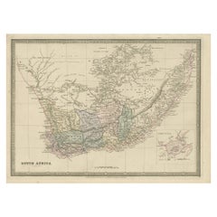
Antique Map of South Africa by Wyld '1845'
Located in Langweer, NL
Antique map titled 'South Africa'. Original antique map of South Africa.
This decorative original old map originates from 'An Atlas of th...
Category
Mid-19th Century Antique Paper Maps
Materials
Paper
$190 Sale Price
20% Off
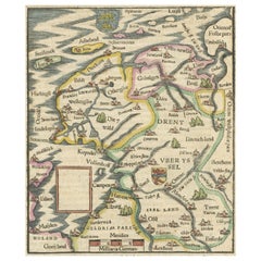
Friesland, Groningen and Overijssel – Rare Woodcut Map by Münster, c. 1550
Located in Langweer, NL
Frisia, Groningen and Overijssel – Rare Woodcut Map by Münster, c. 1550, Germany
This highly decorative 16th-century woodcut map titled “Von dem Teutschen Land: Seelentfrie” was pub...
Category
16th Century Antique Paper Maps
Materials
Paper
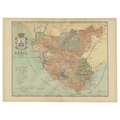
Cádiz 1901: Nautical Crossroads of the Atlantic and Mediterranean
Located in Langweer, NL
The map illustrates the province of Cádiz, located in the autonomous community of Andalusia, Spain, from the year 1901. It displays various geographic and man-made features:
The map...
Category
Early 1900s Antique Paper Maps
Materials
Paper
$399 Sale Price
20% Off
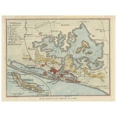
Small Map of St. Anna Bay and Willemstad, Curaçao – Dutch Colonial View, c. 1880
Located in Langweer, NL
Map of St. Anna Bay and Willemstad, Curaçao – Dutch Colonial View, c. 1880
This attractive late 19th-century map titled “De St. Anna-baai en de hoofdstad van Curaçao” offers a detai...
Category
1880s Antique Paper Maps
Materials
Paper
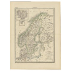
Antique Map of Scandinavia by Lapie, 1842
Located in Langweer, NL
Antique map titled 'Carte de la Scandinavie comprenant les Royaumes de Suède de Norwege et de Danemark'. Map of Scandinavia including Sweden, Norway and Denma...
Category
Mid-19th Century Antique Paper Maps
Materials
Paper
$522 Sale Price
20% Off
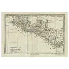
Antique French Engraving of Mexico with Lots of Details, c.1780
Located in Langweer, NL
Antique map titled 'Partie Meridionale, de L'Ancien Mexique ou de la Nouvelle Espagne.'
Detailed map of Mexico, the Yucatan and Central America, prepared under the direction of Rigobert Bonne. Shows towns, rivers, mountains, lakes, etc. Detailed map of the region. Source unknown, to be determined.
Artists and Engravers: Rigobert Bonne (1727-1795 ) was one of the most important cartographers of the late 18th century. In 1773 he succeeded Jacques Bellin as Royal Cartographer to France in the office of the Hydrographer at the Depôt de la Marine. Working in his official capacity Bonne compiled some of the most detailed and accurate maps of the period. Bonne's work represents an important step in the evolution of the cartographic ideology away from the decorative work of the 17th and early 18th century towards a more detail oriented and practical aesthetic. With regard to the rendering of terrain Bonne maps...
Category
18th Century Antique Paper Maps
Materials
Paper
$332 Sale Price
20% Off
Old Original Map of Africa and Arabia, 1848
Located in Langweer, NL
Antique map titled 'Africa et Arabia'.
Old map of Africa and Arabia originating from 'Orbis Terrarum Antiquus in usum Scholarum'.
Artists and Engravers: Published by Justus P...
Category
1840s Antique Paper Maps
Materials
Paper
$123 Sale Price
20% Off
Antique Map Depicting Sydney and Surrounding Areas, Known as Port Jackson, c1889
Located in Langweer, NL
An antique map depicting Sydney and its surrounding areas, known as Port Jackson, dating from around 1889. It was produced by E. Reclus and is part of the "Nouvelle géographie univer...
Category
1880s Antique Paper Maps
Materials
Paper
$332 Sale Price
20% Off
Three Views of Fort James, Van der Schley, c.1760
Located in Langweer, NL
Three views of Fort James. The Dutch subtitles read: a) Grondtekening van ?t eiland St. James, op de Gambra Ao 1732. B) Noord-Oostlyk gezigt van ?t Fort St. James. C) Noord-Noord-Wes...
Category
18th Century Antique Paper Maps
Materials
Paper
$76 Sale Price
20% Off
Antique Map of Kent with Inset Plans of Rochester & Canterbury, England, 1676
Located in Langweer, NL
Antique map titled 'Kent with her Cities and Earles described and observed'.
Map of Kent, England. Includes inset town plans of Rochester and Canterbury....
Category
17th Century Antique Paper Maps
Materials
Paper
$665 Sale Price
20% Off
Print of Makassar 'Ujung Pandang' in the Dutch East Indies 'Indonesia', c.1725
Located in Langweer, NL
Antique print titled 'Macasar, Capitale du Roiaume de même nom'. This rare print shows Makassar, the present capital of South Sulawesi, Indonesia. In the foreground several VOC ships...
Category
18th Century Antique Paper Maps
Materials
Paper
$418 Sale Price
20% Off
Zaragoza: Crossroads of Heritage - The 1901 Cartographic Chronicle
Located in Langweer, NL
The print on sale is a historical map of the province of Zaragoza, Spain, dated 1901. The title on the map is "ZARAGOZA. 1901." This map details the geo...
Category
Early 1900s Antique Paper Maps
Materials
Paper
$304 Sale Price
20% Off
Steel Engraved Map of the United States with Inset Map of Florida
Located in Langweer, NL
Antique map titled 'United States'. Steel engraved map of the United States. With small inset map of the continuation of Florida. Source unknown, to be determined. Published circa 1843.
Category
Mid-19th Century Antique Paper Maps
Materials
Paper
$152 Sale Price
20% Off
Antique Chicago Illinois National Map Commercial Rollup Classroom Census Map 47"
Located in Dayton, OH
Antique early to mid 20th century double sided hanging map titled the New Commercial and Census Map of Illinois, Edition 1073. Verso shows the National Map of Chicago and Suburbs - O...
Category
Early 20th Century North American Paper Maps
Materials
Paper
$940 Sale Price
20% Off
Antique Map of Ancient Persia, Assyria and surroundings, c.1760
Located in Langweer, NL
Antique map titled 'De XII de Landkaart vertoonende de Landen der Assyrische, Babylonische, Persische, Grieksche en daarna Romeinsche Heerschappy.' Map of ancient Persia...
Category
18th Century Antique Paper Maps
Materials
Paper
$323 Sale Price
20% Off
Antique Map of Southern Syria by Fullarton & Co, circa 1860
Located in Langweer, NL
Antique map titled 'Syria south part'. Published by Fullarton & Co, Glasgow, circa 1860.
- Title: Syria South Part
- Publisher: Fullarton & Co, Glasgow
- Date of Publication: Circa ...
Category
Mid-19th Century English Antique Paper Maps
Materials
Paper
Original Antique Map of the American State of Nevada, 1889
Located in St Annes, Lancashire
Great map of Nevada
Drawn and Engraved by W. & A.K. Johnston
Published By A & C Black, Edinburgh.
Original colour
Unframed.
Category
1880s Scottish Victorian Antique Paper Maps
Materials
Paper
Original Antique Map of North and South America in Attractive Old Coloring
By Isaak Tirion
Located in Langweer, NL
Antique map titled 'Nieuwe Kaart van America'. Beautiful map of America. The fabled Quivira is used to name a large mountain range placed just north of M...
Category
Mid-18th Century Antique Paper Maps
Materials
Paper
$941 Sale Price
20% Off
Antique Print of Designs for Ebberston Lodge, Yorkshire, United Kingdom, 1725
Located in Langweer, NL
Antique print titled 'The Elevation of Ebberston Lodge (..)'. Designs for Ebberston Lodge, near Scarborough, Yorkshire, England.
This print originates from 'Vitruvius Britannicus' ...
Category
18th Century Antique Paper Maps
Materials
Paper
Benedictus Goes’ Route – Antique Map of Tartary to China by Van der Aa, 1714
Located in Langweer, NL
Benedictus Goes’ Route – Antique Map of Tartary to China by Van der Aa, 1714
This fascinating antique map titled De Land-Reyse door Benedictus Goes, van Lahor gedaan, door Tartaryen...
Category
Early 18th Century Dutch Antique Paper Maps
Materials
Paper
$513 Sale Price
20% Off
Old Map of Mediterranean Powers: Pompey to Actium (66-31 BC), Published in 1880
Located in Langweer, NL
This is a historical map that depicts the Mediterranean region during a specific timeframe in Roman history, from the return of Pompey the Great after...
Category
1880s Antique Paper Maps
Materials
Paper
$351 Sale Price
20% Off
Original Antique Map of Hungary, Arrowsmith, 1820
Located in St Annes, Lancashire
Great map of Hungary
Drawn under the direction of Arrowsmith.
Copper-plate engraving.
Published by Longman, Hurst, Rees, Orme and Brown, 1820
Unframed.
Category
1820s English Antique Paper Maps
Materials
Paper
Almería 1901: Coastal Contours and Landscapes in a Map of Southeastern Spain
Located in Langweer, NL
An original antique map of the province of Almería, Spain, from the year 1901.
The Mediterranean Sea, labeled as "Mar Mediterraneo," forms the southeastern boundary of the province...
Category
Early 1900s Antique Paper Maps
Materials
Paper
$304 Sale Price
20% Off
A Decorative Map of Nova Scotia and Newfoundland by John Tallis, 1851
Located in Langweer, NL
The map is part of the series created by John Tallis & Company, known for their mid-19th-century maps. This particular map illustrates the regions of Nova Scotia and Newfoundland and...
Category
1850s English Antique Paper Maps
Materials
Paper
Empire's Tapestry: Mapping Portugal's Global Legacy in 1903
Located in Langweer, NL
This map is an original antique map that showcases Portuguese possessions around the turn of the 20th century, with a focus on Guinea-Bissau (referred to on the map as "Guiné Portugu...
Category
Early 1900s Antique Paper Maps
Materials
Paper
$323 Sale Price
20% Off
Antique Print of Batavia or nowadays Jakarta, Indonesia, c.1755
Located in Langweer, NL
Antique print titled 'Vue de l'Isle et de la ville de Batavia appartenant aux Hollandois'. Beautiful view of the island and the city of Batavia belonging to the Dutch, for the India ...
Category
18th Century Antique Paper Maps
Materials
Paper
$693 Sale Price
20% Off
Northern Australia Map with The Routes of Explorers Ringwood and McMinn, 1878
Located in Langweer, NL
Antique map titled 'Neue Aufnahmen in Nord-Australien'.
Old map of Northern Australia showing the 'new routes' of the exploration of Ringwood and McMinn. Covers as far east as pa...
Category
1870s Antique Paper Maps
Materials
Paper
$123 Sale Price
20% Off
Antique Map of Limburg, The Southern Most Province in The Netherlands, c.1870
Located in Langweer, NL
Antique map titled 'Limburg'. Map of the province of Limburg, the Netherlands. This map originates from 'F. C. Brugsma's Atlas van het Koninkrijk der Nederlanden (..)'. Artists and E...
Category
19th Century Antique Paper Maps
Materials
Paper
$123 Sale Price
20% Off
Authentique Map by Pilon of The French Colonies in The West Indies, 1876
Located in Langweer, NL
The 1876 map titled "Carte des Colonies Françaises aux Antilles" represents a significant contribution to cartography within the "Grand Atlas Départemental de la France de L'Algérie ...
Category
Late 19th Century Antique Paper Maps
Materials
Paper
$228 Sale Price
20% Off
Antique Map of the Holy Land by Schut, 1710
Located in Langweer, NL
Antique map of the Holy Land titled 'Het Beloofde Landt Canaan.' Very detailed and decorative map of the Holy Land embellished with sailing ships and com...
Category
18th Century Antique Paper Maps
Materials
Paper
$399 Sale Price
20% Off
Pl. 2 Antique Print of Pavilion Decorations by Le Rouge, c.1785
Located in Langweer, NL
Antique print titled 'Différentes Décorations de Romainville de l'Ordonnance (..)'. Copper engraving showing various pavilion decorations. This print originates from 'Jardins Anglo-C...
Category
18th Century Antique Paper Maps
Materials
Paper
Antique Ptolemaic Map of Ceylon or nowadays Sri Lanka
Located in Langweer, NL
Antique map titled 'Tab XII. Asiae Taprobanam'. Ptolemaic map of Sri Lanka. Ptolemy drew on the accounts of travelers and sailors and though the information was secondhand and often ...
Category
Mid-18th Century Antique Paper Maps
Materials
Paper
$655 Sale Price
20% Off
Original Antique Map of South Africa, Arrowsmith, 1820
Located in St Annes, Lancashire
Great map of South Africa.
Drawn under the direction of Arrowsmith.
Copper-plate engraving.
Published by Longman, Hurst, Rees, Orme and Br...
Category
1820s English Antique Paper Maps
Materials
Paper
Antique Map of the Rhine centered on Cologne, Germany
Located in Langweer, NL
Antique map titled 'Archiepsiscopatus et Electoratus Coloniensis (..)'. Original antique map of the Rhine river, centered on Cologne, Germany. The Rhine River cuts across this map fr...
Category
Early 18th Century Antique Paper Maps
Materials
Paper
$522 Sale Price
20% Off
Antique Map of North America by Lapie '1842'
Located in Langweer, NL
Antique map titled 'Carte de l'Amérique septentrionale'. Map of North America, with an inset map of the Aleutian Islands. This map originates from 'Atlas universel de géographie anci...
Category
Mid-19th Century Antique Paper Maps
Materials
Paper
$570 Sale Price
20% Off
Decorative Antique Map of Eastern Canada, Published in 1882
Located in Langweer, NL
This is a historical map from the 1882 Blackie Atlas, focused on eastern Canada and the maritime provinces. The map is titled "Canada. No. 2. Provinces of Nova Scotia, New Brunswick,...
Category
1880s Antique Paper Maps
Materials
Paper
$237 Sale Price
20% Off
Antique Map of the Northern Part of South America by J. Tallis, circa 1851
Located in Langweer, NL
A decorative and detailed mid-19th century map of the northern part of South America (including modern day Venezuela, Colombia, Ecuador, Guyana, Suriname and French Guiana) which was drawn and engraved by J. Rapkin (vignettes by H. Winkles & W. Lacey) and published in John Tallis & Co.'s The Illustrated Atlas (London & New York: circa 1851).
The Illustrated Atlas, published from 1849 onwards, was the last decorative world atlas. The 'Venezuela, New Granada...' map was typical of the many Fine ones which appeared in this work with its decorative border and attractive vignettes. Illustrated are views of Mount Chimborazo, Ecuador; the 'Fall of the Bagota' (Tequendama Falls, Colombia); Rheas and a prospect of Paramaribo Harbour (Dutch Guiana...
Category
Mid-19th Century Antique Paper Maps
Materials
Paper
$261 Sale Price
20% Off
Copperplate Engraving Showing Forts on the West African Gold Coast, Ghana, 1744
Located in Langweer, NL
Antique print, titled: 'The Fort Fredricksburg formerly to ye Danes and now Fort Royal (…).' - A three panel copperplate engraving showing three forts on the West African Gold Coast, Ghana; a) The Fort Fredricksburgh formerly to ye Danes and now Fort Royal. English at Manfroe, b) The Fort Amsterdam at Cormentyn belonging to ye Hollanders, c) The Fort James, English at Accra. From: "A Collection of Voyages and Travels" published by John and Awnsham Churchill in London in 1744.
Artists and Engravers: Made by 'Johannes Kip' after 'A. Churchill'. Johannes Kip (b Amsterdam, 1653; d London, 1722). Dutch draughtsman, engraver and dealer, active in England. He was a pupil of Bastiaen Stopendaal (1636–1707) from 1668 to 1670. His earliest dated engravings are of 1672 (e.g. the Siege of Groningen , Hollstein, no. 4), and he supplied numerous plates for books published from that date onwards. His work brought him into contact with the court of William of Orange and in 1686 he produced six plates depicting William of Orange, his Wife and Attendants near The Hague (Hollstein, no. 5). Shortly after the Glorious Revolution of 1688 Kip followed the court to England. After settling in Westminster, he worked extensively for London publishers, engraving works after Francis Barlow, Caius Gabriel Cibber (e.g. Interior of the Danish Church in London , 1697; Hollstein, no. 6) and other London-based artists. His engravings were principally destined for book illustrations. The work for which Kip is best remembered is his large corpus...
Category
1740s Antique Paper Maps
Materials
Paper
$342 Sale Price
20% Off
Print of Garden Pavilions of the Earl of Tilney and Knight Stevenson, c.1785
Located in Langweer, NL
Antique print titled 'Pavillon pour les jardins (..)'. Copper engraving showing the pavilions of the Earl of Tilney and Knight Stevenson.
Earl Tylney, of Castlemaine in the Count...
Category
18th Century Antique Paper Maps
Materials
Paper
$275 Sale Price
20% Off
Antique Map of Buckinghamshire in England, 1743
Located in Langweer, NL
Antique map titled 'Buckingham both shyre and shire towne describ'. Map of Buckinghamshire, England. With town plans of Buckingham and Redding. This map originates from Overton's atl...
Category
18th Century Antique Paper Maps
Materials
Paper
$456 Sale Price
20% Off
Large Original Antique Map of Kansas, USA, 1894
Located in St Annes, Lancashire
Fabulous map of Kansas
Original color
By Rand, McNally & Co.
Published, 1894
Unframed
Free shipping.
Category
1890s American Antique Paper Maps
Materials
Paper
Original Antique Map of Part of the Bahar Region (India), 1834
Located in Langweer, NL
Antique map titled 'India X'. Old steel engraved map of part of the Bahar region, it also shows part of Nepal.
Artists and Engravers: Engraved by J. & C. Walker. Published under th...
Category
19th Century Antique Paper Maps
Materials
Paper
$275 Sale Price
20% Off
Original Antique Map the Imperial States of the Habsburg Netherlands, 1609
Located in Langweer, NL
Antique map titled 'Belgii inferioris descriptio (..)'.
Old map of the Seventeen Provinces, the Imperial states of the Habsburg Netherlands in the 16th century. They roughly cove...
Category
Early 1600s Antique Paper Maps
Materials
Paper
$1,188 Sale Price
20% Off
Large Original Antique Map of New Jersey, USA, circa 1900
Located in St Annes, Lancashire
Fabulous map of New Jersey
Original color
Engraved and printed by the George F. Cram Company, Indianapolis.
Published, circa 1900
Unframed
Repairs to minor edge tears
Category
1890s American Antique Paper Maps
Materials
Paper
Antique Map of Borneo (Largely Kalimantan), the Largest Island of Asia, 1726
Located in Langweer, NL
Antique map Indonesia titled 'Kaart van het Eyland Borneo'. Early map of the Island of Borneo. This map originates from 'Oud en Nieuw Oost-Indië...
Category
18th Century Antique Paper Maps
Materials
Paper
$4,040 Sale Price
20% Off
Original Antique Engraving of Sakai in the Osaka Prefecture, Japan, 1669
Located in Langweer, NL
Antique print, titled: 'De Stadt Saccai. La Ville de Saccai.' - ('The City Saccai').
This plate shows a view of Sakai in the Osaka Prefecture, Japan. Sakai has been one of the la...
Category
1660s Antique Paper Maps
Materials
Paper
$617 Sale Price
20% Off
Uncommon Old Map of Lapland to Russia and Denmark to Kazan in the South, 1785
Located in Langweer, NL
Description: Antique map titled 'Kaart van het Noorderdeel van Europa, Bevattende Deenmarken, Noorwegen, Zweden, Lapland en het Grootste Gedeelte van Europeesch Rusland.'
This un...
Category
1780s Antique Paper Maps
Materials
Paper
$522 Sale Price
20% Off
Original Antique Print of a Procession of Monks in Ceylon 'Sri Lanka', 1672
Located in Langweer, NL
Antique print, untitled. This original antique print shows a procession of monks in Ceylon. A group of dancing monks, beating drums, in front of the abbot, seated on an elephant. Dut...
Category
1670s Antique Paper Maps
Materials
Paper
$256 Sale Price
20% Off
Antique Map of Alabama
Located in Langweer, NL
Antique map titled 'Alabama'. Original antique map of Alabama, United States. This print originates from 'Encyclopaedia Britannica', Ninth Editi...
Category
Late 19th Century Antique Paper Maps
Materials
Paper
$275 Sale Price
20% Off
Antique Map of Africa by Lapie, 1842
Located in Langweer, NL
Antique map titled 'Carte d'Afrique'. Map of Africa. This map originates from 'Atlas universel de géographie ancienne et moderne (..)' by Pierre M. Lapie...
Category
Mid-19th Century Antique Paper Maps
Materials
Paper
$570 Sale Price
20% Off
Antique Plan of Underground Area of Baths of Emperor Titus, Rome, Italy, 1786
Located in Langweer, NL
Antique print titled 'Plan des Thermes de Titus Partie Superieure'.
Plan of the underground areas of the Baths of Titus. The Baths of Titus or Thermae Titi were public baths (Thermae) built in 81 AD at Rome, by Roman emperor Titus...
Category
18th Century Antique Paper Maps
Materials
Paper
$228 Sale Price
20% Off
1917 "New Hudson River Map" by Wallace Bruce, Later Edition, Folding Map
Located in Colorado Springs, CO
Presented is a 1917 printing of “New Hudson Map” by Wallace Bruce. The map was published by Bryant Union Publishing Co., in New York City. The map is a later edition, issued in a distinct strip-chart format that is over 100 inches long. The map includes amazing detail, compiled mostly from U.S. Coast Survey data. It is drawn on a scale of 1.5 miles per inch, allowing ample space for it to show historical landmarks, landings, islands, list prominent residents, and more. The verso is filled with related text and illustrations about the Hudson River valley. The map folds into cream paper wrappers, titled "Hudson River Map...
Category
1910s American Beaux Arts Vintage Paper Maps
Materials
Paper
Antique Map of Part of Flanders 'Belgium' by F. de Wit 'circa 1680'
Located in Langweer, NL
Antique map titled 'Marchionatus Sacri Imperii et Dominii Mechelini Tabula'. Large folio size map of the region around Mechelen, Leuven, Brussels, Dendermonde and Antwerp. Published ...
Category
Late 17th Century Antique Paper Maps
Materials
Paper
$546 Sale Price
20% Off
Antique Map of Southeast Asia by H. Chatelain, circa 1720
Located in Langweer, NL
Antique map titled 'Le Royaume de Siam aves les Royaumes qui luy sont Tributaires et les Isles de Sumatra Andemaon'. Influential map of Southeast Asia, including modern day Thailand, southern Vietnam, Cambodia, Malaysia, Singapore, Borneo, Sumatra and Java. Chatelain incorporated information provided by the French Jesuits and charts the route of the French Embassy to and from Siam in 1685-1686 through the Straits of Banca and the Gulf of Siam.
With good detail of the Andaman Islands, the Gulf of Thailand (Golfe de Siam) and coastal Vietnam. In the Kingdom of Siam, this map shows the fortress of Bangkok, the ancient Siamese capital of Ayutthaya, royal palace, and the Dutch trading colony. In Cambodia, it details the village of Ponompingn (Phnom Penh...
Category
Early 18th Century Antique Paper Maps
Materials
Paper
$1,378 Sale Price
20% Off
Antique Map of Canada by Johnston '1909'
Located in Langweer, NL
Antique map titled 'Dominion of Canada'. Original antique map of Canada. With inset maps of Niagara, Montreal, Quebec. This map originates from t...
Category
Early 20th Century Paper Maps
Materials
Paper
$237 Sale Price
20% Off
Large Antique Map of New York State with Inset Maps
Located in Langweer, NL
Antique map titled 'Johnson's New York' Large map of New York State. With insets of Albany, Oswego, Buffalo, Rochester, Syracuse, Troy and NYC. Published by Johnson and Browning, 186...
Category
Mid-19th Century Antique Paper Maps
Materials
Paper
$465 Sale Price
20% Off
Cartographic Elegance of Touraine: A 17th-Century Map Showing French Heritage
Located in Langweer, NL
"Ducatus Turonensis - Touraine," is a original antique historical map of the Touraine region, which is located in the heart of France, centered...
Category
1630s Antique Paper Maps
Materials
Paper
$465 Sale Price
20% Off
Antique Map of South Australia, Victoria, Queensland and New South Wales, c.1860
Located in Langweer, NL
Antique map Australia titled 'South Australia, New South Wales, Victoria & Queensland'. Old map depicting South Australia including New South Wal...
Category
19th Century Antique Paper Maps
Materials
Paper
$323 Sale Price
20% Off
Antique Map of Asia from the Middle East to the Coast of Alaska, 1816
Located in Langweer, NL
Antique map titled ‘L’Asie‘. This is an original antique map of Asia, by Hérisson, taken from atlas ""Nouv. Abrége de Géographie"". An engraved map with coloring of Asia from the Mid...
Category
19th Century Antique Paper Maps
Materials
Paper
$152 Sale Price
20% Off
Large Original Antique Map of Maine, USA, C.1900
Located in St Annes, Lancashire
Fabulous map of Maine
Original color
Engraved and printed by the George F. Cram Company, Indianapolis.
Published, C.1900
Unframed
Free shipping.
Category
1890s American Antique Paper Maps
Materials
Paper
Recently Viewed
View AllMore Ways To Browse
Antique Wellington Chests
Antonio Cassi Ramelli
Archimede Seguso Birds
Art Deco Coasters
Art Deco Footballer
Art Deco Music Cabinet
Art Deco Waterfall Bedroom Furniture
Art Deco Waterfall Bedroom
Art Deco Whisky
Art Foulard
Art Nouveau Sunflower
Arts And Crafts Silver Coffee Pot
Asian Pink Bowl
Avesn Vase
Baccarat Carafe
Bakelite Bird
Bakelite Cocktail Picks
Bamboo Ikebana Vase
