Items Similar to Antique Map of Ancient Persia, Assyria and surroundings, c.1760


Want more images or videos?
Request additional images or videos from the seller
1 of 5
Antique Map of Ancient Persia, Assyria and surroundings, c.1760
About the Item
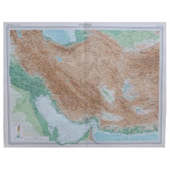
Antique map titled 'De XII de Landkaart vertoonende de Landen der Assyrische, Babylonische, Persische, Grieksche en daarna Romeinsche Heerschappy.' Map of ancient Persia, Assyria etc. Source unknown, to be determined.
Artists and Engravers: Made by 'Willem Albert Bachiene' after an anonymous artist. Willem Albert Bachiene (Leerdam 1712 - Maastricht 1783). He was a Clergyman in the army and in Namen, Belgium and Kuilenburg (Culemborg). From 1759 he was Clergyman in Maastricht and also Professor in Astronomy and Geography at the 'Illustere School'.
Condition: Good, given age. A few small spots. Original folds as issued. General age-related toning and/or occasional minor defects from handling. Please study image carefully.
Date: c.1760
Overall size: 26 x 37.8 cm.
Image size: 23.4 x 33 cm.
We sell original antique maps to collectors, historians, educators and interior decorators all over the world. Our collection includes a wide range of authentic antique maps from the 16th to the 20th centuries. Buying and collecting antique maps is a tradition that goes back hundreds of years. Antique maps have proved a richly rewarding investment over the past decade, thanks to a growing appreciation of their unique historical appeal. Today the decorative qualities of antique maps are widely recognized by interior designers who appreciate their beauty and design flexibility. Depending on the individual map, presentation, and context, a rare or antique map can be modern, traditional, abstract, figurative, serious or whimsical. We offer a wide range of authentic antique maps for any budget.
- Dimensions:Height: 14.89 in (37.8 cm)Width: 10.24 in (26 cm)Depth: 0 in (0.01 mm)
- Materials and Techniques:
- Period:
- Date of Manufacture:circa 1760
- Condition:
- Seller Location:Langweer, NL
- Reference Number:
About the Seller
5.0
Platinum Seller
These expertly vetted sellers are 1stDibs' most experienced sellers and are rated highest by our customers.
Established in 2009
1stDibs seller since 2017
1,916 sales on 1stDibs
Typical response time: <1 hour
- ShippingRetrieving quote...Ships From: Langweer, Netherlands
- Return PolicyA return for this item may be initiated within 14 days of delivery.
More From This SellerView All
- Antique Map of Afghanistan and Surroundings, '1845'Located in Langweer, NLAntique map titled 'Map of Persia and Caubul'. Original antique map of Afghanistan and surroundings. This map originates from 'An Atlas of the World, Comprehending Separate Maps of...Category
Antique Mid-19th Century Maps
MaterialsPaper
- Antique Map of Belgium and Surroundings, 1692Located in Langweer, NLAntique map titled 'Provincie Meridionali de Paesi Bassi Intese sotto nome di Fiandra overo Li Paesi Bassi Cattolici con li confini di Francia di Allemagna et di Hollanda'. Uncommon map of Belgium...Category
Antique 17th Century Maps
MaterialsPaper
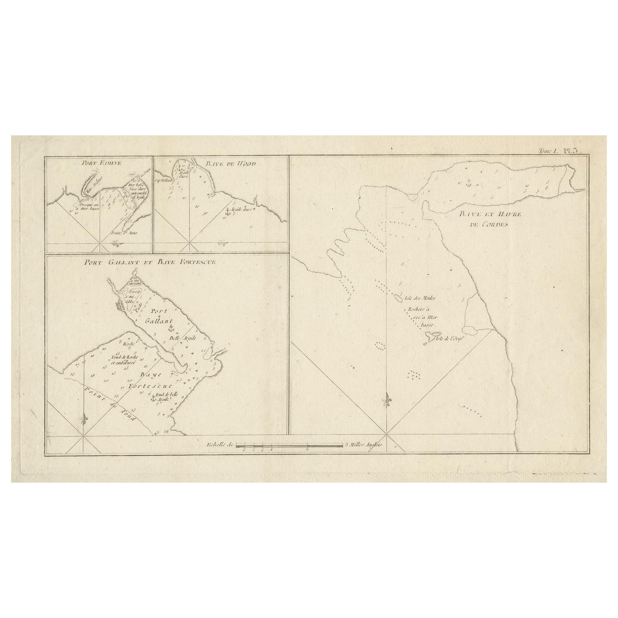
- Antique Map of Cordes Bay and SurroundingsLocated in Langweer, NLAntique map titled 'Baye et Havre de Cordes (..)'. Four maps on the one sheet of; Cordes Bay, Port Famine, Woods Pay, Port Gallant, Fortescue Bay, Chile based on the voyage of John B...Category
Antique Late 18th Century Maps
MaterialsPaper
- Antique Map of Ambon and Surroundings by Valentijn '1726'By F. ValentijnLocated in Langweer, NLAntique map titled 'De landvoogdy van Amboina met de elf onderhoorige Eylanden'. Decorative map of the eastern tip of the islands of Ambon, Indonesia. This print originates from 'Oud...Category
Antique Early 18th Century Dutch Maps
MaterialsPaper
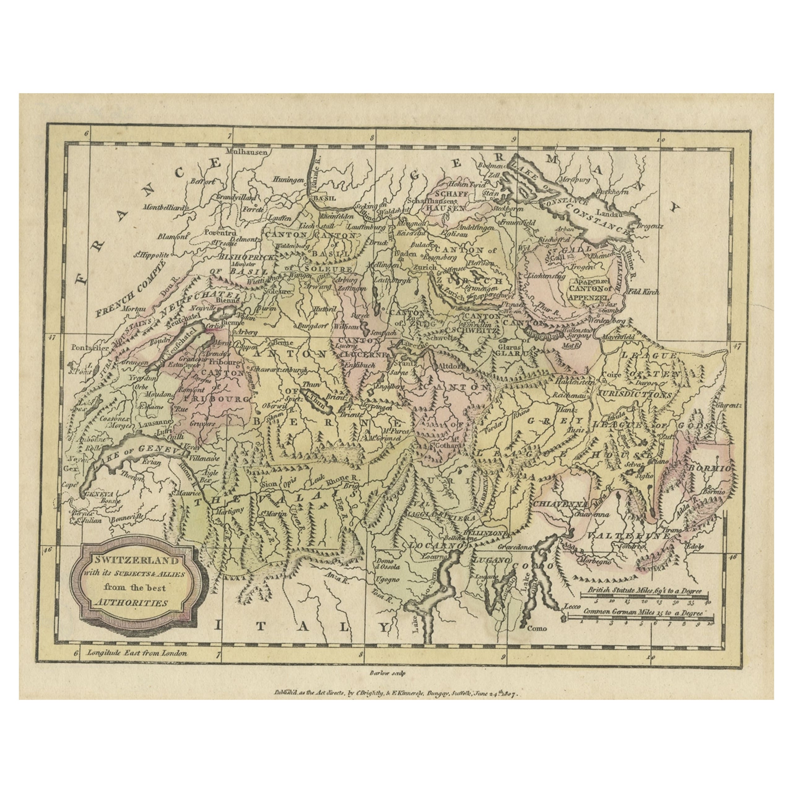
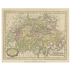
- Small Original Antique Map of Switzerland and Surroundings, 1807Located in Langweer, NLAntique map titled 'Switzerland with its subjects & allies from the best authorities'. Small map of Switzerland and surroundings. Originates from 'A general view of the world' by...Category
Antique Early 1800s Maps
MaterialsPaper
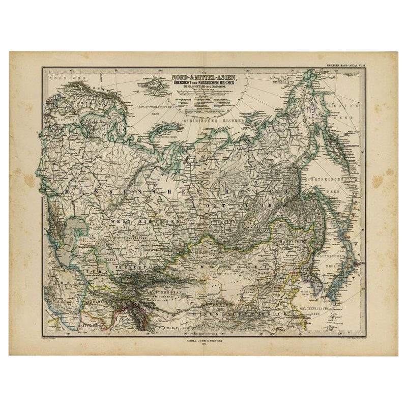
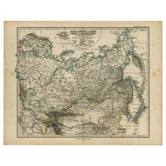
- Antique Map of Russia and Surroundings by Stieler, 1874Located in Langweer, NLAntique map titled 'Nord- & Mittal-Asien, Ubersicht des Russischen Reiches.' A map of Russia in scale 1:20.000.000. The depicted area spans from Iran and Sweden in the left edge of t...Category
Antique 19th Century Maps
MaterialsPaper


You May Also Like
- Large Original Vintage Map of Persia / Iran, circa 1920Located in St Annes, LancashireGreat maps of Persia. Unframed. Original color. By John Bartholomew and Co. Edinburgh Geographical Institute. Published, circa 1920. Free shipping.Category
Vintage 1920s British Maps
MaterialsPaper
- Original Antique Map of Ancient Greece, Phocis, Gulf of Corinth, 1787Located in St Annes, LancashireGreat map of Ancient Greece. Showing the region of Phocis, including the Gulf of Corinth Drawn by J.D. Barbie Du Bocage Copper plate engraving by P.F Tardieu Original hand c...Category
Antique 1780s French Other Maps
MaterialsPaper
- Ancient Neoclassic Cammeo, Neapolitan Manufacture, 1760-1840Located in Roma, ITAncient Neoclassic Cammeo is a decorative object realized in Naples during the second half of 1700 and the beginning of 1800. Lava Stone. Very good conditions. This refined cameo ...Category
Antique Late 19th Century Italian Models and Miniatures
MaterialsStone
- Ancient Neoclassic Cammeo, Neapolitan Manufacture, 1760-1840Located in Roma, ITNeoclassic Cameo is an elegant decorative object realized in Naples during the second half of 1700 and the beginning of 1800. Lava Stone. Contemporary wooden frame. Very good cond...Category
Antique Late 19th Century Italian Models and Miniatures
MaterialsLava
- 1854 Map of Massachusetts, Connecticut and Rhode Island, Antique Wall MapLocated in Colorado Springs, COThis striking wall map was published in 1854 by Ensign, Bridgman & Fanning and has both full original hand-coloring and original hardware. This impression is both informative and highly decorative. The states are divided into counties, outlined in red, green, and black, and subdivided into towns. Roads, canals, and railroad lines are prominently depicted, although they are not all labeled. The mapmakers also marked lighthouses, banks, churches, and prominent buildings, with a key at right. The map is an informative and comprehensive overview of the infrastructural development of New England prior to the Civil War. Physical geographies depicted include elevation, conveyed with hachure marks, rivers and lakes. The impression features an inset map of Boston...Category
Antique 19th Century American Maps
MaterialsPaper
- Antique Map of Principality of MonacoBy Antonio Vallardi EditoreLocated in Alessandria, PiemonteST/619 - "Old Geographical Atlas of Italy - Topographic map of ex-Principality of Monaco" - ediz Vallardi - Milano - A somewhat special edition ---Category
Antique Late 19th Century Italian Other Prints
MaterialsPaper