18th Century and Earlier Maps
to
2,334
2,903
63
2,969
26
12
1
1
2,969
2,280
474
3
290
34
10
126
10
37
9
2
5
4
3
3
2,955
30
20
3
3
354
117
94
81
52
2,969
2,969
2,969
58
21
13
12
12
Period: 18th Century and Earlier
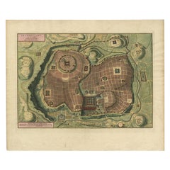
Bird's Eye Plan of the Ancient City of Jerusalem Based on Old Records, c.1725
Located in Langweer, NL
Antique map titled 'Beschryving van het oude Jeruzalem volgens Villalpandus.'
Bird's eye plan of the ancient city of Jerusalem based on Villalpando's foundation map. The plan shows...
Category
Antique 18th Century and Earlier Maps
Materials
Paper
$619 Sale Price
20% Off
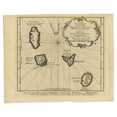
Antique Map of the Main Comoro Islands by Van Schley, 1749
Located in Langweer, NL
Antique map titled ‘Carte des Isles de Comore (..) - Kaart van de Eilanden Komoro (..)’. Original antique map of the main Comoro Islands or Comoros including Comore, Mohéli, Anjouan ...
Category
Antique 18th Century and Earlier Maps
Materials
Paper
$104 Sale Price
20% Off
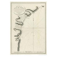
Antique Map of the Bay of Terney by La Pérouse, 1797
Located in Langweer, NL
Antique map titled 'Plan de la Baie de Ternai'. Old map of the north eastern coast of Russia. This map originates from 'Atlas du voyage de La Perouse'. Arti...
Category
Antique 18th Century and Earlier Maps
Materials
Paper
$145 Sale Price
20% Off
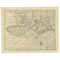
Antique Map of Ambon and Boero by Valentijn, 1726
By F. Valentijn
Located in Langweer, NL
Untitled map of the western part of the island Amboina with Boero, Indonesia. This print originates from 'Oud en Nieuw Oost-Indiën' by F. Valentijn.
Category
Dutch Antique 18th Century and Earlier Maps
Materials
Paper
$476 Sale Price
20% Off
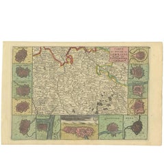
Antique Map of the Lorraine Region 'France' (c.1735)
Located in Langweer, NL
Antique map titled 'Carte du Duche de Lorraine - Kaart van Lotharingen'. A detailed map of the Duchy of Lorraine. The map is surrounded by thirteen vignette bird-eye view of fortifie...
Category
Antique 18th Century and Earlier Maps
Materials
Paper
$262 Sale Price
20% Off
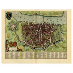
Beautiful Original Antique Map of Antwerp, Belgium by Mapmaker Blaeu, ca.1652
Located in Langweer, NL
Description: Antique map titled 'Antverpia; Gallis Anvers. Vernacule Antwerpen.'
A very nicely coloured plan of Antwerp in Flanders, Belgium. West-oriented, with the river Scheld...
Category
Antique 18th Century and Earlier Maps
Materials
Paper
$2,383 Sale Price
20% Off
Antique Map of the Region of Boulogne and Peronne, France 'C.1590'
Located in Langweer, NL
Antique map titled 'Caletensium et Bononiensium (..)'.
Two detailed regional maps on one sheet. The first map shows Belgian and French Coastal region, from Estaples to Gruerlinge...
Category
Antique 18th Century and Earlier Maps
Materials
Paper
$467 Sale Price
20% Off
Antique Map of the Siege of Breda, City in the Netherlands by Blaeu, 1649
Located in Langweer, NL
Antique map titled 'Breda obsessa et expugnata a Celsissimo Frederico Henrico'.
Old map of the city of Breda, the Netherlands. It shows the Siege of Breda in 1637. Originates fro...
Category
Antique 18th Century and Earlier Maps
Materials
Paper
$800 Sale Price
20% Off
Print of the Interior of the Governor General's Home on Java (Indonesia), 1739
Located in Langweer, NL
Antique print titled 'Ein Prospect der Gallerie, von des General-Gouverneurs Wohnung, nach dem Versammlungs-Saal derer Herren Rathen von Indien.'
View of the interior of the Governor General's home on Java (Indonesia). It shows the ceiling painting and row of columns leading to the ornate door...
Category
Antique 18th Century and Earlier Maps
Materials
Paper
$524 Sale Price
20% Off
Old Map of the Namibia and South Africa Coasts & Inset of Saldanha Bay, ca.1700
Located in Langweer, NL
Antique map titled 'Carte particuliere des Costes de l'Afrique'.
Map of the coasts of Namibia and South Africa. With an inset map of Saldanha Bay.
Artists and Engravers: Publ...
Category
Antique 18th Century and Earlier Maps
Materials
Paper
$610 Sale Price
20% Off
Antique Map of the Empire of China by Bonne, c.1780
Located in Langweer, NL
Antique map titled 'Carte de L'Empire de la Chine.' Decorative map of the Empire of China, depicting China, Corea ( Korea ), Japan, Tonquin and the Philippine island Lucon. Source un...
Category
Antique 18th Century and Earlier Maps
Materials
Paper
$619 Sale Price
20% Off
Antique Map of China Including Korea and Taiwan by Vaugondy, 1749
Located in Langweer, NL
Antique map titled 'Empire de la Chine'. Beautiful map of China including Korea and Taiwan (Formosa). This map originates from 'Atlas Universel (..)' by Gilles Robert de Vaugondy, 17...
Category
Antique 18th Century and Earlier Maps
Materials
Paper
$476 Sale Price
20% Off
Old Map of Algiers, with Surrounding Cities and the Bay of Algiers, 1773
Located in Langweer, NL
Antique print titled 'Plan van de Stad Algiers'.
Old map of Algiers, also depicting surrounding cities and the Bay of Algiers. Originates from the first Dutch editon of an interest...
Category
Antique 18th Century and Earlier Maps
Materials
Paper
$343 Sale Price
20% Off
Antique Map of the North Sea From the English Channel to Norway & Sweden, 1746
Located in Langweer, NL
Antique map titled 'A correct Chart of the German Ocean from the North of Scotland to the Start Point, on the Coast of Great Britain; and from So. Bygden on ye coast of Norway, to C....
Category
Antique 18th Century and Earlier Maps
Materials
Paper
$467 Sale Price
20% Off
Early 18th Century Map of Denmark in Old Coloring, Published in 1706
Located in Langweer, NL
Denmark. Schenk (Petrus), Dania Regnum Ducatus Holsatia. et Slesvicum Insulae Danicae et Provinciae Jutia Scania etc. Amsterdam, 1706, engraved reticulated map on thick paper with co...
Category
Antique 18th Century and Earlier Maps
Materials
Paper
$680 Sale Price
20% Off
Antique Map of Northern Germany by M. Seutter, circa 1730
Located in Langweer, NL
Antique map titled 'Saxoniae Inferioris Circulus'. Old map of the northern part of Germany by M. Seutter. Covering the area of Lower Saxony, Mecklenburg-Vorpommern and Schleswig-Hols...
Category
Antique 18th Century and Earlier Maps
Materials
Paper
$562 Sale Price
20% Off
Chart of the Coast of Cochinchina' and 'Plan of Pulo Condor', Vietnam, 1778
Located in Langweer, NL
Antique map titled 'A Chart of a part of the Coast of Cochinchina' and 'Plan of Pulo Condor'.
Two maps on one sheet. The upper map shows part of the coast of Cochinchina from Cha...
Category
Antique 18th Century and Earlier Maps
Materials
Paper
$514 Sale Price
20% Off
Pl. 8 Antique Print of Various Garden Temples by Le Rouge, c.1785
Located in Langweer, NL
Antique print titled 'Divers petits Temples pour les Jardins Anglais'. Copper engraving showing various temples for English gardens. This print originat...
Category
Antique 18th Century and Earlier Maps
Materials
Paper
Antique Map of Batavia, Nowadays Jakarta, the Capital of Indonesia, 1782
Located in Langweer, NL
Antique map Batavia titled 'Batavia zo als het was in den Jaare 1731'. Old map of the city of Batavia (Jakarta) in Indonesia. Originates from 'Batavia, de Hoofdstad van Neerlands O. ...
Category
Antique 18th Century and Earlier Maps
Materials
Paper
$905 Sale Price
20% Off
Old Map of the Philippines and Part of Indonesia 'Spice Islands', 1744
Located in Langweer, NL
Antique map titled 'Nieuwe Kaart van de Filippynsche, Ladrones, Moluccos of Specery Eilanden, als mede Celebes etc'.
Old map of the Philippines and part of Indonesia. Originates ...
Category
Antique 18th Century and Earlier Maps
Materials
Paper
$629 Sale Price
20% Off
Early Map of Australasia, Marking The Route of Abel Tasman in 1642 'Publ. 1726'
Located in Langweer, NL
Description: Antique map titled 'Kaart der Reyse van Abel Tasman volgens syn eygen opstel'. Rare and early map of Australasia, marking the route of Abel Tasman's voyage from Mauritius to Batavia in 1642, on which he discovered Tasmania and New Zealand and proved that Australia was not part of the Great Southern...
Category
Antique 18th Century and Earlier Maps
Materials
Paper
$8,103 Sale Price
20% Off
Antique Map of Part of Russia, c.1740
Located in Langweer, NL
Antique map titled 'Ienisensis Provinicia cum adjacentibus Toboliensis & Irkutensis'. Old map of part of Russia including the city of Tobolsk and others. Source unknown, to be determ...
Category
Antique 18th Century and Earlier Maps
Materials
Paper
$130 Sale Price
20% Off
Antique Print Showing Remnants of Constantine I the Great's Baths, Rome, 1704
Located in Langweer, NL
Antique print, titled: 'De Overblyfzels der Badstoven van Konstantyn den Grooten' - This original old antique print shows the remnants of Constantine I the Great's baths in Rome, Ita...
Category
Antique 18th Century and Earlier Maps
Materials
Paper
Antique Map of the Region of Liege by Coronelli, 1690
Located in Langweer, NL
Antique map titled 'Vescovato di Liege (..)'. Map of the Belgium area centered on Liege and the course of Meuse/Maas River. Also depicts the cities of Maastricht, Namur and Tienen. O...
Category
Antique 18th Century and Earlier Maps
Materials
Paper
$438 Sale Price
20% Off
Circus Flaminius (..), Anonymous, 1704
Located in Langweer, NL
Antique print, titled: 'Circus Flaminius (?)' - This original old antique print shows a reconstruction of Circus Flaminius, a large, circular area in ancient Rome, located in the sou...
Category
Antique 18th Century and Earlier Maps
Materials
Paper
Pl. 1 Antique Print of Pavillon La Bouëxière by Le Rouge, c.1785
Located in Langweer, NL
Antique print titled 'Pavillon de Labossiere (..)'. Copper engraving of pavillon La Bouëxière. This print originates from 'Jardins Anglo-Chinois à la Mode' by Georg Louis le Rouge. A...
Category
Antique 18th Century and Earlier Maps
Materials
Paper
Antique Map of the Arabian Desert by Cellarius, 1731
Located in Langweer, NL
Antique map titled 'Arabia Petraea et Deserta.' Arabian desert with present day Israel, Jordania, Iraq. With decorative cartouche showing dromedaries. T...
Category
Antique 18th Century and Earlier Maps
Materials
Paper
$166 Sale Price
20% Off
Inside View of Magdalen Chapel – Engraving of Medieval Gothic Interior, 1790
Located in Langweer, NL
Inside View of Magdalen Chapel – Engraving of Medieval Gothic Interior, 1790
This atmospheric antique engraving captures the interior of the Magdalen Chapel near Winchester, as view...
Category
English Antique 18th Century and Earlier Maps
Materials
Paper
The Holy Sepulchre '..', Basire, 1795
Located in Langweer, NL
Antique print titled 'The Holy Sepulchre at Northwold in the County of Norfolk'. Antique print depicting the Holy Sepulchre, Northwold. Artists and Engr...
Category
Antique 18th Century and Earlier Maps
Materials
Paper
$143 Sale Price
20% Off
Antique Map of Gabon, Angola and the Congo Region in Africa c.1680
Located in Langweer, NL
Antique map titled 'Royaume de Congo'.
Map of Gabon, the Congo and Angola from Cape Lopez and Sao Tomé to approximately the border with present-day Namibia. The map is fully engrav...
Category
Antique 18th Century and Earlier Maps
Materials
Paper
Antique Engraving of Kirby Hall Near Gretton, Northamptonshire, England c.1770
Located in Langweer, NL
Antique print titled 'Principal Front of Kirby Hall'.
Kirby Hall is an Elizabethan country house, located near Gretton, Northamptonshire, England. The nearest main town is Corby. One of the great Elizabethan houses of England, Kirby Hall was built for Sir Humphrey Stafford of Blatherwick, beginning in 1570. In 1575 the property was purchased by Sir Christopher Hatton of Holdenby,[1] Lord Chancellor to Queen Elizabeth I. It is a leading and early example of the Elizabethan prodigy house. Construction on the building began in 1570, based on the designs in French architectural pattern books and expanded in the Classical style over the course of the following decades. The house is now in a semi-ruined state with many parts roof-less although the Great Hall and state rooms remain intact. The gardens, with their elaborate "cutwork" design, complete with statues and urns, have been recently restored.
Anne of Denmark stayed at Kirby on 9 August 1605 while King James stayed at Rockingham Castle. King James stayed for three days in August 1616. During a royal progress Esmé Stewart, 3rd Duke of Lennox died at Kirby of the "spotted ague" on 30 July 1624.
The building and gardens are owned by the Earl of Winchilsea and are managed by English Heritage.
Kirby Hall has been used as a filming location in many productions. These include the following; an episode (6. Protest and Communication) of Kenneth Clark...
Category
Antique 18th Century and Earlier Maps
Materials
Paper
$524 Sale Price
20% Off
Antique Hand-Colored Map of France by J.B. Elwe, 1792
Located in Langweer, NL
Antique map titled 'Carte Nouvelle du Royaume de France'. Beautiful antique map of France, including the Southern part of England. Decorated with cartouche and 12 coats of arms.
Category
Antique 18th Century and Earlier Maps
Materials
Paper
$810 Sale Price
20% Off
Antique Map of the Seven United Provinces of Holland by Seutter, 1727
Located in Langweer, NL
Antique map titled ‘Belgium Foederatum Auctius Et Emendatius‘. Important antique map of the Seven United Provinces of Holland with inset views of the East Indies, the province of Lim...
Category
Antique 18th Century and Earlier Maps
Materials
Paper
$691 Sale Price
20% Off
Antique Map of the Danube River by Homann, c.1720
By Homann Heirs
Located in Langweer, NL
Antique map titled 'Danubii Fluminis (..)'. Regional map of the Donau river, Shows the Danube river from Belgrade in Serbia, along the border between Roma...
Category
Antique 18th Century and Earlier Maps
Materials
Paper
$881 Sale Price
20% Off
Antique Print of the Town and Fortress of Ternate by Renneville, 1725
Located in Langweer, NL
Antique print Ternate titled 'La Ville et la Fort de Gamma lamma dans l'isle de Ternade lequel Fort apartient aux Espagnols'. Antique print of the town and fortress of the island of Ternate. Originates from 'Recueil des voyages qui ont servi à l’établissement et aux progrès de la compagnie des Indes orientales...
Category
Antique 18th Century and Earlier Maps
Materials
Paper
Striking Antique Map of Cayenne in French Guyana, South America, ca.1760
Located in Langweer, NL
Description: Antique map titled 'Land-kaart van het Eiland en de Volkplanting van Cayenne aan de Kust van Zuid-Amerika'.
Striking map of the island and settlement of Cayenne in F...
Category
Antique 18th Century and Earlier Maps
Materials
Paper
$1,287 Sale Price
20% Off
Old Color Engraving of Blaeu's first Map of Brazil, North Oriented to the Right
By Willem Blaeu
Located in Langweer, NL
Antique map titled 'Novus Brasiliae Typus'. Fine old color example of Blaeu's first map of Brazil, with north oriented to the right. Includes inset map of Baya de todos Santos, elaborate cartouche, 2 compass roses and richly embellished vignettes of native Brazilian life and animals.
The interior of the map includes vignettes of indigenous animals and native scenes, including cannibalism. Inset within a decorative border is a small map of "Baya de todos Sanctos". In the sea are monsters, a galleon and two compass roses. The large title cartouche features a male and female Brazilian, both of whom are shown naked.
Willem Janszoon Blaeu (1571-1638) was a prominent Dutch geographer and publisher. Born the son of a herring merchant, Blaeu chose not fish but mathematics and astronomy for his focus. He studied with the famous Danish astronomer Tycho Brahe...
Category
Antique 18th Century and Earlier Maps
Materials
Paper
$1,287 Sale Price
40% Off
Antique Map of the Region of Lyon by Janssonius, 1657
Located in Langweer, NL
Antique map of France titled 'La Principaute de Dombes'. Detailed map of the area above Lyon. This map originates from 'Atlas Novus, Sive Theatrum Orbis Orbis Terrarum: In quo Gallia...
Category
Antique 18th Century and Earlier Maps
Materials
Paper
$393 Sale Price
20% Off
Old Map of the Dutch Provinces of Friesland and Groningen, The Netherlands, 1604
Located in Langweer, NL
Antique print, titled: 'Frisiae Occidentalis.'
Handsome map of the Dutch Provinces of Friesland and Groningen. Embellished with strapwork title-car...
Category
Antique 18th Century and Earlier Maps
Materials
Paper
$1,096 Sale Price
20% Off
Antique Map of France under the Reign of Louis XIII by Zannoni, 1765
Located in Langweer, NL
Antique map France titled 'Tableau de la France sous Louis XIII (..)'.
Beautiful old map of France. This map originates from 'Atlas Historique de la France Ancienne et Moderne' b...
Category
Antique 18th Century and Earlier Maps
Materials
Paper
$147 Sale Price
20% Off
Antique Map of the Alsace region and Nova Zembla by Scherer, c.1700
Located in Langweer, NL
Antique map titled 'Chorographia Alsatiae.' Map of the Alsace region and Nova Zembla, printed for Scherer's 'Atlas Novus' (1702-1710). Scherer's 'Atlas Novus' forms an important mile...
Category
Antique 18th Century and Earlier Maps
Materials
Paper
$143 Sale Price
20% Off
Antique Map of the Buton Strait by Philippe, 1787
Located in Langweer, NL
Antique map titled 'Carte du Détroit de Bouton'. Map of the Buton Strait between Paula Buton and Celebes, Indonesia. This map originates from 'World atlas for the study of geography ...
Category
Antique 18th Century and Earlier Maps
Materials
Paper
$114 Sale Price
20% Off
Antique Print of the Stowe House in Stowe, Buckinghamshire, England, c.1785
Located in Langweer, NL
Antique print titled 'Plan actuel du Chateau de Stowe'.
Copper engraving showing a plan and elements of the Stowe House.
Stowe House is a grade I l...
Category
Antique 18th Century and Earlier Maps
Materials
Paper
$543 Sale Price
20% Off
Antique Map of Ambelau and Buru Island, Maluku or Moluccas in Indonesia, 1726
Located in Langweer, NL
Antique map titled 'Boero - Amblauw (..).' Detailed map of the Island Ambelau and Buru, Maluku Islands, Indonesia, by Francois Valentyn. With an inset of the lake on the Buru mountai...
Category
Antique 18th Century and Earlier Maps
Materials
Paper
$352 Sale Price
20% Off
Antique Map of the Coast of Africa and the Cape Verde Islands, ca.1680
Located in Langweer, NL
Antique map Africa titled 'Isles du Cap Verd Coste et Pays des Negres'.
Antique map of the coast of Africa and the Cape Verde islands.
Artis...
Category
Antique 18th Century and Earlier Maps
Materials
Paper
$333 Sale Price
20% Off
Original Old Map of South East England Incl London, Oxford, Cambridge, Etc, 1633
Located in Langweer, NL
Antique map titled 'Warwicum, Northhamtonia, Huntingdonia, Cantabrigia, Suffolcia, Oxonium, Buckinghamia, Befordia, Harfordia, Essexia, Berceria, Middlesexia, Southhatonia, Surria, Catiu & Southsexia'.
Old map of south east England. Includes London, Salisbury, Oxford, Cambridge, Leicester and Norwich and the Isle of Wight. Originates from the 1633 German edition of the Mercator-Hondius Atlas Major, published by Henricus Hondius and Jan Jansson under the title: 'Atlas: das ist Abbildung der gantzen Welt, mit allen darin begriffenen Laendern und Provintzen: sonderlich von Teutschland, Franckreich, Niderland, Ost und West Indien: mit Beschreibung der selben.'
Artists and engravers: Gerard Mercator (1512 - 1594) originally a student of philosophy was one of the most renowned cosmographers and geographers of the 16th century, as well as an accomplished scientific instrument maker. He is most famous for introducing Mercators Projection, a system which allowed navigators to plot the same constant compass bearing on a flat map.
Category
Antique 18th Century and Earlier Maps
Materials
Paper
$1,096 Sale Price / item
20% Off
Antique Map of The Bay of D'Estaing located on the Russian island Sakhalin, 1798
Located in Langweer, NL
Antique map titled 'Plan of La Baie d'Estaing'.
This map shows the bay of D'Estaing located on the Russian island of Sakhalin. La Perouse was selected b...
Category
Antique 18th Century and Earlier Maps
Materials
Paper
$343 Sale Price
20% Off
Antique Lithography Map, Durham, English, Framed, Cartography, Early Georgian
Located in Hele, Devon, GB
This is an antique lithography map of Durham. An English, framed engraving of cartographic interest, dating to the early 18th century and later, circa 1720.
Superb lithography of Du...
Category
British Georgian Antique 18th Century and Earlier Maps
Materials
Wood
Old Antique Map of the Banda Islands (Southeast), Indonesia & Northern Australia
By F. Valentijn
Located in Langweer, NL
Original antique map titled 'Kaart van de Zuyd-Ooster Eylanden van Banda'. Important map of the seas and islands surrounding the Banda Islands, Indonesia, extending south to northern Australia, east to Papua New Guinea and north to Ceram. Published 1724-1726 by Joannes van Braam...
Category
Antique 18th Century and Earlier Maps
Materials
Paper
$734 Sale Price
20% Off
Antique Map of the Bay of Bengal Printed for Robert Sayer, 1787
Located in Langweer, NL
Antique map titled 'A Chart of the Eastern Coast of the Gulf of Bengal'. Original antique map of the Bay of Bengal. The Bay of Bengal is the northeastern...
Category
Antique 18th Century and Earlier Maps
Materials
Paper
$476 Sale Price
20% Off
Detailed Regional Antique Map of Northwestern France and Catholic Belgium, 1648
Located in Langweer, NL
Antique map titled 'Picardie et les Pays Bas Catholiques (..)'.
Detailed regional map of Northwestern France and Catholic Belgium, from an early edition of Sanson's Atlas.
Art...
Category
Antique 18th Century and Earlier Maps
Materials
Paper
$629 Sale Price
20% Off
Antique Map of Germany of German in Roman Times, c.1660
Located in Langweer, NL
Antique map Germany titled 'Germaniae Veteris Typus'. Antique map probably by Blaeu or based on an earlier state by W. Blaeu.
Minor differences shown in the cartouches. Top left ha...
Category
Antique 18th Century and Earlier Maps
Materials
Paper
$810 Sale Price
20% Off
Antique Map of France by Janssonius, c.1650
Located in Langweer, NL
Antique map titled 'Gallia Vetus'. Beautiful map of France based on Caesar's De Bello Gallico. In the columns to the left and right important tribes and people are described.
Art...
Category
Antique 18th Century and Earlier Maps
Materials
Paper
$500 Sale Price
20% Off
Antique Map of the City of Oudewater by Merian, 1659
Located in Langweer, NL
Antique map titled 'Oudewater'. Plan of the city of Oudewater, the Netherlands. This map originates from 'Topographia Germania Inferioris' by C. Merian, 1659.
Artists and Engraver...
Category
Antique 18th Century and Earlier Maps
Materials
Paper
$90 Sale Price
20% Off
Antique Map of Kyoto located in The Kansai Region on the Island of Honshu, c1740
Located in Langweer, NL
Antique map titled 'Plan de la Ville de Meaco'.
Detailed plan of Kyoto, located in the Kansai region on the island of Honshu, Japan. This map most likely originates from an edition of 'Histoire et description generale du Japon' by P.F.X. de Charlevoix.
Artists and Engravers: Jacques-Nicolas Bellin (1703-1772) was among the most important mapmakers of the eighteenth century. In 1721, at age 18, he was appointed hydrographer (chief cartographer) to the French Navy. In August 1741, he became the first Ingénieur de la Marine of the Depot des cartes...
Category
Antique 18th Century and Earlier Maps
Materials
Paper
$429 Sale Price
20% Off
Original Antique Print of the 'Korenbeurs' in Amsterdam, the Netherlands, 1787
Located in Langweer, NL
Antique print titled 'De Nieuwe Koornbeurs, in 1786'.
Original antique print of the 'Korenbeurs' in Amsterdam, the Netherlands. The Korenbeurs ("grain bourse") was a 17th-century commodity market in Amsterdam where grain was traded. The building stood on the banks of the Amstel, on the western side (Nieuwezijde) of the Damrak. It was directly south of the Oude Brug bridge, on a spot now occupied by the former stock and commodity exchange Beurs van Berlage...
Category
Antique 18th Century and Earlier Maps
Materials
Paper
$343 Sale Price / set
20% Off
Antique Map of the Limoges Region in France, c.1690
Located in Langweer, NL
Antique map titled 'Le Diocèse de Limoges'. Large map of the Limoges region, France.
The map is dedicated to the bishop of Limoges, Antoine de Charpin.
Artists and Engravers:...
Category
Antique 18th Century and Earlier Maps
Materials
Paper
$619 Sale Price
20% Off
Antique Map of the World with California as an Island, 1788
Located in Langweer, NL
Description: Antique map titled 'De wareld in een ronde gedaante van de Noord Pool te zien - De Wareld verbeeld in de gedaante van een hard'. This interesting composition contains three world maps on the sheet. At left is a northern projection showing all the landmasses. At right is a cordiform projection (heart-shaped). At top is a map of the world as known to the ancients. Both the polar and cordiform projections show California as an island...
Category
Antique 18th Century and Earlier Maps
Materials
Paper
$619 Sale Price
20% Off
Rare Map of North Africa Depicting Numidia, Libia and Morocco, Published C.1740
Located in Langweer, NL
Antique map Africa titled 'Mauretania, Numidia, Gaetulia & c.'.
Rare map of North Africa depicting Numidia, Libia and Morocco.
Artists and E...
Category
Antique 18th Century and Earlier Maps
Materials
Paper
$419 Sale Price
20% Off
Antique Map of Juan Fernandez Island by Anson, c.1740
Located in Langweer, NL
Antique map titled 'Plan de la Côte du N.E. de l 'Ile de Juan Fernandes'.
Map of the northeast coast of the island of Juan Fernandez with Cumberland Bay, South America. In 1740 Ans...
Category
Antique 18th Century and Earlier Maps
Materials
Paper
$228 Sale Price
20% Off
