Items Similar to Rare Map of North Africa Depicting Numidia, Libia and Morocco, Published C.1740


Want more images or videos?
Request additional images or videos from the seller
1 of 5
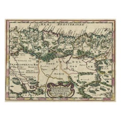
Rare Map of North Africa Depicting Numidia, Libia and Morocco, Published C.1740
About the Item
Antique map Africa titled 'Mauretania, Numidia, Gaetulia & c.'.
Rare map of North Africa depicting Numidia, Libia and Morocco.
Artists and Engravers: Engraved by I. Basire.
- Dimensions:Height: 9.45 in (24 cm)Width: 14.57 in (37 cm)Depth: 0 in (0.02 mm)
- Materials and Techniques:
- Period:1740-1749
- Date of Manufacture:circa 1740
- Condition:Wear consistent with age and use. Condition: Very good, minor defects. Please study image carefully.
- Seller Location:Langweer, NL
- Reference Number:
About the Seller
5.0
Platinum Seller
These expertly vetted sellers are 1stDibs' most experienced sellers and are rated highest by our customers.
Established in 2009
1stDibs seller since 2017
1,933 sales on 1stDibs
Typical response time: <1 hour
- ShippingRetrieving quote...Ships From: Langweer, Netherlands
- Return PolicyA return for this item may be initiated within 14 days of delivery.
More From This SellerView All
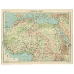
- Old Map of North Africa Depicting Libya, Morocco, Algeria, Tunis Etc, 1922Located in Langweer, NLAntique map of Africa titled 'Northern Africa'. Old map of North Africa depicting Libya, Morocco, Algeria, Tunis and surroundings. This map originates from 'The Times' atlas. ...Category
Vintage 1920s Maps
MaterialsPaper
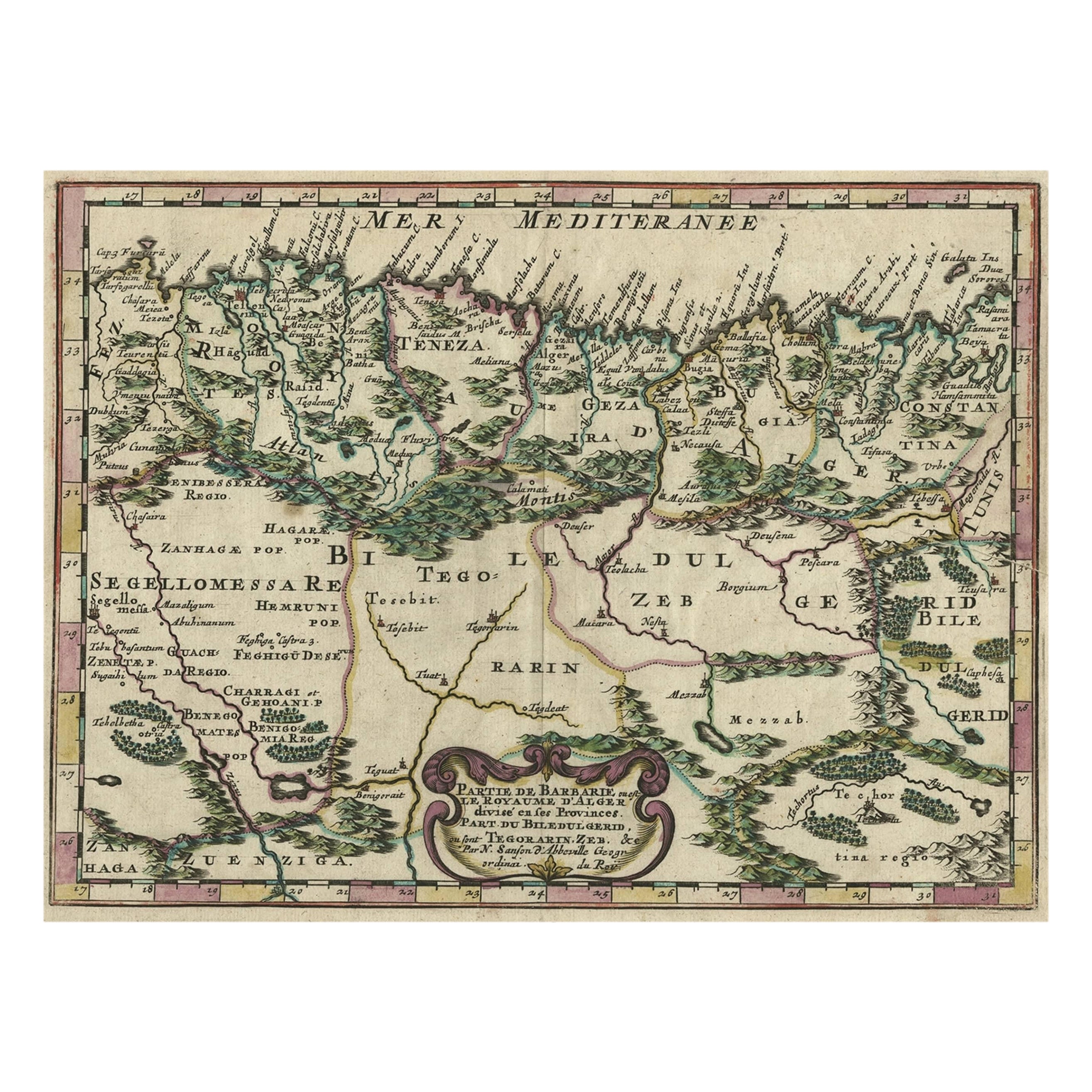
- Copper-Engraved Map Showing the Algerian Coast of North Africa, Published 1683Located in Langweer, NLAntique map titled 'Partie de Barbarie, ou est le Royaume d'Alger (..)'. Copper-engraved map showing the Algerian coast of North Africa. Published 1683. Artists and Engravers:...Category
Antique 1680s Maps
MaterialsPaper
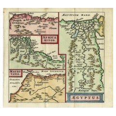
- Antique Map of North Africa showing Egypt, Mauritania and Africa Minor, 1672Located in Langweer, NLAntique map titled 'Africa Minor, Mauritania , Aegyptus.' Charming miniature map of North Africa, showing Egypt, Mauritania and Africa Minor. This map originates from the pocket atla...Category
Antique 17th Century Maps
MaterialsPaper
- Antique Map of North Africa by Lowry '1852'Located in Langweer, NLAntique map titled 'North Africa Marocco Algiers & Tunis'. Two individual sheets of North Africa. This map originates from 'Lowry's Table Atlas constructed and engraved from the most...Category
Antique Mid-19th Century Maps
MaterialsPaper
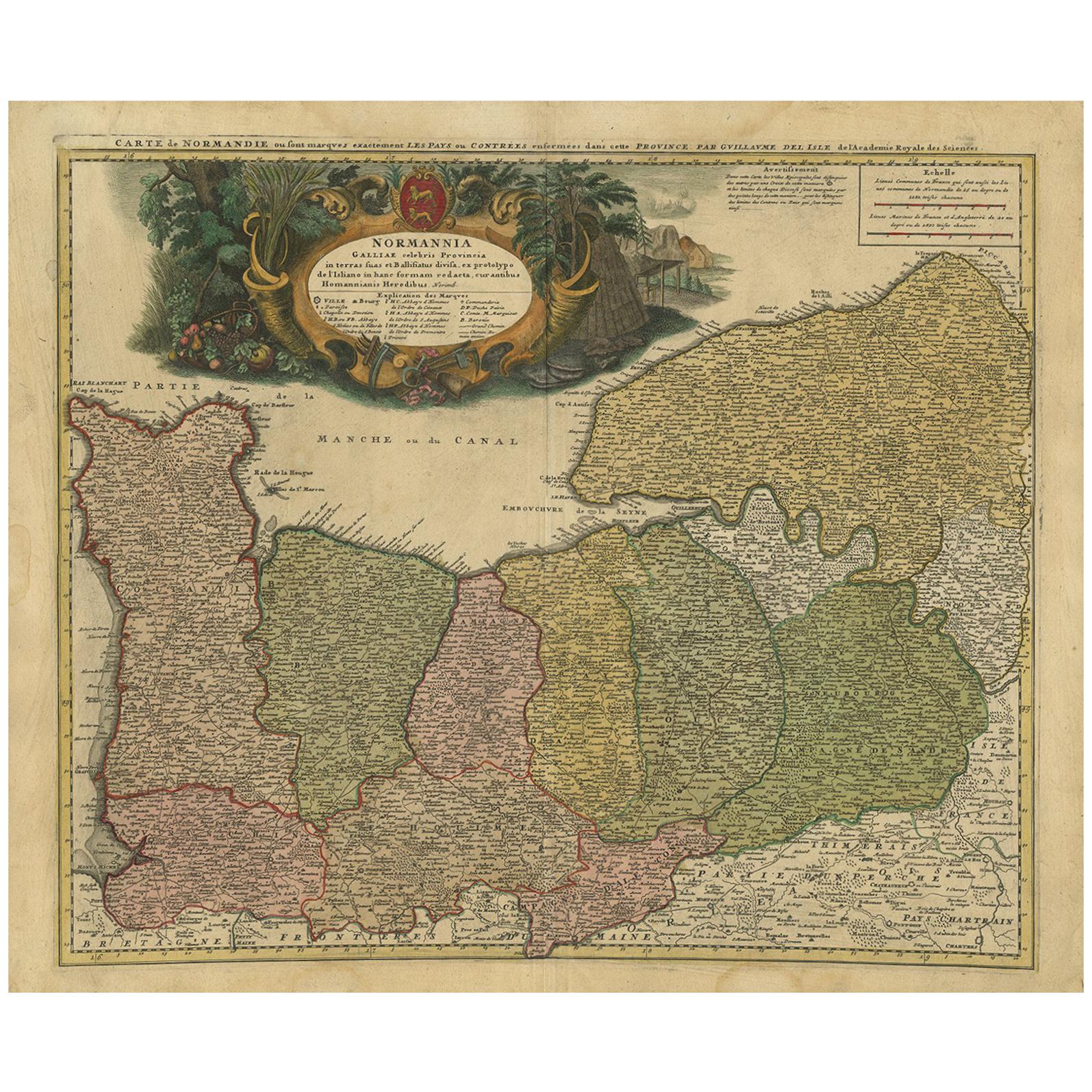
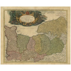
- Antique Map Normandy 'France' by Homann Heirs, Published in c.1740By Homann HeirsLocated in Langweer, NLAntique map France titled 'Normannia Galliae celebris Provincia in terras suas Ballisiatus (..)'. Decorative regional map of Normandy, France, circa ...Category
Antique Mid-18th Century German Maps
MaterialsPaper
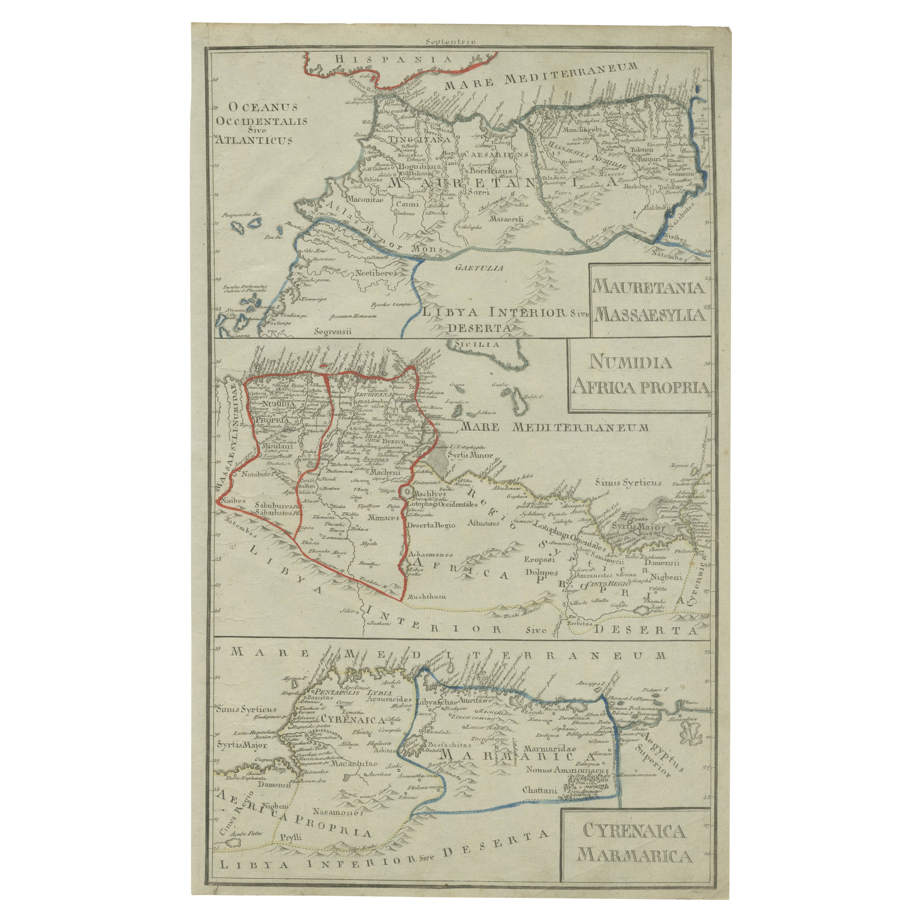
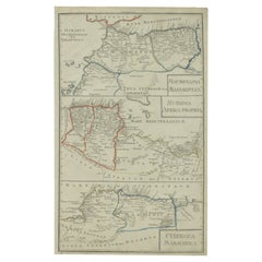
- Antique Map of Mauritania, Massaesylia, Numidia, Tunisia, Cyrenaica & MarmaricaLocated in Langweer, NLThree maps on one sheet showing Mauritania, Massaesylia, Numidia, Tunisia, Cyrenaica and Marmarica (ancient Libya). This map originates from 'Schul-Atlas für die alte Erdbeschreibung...Category
Antique Early 19th Century Maps
MaterialsPaper

You May Also Like
- "Nova Barbariae Descriptio", a 17th Century Hand-Colored Map of North AfricaBy Johannes JanssoniusLocated in Alamo, CAThis original attractive 17th century hand-colored map of North Africa entitled "Nova Barbariae Descriptio" by Johannes Janssonius was published in Paris in 1635. It includes the Med...Category
Antique Mid-17th Century Dutch Maps
MaterialsPaper
- Large Antique 1859 Map of North AmericaLocated in Sag Harbor, NYThis Map was made by Augustus Mitchell in 1859 It is in amazing condition for being 163 years old. This price is for the rolled up easy to ship version of this piece. I will be Frami...Category
Antique Mid-19th Century American Maps
MaterialsCanvas, Paper

- Original Antique Map of South Africa, Arrowsmith, 1820Located in St Annes, LancashireGreat map of South Africa. Drawn under the direction of Arrowsmith. Copper-plate engraving. Published by Longman, Hurst, Rees, Orme and Br...Category
Antique 1820s English Maps
MaterialsPaper
- New Map of North America from the Latest Discoveries, 1763Located in Philadelphia, PAA fine antique 18th century map of the North American seaboard. Entitled "A New Map of North America from the Latest Discoveries 1763". By the Cartographer/Engraver - John Spil...Category
Antique Mid-18th Century English Georgian Maps
MaterialsPaper
- Original Antique English County Map, North Yorkshire, J & C Walker, 1851Located in St Annes, LancashireGreat map of North Yorkshire Original colour By J & C Walker Published by Longman, Rees, Orme, Brown & Co. 1851 Unframed.Category
Antique 1850s English Other Maps
MaterialsPaper
- 17th Century Hand-Colored Map of West Africa by Mercator/HondiusLocated in Alamo, CAA 17th century hand-colored map entitled "Guineae Nova Descriptio" by Gerard Mercator and Jodocus Hondius, published in their 'Atlas Minor' in Amsterdam in 1635. It is focused on the...Category
Antique Mid-17th Century Dutch Maps
MaterialsPaper


Recently Viewed
View AllMore Ways To Browse
North Africa
Africa Antique Map
Antique Map Africa
Antique Map Of Africa
Antique Maps Of Africa
North Africa Map
Morocco Map
Wood Carvings Of Ships
Compass Rose
Classroom Furniture Used
Fine Antique Maps
Orbis Map
17th Century World Map
Book Of Antique Maps
18th Century Southern Antiques
Antique French Globe
Antique Furniture South Africa
South African Antique Furniture