18th Century and Earlier Maps
to
2,336
2,867
64
2,934
26
12
1
1
2,934
2,282
475
3
290
34
10
126
10
37
9
2
5
4
3
3
2,920
30
20
3
3
307
111
81
53
52
2,934
2,934
2,934
59
21
13
12
12
Period: 18th Century and Earlier
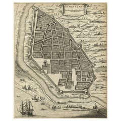
Antique Engraving of a Bird's-Eye Plan of Nagapattinam or Negapatam, India, 1672
Located in Langweer, NL
Antique map titled 'Negapatam.'
Bird's-eye plan of Nagapattinam or Negapatam, India. This map originates from 'Naauwkeurige Beschryvinge van Malabar en Choromandel…en het machtige ...
Category
Antique 18th Century and Earlier Maps
Materials
Paper
$323 Sale Price
20% Off
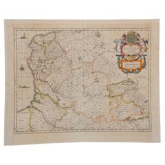
1620 Map of Artois Entitled "Artesia Comitatvs Artois, " by Bleau, Ric.a012
Located in Norton, MA
1640 map of Artois entitled
"Artesia Comitatvs Artois,"
by Bleau
Colored
A-012.
Detailed map of the northern province of Artois, France on the border with Belgium. Feature...
Category
Dutch Antique 18th Century and Earlier Maps
Materials
Paper
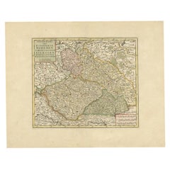
Antique Map of Bohemia in the Present-Day Chech Repubic, 1730
Located in Langweer, NL
Antique map titled 'Nieuwe Kaart van t Koninkryk Bohemen t Hertogdom Silesien markgraafschap Moravien (Moravia) en Lusatien' (Lusatia). Map of Bohemia (Czech Republic) with the surro...
Category
Antique 18th Century and Earlier Maps
Materials
Paper
$523 Sale Price
20% Off
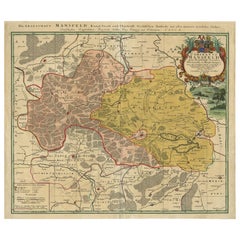
Detailed Antique Map Showing Mansfeld in Saxony-Anhalt, Germany, ca.1750
Located in Langweer, NL
Description: Antique map titled 'Die Grafschaft Mansfeld Konigl. Preuss. Churfurstl. Sachsischen Antheils mit allen darinnen befindlichen Stadten Dorfschaften.'
Detailed map show...
Category
Antique 18th Century and Earlier Maps
Materials
Paper
$438 Sale Price
20% Off
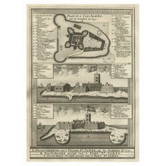
Old Copperplate Engraving of Fort St. James on the Gambra River, Africa, c.1760
Located in Langweer, NL
Plan de l’Isle James sur la Gambra en 1732 (…).
Copperplate engraving/etching on Hand laid (Verge) paper.
Sheet size: 19,7 x 26,7 cm. Image size: 13,8 x 19,8 cm.
From vol. 3 o...
Category
Antique 18th Century and Earlier Maps
Materials
Paper
$152 Sale Price
20% Off
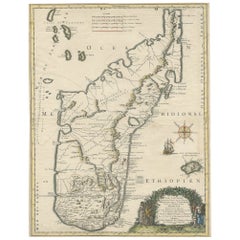
Beautiful Antique Map of Madagascar, The Comoros Islands & Reunion Island, 1667
Located in Langweer, NL
Antique map titled 'Isle d'Auphine, communement Nommée par les Europeens Madagascar, et St. Laurens, et par les Habitans du pays Madecase'.
Beautiful map of Madagascar...
Category
Antique 18th Century and Earlier Maps
Materials
Paper
$866 Sale Price
20% Off
Antique Map of France by Zannoni, 1765
Located in Langweer, NL
Antique map titled 'La France divisée en ses LVIII Provinces (..)'. Beautiful old map of France. This map originates from 'Atlas Historique de la France Ancienne et Moderne' by M. Ri...
Category
Antique 18th Century and Earlier Maps
Materials
Paper
$495 Sale Price
20% Off
Antique Map of France by T. Bowen, 1785
Located in Langweer, NL
Decorative antique map of France titled 'A new and accurate map of France, Drawn from the latest Authorities by T. Bowen'. Engraved for Moore’s new and complete collection of Voyages...
Category
Antique 18th Century and Earlier Maps
Materials
Paper
$152 Sale Price
20% Off
Copper Engraved Map of Tierra del Fuego and the Strait of Magellan, c1780
Located in Langweer, NL
Antique map titled 'Extremite Meridionale de l'Amerique.'
Copper engraved map of Tierra del Fuego and the Strait of Magellan with five detailed insets of the region showing soundings, anchorages, etc. Engraved by Andre. This map originates from 'Atlas de Toutes les Parties Connues du Globe Terrestre'.
Artists and Engravers: Rigobert Bonne (1727-1795 ) was one of the most important cartographers of the late 18th century. In 1773 he succeeded Jacques Bellin as Royal Cartographer to France in the office of the Hydrographer at the Depôt de la Marine. Working in his official capacity Bonne compiled some of the most detailed and accurate maps of the period. Bonne's work represents an important step in the evolution of the cartographic ideology away from the decorative work of the 17th and early 18th century towards a more detail oriented and practical aesthetic. With regard to the rendering of terrain Bonne maps...
Category
Antique 18th Century and Earlier Maps
Materials
Paper
$342 Sale Price
20% Off
Antique Map of the Region of Le Mans 'France' by Blaeu, circa 1640
By Willem Blaeu
Located in Langweer, NL
Antique Map: Cenomanorum Galliae regionis typus vulgo le Mans – Blaeu, circa 1640
This beautifully engraved and hand-colored map depicts the historical province of Maine in northw...
Category
Antique 18th Century and Earlier Maps
Materials
Paper
$476 Sale Price
20% Off
Antique Print of the Stables of Lathom House in Lancashire, England, c.1770
Located in Langweer, NL
Antique print titled 'Elevation of the Stables at Lathom Hall'. Elevation of the stables at Lathom House, Lancashire.
Lathom House was a large c...
Category
Antique 18th Century and Earlier Maps
Materials
Paper
$590 Sale Price
20% Off
Antique Map of France under the Reign of Francois II, 1765
Located in Langweer, NL
Antique map France titled 'La Bretagne et le Cté de Penthièvre (..)'. Beautiful old map of France. This map originates from 'Atlas Historique de la France Ancienne et Moderne' by M. ...
Category
Antique 18th Century and Earlier Maps
Materials
Paper
$140 Sale Price
20% Off
The Iron Duke of Alva of Spain Planning the Atrocities Against the Dutch, c.1680
Located in Langweer, NL
Antique print titled ‘Afbeeldinge van de Spaansche Bloedraad in den Jaare 1567 door den Hartog van Alva aangestelt’.
The Duke of Alva and his entourage seated at a table planning...
Category
Antique 18th Century and Earlier Maps
Materials
Paper
$533 Sale Price
20% Off
Early Antique Map of the Dutch Provinces of Friesland and Groningen, 1604
Located in Langweer, NL
Antique map titled 'Frisiae Occidentalis.'
This attractive map shows the Dutch Provinces of Friesland and Groningen. Embellished with strapwork tit...
Category
Antique 18th Century and Earlier Maps
Materials
Paper
$1,000 Sale Price
25% Off
Antique Hand-Colored Map of Northern Portugal, 1756
Located in Langweer, NL
Antique map Portugal titled 'Parte Sepentrional del Reyno de Portugal'.
Antique map of Northern Portugal. This map originates from 'Atlas Port...
Category
Antique 18th Century and Earlier Maps
Materials
Paper
$171 Sale Price
20% Off
Antique Folding London Map, English, Cartography, Historic, Georgian, Dated 1783
Located in Hele, Devon, GB
This is an antique folding London map. An English, paper on linen cartographical study of the London metropolis and the surrounding area, published in the mid Georgian period, dated ...
Category
British Georgian Antique 18th Century and Earlier Maps
Materials
Linen, Paper
Rare Antique Map of Asia with Cartouche Depicting an Elephant, 1753
Located in Langweer, NL
Antique map titled 'Asia.' Original antique map of Asia. With a small cartouche depicting an elephant. Map by Daniel de la Feuille. This very rare old antique copperplate engraved pr...
Category
Antique 18th Century and Earlier Maps
Materials
Paper
$333 Sale Price
20% Off
Antique Map of Denmark by Moll 'circa 1730'
By Herman Moll
Located in Langweer, NL
Antique map titled 'Denmark, agreeable to Modern History'. Uncommon map of Denmark by Herman Moll, published, circa 1730.
Category
Antique 18th Century and Earlier Maps
Materials
Paper
$333 Sale Price
20% Off
Antique Map of the Region of Franche-Comté by Janssonius, circa 1650
Located in Langweer, NL
Antique map titled 'Burgundiae Comitatus Franche Comté'. Old map of the historical and former region of Franche-Comté, France. As a region, it encompasse...
Category
Antique 18th Century and Earlier Maps
Materials
Paper
$571 Sale Price
20% Off
Antique Map of Cities of the Province of Shanxi in China, 1749
Located in Langweer, NL
Antique print titled: 'Lan-Tcheou ou Lan-Chew dan la province Chensi; Can Tcheou ou Kan-Chew dan la province de Chensi; Tchin-Ywe-Fou ou Chin-Ywen-Fu dans la province de Koei-Tcheou ...
Category
Antique 18th Century and Earlier Maps
Materials
Paper
$238 Sale Price
20% Off
Framed Scene of the Alteration of Amsterdam, Dam square, The Netherlands, c.1720
Located in Langweer, NL
Antique print titled 'd'Afbeelding hoe men de Magistraet en Geestelykheyt der stadt Amsterdam heeft uytgeleydt en t'scheep gebraght den 26 May 1578'.
Scene of the Alteration of Amsterdam on the Dam square...
Category
Antique 18th Century and Earlier Maps
Materials
Paper
$514 Sale Price
20% Off
Old Map of the East Coast of Honshu with an Inset, Japan, c.1785
Located in Langweer, NL
Antique map titled ‘Part of Japan or Nippon'.
View of the Coast of Japan when we first saw it: The Hill a bearing West 3 miles distant. London Published by Allexer Hogg at the Kings Arms...
Category
Antique 18th Century and Earlier Maps
Materials
Paper
$209 Sale Price
20% Off
Old Map of the Alsace 'Elzas' Region with Lotharingen 'Lorraine', France, c1650
Located in Langweer, NL
Antique map titled 'Alsatia superior cum Suntgoia et Brisgoia'.
Old map of the Alsace (or Elzas) region with Lotharingen (Lorraine), Strassburg, Freiburg, Basel etc. Source unkno...
Category
Antique 18th Century and Earlier Maps
Materials
Paper
$419 Sale Price
20% Off
Scandinavia & Baltic Map – Antique by G. & L. Valk, incl. Sweden, Finland, c1700
Located in Langweer, NL
Scandinavia & Baltic Map – Antique by G. & L. Valk, incl. Sweden, Finland, 1700
Antique map titled 'Sueciae Magnae, totius orbis regni antiquissimi (..)' by Gerard and Leonard Valk....
Category
Dutch Antique 18th Century and Earlier Maps
Materials
Paper
$619 Sale Price
20% Off
Antique Map of Oostergo, Part of Friesland, the Netherlands. Published in 1744
Located in Langweer, NL
Antique map titled 'Oostergo'. Original antique map of Oostergo, part of the province of Friesland, the Netherlands. Published 1744.
Artists and Engravers: Isaak Tirion (1705 in U...
Category
Antique 18th Century and Earlier Maps
Materials
Paper
$561 Sale Price
20% Off
Decorative Antique Map of the Berry Region, France, 1657
Located in Langweer, NL
Antique map of France titled 'Bituricum Ducatus - Duche de Berri'.
Decorative map of the Berry region, France. Berry is a region located in the center of France. It was a provinc...
Category
Antique 18th Century and Earlier Maps
Materials
Paper
$533 Sale Price
20% Off
Antique Map of Choromandel, Golconda and Orixa, Malabar, India, 1744
Located in Langweer, NL
Antique map titled 'Regionum Choromandel, Golconda (..).' Handsome map of Choromandel, Golconda and Orixa, published in 'The True and Exact Description of the Most Celebrated East - ...
Category
Antique 18th Century and Earlier Maps
Materials
Paper
$1,095 Sale Price
20% Off
Interesting Antique Map of Tartary and Northeast Asia, 1749
Located in Langweer, NL
Condition: Good, given age. Original folds, as issued. Some small water stains above image and top-right. Please study scan carefully.
Category
Antique 18th Century and Earlier Maps
Materials
Paper
$276 Sale Price
20% Off
Antique Map of Chili by Montanus, circa 1671
Located in Langweer, NL
Antique map titled 'Chili'. A very attractive map covering the known coastal region of Chile. The Andes are shown prominently, with two live volcanoes in the vicinity of Villarrica. ...
Category
Antique 18th Century and Earlier Maps
Materials
Paper
$571 Sale Price
20% Off
Original Old Map of Leeuwarden, European Cultural Capital 2018, Holland, 1649
Located in Langweer, NL
Antique print, titled: 'Leoverdia.'
This map shows Leoverdia (Leeuwarden). Bird's-eye view plan of Leeuwarden in The Netherlands, with key to locations and coats of arms. Text in...
Category
Antique 18th Century and Earlier Maps
Materials
Paper
$1,285 Sale Price
20% Off
Map of Duchy of Brabant Centered on Fortress of Louvain or Leuven, Belgium, 1720
Located in Langweer, NL
Antique map titled 'Ducatus Brabantiae Nova Tabula in qua Lovanii Bruxellarum March S. Impreii Sylvae Ducis et Merchliniae Dominia.'
This fully engraved copperplate map...
Category
Antique 18th Century and Earlier Maps
Materials
Paper
$933 Sale Price
20% Off
Original Antique Map of the City of Stavoren, Friesland, The Netherlands, 1649
Located in Langweer, NL
Antique map titled 'Staveren'. Original antique map of the city of Stavoren, Friesland, The Netherlands. This map originates from 'Toonneel der Steden van de Vereenighde Nederlanden'...
Category
Antique 18th Century and Earlier Maps
Materials
Paper
$1,095 Sale Price
20% Off
Bird's Eye View of Dabhol as Seen from the Sea, North of Goa, India, 1727
Located in Langweer, NL
Antique print titled 'De Bay ende Stadt Dabul'.
Bird's eye view of Dabhol as seen from the sea. The city is situated on the Vashishti river, north of Goa in India, on the Malabar...
Category
Antique 18th Century and Earlier Maps
Materials
Paper
$514 Sale Price
20% Off
Antique Map of the Region of Beauvais by Hondius, circa 1630
Located in Langweer, NL
Antique map titled 'Beauvaisis - Comitatus Belovacium'. Old map of the region of Beauvais, France. This map originates from a composite atlas and is signed by J. Hondius.
Category
Antique 18th Century and Earlier Maps
Materials
Paper
$476 Sale Price
20% Off
Map of the Duchy Clivia & Ravestein, Brabant in The Netherlands & Germany, 1635
Located in Langweer, NL
Antique map titled 'Clivia Ducatus et Ravestein Dominium.'
Map of the Duchy Clivia and Ravestein, part of Brabant in The Nethe...
Category
Antique 18th Century and Earlier Maps
Materials
Paper
$714 Sale Price
20% Off
Original Rare Antique Map of the Ancient German Empire in Northern Europe, c1650
Located in Langweer, NL
Antique map titled 'Germaniae Veteris typus.'
Map of the ancient German Empire in Northern Europe, based upon an earlier map by Ortelius. Extends fr...
Category
Antique 18th Century and Earlier Maps
Materials
Paper
$628 Sale Price
20% Off
Old Dutch Map of the Region Around the Mediterranean Sea, 1773
Located in Langweer, NL
Antique map titled 'Kaart van een Deel der Middelandsche Zee (..)'.
Old map of the region around the Mediterranean Sea. Originates from the first Dutch editon of an interesting t...
Category
Antique 18th Century and Earlier Maps
Materials
Paper
$342 Sale Price
20% Off
Antique Engraving with a Description of the Monkey Temple in Japan, 1669
Located in Langweer, NL
Antique print, titled: 'Beschryving van de Japansche Apen-tempel.' - ('Description of the Japanese Monkey Temple').
Interior of a temple filled wit...
Category
Antique 18th Century and Earlier Maps
Materials
Paper
$228 Sale Price
20% Off
Framed View of the Brouwersgracht in Amsterdam, the Netherlands, 1708
Located in Langweer, NL
Antique print titled 'Societatis Indiae Occident (..) - West Indisch Huys op Raapenburg (..)'.
Despite the title suggesting this print is a view of the West-Indisch House in Amst...
Category
Antique 18th Century and Earlier Maps
Materials
Paper
$409 Sale Price
20% Off
Original Antique Map of the Rhine, South and North of Strasbourg, Germany, 1608
Located in Langweer, NL
Antique map titled 'Argentoratensis agri descriptio'.
Original antique map of the Rhine, both south and north of Strasbourg, based on Daniel Specklin's three-sheet map of the Elz...
Category
Antique 18th Century and Earlier Maps
Materials
Paper
$304 Sale Price
20% Off
Old Sea Chart of the Tenasserim area, Myanmar 'Burma' in South East Asia, c.1790
Located in Langweer, NL
Antique map titled 'Coast of Tenasserim.'
Sea chart of the Tenasserim area, Myanmar in South East Asia. Source unknown, to be determined.
Artists and Engravers: Anonymous.
Category
Antique 18th Century and Earlier Maps
Materials
Paper
$704 Sale Price
20% Off
Antique Map of Northern Europe and European Russia, ca.1780
Located in Langweer, NL
Antique map titled 'Le Nord de L'Europe, Contenant Le Danemark, La Norwege; La Suede et La Laponie avec la Majeure Partie de al Russie Europeenne.'
Map of Northern Europe and Eur...
Category
Antique 18th Century and Earlier Maps
Materials
Paper
$180 Sale Price
20% Off
Detailed Antique Map of the Province of Overijssel in the Netherlands, ca.1700
Located in Langweer, NL
Antique map titled 'La Seigneurie d'Over-Yssel subdivisee en Trois Parties, Sallant, Twente, et Drente.'
Detailed map of the province of Overijssel in the Netherlands. From Jaill...
Category
Antique 18th Century and Earlier Maps
Materials
Paper
$704 Sale Price
20% Off
Original Old Bird's-Eye View Plan of Sint-Winoksbergen or Bergen in France, 1649
Located in Langweer, NL
Antique map titled 'Berga Sti Winoci.' - Bird's-eye view plan of Sint-Winoksbergen in France, with key to locations and coats of arms. Text in Dutch on verso. This plan originates from the famous city Atlas: 'Toneel der Steeden' published by Joan Blaeu...
Category
Antique 18th Century and Earlier Maps
Materials
Paper
$1,380 Sale Price
20% Off
Print of Pleasure Gardens of the Governor-General of Batavia, Indonesia, ca.1744
Located in Langweer, NL
Antique print titled 'Ein Prospect aus Sr. Hoch-Edelheit des Herrn General-Gouverneurs Lust oder Spiel-Haus nach der Werff, dem Vier Kand und der Baum Wachters Häusgen in Batavia gez...
Category
Antique 18th Century and Earlier Maps
Materials
Paper
$742 Sale Price
20% Off
Old Map of the Gulf of Bothnia, the Northernmost Arm of the Baltic Sea, 1759
Located in Langweer, NL
Antique map titled 'Carte du Golphe de Bothnie'.
Original antique map of the Gulf of Bothnia, the northernmost arm of the Baltic Sea. It is situated between Finland's west coast ...
Category
Antique 18th Century and Earlier Maps
Materials
Paper
$228 Sale Price
20% Off
Antique Print of a Castle or Château de Baudour, Hainaut, Belgium, c.1785
Located in Langweer, NL
Antique print titled 'Vue du Chateau de Boudour (..)'. Copper engraving of a castle and garden. Includes a French legend. This print originates from 'Jardins Anglo-Chinois à la Mode'...
Category
Antique 18th Century and Earlier Maps
Materials
Paper
$371 Sale Price
20% Off
Antique Map of Frisian Cities Sloten, Ylst, Workum and Hindelopen by Blaeu, 1652
Located in Langweer, NL
Antique print titled 'Slooten - Ylst - Worcum - Hinloopen'. Three plans and a bird's eye view on one sheet. The plans show the Frisian cities Sloten, IJlst, Workum and the view shows...
Category
Antique 18th Century and Earlier Maps
Materials
Paper
$1,095 Sale Price
20% Off
Antique Map of the Region of Elbogen & Eger, Czech Republic & Hungary, 1742
Located in Langweer, NL
Antique map titled 'Repraesentatio Geographica Circuli Egerani, nec non Elnbogensis : in quo simul viae Egeranae in Thermas Carolinas distincta delineatio conspicitur (..)'.
Orig...
Category
Antique 18th Century and Earlier Maps
Materials
Paper
$514 Sale Price
20% Off
Decorative Antique Map of the Dutch Province of Noord-Brabant, ca.1640
Located in Langweer, NL
Antique map titled 'Quarta pars Brabantiae cujus Sylvaducis Willebordus vanderBurgt desrib'.
Highly detailed original antique map of the province of Noord-Brabant, the Netherlands. It shows the cities of 's-Hertogenbosch, Eindhoven and surroundings. Includes a decorative cartouche, 6 coats of arms, topped by winged cherubs and two larger coats of arms...
Category
Antique 18th Century and Earlier Maps
Materials
Paper
$2,619 Sale Price
20% Off
Old View of the Queen Charlotte's Islands 'Santa Cruz Islands, Solomon', 1774
Located in Langweer, NL
Antique map titled 'Cote Septentrional de la plus grande des Isles de la Reine Charlotte (..)'.
Map and coastal view of the islands within the Queen Charlotte's Islands (Santa Cruz Islands...
Category
Antique 18th Century and Earlier Maps
Materials
Paper
$342 Sale Price
20% Off
Original Old Copper Engravings of Seals of Lubeck, Stavoren, Amsterdam etc. 1767
Located in Langweer, NL
Antique print titled ‚Zegel der stad Lubek (..)’.
Seals of the city of Lubeck and others: Stavoren, Amsterdam (8x), van Amstel, Persijn (..). This print originates from ‘Amsterda...
Category
Antique 18th Century and Earlier Maps
Materials
Paper
$323 Sale Price
20% Off
Antique Map of the Country Inhabited by the Samoyedic and Khanty People '1768'
Located in Langweer, NL
Antique map titled 'Carte des Païs Habités par les Samojedes et Ostiacs'. Original antique map of the country inhabited by the Samoyedic and Khanty (Ostyak) peoples. Engraved by J.N....
Category
Antique 18th Century and Earlier Maps
Materials
Paper
$190 Sale Price
20% Off
Rare Engraving of Dutch and Danish Forts on the West African Gold Coast, 1744
Located in Langweer, NL
Antique print, titled: 'The Dutch Fort Croevecoeur (…).'
A four panel plate showing forts on the West African Gold Coast, Ghana; a) The Dutch Fort Croevecoeur at Accra, b) The Danish Fort Christiaenburgh at Accra, c) Cape Ruygehoeck or Duyvelsbergh, d) The Prospect of the Village and Coast of Lay, the mount Redonda being at NNE. Ussher Fort is a fort in Accra, Ghana. It was built by the Dutch in 1649 as Fort Crevecoeur. From: "A Collection of Voyages and Travels" published by John and Awnsham Churchill in London in 1744.
Artists and Engravers: Made by 'Johannes Kip' after 'A. Churchill'. Johannes Kip (b Amsterdam, 1653; d London, 1722). Dutch draughtsman, engraver and dealer, active in England. He was a pupil of Bastiaen Stopendaal (1636–1707) from 1668 to 1670. His earliest dated engravings are of 1672 (e.g. the Siege of Groningen , Hollstein, no. 4), and he supplied numerous plates for books published from that date onwards. His work brought him into contact with the court of William of Orange and in 1686 he produced six plates depicting William of Orange, his Wife and Attendants near The Hague (Hollstein, no. 5). Shortly after the Glorious Revolution of 1688 Kip followed the court to England. After settling in Westminster, he worked extensively for London publishers, engraving works after Francis Barlow, Caius Gabriel Cibber (e.g. Interior of the Danish Church in London , 1697; Hollstein, no. 6) and other London-based artists. His engravings were principally destined for book illustrations. The work for which Kip is best remembered is his large corpus...
Category
Antique 18th Century and Earlier Maps
Materials
Paper
$428 Sale Price
20% Off
Beautiful Antique Map of Southeastern France with Decorative Cartouche, ca.1790
Located in Langweer, NL
Antique map titled 'Languedoc, Dauphiné, Province'.
Beautiful antique map of Southeastern France with decorative cartouche. Map includes topographical detail as well as a referen...
Category
Antique 18th Century and Earlier Maps
Materials
Paper
$361 Sale Price
20% Off
Large Panoramic View of Eisenerz, an Old Mining Town in Styria, Austria, c.1650
Located in Langweer, NL
Description: Antique print titled 'Der weyt berümpte Marckt und Bergwerck Eysenärtz im Hertzogtum Steyer'.
Large panoramic view of Eisenerz, an old mining town in the Austrian st...
Category
Antique 18th Century and Earlier Maps
Materials
Paper
$695 Sale Price
20% Off
Detailed Original Antique Map of the Picardy Region of France, 1657
Located in Langweer, NL
Antique map of France titled 'Picardia vera et inferior'.
Detailed map of the Picardy region of France. This map originates from 'Atlas Novus, Sive Theatrum Orbis Orbis Terrarum:...
Category
Antique 18th Century and Earlier Maps
Materials
Paper
$466 Sale Price
20% Off
Charming Map of Northeastern Spain with the Areas of Pamplona & Valladolid, 1634
Located in Langweer, NL
Antique map titled 'Biscaia, Guipiscoa, Navarra et Asturias de Santillana'.
Charming map of Northeastern Spain with the areas of Pamplona and Valladolid. This map originates from...
Category
Antique 18th Century and Earlier Maps
Materials
Paper
$419 Sale Price
20% Off
Beautiful Hand-Coloured Miniature Map of the Island of Java, Indonesia, ca.1702
Located in Langweer, NL
Antique map of Java titled‚ Iava Maior‘.
Beautiful hand-coloured miniature map of the island of Java. This map originates from ‘Recueil des Voyages qui ont servi a l'etablissemen...
Category
Antique 18th Century and Earlier Maps
Materials
Paper
$452 Sale Price
20% Off
Copper Engraving of Kamchadal Men from Kamchatka, Russia, 1770
Located in Langweer, NL
Description: Antique print titled 'Habillemens des Kamtchadals'. Copper engraving of Kamchadal men. This print originates from volume 19 of 'Histoire generale des voyages (..)' by Antoine Francois Prevost d'Exile.
Artists and Engravers: Published by Panckoucke.
The Kamchadals inhabit Kamchatka, Russia. The name "Kamchadal" was applied to the descendants of the local Siberians and aboriginal peoples (the Itelmens, Ainu, Koryaks and Chuvans) who assimilated with the Russians. The descendants of the mixed-blood Russian settlers in 18th-19th century are called Kamchadals these days. The Kamchadals speak Russian with a touch of local dialects of the aboriginal languages of Kamchatka. The Kamchadals engage in fur trading...
Category
Antique 18th Century and Earlier Maps
Materials
Paper
$323 Sale Price
20% Off
