18th Century and Earlier Maps
to
2,336
2,869
64
2,936
26
12
1
1
2,936
2,266
475
3
290
34
10
126
10
37
9
2
5
4
3
3
2,922
30
20
3
3
307
111
81
53
52
2,936
2,936
2,936
59
21
13
12
12
Period: 18th Century and Earlier
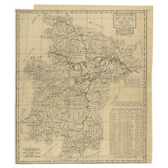
Antique Map of the Huguang Province of China by Du Halde, 1738
Located in Langweer, NL
Antique map titled 'Province VI Hu-Quang'. Old map depicting the Huguang province of China. Originates from 'A description of the Empire of China and Chinese-Tartary' by by J.B. du H...
Category
Antique 18th Century and Earlier Maps
Materials
Paper
$221 Sale Price
20% Off
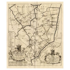
Antique Map of the Baarderadeel Township, 1718
Located in Langweer, NL
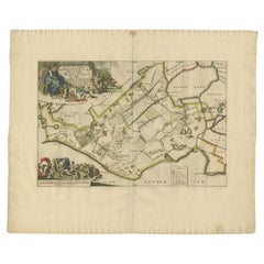
Antique map Friesland titled 'Baardera Deel de Vierde Grietenije van Wester Goo (..)'. Old map of Friesland, the Netherlands. This map depicts the region of B...
Category
Antique 18th Century and Earlier Maps
Materials
Paper
$230 Sale Price
20% Off
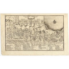
Antique Map of the Expedition of Govert Knol by Valentijn, 1726
Located in Langweer, NL
Antique map titled 'Aftekening der Expeditie van de Hr. Commissaris Govert Cnoll uyt Soerabaja, tot afhalinge van Pangerang Adepati Anom'. Map showing the expedition...
Category
Antique 18th Century and Earlier Maps
Materials
Paper
$102 Sale Price
20% Off
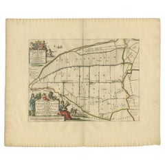
Antique Map of the Bildt Township 'Friesland' by Halma, 1718
Located in Langweer, NL
The map depicts the historical region of 't Bildt in Friesland, with notable places such as St. Jacobiparochie, St. Annaparochie, and Vrouwenparochie. These are still existing towns ...
Category
Antique 18th Century and Earlier Maps
Materials
Paper
Antique Map of the Fortifications of Demak and Jepara by Valentijn, 1726
Located in Langweer, NL
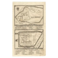
Antique print titled 'Kaarte van de Nieuw ontworpen Pagger op de Qual of Cawala. Kaarte van de Oude en Nieuwe ontworpen Pagger tot Japara'. Plans of the newly designed fortifications...
Category
Antique 18th Century and Earlier Maps
Materials
Paper
$150 Sale Price
20% Off
Antique Map of the Gaasterland Township 'Friesland' by Halma, 1718
Located in Langweer, NL
Antique map Friesland titled 'Gaasterland de Zevende Grietenije van de Zevenwolden (..)'. Old map of Friesland, the Netherlands. This map depicts the region of Gaasterland and includ...
Category
Antique 18th Century and Earlier Maps
Materials
Paper
$379 Sale Price
20% Off
Antique Map of the Hennaarderadeel Township 'Friesland' by Halma, 1718
Located in Langweer, NL
Antique map of Friesland titled 'Hennaardera Deel de Vyfde Grietenije van Wester Goo (..)'. Old map of Friesland, the Netherlands. This map depicts the region...
Category
Antique 18th Century and Earlier Maps
Materials
Paper
$283 Sale Price
20% Off
Antique Map of the Establishment of the French Monarchy by Zannoni, 1765
Located in Langweer, NL
Antique map France titled 'Carte de l'Etablissement de la Monarchie Francoise (..)'. Beautiful old map of France. This map originates from 'Atlas Historique de la France Ancienne et ...
Category
Antique 18th Century and Earlier Maps
Materials
Paper
$154 Sale Price
20% Off
Antique Map of the Island of Java by Van Der Aa, 1725
Located in Langweer, NL
Antique map titled 'Map: 'L'Ile de Java'. (The island of Java.) This map shows the Indonesian island of Java. With compass rose and scale. This plate originates from the very scarse:...
Category
Antique 18th Century and Earlier Maps
Materials
Paper
$375 Sale Price
20% Off
Antique Map of the Netherlands and Belgium by Bowen, 1747
Located in Langweer, NL
Antique map Belgium titled 'A New and Accurate Map of the Netherlands or Low Countries'. Detailed map of South of the Netherlands and Belgium. With large inset of the city of Mons, B...
Category
Antique 18th Century and Earlier Maps
Materials
Paper
$206 Sale Price
20% Off
Antique Map of the City of Alkmaar by Merian, c.1659
Located in Langweer, NL
Antique map titled 'Alckmaer'. Old map of the city of Alkmaar, the Netherlands. This print originates from 'Topographia Germaniae Inferioris (..)'. Artists and Engravers: Caspar Meri...
Category
Antique 18th Century and Earlier Maps
Materials
Paper
$128 Sale Price
20% Off
Antique Map of the Low Countries and Surroundings in Europe, 1685
By Philipp Clüver
Located in Langweer, NL
Antique map titled 'Germaniae Cisrhenanae ut ineter I Caesaris et Traiani Suit imperia Scaldis Item Mose ac Rheni.' Miniature map of the Low Countries and part of Germany and France....
Category
Antique 18th Century and Earlier Maps
Materials
Paper
$142 Sale Price
20% Off
Antique Map of the Maluku Islands by Le Rouge, c.1750
By George Louis Le Rouge
Located in Langweer, NL
Antique map Moluccas/Spice Islands titled 'Isles Moluques'. Detailed map of the famous Spice Islands (Maluku Islands or the Moluccas). Includes also Sulawesi, Bali, Timor, part of Bo...
Category
Antique 18th Century and Earlier Maps
Materials
Paper
$150 Sale Price
20% Off
Antique Map of the Holy Land by Danckerts, c.1710
Located in Langweer, NL
Antique map titled 'Afbeeldinge van de Veertich-Iaarige Reyse der Kinderen Israëls uyt Egypten door de Roode Zee en de Woestyne tot in 't Beloofde Landt Canaan'. Map of the Holy Land...
Category
Antique 18th Century and Earlier Maps
Materials
Paper
$339 Sale Price
20% Off
Antique Map of the Empire of the Assyriens by Mallet, 1683
Located in Langweer, NL
Antique map titled 'Empire des Assyriens' and 'Assyrie Chaldee et Mesopotamie selon les Anciens'. Two maps on one sheet, the upper sheet showing the Empire of the Assyriens and the second showing the region of the Tigres and Euphrates Rivers. This map originates from Alain Manesson Mallet's 'Description de l 'Univers'.
Artists and Engravers: Alain Manesson Mallet (1630–1706) was a French cartographer and engineer. He started his career as a soldier in the army of Louis XIV, became a Sergeant-Major in the artillery and an Inspector of Fortifications. He also served under the King of Portugal, before returning to France, and his appointment to the court of Louis XIV. His military engineering and mathematical background led to his position teaching mathematics at court. His major publications were Description de L'Univers (1683) in 5 volumes, and Les Travaux de Mars ou l'Art de la Guerre (1684) in 3 volumes. His Description de L'Universe contains a wide variety of information, including star maps...
Category
Antique 18th Century and Earlier Maps
Materials
Paper
$266 Sale Price
20% Off
Antique Map of the Jiangxi Province of China by Du Halde, 1738
Located in Langweer, NL
Antique map titled 'Province III Kyang-Si'. Old map depicting the Jiangxi province of China. Originates from 'A description of the Empire of China and Chinese-Tartary' by J.B. du Hal...
Category
Antique 18th Century and Earlier Maps
Materials
Paper
$209 Sale Price
20% Off
Antique Map of the Haskerland Township 'Friesland' by Halma, 1718
Located in Langweer, NL
Antique map Friesland titled 'Haskerland, de vierde Grietenije van de Zevenwolden (..)'. Old map of Friesland, the Netherlands. This map depicts the region of Haskerland and includes...
Category
Antique 18th Century and Earlier Maps
Materials
Paper
$263 Sale Price
20% Off
Antique Map of the Haskerland Township 'Friesland' by Halma, 1718
Located in Langweer, NL
Antique map Friesland titled 'Haskerland, de vierde Grietenije van de Zevenwolden (..)'. Old map of Friesland, the Netherlands. This map depicts the region of Haskerland and includes...
Category
Antique 18th Century and Earlier Maps
Materials
Paper
$337 Sale Price
20% Off
Antique Map of the City of Dokkum by Blaeu, c.1650
Located in Langweer, NL
Antique map titled 'Dockum'. Large map of the city of Dokkum, Friesland, The Netherlands. Originates from 'Toneel der Steden', published by Joan Blaeu, Amsterdam. Artists and Engrave...
Category
Antique 18th Century and Earlier Maps
Materials
Paper
Antique Map of the Cities of the Province of Shen-Si by Basire, 1738
Located in Langweer, NL
Antique print titled 'Cities of the Province of Shen-Si'. Old map depicting four walled cities of the Chinese Qing dynasty province of Shen-si (modern day SHAANXI): Si-ngan-fu, Chwan...
Category
Antique 18th Century and Earlier Maps
Materials
Paper
$193 Sale Price
20% Off
Antique Map of the Netherlands and Belgium by Lapie, 1842
Located in Langweer, NL
Antique map titled 'Carte des Royaumes de Belgique et de Hollande'. Map of the Netherlands and Belgium. This map originates from 'Atlas universel de géographie ancienne et moderne (....
Category
Antique 18th Century and Earlier Maps
Materials
Paper
$274 Sale Price
20% Off
Antique Map of the Hennaarderadeel Township 'Friesland' by Halma, 1718
Located in Langweer, NL
Antique map Friesland titled 'Hennaardera Deel de Vyfde Grietenije van Wester Goo (..)'. Old map of Friesland, the Netherlands. This map depicts the region of...
Category
Antique 18th Century and Earlier Maps
Materials
Paper
$337 Sale Price
20% Off
Antique Map of the Mouth of the Chiang River by Bellin, 1764
Located in Langweer, NL
Antique map titled ‘Carte de la Baye d'Hocsieu et des Entrees de la Riviere de Chang, Dans la Province de Fokyen en Chine’. This impressive map or sea chart d...
Category
Antique 18th Century and Earlier Maps
Materials
Paper
$237 Sale Price
20% Off
Antique Map of the Artois region by Visscher, c.1690
Located in Langweer, NL
Antique map titled 'Geographica Artesiae Comitatus Tabula'. Large map of the Artois region, France. Also shows part of Flanders. Artists and Engravers: Nicolaes Visscher II (1649, Am...
Category
Antique 18th Century and Earlier Maps
Materials
Paper
$317 Sale Price
20% Off
Antique Map of the City of Arnhem by Guicciardini, 1613
Located in Langweer, NL
Antique map titled ?Arnhemium Gelriae in Ripa Rheni Opp?. Plan of Arnhem in the province of Gelderland, The Netherlands, Holland. This map originates from the 1613 edition of 'Discri...
Category
Antique 18th Century and Earlier Maps
Materials
Paper
$180 Sale Price
20% Off
Antique Map of the Hennaarderadeel Township 'Friesland' by Halma, 1718
Located in Langweer, NL
Antique map Friesland titled 'Hennaardera Deel de Vyfde Grietenije van Wester Goo (..)'. Old map of Friesland, the Netherlands. This map depicts the region of...
Category
Antique 18th Century and Earlier Maps
Materials
Paper
$304 Sale Price
20% Off
Antique Map of the Circle of Franconia by Homann, c.1703
Located in Langweer, NL
Antique map titled 'Circuli Franconiae pars Occidentalis, exhibes simul integrum fere Electoratum Moguntinum (..)'. Antique map centered on Nuremberg and Bamberg. Extends from the Do...
Category
Antique 18th Century and Earlier Maps
Materials
Paper
$339 Sale Price
20% Off
Antique Map of Stavoren by Priorato, 1673
Located in Langweer, NL
Antique map titled 'Staveren'. Original antique map of the city of Stavoren, Friesland, the Netherlands. This map orginates from 'Teatro del Belgio (..)', published in Frankfurt am Main in 1673 by Gualdo Priorato. Artists and Engravers: Author: Galeazzo Gualdo Priorato (1606-1678) entered military service at a very young age and served in Flanders under the Prince of Orange. After his retirement, he authored several historical accounts including the Teatro del Belgio, which described the Catholic/Protestant wars in Belgium and Netherlands during the seventeenth century. His superb plans do not show the internal layout of the cities, except for showing the locations of the major churches. Instead the emphasis is on the fortification, as well as on the surrounding site, rivers and canals...
Category
Antique 18th Century and Earlier Maps
Materials
Paper
$156 Sale Price
20% Off
Antique Map of the Aengwirden Township 'Friesland' by Halma, 1718
Located in Langweer, NL
Antique map titled 'De Grietenije van Aengwerden, de Tweede van de Zevenwolden (..)'. Old map of Friesland, the Netherlands. This map depicts the region of Aengwirden and includes ci...
Category
Antique 18th Century and Earlier Maps
Materials
Paper
Antique Map of the Bildt Township 'Friesland' by Halma, 1718
Located in Langweer, NL
Antique map Friesland titled 'Het Bild, de negende en laatste Grietenije van Wester Goo (..)'. Old map of Friesland, the Netherlands. This map depicts the reg...
Category
Antique 18th Century and Earlier Maps
Materials
Paper
$350 Sale Price
20% Off
Antique Map of the 'Biesbosch' Region by Tirion, 1749
Located in Langweer, NL
Antique map titled 'Nieuwe Kaart van het Zuid Oostelykste deel van Holland behelzende de Landen van Heusden, Altena, de Alblasserwaard, Krimpenerwaard, de Vyf Heeren Landen enz. enz'...
Category
Antique 18th Century and Earlier Maps
Materials
Paper
$308 Sale Price
20% Off
Antique Map of the Island of Buru by Van Schley, 1755
Located in Langweer, NL
Antique map titled 'Carte de L'Isle de Bouro - Kaart van 't Eyland Boero'. This map depicts the island of Buru, Maluku, Indonesia. Originates from the Dutch edition of 'Histoire Gene...
Category
Antique 18th Century and Earlier Maps
Materials
Paper
$161 Sale Price
20% Off
Antique Map of the Lower Saxony Region by Homann, c.1730
Located in Langweer, NL
Antique map titled 'Circulus Saxoniae Inferioris (..)'. Map of the Circle of Lower Saxony. The map covers most of present-day northern Germany, as far south as Göttingen, including m...
Category
Antique 18th Century and Earlier Maps
Materials
Paper
$179 Sale Price
20% Off
Antique Map of Switzerland by Homann, 1753
Located in Langweer, NL
Antique map Switzerland titled 'Territorium Reipublicae liberae Helveticae Scaphusiensis (..)'. Regional map of Switzerland. Artists and Engrav...
Category
Antique 18th Century and Earlier Maps
Materials
Paper
$283 Sale Price
20% Off
Antique Map of Sumatra by Bellin, 1764
Located in Langweer, NL
Antique map Sumatra titled 'Carte de l'Isle de Sumatra'. Old map of Sumatra, Malaysia and the Straits of Malacca, including Singapore. This map originates ...
Category
Antique 18th Century and Earlier Maps
Materials
Paper
$460 Sale Price
20% Off
Antique Map of the Bay of Batavia by Van der Aa, c.1720
Located in Langweer, NL
Antique map titled 'La Rade de Batavia'. A small early 18th century black and white map of the Bay of Batavia (Jakarta), Indonesia. Published by P....
Category
Antique 18th Century and Earlier Maps
Materials
Paper
$256 Sale Price
20% Off
Antique Map of the Baltic Region by Homann Heirs, c.1730
Located in Langweer, NL
Antique map titled 'Regnum Borussiae gloriosis auspicijs Seerenissimi et Potentissimi Princip Friderici III (..).' Detailed map of the Baltic region from Memel to Pomerania, extendin...
Category
Antique 18th Century and Earlier Maps
Materials
Paper
$446 Sale Price
20% Off
Antique Map of the Alsace Region of France by Hondius, c.1630
Located in Langweer, NL
Antique map titled 'Alsatia Superior (..)'. Original antique map of the Alsace (Elzas) region of France. The map is centered on the course of the Rhine River, from Strasbourg in the north to Basle. Artists and Engravers: Published by H. Hondius. Henricus Hondius...
Category
Antique 18th Century and Earlier Maps
Materials
Paper
$241 Sale Price
20% Off
Antique Map of the City of Bolsward by Merian, c.1650
Located in Langweer, NL
Antique map titled 'Bolzvardia'. Old map of the city of Bolsward, Friesland. This map was published with two other maps on one sheet (Hindeloopen and Stavoren). Artists and Engravers...
Category
Antique 18th Century and Earlier Maps
Materials
Paper
$80 Sale Price
20% Off
Antique Map of the City of Franeker by Guicciardini, 1612
Located in Langweer, NL
Antique map titled 'Franicher'. Original antique map of the city of Franeker, Friesland, the Netherlands. This map originates from 'Beschryvinghe van alle de Neder-landen, anderssins...
Category
Antique 18th Century and Earlier Maps
Materials
Paper
$128 Sale Price
20% Off
Antique Map of the Gaasterland Township 'Friesland' by Halma, 1718
Located in Langweer, NL
Antique map Friesland titled 'Gaasterland de Zevende Grietenije van de Zevenwolden (..)'. Old map of Friesland, the Netherlands. This map depicts the region of Gaasterland and includ...
Category
Antique 18th Century and Earlier Maps
Materials
Paper
$364 Sale Price
20% Off
Antique Map of the City of Franeker by Blaeu, 1649
Located in Langweer, NL
Antique map titled 'Franekera'. Old map of the city of Franeker, Friesland. Also shows two cartouches, coats of arms and legend. This plan originates from the famous city Atlas: 'Ton...
Category
Antique 18th Century and Earlier Maps
Materials
Paper
$359 Sale Price
20% Off
Antique Map of the City of Franeker by Blaeu, 1652
Located in Langweer, NL
Antique map titled 'Franekera'. Old map of the city of Franeker, Friesland. Also shows two cartouches, coats of arms and legend. This map originates from a Latin edition of the town ...
Category
Antique 18th Century and Earlier Maps
Materials
Paper
Antique Map of the Franekeradeel Township 'Friesland' by Halma, 1718
Located in Langweer, NL
Antique map Friesland titled 'De Grietenije van Franeker Deel (..) '. Old map of Friesland, the Netherlands. This map depicts the region of Franekeradeel and includes cities and vill...
Category
Antique 18th Century and Earlier Maps
Materials
Paper
$342 Sale Price
20% Off
Antique Map of the Fortress of Captain E. Bintang by Valentijn, 1726
Located in Langweer, NL
Antique print titled 'Kaarte van de Schans gemaakt door den E. Capitein Bintang. Kaarte van de Vesting op Rembang.' A plan of the fort constructed by the Captain E. Bintang, in the B...
Category
Antique 18th Century and Earlier Maps
Materials
Paper
$88 Sale Price
20% Off
Antique Map of the Caspian Sea and Surroundings by Bellin, 1764
Located in Langweer, NL
Antique map titled 'Carte de la Mer Caspienne et ses Environs'. Old map depicting the region of the Caspian Sea. This map originates from 'Le Petit Atlas M...
Category
Antique 18th Century and Earlier Maps
Materials
Paper
$177 Sale Price
20% Off
Antique Map of the Hesse Region of Germany by Blaeu, 1665
Located in Langweer, NL
Antique map titled 'Hassia Landgraviatus'. Map of the Hesse Region of Germany. This map originates from 'Atlas Maior Sive Cosmographia Blaviana, Qua Solvm, Salvm, Coelvm, Accvratissi...
Category
Antique 18th Century and Earlier Maps
Materials
Paper
Antique Map of the Islands of Denmark by Homann Heirs, 1720
Located in Langweer, NL
Antique map titled 'Insula Danicae in Mari Balthico sitae (..).' - Map of the Danish islands situated in the Baltic Sea by J. B. Homann, (after J. Hübner's map of the region ) with g...
Category
Antique 18th Century and Earlier Maps
Materials
Paper
$330 Sale Price
20% Off
Antique Map of Stavoren, Bolsward and Hindeloopen by Merian, c.1650
Located in Langweer, NL
Antique map titled 'Stavera, Bolzvardia, Hindelopia'. Three maps on one sheet depicting Stavoren, Bolsward and Hindeloopen (Friesland, The Netherlands). With German legend. Artists a...
Category
Antique 18th Century and Earlier Maps
Materials
Paper
$166 Sale Price
20% Off
Antique Map of Part of Germany by Moll, c.1740
Located in Langweer, NL
Antique map Germany titled 'The North West Part of Germany; Containing ye Dominions of ye Arch: and El: of Cologne, Westphalia, / Juliers, Cleeves,...
Category
Antique 18th Century and Earlier Maps
Materials
Paper
$109 Sale Price
20% Off
Antique Map of Oostergo, Friesland by Tirion, 1785
Located in Langweer, NL
Antique map Friesland titled 'Oostergo'. Antique map of part of Friesland depicting the 'Oostergo' region. Decorative titled cartouche with horse and plough. Originates from 'Tegenwo...
Category
Antique 18th Century and Earlier Maps
Materials
Paper
$178 Sale Price
20% Off
Antique Map of Oostergo, Friesland by Tirion, 1785
Located in Langweer, NL
Antique map Friesland titled 'Oostergo'. Antique map of part of Friesland depicting the 'Oostergo' region. Decorative titled cartouche with horse and plough. Originates from 'Tegenwo...
Category
Antique 18th Century and Earlier Maps
Materials
Paper
Antique Map of Spain and Portugal by Bowles, c.1780
Located in Langweer, NL
"Antique map titled 'Bowles's New Pocket Map of the Kingdom of Spain and Portugal according to De Lisle'. Large and detailed map of Spain and Portugal. Artists and Engravers: Made by 'Thomas & Carington Bowles' after an anonymous artist. Thomas Bowles, born around 1712, was map publisher and seller in London...
Category
Antique 18th Century and Earlier Maps
Materials
Paper
$375 Sale Price
20% Off
Antique Map of Part of Groningen by Von Reilly, 1792
Located in Langweer, NL
Antique map titled 'Oldambt oder die Alten Aemter'. This map depicts part of the Dutch province Groningen. This map originates from 'Schauplatz der fünf Theile der Welt' published in...
Category
Antique 18th Century and Earlier Maps
Materials
Paper
$99 Sale Price
20% Off
Antique Map of Part of Overijssel by Von Reilly, 1792
Located in Langweer, NL
Antique map titled 'Das Drostamt Twenthe und Haarbergen'. This map depicts part of The Netherlands (Overijssel). This map originates from 'Schauplatz der fünf Theile der Welt' publis...
Category
Antique 18th Century and Earlier Maps
Materials
Paper
$118 Sale Price
20% Off
Antique Map of Overijssel by Van Jagen, 1771
Located in Langweer, NL
Antique map titled 'L'Over-Issel'. This map depicts the Dutch province Overijssel. This map originates from 'Nouvel Atlas, très exact et fort commode pour toutes sortes de personnes,...
Category
Antique 18th Century and Earlier Maps
Materials
Paper
$180 Sale Price
20% Off
Antique Map of Novaya Zemlya and the Russian Mainland by Bellin, c.1760
Located in Langweer, NL
Antique map titled 'Carte Des Pais Habites par les Samojedes et Ostiacs.' Map of Novaya Zemlya and the Russian mainland. Source unknown, to be determined. Artists and Engravers: Made...
Category
Antique 18th Century and Earlier Maps
Materials
Paper
Antique Map of Overijssel and Drenthe by Von Reilly, c.1795
Located in Langweer, NL
Antique map titled 'Overyssel und Drenthe'. Decorative map of Overijssel and Drenthe, The Netherlands. From 'Schauplatz Der Funf Theile der Welt' (Wien: Reilly, 1791-1806), a world a...
Category
Antique 18th Century and Earlier Maps
Materials
Paper
$142 Sale Price
20% Off
Antique Map of Oostergo by Von Reilly, 1791
Located in Langweer, NL
Antique map titled 'Der Provinz Oostergo sechs südliche Grietenyen'. Map of the Oostergo region, Friesland, the Netherlands. This map orginates from 'Schauplatz der fünf Theile der W...
Category
Antique 18th Century and Earlier Maps
Materials
Paper
$150 Sale Price
20% Off
Antique Map of Southern Zeeland by Von Reilly, 1790
Located in Langweer, NL
"Antique map titled 'Seelands südlicher Theil oder die Inseln Süd Beverland, Tholen, Wolfersdyk und S. Philipsland'. Original antique map of the southern portion of the province of Z...
Category
Antique 18th Century and Earlier Maps
Materials
Paper
$188 Sale Price
20% Off
