19th Century Maps
to
1,675
2,184
70
2,257
72
9
5
4
2
2
1
1
2,927
2,257
475
3
290
34
10
126
10
37
9
2
5
4
3
3
2,219
66
28
12
10
318
166
101
98
97
2,257
2,257
2,257
104
23
9
8
7
Period: 19th Century
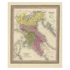
Old Antique Colourful Decorative Map of Northern Italy, 1846
Located in Langweer, NL
Description: Antique map titled 'Italy North Part'.
Old map of Northern Italy. This map originates from 'A New Universal Atlas Containing Maps of the various Empires, Kingdoms, S...
Category
Antique 19th Century Maps
Materials
Paper
$207 Sale Price
20% Off
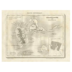
Antique Map of Guadeloupe and Dependencies – France Pittoresque, c. 19th Century
Located in Langweer, NL
Antique Map of Guadeloupe and Dependencies – France Pittoresque, c. 19th Century
This finely engraved antique map of Guadeloupe and its dependencies originates from France Pittore...
Category
Antique 19th Century Maps
Materials
Paper
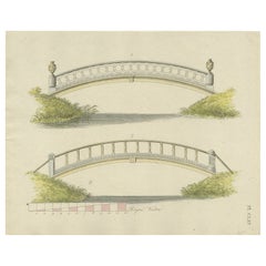
Antique Print of Garden Architecture showing a Garden Bridge by Van Laar, 1802
Located in Langweer, NL
Untitled print of garden architecture. It shows garden bridges. This print originates from 'Magazijn van tuin-sieraden'. The book is compiled by Gijsbert...
Category
Antique 19th Century Maps
Materials
Paper
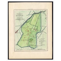
Dutch Municipality of Wedde in Groningen, Fehse, 1862
Located in Langweer, NL
These scarse detailed maps of Dutch Towns originate from the 'Gemeente atlas van de Provincie Groningen in 62 kaarten.' by C. Fehse. This atlas of all towns in Groningen, the Netherl...
Category
Antique 19th Century Maps
Materials
Paper
$113 Sale Price
20% Off
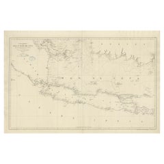
Large Chart of the island and sea of Java, Indonesia
Located in Langweer, NL
Antique map titled 'Carte Esférica de la Isla Y Mar de Java'. Large chart of the island and sea of Java, Indonesia. Beautiful nautical chart, published 1863 in Spain.
Category
Antique 19th Century Maps
Materials
Paper
$2,357 Sale Price
20% Off
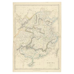
Antique Map of China, 1874
Located in Langweer, NL
Antique map titled 'China'. Detailed map of China originates from Blackie's 'The Comprehensive Atlas & Geography of the World'.
Artists and Engravers: ...
Category
Antique 19th Century Maps
Materials
Paper
$235 Sale Price
20% Off
Map of Southern Italy inlcluding Sardinia and Inset of the Bay of Naples, c.1860
Located in Langweer, NL
Antique map titled 'South Italy and the Island of Sardinia'.
Old map of Southern Italy and the island of Sardinia. With an inset map of the B...
Category
Antique 19th Century Maps
Materials
Paper
$320 Sale Price
20% Off
Antique Map of of Brazil, Paraguay and Uruguay
Located in Langweer, NL
Antique map titled 'Bresil Paraguay et Uruguay'. Fine steel engraved map of Brazil, Paraguay and Uruguay. Engraved by Leclercq and published by Armand Aubree in "Atlas Classique et U...
Category
Antique 19th Century Maps
Materials
Paper
$320 Sale Price
20% Off
1882 Map of the Pacific Ocean Highlighting Islands and Surrounding Regions
Located in Langweer, NL
This 1882 map of the Pacific Ocean, published by Blackie and Son as part of the 'Comprehensive Atlas and Geography of the World,' presents a detailed and fascinating overview of the ...
Category
Antique 19th Century Maps
Materials
Paper
Interesting Antique Print of Garden Architecture by Van Laar, 1802
Located in Langweer, NL
Untitled print of garden architecture. It shows a garden building. This print originates from 'Magazijn van tuin-sieraden'. The book is compiled by...
Category
Antique 19th Century Maps
Materials
Paper
$113 Sale Price
20% Off
Antique Map of Ille et Vilaine ‘France’ by V. Levasseur, 1854
Located in Langweer, NL
Antique map titled 'Dépt. d'Ille et Vilaine'. Map of the French department of Ille et Vilaine. France. Its coastal area is famous for its seafood, and especially its oysters. The reg...
Category
Antique 19th Century Maps
Materials
Paper
$169 Sale Price
20% Off
Antique Map of Germany and Switzerland by Lowry, '1852'
Located in Langweer, NL
Antique map titled 'Germany and Switzerland'. Four individual sheets of Germany and Switzerland. This map originates from 'Lowry's Table Atlas constructed and engraved from the most ...
Category
Antique 19th Century Maps
Materials
Paper
$235 Sale Price / set
20% Off
Set of two Antique Maps of the region of Oregon, Idaho, Wyoming, Nebraska & Iowa
Located in Langweer, NL
Set of two individual antique maps of part of the United States. It shows the region and surroundings of Oregon, Idaho, Wyoming, Nebraska, Iowa, Dakota and Wisconsin. Published as pa...
Category
Antique 19th Century Maps
Materials
Paper
$452 Sale Price / set
20% Off
Antique Lithography Map, South America, English, Framed, Cartography, Victorian
Located in Hele, Devon, GB
This is an antique lithography map of South America. An English, framed atlas engraving of cartographic interest by John Rapkin , dating to the early Victorian period and later, circ...
Category
British Early Victorian Antique 19th Century Maps
Materials
Wood
Dutch Antique Engraving with Coastal Views of Asia by Cook, 1803
Located in Langweer, NL
Antique print Asia titled 'Gezigt der Kust van Asiën'. Antique print depicting various coastal views of Asia including Kamchatka. Originates from 'Reizen Rondom de Waereld door James...
Category
Antique 19th Century Maps
Materials
Paper
$452 Sale Price
20% Off
Antique Map of China and Japan by Meyer, 1895
Located in Langweer, NL
Antique map titled 'China und Japan'. Map of China, Mongolia, Taiwan and Japan. With an inset map of Jiaozhou Wan near Qingdao, and another of the region around Hongkong, including Kanton and Macau, with small plans of Hong Kong and Kanton. This map originates from a 1885-1907 edition of a famous German encyclopedia titled 'Meyers grosses Konversations-Lexikon', published in Leipzig and Vienna. Meyers Konversations-Lexikon was a major German encyclopedia that existed in various editions from 1839 until 1984, when it merged with the Brockhaus encyclopedia. Several of the plates were also used in Dutch Encyclopedia's like Winkler Prins...
Category
Antique 19th Century Maps
Materials
Paper
$80 Sale Price
20% Off
Antique Map of Turkey in Asia by J. Tallis, circa 1851
Located in Langweer, NL
A highly decorative and finely engraved mid-19th century map of 'Turkey in Asia' (Middle Eastern part of the Ottoman Empire) which was engraved by J. Rapkin (vignettes by H. Warren &...
Category
Antique 19th Century Maps
Materials
Paper
$259 Sale Price
20% Off
Print of Tenggarong in East-Kalimantan on The Island of Borneo, Indonesia, 1881
Located in Langweer, NL
Antique print with a view of Tenggarong, Indonesia. This print originates from 'Reis in Oost- en Zuid-Borneo van Koetei naar Banjermassin (..)' by Carl Bock....
Category
Antique 19th Century Maps
Materials
Paper
$226 Sale Price
20% Off
1876 Antique Map of New York State with Niagara and Hudson River Insets
Located in Langweer, NL
Title: Detailed Map of New York State - 1876 by Samuel Augustus Mitchell Jr.
Description: This is a hand-colored map of the state of New York from 1876, created by Samuel Augustus ...
Category
Antique 19th Century Maps
Materials
Paper
$207 Sale Price
20% Off
Antique Map of North and Central America by Migeon '1880'
By J. Migeon
Located in Langweer, NL
Antique map titled 'Amérique Septentrionale'. Old map of North and Central America. With a decorative vignette of the Niagara Falls. This map originates from 'Géographie Universelle ...
Category
French Antique 19th Century Maps
Materials
Paper
$141 Sale Price
20% Off
Old Hand-Colored Print of the Guards of the King of France, 1890
Located in Langweer, NL
Antique print titled 'Gardes-du-Crops du Roi'.
Old print of the Guards of the King of France. This print originates from 'Histoire de la maison militaire du roi de 1814 à 1830 : ...
Category
Antique 19th Century Maps
Materials
Paper
$179 Sale Price
20% Off
Antique Map of Europe from an Old Dutch School-Atlas, 1852
Located in Langweer, NL
Antique map titled 'Europa'. Map of Europe. This map originates from 'School-Atlas van alle deelen der Aarde' by Otto Petri.
Artists and Engravers: Published by A. Baedeker (Otto...
Category
Antique 19th Century Maps
Materials
Paper
$132 Sale Price
20% Off
1849 Hand-Colored Map of Fort Smith to Santa Fe Route, Detailing Trails & Camps
Located in Langweer, NL
Map Title: Map, No. 3, Showing Continuation of Details of Fort Smith and Santa Fe Route, from Mounds Near the 100½ Degree of W. Longitude to Tucumcari Creek
Cartographer: James H....
Category
Antique 19th Century Maps
Materials
Paper
$396 Sale Price
20% Off
Antique Map of Southeast Asia by Larousse, 1897
Located in Langweer, NL
"Front: 'Carte Generale des Indes.' (General map of India / The Indies / Thailand / Malaysia). Rear: 'Empire des Indes.' (India; artefacts, architecture, design, ornaments).' This li...
Category
Antique 19th Century Maps
Materials
Paper
$70 Sale Price
20% Off
Antique Map of French Colonies – La France, 19th Century
Located in Langweer, NL
Title: Antique Map of French Colonies – La France, 19th Century
Description: This antique 19th-century map, titled La France, presents a detailed depiction of France’s overseas c...
Category
Antique 19th Century Maps
Materials
Paper
Antique Map of Asia, 1846
Located in Langweer, NL
Antique map titled 'Asie'. Original antique map of Asia. Source unknown, to be determined.
Artists and Engravers: Alexandre Vuillemin (1812-188...
Category
Antique 19th Century Maps
Materials
Paper
$73 Sale Price
20% Off
Antique Map of Northern Germany and the Netherlands – circa 1806
Located in Langweer, NL
Title: Antique Map of Northern Germany and the Netherlands – circa 1806
Description: This finely engraved antique map, titled L'Allemagne 1re Feuille, depicts the northern regions...
Category
Antique 19th Century Maps
Materials
Paper
Original Large Antique Map of Paris, France by John Dower, 1861
Located in St Annes, Lancashire
Fabulous monochrome map of Paris.
Vignettes of St Germain En Laye, Saint Cloud, Versailles and Fontainbleau.
Unframed.
Drawn by J.Dower.
Lithography by Weller. 4 sheets joined to...
Category
English Victorian Antique 19th Century Maps
Materials
Paper
Antique Print of a Malayan Houses in Sumatra, Indonesia, 1881
Located in Langweer, NL
Antique print with a view of the place of the Sultan of Koetai and a Malayan house in Sumatra. This print originates from 'Reis in Oost- en Zuid-Borneo van Koetei naar Banjermassin (..)' by Carl Bock...
Category
Antique 19th Century Maps
Materials
Paper
$245 Sale Price
20% Off
Two Men in Civilian & Military Outfit from Cochinchine or Southern Vietnam, 1830
Located in Langweer, NL
Antique print titled 'Cochinchine'. Two portaits of Vietnamese men one showing in military attire and the second in civilian dress.
Cochinchina or Cochin-China is a historical ex...
Category
Antique 19th Century Maps
Materials
Paper
$612 Sale Price
20% Off
Antique Map of Brazil, Uruguay, Paraguay and Guyana by A & C. Black, 1870
Located in Langweer, NL
Antique map titled 'Brazil'. Original antique map of Brazil, Uruguay, Paraguay and Guyana. This map originates from ‘Black's General Atlas of The...
Category
Antique 19th Century Maps
Materials
Paper
$165 Sale Price
20% Off
Old Map of the French Department of Nièvre, France
Located in Langweer, NL
Antique map titled 'Dept. de la Nièvre'. Map of the French department of Nievre, France. Part of the prestiegous Burgundy or Bourgogne wine region this area is known for its producti...
Category
Antique 19th Century Maps
Materials
Paper
$320 Sale Price
20% Off
1882 Map of Queensland, New South Wales, and Victoria with Detailed Features
Located in Langweer, NL
This 1882 map of Queensland, New South Wales, and Victoria, published by Blackie and Son as part of the 'Comprehensive Atlas and Geography of the World,' provides a detailed depictio...
Category
Antique 19th Century Maps
Materials
Paper
Antique Map of the Black Sea by Perthes, 1848
Located in Langweer, NL
Antique map titled 'Pontus Euxinus'. Old map of the Black Sea and surroundings originating from 'Orbis Terrarum Antiquus in usum Scholarum'. Artists and Engravers: Published by Justu...
Category
Antique 19th Century Maps
Materials
Paper
$93 Sale Price
20% Off
Antique Map of China and Japan, with Frame Style Border
Located in Langweer, NL
Antique map titled 'Empires Chinois et Japonnais'. Attractive map of China and Japan. This map originates from Maison Basset's 1852 edition of 'Atlas Illustre Destine a l'enseignemen...
Category
Antique 19th Century Maps
Materials
Paper
$160 Sale Price
20% Off
1880 Map of the Caribbean and Central America by Adolf Stieler
Located in Langweer, NL
This is a detailed map titled "West-Indien und Central-Amerika," created by Adolf Stieler and published in Gotha in 1880. The map covers the Caribbean islands and the Central America...
Category
Antique 19th Century Maps
Materials
Paper
$273 Sale Price
20% Off
Large Original Antique City Plan of Detroit, USA, 1894
Located in St Annes, Lancashire
Fabulous colorful map of Detroit
Original color
By Rand, McNally & Co.
Published, 1894
Unframed
Free shipping.
Category
American Antique 19th Century Maps
Materials
Paper
Original Antique Print of Crimean Costumes, Russia & Ukraine, ca.1880
Located in Langweer, NL
Antique print titled 'Die Krim - Trachten'.
Original antique print of Crimean costumes. Source unknown, to be determined.
Artists and Engravers: Anonymous.
Category
Antique 19th Century Maps
Materials
Paper
$122 Sale Price
20% Off
Rare Antique Map with Timor and Nearby Islands Plus an Inset of Hawaii, 1825
Located in Langweer, NL
Antique map titled 'Essai sur la Geographie de l'Ile Timor.'
A map showing Timor and the surrounding nearby islands (Floris, Sabrao, Solor, Lomblem, Panter, Ombai and Wetter. Wit...
Category
Antique 19th Century Maps
Materials
Paper
$801 Sale Price / set
20% Off
Antique Map of the West Indies and Central America by Lowry '1852'
Located in Langweer, NL
Antique map titled 'West Indies and Central America'. Original map of the West Indies and Central America. This map originates from 'Lowry's Table Atlas constructed and engraved from...
Category
Antique 19th Century Maps
Materials
Paper
$94 Sale Price
20% Off
Antique Map of the Region of Hokkaido, Island of Japan, 1812
Located in Langweer, NL
Antique map titled 'Karte von Jesso und Sagalien'. Old map of the region of the island of Yesso (Mororan, Hokkaido, Japan). This map originates from Volume 38 of 'Allgemeine geograph...
Category
Antique 19th Century Maps
Materials
Paper
Large Original Antique Map of California, USA, circa 1900
Located in St Annes, Lancashire
Fabulous map of California
Original color
Engraved and printed by the George F. Cram Company, Indianapolis.
Published, circa 1900
Unframed
Free shipping.
Category
American Antique 19th Century Maps
Materials
Paper
Antique Woodblock Print Map of Japan 'circa 1860'
Located in Langweer, NL
Original Japanese woodblock print map of Japan. Very large and fascinating map, rebacking with Japanese paper. Published circa 1860.
Category
Antique 19th Century Maps
Materials
Paper
$2,209 Sale Price
25% Off
Antique Map of North America by Johnson, '1872'
Located in Langweer, NL
Antique map titled 'Johnson's North America'. Original map of North America, with an inset map of the Hawaiian group or Sandwich Islands. This map originates from 'Johnson's New Illu...
Category
Antique 19th Century Maps
Materials
Paper
$377 Sale Price
20% Off
1882 Map of France Highlighting Political Boundaries, Cities, Insets of Corsica
Located in Langweer, NL
This 1882 map of France, published by Blackie and Son as part of the 'Comprehensive Atlas and Geography of the World,' offers a detailed depiction of the country during the late 19th...
Category
Antique 19th Century Maps
Materials
Paper
Antique Print of Jacobite Drinking Glasses by Gibb, 1890
Located in Langweer, NL
Antique print titled 'Three Jacobite drinking glasses'. Chromolithographic plate originating from 'The Royal House of Stuart. Illustrated By ...
Category
Antique 19th Century Maps
Materials
Paper
$80 Sale Price
20% Off
Antique Lithography Map, Cumberland, English, Framed, Cartography, Victorian
Located in Hele, Devon, GB
This is an antique lithography map of Cumberland. An English, framed atlas engraving of cartographic interest, dating to the mid 19th century and la...
Category
British Victorian Antique 19th Century Maps
Materials
Wood
Old German Antique Map of Iran and Arabia, 1866
Located in Langweer, NL
Antique map titled 'Vorder-Asien oder Iran, Turan, Arabien, Kleinasien und die Kaukasus Länder'. Large map centered on Iran. It shows the area from Turkey to Mumbai in India. Include...
Category
Antique 19th Century Maps
Materials
Paper
$235 Sale Price
20% Off
Antique Zoological Map, 1843
Located in Langweer, NL
Two antique world maps on one sheet. The upper map shows the distribution of animals over the world. The lower map shows the distribution of birds & reptiles over the world. Originat...
Category
Antique 19th Century Maps
Materials
Paper
$207 Sale Price
20% Off
North & Central Africa & Arabia, Inset Map of Habesch 'Ethiopia & Eritrea', 1845
Located in Langweer, NL
Antique map titled 'Mittel- und Nord-Africa (östl. Theil) und Arabien'.
This map depicts North and Central Africa and Arabia with an inset map of Habesch (Ethiopia and Eritrea).
...
Category
Antique 19th Century Maps
Materials
Paper
$226 Sale Price
20% Off
Antique Map of Haut-Rhin, France by V. Levasseur, 1854
Located in Langweer, NL
Antique map titled 'Dépt. du Haut Rhin'. Map of the French department of Haut-Rhin, France. This mountainous area is part of the Alsace wine region and is known for its production of...
Category
Antique 19th Century Maps
Materials
Paper
$141 Sale Price
20% Off
Antique Lithography Map, West Africa, English, Framed, Cartography, Victorian
Located in Hele, Devon, GB
This is an antique lithography map of Western Africa. An English, framed atlas engraving of cartographic interest by John Rapkin, dating to the early Victorian period and later, circ...
Category
British Early Victorian Antique 19th Century Maps
Materials
Wood
Antique Map of Central Asia between the Caspian Sea and Lake Balkhash
Located in Langweer, NL
Antique map titled 'Independent Tartary'. Original steel engraved map of Central Asia. It covers the regions between the Caspian Sea and Lake Balkhash and between Russia and Afghanis...
Category
Antique 19th Century Maps
Materials
Paper
$546 Sale Price
20% Off
Hand-Colored Print of Corporal Punishment with a Cangue (or Tcha), China, 1844
Located in Langweer, NL
Antique print titled 'Chine - Supplice du Tcha ou Kangue'.
View of corporal punishment with a cangue (or tcha). The cangue is a device that was...
Category
Antique 19th Century Maps
Materials
Paper
$169 Sale Price
20% Off
Antique Map of Egypt and Abyssinia by W. G. Blackie, 1859
Located in Langweer, NL
Antique map titled 'Egypt and Abyssinia'. Original antique map of Egypt and part of Nubia and Nubia with Abyssinia. This map originates from ‘The Imperial Atlas of Modern Geography’....
Category
Antique 19th Century Maps
Materials
Paper
$235 Sale Price
20% Off
Antique Map of Asia by Wyld '1845'
Located in Langweer, NL
Antique map titled 'Asia'. Original antique map of Asia. This map originates from 'An Atlas of the World, Comprehending Separate Maps of its Variou...
Category
Antique 19th Century Maps
Materials
Paper
$188 Sale Price
20% Off
Antique Plan of Turkey in Europe with Inset Map of the Bosporus, ca.1850
Located in Langweer, NL
Antique map titled 'Turkey in Europe'.
A map of European Turkey and the surrounding countries. With an inset map of the Bosporus. This includes Macedonia, Bulgaria, Croatia, Bosn...
Category
Antique 19th Century Maps
Materials
Paper
$207 Sale Price
20% Off
Hand Colored Antique Map of the Department of Haute-Vienne, France
Located in Langweer, NL
Antique map titled 'Dépt. de l'Ariège'. Map of the French department of Haute-Vienne, France. Haute-Vienne is home to the commune of Limoge, which makes oak barrels used...
Category
Antique 19th Century Maps
Materials
Paper
$320 Sale Price
20% Off
Circa 1802 Map of the Troad Region by Tardieu – From the Voyage de la Troade
Located in Langweer, NL
This is a large fold-out map titled *Carte de la Troade*, measuring approximately 53.5 x 68 cm, engraved by Tardieu, and extracted from the atlas of *Voyage de la Troade, fait dans l...
Category
Antique 19th Century Maps
Materials
Paper
$235 Sale Price
20% Off
Large Original Antique Map of The State of Washington, USA, 1894
Located in St Annes, Lancashire
Fabulous map of Washington.
Original color.
By Rand, McNally & Co.
Published, 1894.
Unframed.
Free shipping.
Category
American Antique 19th Century Maps
Materials
Paper
