19th Century Maps
to
1,669
2,205
75
2,283
72
9
9
4
2
2
1
1
2,936
2,283
475
3
290
34
10
126
10
37
9
2
5
4
3
3
2,245
71
33
13
11
352
175
107
106
102
2,283
2,283
2,283
104
23
9
8
7
Period: 19th Century
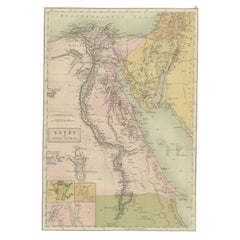
Antique Map of Egypt and Arabia Petraea by A & C. Black, 1870
Located in Langweer, NL
Antique map titled 'Egypt and Arabia Petraea'. Original antique map of Egypt and Arabia Petraea. This map originates from ‘Black's General Atlas of The World’. Published by A & C. Bl...
Category
Antique 19th Century Maps
Materials
Paper
$144 Sale Price
30% Off
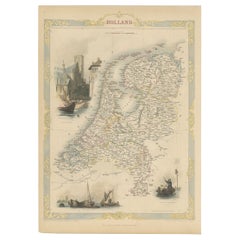
Antique Map of Holland with Colorful Vignettes, 1851
Located in Langweer, NL
Antique map titled 'Holland'.
Decorative map of Holland. Includes vignettes of Rotterdam, Dutch Peasants and a boating scene on the Dort, the Netherlands.
Originates from 'Th...
Category
Antique 19th Century Maps
Materials
Paper
$156 Sale Price
20% Off
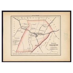
Original Antique Map of the Township of Winschoten in The Netherlands, 1862
Located in Langweer, NL
Groningen: Gemeente Winschoten-St. Vitus Holt. These scarse detailed maps of Dutch Towns originate from the 'Gemeente atlas van de Provincie Groningen in 62 kaarten.' by C. Fehse. Th...
Category
Antique 19th Century Maps
Materials
Paper
$152 Sale Price
20% Off
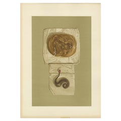
Antique Print of a Lock of Hair by Gibb, 1890
Located in Langweer, NL
Antique print titled 'Lock of Hair of Mary Queen of Scots - Lock of Hair of King Charles I'. Chromolithographic plate originating from 'The Royal House of...
Category
Antique 19th Century Maps
Materials
Paper
$80 Sale Price
20% Off
Large Antique County Map of Middlesex, England
Located in Langweer, NL
Antique map titled 'A Map of Middlesex from the best Authorities'. Original old county map of Middlesex, England. Engraved by John Cary. Originates from 'New British Atlas' by John S...
Category
Antique 19th Century Maps
Materials
Paper
$266 Sale Price
20% Off
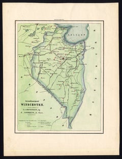
Antique Map of the Region of Winschoten, Groningen in The Netherlands, 1862
Located in Langweer, NL
Groningen: Gemeente Arrondisement Winschoten. These scarse detailed maps of Dutch Towns originate from the 'Gemeente atlas van de Provincie Groningen in 62 kaarten.' by C. Fehse. Thi...
Category
Antique 19th Century Maps
Materials
Paper
$180 Sale Price
20% Off
Antique Map of Siberia by Lapie, 1842
Located in Langweer, NL
Antique map titled 'Carte de la Sibérie ou Russie d'Asie'. Map of Siberia. This map originates from 'Atlas universel de géographie ancienne et moderne (..)' by Pierre M. Lapie and Al...
Category
Antique 19th Century Maps
Materials
Paper
$332 Sale Price
20% Off
Maps of the Ancient World and the Posterity of Noah, 1820
Located in Langweer, NL
Two maps on one sheet. Hhand colored engraved lithograph, depicting the world as known to the Ancients on Mercator's projection and the Posterity of Noah. The first showns the Empire...
Category
Antique 19th Century Maps
Materials
Paper
$237 Sale Price
20% Off
Old Print from Capt. Cooks Travels with Boats and a Ship in the South Sea, 1803
Located in Langweer, NL
Antique print titled 'Gezigt van eenen grooten Ys-klomp drijvende in de Zuid-Zee 9. jan. 1773'.
Antique print depicting boats and a ship near ice islands. Originates from 'Reizen...
Category
Antique 19th Century Maps
Materials
Paper
$304 Sale Price
20% Off
Antique Map of the Eastern Part of Germany, with Parts of Poland and Slovakia
Located in Langweer, NL
Antique map titled 'A New Map of the Circle of Upper Saxony: with the Duchy of Silesi and Lusatia, from the latest authorities'. Clear and accurate map of what is now the eastern par...
Category
Antique 19th Century Maps
Materials
Paper
$418 Sale Price
20% Off
Original Antique Map of the Township of Borger in The Netherlands, 1865
Located in Langweer, NL
Drenthe - Gemeente Borger, Drouwen, Buinene, Westdorp. These scarse detailed maps of Dutch Towns originate from the 'Gemeente-atlas' of Jacob Kuyper. This atlas of all towns in the N...
Category
Antique 19th Century Maps
Materials
Paper
$171 Sale Price
20% Off
Antique Map of the Extension of the Russian Empire in the XIXth Century, 1806
Located in Langweer, NL
Antique map titled 'L'Empire Russe en Europe et en Asie'.
Map showing the extension of the Russian Empire at the beginning of the XIXth century. Several letterpress notations are...
Category
Antique 19th Century Maps
Materials
Paper
$532 Sale Price
20% Off
Antique Map of England and Wales, Also Including the Isle of Man
Located in Langweer, NL
Antique map titled 'England'. Original antique map of England and Wales from Northumberland to Cornwall from the St. George Channel east as far as the Strait of Dover. The Isle of Ma...
Category
Antique 19th Century Maps
Materials
Paper
$370 Sale Price
20% Off
Antique Map of the City of Berlin in Germany, '1847'
Located in Langweer, NL
Antique map titled 'Berlin'. Original antique map of the city of Berlin, Germany. This map originates from 'Abrégé de Géographie (..)' by Adrien Balbi. Published 1847.
Category
Antique 19th Century Maps
Materials
Paper
$142 Sale Price
20% Off
Antique Print with Coastal Views of Kamchatka in Russia by Cook, 1803
Located in Langweer, NL
Antique print Russia titled 'Gezigten der Kust van Kamtchatka'. Print with coastal views of Kamchatka including volcanoes. Originates from 'Reizen...
Category
Antique 19th Century Maps
Materials
Paper
$275 Sale Price
20% Off
Antique Map of the State of Ohio by Titus '1871'
Located in Langweer, NL
Antique map titled 'Railroad & Township Map of the State of Ohio'. Original antique map of the State of Ohio. This map originates from 'Atlas of Preble County Ohio' by C.O. Titus. Pu...
Category
Antique 19th Century Maps
Materials
Paper
$1,069 Sale Price
25% Off
Antique Print of the Palace of Justice in Leeuwarden by Terwen, 1858
Located in Langweer, NL
Antique print titled 'Leeuwarden. Het Paleis van Justitie.' Old print of the city of Leeuwarden showing the Palace of Justice. This print originates from 'Het koningrijk der Nederlan...
Category
Antique 19th Century Maps
Materials
Paper
1850 Old French Map Depicting the Entire Earth's Surface Divided into Two Parts
Located in Milan, IT
Geographical map depicting the entire earth's surface divided into two parts that correspond to the two hemispheres or globes, the map deals with the earth in general. Detailed expla...
Category
French Antique 19th Century Maps
Materials
Glass, Wood, Paper
Antique Map of Peru and Bolivia by Thierry, 1836
Located in Langweer, NL
Antique map titled 'Pérou et Bolivia'. Decorative map of Peru and Bolivia with outline coloring. Originates from 'Atlas Complet Du Precis De La Geographie ...
Category
Antique 19th Century Maps
Materials
Paper
$123 Sale Price
20% Off
Antique French Map of the Pacific Ocean with Australia and Polynesia, 1806
Located in Langweer, NL
Antique map titled 'Australasie et Polynesie'. Old map of Oceania and the Pacific Ocean. Originates from 'Atlas Portatif contenant la Géographie Universelle Ancienne et Moderne' by H...
Category
Antique 19th Century Maps
Materials
Paper
$114 Sale Price
20% Off
Antique Map of Ijlst , Friesland in the Netherlands, 1865
Located in Langweer, NL
Friesland: Gemeente IjJlst. These scarse detailed maps of Dutch Towns originate from the 'Gemeente-atlas' of Jacob Kuyper. This atlas of all towns in the Netherlands was published fr...
Category
Antique 19th Century Maps
Materials
Paper
$180 Sale Price
20% Off
Antique Lithograph of a Japanese Junk, a Type of Sailing Ship, 1856
Located in Langweer, NL
Antique print titled ‘Japanese Junk'.
Lithograph of a Japanese junk, a type of sailing ship. This print originates from 'Narrative of the expedition of an A...
Category
Antique 19th Century Maps
Materials
Paper
$361 Sale Price
20% Off
Original Antique Map of Northern India
Located in Langweer, NL
Antique map titled 'India. Northern Part'. Original antique map of Northern India. Drawn and engraved by J. Archer. Publishes by H.G. Collins, ci...
Category
Antique 19th Century Maps
Materials
Paper
$323 Sale Price
20% Off
Antique Map of the French Colonies in Senegal and Madagascar by V. Levasseur
Located in Langweer, NL
The antique map titled 'Colonies Françaises (en Afrique)' presents a decorative depiction of the French colonies located in Senegal and Madagascar within Africa. Surrounding the map ...
Category
Antique 19th Century Maps
Materials
Paper
$190 Sale Price
20% Off
Antique Lithography Map, Gloucestershire, English, Framed Engraving, Cartography
Located in Hele, Devon, GB
This is an antique lithography map of Gloucestershire. An English, framed atlas engraving of cartographic interest, dating to the mid 19th century ...
Category
British Victorian Antique 19th Century Maps
Materials
Wood
Antique Map of Western Russia by Levasseur, '1875'
Located in Langweer, NL
Antique map titled 'Carte de la Russie Occidentale (..)'. Large map of Western Russia. This map originates from 'Atlas de Géographie Moderne Physique et Politique' by A. Levasseur. P...
Category
Antique 19th Century Maps
Materials
Paper
$332 Sale Price
20% Off
Antique Map of Moldova to Thessaly and from the Adriatic to the Black Sea, 1880
Located in Langweer, NL
Antique map titled 'Turquie d'Europe'.
Map of the european parts of Turkey. The map covers from Moldova to Thessaly and from the Adriatic to the Black Sea. Greece and the island ...
Category
French Antique 19th Century Maps
Materials
Paper
Antique Print of the Interior of Lund Cathedral by Sandberg, c.1864
Located in Langweer, NL
Antique print titled 'Choret I Lunds Domkyrka'. View of the interior of Lund Cathedral (Swedish: Lunds domkyrka), a cathedral of the Lutheran Church of Sweden in Lund, Scania, Sweden...
Category
Antique 19th Century Maps
Materials
Paper
$61 Sale Price
20% Off
Antique Map of Kollumerland, a Township in Friesland, The Netherlands, 1868
Located in Langweer, NL
Antique map titled 'Provincie Friesland - Gemeente Kollumerland en Nieuw-Kruisland'.
Map of the township of Kollumerland including Kollum, Westergeest, Burum and many other villa...
Category
Antique 19th Century Maps
Materials
Paper
$123 Sale Price
20% Off
Antique Print of the Ophthalmology Hospital in Utrecht, the Netherlands, 1859
Located in Langweer, NL
Antique print titled 'Nederlandsch Gasthuis voor behoeftige en minvermogende ooglijders'. Lithograph of the Ooglijdersgasthuis in Utrecht, a former ophthalmology hospital. This print...
Category
Antique 19th Century Maps
Materials
Paper
$185 Sale Price
20% Off
Old Map of the French Department of Loiret, France
Located in Langweer, NL
Antique map titled 'Dépt. du Loiret'. Map of the French department of Loiret, France. Surrounding the city of Orleans, Loiret is considered the heart of France and is a registered Unesco World Heritage Site. This area of France is also part of the Loire Valley wine region, and is especially known for its production of Pinot Noirs...
Category
Antique 19th Century Maps
Materials
Paper
$323 Sale Price
20% Off
Antique Map of the Netherlands and Belgium, circa 1880
Located in Langweer, NL
Antique map titled 'Hollande et Belgique'. Old map of the Netherlands and Belgium. With decorative vignette of the Antwerp cathedral. This map o...
Category
Antique 19th Century Maps
Materials
Paper
$180 Sale Price
20% Off
Antique Map of South America, Southern Part, 1882
Located in Langweer, NL
Antique map titled 'South America'. Old map of South America. This map originates from 'The Royal Atlas of Modern Geography, Exhibiting, in a Series of Entirely Original and Authenti...
Category
Antique 19th Century Maps
Materials
Paper
Antique Map of the Coast of Guinea, Africa, 1820
Located in Langweer, NL
Antique map Africa titled 'Carte de la Haute et de la Basse Guinée'. Map of the Coast of Guinea, Africa. Represents modern day Liberia, Ivory Coast, Ghana, Nigeria, Cameroon, Gabon, Congo, and Equatorial Guinea...
Category
Antique 19th Century Maps
Materials
Paper
Old Map of the French Department of Indre, France
Located in Langweer, NL
Antique map titled 'Dept. de l'Indre'. Map of the French department of Indre, France. Part of the Loire Valley wine region, this area is known for its production of Chinon wines, typically red, and production of Pouligny-Saint-Pierre, goats'-milk cheese. It is also the birthplace of the great philosopher Rene Descartes...
Category
Antique 19th Century Maps
Materials
Paper
$323 Sale Price
20% Off
Antique Map of France Showing Post-Napoleonic Departments, 1816
Located in Langweer, NL
Antique map of France titled 'France divided into departments'. Detailed map of France, colored by post-Napoleonic Departments. With an inset map of Corsica...
Category
Antique 19th Century Maps
Materials
Paper
$266 Sale Price
20% Off
Antique Print of Reims Cathedral by Knight, 1835
Located in Langweer, NL
Antique print titled 'West Front of the Cathedral at Rheims'. Old print of Reims Cathedral, a Roman Catholic cathedral in the French city of the same n...
Category
Antique 19th Century Maps
Materials
Paper
$75 Sale Price
20% Off
Hand Colored Antique Map of the department of Finistère, France
Located in Langweer, NL
Antique map titled 'Dépt. du Finistère'. Map of the French department of Finistere, Brittany, France. This area of France is known for its cider production and excellent boar hunting...
Category
Antique 19th Century Maps
Materials
Paper
$323 Sale Price
20% Off
Antique Print of a Ship Near the Coast of Sumatra, Indonesia, c.1845
Located in Langweer, NL
Antique print titled 'Gezigt aan de Westkust van Sumatra - Vue de la Côte Occidentale de Sumatra'. Lithograph on chine collé with a view of a ship near the coast of Sumatra, Indonesi...
Category
Antique 19th Century Maps
Materials
Paper
$399 Sale Price
20% Off
Original Antique Map of Peru in South America, 1875
Located in Langweer, NL
Antique map titled 'Carte générale du Pérou'. Large map of Peru. This map originates from 'Atlas de Géographie Moderne Physique et Politique' by A. Levasse...
Category
Antique 19th Century Maps
Materials
Paper
$332 Sale Price
20% Off
Antique Map of Eastern Europe, Incl Montenegro & Serbia & a Budapest Map, 1890
Located in Langweer, NL
Antique map titled 'Osterreich-Ungarn in 4 Blattern, Blatt 4.'
Map of Eastern Europe, with Montenegro in the lower left corner, the southern ...
Category
Antique 19th Century Maps
Materials
Paper
Antique Map of Part of Borneo 'Kalimantan' Indonesia by Vandermaelen, C.1825
Located in Langweer, NL
Antique map titled 'Partie de l'Ile de Bornéo'. Map of a portion of Borneo, showing Magidara Unsung, Isles Soulous, Mandren and Candepan, along with many other places in the area. Or...
Category
Antique 19th Century Maps
Materials
Paper
$589 Sale Price
20% Off
Antique Colourful Antique Map of Spain and Portugal, 1815
Located in Langweer, NL
Antique map of Spain and Portugal. Thomson's map includes both countries in full, with Spain being divided into its various semi-autonomous provin...
Category
Antique 19th Century Maps
Materials
Paper
$275 Sale Price
20% Off
Antique Map of the Township of Smilde, Drenthe in the Netherlands, 1865
Located in Langweer, NL
Drenthe: Gemeente Smilde, Bovensmilde, Hoogersmilde. These scarse detailed maps of Dutch Towns originate from the 'Gemeente-atlas' of Jacob Kuyper. This atlas of all towns in the Net...
Category
Antique 19th Century Maps
Materials
Paper
$180 Sale Price
20% Off
Antique Map the Windward or South Caribbean Islands and Guiana, 1859
Located in Langweer, NL
Antique map titled 'The Windward or South Caribbean Islands'. Original antique map of South Caribbean Islands. This map originates from ‘The Imperial Atlas of Modern Geography’. Published by W. G. Blackie, 1859.
The Windward Islands, also known as the Islands of Barlovento, are the southern, generally larger islands of the Lesser Antilles. Part of the West Indies, they lie south of the Leeward Islands...
Category
Antique 19th Century Maps
Materials
Paper
$247 Sale Price
20% Off
Antique Physical Map of the World by Reynolds, 1849
Located in Langweer, NL
Antique physical map of the world, showing the discoveries of the most eminent modern geographers. Originates from 'Geographical Diagrams '.
Artists and Engravers: Published by J...
Category
Antique 19th Century Maps
Materials
Paper
$266 Sale Price
20% Off
Antique Map of the British Isles by Delamarche, 1806
Located in Langweer, NL
Antique map titled 'Les Isles Britanniques.' Decorative map of the British Isles by Robert de Vaugondy, revised and published by Delamarche. Source unkno...
Category
Antique 19th Century Maps
Materials
Paper
$142 Sale Price
20% Off
Antique German Print of Macau or Macao in Asia, Published Around 1800
Located in Langweer, NL
Description: Antique print China titled 'Ansicht der Stadt Macao von der See Seite'. Miniature view of the city of Macao/Macau, China. The scene il...
Category
Antique 19th Century Maps
Materials
Paper
$152 Sale Price
20% Off
Antique Map of Nebraska
Located in Langweer, NL
Antique map titled 'Nebraska'. Original antique map of Nebraska, United States. This print originates from 'Encyclopaedia Britannica', Ninth Edition. Pu...
Category
Antique 19th Century Maps
Materials
Paper
$275 Sale Price
20% Off
Antique Map of Surinam by Stedman '1813'
Located in Langweer, NL
Antique map titled 'A Map of Surinam'. Original antique map of Surinam, showing Dutch settlements, military posts, rebel Maroon camps and native villages. This map originates from 'N...
Category
Antique 19th Century Maps
Materials
Paper
$475 Sale Price
20% Off
Antique Print of a Cap and Glove by Gibb, 1890
Located in Langweer, NL
Antique print titled 'Skull Cap of King Charles I - Glove of King Charles I'. Chromolithographic plate originating from 'The Royal House of Stuart. Illustrated by a Series of Forty P...
Category
Antique 19th Century Maps
Materials
Paper
$80 Sale Price
20% Off
Antique Map of Bavaria and Salzburg by Cary, 1811
By John Cary
Located in Langweer, NL
Antique map titled 'A New Map of the Circle of Bavaria'. Antique map of Bavaria and Salzburg, Germany. Covers the Duchy of Bavaria and the mountainous A...
Category
Antique 19th Century Maps
Materials
Paper
$237 Sale Price
20% Off
Beautiful Antique Print of Garden Architecture by Van Laar, 1802
Located in Langweer, NL
Untitled print of garden architecture. It shows a garden building.
This print originates from 'Magazijn van tuin-sieraden'. The book is compile...
Category
Antique 19th Century Maps
Materials
Paper
$123 Sale Price
20% Off
Handcolored Antique Print of the Marine Administration of the Belgium Army, 1833
Located in Langweer, NL
One nicely hand coloured print of an original serie of 23 plates, showing marine officers and soldiers discussing matters on the seaside. published in 1833. Rare.
From a serie of beautiful lithographed plates with Belgian military costumes after Madou and printed by Dero-Becker. Comes from a Belgian military costume album, dedicated to the Belgian King, and financed by subscribers, some 90 Belgian nobility and officers of the Belgian Army...
Category
Antique 19th Century Maps
Materials
Paper
$209 Sale Price
20% Off
Antique Print of Garden Architecture by Van Laar, 1802
Located in Langweer, NL
Untitled print of garden architecture. It shows garden buildings. This print originates from 'Magazijn van tuin-sieraden'. The book is compiled by Gijsbert van Laar, providing a surv...
Category
Antique 19th Century Maps
Materials
Paper
Original Antique Map of the State of New Jersey Published in France
Located in Langweer, NL
Original antique map titled 'Carte Géographique Statistique et Historique du New-Jersey'. One of the earliest obtainable maps of the State of New Jersey published outside of the Unit...
Category
Antique 19th Century Maps
Materials
Paper
$190 Sale Price
20% Off
Hand Colored Antique Map of the department of Lozere, France
Located in Langweer, NL
Antique map titled 'Dept. de la Lozère'. Map of the French department of Lozere, France. This remote mountainous part of Languedoc is rural, sparcely populated, and extremely beautif...
Category
Antique 19th Century Maps
Materials
Paper
$323 Sale Price
20% Off
Antique Map of the Township of Vries in the Dutch Province of Drenthe, 1865
Located in Langweer, NL
Drenthe: Gemeente Vries, Bunne, Donderen, Tijnaarloo, Zeijen. These scarse detailed maps of Dutch Towns originate from the 'Gemeente-atlas' of Jacob Kuyper. This atlas of all towns i...
Category
Antique 19th Century Maps
Materials
Paper
$133 Sale Price
20% Off
Antique Map of Northwestern India by Weller, 1857
Located in Langweer, NL
Antique map titled 'India, The North West Provinces and Oude'.Detailed map of the northwestern part of India, extending to the Himalaya Mountains. Shows part of Nepal including Dharm...
Category
Antique 19th Century Maps
Materials
Paper
Old Map of the Black Sea, The Krim, Ukraine, Russia, etc in Historic Times, 1848
Located in Langweer, NL
Antique map titled 'Pontus Euxinus'. Old map of the black Sea and surroundings originating from 'Orbis Terrarum Antiquus in usum Scholarum'.
Artists and Engravers: Published by J...
Category
Antique 19th Century Maps
Materials
Paper
$228 Sale Price
20% Off
