19th Century Maps
to
1,667
2,202
75
2,280
71
9
9
4
2
2
1
1
2,969
2,280
474
3
290
34
10
126
10
37
9
2
5
4
3
3
2,242
70
32
13
11
358
175
108
106
102
2,280
2,280
2,280
104
23
9
8
7
Period: 19th Century
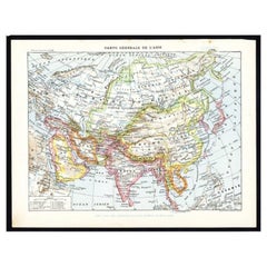
Antique Map of Asia by Larousse, 1897
Located in Langweer, NL
Front: 'Carte Generale de l'Asie.' (General map of Asia). Rear: 'Asie.' (Asia, scenes of Asia, nature, plants and animals, people, costume).' This rare early lithographic print origi...
Category
Antique 19th Century Maps
Materials
Paper
$71 Sale Price
20% Off
Antique Map of the Strait of Le Maire Between Terra Fuego & Staten Island, 1803
Located in Langweer, NL
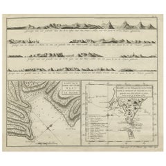
Antique map titled 'Kaart van de Good Success Baai in de Straat van Le Maire (..)'.
Antique map of the Strait of Le Maire between Terra Fuego and Staten Island. On top, various c...
Category
Antique 19th Century Maps
Materials
Paper
$600 Sale Price
20% Off
Antique Map of the Region of Wakayama, Nara and Osaka 'Japan'
Located in Langweer, NL
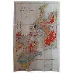
Geological folding map of the area with Wakayama, Nara, Osaka, Mie, and Shiga in Japan, circa 1880:
This map is a geological folding map, which means it was designed to be portable ...
Category
Antique 19th Century Maps
Materials
Linen, Paper
$905 Sale Price
20% Off
Antique Map of South America by Balbi '1847'
Located in Langweer, NL
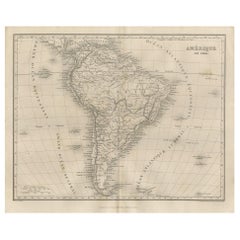
Antique map titled 'Amérique du sud'. Original antique map of South America. This map originates from 'Abrégé de Géographie (..)' by Adrie...
Category
Antique 19th Century Maps
Materials
Paper
$190 Sale Price
20% Off
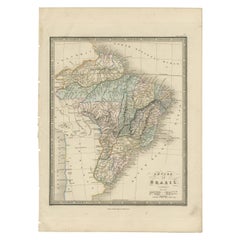
Antique Map of Brazil by Wyld, '1845'
Located in Langweer, NL
Antique map titled 'Empire of Brazil'. Original antique map of Brazil. This map originates from 'An Atlas of the World, Comprehending Separate Ma...
Category
Antique 19th Century Maps
Materials
Paper
$238 Sale Price
20% Off
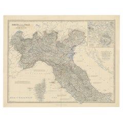
Antique Map of North and Central Italy and the Island of Corsica, c.1860
Located in Langweer, NL
Antique map titled 'North & Central Italy and the Island of Corsica'.
Old map of North and Central Italy, and the island of Corsica. With an inset map of the region of Rome. Orig...
Category
Antique 19th Century Maps
Materials
Paper
$295 Sale Price
20% Off
Large Original Antique Map of the Dutchy of Holstein, Germany, ca.1840
Located in Langweer, NL
Antique map titled 'A Map of the Dutchy of Holstein, with the Territories of the Imperial Towns Hamburg & Lubek, Also The Bishoprick of Eutin, Laid down from Fischer's Map (..)'. Sca...
Category
Antique 19th Century Maps
Materials
Paper
$800 Sale Price
20% Off
Antique Map of Western Australia and Van Diemen's Land or Tasmania, 1833
Located in Langweer, NL
Antique map of Australia titled 'Western Australia - Van-Diemen Island'. Two maps on one sheet. Left, Western Australia containing the settlements of the Swan river...
Category
Antique 19th Century Maps
Materials
Paper
Antique Tidal Chart and Botanical Map, 1843
Located in Langweer, NL
Two antique world maps on one sheet. The upper map is a tidal chart of the world and shows the progress of the wave of high water. The lower botanical map shows the distribution of p...
Category
Antique 19th Century Maps
Materials
Paper
$209 Sale Price
20% Off
Old Rare Fish Print of the Witch Flounder or Torbay Sole, 1842
Located in Langweer, NL
Antique print, titled: 'Poissons Plate 13 - La Pole (Pleuronectes nigromanus).' - This rare plate shows the Witch flounder or Torbay sole (Glyptocephalus cynoglossus). From: 'Voyage ...
Category
Antique 19th Century Maps
Materials
Paper
$781 Sale Price
20% Off
Hand Colored Antique Map of the Department of Orne, France
Located in Langweer, NL
Antique map titled 'Dépt. de l'Orne'. Map of the French department of Orne, France. This area, part of Normandy, includes the village of Camembert, where the famous Camembert cheese ...
Category
Antique 19th Century Maps
Materials
Paper
$324 Sale Price
20% Off
Capt. Cook Aiming His Gun Near Islands of the New Hebrides, Vanuatu, 1803
Located in Langweer, NL
Antique print New Hebrides titled 'Landing op het Eiland Erramanga, een van de Nieuwe Hebriden'.
Antique print depicting the landing at one of the isl...
Category
Antique 19th Century Maps
Materials
Paper
$600 Sale Price
40% Off
Decorative Antique Map of Germany, 1846
Located in Langweer, NL
Antique map titled 'Germany'. Old map of Germany.
This map originates from 'A New Universal Atlas Containing Maps of the various Empires, Kingdoms, ...
Category
Antique 19th Century Maps
Materials
Paper
$219 Sale Price
20% Off
Original Antique Print of Byzantine Decorative Art, 1869
Located in Langweer, NL
Old print of Byzantine decorative art. This print originates from 'L'Ornement polychrome'. A beautiful work containing about 2000 patterns of all the styles of Art old and Asian, mid...
Category
Antique 19th Century Maps
Materials
Paper
$143 Sale Price
20% Off
Old Map of the Pacific, Incl Australia, Polynesia, Melanesia and Malaysia, 1872
Located in Langweer, NL
Antique map Oceania titled 'Map of Oceanica exhibiting its various divisions, island groups & c'.
Map of the Pacific, including Australia, Polynes...
Category
Antique 19th Century Maps
Materials
Paper
$181 Sale Price
20% Off
Antique Map of New South Wales in Australia, ca. 1850
Located in Langweer, NL
Antique map of Victoria, or Port Phillip (12.7 x 10.0") in Australia. Superb map of Victoria roughly centered on Melbourne. Vignettes of Aborigines, a ...
Category
European Antique 19th Century Maps
Materials
Paper
$690 Sale Price
40% Off
Old Colourful Map of Sweden and Norway, 1846
Located in Langweer, NL
Antique map titled 'Sweden & Norway'. Old map of Sweden and Norway.
This map originates from 'A New Universal Atlas Containing Maps of the various Em...
Category
Antique 19th Century Maps
Materials
Paper
$209 Sale Price
20% Off
Anitque Print of a Fire Station in Yokohama, Japan, 1856
Located in Langweer, NL
Description: Antique print titled ‘Fire Companys House & Engine Yokuhama‘.
View of a fire station in Yokohama, Japan. This print originates from 'Narrat...
Category
Antique 19th Century Maps
Materials
Paper
$228 Sale Price
20% Off
Antique Map of Greece and Macedonia, 1848
Located in Langweer, NL
Antique map titled 'Graecia Epirus Macedonia Moesia Thracia'. Old map of Greece originating from 'Orbis Terrarum Antiquus in usum Scholarum'. Artists and Engravers: Published by Just...
Category
Antique 19th Century Maps
Materials
Paper
$238 Sale Price
20% Off
Antique Map of New South Wales with Inset Maps of Australia and Swan River, 1854
Located in Langweer, NL
Antique map titled 'Colony of New South Wales'. Map of New South Wales with inset maps of Australia and Swan River. Artists and Engravers: Drawn and engrave...
Category
Antique 19th Century Maps
Materials
Paper
$305 Sale Price
20% Off
Interesting Detailed Antique Map of Eastern India, 1832
Located in Langweer, NL
Antique map titled 'India IV'. Old steel engraved map of the eastern part of India, including the Bay of Bengal, Hydrabad and Masulipatam.
Artists and...
Category
Antique 19th Century Maps
Materials
Paper
$276 Sale Price
20% Off
Steel Engraved Map of the United States with Inset Map of Florida
Located in Langweer, NL
Antique map titled 'United States'. Steel engraved map of the United States. With small inset map of the continuation of Florida. Source unknown, to be determined. Published circa 1843.
Category
Antique 19th Century Maps
Materials
Paper
$152 Sale Price
20% Off
Colourful Antique Map of Switzerland, 1846
Located in Langweer, NL
Antique map titled 'Switzerland'. Old map of Switzerland.
This map originates from 'A New Universal Atlas Containing Maps of the various Empires...
Category
Antique 19th Century Maps
Materials
Paper
$209 Sale Price
20% Off
Old Original Antique Map of Western Canada, 1882
Located in Langweer, NL
Antique map titled 'Dominion of Canada'.
Old map of Western Canada. This map originates from 'The Royal Atlas of Modern Geography, Exhibiting, in a ...
Category
Antique 19th Century Maps
Materials
Paper
$266 Sale Price
20% Off
Antique Map of Russia in Europe, 1842
Located in Langweer, NL
Antique map titled 'Carte de la Russie d'Europe'. Map of Russia in Europe. This map originates from 'Atlas universel de géographie ancienne et moderne (....
Category
Antique 19th Century Maps
Materials
Paper
$227 Sale Price
20% Off
Original Engraving of Rotterdam Island, Nowadays Nomuka, Kingdom of Tonga, c1800
Located in Langweer, NL
Antique print titled 'Gezigt op het eiland Rotterdam'.
View of Rotterdam Island, Pacific. Originates from 'Reizen Rondom de Waereld door James Cook (..)'.
Rotterdam or nowadays Nomuka is a small island in the southern part of the Ha?apai group of islands in the Kingdom of Tonga. It is part of the Nomuka Group of islands, also called the ?Otu Mu?omu?a.
Nomuka, is 7 square kilometres in area and contains a large, brackish lake (Ano Lahi) in the middle, and also three other smaller lakes—Ano Ha'amea, Ano Fungalei, and Molou. There are approximately 400-500 inhabitants who subsist on fishing, farming, and remittances from family members abroad. The island has a secondary school, two primary schools, and a kindergarten. It also has seven churches.
The island is accessible by boat only. Boats leave weekly from Nuku?alofa and Lifuka, Ha?apai. There is one guesthouse on the island, and three or four small fale koloa, or convenience stores. It is also home to the Royal Nomuka Yacht Club
Notable historic visitors include Abel Tasman, Captain Cook, Captain Bligh, and William Mariner. The Dutch Abel Tasman made the first European discovery of the island on 24 January 1643. A party went ashore to get water, and the description of the huge lake they brought back afterwards leaves little doubt about the identification. Tasman called it Rotterdam island, after the city of Rotterdam, a major port in the Netherlands, and noted in his maps the indigenous name of Amamocka, a misspelling of ?a Nomuka, ?a being a subject-indicating article. We also find the name of Amorkakij for Nomuka iki.[1] Captain Bligh in the Bounty spent 3 days wooding and watering at Nomuka in April 1789. The Mutiny on the Bounty occurred the day after they left.
Nomuka is known for raising up the greatest number of church leaders for the major Christian denominations in Tonga such as Rev. Sione Lepa To'a the former president of the Free Wesleyan Church of Tonga, Rev. Seluipepeli Mafi and his son Rev Dr Feke Mafi as both former presidents of the Church of Tonga, and Pastor Tetileti Pahulu, a former president of the Seventh Day Adventist...
Category
Antique 19th Century Maps
Materials
Paper
$190 Sale Price
52% Off
Hand Colored Antique Map of the Department of Haute Marne, France
Located in Langweer, NL
Antique map titled 'Dépt. de la Hte Marne'. Map of the French department of Haute Marne, France. This department is part of the Champagne region, where the world-famous sparkling win...
Category
Antique 19th Century Maps
Materials
Paper
$324 Sale Price
20% Off
Old Handcolored Print of a Regiment of the Belgium Army, 1833
Located in Langweer, NL
One nicely hand colored print of an original serie of 23 plates, showing soldiers discussing matters in a village. published in 1833. Rare.
From a serie of beautiful lithographed plates with Belgian military costumes after Madou and printed by Dero-Becker. Comes from a Belgian military costume album, dedicated to the Belgian King, and financed by subscribers, some 90 Belgian nobility and officers of the Belgian Army...
Category
Antique 19th Century Maps
Materials
Paper
$133 Sale Price
20% Off
Hand-Colored Steel Engraving of Batavia 'Jakarta', Indonesia, Ca.1840
Located in Langweer, NL
Antique print titled 'Batavia'.
Steel engraving of Batavia (Jakarta), Indonesia. Originates from 'Meyers Universum'.
Artists and Engravers: Jos...
Category
Antique 19th Century Maps
Materials
Paper
$143 Sale Price
20% Off
Pl. 67 Antique Print of Road Making in Poland by Turrell, c.1838
Located in Langweer, NL
Antique print titled 'Pl. 67 Polish Road'. Original antique print of road making in Poland. Source unknown, to be determined. Published circa 1838. Artists and Engravers: Engraved by...
Category
Antique 19th Century Maps
Materials
Paper
$94 Sale Price
20% Off
Antique Map of the Dutch Gold Coast in Africa by Van den Bosch '1818'
Located in Langweer, NL
Antique map titled 'Kaart van de Goud-Kust of Kust van Guina'. A rare and attractive early 19th century Dutch map of the Dutch Gold Coast. The Dutch Gold Co...
Category
Antique 19th Century Maps
Materials
Paper
$1,144 Sale Price
20% Off
Antique Map of Europe by Balbi '1847'
Located in Langweer, NL
Antique map titled 'Europe'. Original antique map of Europe. This map originates from 'Abrégé de Géographie (..)' by Adrien Balbi. Published 1847.
Category
Antique 19th Century Maps
Materials
Paper
$143 Sale Price
20% Off
Antique Map of The Dutch Achtkarspelen Township by Behrns, 1861
Located in Langweer, NL
Antique map titled 'Gemeente Achtkarspelen'. Old map depicting the Achtkarspelen township including cities and villages like Buitenpost, Twijzel, Drogeham and Surhuisterveen. This ma...
Category
Antique 19th Century Maps
Materials
Paper
$114 Sale Price
20% Off
Old Map of Holstein with the Imperial Towns Hamburg & Lubeck, Germany, 1854
Located in Langweer, NL
Antique map titled 'Map of the Duchy of Holstein with the territories of the Imperial Towns Hamburg & Lubeck (..)
Based on a map by Fischer.' Map of the Duchy of Holstein. From Jam...
Category
Antique 19th Century Maps
Materials
Paper
$924 Sale Price
20% Off
Antique Map of Hungary, Transylvania and Dalmatia by W. G. Blackie, 1859
Located in Langweer, NL
Antique map titled 'Hungary, Transylvania, Dalmatia'. Original antique map of Hungary, Transylvania (Romania), Dalmatia (Croatia) and the Military Frontiers (Croatia, Slavonia & Bana...
Category
Antique 19th Century Maps
Materials
Paper
$238 Sale Price
20% Off
Antique Map of Europe by Lapie, '1809'
Located in Langweer, NL
Antique map titled 'Europe'. Original antique map of Europe by P. Lapie, published 1809. Frame included.
Category
Antique 19th Century Maps
Materials
Paper
$286 Sale Price
20% Off
Antique Map of the Middle East by Perthes, 1848
Located in Langweer, NL
Antique map titled 'Terra inter Euphratem et Indum Antiqua'. Old map of the Middle East originating from 'Orbis Terrarum Antiquus in usum Schola...
Category
Antique 19th Century Maps
Materials
Paper
$94 Sale Price
20% Off
Antique Map of Overijssel by Kuyper, 1883
Located in Langweer, NL
Antique map titled 'De Provincie Overijssel'. Map of the province of Overijssel, the Netherlands. This map originates from 'F. C. Brugsma's Atlas van het Koninkrijk der Nederlanden (...
Category
Antique 19th Century Maps
Materials
Paper
$119 Sale Price
20% Off
Original Antique Print of Garden Architecture by Van Laar, 1802
Located in Langweer, NL
Untitled print of garden architecture. It shows a garden building. This print originates from 'Magazijn van tuin-sieraden'. The book is compiled by Gijsbert van Laar, providing a survey - chiefly inspired by English horticulture - of the way in which the proud owners of gardens can make their moderate and small plots look more beautiful and decorative. He questioned: ""what could be a more appropriate relaxation from his work for the imperturbable, industrious and hard-working Dutch...
Category
Antique 19th Century Maps
Materials
Paper
Antique Map of Central Asia, Finely Engraved, 1841
Located in Langweer, NL
Antique map titled 'Central Asia, Middle Division'. A finely engraved and attractive mid 19th Century map of Central Asia which was drawn and engraved by Joshua Archer and published ...
Category
Antique 19th Century Maps
Materials
Paper
$228 Sale Price
20% Off
Old Map of the French Department of Loiret, France
Located in Langweer, NL
Antique map titled 'Dépt. du Loiret'. Map of the French department of Loiret, France. Surrounding the city of Orleans, Loiret is considered the heart of France and is a registered Unesco World Heritage Site. This area of France is also part of the Loire Valley wine region, and is especially known for its production of Pinot Noirs...
Category
Antique 19th Century Maps
Materials
Paper
$324 Sale Price
20% Off
Antique Map of Belgium and Part of the Southern Netherlands, 1810
Located in Langweer, NL
Antique map titled 'Belgium, or the Netherlands divided into Departments'. Original antique map of Belgium and the southern part of the Netherlands. This map originates from 'The Mod...
Category
Antique 19th Century Maps
Materials
Paper
$238 Sale Price
20% Off
Hand Colored Antique Map of the Department of Oise, France
Located in Langweer, NL
Antique map titled 'Dept. de l'Oise'. Old map of the French department of Oise, France. The map proper is surrounded by elaborate decorative engravings designed to illustrate both th...
Category
Antique 19th Century Maps
Materials
Paper
$324 Sale Price
20% Off
Antique Map of Iowa
Located in Langweer, NL
Antique map titled 'Iowa'. Original antique map of Iowa, United States. This print originates from 'Encyclopaedia Britannica', Ninth Edition. Published 188...
Category
Antique 19th Century Maps
Materials
Paper
$276 Sale Price
20% Off
Antique Map of New Hampshire
Located in Langweer, NL
Antique map titled 'New Hampshire'. Original antique map of New Hampshire, United States. This print originates from 'Encyclopaedia Britan...
Category
Antique 19th Century Maps
Materials
Paper
$276 Sale Price
20% Off
Hand Colored Antique Map of the Department of Doubs, France
Located in Langweer, NL
Antique map titled 'Dépt. du Doubs'. Map of the French department of Doubs, France. The whole is surrounded by elaborate decorative engravings designed to illustrate both the natural...
Category
Antique 19th Century Maps
Materials
Paper
$202 Sale Price
50% Off
Antique Map of Europe and Part of Asia and Africa, 1848
Located in Langweer, NL
Antique map titled 'Orbis Veteribus Notus'. Old map of the European continent, also depicting a portion of Asia and Africa. Originating from 'Orbis Terrarum Antiquus in usum Scholaru...
Category
Antique 19th Century Maps
Materials
Paper
$94 Sale Price
20% Off
Hand Colored Antique Map of the department of Cantal, France
Located in Langweer, NL
Antique map titled 'Dépt. du Cantal'. Map of the French department of Cantal, France. This area of France is known for its production of Cantal, a firm cheese, named after the region...
Category
Antique 19th Century Maps
Materials
Paper
$324 Sale Price
20% Off
Hand Colored Antique Map of the department of Indre and Loire, France
Located in Langweer, NL
Antique map titled 'Dépt. d'Indre et Loire'. Map of the Department de L’Indre et Loire, France. This region is known for its fine wines, agriculture, distilled spirits, and cheese. T...
Category
Antique 19th Century Maps
Materials
Paper
$324 Sale Price
20% Off
Old Street View in Guangzhou 'Canton' and Inhabitants of Guangzhou, China, 1834
Located in Langweer, NL
Antique print titled 'Une Rue de Canton - Barbier - Habitans de Canton'.
View of a street in Guangzhou (Canton) and inhabitants of Guangzhou, also includes a small image of a Chinese barber...
Category
Antique 19th Century Maps
Materials
Paper
$114 Sale Price
20% Off
Hand Colored Antique Map of the Department of Ardèche, France
Located in Langweer, NL
Antique map titled 'Dépt. de l'Ardèche'. Map of the Department of Ardèche, France. This region is known for its fine wines, agriculture, distilled spirits, and cheese. The capital ci...
Category
Antique 19th Century Maps
Materials
Paper
$324 Sale Price
20% Off
Hand Colored Antique Map of the Department of Correze, France
Located in Langweer, NL
Antique map titled 'Dépt. de la Corrèze'. Map of the French department of Correze, France. This area of France is known for its production of Straw Wine, a sweet red or white wine. T...
Category
Antique 19th Century Maps
Materials
Paper
$324 Sale Price
20% Off
Hand Colored Antique Map of the Department of Nord, France
Located in Langweer, NL
Antique map titled 'Dept. du Nord'. Map of the French department of Nord, France. This area is known for its production of Maroilles, a cow's milk cheese. This cheese is produced in ...
Category
Antique 19th Century Maps
Materials
Paper
$324 Sale Price
20% Off
Hand Colored Antique Map of the Department of Calais, France
Located in Langweer, NL
Antique map titled 'Dépt. du Pas de Calais'. Map of the French department of Calais, France. This area is known for producing Maroilles, a soft cheese made from cow’s milk and with a...
Category
Antique 19th Century Maps
Materials
Paper
$324 Sale Price
20% Off
Hand Colored Antique Map of the Department of Marne, France
Located in Langweer, NL
Antique map titled 'Dépt. de la Marne'. Map of the French department of Marne, France. This department is home to the Champagne region where the world's finest sparkling wine is prod...
Category
Antique 19th Century Maps
Materials
Paper
$324 Sale Price
20% Off
Old Map of the French department of l'Aisne, France
Located in Langweer, NL
Antique map titled 'Dépt. de l'Aisne'. Map of the French department of l'Aisne, France. The whole is surrounded by elaborate decorative engravings designed to illustrate both the nat...
Category
Antique 19th Century Maps
Materials
Paper
$324 Sale Price
20% Off
Hand Colored Antique Map of the department of Drôme, France
Located in Langweer, NL
Antique map titled 'Dépt. de la Drôme'. Map of the French department of Drôme, France. This area is known for its production of Picodon, a spicy goats-milk ch...
Category
Antique 19th Century Maps
Materials
Paper
$324 Sale Price
20% Off
Antique Map of Groningen from a 19th Century Dutch Atlas, 1864
Located in Langweer, NL
Antique map titled 'De Provincie Groningen'. Map of the province of Groningen, the Netherlands. This map originates from 'F. C. Brugsma's Atlas van het Koninkrijk der Nederlanden (.....
Category
Antique 19th Century Maps
Materials
Paper
$133 Sale Price
20% Off
Antique Map of Denmark with an Inset Map of Iceland, 1832
Located in Langweer, NL
Antique map titled 'Denmark'. Large map of Denmark with an inset map of Iceland.
Artists and Engravers: Published by J. Arrowsmith in London, 1832.
Condition: Good, general age...
Category
Antique 19th Century Maps
Materials
Paper
$333 Sale Price
20% Off
Antique Map of Germany in Roman Times, Showing Roman Provinces, 1825
Located in Langweer, NL
Antique map titled 'Germania, Vindelicia, Rhaetia et Noricum Jllyria, Pannonia, Dacie & Moesia'. Old map of Germany and surroundings originating from 'Atlas der Oude Wereld'. Artists...
Category
Antique 19th Century Maps
Materials
Paper
$117 Sale Price
20% Off
