18th Century and Earlier Collectibles and Curiosities

to
2,716
3,848
551
4,431
216
93
41
35
29
14
10
5
4
2
2
2
1
1
1
6,787
13,467
2,724
3,525
4,678
3,076
513
301
606
745
481
898
888
898
659
595
3,341
599
524
136
128
1,281
254
230
221
171
4,431
4,431
4,431
59
21
14
13
12
Period: 18th Century and Earlier
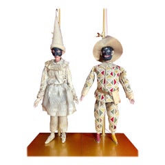
16 x 18th Century Venetian Marionette Puppets from Commedia dell’arte Theatre
Located in London, GB
Antique Venetian Marionettes, Antique Puppets, Venice Carnival Antiques, Masked Ball Antiques, Venetian Mask, Commedia dell'art Theatre Marionettes. Co...
Category

Italian Baroque Antique 18th Century and Earlier Collectibles and Curiosities

Materials

Metal

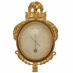
French Louis XVI Barometer
Located in Queens, NY
French Louis XVI (18th Century) barometer with original scientific illustrations and mercury vial framed with gilt foliate carvings & ebonized ...
Category

French Louis XVI Antique 18th Century and Earlier Collectibles and Curiosities

Materials

Giltwood, Glass

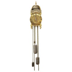
17th Century Lantern Alarm Clock by Johannes Quelch, Oxford
Located in Oxfordshire, United Kingdom
An English 17th century lantern clock made of brass and iron, circa 1665-1670. The clock consists of going and striking trains, as well as a...
Category

British Baroque Antique 18th Century and Earlier Collectibles and Curiosities

Materials

Brass

Spanish Arquebus, Salvador Cenarro, Madrid, 1761-1793
Located in Madrid, ES
Marks: In key, chamber of the cannon and trigger guard. Date: between 1761 and 1793. Author: Salvador de Zenarro. "Real Arcabucero". Origin / Provenance: Madrid, Spain. Material:...
Category

Spanish Neoclassical Antique 18th Century and Earlier Collectibles and Curiosities

Materials

Gold, Steel

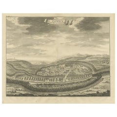
Panoramic Engraved View of the Town of Longvek 'or Lavek' in Cambodia, ca.1726
Located in Langweer, NL
Description: Antique print titled 'Eauweck, Hooft Stad van Cambodia'. Decorative panoramic view of the town of Longvek (or Lavek) in Cambodia. It was the second capital city during t...
Category

Antique 18th Century and Earlier Collectibles and Curiosities

Materials

Paper

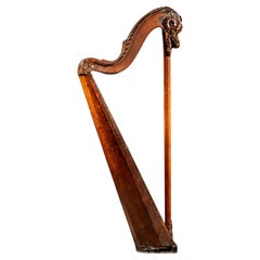
Late 18th Century Cousineau Single Action Pedal Harp
By Georges Cousineau
Located in Dekalb, IL
c. 1770s pedal harp manufactured by Georges Cousineau (1733-1800), a French luthier who specialized in harps; Cousineau's signature is present on the soundboard as well as the city o...
Category

French Rococo Antique 18th Century and Earlier Collectibles and Curiosities

Materials

Wood

Spectacular View of the Siege of Jerusalem by King Nebuchadnezzar, ca.1730
Located in Langweer, NL
Antique print titled 'Belegering van Jerusalem door Nebucadnezar (..)'. This original antique print shows the siege of Jerusalem by King Nebucha...
Category

Antique 18th Century and Earlier Collectibles and Curiosities

Materials

Paper

Large 1693 Maritime Map of Irish Sea, West Coasts of Ireland, England, Scotland
Located in Langweer, NL
This is a historical sea chart titled "Carte Generale des Costes d'Irlande, et des Costes Occidentales d'Angleterre avec une Partie de celles d'Ecosse," which translates to "General Map of the Coasts of Ireland and the Western Coasts of England with a Part of Scotland." The map was first published in 1693 in the atlas "La Neptune Francois," created by Jaillot and published by Pieter Mortier in Amsterdam. This initiative was started by the French minister Colbert to improve maritime navigation. Details of the Map: 1. **Geographical Coverage:** - The map primarily focuses on the Irish coast. - It also includes the west coast of England and Wales. - Parts of the west coast of Scotland are also depicted. 2. **Inset Map:** - There is a detailed inset map showing the area around Chester and the course of the River Dee. 3. **Features:** - **Depth Soundings:** The Irish Sea is detailed with depth soundings to assist in navigation. - **Coastal Towns and Islands:** Numerous coastal towns, islands, and geographical features are indicated. - **Rhumb Lines:** The map includes extensive rhumb lines, which are lines used by navigators to plot a straight-line course. - **Key:** There is a key describing the quality of the terrain along the coast, important for navigators to understand the nature of the coastal landscape. 4. **Labels and Annotations:** - **Coastal Settlements:** Ports, forts, and villages along the coast are labeled. - **Geographical Features:** Islands and other significant features are marked. 5. **Artistic and Practical Elements:** - The map is printed on thick paper and is hand-colored, reflecting contemporary coloring techniques. - Detailed lines and soundings are included to help ships navigate around the numerous small islands and narrow inlets safely. 6. **Historical Context:** - The map was part of a significant French maritime project aimed at improving navigation and charting European waters more accurately. - It reflects the high level of cartographic skill and knowledge of the late 17th century. This map would have been a valuable tool for mariners of the time, providing them with crucial information about the coastal features, depth soundings, and safe passage routes around the complex coastlines of Ireland, England, and Scotland. About the Makers and the Atlas **1. Alexis-Hubert Jaillot (1632-1712):** - **Background:** Jaillot was a prominent French cartographer and publisher in the 17th century. He was known for his detailed and accurate maps and atlases. - **Work:** He collaborated with other notable cartographers of his time and played a key role in improving and publishing detailed maps. Jaillot's work was characterized by its precision and artistic quality. - **Contribution:** He was instrumental in the creation of "La Neptune Francois," a maritime atlas aimed at improving French naval navigation. **2. Pieter Mortier (1661-1711):** - **Background:** Mortier was a Dutch engraver, publisher, and mapmaker based in Amsterdam. He was well-known for his high-quality prints and maps. - **Work:** Mortier published several important atlases and maps, often collaborating with other cartographers and engravers. His work was recognized for its detailed craftsmanship and accuracy. - **Contribution:** Mortier published "La Neptune Francois" in Amsterdam, making significant contributions to maritime navigation by providing highly detailed sea charts. About the Atlas "La Neptune Francois": **1. Purpose:** - The atlas was created as part of an initiative led by Jean-Baptiste Colbert, the French minister of finance under King Louis XIV. The goal was to enhance the accuracy and availability of maritime charts for French naval and commercial vessels. - "La Neptune Francois" was designed to be a comprehensive and detailed reference for navigators, covering various European waters with a focus on the French coast and adjacent regions. **2. Content:** - The atlas includes a series of sea charts, each providing detailed information on coastal regions, depth soundings, rhumb lines, and other navigational aids. - The maps were printed on high-quality paper and hand-colored, reflecting the artistic standards of the time. **3. Historical Significance:** - "La Neptune Francois" was a landmark in the history of cartography, representing a significant advancement in the accuracy and detail of maritime maps...
Category

Antique 18th Century and Earlier Collectibles and Curiosities

Materials

Paper

Pocket Globe by Nathaniel Hill, London 1754
Located in Milano, IT
Nathaniel Hill Pocket globe London, 1754 The globe is contained in its original case, which itself is covered in shark skin. There are slight gaps in the original paint on the sphere. The case no longer closes. The sphere measures 2.6 in (6.8 cm) in diameter whereas the case measures 2.9 in (7.4 cm) in diameter. lb 0.24 (kg 0.11) The globe is made up of twelve printed paper gores aligned and glued to the sphere. In the North Pacific Ocean there is a scroll with the inscription: A New terrestrial Globe by Nath. Hill, 1754. The celestial globe is depicted on the inside of the box. On the terrestrial globe much of central and southern Africa is empty. North America bears only the name of some British colonies. It shows California as a peninsula and the northwest coast of America as "unknown parts" (Alaska is not described and is only partially delineated; it would become part of the United States in 1867). The route of Admiral Anson is traced (1740) and the trade winds are indicated by arrows. Australia, still named New Holland (the new name would be introduced in 1829), is part of the west coast. (See Van der Krogt, P., Old Globes in the Netherlands, Utrecht 1984, p. 146 and Van der Krogt, P. - Dekker, E., Globes from the Western World, London 1993, p. 115.) Nathaniel Hill (London, news from 1746 to 1768) had impeccable professional credentials: he had done his apprenticeship with Richard Cushee, who at the time was carrying out surveying work for John Senex's Surrey map...
Category

English George II Antique 18th Century and Earlier Collectibles and Curiosities

Materials

Shagreen, Paper

Antique Map of Saxony, Germany
Located in Langweer, NL
Original antique map titled 'Circulus Saxoniae Superioris'. Original antique map of Saxony, Germany. The cities of Leipzig, Freiburg and many others are highlighted in gold. This map originates from 'Atlas Novus Terrarum Orbis...
Category

Antique 18th Century and Earlier Collectibles and Curiosities

Materials

Paper

Antique Map of Saxony, Germany
$566 Sale Price
20% Off
A 18th-Century scientific instrument: wooden screw dilator clamp.
Located in Milan, IT
A medical instrument. A brass screw clamp (dilator), with a rosewood handle. It consists of two symmetrical parts, each with a circular cushion element that continues with a cylindri...
Category

English Antique 18th Century and Earlier Collectibles and Curiosities

Materials

Brass

Antique Print of a Canoe of Chukotka, Tartary, 1800
Located in Langweer, NL
Antique print titled 'A Canoe of Tchoka, or Segalian Island, opposite the East Coast of Tartary first explored by M. de la Perouse'. Engraving of a canoe of Chukotka, Russia. Source ...
Category

Antique 18th Century and Earlier Collectibles and Curiosities

Materials

Paper

Original Antique Map of the Northern Part of Scotland, circa 1640
Located in Langweer, NL
The antique map, titled 'Scotiae pars septentrionalis,' depicts the northern part of Scotland. Crafted by Hondius around 1640, this map is a historical treasure showcasing the geogra...
Category

Antique 18th Century and Earlier Collectibles and Curiosities

Materials

Paper

Antique Map of Champagne and surrounding Regions, France
Located in Langweer, NL
Antique map titled 'Carte de la Champagne et des Pays Voisins (..)'. Detailed map of Champagne and surrounding regions of Chalons and Soissons, Reims,...
Category

Antique 18th Century and Earlier Collectibles and Curiosities

Materials

Paper

Southern Sweden Provinces Map – Homann’s ‘Nova Tabula Scaniae’, ca. 1730
Located in Langweer, NL
Southern Sweden Provinces Map – Homann’s ‘Nova Tabula Scaniae’, ca. 1730 Antique map titled 'Nova Tabula Scaniae in qua sunt Scania, Blekingia et Hallandia'. This decorative map sho...
Category

German Antique 18th Century and Earlier Collectibles and Curiosities

Materials

Paper

18th 1st Edition of "New Art of Cooking" in Spanish by Juan Altamiras
Located in Miami, FL
18th First Edition of "New Art of Cooking" in Spanish with skin flap. Traditional recipes of Spanish gastronomy
Category

Spanish Baroque Antique 18th Century and Earlier Collectibles and Curiosities

Materials

Animal Skin, Paper

Antique Print of the Malabar Coast of India showing the VOC establishments, 1726
Located in Langweer, NL
Dutch print with the title: Platte Grond van t'Fort Tricoen male met de daar aangelegen Pagoods-Berg (Trincomalee, Sri Lanka) The map is taken from: 'Oud en Nieuw Oost-Indiën' van François Valentyn. 1) Ottens, Frederik (engraver / etcher) 2) Braam, J. van (publisher) 3) Linden, Gerard onder de (publisher) MALABAR COAST...
Category

Antique 18th Century and Earlier Collectibles and Curiosities

Materials

Paper

Original Antique Map of Greece and part of Turkey
Located in Langweer, NL
Original antique map titled 'La Grece ou partie meridionale de la Turquie d'Europe'. Small map of Greece and part of Turkey. This map originates from 'Le nouveau et curieux Atlas Geo...
Category

Antique 18th Century and Earlier Collectibles and Curiosities

Materials

Paper

Old Genealogy Chart of the Rulers of Margraviate Brandenburg in Germany, 1732
Located in Langweer, NL
Antique print titled 'Genealogie de la Maison de Brandebourg (..)'. Genealogy of the rulers of the Margraviate Brandenburg. This print orginates from 'Atlas Historique'. The Margraviate of Brandenburg (German: Markgrafschaft Brandenburg) was a major principality of the Holy Roman Empire from 1157 to 1806 that played a pivotal role in the history of Germany and Central Europe. Brandenburg developed out of the Northern March founded in the territory of the Slavic Wends. It derived one of its names from this inheritance, the March of Brandenburg (Mark Brandenburg). Its ruling margraves were established as prestigious prince-electors in the Golden Bull...
Category

Antique 18th Century and Earlier Collectibles and Curiosities

Materials

Paper

Roman Christ 17th Century
Located in Madrid, ES
Romanesque Christ of the 17th century carved in fruit wood with posterior cross. It has remains of the original Polychrome. Total dimensions: 58x43 cm.
Category

Antique 18th Century and Earlier Collectibles and Curiosities

Materials

Fruitwood

Antique Original Engraving of Seasons by Le Bas, C.1780
Located in Langweer, NL
Antique astronomy print titled 'L'inégalité des Saisons et des Jours'. Interesting print explaining why there is an inequality in the length of days and seasons. Source unknown, to b...
Category

Antique 18th Century and Earlier Collectibles and Curiosities

Materials

Paper

1684 Mallet Map of Amazon River & Kingdom of Amazons – Hand Colored, Miniature
Located in Langweer, NL
This map, titled 'Royaume des Amazones', was created by Alain Manesson Mallet and published in 1684 in a German edition of *Beschreibung des Gantzen Welt-Kreisses*, a renowned work d...
Category

Antique 18th Century and Earlier Collectibles and Curiosities

Materials

Paper

Map of Northern India & Surrounding Regions, incl Kabul, Candahar & Bhutan, 1710
Located in Langweer, NL
Antique map titled 'Magni Mogolis Imperium de Novo Correctum et Divisum Per F. de Witt Amstelodami.' Map of Northern India and surrounding regions. This includes Kabul and Candah...
Category

Antique 18th Century and Earlier Collectibles and Curiosities

Materials

Paper

Copper Engraving of a Section of the Royal Botanic Gardens, Kew, London, 1776
Located in Langweer, NL
Antique print titled 'Coupe sur la longueur d'une partie de la Galerie des Antiques dans les jardins de Kew'. Copper engraving showing a section of the Royal Botanic...
Category

Antique 18th Century and Earlier Collectibles and Curiosities

Materials

Paper

Late 18th Century Embossed Brass Powder Flask Hunting Scene Design
Located in Sofia, BG
Antique Embossed Brass Powder Flask – Hunting Scene Design This is a beautifully crafted 18th-century brass powder flask, featuring an ornate embossed hunting scene. The front showcases a finely detailed stag head and oak leaf motif, symbolizing traditional European hunting themes. The flask is made of solid brass with a warm, aged patina that adds to its charm and authenticity. • Material: Brass • Design: Embossed stag and foliage with rich detailing • Function: Vintage gunpowder flask (historically used with muzzle-loading firearms) • Condition: Very good antique condition with working spring-top spout and minor wear consistent with age Ideal for collectors of antique hunting memorabilia...
Category

French Antique 18th Century and Earlier Collectibles and Curiosities

Materials

Brass

Map Holy Land La Terre Sainte Engraved van Loon Published N de Fer 1703 French
Located in BUNGAY, SUFFOLK
La Terre Sainte, The Holy Land, Tiree Des Memoires De M.De.La Rue. Par N. de Fer. Geographe de Sa Majeste Catoliq et de Monseigneur le Dauphin. Avec Privil du Roi 1703 Detailed map of the Holy Land from Nicholas de Fer's L'Atlas Curieux ou le Monde. East is oriented at the top. MAKER Nicolas de Fer 1646-1720 The French cartographer and engraver, Nicolas de Fer, was a master at creating maps that were works of art. The maps that he published were printed during the Baroque period when the decorative arts were characterized by ornate detail. De Fer’s detailed maps and atlases were valued more for their decorative content than their geographical accuracy. Nicolas de Fer was born in 1646. His father, Antoine de Fer, owned a mapmaking firm. At the age of twelve, Nicolas was apprenticed to a Parisian engraver named Louis Spirinx. The family business was starting to decline when his father died in 1673. Nicolas de Fer’s mother, Genevieve, took over the business after the death of her husband. In 1687 the business was passed on to Nicolas and the profits increased after he took over the firm. Nicolas de Fer was a prolific cartographer who produced atlases and hundreds of single maps. He eventually became the official geographer to King Louis XIV of France and King Philip V...
Category

French Louis XIV Antique 18th Century and Earlier Collectibles and Curiosities

Materials

Paper

Antique Map of Sri Lanka with an unusual five-sided shape, circa 1606
Located in Langweer, NL
Antique map titled 'Ins. Ceilan quae incolis Tenarisin dicitur'. This exquisite, early map of Sri Lanka is shown with an unusual five-sided shape. North is oriented to the left by an...
Category

Antique 18th Century and Earlier Collectibles and Curiosities

Materials

Paper

Circa 1686 Daniel Stoopendaal Map: Biblical Sites from Paradise to Canaan
Located in Langweer, NL
Circa 1686 Daniel Stoopendaal Map: Biblical Sites from Paradise to Canaan This circa 1686 hand-colored map by Daniel Stoopendaal, titled "De Gelegentheyt van 't Paradys en 't Landt Canaan," beautifully illustrates the Middle East, extending from the Mediterranean to the Persian Gulf. The map features numerous Biblical locations, such as the Garden of Eden, the wanderings of the Children of Israel, and the story of Jonas and the whale. It is adorned with elaborate decorations, including a banner-style title cartouche and four corner vignettes depicting scenes from Genesis: Paradise, the creation of Adam and Eve, Eve offering the apple, and their expulsion from Eden. The bottom center showcases a dramatic portrayal of Noah's Ark. Measuring 18.3 inches wide by 11.9 inches high, this first state map includes Dutch text on the reverse and is in good condition, with a crisp impression, light toning along the centerfold, and a small chip in the bottom margin. Keywords: - Daniel Stoopendaal map - Biblical map - Garden of Eden - Land of Canaan - Middle East historical map - Noah's Ark map - Adam and Eve - 17th-century Bible...
Category

Antique 18th Century and Earlier Collectibles and Curiosities

Materials

Paper

Saint Jerome. Oil on slatted panel. Surroundings of KEY, Willem. 16th century.
Located in Madrid, ES
Saint Jerome. Oil on slatted panel. Surroundings of KEY, Willem. 16th century. With monogram (illegible) and dated (right ear of the saint). Oil on oak panel showing a thin, elderl...
Category

European Renaissance Antique 18th Century and Earlier Collectibles and Curiosities

Materials

Other

Pair of Islamic Enameled Vessels, Ancient Urns
Located in Vero Beach, FL
This is an exceptional and historic pair of Damascus enameled metalwork vessels or urns. These art objects show signs of rough use and handling through the centuries. Although it is ...
Category

West Asian Islamic Antique 18th Century and Earlier Collectibles and Curiosities

Materials

Enamel

Masterpieces from the Museum of Classical Chinese Furniture (Book)
Located in North Yorkshire, GB
A beautiful catalogue which was published in 1995, still in the original slipcase, to coincide with an exhibition of the collection of the Museum of Classical Chinese Furniture in San Francisco...
Category

Antique 18th Century and Earlier Collectibles and Curiosities

Materials

Paper

18th Century Painted Lifesize Dummy Board
Located in Gloucestershire, GB
18th Century painted lifesize dummy board, featuring a cavalier holding a monkey. Original decoration. Circa 1760.
Category

Antique 18th Century and Earlier Collectibles and Curiosities

Materials

Wood

Palaces of the Sun King by Andrew Zega & Bernd h. Dams (Book)
Located in North Yorkshire, GB
:Versailles, Trianon, Marly, The Chateaux of Loius XIV This Comprehensive volume documents for the first time twenty-one chateaux and pavilions commissioned by Louis XIV, the 'Sun K...
Category

Antique 18th Century and Earlier Collectibles and Curiosities

Materials

Paper

The Works of the Famous Nicolas Machiavelli - SECOND EDITION - 1695
Located in Hillsborough, NJ
AUTHOR: MACHIAVELLI, Nicolas TITLE: The Works of the Famous Nicolas Machiavel, Citizen and Secretary of Florence. Written originaIly [sic] in Italian, and from thence newly and fait...
Category

British Antique 18th Century and Earlier Collectibles and Curiosities

Materials

Leather

Antique Rare Bronze Gavel in the Form of a Fist Dated 1603, England
Located in Doha, QA
EVERY LAWYER AND JUDGE MUST HAVE! This extraordinary bronze gavel, dated 1603 and weights 1,3 kg. It is a rare and evocative example of early ceremonial instruments. Cast in the form of a clenched fist- symbolising authority, resolve, and order- it is mounted on a worn, aged wooden handle that enhances its historic character. The craftsmanship and materials suggest it originated in medieval or early Stuart England, a period when guilds, courts, and civic bodies often used symbolic tools to assert power and structure in meetings and proceedings. While the term “gavel” became widely recognised in the 18th and 19th centuries, mallet-like instruments were used much earlier, particularly in English trade guilds and legal contexts, where they served as emblems of control and decision-making. The clenched fist design is highly unusual, possibly denoting a unique ceremonial role or elevated authority within a guild or council. This piece is not only a striking object of early design but also a rare surviving example from the transitional period between the Elizabethan and Jacobean eras...
Category

English Antique 18th Century and Earlier Collectibles and Curiosities

Materials

Bronze

Original Antique Map of the Northern Baltic Region
Located in Langweer, NL
Title: "Livonia: Antique Map of the Northern Baltic Region" Description: This antique map, titled "Livonia," is a detailed representation of the northern Baltic region. Centered on ...
Category

Antique 18th Century and Earlier Collectibles and Curiosities

Materials

Paper

Antique Map of Sweden by Bowen, 1747
Located in Langweer, NL
Antique map titled 'A New & Accurate Map of Sweden'. This map covers Sweden and Finland (shown as part of Sweden) as well as parts of modern day Estonia,...
Category

Antique 18th Century and Earlier Collectibles and Curiosities

Materials

Paper

Antique Asian Temple Stone Relief Carved Architectural Element
Located in Forney, TX
A magnificent, rare, one of a kind, ancient Asian temple stone architectural panel, likely frieze fragment. Born in Asia, pre-18th century, most likely mu...
Category

Asian Ming Antique 18th Century and Earlier Collectibles and Curiosities

Materials

Stone

Italian 18th Century Architectural Carved and Giltwood Tabernacle as a Temple
Located in Firenze, IT
This Italian 18th century Louis XVI period hand carved and gilt wood architectural fragment probably was the central section of a bigger altar tabernacle that can now be used as a de...
Category

Italian Louis XVI Antique 18th Century and Earlier Collectibles and Curiosities

Materials

Iron, Wrought Iron, Gold Leaf

Detailed Antique Map of Hungary and Transylvania by Tirion, 1753
Located in Langweer, NL
Title: Nieuwe Kaart van’t Koninkryk Hongaryen en Zevenbergen by Isaak Tirion, 1753 – Antique Map of Hungary and Transylvania Description: This is an antique 1753 map titled *Nieuwe Kaart van’t Koninkryk Hongaryen en Zevenbergen*, created by the notable Dutch cartographer and publisher Isaak Tirion. The map showcases the Kingdom of Hungary and the region of Transylvania (referred to as "Zevenbergen") as they appeared in the mid-18th century. Tirion’s maps are well-known for their clarity, precision, and attention to geographic detail, making them highly sought after by collectors of antique maps. This map provides a detailed view of Hungary and Transylvania, including borders, towns, cities, rivers, and mountain ranges. It was created using the latest discoveries and updates of the time and reflects the political landscape of the region, which was part of the Habsburg Empire during a period of territorial changes and consolidations. The map’s borders are highlighted with color to distinguish different regions, and significant cities such as Buda, Pest, and Debrecen are clearly labeled. Isaak Tirion was one of the most prominent Dutch publishers of the 18th century, particularly known for his *Nieuwe en Beknopte Hand-Atlas* (New and Concise Hand Atlas) series, which included a wide range of maps of Europe and beyond. His works were appreciated for their cartographic accuracy and artistic quality. This map is a valuable piece for collectors interested in 18th-century European maps, particularly those that highlight Central Europe, Hungary, Transylvania, and the Habsburg Empire. It is a fine example of the craftsmanship of Isaak Tirion and offers insight into the historical geography of the region. Condition: Excellent for its age, with finely preserved hand-coloring and wide margins. Slight edge wear typical of maps from this period. Effective keywords that may help attract collectors or enthusiasts interested in historical maps of Hungary, Transylvania, and Central Europe: - Antique map of Hungary - Historical map of Transylvania - 18th-century map of Central Europe - Habsburg Empire map - Isaak Tirion map - Nieuwe Kaart van’t Koninkryk Hongaryen en Zevenbergen - Kingdom of Hungary map...
Category

Antique 18th Century and Earlier Collectibles and Curiosities

Materials

Paper

Rare Town Plan of Jerusalem, Includes an Extensive Key to Locations etc, 1708
Located in Langweer, NL
Antique map titled 'Eigentliche Vorstellung der Statt Jerusalem und derselben umliegenden Gegenden zu Salomonis auch zu und kurtz nach Christi Zeiten.' Rare town plan...
Category

Antique 18th Century and Earlier Collectibles and Curiosities

Materials

Paper

Antique Chart of the Passage of Comets in the Southern Sky, circa 1740
Located in Langweer, NL
Antique map titled 'Motus Comtarum in Hemispaerio Australi (..)'. This uncommon chart depicts the passage of comets in the southern sky between the years 1530-1704. Centered on the ecliptic poles and shows the constellation figures based on classical mythology, without showing the stars. The paths of dozens of comets are illustrated, eincluding those sighted by Tycho Brahe...
Category

Antique 18th Century and Earlier Collectibles and Curiosities

Materials

Paper

Antique Print of Martin Luther, 1701
Located in Langweer, NL
Antique portrait titled 'Martinus Lutherus'. Portrait of Martin Luther with an opened Bible in his hands. This print originates from 'Historie der kerken en ketteren van den beginne des Nieuwen Testaments tot aan het jaar onses Heeren 1688 ... In het Neederduyts vertaald' by G. Arnold. Artists and Engravers: Gottfried Arnold (1666 – 1714) was a German Lutheran...
Category

Antique 18th Century and Earlier Collectibles and Curiosities

Materials

Paper

Antique Map of the Holy Land, with vignette of the Garden of Eden
Located in Langweer, NL
Antique map titled 'Hondius his Map of Paradise'. Beautiful map of the region bounded by the Holy Land. Syria, Mesopotamia, Chaldea and part of Arabia. W...
Category

Antique 18th Century and Earlier Collectibles and Curiosities

Materials

Paper

Large 1695 Hand-Colored Engraved Map of Gascony (Gascogna), France
Located in Langweer, NL
This map, created by Giacomo Cantelli da Vignola in 1695, represents the "General Government of Guyenne and Gascony" in southwest France. Cantelli da Vignola was a renowned Italian c...
Category

Antique 18th Century and Earlier Collectibles and Curiosities

Materials

Paper

Large Wood Sculpture of Boddhisatva Head Ming Dynasty
Located in Atlanta, GA
Large antique Chinese carved wood sculpture of a Boddhisattva head circa 16-17th century from Ming Dynasty. Likely part of a full body life-size statue, the head was finely carved, p...
Category

Chinese Ming Antique 18th Century and Earlier Collectibles and Curiosities

Materials

Wood

Map of Tartary by Isaak Tirion: Detailed Cartography of Northern Asia, ca.1740
Located in Langweer, NL
This is an antique map titled "Nieuwe Kaart van Tartarie," which translates to "New Map of Tartary." The map was created by Isaak Tirion, a prominent Dutch cartographer and publisher...
Category

Antique 18th Century and Earlier Collectibles and Curiosities

Materials

Paper

18th Century Brass Bedpan with Original Dark Oak Wooden Turned Steel
Located in Delft, NL
18th century brass bedpan with original dark oak wooden turned steel. A brass bedpan, made in The Netherlands in the 18th Century This bedpan would be f...
Category

Dutch Antique 18th Century and Earlier Collectibles and Curiosities

Materials

Brass

Georgian Oak Miniature Chest of Drawers
Located in Bedfordshire, GB
An extremely attractive and very good quality late 18th century, Georgian, oak miniature chest, having well figured rectangular top, over two short and three long drawers retaining original turned wooden knobs, flanked by elegant half turned columns, raised on elegant original shaped bracket feet. A beautifully charming little piece of 18th century miniature furniture, constructed from rich, warm oak timbers which retain an exceptional colour and patina, it boasts original handles and feet. Almost certainly it was made as a sample piece of furniture originally. There is regular debate over whether miniature furniture was made as an apprentice piece, which is when a craftsmen who was looking for a job at a workshop would create something to showcase their talents. Or whether it was made as a travelling salesman...
Category

English Georgian Antique 18th Century and Earlier Collectibles and Curiosities

Materials

Oak

Antique Print of Cairo in Egypt, 1698
Located in Langweer, NL
Untitled antique print with two views of Cairo, Egypt. 78: Palace of Sultan Gori. 79. Tower and aqueduct. This print originates from 'Reizen van Cornelis de Bruyn, door de vermaardst...
Category

Antique 18th Century and Earlier Collectibles and Curiosities

Materials

Paper

18th Century Italian Tabernacle Door Fragment
Located in San Angelo, TX
18th Century Italian Tabernacle Door Fragment. Unique piece that can go anywhere. Perfect for a sculpture on the wall in a hallway or niche.
Category

Italian Antique 18th Century and Earlier Collectibles and Curiosities

Materials

Gold Leaf

Old Engraving of Longvek or Lavek (Eauweck), the Second Capital City of Cambodia
Located in Langweer, NL
Antique print titled 'Eauweck, capitale de Camboye'. Decorative panoramic view of the town of Longvek (or Lavek) in Cambodia. It was the second capital city during the Cambodia's Mid...
Category

Antique 18th Century and Earlier Collectibles and Curiosities

Materials

Paper

Mercator's Ptolemaic Map of Ancient Assyria, Media, and Persia
Located in Langweer, NL
This map, "Asiae I Tab:", features the region corresponding to modern-day Iran and Iraq, intricately depicted in Gerard Mercator's edition of Claudius Ptolemy's "Tabulae Geographicae...
Category

Antique 18th Century and Earlier Collectibles and Curiosities

Materials

Paper

Mapping the Heart of France: Willem Blaeu's 17th Century Île-de-France, ca.1650
Located in Langweer, NL
This original antique map titled "Le Gouvernement de l'Isle de France" represents the Île-de-France region, which historically was one of the provinces of France and contained the ci...
Category

Antique 18th Century and Earlier Collectibles and Curiosities

Materials

Paper

Antique Map of Northern Germany, Including Schleswig-Holstein and Hamburg
Located in Langweer, NL
Antique map titled 'Basse Partie de la Basse Saxe ou sont les Duchés de Sleswick, Holsace, Meckelenbourg et Lauvenbourg (..)'. Original old map of northern Germany, including Schlesw...
Category

Antique 18th Century and Earlier Collectibles and Curiosities

Materials

Paper

Antique Map of England and Wales Depicting the Period of the Saxon Heptarchy
Located in Langweer, NL
Antique map titled 'Britain as divided under the Saxon Heptarchy'. An antique copper engraving map of England and Wales by Joseph Ellis depicting the period of the Saxon Heptarchy. E...
Category

Antique 18th Century and Earlier Collectibles and Curiosities

Materials

Paper

Attractive Antique Map showing Denmark and part of Sweden and Germany c.1750
Located in Langweer, NL
Antique map titled 'Nieuwe Kaart van het Koninkryk van Deenemarken (..).' Attractive detailed map showing Denmark and a part of Sweden and Germany. Title in block-style cartouche wit...
Category

Antique 18th Century and Earlier Collectibles and Curiosities

Materials

Paper

Antique Map of Central Sweden by J. Blaeu, 1662
Located in Langweer, NL
A striking, rare map with a cartouche dedicated to Gabriel Bengtsson Oxenstierna. Published by J. Bleau, Amsterdam, 1662. Contemporary coloring.
Category

Antique 18th Century and Earlier Collectibles and Curiosities

Materials

Paper

Antique Map of the Region of Mansfeld, Saxony-Anhalt, Germany
Located in Langweer, NL
Antique map titled 'Mansfeldiae Comitatus Descriptio'. Original antique map of the region of Mansfeld, Saxony-Anhalt, Germany. Shows the area between Halle a. d. Saale, Aschersleben,...
Category

Antique 18th Century and Earlier Collectibles and Curiosities

Materials

Paper

Silver Reformation Commemorative Medal 1630, 100th Anniversary Augsburg
Located in Bilzen, BE
"Silver Reformation Commemorative Medal 1630, 100th Anniversary Of The Augsburg Confession" Silver Reformation Commemorative Medal 1630 — Johann the Steadfast — 100th Anniversary of ...
Category

German Baroque Antique 18th Century and Earlier Collectibles and Curiosities

Materials

Silver

Read More

Medal-Worthy Memorabilia from Epic Past Olympic Games

Get into the games! These items celebrate the events, athletes, host countries and sporting spirit.

Ahoy! You’ve Never Seen a Collection of Sailor Art and Kitsch Quite Like This

French trendsetter and serial collector Daniel Rozensztroch tells us about his obsession with objects related to seafaring men.

Pamela Shamshiri Shares the Secrets behind Her First-Ever Book and Its Effortlessly Cool Interiors

The sought-after designer worked with the team at Hoffman Creative to produce a monograph that beautifully showcases some of Studio Shamshiri's most inspiring projects.

Moroccan Artworks and Objects Take Center Stage in an Extraordinary Villa in Tangier

Italian writer and collector Umberto Pasti opens the doors to his remarkable cave of wonders in North Africa.

Montecito Has Drawn Royalty and Celebrities, and These Homes Are Proof of Its Allure

Hollywood A-listers, ex-pat aristocrats and art collectors and style setters of all stripes appreciate the allure of the coastal California hamlet — much on our minds after recent winter floods.

Whaam! Blam! Pow! — a New Book on Pop Art Packs a Punch

Publishing house Assouline and writer Julie Belcove have teamed up to trace the history of the genre, from Roy Lichtenstein, Andy Warhol and Yayoi Kusama to Mickalene Thomas and Jeff Koons.

What Makes a Gem-Encrusted Chess Set Worth $4 Million?

The world’s most opulent chess set, weighing in at 513 carats, is literally fit for a king and queen.

Tauba Auerbach’s Geometric Pop-Up Book Is Mighty Rare, Thanks to a Hurricane

This sculptural art book has an epic backstory of its own.
Recently Viewed

View All