18th Century and Earlier Collectibles and Curiosities

to
2,760
3,767
586
4,378
204
90
41
39
33
13
7
4
4
2
2
2
1
1
1
6,589
13,340
2,719
3,508
4,613
3,040
518
305
588
733
464
897
880
904
659
578
3,335
580
492
130
120
1,163
238
213
203
160
4,378
4,378
4,378
63
24
16
14
13
Period: 18th Century and Earlier
Antique Print of Designs for Pembroke House Whitehall, London, England, 1725
Located in Langweer, NL
Antique print titled 'Elevation of the Right Honourable the Lord Herbert (..)'. Designs for Pembroke House, front elevation and plans of the principal storey and the attic storey o...
Category

Antique 18th Century and Earlier Collectibles and Curiosities

Materials

Paper

Antique Map of Southern Asia with India, the Maldives, Ceylon and Arabia, c.1700
Located in Langweer, NL
Stunning Old Map of Asia. Description: Two-sheet map of Asia, joined. The left part of this antique map is titled 'Partie occidentale d'une partie d'Asie ou sont les Isles de Zoco...
Category

Antique 18th Century and Earlier Collectibles and Curiosities

Materials

Paper

Antique Map of CAP Providence, St. David's Cove and Surroundings
Located in Langweer, NL
Antique map titled 'Baye du Cap Upright (..)'. Eight charts on one sheet of Cap Providence, St. David's Cove, the Bay of the Island, Swallow's Haven, Puzzlin...
Category

Antique 18th Century and Earlier Collectibles and Curiosities

Materials

Paper

Beautiful Antique Map of the Moluccas or Spice Islands, Indonesia, ca.1650
Located in Langweer, NL
Antique map titled 'Insularum Moluccarum Nova Descriptio.' Beautiful map of the Moluccas. The famous Spice Islands, the cornerstone of the Dutc...
Category

Antique 18th Century and Earlier Collectibles and Curiosities

Materials

Paper

Antique Print of Various Churches on Ceylon or Nowadays Sri Lanka, 1732
Located in Langweer, NL
Antique print titled 'Paneteripou, Manipay, Changane, Vanarpone'. Antique print with four views of the churches of Paneteripoum, Manipay, Changane and Vanarpone (Ceylon/Sri Lanka). This print originates from 'A Collection of Voyages and Travels, some now first printed from original manuscripts others now first printed in English'. Artists and Engravers: Published by Awnsham and John Churchill...
Category

Antique 18th Century and Earlier Collectibles and Curiosities

Materials

Paper

Early Chart Identifying British Spice Trading Colony of Bencoolen, Sumatra, 1797
Located in Langweer, NL
Antique map titled 'A Chart of the West Coast of Sumatra'. Early nautical chart identifying the British spice trading colony of Bencoolen and F...
Category

Antique 18th Century and Earlier Collectibles and Curiosities

Materials

Paper

Antique Original Engraving of Seasons by Le Bas, C.1780
Located in Langweer, NL
Antique astronomy print titled 'L'inégalité des Saisons et des Jours'. Interesting print explaining why there is an inequality in the length of days and seasons. Source unknown, to b...
Category

Antique 18th Century and Earlier Collectibles and Curiosities

Materials

Paper

Original Antique Map of the Coast of Part of Greece, with Athens and Thebes
Located in Langweer, NL
Original antique map titled 'Achaia quae et Hellas hodie Livadia'. Detailed map of the coast of part of Greece. With inset maps of Athens and Thebes. This map originates from 'Philippi Cluveri Introductionis in universam geographiam (..)' by P. Clüver. Published 1729. Philipp Clüver was an Early Modern German geographer and historian. Cluver's Geography was one of the most enduring works of the 17th & 18th Centuries, issued by several different publishers with many different sets of maps...
Category

Antique 18th Century and Earlier Collectibles and Curiosities

Materials

Paper

Antique Map of Great Britain and Ireland by Brion de la Tour, 1766
Located in Langweer, NL
Antique map titled 'Les Isles Britanniques (..).' Attractive map of Great Britain surrounded by an engraved border printed from a separate coppe...
Category

Antique 18th Century and Earlier Collectibles and Curiosities

Materials

Paper

Rare Print of the Siege of Doornik Between the English and French Armies, c.1680
Located in Langweer, NL
Antique print of the Siege of Doornik (Tournai) in 1581, during the Eighty Years' War. This print most likely originates from an edition of 'Histoire de la guerre de Flandre' by F. S...
Category

Antique 18th Century and Earlier Collectibles and Curiosities

Materials

Paper

Old Battle Print of Rossbach in Prussian Saxony, ca.1790
Located in Langweer, NL
Antique print titled 'The Battle of Rosbach in Saxony, fought on the 5th of November 1757 (..)'. Antique print depicting the Battle of Rossbach in Prussian Saxony. Frederick the Great defeated the allied armies of France and the Holy Roman/Austrian...
Category

Antique 18th Century and Earlier Collectibles and Curiosities

Materials

Paper

Antique Bible Plan of Jerusalem by Covens & Mortier, 1743
Located in Langweer, NL
This plan originates from ‘Biblia Sacra, dat is, de H. Schriftuer van het Oude, en het Nieuwe Testament, naer de laetste Roomsche keure der gemeine Latijnsche overzettinge, in nederd...
Category

Antique 18th Century and Earlier Collectibles and Curiosities

Materials

Paper

Antique Map of the Rethelois or Rethel Region in France by Janssonius, ca.1650
Located in Langweer, NL
Antique map of France titled 'Dioecese de Rheims et le Païs de Rethel'. Detailed map, centered on the River Ayne and the River Velle and sowing Reims, Chalons, Rethel, Sedan, Cha...
Category

Antique 18th Century and Earlier Collectibles and Curiosities

Materials

Paper

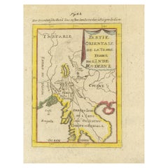
Antique Map of Southern India, the Maldives and Sri Lanka with Currents
Located in Langweer, NL
Antique map titled 'Carte de la Partie Inferieure De L'Inde En Deca Du Gange (..)'. Interesting map of Southern India, the Maldives and Sri Lanka. Includes a month by month charting ...
Category

Antique 18th Century and Earlier Collectibles and Curiosities

Materials

Paper

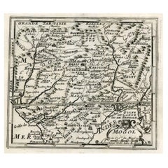
Antique Map of Western Tartary, with Information from Kyrkov's Surveys
Located in Langweer, NL
Antique map titled 'Carte de la Tartarie Occidentale'. This map covers western Tartary with a focus on the region of present-day Mongolia. This map includes information from Kyrkov's...
Category

Antique 18th Century and Earlier Collectibles and Curiosities

Materials

Paper

Antique Map of Picardy, Aroits and French Flanders by Bonne, c.1780
Located in Langweer, NL
Antique map titled 'Carte des Gouvernements de Flandre Francoise, d'Artois, de Picardie et du Boulenois.' An attractive example of Rigobert Bonne's 1771 decorative map of the French regions of Picardy, Artois, and French Flanders. Covers the region in full from the English Chanel to Normandy. A large decorative title cartouche appears in the upper right. Source unknown, to be determined. Artists and Engravers: Rigobert Bonne (1727-1795 ) was one of the most important cartographers of the late 18th century. In 1773 he succeeded Jacques Bellin as Royal Cartographer to France in the office of the Hydrographer at the Depôt de la Marine. Working in his official capacity Bonne compiled some of the most detailed and accurate maps of the period. Bonne's work represents an important step in the evolution of the cartographic ideology away from the decorative work of the 17th and early 18th century towards a more detail oriented and practical aesthetic. With regard to the rendering of terrain Bonne maps...
Category

Antique 18th Century and Earlier Collectibles and Curiosities

Materials

Paper

Inside View of Magdalen Chapel in the Cowgate in Edinburgh. Scotland, 1790
Located in Langweer, NL
Antique print titled 'Inside View of Magdalen Chapel, near Winchester, from the West'. Inside view of the Magdalen Chapel taken from the Chancel from the West. Artists and Engravers:...
Category

Antique 18th Century and Earlier Collectibles and Curiosities

Materials

Paper

Antique Map of Northern Jutland by Kaerius, 1628
Located in Langweer, NL
Antique map titled 'Iutia Septentrionalis'. Copper engraved map of Northern Jutland (Denmark) by P. Kaerius. This map originates from 'Atlas Minor (..)' by G. Mercator.
Category

Antique 18th Century and Earlier Collectibles and Curiosities

Materials

Paper

Charming 18th Century Miniature Map of Greece, 1685
Located in Langweer, NL
Antique map titled 'Graeciae Descriptio.' Charming miniature map of Greece from the pocket atlas 'Introductionis in Universam Geographiam tam Veterem qu...
Category

Antique 18th Century and Earlier Collectibles and Curiosities

Materials

Paper

Set of 2 Costume Prints and a Map of Spain and Portugal, circa 1720
Located in Langweer, NL
Set of two costume prints and a map of Spain and Portugal. The costume prints show costumes of Portugal and Spain and originate from Nouvelle méthode pour apprendre la géographie uni...
Category

Antique 18th Century and Earlier Collectibles and Curiosities

Materials

Paper

Antique Engravings of Japan incl a Map and the Arrival of the Dutch, 1732
Located in Langweer, NL
Original antique print titled 'Succession des Empereurs du Japon avec une Description de Meurtre de l'Empereur Cubo et la Reception des Ambassadeurs Hollandois en ce Pays la'. It sho...
Category

Antique 18th Century and Earlier Collectibles and Curiosities

Materials

Paper

Original Antique Map of England and Wales, with Decorative Cartouche
Located in Langweer, NL
Antique map titled 'England and Wales from the best Authorities'. Original antique map of England and Wales, with decorative cartouche. Engraved by T. Conder. Published circa 1790.
Category

Antique 18th Century and Earlier Collectibles and Curiosities

Materials

Paper

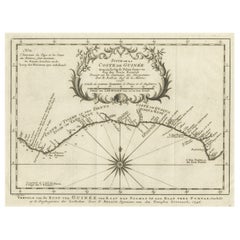
Antique Map of the West Coast of Africa, 1771
Located in Langweer, NL
Antique map titled 'Carte de la Guinee contenant les Isles du Cap Verd, le Senegal, la Cote de Guinee proprement dite, les Royaumes de Loango, Congo, Angola, et Benguela avec les Pay...
Category

Antique 18th Century and Earlier Collectibles and Curiosities

Materials

Paper

Original Antique County Map of Derbyshire, England
Located in Langweer, NL
Antique map titled 'Darbyshire'. Original antique map of the country of Derbyshire, England. Engraved by Robert Morden. Sold by Abel Swale, Awnsham and John Churchill...
Category

Antique 18th Century and Earlier Collectibles and Curiosities

Materials

Paper

Antique Map of the Bay of Brusc, France
Located in Langweer, NL
Antique map titled 'Carte de la rade du Brusc'. Original map of the bay of Brusc, France. This map originates from 'Le Petit Atlas Maritime (..)' by J.N. Bellin. Published 1764. ...
Category

Antique 18th Century and Earlier Collectibles and Curiosities

Materials

Paper

Old Original Copper Engraving Depicting a Viceroy with Entourage in China, 1735
Located in Langweer, NL
Original handtinted copper engraving with title: 'Cortege d'un Viceroy tout les fois qu'il sort de son palais'. Translate in English: 'Procession of a Viceroy whenever he leaves h...
Category

Antique 18th Century and Earlier Collectibles and Curiosities

Materials

Paper

Old Map of Ancient Rome Illustrating Major Monuments and the Seven Hills, c.1704
Located in Langweer, NL
Antique map Rome titled 'Omnia Romanae cedant Miracula Terrae (..)'. Map of Ancient Rome Illustrating Major Monuments and the Seven Hills. This map or...
Category

Antique 18th Century and Earlier Collectibles and Curiosities

Materials

Paper

Antique Print of the Churches of Cathay and Waranni in Ceylon 'Sri Lanka', 1703
Located in Langweer, NL
Antique print titled 'Cathay, Waranni'. Copper engraving of the churches of Cathay and Waranni, Sri Lanka (Ceylon). This print originates from 'A true and exact description of the mo...
Category

Antique 18th Century and Earlier Collectibles and Curiosities

Materials

Paper

Antique Print of the City of Kinnungam in China, 1668
Located in Langweer, NL
Antique print China titled 'Kinnungam'. Old print depicting a view of the Chinese city of Kinnungam with its ramparts. This print originates from t...
Category

Antique 18th Century and Earlier Collectibles and Curiosities

Materials

Paper

Antique Map of the Danube River by Homann, c.1720
Located in Langweer, NL
Antique map titled 'Danubii Fluminis (..)'. Regional map of the Donau river, Shows the Danube river from Belgrade in Serbia, along the border between Roma...
Category

Antique 18th Century and Earlier Collectibles and Curiosities

Materials

Paper

Large and Detailed Map of the Russian Empire in Asia, ca.1780
Located in Langweer, NL
Description: Antique map titled 'Bowles's New Pocket Map of the East Part of the Russian Empire in Asia'. Large and detailed map of the Russian Empire in Asia. Source unknown, to be determined. Artists and Engravers: Made by 'Thomas & Carington Bowles' after 'D'Anville'. Thomas Bowles, born around 1712, was map publisher and seller in London...
Category

Antique 18th Century and Earlier Collectibles and Curiosities

Materials

Paper

Original Hand-Colored Antique Print of Various Apples, 1758
Located in Langweer, NL
Antique print depicting apple variaties including the Rode Wijn-Appel, Geele Soete Silverling, Bellefleur, Oranje Appel, Bruindeling, Witte Renet, Groene Renet, Wildjes Appel (Reinet...
Category

Antique 18th Century and Earlier Collectibles and Curiosities

Materials

Paper

Original Antique Map of Brecknockshire, Wales
Located in Langweer, NL
Antique map titled 'Brecknoc comitaus pars olim silurum'. Original old map of Brecknockshire, Wales. Engraved by R. Vaughan after Christopher Saxton. Published circa 1640.
Category

Antique 18th Century and Earlier Collectibles and Curiosities

Materials

Paper

Beautiful Decorative Antique Map of the City of Dordrecht, the Netherlands, 1581
Located in Langweer, NL
Antique map titled 'Dordrecht'. Map of the city of Dordrecht, the Netherlands. Bird's-eye plan view of the city, with many ships and two coats of arms in upper corners. This map ...
Category

Antique 18th Century and Earlier Collectibles and Curiosities

Materials

Paper

Original Antique Map of the Dutch Provinces of Overijssel and Drenthe, 1635
Located in Langweer, NL
Antique map titled 'Transiselania Dominium vernacule Over-Yssel.' - Map of the Dutch Provinces of Overijssel and Drenthe. Dedicated to Mr. Bartold Wich...
Category

Antique 18th Century and Earlier Collectibles and Curiosities

Materials

Paper

Antique Map of France with Inset showing the Northern Departments
Located in Langweer, NL
Antique map titled 'The Republic of France divided according to its 103 Departments'. Decorative map of France. Includes a large cartouche and an in...
Category

Antique 18th Century and Earlier Collectibles and Curiosities

Materials

Paper

Original Antique Map of the British Isles Surrounded by Text
Located in Langweer, NL
Antique map titled 'Des Isles Britanniques'. Original antique map of the British isles. This map is divided in to three major regions of the 18th century United Kingdom: England, Ire...
Category

Antique 18th Century and Earlier Collectibles and Curiosities

Materials

Paper

Antique Map of Cordes Bay and Surroundings
Located in Langweer, NL
Antique map titled 'Baye et Havre de Cordes (..)'. Four maps on the one sheet of; Cordes Bay, Port Famine, Woods Pay, Port Gallant, Fortescue Bay, Chile based on the voyage of John B...
Category

Antique 18th Century and Earlier Collectibles and Curiosities

Materials

Paper

Old Print with a View on the City & Castle of Batavia 'Jakarta', Indonesia, 1668
Located in Langweer, NL
Antique print Indonesia titled ‘La ville de Batavie. De Stadt Batavia. Chateau de Batavia. ‘t Casteel van Batavia’. Antique print with a view on the city of Djakarta, Indonesia. ...
Category

Antique 18th Century and Earlier Collectibles and Curiosities

Materials

Paper

Antique Print of the Giants Attempting to Scale Heaven, 1733
Located in Langweer, NL
Antique print titled 'Les Géans ou les Titans (..)'. This print depicts the Giants attempting to Scale Heaven by piling mountains upon one another. Giants were the children of Gaia o...
Category

Antique 18th Century and Earlier Collectibles and Curiosities

Materials

Paper

Original Antique Map of England, Showing the Most Memorable Battles
Located in Langweer, NL
Antique map titled 'Carte d'Angleterre ou l'on fait observer les Batailes les plus Memorables de ce Royaume'. Original antique map of England, showing the most memorable battles. Thi...
Category

Antique 18th Century and Earlier Collectibles and Curiosities

Materials

Paper

Decorative Map of the Spice Islands in the Mollucas, Indonesia, ca.1640
Located in Langweer, NL
Antique map titled 'Moluccae Insulae Celeberrimae'. Decorative map of the Spice Islands. Inset of the Island of Bachian (Batjan) in an elaborate frame as well as a Moluccan couple in the lower right corner in Europeanized native dress. Artists and Engravers: Willem Janszoon Blaeu (1571-1638) was a prominent Dutch geographer and publisher. Born the son of a herring merchant, Blaeu chose not fish but mathematics and astronomy for his focus. He studied with the famous Danish astronomer Tycho...
Category

Antique 18th Century and Earlier Collectibles and Curiosities

Materials

Paper

Original Antique Map of England and Wales with Large Cartouche
Located in Langweer, NL
Antique map titled 'Le Royaume d'Angleterre divisé en plusieurs Parties (..)'. Large and rare map of England and Wales by J.B. Nolin after Coronelli. With decorative cartouche, table...
Category

Antique 18th Century and Earlier Collectibles and Curiosities

Materials

Paper

Antique Map of the Coastline Between Calais and Estaples and Northern France
Located in Langweer, NL
Antique map titled 'Caletensium et Bononiensium Ditionis Accurata Delinatio [on sheet with] Veromanduorum Eorumque Confinium Exactissima Discriptio'. Two maps on a folio sheet. Calentensium covers the coastline between Calais and Estaples based in part on a four-sheet map by Nicolas de Nicolay...
Category

Antique 18th Century and Earlier Collectibles and Curiosities

Materials

Paper

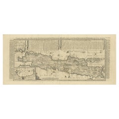
Antique Map of the Region of Bavaria and Austria by Tirion, c.1740
Located in Langweer, NL
Antique map titled 'Carte des environs de Batavia - Kaart van de Buitenstreken van Batavia'. Map of the Batavia area (Jakarta) in Indonesia. With cartouche, scale and compass rose. P...
Category

Antique 18th Century and Earlier Collectibles and Curiosities

Materials

Paper

Rare Original Miniature Map of Papua New Guinea and the Salomon Islands, 1600
Located in Langweer, NL
Very handsome original old coloured copper engraving of Papua and the Solomon Island. Title of the map 'Descriptio Novae Guneae et Inss. Salom. On the reverse text in Latin. Ve...
Category

Antique 18th Century and Earlier Collectibles and Curiosities

Materials

Paper

Antique Map of the British Isles with Walls, Settlements and Other Features
Located in Langweer, NL
Antique map titled 'Insulae Britannicae'. Interesting map of Britain, Scotland, and Ireland. It shows a rudimentary outline of the islands according to the geography of the Roman Emp...
Category

Antique 18th Century and Earlier Collectibles and Curiosities

Materials

Paper

Original Antique Poly-Olbion Map of Denbighshire and Flintshire, Wales
Located in Langweer, NL
Rare and original antique map of Denbighshire and Flintshire, Wales. From the 'Poly-Olbion,' an illustrated topographical poem describing Great Britain by Michael Drayton, 1622.
Category

Antique 18th Century and Earlier Collectibles and Curiosities

Materials

Paper

Antique Map of the Seven United Provinces of Holland by Seutter, 1727
Located in Langweer, NL
Antique map titled ‘Belgium Foederatum Auctius Et Emendatius‘. Important antique map of the Seven United Provinces of Holland with inset views of the East Indies, the province of Lim...
Category

Antique 18th Century and Earlier Collectibles and Curiosities

Materials

Paper

Interesting Small Map of the British Isles with Hand Coloring
Located in Langweer, NL
Antique map titled 'Insularum Britannicarum Tabula'. Interesting small map of the British Isles by Wells. This map originates from 'Oikumenes Periegesis, sive, Dionysii Geographia em...
Category

Antique 18th Century and Earlier Collectibles and Curiosities

Materials

Paper

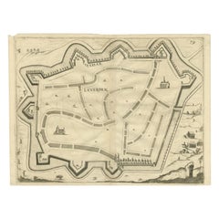
Antique Map of the City of Leeuwarden by Christyn, 1785
Located in Langweer, NL
Antique map titled 'La Ville de Lewarde'. Old map of the city of Leeuwarden, Friesland. Originates from 'Les Délices des Pays-Bas' by J.B. Christyn. Artists and Engravers: Author:...
Category

Antique 18th Century and Earlier Collectibles and Curiosities

Materials

Paper

Spectacular Large Map of Upper and Lower Austria between Passau and Wien, c.1700
Located in Langweer, NL
Antique map titled 'Austriae Archiducatus pars superior in omnes ejusdem (..).' Spectacular large map of Upper and Lower Austria between Passau and Wien with figurative cartouche a...
Category

Antique 18th Century and Earlier Collectibles and Curiosities

Materials

Paper

Antique French Map of Asia with Original Border Colouring, c.1785
Located in Langweer, NL
Antique map titled 'L'Asie divisee en ses principaux Etats.' (Map of Asia and its principal states). This map originates from an Atlas by Didier Robert de Vaugondy or his successor D...
Category

Antique 18th Century and Earlier Collectibles and Curiosities

Materials

Paper

Old Antique Map of the East Indies and Southeast Asia, ca.1644
Located in Langweer, NL
Antique map titled 'India quae Orientalis dicitur, et Insulae adiacentes'. Old map of the East Indies and Southeast Asia showing the area between India in the West and parts of Japan, the Marianas and New Guinea/Australia in the East. This map is dedicated to D. Christophorus Thisius by Henricus...
Category

Antique 18th Century and Earlier Collectibles and Curiosities

Materials

Paper

Antique Map of Northeastern Spain by Mercator, 1634
Located in Langweer, NL
Antique map titled 'Biscaia, Guipiscoa, Navarra et Asturias de Santillana'. Charming map of Northeastern Spain with the areas of Pamplona and Valladolid. This map originates from 'At...
Category

Antique 18th Century and Earlier Collectibles and Curiosities

Materials

Paper

A Gold Highlighted Antique Map of Northamptonshire by Blaeu '1659'
Located in Langweer, NL
Antique map titled 'Comitatus Northantonensis vernacule Northamtonshire'. Original antique map of Northamptonshire, England. This map originates from 'Atlas Universal y Cosmographico...
Category

Antique 18th Century and Earlier Collectibles and Curiosities

Materials

Paper

Decorative Original Antique Map of Southern Germany, c.1730
Located in Langweer, NL
"Antique map titled 'The South West Part of Germany. Containing ye Dominions of the Archbishops and Electors of Mentz Y Treves, and of ye Elec. Palatine of ye Rhine; with Franconia, ...
Category

Antique 18th Century and Earlier Collectibles and Curiosities

Materials

Paper

Map of the Western Coast of South America from Ecuador into Chili, ca.1780
Located in Langweer, NL
Antique map titled 'Carte du Perou avec une partie des pays qui en sont a l'est.' Map of the western coast of South America extending from Ecuador, through Peru and present-day B...
Category

Antique 18th Century and Earlier Collectibles and Curiosities

Materials

Paper

Read More

Medal-Worthy Memorabilia from Epic Past Olympic Games

Get into the games! These items celebrate the events, athletes, host countries and sporting spirit.

Ahoy! You’ve Never Seen a Collection of Sailor Art and Kitsch Quite Like This

French trendsetter and serial collector Daniel Rozensztroch tells us about his obsession with objects related to seafaring men.

Pamela Shamshiri Shares the Secrets behind Her First-Ever Book and Its Effortlessly Cool Interiors

The sought-after designer worked with the team at Hoffman Creative to produce a monograph that beautifully showcases some of Studio Shamshiri's most inspiring projects.

Moroccan Artworks and Objects Take Center Stage in an Extraordinary Villa in Tangier

Italian writer and collector Umberto Pasti opens the doors to his remarkable cave of wonders in North Africa.

Montecito Has Drawn Royalty and Celebrities, and These Homes Are Proof of Its Allure

Hollywood A-listers, ex-pat aristocrats and art collectors and style setters of all stripes appreciate the allure of the coastal California hamlet — much on our minds after recent winter floods.

Whaam! Blam! Pow! — a New Book on Pop Art Packs a Punch

Publishing house Assouline and writer Julie Belcove have teamed up to trace the history of the genre, from Roy Lichtenstein, Andy Warhol and Yayoi Kusama to Mickalene Thomas and Jeff Koons.

The Sparkling Legacy of Tiffany & Co. Explained, One Jewel at a Time

A gorgeous new book celebrates — and memorializes — the iconic jeweler’s rich heritage.

What Makes a Gem-Encrusted Chess Set Worth $4 Million?

The world’s most opulent chess set, weighing in at 513 carats, is literally fit for a king and queen.

Recently Viewed

View All