18th Century Collectibles and Curiosities

to
1,807
2,454
322
2,795
115
92
40
34
28
13
7
5
1
1
1
1
1
4,430
6,784
13,456
2,726
3,517
4,676
3,078
512
300
605
745
480
898
887
899
659
595
2,178
384
283
92
82
766
185
164
133
131
2,795
2,795
2,795
21
14
13
12
11
Period: 18th Century
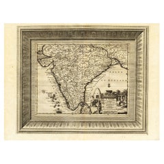
Rare Engraved Antique Map of India with Elephants in the Cartouche, c.1725
Located in Langweer, NL
Antique map titled 'L'Inde de ca le Gange suivant les nouvelles observations (..)'. Detailed map of India, with part of Sri Lanka. Compass rose and decorative cartouche lower rig...
Category

Antique 18th Century Collectibles and Curiosities

Materials

Paper

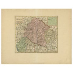
Antique Map of Hungary Incl Surroundings like Croatia, Bosnia, Servia, 1730
Located in Langweer, NL
Antique map titled 'Nieuwe Kaart van t Koninkryk Hongaryen en Zevenbergen na de laatste ontdekkingen'. This map depicts Hungary including surroundings like Croatia, Bosnia, Servia,...
Category

Antique 18th Century Collectibles and Curiosities

Materials

Paper

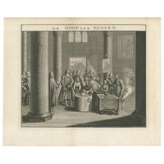
Mid-18th Century Engraving Depicting The Baptism of Russians, 1735
Located in Langweer, NL
Description: Antique print titled 'De Doop der Russen' (Dutch for 'Baptism of the Russians') Old print depicting the baptism of Russians. This print originates from 'Hedendaegsch...
Category

Antique 18th Century Collectibles and Curiosities

Materials

Paper

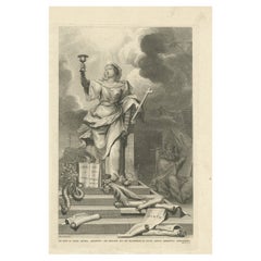
Antique Print Stating That Law is Given by Moses, Mercy and Truth by Jesus, 1725
Located in Langweer, NL
Antique print titled 'De wet is door Mozes gegeven, de genade en de waarheid is door Jesus Christus geworden.' The law is given by Moses, Mercy and Truth established by Jesus Christ....
Category

Antique 18th Century Collectibles and Curiosities

Materials

Paper

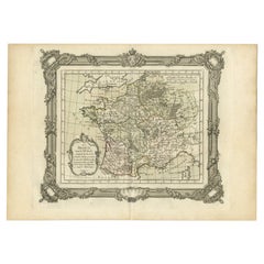
Antique Map of France in the 7th Century by Zannoni, 1765
Located in Langweer, NL
Antique map France titled 'La France sous le VIIe Siècle (..)'. Beautiful old map of France. This map originates from 'Atlas Historique de la France Ancienne et Moderne' by M. Rizzi ...
Category

Antique 18th Century Collectibles and Curiosities

Materials

Paper

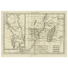
Antique Map of Mozambique Channel with Madagascar and Inset of Cape Region, 1780
Located in Langweer, NL
Antique map titled 'Carte du canal de Mosambique, contenant l'Isle de Madagascar avec les Cotes d'Afrique.' Map of Mozambique Channel, containing the Island of Madagascar with the coasts of Africa from Cape of Good Hope to Melinde. The inset map shows the Cape region in South Africa with False Bay, Robben Island etc. Source unknown, to be determined. Artists and Engravers: Rigobert Bonne (1727-1795 ) was one of the most important cartographers of the late 18th century. In 1773 he succeeded Jacques Bellin as Royal Cartographer to France in the office of the Hydrographer at the Depôt de la Marine. Working in his official capacity Bonne compiled some of the most detailed and accurate maps of the period. Bonne's work represents an important step in the evolution of the cartographic ideology away from the decorative work of the 17th and early 18th century towards a more detail oriented and practical aesthetic. With regard to the rendering of terrain Bonne maps...
Category

Antique 18th Century Collectibles and Curiosities

Materials

Paper

Antique Map of Mozambique Bay and a Map Fort de Mozambique, c.1759
Located in Langweer, NL
Two antique maps on one sheet. The upper antique map is titled 'Plan du Fort de Mozambique tiré de Faria' and depicts the island of Mozambique with its fort, settlement, harbor and i...
Category

Antique 18th Century Collectibles and Curiosities

Materials

Paper

Antique Map of Guadeloupe with Les Saintes, Grand Bourg and La Désirade, c.1780
Located in Langweer, NL
Antique map titled 'Les Isles de la Guadeloupe (..).' Map of the Caribbean Island of Guadeloupe with the surrounding islands Les Saintes, Grand Bourg and La Désirade. Source unknow...
Category

Antique 18th Century Collectibles and Curiosities

Materials

Paper

Antique Map of Lapland Covering all of Sweden around the Gulf of Bothnia, 1714
Located in Langweer, NL
Antique map titled 'Carte de la Laponie Suedoise (..)'. Includes an inset map of Lapland covering all of Sweden around the Gulf of Bothnia. A series of ...
Category

Antique 18th Century Collectibles and Curiosities

Materials

Paper

French Antique Miniature Map of Germany and Surrounding Countries, 1721
Located in Langweer, NL
Antique map Germany titled 'Allemagne Par N. Sanson le Fils Geographe du Roy'. Minitaure map of Germany and surroundings. Originates from 'Introduc...
Category

Antique 18th Century Collectibles and Curiosities

Materials

Paper

French Edition of an Antique Map of Friesland in the Netherlands, 1709
Located in Langweer, NL
Antique map titled 'La Seigneurie d'Ouest-Frise ou Frise Occidentale (..)'. Original antique map of Friesland, published 1709. Artists and Engravers: Alexis-Hubert Jaillot (1632 ? 2 ...
Category

Antique 18th Century Collectibles and Curiosities

Materials

Paper

Attractive Antique Map of Asia with Borders Hand-Coloured, c.1780
Located in Langweer, NL
Antique map titled 'L'Asie.' This map shows the Asia continent. Originates from 'Atlas de toutes les parties du Globe Terrestre (..)', published by M. Bonne in Paris, c. 1780. ...
Category

Antique 18th Century Collectibles and Curiosities

Materials

Paper

Antique Map of France under the Reign of Philip VI by Zannoni, 1765
Located in Langweer, NL
Antique map France titled 'Le Dauphine et la Champagne (..)'. Beautiful old map of France. This map originates from 'Atlas Historique de la France Ancienne...
Category

Antique 18th Century Collectibles and Curiosities

Materials

Paper

Antique Map of France under the Reign of St. Louis by Zannoni, 1765
Located in Langweer, NL
Antique map France titled 'Le Domaine de la Couronne (..)'. Beautiful old map of France. This map originates from 'Atlas Historique de la France Ancienne et Moderne' by M. Rizzi Zann...
Category

Antique 18th Century Collectibles and Curiosities

Materials

Paper

Antique Map of France up-to the Peace of Ryswick by Zannoni, 1765
Located in Langweer, NL
Antique map France titled 'Carte pour servir à l'intelligence de l'Histoire de France (..)'. Beautiful old map of France. This map originates from 'Atlas Historique de la France Anci...
Category

Antique 18th Century Collectibles and Curiosities

Materials

Paper

Antique Map of Friesland by Bussemacher in Frame, c.1592
Located in Langweer, NL
Original antique map titled 'Frisiae Antiquissimae (..)'. Original antique map of Friesland. Published by J. Bussemacher, circa 1592. Artists and Engravers: Bussemacher was active as...
Category

Antique 18th Century Collectibles and Curiosities

Materials

Paper

Antique Map of Friesland after the Floods of the 13th Century, 1718
Located in Langweer, NL
Antique map Friesland titled 'Pars II et III Frisiae Libera(..)'. Old map of Friesland, the Netherlands, after the floods of the 13th century. Originates from 'Uitbeelding van de Hee...
Category

Antique 18th Century Collectibles and Curiosities

Materials

Paper

Rare Map of St. Louis on the Island of Hispaniola 'Santa Domingo', 1748
Located in Langweer, NL
Description: Antique map titled 'A New & Exact Planof the Harbour of Port Louis (..)'. Scarce early plan of the Harbor of St. Louis on the Island of Hispaniola (Santa Domingo), showing the the harbor at the time it was taken by Admiral Knowles in March 1748. Charles Knowles (1704 – 1777) was an officer of the Royal Navy, who saw service during the War of Jenkins' Ear, the War of the Austrian Succession, and the Seven Years War. He also briefly served with the Imperial Russian Navy...
Category

Antique 18th Century Collectibles and Curiosities

Materials

Paper

Antique Map of Gaasterland in Friesland, the Netherlands, 1718
Located in Langweer, NL
Antique map titled 'Gaasterland. De zevende Grietenije van de Zevenwolden (..)'. Original antique map of Gaasterland, Friesland, the Netherlands. Originates from 'Uitbeelding van de ...
Category

Antique 18th Century Collectibles and Curiosities

Materials

Paper

Antique Map of Friesland by Von Reilly, 1791
Located in Langweer, NL
Antique map titled 'Friesland'. Map of the province of Friesland, the Netherlands. This map orginates from 'Schauplatz der fünf Theile der Welt'. Artists and Engravers: Franz Joseph ...
Category

Antique 18th Century Collectibles and Curiosities

Materials

Paper

Antique Map of Friesland in the Time of the Franks, 1718
Located in Langweer, NL
Antique map Friesland titled 'Descriptio Frisiae sub Francorum reditum (..)'. Old map of Friesland, the Netherlands, in the time of the Franks. Originates from 'Uitbeelding van de He...
Category

Antique 18th Century Collectibles and Curiosities

Materials

Paper

Antique Map of Anjouan or Ndzuani, Island of The Comoros, 1748
Located in Langweer, NL
Antique map titled ‘Carte de L’Isle D’Anjouan’. Original antique map of Anjouan, also known as Ndzuwani or Nzwani, or, historically, as Johanna, an autonomous island in the Indian Oc...
Category

Antique 18th Century Collectibles and Curiosities

Materials

Paper

Antique Map of a Bay Nearby Makassar, Celebes 'Sulawesi)' by Hawkesworth, 1774
Located in Langweer, NL
Antique map titled 'Vue de la Baye de Bonthain (..)'. Map of the island Sulawesi (Celebes), Indonesia that Philip Carteret rested his crew and made repairs to his ship the Swallow fo...
Category

Antique 18th Century Collectibles and Curiosities

Materials

Paper

Antique Frontispiece of a Book about Europe by Tirion, 1734
Located in Langweer, NL
Antique frontispiece of the 6th volume of 'Hedendaagsche historie of tegenwoordige staat van allen volkeren (..)' by Thomas Salmon. This volume describes par...
Category

Antique 18th Century Collectibles and Curiosities

Materials

Paper

Antique Map of Asia by Guthrie, 1787
Located in Langweer, NL
Antique map titled 'Asia from the best Authorities'. Old map of the Asian continent. This map originates from 'A New Geographical, Historical and Commercial Grammar; and Present State of the several Kingdoms of the World' 10th ed. by W. Guthrie. Artists and Engravers: Published by Ch.Dilly; GGJ...
Category

Antique 18th Century Collectibles and Curiosities

Materials

Paper

Antique Map of Asia with Northern Portion of Australia “Hollandia Nova", 1727
Located in Langweer, NL
Antique map titled 'Exactissima Asiae Delineatio in praecipuas regiones Caeterasq Partes.' Original antique map of the continent of Asia with a northern portion of Australia “Holland...
Category

Antique 18th Century Collectibles and Curiosities

Materials

Paper

Antique Map of France After the Peace of Ryswick by Zannoni, 1765
Located in Langweer, NL
Antique map France titled 'Etat du Domaine apès le Traité de Ryswick (..)'. Beautiful old map of France. This map originates from 'Atlas Historique de la France Ancienne et Moderne' ...
Category

Antique 18th Century Collectibles and Curiosities

Materials

Paper

Large Antique Map of Denmark by Bowles, c.1780
Located in Langweer, NL
Antique map titled 'Bowles's new pocket map of the Kingdom of Denmark (..)' Large map of Denmark. Source unknown, to be determined. Artists and Engravers: Made by 'Thomas & Carington Bowles' after 'J. Palairet'. Thomas Bowles, born around 1712, was map publisher and seller in London...
Category

Antique 18th Century Collectibles and Curiosities

Materials

Paper

Antique Engraving of a Map or Plan of Jerusalem and Surrounding Mountains, 1773
Located in Langweer, NL
Antique map titled 'Platte grond van Jerusalem, en de omliggende Bergen'. Plan of the city of Jerusalem, with surrounding mountains. Originates from the first Dutch editon of an inte...
Category

Antique 18th Century Collectibles and Curiosities

Materials

Paper

Antique Map Showing Estates of 1669 in Amsterdam, Published in c.1767
Located in Langweer, NL
Antique map titled 'Kaart der landeryen, gelegen aan of onder de honderd gaarden, zo in de Buitenvelder- als Stads-polder; van welken de gestreepten, voor 't geregt van Nieuwer-Amste...
Category

Antique 18th Century Collectibles and Curiosities

Materials

Paper

Rare Antique Map of Noord-Holland, Province in The Netherlands, c.1750
Located in Langweer, NL
Antique map titled 'Kaart van Noord-Holland'. Map of the province of Noord-Holland, the Netherlands. Published circa 1750. Artists and Engravers: Published by 'de Erven van J. Ratelb...
Category

Antique 18th Century Collectibles and Curiosities

Materials

Paper

Antique Map of France by Covens & Son, c.1790
Located in Langweer, NL
A detailed description of the 'Carte de France divisée en 83 Departements (..)', an antique map circa 1790, along with information about its publishers, Covens & Mortier: **Title**:...
Category

Antique 18th Century Collectibles and Curiosities

Materials

Paper

Antique Map of France with Decorative Border, 1766
Located in Langweer, NL
Antique map titled 'La France, divisée en ses quarante Gouvernemens Généraux.' Attractive map of France by Brion de la Tour, published by Desnos. The decorative border was printed fr...
Category

Antique 18th Century Collectibles and Curiosities

Materials

Paper

Antique Map of France under the Reign of Charles IX by Zannoni, 1765
Located in Langweer, NL
Antique map France titled 'Tableau du Domaine sous Charles IX (..)'. Beautiful old map of France. This map originates from 'Atlas Historique de la France An...
Category

Antique 18th Century Collectibles and Curiosities

Materials

Paper

Antique Map of Cities of the Province of Che-Kyang in China, 1738
Located in Langweer, NL
Antique print China titled 'Cities of the Province of Che-Kyang'. Old map depicting four walled cities of the Chinese Qing dynasty province of Che-Kiang (modern day CHEKIANG): Hang C...
Category

Antique 18th Century Collectibles and Curiosities

Materials

Paper

Antique Map of Asia with Additional Country Information, c. 1749
Located in Langweer, NL
Antique map titled 'L'Asie divisée en ses principaux Empires et Royaumes'. Detailed map of Asia, with a large table on the right side, providing information about the various major c...
Category

Antique 18th Century Collectibles and Curiosities

Materials

Paper

Antique Map of Asia with Misshaped Coastlines and Distorted Islands c.1760
Located in Langweer, NL
Antique map titled 'L’Asie la feuille exc'. Old map of Asia. The map contains several misshaped coastlines and distorted islands with a small cartouche held by an elephant in the top...
Category

Antique 18th Century Collectibles and Curiosities

Materials

Paper

Antique Map of Asia Showing all of Indonesia and the Marianas, 1790
Located in Langweer, NL
Antique map titled 'L'Asie dressee pour l'etude de la Geographie (..)'. Attractive map of Asia with an ornate cartouche and ships surrounding the coast. Extends to an incomplete New ...
Category

Antique 18th Century Collectibles and Curiosities

Materials

Paper

Antique Map of Ambon with Inset of the Victoria Castle, Moluku, Indonesia, 1726
Located in Langweer, NL
Antique map titled 'Caart van het Eyland Ambonia in het bijsonder. ' This is a print of an antique map of the Islands Ambon and Timor, one of the Moluccan Islands, Indonesia, with an...
Category

Antique 18th Century Collectibles and Curiosities

Materials

Paper

Antique Frontispiece of Book about The Turkish Empire in Asia and Africa, 1733
Located in Langweer, NL
Antique frontispiece of the 5th volume of 'Hedendaagsche historie of tegenwoordige staat van allen volkeren (..)' by Thomas Salmon. This volume describes the...
Category

Antique 18th Century Collectibles and Curiosities

Materials

Paper

Antique Map of Eastern Tartary and the Gobi Desert by Van Schley, 1758
Located in Langweer, NL
Antique map titled 'Carte de la Tartarie occidentale.' Original antique map of Eastern Tartary and the Gobi desert showing the silk road and the Great Wall of China. While these maps...
Category

Antique 18th Century Collectibles and Curiosities

Materials

Paper

Antique Map of Eastern Siberia Extending to Kamtchatka, Russia, 1764
Located in Langweer, NL
Antique map titled 'Suite De La Carte De La Siberie Et le Pays de Kamtchatka'. Detailed map the Eastern portion of Siberia, extending to Kamtchatka. Shows the Russian voyage of 1648 in the NE Passage region. Includes a decorative title cartouche. Originates from Prevost d'Exiles influential travel book, 'L'Histoire Generale des Voyages'. Artists and Engravers: Jacques-Nicolas Bellin (1703-1772) was among the most important mapmakers of the eighteenth century. In 1721, at age 18, he was appointed hydrographer (chief cartographer) to the French Navy. In August 1741, he became the first Ingénieur de la Marine of the Depot des cartes...
Category

Antique 18th Century Collectibles and Curiosities

Materials

Paper

Antique Map of Gallia and Germania on one Sheet, c.1703
Located in Langweer, NL
Antique map depicting France (Gallia) and Germany (Germania). Printed for Scherer's 'Atlas Novus' (1702-1710). Artists and Engravers: Heinrich Scherer (1628-1704) was a Professor o...
Category

German Antique 18th Century Collectibles and Curiosities

Materials

Paper

Antique Map of France by Homann, 1738
Located in Langweer, NL
Antique map titled 'Gallia Benedictina seu Abbatiar & Prioratus tam Monachorum quam Monialium Ord. S. Benedict (..)'. Beautiful antique map of France...
Category

Antique 18th Century Collectibles and Curiosities

Materials

Paper

Antique Map of Cities in the Hubei and Hunan Provinces of China, 1755
Located in Langweer, NL
Antique print titled 'Plans de Quelques villes de la province de Hou-Quang.' Three bird's-eye view plans of walled cities in what are now China's Hubei (Hou-Quang) and Hunan Province...
Category

Antique 18th Century Collectibles and Curiosities

Materials

Paper

Antique Genealogy Chart of Weteravie, Swabia, Westphalia & Franconia, 1732
Located in Langweer, NL
Antique print titled 'Carte de la Seconde Noblesse (..)'. Chart of the noble counts of the second branch of Weteravie, Swabia, Westphalia and Franconia. This print orginates from 'At...
Category

Antique 18th Century Collectibles and Curiosities

Materials

Paper

Antique Frontispiece with Religious Figures by Van Dùren, 1752
Located in Langweer, NL
Antique frontispiece with religious figures. This print originates from volume 5 of '' New collection of the strangest travel stories, especially the...
Category

Antique 18th Century Collectibles and Curiosities

Materials

Paper

Antique Map of the Tunquin River and Bay by Van Schley 'c.1750'
Located in Langweer, NL
Antique map titled ‘Kaart van den Loop der Rivier van Tonkin van Cacho tot aan de Zee / Carte du Cours de la Riviere de Tunquin Depuis Cacho jusqu'à la Mer J. v. Schley direx.’ Detai...
Category

Antique 18th Century Collectibles and Curiosities

Materials

Paper

Antique Map of the Seventeen Provinces by Halma '1705'
Located in Langweer, NL
Antique map titled 'De zeventien Nederlantsche Provintiën'. Original antique map of the Seventeen Provinces, the Imperial states of the Habsburg Netherlands in the 16th century. This...
Category

Antique 18th Century Collectibles and Curiosities

Materials

Paper

18th Century French Reliquaries
Located in Dallas, TX
Set of three 18th century French Reliquaries. Carved wood with metal repousse over the wood Each piece contains the original Latin pages framed in o...
Category

French French Provincial Antique 18th Century Collectibles and Curiosities

Materials

Metal

Antique Spanish-Colonial Santo
Located in Atlanta, GA
An very well weathered Spanish-colonial Santo, likely depicting St Michael or St Miguel. Carved from the wood, the statue displays historical loss on both limbs and also the wings on...
Category

Mexican Spanish Colonial Antique 18th Century Collectibles and Curiosities

Materials

Wood

Antique Miniature Map of the Maluku Islands by Van Esveldt & Holtrop 'c.1790'
Located in Langweer, NL
Antique map titled 'De Moluksche Eilanden'. Original antique miniature map of the Maluku Islands (Moluccas), an archipelago in eastern Indonesia. This map originates from an extremel...
Category

Antique 18th Century Collectibles and Curiosities

Materials

Paper

Antique Map of the Arctic Ocean and Novaya Zemlya by Bellin '1759'
Located in Langweer, NL
Antique map titled 'Partie de la Mer Glaciale contenant la Nouvelle Zemle et le Pais des Samoiedes (..)'. Original antique map of the Arctic Ocean containing Novaya Zemlya and the co...
Category

Antique 18th Century Collectibles and Curiosities

Materials

Paper

Antique Map of Eastern Siberia by Bellin '1768'
Located in Langweer, NL
Antique map titled 'Suite de la Carte de la Siberie et le Pays de Kamtchatka'. Original antique map of the eastern portion of Siberia, centered on eastern Russia and the Mer d'Ochozk (Sea of Okhotsk) showing the Kamchatka Peninsula and I. de Beringe and I. Sagalin. The map shows the tracks of Russian ships...
Category

Antique 18th Century Collectibles and Curiosities

Materials

Paper

Antique Hand-Colored Engraving of Raid on the Medway, England, 'c.1790'
Located in Langweer, NL
Antique print titled 'Aftekening der Schilderye op 't Stadhuis te Dordrecht (..)'. Scene of the battle of Chattam during one of the many Anglo-Dutch wars. In this battle, the Dutch sailed up the river Thames and destroyed part of the English fleet at anchor in the harbor of Chattam. Pictured in the foreground is the Dutch commander, Cornelius de Wit, being presented with the spoils of war...
Category

Antique 18th Century Collectibles and Curiosities

Materials

Paper

Antique Map of Southeast Asia by Van Dùren, 1752
Located in Langweer, NL
Antique map titled 'Neue Vorstellung von Indien und China'. Original antique map of Southeast Asia. This map originates from 'Neue Sammlung der merkwürdigsten Reisegeschichten, inson...
Category

Antique 18th Century Collectibles and Curiosities

Materials

Paper

Antique Map of Coiba Island by Anson '1749'
Located in Langweer, NL
Antique map titled 'Plan van de Oost-Zyde van het Eiland Quibo'. Original antique map of the eastside of Coiba Island (Quibo), Panama, showing the shoreline around Port de Dames indi...
Category

Antique 18th Century Collectibles and Curiosities

Materials

Paper

Original Antique Map of Northern Africa by Van Dùren (1749)
Located in Langweer, NL
This is a German antique map titled 'Neue Geographische Vorstellung der Mitternaechtlichen Küste von Africa'. Original antique engraving of Northern Africa extending from the Strait ...
Category

Antique 18th Century Collectibles and Curiosities

Materials

Paper

Antique Map of Africa by Keizer & de Lat, 1788
Located in Langweer, NL
Antique map titled 'Kaartje van Africa (..)'. Uncommon original antique map of Africa. This map originates from 'Nieuwe Natuur- Geschied- en Handelkundige Zak- en Reisatlas' by Gerri...
Category

Antique 18th Century Collectibles and Curiosities

Materials

Paper

Antique Map of the Kingdom of Prussia by Keizer & de Lat, 1788
Located in Langweer, NL
Antique map titled 't Koninkryk Pruissen (..)'. Uncommon original antique map of the Kingdom of Prussia. This map originates from 'Nieuwe Natuur- Geschied- en Handelkundige Zak- en R...
Category

Antique 18th Century Collectibles and Curiosities

Materials

Paper

Read More

Medal-Worthy Memorabilia from Epic Past Olympic Games

Get into the games! These items celebrate the events, athletes, host countries and sporting spirit.

Ahoy! You’ve Never Seen a Collection of Sailor Art and Kitsch Quite Like This

French trendsetter and serial collector Daniel Rozensztroch tells us about his obsession with objects related to seafaring men.

Pamela Shamshiri Shares the Secrets behind Her First-Ever Book and Its Effortlessly Cool Interiors

The sought-after designer worked with the team at Hoffman Creative to produce a monograph that beautifully showcases some of Studio Shamshiri's most inspiring projects.

Moroccan Artworks and Objects Take Center Stage in an Extraordinary Villa in Tangier

Italian writer and collector Umberto Pasti opens the doors to his remarkable cave of wonders in North Africa.

Montecito Has Drawn Royalty and Celebrities, and These Homes Are Proof of Its Allure

Hollywood A-listers, ex-pat aristocrats and art collectors and style setters of all stripes appreciate the allure of the coastal California hamlet — much on our minds after recent winter floods.

Whaam! Blam! Pow! — a New Book on Pop Art Packs a Punch

Publishing house Assouline and writer Julie Belcove have teamed up to trace the history of the genre, from Roy Lichtenstein, Andy Warhol and Yayoi Kusama to Mickalene Thomas and Jeff Koons.

What Makes a Gem-Encrusted Chess Set Worth $4 Million?

The world’s most opulent chess set, weighing in at 513 carats, is literally fit for a king and queen.

Tauba Auerbach’s Geometric Pop-Up Book Is Mighty Rare, Thanks to a Hurricane

This sculptural art book has an epic backstory of its own.
Recently Viewed

View All