Items Similar to Attractive Antique Map of Asia with Borders Hand-Coloured, c.1780

Want more images or videos?
Request additional images or videos from the seller
1 of 5
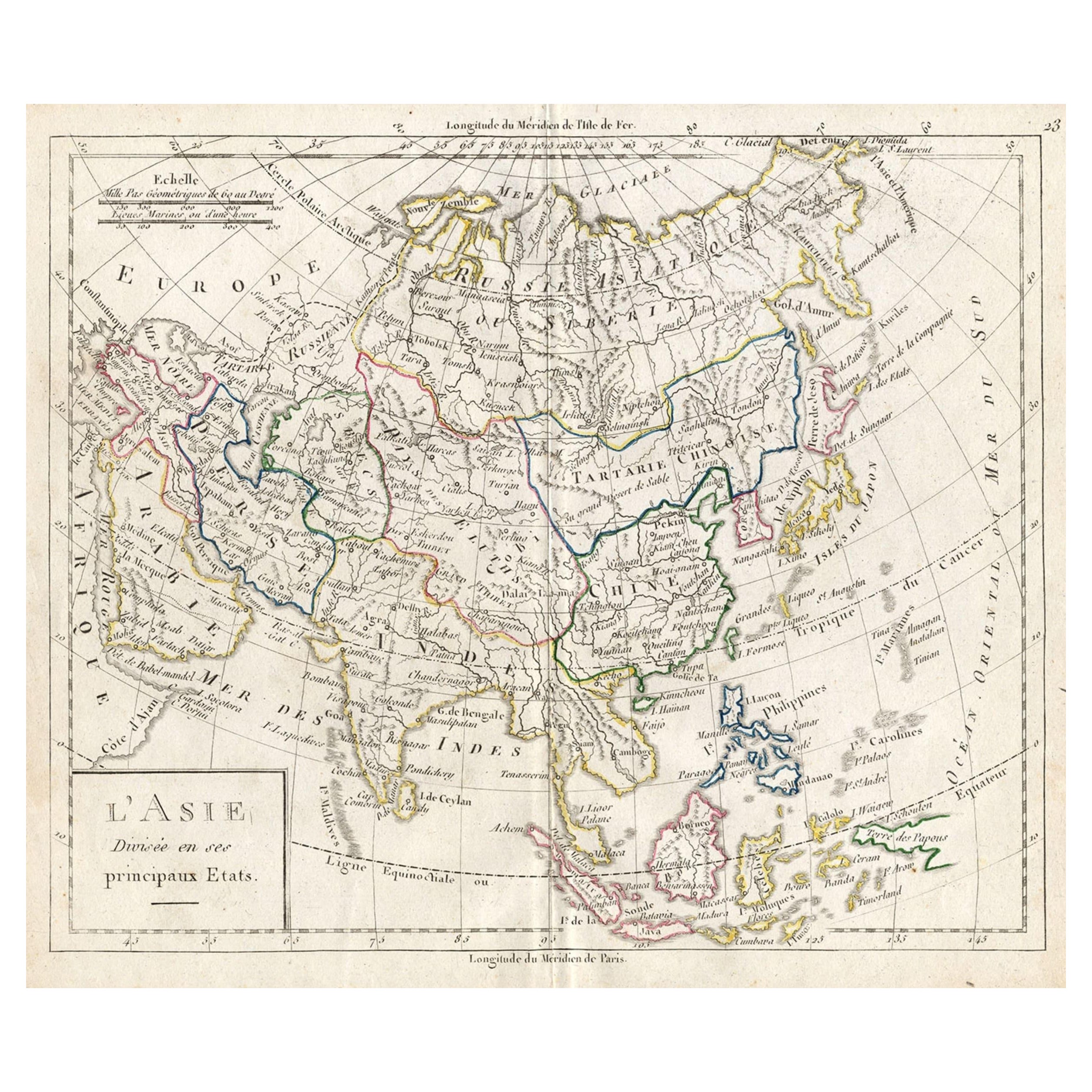
Attractive Antique Map of Asia with Borders Hand-Coloured, c.1780
About the Item
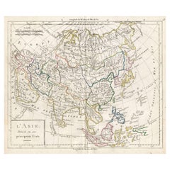
Antique map titled 'L'Asie.'
This map shows the Asia continent. Originates from 'Atlas de toutes les parties du Globe Terrestre (..)', published by M. Bonne in Paris, c. 1780.
Artists and Engravers: Cartographer: Rigobert Bonne, (1727 - 1795), was one of the most important cartographers of the late 18th century. He succeeded Jacques Nicolas Bellin as Royal Cartographer to France in the office of the Hydrographer at the French Depôt de la Marine. Engraved by Gaspard Andre.
Condition: Fine. General age related toning and occasional light staining from handling as visible on image. Please study image carefully.
Date: c.1780
Overall size: 38 x 25 cm.
Image size: 32 x 22 cm.
We sell original antique maps to collectors, historians, educators and interior decorators all over the world. Our collection includes a wide range of authentic antique maps from the 16th to the 20th centuries. Buying and collecting antique maps is a tradition that goes back hundreds of years. Antique maps have proved a richly rewarding investment over the past decade, thanks to a growing appreciation of their unique historical appeal. Today the decorative qualities of antique maps are widely recognized by interior designers who appreciate their beauty and design flexibility. Depending on the individual map, presentation, and context, a rare or antique map can be modern, traditional, abstract, figurative, serious or whimsical. We offer a wide range of authentic antique maps for any budget.
- Dimensions:Height: 9.85 in (25 cm)Width: 14.97 in (38 cm)Depth: 0 in (0.01 mm)
- Materials and Techniques:
- Period:
- Date of Manufacture:circa 1780
- Condition:
- Seller Location:Langweer, NL
- Reference Number:
About the Seller
5.0
Platinum Seller
These expertly vetted sellers are 1stDibs' most experienced sellers and are rated highest by our customers.
Established in 2009
1stDibs seller since 2017
1,933 sales on 1stDibs
Typical response time: <1 hour
- ShippingRetrieving quote...Ships From: Langweer, Netherlands
- Return PolicyA return for this item may be initiated within 14 days of delivery.
More From This SellerView All
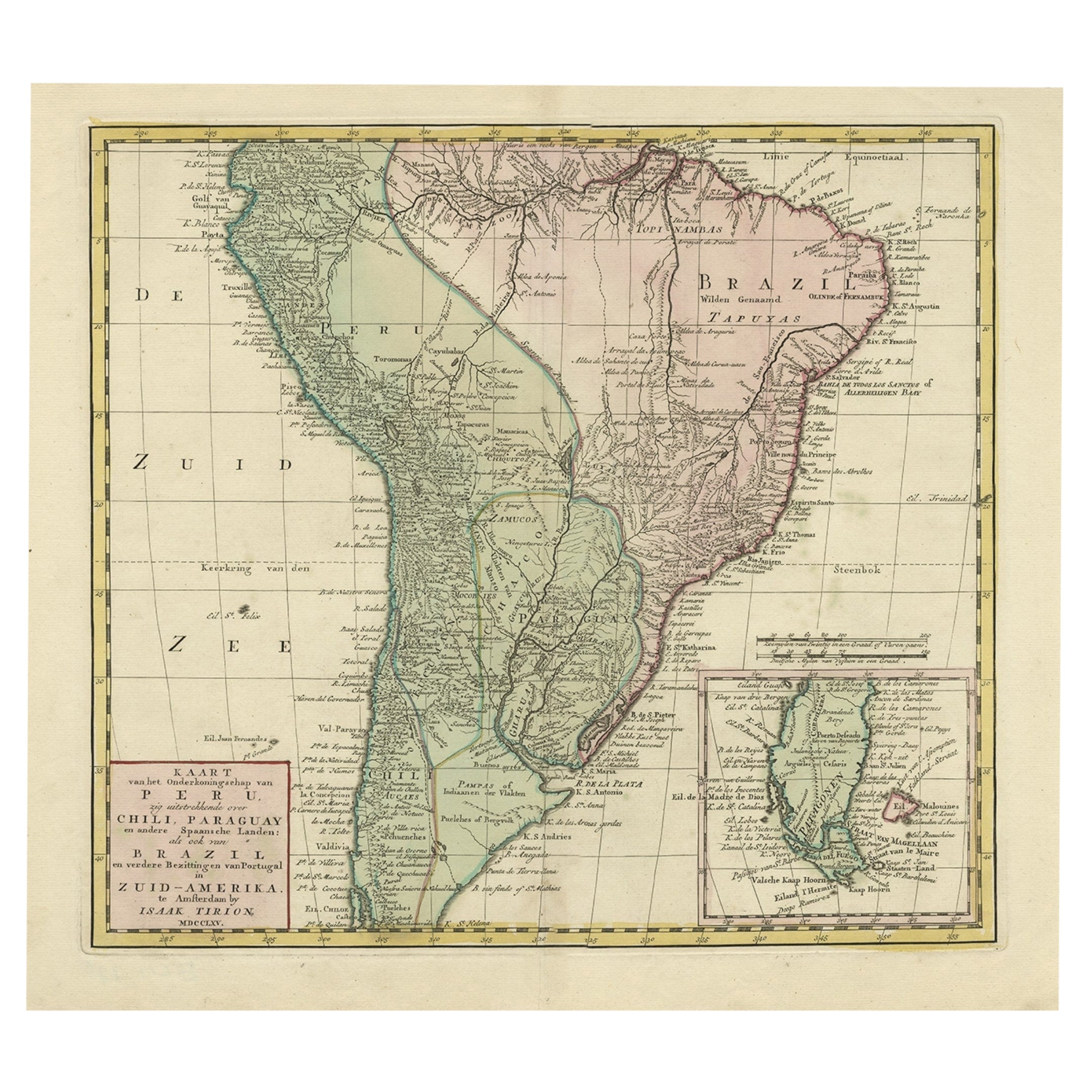
- Attractive Antique Hand-Coloured Map of South America, ca.1765Located in Langweer, NLAntique map titled 'Kaart van het Onderkoningschap van Peru zig uitstrekkende: over Chile, Paraguay en andere Spaansche Landen als ook van Brazil en verdere Bezittingen van Portugal ...Category
Antique 1760s Maps
MaterialsPaper
- Antique French Map of Asia with Original Border Colouring, c.1785Located in Langweer, NLAntique map titled 'L'Asie divisee en ses principaux Etats.' (Map of Asia and its principal states). This map originates from an Atlas by Didier Robert de Vaugondy or his successor D...Category
Antique 18th Century Maps
MaterialsPaper
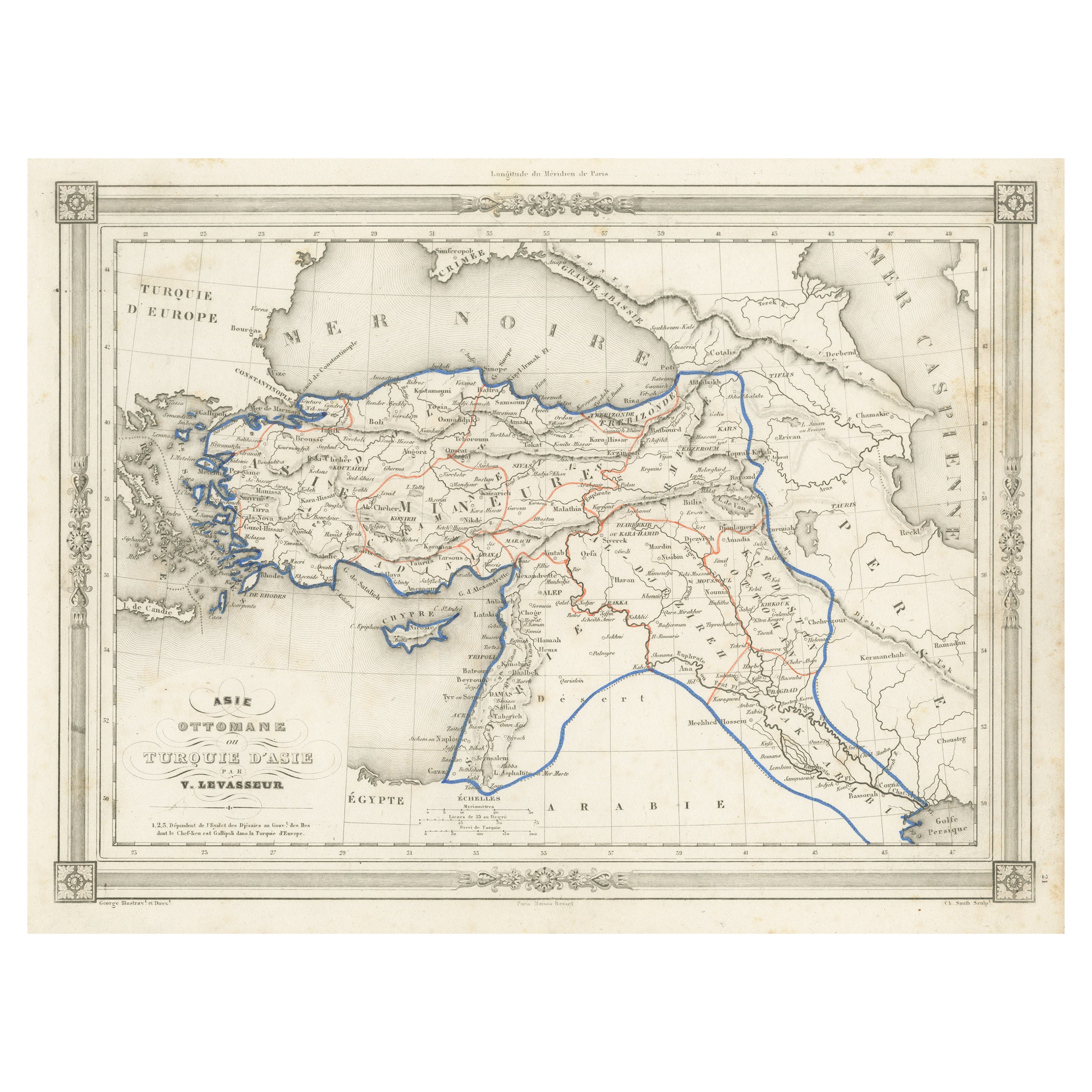
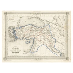
- Antique Map of Turkey in Asia, with Frame Style BorderLocated in Langweer, NLAntique map titled 'Asie Ottomane ou Turquie d'Asie'. Attractive map of Turkey in Asia. The map covers the Asian territories claimed by the Turkish Ottoman Empire c.1850 from the Bla...Category
Antique Mid-19th Century Maps
MaterialsPaper
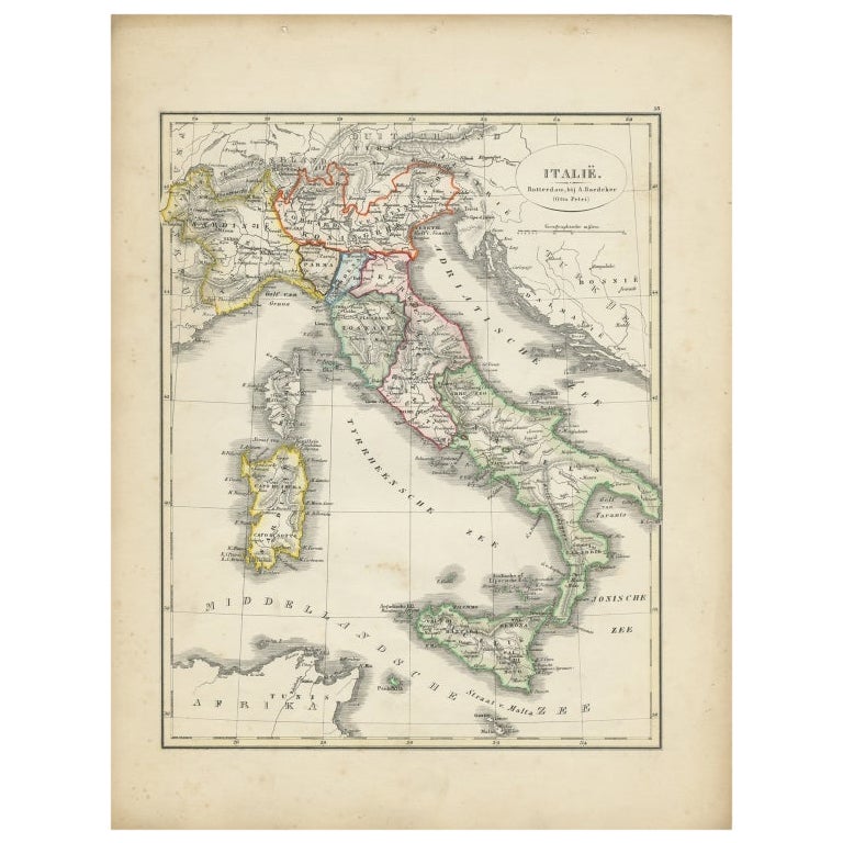
- Antique Map of Italy with Hand-Colored Borders, 1852Located in Langweer, NLAntique map titled 'Italië'. Map of Italy. This map originates from 'School-Atlas van alle deelen der Aarde' by Otto Petri. Artists and Engravers: Published by A. Baedeker (Otto Petr...Category
Antique 19th Century Maps
MaterialsPaper
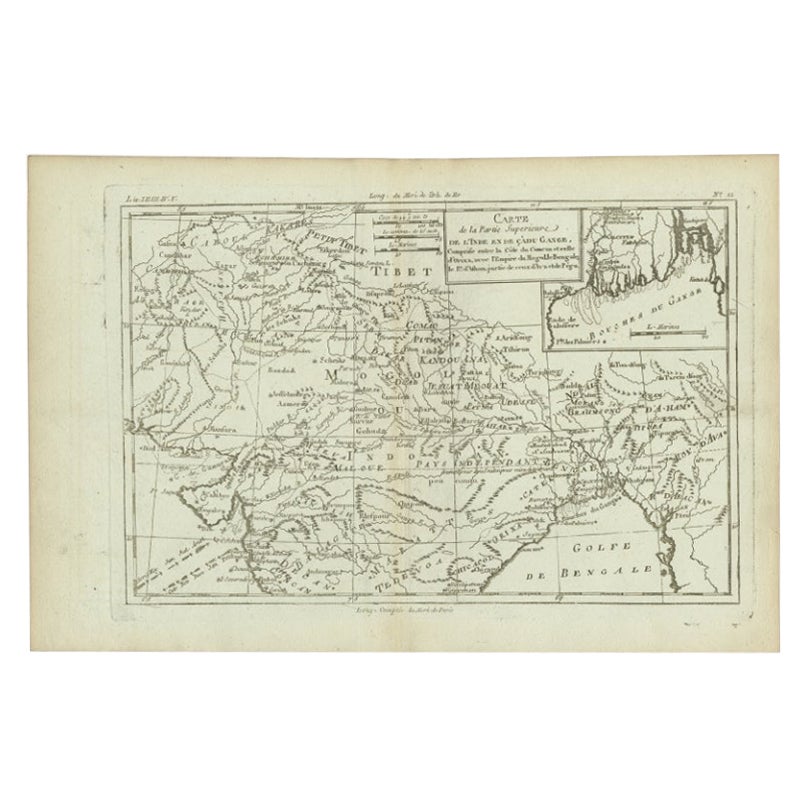
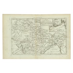
- Antique Map of Part of Southern Asia by Bonne, c.1780Located in Langweer, NLAntique map titled 'Carte de la Partie Superieure de l'Inde en deca du Gange. Comprise entre la Cote du Concan et celle d'Orixa, avec l'Empire du Mogol, le Bengale, le R. d'Asham, pa...Category
Antique 18th Century Maps
MaterialsPaper
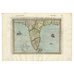
- Rare Attractive Antique Map of Asia, India, Sri Lanka, Maldives, 1599Located in Langweer, NLOriginal Antique map of Asia, India, Ceylon (Sri Lanka), Maldives by Rosaccio / Ruscelli in attractive coloring. Title: Calecut Nuova Tavola Year: 1599 Relief shown pictorially. ...Category
Antique 16th Century European Maps
MaterialsPaper


You May Also Like
- Original Antique Map of Asia. C.1780Located in St Annes, LancashireGreat map of Asia Copper-plate engraving Published C.1780 Two small worm holes to right side of map Unframed.Category
Antique Early 1800s English Georgian Maps
MaterialsPaper

- Original Antique Map of Italy. C.1780Located in St Annes, LancashireGreat map of Italy Copper-plate engraving Published C.1780 Unframed.Category
Antique Early 1800s English Georgian Maps
MaterialsPaper

- Original Antique Map of India. C.1780Located in St Annes, LancashireGreat map of India Copper-plate engraving Published C.1780 Three small worm holes to right side of map and one bottom left corner Unframed.Category
Antique Early 1800s English Georgian Maps
MaterialsPaper

- Antique Hand-Coloured Map of Venice with Vintage Frame, Italy, Late 18th CenturyLocated in Copenhagen K, DKItaly, late 18th Century Antique hand-coloured map of Venice. Measures: H 52 x W 59 cm.Category
Antique Late 18th Century Italian Decorative Art
MaterialsOther
- Original Antique Map of South America. C.1780Located in St Annes, LancashireGreat map of South America Copper-plate engraving Published C.1780 Two small worm holes to left side of map Unframed.Category
Antique Early 1800s English Georgian Maps
MaterialsPaper
- Original Antique Map of South East Asia, Arrowsmith, 1820Located in St Annes, LancashireGreat map of South East Asia Drawn under the direction of Arrowsmith Copper-plate engraving Published by Longman, Hurst, Rees, Orme and Brown, 1820 Unframed.Category
Antique 1820s English Maps
MaterialsPaper


Recently Viewed
View AllMore Ways To Browse
French Border
Hand Coloured
Map Light
Antique Globes Of The World
Map Of Asia
Marine Collectibles
Antique Map Of Asia
Antique Maps Of Asia
Fine Antique Maps
Antique French Globe
Antique Map Border
Antique Globes And Maps
Antique Paper Globe
World Map Globe
Antique Asian Maps
La Marine Antique
World Globe With Light
Used Furniture Depot