Mid-18th Century Collectibles and Curiosities

to
421
516
56
574
23
14
13
2
2
2
1
1
4,371
6,581
13,298
2,710
3,505
4,604
3,012
518
314
588
735
463
897
874
892
655
566
462
66
44
24
19
135
30
23
22
22
574
574
574
9
5
3
3
3
Period: Mid-18th Century
Authentic Old Map of Persia with Original Border Coloring, 1745
Located in Langweer, NL
Title: "Kaartje van Persien na de stelling van den Heer Guillaume de L'Isle" Translates to "Map of Persia based on the work of Mr. Guillaume de L'Isle." Guillaume de L'Isle was a p...
Category

Antique Mid-18th Century Collectibles and Curiosities

Materials

Paper

Antique Map of Germany by T. Kitchin, circa 1770
Located in Langweer, NL
Antique map titled 'An Accurate Map of Germany (..) '. Drawn from the best Authorities by T.Kitchin Geogr." Rare edition, drawn and etched by Thomas Kitchin, published, circa 1770.
Category

Antique Mid-18th Century Collectibles and Curiosities

Materials

Paper

Antique Map of Gambia, West Africa
Located in Langweer, NL
Antique map titled 'Carte du Cours de la Riviere de Gambra ou Gambie (..)'. Detailed map of Gambia, West Africa, surrounded by Senegal with decorative title based on information supp...
Category

Antique Mid-18th Century Collectibles and Curiosities

Materials

Paper

Attractive Hand-Tinted Antique Map of Japan, Published in 1752
Located in Langweer, NL
Nice decorative hand tinted map of Japan with the title (in French): Carte de L'Empire du Japon Bellin, 1752 This antique map is engraved with very attractive title cartouche. ...
Category

Antique Mid-18th Century Collectibles and Curiosities

Materials

Paper

Antique Map of Khwarezm, Turkestan and Great Bukhara by Bellin, '1749'
Located in Langweer, NL
Antique map titled 'Carte de Karazm, Turkestan, et Grande Bukarie'. Original antique map of Khwarezm, Turkestan and Great Bukhara. Engraved by J.N. Bellin for 'Histoire Générale des ...
Category

Antique Mid-18th Century Collectibles and Curiosities

Materials

Paper

Decorative Ancient World Map with Large Parts of the World Still Unknown, c 1731
Located in Langweer, NL
Interesting ancient map of the world, based upon Strabo. The Southern tip of Africa is undiscovered. No sign of Japan, the Korean Peninsula or Australia and Oceana. Excellent NE Pass...
Category

Antique Mid-18th Century Collectibles and Curiosities

Materials

Paper

Antique Map of Oberlausitz by Homann Erben, '1746'
Located in Langweer, NL
Antique map titled 'Geographische Verzeichnung des Budissinischen Creises (..) - Carte du Cercle de Budissin (..)'. Copper engraved map of Oberlausitz, a historical region of Saxony ...
Category

Antique Mid-18th Century Collectibles and Curiosities

Materials

Paper

Antique Map of Egypt and the Nile River
Located in Langweer, NL
Antique map titled 'Egypten nach dem Zustand der alten Zeit vorgestellt'. This uncommon and richly detailed map of Egypt features hundreds of place names along the Nile. The Sinai Pe...
Category

Antique Mid-18th Century Collectibles and Curiosities

Materials

Paper

Old Map of Ceylon 'Sri Lanka' with The North Oriented to The Left, 1731
Located in Langweer, NL
Description: Antique map Ceylon titled 'Nieuwe Kaart van t Eland Ceilon'. Old map of present-day Sri Lanka with north oriented to the left. The ...
Category

Antique Mid-18th Century Collectibles and Curiosities

Materials

Paper

Map of Northern India and Pakistan 'Mogol', Showing Kabul, Delhi Etc., 1758
Located in Langweer, NL
Antique map titled 'Mogol'. Map of Northern India and Pakistan ('Mogol'), showing Kabul, Delhi and surroundings. This map originates from 'Kort begrip der Oude en Nieuwe Staatkun...
Category

Antique Mid-18th Century Collectibles and Curiosities

Materials

Paper

Old Engraving of Batavia 'Jakarta, Indonesia' with Map and Harbour View, 1750
Located in Langweer, NL
Antique map titled 'Carte des environs de Batavia '. French map of the Batavia area (Jakarta) in Indonesia. With cartouche, scale and compass rose. Published circa 1750. The map i...
Category

Antique Mid-18th Century Collectibles and Curiosities

Materials

Paper

18th Century Dutch Copper Tobacco Box
Located in Delft, NL
18th century Dutch copper tobacco box 18th century copper tobacco box in oval shape with rims. Engraved with Biblical scenes and Dutch text. Text is: "...
Category

Dutch Antique Mid-18th Century Collectibles and Curiosities

Materials

Copper

Antique Map of the Arabian Peninsula by Franceschini, '1739'
Located in Langweer, NL
Antique map titled 'Conventus et Residentiae'. Rare map of the Arabian Peninsula. This map originates from 'Provinciarum et Conventum Fratrum Discalc...
Category

Antique Mid-18th Century Collectibles and Curiosities

Materials

Paper

Antique Map of the Eastern Part of the World by Tirion, 1755
Located in Langweer, NL
Antique map titled 'Nieuwe Kaart van het Oostelykste Deel der Weereld, dienende tot Aanwyzing van de Scheepstogten der Nederlanderen naar Oostindië'. Australia (Nieuw Holland) shown ...
Category

Dutch Antique Mid-18th Century Collectibles and Curiosities

Materials

Paper

Antique Engraved Map of the Northern Part of Greece and the Aegean Sea, Ca.1730
Located in Langweer, NL
Title: "GRÆCIÆ PARS Septentrionalis". Hand Coloured Engraved map by G. Delisle of the northern part of the Aegean. In the top left corner a distance scale included. Condition...
Category

Antique Mid-18th Century Collectibles and Curiosities

Materials

Paper

De Zeden der Wilden van Amerika by La Fiteau, 1731
Located in Langweer, NL
'De Zeden der Wilden van Amerika. Zynde een nieuwe uitvoerige en zeer kurieuse Beschryving van derzelver Oorsprong, Godsdienst, manier van Oorlogen, Huwelyken, Opvoeding, Oeffeningen...
Category

Antique Mid-18th Century Collectibles and Curiosities

Materials

Paper

Detailed Antique Map of Slavonia, the Region in Eastern Croatia, ca.1745
Located in Langweer, NL
Antique map titled 'Tabula Geographica exhibens Regnum Sclavoniae.' Detailed map of Slavonia, the region in eastern Croatia. Map is dated shortly after the Peace of Belgrade sign...
Category

Antique Mid-18th Century Collectibles and Curiosities

Materials

Paper

Antique Map of the Region of Berre-l'Étang, France
Located in Langweer, NL
Antique map titled 'Carte des etangs de Berre de Martigue et environs'. Original map of the region of Berre-l'Étang, France. This map originates from 'Le Petit Atlas Maritime (..)' b...
Category

Antique Mid-18th Century Collectibles and Curiosities

Materials

Paper

Antique Map of the Gironde, part of the Dordogne and the Garonne, France
Located in Langweer, NL
Antique map titled 'Cours de la riviere de Gironde et parties de la Dordogne et de la Garonne depuis Bourdeaux jusqu'au banc de Bey'. Original old map of the Gironde, part of the Dor...
Category

Antique Mid-18th Century Collectibles and Curiosities

Materials

Paper

Antique Engraving of Tinian, an Island of the Northern Mariana Islands, 1757
Located in Langweer, NL
Antique print titled 'Vue de la Rde de Tinian Gezigt van de Rheede van Tinian (..)'. Views of the south-west side of the island of Tinian and a view of the anchorage of Tinian, w...
Category

Antique Mid-18th Century Collectibles and Curiosities

Materials

Paper

Old Print with a View of the Cape of Good Hope and Table Bay, South Africa, 1750
Located in Langweer, NL
Antique print titled 'Gezigt van de Kaap de Goede-Hoop'. Old print with a view of the Cape of Good Hope and Table Bay. Engraved by J. van Schley for a Du...
Category

Antique Mid-18th Century Collectibles and Curiosities

Materials

Paper

Antique Map of South America by J. Cook, 1775
Located in Langweer, NL
Antique map titled 'Kaart van het Zuidlyk Eind van Amerika'. Map of the sourthern part of South America, focusing on Cook's tracks around the Cape Horn and T...
Category

Antique Mid-18th Century Collectibles and Curiosities

Materials

Paper

Historical Map of Holstein - Copperplate Engraving by Matthias Seutter, ca. 1730
Located in Langweer, NL
Historical Map of Holstein - Copperplate Engraving by Matthias Seutter, ca. 1730 This impressive historical map, titled Holsatiae. Mappa universalis in suos ducatus nimirum Holsat...
Category

Antique Mid-18th Century Collectibles and Curiosities

Materials

Paper

Old Bird's Eye View of the European Trading Posts at Sabi, Benin, Africa, 1748
Located in Langweer, NL
Antique print titled 'Vue des comtoirs Europeins de Xavier ou Sabi (..) - Gezigt der Europese Faktooryen, te Xavier of Sabi (..)'. Bird's eye view of the European trading posts a...
Category

Antique Mid-18th Century Collectibles and Curiosities

Materials

Paper

Copperplate Engraving Showing Forts on the West African Gold Coast, Ghana, 1744
Located in Langweer, NL
Antique print, titled: 'The Fort Fredricksburg formerly to ye Danes and now Fort Royal (…).' - A three panel copperplate engraving showing three forts on the West African Gold Coast, Ghana; a) The Fort Fredricksburgh formerly to ye Danes and now Fort Royal. English at Manfroe, b) The Fort Amsterdam at Cormentyn belonging to ye Hollanders, c) The Fort James, English at Accra. From: "A Collection of Voyages and Travels" published by John and Awnsham Churchill in London in 1744. Artists and Engravers: Made by 'Johannes Kip' after 'A. Churchill'. Johannes Kip (b Amsterdam, 1653; d London, 1722). Dutch draughtsman, engraver and dealer, active in England. He was a pupil of Bastiaen Stopendaal (1636–1707) from 1668 to 1670. His earliest dated engravings are of 1672 (e.g. the Siege of Groningen , Hollstein, no. 4), and he supplied numerous plates for books published from that date onwards. His work brought him into contact with the court of William of Orange and in 1686 he produced six plates depicting William of Orange, his Wife and Attendants near The Hague (Hollstein, no. 5). Shortly after the Glorious Revolution of 1688 Kip followed the court to England. After settling in Westminster, he worked extensively for London publishers, engraving works after Francis Barlow, Caius Gabriel Cibber (e.g. Interior of the Danish Church in London , 1697; Hollstein, no. 6) and other London-based artists. His engravings were principally destined for book illustrations. The work for which Kip is best remembered is his large corpus...
Category

Antique Mid-18th Century Collectibles and Curiosities

Materials

Paper

Antique Engraved Map of Italy in Roman Times, ca.1730
Located in Langweer, NL
Plain engr. map of Italy according to the division of Emperor Augustus by G. Delisle. Title: "Tabula Italiae Antiquae In Regiones XI Ab Augusto Divisae Et Tum Ad Mensuras Itinerari...
Category

Antique Mid-18th Century Collectibles and Curiosities

Materials

Paper

Original Antique Map of North and South America in Attractive Old Coloring
Located in Langweer, NL
Antique map titled 'Nieuwe Kaart van America'. Beautiful map of America. The fabled Quivira is used to name a large mountain range placed just north of M...
Category

Antique Mid-18th Century Collectibles and Curiosities

Materials

Paper

Old Map of Region Champagne-Ardenne with Reims, Troyes & Épernay in France, 1759
Located in Langweer, NL
Antique map titled 'Tabula Geographica Campaniae (..).' Detailed map of the Champagne region in France by J. B. Homann, covering the region Champagne-Ardenne with Reims, Troyes a...
Category

Antique Mid-18th Century Collectibles and Curiosities

Materials

Paper

Coppia di Fregi Italiani Dorati e Intagliati con la Figura di San Michele 1750s
Located in Milano, MI
Coppia Di Fregi Dorati riccamente intagliati in legno di tiglio con un tableau centrale ovale raffigurante San Michele mentre impugna la spada con la mano destra e regge la bilancia ...
Category

European Antique Mid-18th Century Collectibles and Curiosities

Materials

Giltwood

Detailed Antique Map of Portugal, Published for the 'Gentleman's Magazine', 1758
Located in Langweer, NL
Antique map Portugal titled 'A Map of the Kingdom of Portugal'. Detailed map of Portugal, published for the 'Gentleman's Magazine'. Artist...
Category

Antique Mid-18th Century Collectibles and Curiosities

Materials

Paper

Antique Map of the Region of Fréjus, France
Located in Langweer, NL
Title: "Golf de Fréjus" Description: This antique map, titled "Golf de Fréjus," is an original depiction of the region of Fréjus, France. It is part of the work "Le Petit Atlas Mari...
Category

Antique Mid-18th Century Collectibles and Curiosities

Materials

Paper

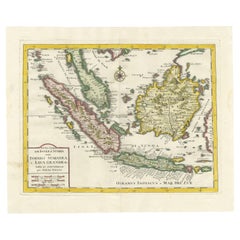
Antique Map of the Sunda Islands Sumatra, Java, Malay Peninsula & Borneo (1739)
Located in Langweer, NL
Antique map titled 'Nieuwe kaart van de Sundasche Eilanden als Borneo, Sumatra en Groot Iava & c'. Detailed map of the Sunda Islands, Southeast Asia, extending from the tip of Cambod...
Category

Antique Mid-18th Century Collectibles and Curiosities

Materials

Paper

Original Antique Map of the Bay and Rocks of Petatlan, Mexico, 1749
Located in Langweer, NL
Antique map titled 'Baye et Rochers de Petaplan (..) - De Baay en de Rotsen van Petaplan (..)'. Original antique map of the bay and rocks of Petatlan, Mexico. This map originates...
Category

Antique Mid-18th Century Collectibles and Curiosities

Materials

Paper

Detailed Regional Map of the Gulf of Bengal and the Lower Ganges River, ca.1750
Located in Langweer, NL
Title of this original and rare antique map: Nouvelle Carte Du Royaume De Bengale Mapmaker: Jacques-Nicolas Bellin (1703-1772). He was among the most important mapmakers of the eighteenth century. In 1721, at only the age of 18, he was appointed Hydrographer to the French Navy. In August 1741, he became the first Ingénieur de la Marine of the Dépôt des cartes...
Category

Antique Mid-18th Century Collectibles and Curiosities

Materials

Paper

Old Original Antique Map of the Sunda Islands of Indonesia, 1756
Located in Langweer, NL
Title: Isles De La Sonde. Attractive old decorative map of the Isles de la Sonde, Borneo, Sumatra, Java and Malacca ( Malaysia) with the Straits of Malacca. Penang is spelled as P...
Category

Antique Mid-18th Century Collectibles and Curiosities

Materials

Paper

Wordsworth's Grave and Other Poems by William Watson
Located in Middletown, NY
This is a RARE first limited edition of Watson's poems, printed on deluxe japon and bound in vellum. Unwin's Cameo series of poetry was a distinctively packaged sequence of books tha...
Category

English Antique Mid-18th Century Collectibles and Curiosities

Materials

Gold Leaf

Original Antique Map of the Maluku Islands or Moluccas, Indonesia
Located in Langweer, NL
Antique map titled 'Carte Particuliere des Isles Moluques'. This map depicts the islands of Herij, Ternate, Tidor, Pottebackers, Timor, Machian and Bachian. The Moluccan islands were...
Category

Antique Mid-18th Century Collectibles and Curiosities

Materials

Paper

Antique Map of Japan by J.N. Bellin, 1752
Located in Langweer, NL
Bellin's wonderfully detailed map of Japan from the atlas of Prevost d'Exiles' influential collection of travel narratives, Histoire Generale des Voyages. Considered the best general...
Category

Antique Mid-18th Century Collectibles and Curiosities

Materials

Paper

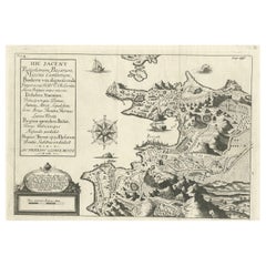
Old Original Map of Pozzuoli Near Naples in the Campania Region, Italy, ca.1740
Located in Langweer, NL
Antique map titled 'Hic Jacent Puteolorum Bajarum (..)'. Old map of the region of Pozzuoli showing the topographic and architectural features of interest. Pozzuoli is a city and comu...
Category

Antique Mid-18th Century Collectibles and Curiosities

Materials

Paper

Georgian 18th Century Elm Table Top Bureau
Located in Bedfordshire, GB
An Extremely Rare Mid 18th Century, George II Period Elm Table Top, Miniature, Bureau Retaining Exceptional Colour And Patina To Figured Timber Throughout, Having Fall Front Enclosin...
Category

English George II Antique Mid-18th Century Collectibles and Curiosities

Materials

Elm

Roseaux, St. Lucia Island Map by BELLIN, Handcolored Engraving, 1763
Located in Langweer, NL
Dating back to around 1763, this antique hand-colored print, a creation by Jacques Nicolas Bellin, unveils a meticulously detailed "Plan du Cul de Sac des Roseaux dans l'Isle de Ste....
Category

Antique Mid-18th Century Collectibles and Curiosities

Materials

Paper

18th Century Painted Lifesize Dummy Board
Located in Gloucestershire, GB
18th Century painted lifesize dummy board, featuring a cavalier holding a monkey. Original decoration. Circa 1760.
Category

Antique Mid-18th Century Collectibles and Curiosities

Materials

Wood

West Coast of Africa, Guinea & Sierra Leone: An 18th Century Map by Bellin
Located in Alamo, CA
Jacques Bellin's copper-plate map entitled "Partie de la Coste de Guinee Dupuis la Riviere de Sierra Leona Jusquau Cap das Palmas", depicting the coast of Guinea and Sierra Leone in ...
Category

French Antique Mid-18th Century Collectibles and Curiosities

Materials

Paper

Rare Map of Rama or Ramma 'Ramallah?' in Palestine or the Holy Land, ca.1730
Located in Langweer, NL
Antique map titled 'Rama'. This maps shows a view of Ramma (Ramallah?) in Palestine or the Holy Land. With Dutch legend. Source unknown, to be determined. Artists and Engraver...
Category

Antique Mid-18th Century Collectibles and Curiosities

Materials

Paper

Antique Map of Senegal, West Africa
Located in Langweer, NL
Original antique map titled 'Carta del Senegal'. Antique map of Senegal, West Africa. This map originates from 'Compendio della storia generale dei viaggi (..)'. Published by De la Harpe...
Category

Antique Mid-18th Century Collectibles and Curiosities

Materials

Paper

Antique Map of Indochina, the Malaysian Peninsula and Northern Sumatra
Located in Langweer, NL
Antique map titled 'Nieuwe Kaart van India over de Ganges of van Malakka, Siam, Cambodia, Chiampa, Kochinchina, Laos, Pegu, Ava, enz'. Original old map of Indochina, the Malaysian Pe...
Category

Antique Mid-18th Century Collectibles and Curiosities

Materials

Paper

Antique Plan of the Region of Cassis, France
Located in Langweer, NL
Antique map titled 'Plan de Cassis et environs'. Original plan of the region of Cassis, France. This map originates from 'Le Petit Atlas Maritime (..)' by J.N. Bellin. Published 1764...
Category

Antique Mid-18th Century Collectibles and Curiosities

Materials

Paper

Antique Map of the Coast of Roussillon, France
Located in Langweer, NL
Antique map titled 'Coste de Roussillon depuis Port Vendres, jusqu'au golphe de Rozes'. Original map of the coast of Roussillon, France. This map originates from 'Le Petit Atlas Mari...
Category

Antique Mid-18th Century Collectibles and Curiosities

Materials

Paper

Antique Map of Russia and Central Asia, showing the Northeast Passage
Located in Langweer, NL
Antique map titled 'Generalis Totius Imperii Moscovitici (..)'. Decorative map of Russia and Central Asia, showing the Northeast Passage. The map covers the entirety of the Russian Empire at the time, stretching from the Arctic Circle in the north to the "Oceanus Orientalis" and the northern parts China (Chinae Septentrionalis confinia), Mongolia and India in the south. Published by J.B. Homann, circa 1730. Johann Baptist Homann was born 1664 in Oberkammlach. He founded his business 1702 in Nuremberg, Germany. After a long period of Dutch domination in map publishing, the Homann publishing house became the most important map...
Category

Antique Mid-18th Century Collectibles and Curiosities

Materials

Paper

Antique Map of Juan Fernandez Island and Cumberland Bay, Chile - c. '1749'
Located in Langweer, NL
Antique map titled 'Plan de la Côte du N.E. de l 'Ile de Juan Fernandes - Schets van den Noord-Oost kant van het eiland Juan Fernandes '. This map depicts the northeast coast of the ...
Category

Antique Mid-18th Century Collectibles and Curiosities

Materials

Paper

Antique Engravring of Different Artillery like Bullets, Cannons, Bombs, c.1769
Located in Langweer, NL
Antique print titled ‚Tab IX. von der Artillerie‘. This print depicts many different artillery like bullets, cannons, bombs and many more. German subtitles. Artists and Engra...
Category

Antique Mid-18th Century Collectibles and Curiosities

Materials

Paper

Large Antique Map of the Netherlands with Original Hand Coloring
Located in Langweer, NL
Original antique map titled 'Belgica Foederata complectens septem Provincias Ducatum Geldriae (..)". Large map of the Netherlands. Title a...
Category

Antique Mid-18th Century Collectibles and Curiosities

Materials

Paper

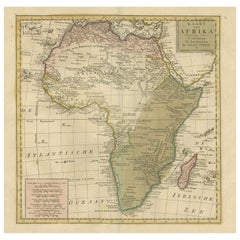
Antique Map of Africa with Original Hand Coloring
Located in Langweer, NL
Antique map titled 'Kaart van Afrika door den Heer d'Anville'. Detailed original old map of Africa, with very small inset map titled 'Vlaamsche Eilanden', which shows the Azores. Pub...
Category

Antique Mid-18th Century Collectibles and Curiosities

Materials

Paper

Antique Map of Asia Minor including part of the Greek Archipelago and Cyprus
Located in Langweer, NL
Antique map titled 'Chersonesi quae hodie Natolia Descriptio'. Decorative, smaller map of Asia Minor including part of the Greek Archipelago and Cyprus. The drape-style title cartouc...
Category

Antique Mid-18th Century Collectibles and Curiosities

Materials

Paper

1750 Bellin Map of the Red River (Tonkin River) and Hanoi, Vietnam
Located in Langweer, NL
Title: 1750 Bellin Map of the Red River and Hanoi, Vietnam Description: This finely engraved eighteenth-century French map, titled Carte du Cours de la Riviere de Tunquin, was created by the renowned cartographer Jacques-Nicolas Bellin and published in 1750. It depicts the course of the Red River, historically referred to as the Tonkin River, from Hanoi, labeled as Cacho, Ville Capitale du Tunquin, to the Gulf of Tonkin, labeled as Baye de Tunquin. Bellin’s work was based on navigational surveys by an English explorer, as stated in the title, reflecting the growing European interest in Southeast Asia during the early colonial period. The Red River Delta was a crucial region for trade and agriculture, forming the backbone of Vietnam’s economic and cultural history. The river originates in China and flows through northern Vietnam, passing through Hanoi before emptying into the Gulf of Tonkin. This map captures the strategic importance of the river, as it served as a major trade route for goods and a point of interest for European navigators, merchants, and missionaries seeking access to Indochina. The map includes numerous geographical details. Hanoi is prominently labeled as the capital of Tonkin, a historical term used by Europeans to describe northern Vietnam. The surrounding settlements, islands, and tributaries are carefully marked, illustrating the intricate network of waterways that characterized the region. Notable features include Île de la Potterie, referring to a location known for ceramic production, and various sandbanks and fortified locations along the river. A decorative compass rose is placed in the upper left corner, reinforcing the map’s navigational purpose. The scale of measurement is provided in French leagues, labeled as Grandes Lieues...
Category

Antique Mid-18th Century Collectibles and Curiosities

Materials

Paper

Attractive Antique Hand-Coloured Map of South America, ca.1765
Located in Langweer, NL
Antique map titled 'Kaart van het Onderkoningschap van Peru zig uitstrekkende: over Chile, Paraguay en andere Spaansche Landen als ook van Brazil en verdere Bezittingen van Portugal ...
Category

Antique Mid-18th Century Collectibles and Curiosities

Materials

Paper

Antique Original Engraving of Chinese Vessels in the 18th Century, 1765
Located in Langweer, NL
Description: Plate no.34: 'Vaisseaux chinois.' (Chinese vessels.) This original auhentic plate originates from: 'Reize rondom de werreld, Gedaan in de jaaren 1740 tot 1744, door den ...
Category

Antique Mid-18th Century Collectibles and Curiosities

Materials

Paper

Antique Bible Plan of Jerusalem by Covens & Mortier, 1743
Located in Langweer, NL
This plan originates from ‘Biblia Sacra, dat is, de H. Schriftuer van het Oude, en het Nieuwe Testament, naer de laetste Roomsche keure der gemeine Latijnsche overzettinge, in nederd...
Category

Antique Mid-18th Century Collectibles and Curiosities

Materials

Paper

Read More

Medal-Worthy Memorabilia from Epic Past Olympic Games

Get into the games! These items celebrate the events, athletes, host countries and sporting spirit.

Ahoy! You’ve Never Seen a Collection of Sailor Art and Kitsch Quite Like This

French trendsetter and serial collector Daniel Rozensztroch tells us about his obsession with objects related to seafaring men.

Pamela Shamshiri Shares the Secrets behind Her First-Ever Book and Its Effortlessly Cool Interiors

The sought-after designer worked with the team at Hoffman Creative to produce a monograph that beautifully showcases some of Studio Shamshiri's most inspiring projects.

Moroccan Artworks and Objects Take Center Stage in an Extraordinary Villa in Tangier

Italian writer and collector Umberto Pasti opens the doors to his remarkable cave of wonders in North Africa.

Montecito Has Drawn Royalty and Celebrities, and These Homes Are Proof of Its Allure

Hollywood A-listers, ex-pat aristocrats and art collectors and style setters of all stripes appreciate the allure of the coastal California hamlet — much on our minds after recent winter floods.

Whaam! Blam! Pow! — a New Book on Pop Art Packs a Punch

Publishing house Assouline and writer Julie Belcove have teamed up to trace the history of the genre, from Roy Lichtenstein, Andy Warhol and Yayoi Kusama to Mickalene Thomas and Jeff Koons.

The Sparkling Legacy of Tiffany & Co. Explained, One Jewel at a Time

A gorgeous new book celebrates — and memorializes — the iconic jeweler’s rich heritage.

What Makes a Gem-Encrusted Chess Set Worth $4 Million?

The world’s most opulent chess set, weighing in at 513 carats, is literally fit for a king and queen.

Recently Viewed

View All