Mid-18th Century Collectibles and Curiosities

to
418
531
51
585
23
16
13
3
2
1
1
1
4,431
6,784
13,459
2,726
3,521
4,676
3,077
513
300
606
745
480
898
888
899
659
595
468
71
46
24
19
159
33
33
29
22
585
585
585
6
4
3
3
2
Period: Mid-18th Century
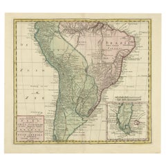
Attractive Antique Hand-Coloured Map of South America, ca.1765
Located in Langweer, NL
Antique map titled 'Kaart van het Onderkoningschap van Peru zig uitstrekkende: over Chile, Paraguay en andere Spaansche Landen als ook van Brazil en verdere Bezittingen van Portugal ...
Category

Antique Mid-18th Century Collectibles and Curiosities

Materials

Paper

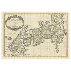
Attractive Hand-Tinted Antique Map of Japan, Published in 1752
Located in Langweer, NL
Nice decorative hand tinted map of Japan with the title (in French): Carte de L'Empire du Japon Bellin, 1752 This antique map is engraved with very attractive title cartouche. ...
Category

Antique Mid-18th Century Collectibles and Curiosities

Materials

Paper

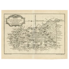
Original Engraved Map of Saint Lucia in the West Indies by Bellin, 1758
Located in Langweer, NL
The "Carte de L’Isle de Sainte Lucie" by Jacques Nicolas Bellin, a prominent figure as the Royal Hydrographer and engineer of the French Navy, is a remarkable antique map showcasing ...
Category

Antique Mid-18th Century Collectibles and Curiosities

Materials

Paper

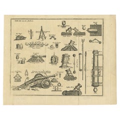
Antique Engravring of Different Artillery like Bullets, Cannons, Bombs, c.1769
Located in Langweer, NL
Antique print titled ‚Tab IX. von der Artillerie‘. This print depicts many different artillery like bullets, cannons, bombs and many more. German subtitles. Artists and Engra...
Category

Antique Mid-18th Century Collectibles and Curiosities

Materials

Paper

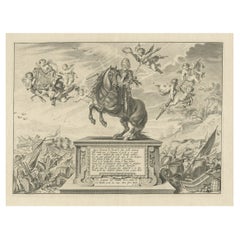
Old Print of William Cavendish, First Duke of Newcastle, on Horseback, ca.1740
Located in Langweer, NL
Antique print titled 'Apres l'homme le Cheval (..)'. Antique print depicting William Cavendish, first Duke of Newcastle, on horseback on an inscr...
Category

Antique Mid-18th Century Collectibles and Curiosities

Materials

Paper

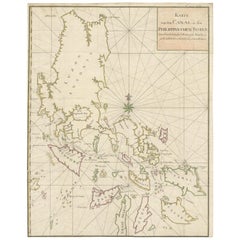
Large German Chart of the Islands of the Philippines with Hand-Colored Borders
Located in Langweer, NL
Original antique map titled 'Karte von dem Canal in den Philippinischen Inseln (..)'. Large detailed chart of the islands of the Philippines. One of the most detailed charts of the Philippines of the era. Shows Islands, bays, reefs, soundings tracks of the Manila Galleon route, etc. Includes a large compass rose and rhumb lines. Originates from a German edition of "Voyage around the World...
Category

Antique Mid-18th Century Collectibles and Curiosities

Materials

Paper

Rare Handcolored Map of Isle de Juan Fernandes 'Robinson Crusoe Island', Chili
Located in Langweer, NL
Antique map titled 'Die Insel Iuan Fernandes in der Sudsee (..)'. This map depicts Robinson Crusoe, one of the Juan Fernández Islands. Robinson Crusoe Island, formerly known as Más a Tierra, is the second largest of the Juan Fernández Islands. From 1704 to 1709, the island was home to the marooned sailor Alexander Selkirk, who at least partially inspired novelist Daniel Defoe's fictional Robinson Crusoe in his 1719 novel, although the novel is explicitly set in the Caribbean. This was just one of several survival stories from the period of which Defoe would have been aware. To reflect the literary lore associated with the island and attract tourists, the Chilean government renamed the place Robinson Crusoe Island in 1966. This map originates from a German edition of 'Voyage around the World...
Category

Antique Mid-18th Century Collectibles and Curiosities

Materials

Paper

Fine Engraving of the 2nd Corps de Garde in the Low Countries 'Holland', 1760
Located in Langweer, NL
Title on page (Dutch and French): TWEEDE CORPS DE GARDE van Hollandsche Officiers / Second Corps de Garde d'Officiers Hollandois". Amst., P. Fouquet, 1760. An interior with several Dutch officers. On the right a man is sitting at a writing table, on the left a man is working on fire from the fireplace, in the middle three gentlemen are looking at a map. Above the chimney a coat of arms and above it a portrait of a man in profile, surrounded by a laurel wreath. Fine engraved print depicting an officer's mess by J. Houbraken after a painting by C. Troost, with coat of arms engraved in lower margin and dedication to D. Muilman. Cornelis Troost...
Category

Antique Mid-18th Century Collectibles and Curiosities

Materials

Paper

Hand-colored Nautical Chart: St. George's Channel and the Irish Sea, 1744
Located in Langweer, NL
The map was engraved by Richard William Seale, a notable British engraver. This map is a fine example of 18th-century cartography, particularly focused on maritime navigation. The m...
Category

Antique Mid-18th Century Collectibles and Curiosities

Materials

Paper

Charting Eastern Tartary: An 18th-Century Jesuit and English Collaboration, 1757
Located in Langweer, NL
The antique map titled 'Carte de la Tartarie Orientale pour Servir a l'Histoire Generale des Voyages Tiree des Cartes Levees par les P.P. Jesuites' is an original old map that covers...
Category

Antique Mid-18th Century Collectibles and Curiosities

Materials

Paper

Antique Map of Guyenne, Gascony and Béarn, France
Located in Langweer, NL
Antique map titled 'Guyenne et Gascogne et Bearn'. Original old map of Guyenne (or Guienne), Gascony and Béarn, France. This map originates from 'Le Petit Atlas Maritime Recueil De C...
Category

Antique Mid-18th Century Collectibles and Curiosities

Materials

Paper

Copperplate Engraving Showing Forts on the West African Gold Coast, Ghana, 1744
Located in Langweer, NL
Antique print, titled: 'The Fort Fredricksburg formerly to ye Danes and now Fort Royal (…).' - A three panel copperplate engraving showing three forts on the West African Gold Coast, Ghana; a) The Fort Fredricksburgh formerly to ye Danes and now Fort Royal. English at Manfroe, b) The Fort Amsterdam at Cormentyn belonging to ye Hollanders, c) The Fort James, English at Accra. From: "A Collection of Voyages and Travels" published by John and Awnsham Churchill in London in 1744. Artists and Engravers: Made by 'Johannes Kip' after 'A. Churchill'. Johannes Kip (b Amsterdam, 1653; d London, 1722). Dutch draughtsman, engraver and dealer, active in England. He was a pupil of Bastiaen Stopendaal (1636–1707) from 1668 to 1670. His earliest dated engravings are of 1672 (e.g. the Siege of Groningen , Hollstein, no. 4), and he supplied numerous plates for books published from that date onwards. His work brought him into contact with the court of William of Orange and in 1686 he produced six plates depicting William of Orange, his Wife and Attendants near The Hague (Hollstein, no. 5). Shortly after the Glorious Revolution of 1688 Kip followed the court to England. After settling in Westminster, he worked extensively for London publishers, engraving works after Francis Barlow, Caius Gabriel Cibber (e.g. Interior of the Danish Church in London , 1697; Hollstein, no. 6) and other London-based artists. His engravings were principally destined for book illustrations. The work for which Kip is best remembered is his large corpus...
Category

Antique Mid-18th Century Collectibles and Curiosities

Materials

Paper

Coppia di Fregi Italiani Dorati e Intagliati con la Figura di San Michele 1750s
Located in Milano, MI
Coppia Di Fregi Dorati riccamente intagliati in legno di tiglio con un tableau centrale ovale raffigurante San Michele mentre impugna la spada con la mano destra e regge la bilancia ...
Category

European Antique Mid-18th Century Collectibles and Curiosities

Materials

Giltwood

Set of Two Antique Maps of Northern Italy by Homann Heirs, 1754
Located in Langweer, NL
Set of two maps of northern Italy showing the position of troups during the war in April and March 1746. The area covered includes the course of the River Po between Valenza (north of Alexandria) and San Benedetto...
Category

Antique Mid-18th Century Collectibles and Curiosities

Materials

Paper

Original Antique Map of North and South America in Attractive Old Coloring
Located in Langweer, NL
Antique map titled 'Nieuwe Kaart van America'. Beautiful map of America. The fabled Quivira is used to name a large mountain range placed just north of M...
Category

Antique Mid-18th Century Collectibles and Curiosities

Materials

Paper

Antique Map of the Auvergne-Rhône-Alpes region of France by Valk, circa 1730
Located in Langweer, NL
Antique map titled 'Praefectura Lugdunensis Generalis'. Detailed map of the Auvergne-Rhône-Alpes region in the southeast of France. To the east the Rhône from Chalon-sur-Saône, Mâcon...
Category

Antique Mid-18th Century Collectibles and Curiosities

Materials

Paper

De Zeden der Wilden van Amerika by La Fiteau, 1731
Located in Langweer, NL
'De Zeden der Wilden van Amerika. Zynde een nieuwe uitvoerige en zeer kurieuse Beschryving van derzelver Oorsprong, Godsdienst, manier van Oorlogen, Huwelyken, Opvoeding, Oeffeningen...
Category

Antique Mid-18th Century Collectibles and Curiosities

Materials

Paper

Detailed Old Map showing Spain and Portugal Incl. Majorca, Minorca & Ibiza, 1740
Located in Langweer, NL
Antique map titled 'Nieuwe Kaart van Spanje en Portugal.' Attractive detailed map showing Spain and Portugal. Including Majorca, Minorca and Ibiza. Title in block-style cartouche...
Category

Antique Mid-18th Century Collectibles and Curiosities

Materials

Paper

Antique Map with Plans of Cremona, Pavia, Montferrato & Others by Homann, '1734'
Located in Langweer, NL
Antique map titled 'Plan von Cremona und denen übrigen Maylaendischen (..)'. Original antique map showing plans of Cremona, Pavia, Casale Montferrato, Fort de Fuentes, Novara, Serava...
Category

Antique Mid-18th Century Collectibles and Curiosities

Materials

Paper

Rare Detailed Antique Map of Prague and Its North West Environs, ca.1760
Located in Langweer, NL
Description: original antique map of the environs of North West Prague. This map originates from the 'Gentlemans Magazine'. Published circa 1760. Artists and Engravers: Engraved ...
Category

Antique Mid-18th Century Collectibles and Curiosities

Materials

Paper

Small Detailed Antique Map of France, with Decorative Title Cartouche, 1754
Located in Langweer, NL
Antique map France titled 'An Accurate Map of France drawn from the best authorities'. Small, detailed map of France. With decorative title cartouche. ...
Category

Antique Mid-18th Century Collectibles and Curiosities

Materials

Paper

Antique Ptolemaic Map of Ceylon or nowadays Sri Lanka
Located in Langweer, NL
Antique map titled 'Tab XII. Asiae Taprobanam'. Ptolemaic map of Sri Lanka. Ptolemy drew on the accounts of travelers and sailors and though the information was secondhand and often ...
Category

Antique Mid-18th Century Collectibles and Curiosities

Materials

Paper

Antique Map of Germany by T. Kitchin, circa 1770
Located in Langweer, NL
Antique map titled 'An Accurate Map of Germany (..) '. Drawn from the best Authorities by T.Kitchin Geogr." Rare edition, drawn and etched by Thomas Kitchin, published, circa 1770.
Category

Antique Mid-18th Century Collectibles and Curiosities

Materials

Paper

Antique Map of the Kanton Luzerne 'Switzerland' by Homann Heirs, 1763
Located in Langweer, NL
Antique map titled 'Canton Lucern (..)'. Fine decorative copper plate engraved antique map of the Canton of Lucerne in Central Switzerland with pictorial cartouche in top right corne...
Category

Antique Mid-18th Century Collectibles and Curiosities

Materials

Paper

18th Century Giltwood and Polychrome Painted Putti / Cherub
Located in Hastings, GB
Hand carved winged Italian Baroque Putti, water gilded over applied gesso, the face and head polychrome painted. Small hanging hook to the back of the head. Width 23 cm x Height 1...
Category

Italian Baroque Antique Mid-18th Century Collectibles and Curiosities

Materials

Gesso, Wood

Antique Portrait of Frederik Hendrik, Prince of Orange, Etc Etc, 1749
Located in Langweer, NL
Antique portrait titled 'Frederik Hendrik, Prins van Oranje enz. enz. enz'. Portrait of Frederick Henry, or Frederik Hendrik in Dutch (29 January 1584 – 14 March 1647). The sover...
Category

Dutch Antique Mid-18th Century Collectibles and Curiosities

Materials

Paper

Antique Map of the Gambia River by J. Van Schley, circa 1750
Located in Langweer, NL
"Carte de la Riviere de Gambra ou Gambie. Depuis son Embouchure Jusqu a Eropina". Orig. copper-engraving after Capt. J. Leach's map of the region from 1732. With ornamental title cartouche and Dutch...
Category

Antique Mid-18th Century Collectibles and Curiosities

Materials

Paper

Antique Map of Indochina, the Malaysian Peninsula and Northern Sumatra
Located in Langweer, NL
Antique map titled 'Nieuwe Kaart van India over de Ganges of van Malakka, Siam, Cambodia, Chiampa, Kochinchina, Laos, Pegu, Ava, enz'. Original old map of Indochina, the Malaysian Pe...
Category

Antique Mid-18th Century Collectibles and Curiosities

Materials

Paper

John Kidgell, the Card, 1755, First Ed, the Earliest Known Mention of Baseball
Located in Hillsborough, NJ
AUTHOR: KIDGELL (John) TITLE: The Card. PUBLISHER: London: for the Maker & sold by J. Newberry, 1755. DESCRIPTION: FIRST AND ONLY EDITION. 2 vols., 6-5/8" x 4-1/4", hand col...
Category

British Antique Mid-18th Century Collectibles and Curiosities

Materials

Leather

Antique Original Engraving of Chinese Vessels in the 18th Century, 1765
Located in Langweer, NL
Description: Plate no.34: 'Vaisseaux chinois.' (Chinese vessels.) This original auhentic plate originates from: 'Reize rondom de werreld, Gedaan in de jaaren 1740 tot 1744, door den ...
Category

Antique Mid-18th Century Collectibles and Curiosities

Materials

Paper

Antique Map of the Arabian Peninsula by Franceschini, '1739'
Located in Langweer, NL
Antique map titled 'Conventus et Residentiae'. Rare map of the Arabian Peninsula. This map originates from 'Provinciarum et Conventum Fratrum Discalc...
Category

Antique Mid-18th Century Collectibles and Curiosities

Materials

Paper

Authentic Old Map of Persia with Original Border Coloring, 1745
Located in Langweer, NL
Title: "Kaartje van Persien na de stelling van den Heer Guillaume de L'Isle" Translates to "Map of Persia based on the work of Mr. Guillaume de L'Isle." Guillaume de L'Isle was a p...
Category

Antique Mid-18th Century Collectibles and Curiosities

Materials

Paper

Antique Map of Asia Minor including part of the Greek Archipelago and Cyprus
Located in Langweer, NL
Antique map titled 'Chersonesi quae hodie Natolia Descriptio'. Decorative, smaller map of Asia Minor including part of the Greek Archipelago and Cyprus. The drape-style title cartouc...
Category

Antique Mid-18th Century Collectibles and Curiosities

Materials

Paper

Antique Plan of Alicante Bay, Spain
Located in Langweer, NL
Antique map titled 'Plan de la Baye d'Alicant'. Black and white harbor chart /port plan of Alicante Bay, Spain. This map originates from the scarce atlas 'Recueil de Plusiers Plans d...
Category

Antique Mid-18th Century Collectibles and Curiosities

Materials

Paper

Antique Map of Russia and Central Asia, showing the Northeast Passage
Located in Langweer, NL
Antique map titled 'Generalis Totius Imperii Moscovitici (..)'. Decorative map of Russia and Central Asia, showing the Northeast Passage. The map covers the entirety of the Russian Empire at the time, stretching from the Arctic Circle in the north to the "Oceanus Orientalis" and the northern parts China (Chinae Septentrionalis confinia), Mongolia and India in the south. Published by J.B. Homann, circa 1730. Johann Baptist Homann was born 1664 in Oberkammlach. He founded his business 1702 in Nuremberg, Germany. After a long period of Dutch domination in map publishing, the Homann publishing house became the most important map...
Category

Antique Mid-18th Century Collectibles and Curiosities

Materials

Paper

Rare Small Antique Map of Great Britain and Ireland
Located in Langweer, NL
Antique map titled 'La Grande Bretagne et Irlande'. Small antique map of Great Britain and Ireland. Source unknown, to be determined. Publ...
Category

Antique Mid-18th Century Collectibles and Curiosities

Materials

Paper

Original Detailed Antique Map of the East Coast of Africa, 1747
Located in Langweer, NL
Antique map titled 'Carte de la coste Orientale d'Afrique - Kaart van de Oostkust van Afrika'. Original antique map of the east coast of Africa. Reaches from Cape of Good Hope an...
Category

Antique Mid-18th Century Collectibles and Curiosities

Materials

Paper

Original Antique Map of the Empire of Japan, Centered on the Bay of Osaka, c1752
Located in Langweer, NL
Antique map titled 'Carte de L'Empire de Japon (..).' Map of the Empire of Japan. Centered on the Bay of Osaka, this map covers from Hirado (here identified as I. Firando) and Na...
Category

Antique Mid-18th Century Collectibles and Curiosities

Materials

Paper

Detailed Antique Map of the Southern Part of European Russia and Ukraine, 1752
Located in Langweer, NL
Antique map titled 'Partie meridionale de la Russie Européenne'. Detailed map of the southern part of European Russia by Robert de Vaugondy. It covers from Moscow south to Georgia and from Poland east to the Volga River, including Crimea and Ukraine. Artists and engravers: Gilles Robert de Vaugondy (1688-1766) was the head of a leading family of geographers in eighteenth century France. Gilles got his start when he jointly inherited the shop of Pierre-Moullart Sanson, grandson of the famous geographer Nicholas Sanson. The inheritance included the business, its stock of plates, and a roller press...
Category

Antique Mid-18th Century Collectibles and Curiosities

Materials

Paper

Antique Map of Korea and Southern China by Bonne '1771'
Located in Langweer, NL
Antique map titled 'Carte de la Tartarie Chinoise'. Original antique map of Korea and Southern China. Covers from the Lop Nor region eastward to K...
Category

Antique Mid-18th Century Collectibles and Curiosities

Materials

Paper

Antique Map of the Region Centered on the Malay Peninsula by Tirion 'c.1760'
Located in Langweer, NL
Antique map titled 'Nuova Carta dell' India (..)'. Decorative map of the region centered on the Malay Peninsula and extending from the Straits of Singapore, Malacca and Borneo in the South to China in the east and the Bay of Bengal...
Category

Antique Mid-18th Century Collectibles and Curiosities

Materials

Paper

Antique Map of Northern China and Far Eastern Russia Around the Amur River, 1754
Located in Langweer, NL
Antique map titled 'Carte De La Tartarie Orientale (..)'. A map for this far eastern portion of what is present day northern China and far eastern Russia...
Category

Antique Mid-18th Century Collectibles and Curiosities

Materials

Paper

Antique Map of Guadelupe in the Caribbean, 1759
Located in Langweer, NL
Antique map titled 'Carte De L'Isle De La Guadeloupe'. Detailed map of Guadalupe, Mari-Galante and the Isles de Saintes. Produced by Nichlas Bellin for Prevost d'Exiles influential t...
Category

French Antique Mid-18th Century Collectibles and Curiosities

Materials

Paper

Antique Map of the Turkish Empire by Tirion 'c.1760'
Located in Langweer, NL
Antique map titled 'Nieuwe Kaart van het Turksche Ryk gelegen in Europa, Asia en Africa'. Original antique map of the Turkish Empire. The map is centered on the Mediterranean Sea but...
Category

Antique Mid-18th Century Collectibles and Curiosities

Materials

Paper

Detailed Regional Map of the Gulf of Bengal and the Lower Ganges River, ca.1750
Located in Langweer, NL
Title of this original and rare antique map: Nouvelle Carte Du Royaume De Bengale Mapmaker: Jacques-Nicolas Bellin (1703-1772). He was among the most important mapmakers of the eighteenth century. In 1721, at only the age of 18, he was appointed Hydrographer to the French Navy. In August 1741, he became the first Ingénieur de la Marine of the Dépôt des cartes...
Category

Antique Mid-18th Century Collectibles and Curiosities

Materials

Paper

Antique Map Dedicated to British Merchants Trading to North America, ca.1746
Located in Langweer, NL
Description: Antique map titled 'A New Chart of the Coast of New England, Nova Scotia, New France or Canada, with the islands of Newfoundland, Capte Breton, St John's (..)'. Map stre...
Category

Antique Mid-18th Century Collectibles and Curiosities

Materials

Paper

Bay of Arguin, West Coast of Africa from Cape Blanco to Tanit, Africa, 1747
Located in Langweer, NL
Antique map titled 'Carte De La Coste Occidentale D'Afrique (..) Kaart van de Westkust van Afrika (..)'. Original antique map of the western coast of Africa. Shows the area aroun...
Category

Antique Mid-18th Century Collectibles and Curiosities

Materials

Paper

Antique Map of Southeast Asia with Decorative Allegorical Cartouche
Located in Langweer, NL
Antique map titled 'Les Indes Orientales et leur Archipel'. Old map of Southeast Asia, the Straits of Malaca, Philippines, Sumatra, Java, India etc., extending north to Canton and Ma...
Category

Antique Mid-18th Century Collectibles and Curiosities

Materials

Paper

Antique Map of the Eastern Part of the World
Located in Langweer, NL
Antique map titled 'Nieuwe Kaart van het Oostelykste Deel der Weereld, diendende tot aanwyzing van de Scheepstogten der Nederlanderen Naar Oostindie'. This finely engraved map of the...
Category

Antique Mid-18th Century Collectibles and Curiosities

Materials

Paper

Rare Antique Map of the Rio De La Plata, Buenos Ayres, Brazil, ca.1760
Located in Langweer, NL
Description: Antique map titled 'De Ingang van Rio de la Plata, Waar aan de Stad Buenos Ayres ligt, in Zuid-Amerika'. A map showing the Rio de la Plata es...
Category

Antique Mid-18th Century Collectibles and Curiosities

Materials

Paper

Old Hand-Colored Map of Western Tartary with Focus on Present-Day Mongolia, 1749
Located in Langweer, NL
Antique map titled 'Carte de la Tartarie Occidentale pour Servir a l'Histoire Générale des Voyages. Tirée des Auteurs Anglois.' This map covers western Tartary and focuses on the...
Category

Antique Mid-18th Century Collectibles and Curiosities

Materials

Paper

18th Century Baroque Style Baptismal Charger in Brass
Located in Haddonfield, NJ
An 18th century baptismal plate in brass with beveled flower decoration to celebrate the birth of the infant or perhaps as in French is called "Plat a offrandes", which means "Plate ...
Category

European Baroque Antique Mid-18th Century Collectibles and Curiosities

Materials

Copper, Gold Plate

Original Antique Map of Southern India and Ceylon 'Present-Day Sri Lanka'
Located in Langweer, NL
Antique map titled 'Suite de la Carte de l'Indoustan (..) - Vervolg van de Kaart van Hindoestan (..)'. Original antique map of Southern India and Ceylon (present-day Sri Lanka). This...
Category

Antique Mid-18th Century Collectibles and Curiosities

Materials

Paper

Large Title Cartouche and a View of Wilhermsdorf, Beieren, Germany, 1744
Located in Langweer, NL
Antique print titled 'Sauber und nach dem Leben gezeichnete Prospecten und Plans, von den wichtigsten der Holländisch-Ost-Indischen-Compagnie in Africa u: Asia (..)'. Frontispiece of...
Category

Antique Mid-18th Century Collectibles and Curiosities

Materials

Paper

Print of the British Parliament & an Assembly before the King of England, 1732
Located in Langweer, NL
Antique print titled 'Representation du Parlement d'Angletrre (..)'. Series of scenes, which include from the British Parliament and an assembly...
Category

Antique Mid-18th Century Collectibles and Curiosities

Materials

Paper

Scarce Engraved Plate Showing the Holy Virgin and the Archangel Gabriel, 1762
Located in Langweer, NL
Description: Antique print titled 'Sma Virgo ab Angelo salutata; Gabriel Archangelus B. M. V. salutans'. Scarce plate showing the holy Virgin and t...
Category

Antique Mid-18th Century Collectibles and Curiosities

Materials

Paper

Large Antique Map of Gaul under Roman Rule, ca.1760
Located in Langweer, NL
Antique map titled 'Gallia Augustiniana in suas provincias divisa (..)'. Large antique map of Roman Gaul, it refers to Gaul under provincial rule in ...
Category

Antique Mid-18th Century Collectibles and Curiosities

Materials

Paper

Antique Map of the Region of Fréjus, France
Located in Langweer, NL
Title: "Golf de Fréjus" Description: This antique map, titled "Golf de Fréjus," is an original depiction of the region of Fréjus, France. It is part of the work "Le Petit Atlas Mari...
Category

Antique Mid-18th Century Collectibles and Curiosities

Materials

Paper

Antique Map of India, the East Indies and the Philippines
Located in Langweer, NL
Antique map titled 'Les Indes Orientales et leur Archipel'. Original antique map of India, the East Indies and the Philippines. Source unknown, to be determined. Published circa 1760.
Category

Antique Mid-18th Century Collectibles and Curiosities

Materials

Paper

Horace WALPOLE. The Castle Of Otranto, A Gothic Story. SECOND EDITION - 1765
Located in Hillsborough, NJ
AUTHOR: WALPOLE, Horace. TITLE: The Castle Of Otranto, A Gothic Story. PUBLISHER: London: for William Bathoe and Thomas Lownds, 1765. DESCRIPTION: SECOND EDITION. 1 vol., 7-1/8" ...
Category

British Antique Mid-18th Century Collectibles and Curiosities

Materials

Leather

Read More

Medal-Worthy Memorabilia from Epic Past Olympic Games

Get into the games! These items celebrate the events, athletes, host countries and sporting spirit.

Ahoy! You’ve Never Seen a Collection of Sailor Art and Kitsch Quite Like This

French trendsetter and serial collector Daniel Rozensztroch tells us about his obsession with objects related to seafaring men.

Pamela Shamshiri Shares the Secrets behind Her First-Ever Book and Its Effortlessly Cool Interiors

The sought-after designer worked with the team at Hoffman Creative to produce a monograph that beautifully showcases some of Studio Shamshiri's most inspiring projects.

Moroccan Artworks and Objects Take Center Stage in an Extraordinary Villa in Tangier

Italian writer and collector Umberto Pasti opens the doors to his remarkable cave of wonders in North Africa.

Montecito Has Drawn Royalty and Celebrities, and These Homes Are Proof of Its Allure

Hollywood A-listers, ex-pat aristocrats and art collectors and style setters of all stripes appreciate the allure of the coastal California hamlet — much on our minds after recent winter floods.

Whaam! Blam! Pow! — a New Book on Pop Art Packs a Punch

Publishing house Assouline and writer Julie Belcove have teamed up to trace the history of the genre, from Roy Lichtenstein, Andy Warhol and Yayoi Kusama to Mickalene Thomas and Jeff Koons.

What Makes a Gem-Encrusted Chess Set Worth $4 Million?

The world’s most opulent chess set, weighing in at 513 carats, is literally fit for a king and queen.

Tauba Auerbach’s Geometric Pop-Up Book Is Mighty Rare, Thanks to a Hurricane

This sculptural art book has an epic backstory of its own.
Recently Viewed

View All