Items Similar to De Zeden der Wilden van Amerika by La Fiteau, 1731


Want more images or videos?
Request additional images or videos from the seller
1 of 7
De Zeden der Wilden van Amerika by La Fiteau, 1731
About the Item
'De Zeden der Wilden van Amerika. Zynde een nieuwe uitvoerige en zeer kurieuse Beschryving van derzelver Oorsprong, Godsdienst, manier van Oorlogen, Huwelyken, Opvoeding, Oeffeningen, Feesten, Danzeryen, Begravenissen, en andere zeldzame gewoonten' by J.F. la Fiteau. The Hague, G. van der Poel, 1731, 2 parts in 1 vol., (4),36,(18),1-300; (4),301-555p., engr. frontisp., 2 ident. title-vignettes, 1 map and 41 plates, contemp. calf, folio.
- Dimensions:Height: 12.8 in (32.5 cm)Width: 8.27 in (21 cm)Depth: 2.17 in (5.5 cm)
- Materials and Techniques:
- Period:
- Date of Manufacture:1731
- Condition:First 4 lvs. loose(ning); upper pastedown dam.; a few leaves torn/ lacking marginal part; some lvs. unobtrusively waterst. Calf dried/ partly cracked; corners showing; spine-ends worn; calf splitting along upper joint.
- Seller Location:Langweer, NL
- Reference Number:
About the Seller
5.0
Platinum Seller
These expertly vetted sellers are 1stDibs' most experienced sellers and are rated highest by our customers.
Established in 2009
1stDibs seller since 2017
1,922 sales on 1stDibs
Typical response time: <1 hour
- ShippingRetrieving quote...Ships From: Langweer, Netherlands
- Return PolicyA return for this item may be initiated within 14 days of delivery.
More From This SellerView All
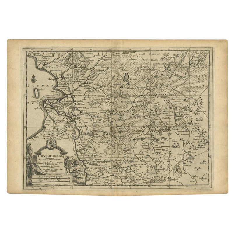
- Antique Map of Overijssel by Van der Aa, c.1715Located in Langweer, NLAntique map titled 'L'Over-Issel'. This map depicts the Dutch province Overijssel. This map originates from 'Nouvel Atlas, très exact et fort commode pour toutes sortes de personnes,...Category
Antique 18th Century Maps
MaterialsPaper
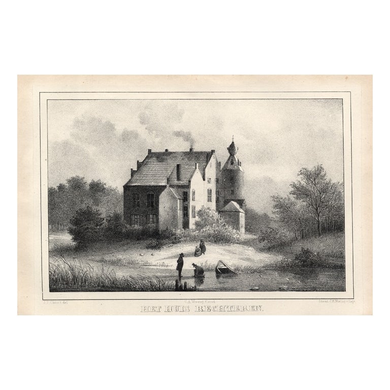
- Liaukama-State, Van der Aa, 1846Located in Langweer, NLLiaukama-State.' (Liauckama Castle.) This Castle was situated in the province of Friesland in Sexbierum. The castle was demolished in 1824. Today there is a hotel and restaurant on t...Category
Antique 19th Century Prints
MaterialsPaper
- Orxma-State, Van der Aa, 1846Located in Langweer, NLOrxma-State.' (Orxma Castle.) This Castle was situated in the province of Friesland in Menaldum. The castle was demolished in 1831. Well known occupants were the Van Juckema family a...Category
Antique 19th Century Prints
MaterialsPaper
- Antique Map of Peru by van der Aa, 'circa 1720'Located in Langweer, NLAntique map titled 'Le Perou, Grand Pays de l Amerique Meridionale (..)'. Decorative map of Peru including portions of Ecuador and northern Chile and Boliv...Category
Antique Early 18th Century Maps
MaterialsPaper
- Antique Map of Scandinavia by Van der Aa 'circa 1710'Located in Langweer, NLAntique map titled 'Scandinavie Septentrionale' and 'Scandinavie Meridionale'. Copper engraving with two maps on one sheet. The upper map depicts Northern Scandinavia with Norway, Sw...Category
Antique Early 18th Century Maps
MaterialsPaper
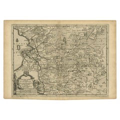
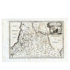
- Antique Map of the Arabian Desert by Cellarius, 1731Located in Langweer, NLAntique map titled 'Arabia Petraea et Deserta.' Arabian desert with present day Israel, Jordania, Iraq. With decorative cartouche showing dromedaries. T...Category
Antique 18th Century Maps
MaterialsPaper


You May Also Like
- Mies Van Der Rohe A Critical Biography by Franz SchulzeLocated in valatie, NYMies Van Der Rohe: A Critical Biography by Franz Schulze. The University of Chicago Press, Chicago, 1985. Hardcover with Brodart covered dust jacket. Ludwig Mies van der Rohe (1886-1...Category
Vintage 1980s American Books
MaterialsPaper
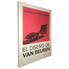
- La Bauhaus y el México Moderno, EL Diseño de Van beuren Book by Ana Elena MalletBy BauhausLocated in San Diego, CA2014 Ana Elena Mallet BAUHAUS & MODERN MEXICO Design by Michael Van Beuren Book. (Spanish). First edition.Category
2010s Mexican Mid-Century Modern Antiquities
MaterialsPaper
- 1656 "La Souverainete de Sedan et de Raucourt, et la Prevoste de Doncheri Ric004Located in Norton, MA1656 map entitled "La Souverainete de Sedan et de Raucourt, et la Prevoste de Doncheri," Hand Colored Ric0004. Description: Lovely map centered on Sedan and Doncheri an...Category
Antique 17th Century Dutch Maps
MaterialsPaper
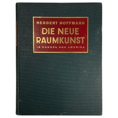
- Die Neue Raumkunst in Europa und Amerika BookBy Julius HoffmannLocated in New York, NYImportant and brilliantly edited survey of early modernist furniture and interiors. Written by Herbert Hoffmann and published by Julius Hoffmann in Stuttgart in 1930. Features work by a who's who of the period's top designers, including Alvar Aalto, Marcel Breuer, Le Corbusier, Donald Deskey, Maurice Dufresne, Paul Laszlo, Jaques Adnet, Rene Herbst, Eugene Printz, Fritz Brehaus, Andre Lurcat...Category
Vintage 1930s German Art Deco Books
MaterialsPaper
- Map Holy Land La Terre Sainte Engraved van Loon Published N de Fer 1703 FrenchLocated in BUNGAY, SUFFOLKLa Terre Sainte, The Holy Land, Tiree Des Memoires De M.De.La Rue. Par N. de Fer. Geographe de Sa Majeste Catoliq et de Monseigneur le Dauphin. Avec Privil du Roi 1703 Detailed map of the Holy Land from Nicholas de Fer's L'Atlas Curieux ou le Monde. East is oriented at the top. MAKER Nicolas de Fer 1646-1720 The French cartographer and engraver, Nicolas de Fer, was a master at creating maps that were works of art. The maps that he published were printed during the Baroque period when the decorative arts were characterized by ornate detail. De Fer’s detailed maps and atlases were valued more for their decorative content than their geographical accuracy. Nicolas de Fer was born in 1646. His father, Antoine de Fer, owned a mapmaking firm. At the age of twelve, Nicolas was apprenticed to a Parisian engraver named Louis Spirinx. The family business was starting to decline when his father died in 1673. Nicolas de Fer’s mother, Genevieve, took over the business after the death of her husband. In 1687 the business was passed on to Nicolas and the profits increased after he took over the firm. Nicolas de Fer was a prolific cartographer who produced atlases and hundreds of single maps. He eventually became the official geographer to King Louis XIV of France and King Philip V...Category
Antique Early 1700s French Louis XIV Maps
MaterialsPaper
- 1731 Original German Engraving Print Chart of European Distances by T. MayerLocated in Milan, ITTabula Poliometrica Germaniae ac Praecipuorum quorundam locorum Europae Nuremberg, 1731. Author: T. Mayer; publisher: Homman. Chart printed by engraving on copper plate, coeval color...Category
Antique 1730s German Scientific Instruments
MaterialsGlass, Wood, Paper


Recently Viewed
View AllMore Ways To Browse
4 Folio
F 300
Poel Antique
Vintage Ford Collectibles
Vintage Ford Collectables
Trent University
Vintage Tools Art Collectibles
Sample Book
French Royal Books
Antique Readers
Collecting Vintage Paperbacks
Sothebys Home
Books Jewels
Star Dust Furniture
Book Tower
Trent Antiques Jewelry
England Map Vintage
England Vintage Map