Benelux - Collectibles and Curiosities

to
4,811
6,825
15,076
11,614
6,775
36
14
115
31
28
27
27
19
17
14
14
12
6
5
4
4
3
2
2
3,243
2,604
928
50
380
206
70
82
20
10
17
7
32
45
30
15
7
5,808
519
362
108
99
1,351
372
284
163
121
6,825
6,824
6,824
104
58
20
14
14
Item Ships From: Benelux
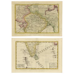
18th Century Cartographic Depiction of Upper India and Ceylon, 1835
Located in Langweer, NL
An exquisite set of two maps, 'Carte de la Partie Superieure De L'Inde en de Cadu Gange,' masterfully crafted by the renowned 18th-century French cartographer, Charles Marie Rigobert...
Category

1830s Antique Benelux - Collectibles and Curiosities

Materials

Paper

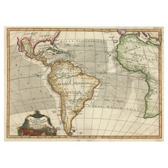
Antique Map of South American, The West Indies & Most of Africa, Ca.1775
Located in Langweer, NL
Antique map titled 'Carte pour Servir a l' Histoire Philosophique et Politique des Etablissemens et du Commerce des Europeens dans les deux Indes'. This map is roughly centered o...
Category

1770s Antique Benelux - Collectibles and Curiosities

Materials

Paper

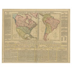
Antique Map of North and South America by Walker, 1828
Located in Langweer, NL
Antique map titled 'Geographical, Historical and Statistical Map of America'. Two maps on one sheet depicting North and South America. Text provides a lot of information about the Am...
Category

19th Century Antique Benelux - Collectibles and Curiosities

Materials

Paper

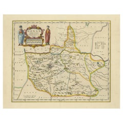
Original 17th-Century Antique Map of Henan (Honan) Province, China – by Blaeu
Located in Langweer, NL
17th-Century Antique Map of Henan Province, China – "Honan" by Blaeu, with Detailed Cartography and Artistic Cartouches Description: This exceptional 17th-century map of Henan Province, historically referred to as "Honan," was created by Johannes Blaeu and published in 1655 as part of the *Novus Atlas Sinensis*. Henan, located in central China, is known as the cradle of Chinese...
Category

1650s Antique Benelux - Collectibles and Curiosities

Materials

Paper

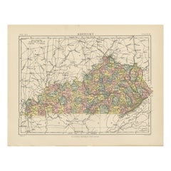
Antique Map of Kentucky
Located in Langweer, NL
Antique map titled 'Kentucky'. Original antique map of Kentucky, United States. This print originates from 'Encyclopaedia Britannica', Ninth E...
Category

Late 19th Century Antique Benelux - Collectibles and Curiosities

Materials

Paper

Antique Map of Kentucky
$277 Sale Price
20% Off
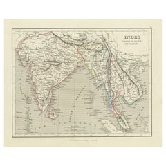
Antique Map of India to Southeast Asia
Located in Langweer, NL
Antique map titled 'Indes en-decà et au-delà du Gange'. Original old map of India to Southeast Asia, showing India, Nepal, Bhutan, Sri Lanka (Ceylon), Myanmar (Birma), part of Indone...
Category

Mid-19th Century Antique Benelux - Collectibles and Curiosities

Materials

Paper

Original Antique Engraved Map of the Russian Empire, 1778
Located in Langweer, NL
Description: Antique map titled 'A New and Correct Map of the Russian Empire'. Original antique map of the Russian Empire. This map originates from Moore's 'New and Complete Coll...
Category

1770s Antique Benelux - Collectibles and Curiosities

Materials

Paper

Atlantic Eden: The Azores and Madeira Archipelagos in 1903
Located in Langweer, NL
This original antique print is a historical map titled "PORTUGAL INSULAR," which translates to "Insular Portugal." It shows the Portuguese archipelagos of the Azores and Madeira, wit...
Category

Early 1900s Antique Benelux - Collectibles and Curiosities

Materials

Paper

1885 Shinsen Tokyo Zenzu: Rare Meiji-Era Map of Tokyo by Sakai Kinzaburo
Located in Langweer, NL
Title: Detailed Edo Period Map of Tokyo (Edo), Featuring Neighborhoods and Landmarks This beautifully detailed patina rich map, titled "Shinsen Tokyo Zenzu" (Newly Selected Complete...
Category

1880s Antique Benelux - Collectibles and Curiosities

Materials

Paper

Antique Coastal Map of West Sumatra 'Indonesia' by J. Mannevillette, 1745
Located in Langweer, NL
Antique map titled 'Carte de la côte occidentale de l'isle Sumatra depuis la ligne équinoctiale jusqu'au détroit de la Sonde'. Beautiful coastal map of We...
Category

Mid-18th Century Antique Benelux - Collectibles and Curiosities

Materials

Paper

Antique Map of Portugal by Placide, c.1700
Located in Langweer, NL
Antique map titled 'Le Portugal dedié au Roy (..)'. Large and detailed map of Portugal. With a small inset map of Porto. Artists and Engravers: Publish...
Category

18th Century Antique Benelux - Collectibles and Curiosities

Materials

Paper

Original Antique Map of the Virgin Islands with Insets of Caribbean Isles, 1787
Located in Langweer, NL
Antique map titled 'Supplément pour les Isles Antilles (..)'. Original old map of the Virgin Islands, with insets of Barbuda, St. Kits, Antigua, Dominica, St. Lucia, Barbados, St. Vi...
Category

Late 18th Century Antique Benelux - Collectibles and Curiosities

Materials

Paper

Collection of Dutch miniature dollhouse pewter, 17th - 18th century
Located in Delft, NL
Collection of Dutch miniature dollhouse pewter, 17th - 18th century A collection of 4 pieces of antique miniature pewter from the periods 17th century and 18th century A porringer ...
Category

17th Century Dutch Antique Benelux - Collectibles and Curiosities

Materials

Pewter

19th Century traditional Russian Religious Icon “The Holy Family”
Located in Meulebeke, BE
Russia / 19th century / Religious Icon / oak / Baroque / Antique Beautiful antique traditional Russian Icon “The Holy Family” from the estate of a collector. Hand painted in tempura...
Category

19th Century Russian Baroque Antique Benelux - Collectibles and Curiosities

Materials

Wood

Antique Map of Gelderland with the Veluwe Etc, the Netherlands, 1864
Located in Langweer, NL
Antique map titled 'De Provincie Gelderland'. Map of the province of Gelderland, the Netherlands. This map originates from 'F. C. Brugsma's Atlas van het Koninkrijk der Nederland...
Category

19th Century Antique Benelux - Collectibles and Curiosities

Materials

Paper

Antique Print Religion 'Joshua Makes a Convenant with God' by De Hondt, 1728
Located in Langweer, NL
Antique religion print titled 'Joshua makes a convenant with God'. This print originates from 'Figures de la Bible'. Published by P. de Hondt. Illustrated by G. van der Gouwen.
Category

Mid-18th Century Dutch Antique Benelux - Collectibles and Curiosities

Materials

Paper

Antique Map Eastern Mediterranean by D. Stoopendaal 'circa 1710'
Located in Langweer, NL
Antique map Middle East titled 'De Beschryving van de Reysen Pauli en van de Andere Apostelen'. Antique map of the Eastern Mediterranean with details of the travels by Apostle Paul...
Category

Early 18th Century Dutch Antique Benelux - Collectibles and Curiosities

Materials

Paper

Antique Map of Africa by Bordiga Fratelli 'circa 1818'
Located in Langweer, NL
Antique map titled 'Carta dell Africa'. Large and quite scarce Italian map of Africa, reflecting the then-current knowledge of the continent's geography, with large areas left comple...
Category

Early 19th Century Antique Benelux - Collectibles and Curiosities

Materials

Paper

Antique Map: Carte du Détroit du Sond with Copenhagen Inset, 1693
Located in Langweer, NL
Antique Map: Carte du Détroit du Sond with Copenhagen Inset, Jaillot/Mortier, 1693 This rare and striking antique map, titled *Carte du détroit du Sond contenant les costes de l’Is...
Category

Late 17th Century Antique Benelux - Collectibles and Curiosities

Materials

Paper

Rare and Very Old Antique Map of South East Asia, Published circa 1574
Located in Langweer, NL
A very fine impression of this map of the Malay Peninsula, Sumatra, Java, with Singapore denoted as 'Cinca Pula'. Highly distorted and inaccurate map by Girolamo Ruscelli after J...
Category

16th Century Antique Benelux - Collectibles and Curiosities

Materials

Paper

18th-Century Map of Tyrol and Surrounding Regions by Johann Baptist Homann
Located in Langweer, NL
18th-Century Map of Tyrol and Surrounding Regions by Johann Baptist Homann Description: This striking 18th-century map by Johann Baptist Homann depicts the County of Tyrol (Tirol)...
Category

1720s Antique Benelux - Collectibles and Curiosities

Materials

Paper

Original 18th-Century Map of Southern Austria, Carinthia, Carniola, and Styria
Located in Langweer, NL
title: 18th-Century Map of Southern Austria, Carinthia, Carniola, and Styria by Robert de Vaugondy Description: This finely engraved 18th-century map by Gilles Robert de Vaugondy ...
Category

1750s French Antique Benelux - Collectibles and Curiosities

Materials

Paper

Swing Tractor Seat Chair, in Red like Achille Castiglione Stool, circa 1970
By Achille Castiglioni
Located in Amsterdam IJMuiden, NL
This item is part of the private collection of Casey Godrie and is situated in his private house. Ask him for competitive shipping quotes. His incredible Dune Villa, Amsterdam Beach...
Category

1970s Italian Mid-Century Modern Vintage Benelux - Collectibles and Curiosities

Materials

Metal

A Tallis Map of British Guiana with Colonial Vignettes and Other Landmarks, 1851
Located in Langweer, NL
This Tallis map of British Guiana (now known as Guyana) is a richly decorated document, much like other maps from the esteemed cartographic publisher John Tallis & Company. The firm,...
Category

1850s Antique Benelux - Collectibles and Curiosities

Materials

Paper

Antique Print of Spanish Inquisitions in Madrid and Goa by B. Picart '1723'
By Bernard Picart
Located in Langweer, NL
Antique print with two religious images on one sheet. 1. Iugement de l'Inquisition dans la grande Place de Madrid, 2. La Procession de l'Inquistion, a Goa'. Antique print depicting Spanish inquisitions...
Category

Early 18th Century Dutch Antique Benelux - Collectibles and Curiosities

Materials

Paper

Antique 1830 Map of Eastern England with Suffolk, Norfolk Cambridge, Huntingdon
Located in Langweer, NL
Title: Antique 1830 Map of Eastern England with Suffolk, Norfolk, Cambridge, and Huntingdon Description: This 1830 German-language map, titled Britisches Reich – A. Kon: England,...
Category

1830s Antique Benelux - Collectibles and Curiosities

Materials

Paper

1584 Ortelius Map of Switzerland: A Cartographic Reversal
Located in Langweer, NL
This is a fine example of Ortelius' map of Switzerland from his *Theatrum Orbis Terrarum*, recognized as the first modern atlas of the world. The map is oriented with south at the top, which reverses the typical north-up orientation seen in most modern maps. It highlights significant geographical features such as Lake Geneva (Lemanus Lacus) to the right of the map and the Rhine river entering Switzerland near the center. The *Theatrum Orbis Terrarum*, first published in 1570 by Abraham Ortelius in Antwerp, was groundbreaking as it compiled uniform maps with supporting text in a single volume, marking a departure from earlier collections of maps that were custom-assembled on demand. This atlas included a wealth of sixteenth-century cartographic knowledge, reflecting the extensive global explorations occurring after the discovery of America...
Category

16th Century Antique Benelux - Collectibles and Curiosities

Materials

Paper

1726 Valentyn's Map of Bali and Lombok, Original Engraving
Located in Langweer, NL
This antique map is a detailed 18th-century chart of the island of Bali, one of the many islands of Indonesia, with an inset of the neighboring island Lombok, attributed to François ...
Category

Early 18th Century Antique Benelux - Collectibles and Curiosities

Materials

Paper

Decorative Original Antique Map of Valencia in Southern Spain, circa 1601
Located in Langweer, NL
This is an original antique map titled 'Valentiae Regni olim Contestanorum Si Ptolemaeo, Edentanorum Si Plinio Credimus Typus'. This is a historical map of the Kingdom of Valencia in...
Category

Early 17th Century Antique Benelux - Collectibles and Curiosities

Materials

Paper

Old Print of Nature Godess Sibyl and Puzza of China on a Lotus Flower, ca.1725
Located in Langweer, NL
Antique print, titled: 'Puzza ou la Cybele des Chinois (…)' - This plates hows Puzza, Sibyl of China and Puzza sitting on a Lotus flower. Source unknown, to be determined. Artists...
Category

1720s Antique Benelux - Collectibles and Curiosities

Materials

Paper

Ancient Cartography of the Indian Subcontinent, Published in 1880
Located in Langweer, NL
This map is titled "INDIA," and it provides a detailed view of the Indian subcontinent with various inset maps that offer additional historical and geographical context. The main ma...
Category

1880s Antique Benelux - Collectibles and Curiosities

Materials

Paper

Old Print of the City of Anyer, West-Java Near Krakatau Volcano, Indonesia, 1833
Located in Langweer, NL
Antique print titled 'Vue d'Anger (Détroit de la Sonde)'. View of the city of Anyer, a coastal town in Banten, formerly West Java, Indonesia. This print originates from 'Voyage de la Corvette l'Astrolabe exécuté par ordre du Roi pendant les années 1826, 1827, 1828, 1829' by Jules Sebastien Cesar Dumont D'Urville. Artists and Engravers: Published by J. Tastu. Dumont was a French explorer and naval officer. For thirty-eight months he explored the south and western Pacific...
Category

19th Century Antique Benelux - Collectibles and Curiosities

Materials

Paper

Large Antique Map of New York State with Inset Maps
Located in Langweer, NL
Antique map titled 'Johnson's New York' Large map of New York State. With insets of Albany, Oswego, Buffalo, Rochester, Syracuse, Troy and NYC. Published by Johnson and Browning, 186...
Category

Mid-19th Century Antique Benelux - Collectibles and Curiosities

Materials

Paper

1859 Antique Arctic Vista: Greenland, Iceland and Faroe Islands, Blackie's Atlas
Located in Langweer, NL
The "1859 Antique Arctic Vista: Greenland, Iceland, and Faroe Islands" is an original antique map from 'The Imperial Atlas of Modern Geography', publishe...
Category

Mid-19th Century Antique Benelux - Collectibles and Curiosities

Materials

Paper

Antique Map of Russia and Poland by Petri, 1852
Located in Langweer, NL
Antique map titled 'Europeesch Rusland en Polen'. Map of Russia in Europe and Poland. This map originates from 'School-Atlas van alle deelen der Aarde' by Otto Petri...
Category

19th Century Antique Benelux - Collectibles and Curiosities

Materials

Paper

Map of Soria Province, 1901: Detailed Cartography of Northeastern Spain
Located in Langweer, NL
The map is a historical map of the province of Soria from 1901. A decorative coat of arms enhances the aesthetic of the map, signifying the historical and cultural significance of ...
Category

Early 1900s Antique Benelux - Collectibles and Curiosities

Materials

Paper

Bicycle Figurine by Designer Marcel Wanders
By MARCEL WANDERS
Located in Waddinxveen, ZH
This small bicycle was designed by Marcel Wanders for Randstad Group. Randstad Group is big employment agency. Since 2018 Marcel Wanders designs a bicycl...
Category

2010s Dutch Modern Benelux - Collectibles and Curiosities

Materials

Bamboo

Antique Map of the Eastern Hemisphere by Wyld, 1842
Located in Langweer, NL
Antique map titled 'Eastern Hemisphere'. Large map depicting the continents Europe, Asia, Afrika and Australia. Artists and Engravers: James Wyld (1812–1887) was a British geograph...
Category

19th Century Antique Benelux - Collectibles and Curiosities

Materials

Paper

Christian Presbyter Arius 'Arrius' Alexandrinus of Alexandria, Egypt, 1701
By Romeyn de Hooghe
Located in Langweer, NL
Antique portrait titled 'Arrius Alexandrinus'. Portrait of Arius. Arius was a Christian presbyter in Alexandria, Egypt of Libyan origins. His teachings about the nature of the Godhea...
Category

18th Century Antique Benelux - Collectibles and Curiosities

Materials

Paper

Beautiful Antique Map with Views of Dendermonde, Belgium, 1735
Located in Langweer, NL
Antique map titled 'Teneramonda vulgo Dendermonde'. Beautiful map with views of Dendermonde, Belgium. This map originates from 'Flandria illustrata, sive provinciae ac comitatus huju...
Category

18th Century Antique Benelux - Collectibles and Curiosities

Materials

Paper

Weapon Keris Ukurian Ceremonial Sword Dagger, Southeast Asia Indonesia, 20th C.
Located in Amsterdam, Noord Holland
20th c Weapon Keris Ukurian Ceremonial Sword Dagger Southeast Asia Indonesia. Additional information: Material: Bronze & Metal, Wood / Bamboo Region of Origin: India/Indonesia Perio...
Category

20th Century Indonesian Benelux - Collectibles and Curiosities

Materials

Bronze

French Guiana and Cayenne: Mid-19th Century Map from France Pittoresque Series
Located in Langweer, NL
This map titled "Guyane" is part of the France Pittoresque series and provides a detailed view of French Guiana along with a plan of the city of Cayenne. Features: - The map showcases the broader region of French Guiana, indicating key rivers, settlements, and the coastline along the Atlantic Ocean. - To the left, there's an inset labeled "Plan de la Ville de Cayenne", which shows the street layout, squares, and main buildings of the capital city, Cayenne. This inset provides a more detailed view of the urban area, highlighting its geometric grid layout near the coast. - The larger map outlines geographical features such as rivers (e.g., Oyapock and Maroni), forests, and territories in the surrounding area, including the neighboring Brazilian Empire...
Category

1850s Antique Benelux - Collectibles and Curiosities

Materials

Paper

Decorative Antique Map of Eastern Canada, Published in 1882
Located in Langweer, NL
This is a historical map from the 1882 Blackie Atlas, focused on eastern Canada and the maritime provinces. The map is titled "Canada. No. 2. Provinces of Nova Scotia, New Brunswick,...
Category

1880s Antique Benelux - Collectibles and Curiosities

Materials

Paper

Missionary to the New Hebrides, an Autobiography by John G. Paton, '1889'
Located in Langweer, NL
'Missionary to the New Hebrides, an Autobiography' by John G. Paton. Edited by his brother. ibid., 1889, frontisp. portrait, map, orig. cl.
Category

Late 19th Century Antique Benelux - Collectibles and Curiosities

Materials

Paper

Antique Print of Dutch Prince Willem of Orange at the Battle of Waterloo, c.1855
Located in Langweer, NL
Antique print titled 'Slag bij Waterloo (De Kroonprins gekwetst)'. Old print of Willem Frederik George, Prince of Orange, wounded during the Battle of Waterloo...
Category

1850s Antique Benelux - Collectibles and Curiosities

Materials

Paper

Antique Map of the World by Balbi '1847'
Located in Langweer, NL
Antique map titled 'Planisphère'. Original antique map of the world. This map originates from 'Abrégé de Géographie (..)' by Adrien Balbi. Pub...
Category

Mid-19th Century Antique Benelux - Collectibles and Curiosities

Materials

Paper

Antique Map of Southern India by Chatelain, c.1720
Located in Langweer, NL
"Antique map titled 'Carte Nouvelle des Terres de Cucan, de Canara, de Malabar, de Madura, et de Coromandel'. Map of the southern portion of India, originating from Chatelain's 'Atla...
Category

18th Century Antique Benelux - Collectibles and Curiosities

Materials

Paper

Antique Map of France by Lowry, '1852'
Located in Langweer, NL
Antique map titled 'France in Provinces'. Original map of France. This map originates from 'Lowry's Table Atlas constructed and engraved from the most recent Authorities' by J.W. Low...
Category

Mid-19th Century Antique Benelux - Collectibles and Curiosities

Materials

Paper

Vintage Road Map of the Netherlands '1928'
Located in Langweer, NL
Vintage map titled 'Volgens het vijfjarig Werkplan te verbeteren Rijkswegen en nieuw aan te leggen wegen welke voorkomen op het Rijkswegenplan'. Map of the Netherlands...
Category

20th Century Benelux - Collectibles and Curiosities

Materials

Paper

Antique Engraving of the Story of Jephthah’s Daughter, 1728
Located in Langweer, NL
Antique religion print titled 'Jephthah's daughter meets him at the door of his house'. The story of Jephthah’s Daughter (Judges 11) tells us that Jephthah the Gileadite made a vow to the Lord before going into battle with the Ammonites. This print originates from 'Figures de la Bible'. Artists and Engravers: Published by P. de Hondt. Illustrated by Gerard Hoet...
Category

1720s Antique Benelux - Collectibles and Curiosities

Materials

Paper

Newfoundland and St. Pierre & Miquelon: Early 19th Century French Map
Located in Langweer, NL
The map is titled "Île et Banc de Terre-Neuve avec les Îles St. Pierre et Miquelon", depicting Newfoundland and the French islands of St. Pierre and Miquelon. It is from the Petit Atlas National series. Features: - The map is divided into two sections: 1. The left side shows Newfoundland (Terre-Neuve) and its surrounding waters, including important locations such as the Île du Cap Breton and Grand Bank fishing areas. 2. The right side focuses on St. Pierre and Miquelon, a French overseas territory near Newfoundland. - Hand-colored outlines mark the territories, with color distinctions for the different islands. - Administrative divisions and key geographic features, such as capes, bays, and towns, are labeled on the map. Here the text translated: Here is the translation of the text from French to English: **NOTICE.** The islands of St. Pierre and Miquelon, the only remaining French possession in this part of America since the loss of Canada, are located a few miles from the southern coast of Newfoundland, which belongs to the English. Their relatively fertile soil is broken up by hills that give rise to small streams. **Grande Miquelon**, the northernmost of the two islands, has a circumference of about 9 to 10 leagues. It offers a convenient port for fishing boats. **Petite Miquelon**, to the south of Grande Miquelon, has a circumference of about 6 leagues. It is well-watered and well-wooded. **Saint Pierre**, to the south-southwest of the two other islands, presents a somewhat similar appearance but is devoid of trees. Although it is the smallest of the three islands, it is the most important due to the size of its harbor, which can accommodate 30 to 40 ships of various sizes, and because of its favorable coastline for the preparation, preservation, and export of cod. On its eastern coast, at the bottom of a beautiful bay, lies the town of Saint Pierre, the only notable settlement on the three islands. It is the residence of a naval officer who, under the title of Commander, governs the colony. The permanent population is about 2,000 souls, of which 800 reside in Saint Pierre. However, sailors come to the islands from the coasts of Brittany and Normandy during the cod fishing season on the Grand Banks of Newfoundland and the Gulf of St. Lawrence. In 1833, it was estimated that about 14,000 sailors were employed in this fishery, and the purchase of supplies required by the colony was valued at over one million francs. --- This translation reflects the original notice describing the French islands of St. Pierre and Miquelon, with details about their geography, population, and economic activities related to the fishing industry. Historical Context: - This map is part of a collection meant to showcase France's overseas colonies and territories, including the small but significant St. Pierre and Miquelon, which has been under French control for centuries and was a critical fishing and trading hub. - The Petit Atlas National series was typically published in the early 19th century, and this map likely dates from the same period, around 1815–1820. People searching for maps or information about Newfoundland and the French islands of St. Pierre and Miquelon use the following keywords: 1. Newfoundland map...
Category

1820s Antique Benelux - Collectibles and Curiosities

Materials

Paper

Old Colourful Decorative Map of Turkey in Europe, 1846
Located in Langweer, NL
Antique map titled 'Turkey in Europe'. Old map of Turkey in Europe. This map originates from 'A New Universal Atlas Containing Maps of the various Em...
Category

1840s Antique Benelux - Collectibles and Curiosities

Materials

Paper

A Toba Batak Indonesian bracelet, ca 1900
Located in Delft, NL
A Toba Batak Indonesian bracelet, ca 1900 A bracelet made of brass in the shape of an elephant head with trunk with a green stone on the neck followed by a salamander, the rest with...
Category

Early 20th Century Indonesian Benelux - Collectibles and Curiosities

Materials

Brass

Early French Nautical Chart of the Northern Coast of of Java, Indonesia, C.1850
Located in Langweer, NL
Antique map titled Carte de la côte Nord de Java. Early French nautical chart of the northern coast of the island of Java, Indonesia. It includes Ci...
Category

1850s Antique Benelux - Collectibles and Curiosities

Materials

Paper

Hibernia Regnum Map by Carel Allard, 1700: Hand-Colored Provinces of Ireland
Located in Langweer, NL
This is a historical map of Ireland created by Carel Allard around 1700, titled "Hibernia Regnum in Quatuor Provincias Ultoniam, Connaciam, Lageniam, et Momoniam". The map is hand-colored and engraved. It includes two large decorative cartouches. The map is part of an atlas by Carel Allard, an Amsterdam-based cartographer. Here are the detailed points about the map: Maker: Carel Allard - a prominent Dutch cartographer and publisher from Amsterdam. Atlas: Source Atlas - Likely part of an atlas published by Carel Allard, but specific title of the atlas isn't mentioned. Interesting Features 1. Decorative Cartouches: The map features two large, ornate cartouches. One in the upper left depicts a classical figure and British Royal arms...
Category

Early 1700s Antique Benelux - Collectibles and Curiosities

Materials

Paper

Copper Engraving with a Panoramic View of Mexico City, 1754
Located in Langweer, NL
Antique print titled 'Nouveau Mexico'. Copper engraving with a panoramic view of Mexico city. This print originates from 'Histoire générale des voyages, ou nouvelle collection de...
Category

1750s Antique Benelux - Collectibles and Curiosities

Materials

Paper

Antique Map of North and South America by Schneider and Weigel, 1818
Located in Langweer, NL
Antique map titled 'America nach Arrowsmiths Weltcharte und dessen Globular Projection (..)'. Map of North and South America. Published by Schneider and Weigel, 1818.
Category

Early 19th Century Antique Benelux - Collectibles and Curiosities

Materials

Paper

Old Map of Arabian Peninsula and Canaan, Highlighting Biblical Territories, 1750
Located in Langweer, NL
This antique map, titled "Terre de Chanaan ou Terre Promise a Abraham," is a finely detailed copper-engraved map created around 1750 by Delamarche in Paris, based on earlier works by...
Category

1750s French Antique Benelux - Collectibles and Curiosities

Materials

Paper

Antique Map of the Region of Bengkulu in Indonesia, 1900
Located in Langweer, NL
Antique map of the region of Benkulu, Sumatra. Also depicting Enggano Island. This map originates from 'Atlas van Nederlandsch Oost- en West-Indië' by I. Dornseiffen. Artists and E...
Category

20th Century Benelux - Collectibles and Curiosities

Materials

Paper

Antique Map of France by Johnston (1909)
Located in Langweer, NL
Antique map titled 'France'. Original antique map of France. With inset maps of France in provinces, part of the Riviera and Corsica. This map or...
Category

Early 20th Century Benelux - Collectibles and Curiosities

Materials

Paper

Read More

Medal-Worthy Memorabilia from Epic Past Olympic Games

Get into the games! These items celebrate the events, athletes, host countries and sporting spirit.

Ahoy! You’ve Never Seen a Collection of Sailor Art and Kitsch Quite Like This

French trendsetter and serial collector Daniel Rozensztroch tells us about his obsession with objects related to seafaring men.

Pamela Shamshiri Shares the Secrets behind Her First-Ever Book and Its Effortlessly Cool Interiors

The sought-after designer worked with the team at Hoffman Creative to produce a monograph that beautifully showcases some of Studio Shamshiri's most inspiring projects.

Moroccan Artworks and Objects Take Center Stage in an Extraordinary Villa in Tangier

Italian writer and collector Umberto Pasti opens the doors to his remarkable cave of wonders in North Africa.

Montecito Has Drawn Royalty and Celebrities, and These Homes Are Proof of Its Allure

Hollywood A-listers, ex-pat aristocrats and art collectors and style setters of all stripes appreciate the allure of the coastal California hamlet — much on our minds after recent winter floods.

Whaam! Blam! Pow! — a New Book on Pop Art Packs a Punch

Publishing house Assouline and writer Julie Belcove have teamed up to trace the history of the genre, from Roy Lichtenstein, Andy Warhol and Yayoi Kusama to Mickalene Thomas and Jeff Koons.

What Makes a Gem-Encrusted Chess Set Worth $4 Million?

The world’s most opulent chess set, weighing in at 513 carats, is literally fit for a king and queen.

Tauba Auerbach’s Geometric Pop-Up Book Is Mighty Rare, Thanks to a Hurricane

This sculptural art book has an epic backstory of its own.
Recently Viewed

View All