Benelux - Collectibles and Curiosities

to
4,836
6,789
15,050
11,552
6,737
38
14
115
31
29
28
27
19
17
14
13
12
6
5
4
4
3
2
2
3,213
2,601
923
52
380
203
67
83
20
10
17
7
32
43
29
14
7
5,775
517
362
107
97
1,228
311
257
151
108
6,789
6,788
6,788
104
59
20
14
14
Item Ships From: Benelux
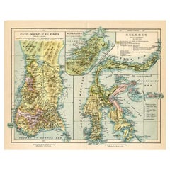
Antique Map of Sulawesi by Winkler Prins, c.1900
Located in Langweer, NL
Antique map titled 'Celebes.' (Sulawesi .) This map shows the Indonesian island of Sulawesi, one of the Sunda islands. With inset maps of South-west Sulawesi and Semenanjung Minahassa. Legend and scale. This map originates from 'De Grote Winkler Prins...
Category

20th Century Benelux - Collectibles and Curiosities

Materials

Paper

Dutch Antique Engraving with Coastal Views of Asia by Cook, 1803
Located in Langweer, NL
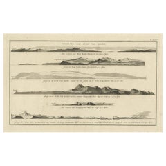
Antique print Asia titled 'Gezigt der Kust van Asiën'. Antique print depicting various coastal views of Asia including Kamchatka. Originates from 'Reizen Rondom de Waereld door James...
Category

19th Century Antique Benelux - Collectibles and Curiosities

Materials

Paper

Antique Map of the Holy Land, Showing the Location of the Various Tribes
Located in Langweer, NL
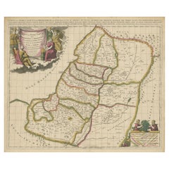
Antique map titled 'Judaea seu Terra Sancta quae Hebraeorum sive Israelitarum (..)'. Map of The Holy Land, showing the location of the various tribes, in two kingdoms, Judah and Isra...
Category

Early 18th Century Antique Benelux - Collectibles and Curiosities

Materials

Paper

Antique Hand-Colored Print of Sister of the Third Order of St. Francis
Located in Langweer, NL
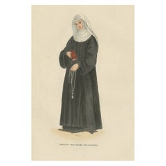
Antique print titled 'Soeur du Tiers Ordre des Servites'. Print of a Sister of the Third Order. This print originates from 'Histoire et Costumes des Ordres Religieux'. Artists and...
Category

19th Century Antique Benelux - Collectibles and Curiosities

Materials

Paper

Interesting Antique Print of Garden Architecture by Van Laar, 1802
Located in Langweer, NL
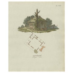
Untitled print of garden architecture. It shows a garden building. This print originates from 'Magazijn van tuin-sieraden'. The book is compiled by...
Category

19th Century Antique Benelux - Collectibles and Curiosities

Materials

Paper

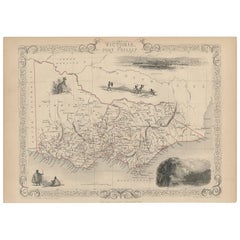
Antique Map of Victoria ‘Australia’ by J. Tallis, circa 1855
Located in Langweer, NL
A highly decorative and finely engraved mid-19th century map of Victoria, Australia which appeared in John Tallis & co.'s The Illustrated Atlas (London...
Category

Mid-19th Century Antique Benelux - Collectibles and Curiosities

Materials

Paper

Antique Map of of Brazil, Paraguay and Uruguay
Located in Langweer, NL
Antique map titled 'Bresil Paraguay et Uruguay'. Fine steel engraved map of Brazil, Paraguay and Uruguay. Engraved by Leclercq and published by Armand Aubree in "Atlas Classique et U...
Category

Mid-19th Century Antique Benelux - Collectibles and Curiosities

Materials

Paper

Antique Map of India as Described It Was before the 5th Century, 1744
Located in Langweer, NL
Antique map titled 'India, as described by all Authors before the fifth Century'. Detailed map of part of India, including Hyrcania, Parthia, Carmania, Gedorossii, Drangiana, Aria, M...
Category

18th Century Antique Benelux - Collectibles and Curiosities

Materials

Paper

Antique Print of Inhabitants of Arakan in Southern Myanmar 'Burma', 1738
Located in Langweer, NL
Antique print titled 'Il mode nel quale si vestono gti abilanti di Arakan'. Engraving of inhabitants of Arakan, a historic coastal region in Southeast Asia. This print originates fro...
Category

18th Century Antique Benelux - Collectibles and Curiosities

Materials

Paper

Print of Tenggarong in East-Kalimantan on The Island of Borneo, Indonesia, 1881
Located in Langweer, NL
Antique print with a view of Tenggarong, Indonesia. This print originates from 'Reis in Oost- en Zuid-Borneo van Koetei naar Banjermassin (..)' by Carl Bock....
Category

19th Century Antique Benelux - Collectibles and Curiosities

Materials

Paper

Antique Plan of Fort Mardyck Mardijk, France by S. Beaulieu, 1649
Located in Langweer, NL
Plan of Fort Mardyck (Fort Mardijk) and surroundings by Sébastian de Pontault Beaulieu. Mardyck is a former commune in the Nord department in northern France. It is an associated com...
Category

Mid-17th Century Antique Benelux - Collectibles and Curiosities

Materials

Paper

Map of Europe Highlighting Ancient and Modern Geographical Divisions (1794)
Located in Langweer, NL
Map of Europe Highlighting Ancient and Modern Geographical Divisions (1794). Germany, France, Italy, Spain, and the British Isles – Map by D’Anville (1794). This detailed 18th-cent...
Category

1790s Antique Benelux - Collectibles and Curiosities

Materials

Paper

Antique Map of the Burgundy Region by Merian, 1646
Located in Langweer, NL
Antique map titled 'Utriusque Burgundiae tum Ducatus tum Comitatus descriptio'. Old map of the Burgundy region of France. This map originates from 'Neuwe Archontologia cosmica'. Arti...
Category

17th Century Antique Benelux - Collectibles and Curiosities

Materials

Paper

Antique Map of the West African Coast and the Cape Verde Islands, c.1680
Located in Langweer, NL
Antique map Africa titled 'Isles du Cap Verd Coste et Pays des Negres'. Antique map of the coast of Africa and the Cape Verde islands. Artists and...
Category

17th Century Antique Benelux - Collectibles and Curiosities

Materials

Paper

19th Century Brass and Gold Watch-Key with Agate and Heliotrope Stones
Located in Delft, NL
19th century Brass and Gold Watch-Key with Agate and Heliotrope Stones 19th century brass and gold Watch-Key with each side a different stone A brass watch...
Category

Early 19th Century Dutch Antique Benelux - Collectibles and Curiosities

Materials

Gold, Brass

The Communion of the Lutherans in the Minorite Church in Augsburg, Germany, 1730
Located in Langweer, NL
Antique print, titled: 'La communion des Lutheriens dans l'Eglise des Minorites à Augsbourg' - This original antique print shows the Communion of the Lutherans in the Minorite Chu...
Category

1730s Antique Benelux - Collectibles and Curiosities

Materials

Paper

1584 Ortelius Map of Switzerland: A Cartographic Reversal
Located in Langweer, NL
This is a fine example of Ortelius' map of Switzerland from his *Theatrum Orbis Terrarum*, recognized as the first modern atlas of the world. The map is oriented with south at the top, which reverses the typical north-up orientation seen in most modern maps. It highlights significant geographical features such as Lake Geneva (Lemanus Lacus) to the right of the map and the Rhine river entering Switzerland near the center. The *Theatrum Orbis Terrarum*, first published in 1570 by Abraham Ortelius in Antwerp, was groundbreaking as it compiled uniform maps with supporting text in a single volume, marking a departure from earlier collections of maps that were custom-assembled on demand. This atlas included a wealth of sixteenth-century cartographic knowledge, reflecting the extensive global explorations occurring after the discovery of America...
Category

16th Century Antique Benelux - Collectibles and Curiosities

Materials

Paper

Antique Hand-colored Print of an English Benedictine in Choir Dress, 1845
Located in Langweer, NL
Antique print titled 'Bénédictin Anglais, au Choeur'. Print of an English Benedictine in choir dress. This print originates from 'Histoire et Costumes des Ordres Religieux'. Artists...
Category

19th Century Antique Benelux - Collectibles and Curiosities

Materials

Paper

Antique Map of China and Japan, with Frame Style Border
Located in Langweer, NL
Antique map titled 'Empires Chinois et Japonnais'. Attractive map of China and Japan. This map originates from Maison Basset's 1852 edition of 'Atlas Illustre Destine a l'enseignemen...
Category

Mid-19th Century Antique Benelux - Collectibles and Curiosities

Materials

Paper

Navigating the Spice Trade: A Maritime Chart of the Banda Sea, 1799
Located in Langweer, NL
This original antique map is an 18th-century nautical chart by Laurie & Whittle, a well-known British firm that was involved in the publication of maps, charts, and maritime books. ...
Category

Late 18th Century Antique Benelux - Collectibles and Curiosities

Materials

Paper

Antique Map of Southern India by Andree, 1904
Located in Langweer, NL
"Antique map titled 'Vorderindien, sudlicher Teil'. Map of India, southern part. This map originates from 'Andrees Allgemeiner Handatlas in 126 Haupt-Und 139 Nebenkarten', Bielefeld;...
Category

20th Century Benelux - Collectibles and Curiosities

Materials

Paper

1625 Petrus Plancius / Cloppenburg Map of the Holy Land with Biblical Vignettes
Located in Langweer, NL
1625 Petrus Plancius / Johannes Cloppenburg Map of the Holy Land with Biblical Vignettes This exquisite 1625 map by Petrus Plancius and Johannes Cloppenburg represents the Holy Lan...
Category

1620s Antique Benelux - Collectibles and Curiosities

Materials

Paper

Exquisite 1600 Ortelius Map of Artois, France: A Collector’s Piece
Located in Langweer, NL
Exquisite 1600 Ortelius Map of Artois, France: A Collector’s Piece with Rich Historical Detail Description of the Map: This map, titled "Atrebatum Regionis Vera Descriptio," create...
Category

Early 1600s Antique Benelux - Collectibles and Curiosities

Materials

Paper

Rare Print of the Siege of Doornik Between the English and French Armies, c.1680
Located in Langweer, NL
Antique print of the Siege of Doornik (Tournai) in 1581, during the Eighty Years' War. This print most likely originates from an edition of 'Histoire de la guerre de Flandre' by F. S...
Category

17th Century Antique Benelux - Collectibles and Curiosities

Materials

Paper

Northwest Orient Airlines / Hong Kong, 1960s. Vintage Airline Tourism Poster
Located in Langweer, NL
Beautiful original poster of Northwest Orient Airlines / Hong Kong. 1960s. Vintage airline tourism poster depicting a junk boat. 40 x 25 ¼”. Linen bac...
Category

Mid-20th Century Benelux - Collectibles and Curiosities

Materials

Paper

Spectacular Large Map of Upper and Lower Austria between Passau and Wien, c.1700
Located in Langweer, NL
Antique map titled 'Austriae Archiducatus pars superior in omnes ejusdem (..).' Spectacular large map of Upper and Lower Austria between Passau and Wien with figurative cartouche a...
Category

Early 1700s Antique Benelux - Collectibles and Curiosities

Materials

Paper

Antique Map of the City of Emden by Blaeu, 1649
Located in Langweer, NL
Antique map titled 'Emda'. Old map of the city of Emden, Germany. This map originates from 'Novum Ac Magnum Theatrum Urbium Belgicæ Liberæ ac Foederatæ' by J. Blaeu. Artists and Engr...
Category

17th Century Antique Benelux - Collectibles and Curiosities

Materials

Paper

Antique Map of the Island of Tinos by Dapper, 1687
Located in Langweer, NL
Antique map titled 'Tino.' This original antique map shows the island of Tinos, Greece. Source unknown, to be determined. Artists and Engravers: Made by 'Olfert Dapper' after an a...
Category

17th Century Antique Benelux - Collectibles and Curiosities

Materials

Paper

Antique Map of Korea by Kozaki, 1903
Located in Langweer, NL
Old map of Korea by S. Kozaki. Restored and mounted.
Category

20th Century Benelux - Collectibles and Curiosities

Materials

Paper

Brass Chart Divider-Replicate of One Recovered From Wreck
Located in Den Haag, NL
CHART DIVIDER-REPLICATE OF ONE RECOVERED FROM WRECK OF HMS ASSOCIATION, 1697-1707. Very good condition, comes complete in wooden box
Category

1970s English Edwardian Vintage Benelux - Collectibles and Curiosities

Materials

Brass

Antique Map of Central Asia between the Caspian Sea and Lake Balkhash
Located in Langweer, NL
Antique map titled 'Independent Tartary'. Original steel engraved map of Central Asia. It covers the regions between the Caspian Sea and Lake Balkhash and between Russia and Afghanis...
Category

Mid-19th Century Antique Benelux - Collectibles and Curiosities

Materials

Paper

Old Map of the French Department of Nièvre, France
By Victor Levasseur
Located in Langweer, NL
Antique map titled 'Dept. de la Nièvre'. Map of the French department of Nievre, France. Part of the prestiegous Burgundy or Bourgogne wine region this area is known for its producti...
Category

Mid-19th Century Antique Benelux - Collectibles and Curiosities

Materials

Paper

Antique Print of a Malayan Houses in Sumatra, Indonesia, 1881
Located in Langweer, NL
Antique print with a view of the place of the Sultan of Koetai and a Malayan house in Sumatra. This print originates from 'Reis in Oost- en Zuid-Borneo van Koetei naar Banjermassin (..)' by Carl Bock...
Category

19th Century Antique Benelux - Collectibles and Curiosities

Materials

Paper

Antique Map of Southeast Asia by Larousse, 1897
Located in Langweer, NL
"Front: 'Carte Generale des Indes.' (General map of India / The Indies / Thailand / Malaysia). Rear: 'Empire des Indes.' (India; artefacts, architecture, design, ornaments).' This li...
Category

19th Century Antique Benelux - Collectibles and Curiosities

Materials

Paper

Old Hand-Colored Print of the Guards of the King of France, 1890
Located in Langweer, NL
Antique print titled 'Gardes-du-Crops du Roi'. Old print of the Guards of the King of France. This print originates from 'Histoire de la maison militaire du roi de 1814 à 1830 : ...
Category

1890s Antique Benelux - Collectibles and Curiosities

Materials

Paper

Antique Map of China and Japan by Meyer, 1895
Located in Langweer, NL
Antique map titled 'China und Japan'. Map of China, Mongolia, Taiwan and Japan. With an inset map of Jiaozhou Wan near Qingdao, and another of the region around Hongkong, including Kanton and Macau, with small plans of Hong Kong and Kanton. This map originates from a 1885-1907 edition of a famous German encyclopedia titled 'Meyers grosses Konversations-Lexikon', published in Leipzig and Vienna. Meyers Konversations-Lexikon was a major German encyclopedia that existed in various editions from 1839 until 1984, when it merged with the Brockhaus encyclopedia. Several of the plates were also used in Dutch Encyclopedia's like Winkler Prins...
Category

19th Century Antique Benelux - Collectibles and Curiosities

Materials

Paper

Large Antique Map of New Guinea and New Britain Showing Capt. Cooks Tract, 1773
Located in Langweer, NL
Antique map titled 'A Chart of Captain Carteret's Discoveries at New Britain, with part of Captain Cooke's Passage thro Endeavour Streights, & of Captain Dampier's tract & discoverie...
Category

18th Century Antique Benelux - Collectibles and Curiosities

Materials

Paper

Antique Religion Print of the Seven Sacraments, Confirmation, '1913'
Located in Langweer, NL
Large antique print of the seven sacraments. Published by Mosella-Verlag, 1913. This print originates from a series titled 'Kathol. Schulbibelwerk von Dr. Ecker'.
Category

Early 20th Century Benelux - Collectibles and Curiosities

Materials

Paper

Antique Map of Germany and Switzerland by Lowry, '1852'
Located in Langweer, NL
Antique map titled 'Germany and Switzerland'. Four individual sheets of Germany and Switzerland. This map originates from 'Lowry's Table Atlas constructed and engraved from the most ...
Category

Mid-19th Century Antique Benelux - Collectibles and Curiosities

Materials

Paper

Original Hand-Colored Antique Print of a Jesuit Missionary in China, 1845
Located in Langweer, NL
Antique print titled 'Jesuite Missionnaire a la Chine'. Print of a Jesuit Missionary in China. This print originates from 'Histoire et Costumes des Ordres Religieux'. Artists ...
Category

1840s Antique Benelux - Collectibles and Curiosities

Materials

Paper

Antique Map of Europe from an Old Dutch School-Atlas, 1852
Located in Langweer, NL
Antique map titled 'Europa'. Map of Europe. This map originates from 'School-Atlas van alle deelen der Aarde' by Otto Petri. Artists and Engravers: Published by A. Baedeker (Otto...
Category

19th Century Antique Benelux - Collectibles and Curiosities

Materials

Paper

Cartographic Elegance of the Mughal Dominion in a Hand-Colored Antique Map, 1705
Located in Langweer, NL
This original antique map titled “'T Ryk van den Grooten Mogol” by Nicolas Sanson from 1705 is an interesting historical artifact. It depicts the extent of the Mughal Empire in North...
Category

Early 1700s Antique Benelux - Collectibles and Curiosities

Materials

Paper

Antique Map of the Koblentz Region by Moll, 1695
By Herman Moll
Located in Langweer, NL
Antique map Koblentz titled 'Coblentz'. Rare antique map of the Koblentz region in Germany. On verso, an antique map of the Mont Royal fortress, Germany. Originates from 'Thesaurus Geographicus. A New Body of Geography: or a Compleat Description of the Earth 'by H. Moll. Artists and Engravers: Herman Moll...
Category

17th Century Antique Benelux - Collectibles and Curiosities

Materials

Paper

Antique Architectural Print of the Melville House in Fife, Scotland, 1725
Located in Langweer, NL
Antique print titled 'The Elevation of Melvin House in the Shire of Fyfe (..)'. Old engraving of Melville House in Fife, Scotland. This print originates from 'Vitruvius Britannic...
Category

18th Century Antique Benelux - Collectibles and Curiosities

Materials

Paper

Colourful Old Detailed Map of Northern Carolina, United States of America
Located in Langweer, NL
Vintage map titled 'The Geographical Publishing Company's Premier Map of North Carolina'. Beautiful map of North Carolina. This map originates from Comme...
Category

Early 20th Century Benelux - Collectibles and Curiosities

Materials

Paper

Antique Map of Italy by R. Bonne, circa 1780
Located in Langweer, NL
Beautiful map of Italy, Corsica, Sardinia and Sicily. Highly detailed, showing towns, rivers, some topographical features and political boundaries. Published by R. Bonne, circa 1780.
Category

Late 18th Century French Antique Benelux - Collectibles and Curiosities

Materials

Paper

Antique Map of Asia, 1846
Located in Langweer, NL
Antique map titled 'Asie'. Original antique map of Asia. Source unknown, to be determined. Artists and Engravers: Alexandre Vuillemin (1812-188...
Category

19th Century Antique Benelux - Collectibles and Curiosities

Materials

Paper

Antique Map of Asia, 1846
$74 Sale Price
20% Off
Antique Map of the Black Sea by Perthes, 1848
Located in Langweer, NL
Antique map titled 'Pontus Euxinus'. Old map of the Black Sea and surroundings originating from 'Orbis Terrarum Antiquus in usum Scholarum'. Artists and Engravers: Published by Justu...
Category

19th Century Antique Benelux - Collectibles and Curiosities

Materials

Paper

Antique Print of Mary Holding Jesus Christ, C.1880
Located in Langweer, NL
Untitled antique print depicting Mary holding Christ on her lap. Source unknown, to be determined. Artists and Engravers: Made after Bellini, signed by L. Boscato (?). Conditi...
Category

19th Century Antique Benelux - Collectibles and Curiosities

Materials

Paper

Original Antique Engraving of Various Houses of Tonga Tabu, c.1836
Located in Langweer, NL
Antique print titled 'Tonga-Tabu'. Old print depicting houses and a warehouse of Tonga Tabu. This print originates from 'Entdeckungs, Reise der Franzosischen Corvette Astrolabe Unter...
Category

19th Century Antique Benelux - Collectibles and Curiosities

Materials

Paper

Two Men in Civilian & Military Outfit from Cochinchine or Southern Vietnam, 1830
Located in Langweer, NL
Antique print titled 'Cochinchine'. Two portaits of Vietnamese men one showing in military attire and the second in civilian dress. Cochinchina or Cochin-China is a historical ex...
Category

1830s Antique Benelux - Collectibles and Curiosities

Materials

Paper

1654 Nicolas Sanson Map of Southern India and Southeast Asia
Located in Langweer, NL
1654 Nicolas Sanson Map of Southern India and Southeast Asia - Partie Meridionale de L'Inde This 1654 map by Nicolas Sanson, titled "Partie Meridionale de L'Inde en deux Presqu'Is...
Category

1650s Antique Benelux - Collectibles and Curiosities

Materials

Paper

Old Map of Australia Showing The Routes of the Main Explorers, ca.1900
Located in Langweer, NL
Antique print, untitled. This map shows Australia with the routes of explorers in the continent and marking the furthest point reached.. Source unknown, to be determined. Artists ...
Category

Early 1900s Antique Benelux - Collectibles and Curiosities

Materials

Paper

Antique Map of Ille et Vilaine ‘France’ by V. Levasseur, 1854
Located in Langweer, NL
Antique map titled 'Dépt. d'Ille et Vilaine'. Map of the French department of Ille et Vilaine. France. Its coastal area is famous for its seafood, and especially its oysters. The reg...
Category

Mid-19th Century Antique Benelux - Collectibles and Curiosities

Materials

Paper

19th Century Italian Hand Carved Coral and Gold Bacchante Bacchus Cameo Pendant
Located in Haarlem, NL
19th Century Italian hand carved coral and gold Bacchante / Bacchus pendant. Made from 9 Kt gold and natural, untreated hand carved blood coral from S...
Category

Mid-19th Century Italian Antique Benelux - Collectibles and Curiosities

Materials

Coral, Gold

Antique Zoological Map, 1843
Located in Langweer, NL
Two antique world maps on one sheet. The upper map shows the distribution of animals over the world. The lower map shows the distribution of birds & reptiles over the world. Originat...
Category

19th Century Antique Benelux - Collectibles and Curiosities

Materials

Paper

Antique Zoological Map, 1843
$209 Sale Price
20% Off
Imperial map of Northern Russia with Archangel, Lapland and Permia, c.1730
Located in Langweer, NL
Imperial map of Northern Russia with Archangel, Lapland, and Permia, c.1730 Description: This intricately engraved and hand-colored map presents the northern reaches of the Russian ...
Category

Early 18th Century German Antique Benelux - Collectibles and Curiosities

Materials

Paper

Antique Plan of Port-Vendres, Roussillon, France
Located in Langweer, NL
Antique map titled 'Plan de Port Vendre en Roussillon'. Original plan of Port-Vendres, Roussillon, France. This map originates from 'Le Petit Atlas Maritime (..)' by J.N. Bellin. Pub...
Category

Mid-18th Century Antique Benelux - Collectibles and Curiosities

Materials

Paper

Rare Antique Map of Southwestern Europe and West Africa by V.M. Coronelli, 1692
By Vincenzo Coronelli
Located in Langweer, NL
Antique Globe Gore: Southwestern Europe and West Africa by Vincenzo Coronelli This exquisite, hand-colored globe gore by Vincenzo Coronelli, one of the most renowned 17th-century cartographers, represents Southwestern Europe and West Africa. A segment of Coronelli's monumental 42-inch terrestrial globe, this gore is a remarkable example of the artistry and geographical knowledge of the late 1600s. Covering France, the Iberian Peninsula, and all of Africa west of a line extending from Algeria to the Bight of Benin, it also includes the Canary Islands and Madeira. Coronelli’s globe gores are celebrated for their exceptional engraving and accuracy, and this piece is no exception. The coastline of Africa is depicted with remarkable precision for its time, reflecting the latest geographical knowledge of European explorers. In contrast, the interior of Africa—still a mystery to European mapmakers—features mythical elements such as fantastical mountain ranges and exotic fauna. Giraffes, elephants, lions, and mysterious giant birds populate the landscape, offering a glimpse into the imagination and curiosity of the era. One notable detail is the Gambia...
Category

Late 17th Century Antique Benelux - Collectibles and Curiosities

Materials

Paper

Original Antique Engraving of A Jewish Priest, 1709
Located in Langweer, NL
Antique print titled 'La Representation du Grand Pontise'. Old print depicting a Jewish Priest. This print originates from 'Introduction à l'écriture sainte, où l'on traite tout ...
Category

Early 1700s Antique Benelux - Collectibles and Curiosities

Materials

Paper

Read More

Medal-Worthy Memorabilia from Epic Past Olympic Games

Get into the games! These items celebrate the events, athletes, host countries and sporting spirit.

Ahoy! You’ve Never Seen a Collection of Sailor Art and Kitsch Quite Like This

French trendsetter and serial collector Daniel Rozensztroch tells us about his obsession with objects related to seafaring men.

Pamela Shamshiri Shares the Secrets behind Her First-Ever Book and Its Effortlessly Cool Interiors

The sought-after designer worked with the team at Hoffman Creative to produce a monograph that beautifully showcases some of Studio Shamshiri's most inspiring projects.

Moroccan Artworks and Objects Take Center Stage in an Extraordinary Villa in Tangier

Italian writer and collector Umberto Pasti opens the doors to his remarkable cave of wonders in North Africa.

Montecito Has Drawn Royalty and Celebrities, and These Homes Are Proof of Its Allure

Hollywood A-listers, ex-pat aristocrats and art collectors and style setters of all stripes appreciate the allure of the coastal California hamlet — much on our minds after recent winter floods.

Whaam! Blam! Pow! — a New Book on Pop Art Packs a Punch

Publishing house Assouline and writer Julie Belcove have teamed up to trace the history of the genre, from Roy Lichtenstein, Andy Warhol and Yayoi Kusama to Mickalene Thomas and Jeff Koons.

What Makes a Gem-Encrusted Chess Set Worth $4 Million?

The world’s most opulent chess set, weighing in at 513 carats, is literally fit for a king and queen.

Tauba Auerbach’s Geometric Pop-Up Book Is Mighty Rare, Thanks to a Hurricane

This sculptural art book has an epic backstory of its own.
Recently Viewed

View All