Benelux - Collectibles and Curiosities

to
4,924
6,563
14,776
11,442
6,509
40
14
116
30
30
25
21
18
16
13
13
6
5
5
4
4
2
1
3,132
2,461
916
54
378
200
63
83
18
9
17
7
31
41
28
12
6
5,599
489
333
103
97
845
189
165
83
77
6,563
6,562
6,562
104
59
20
14
14
Item Ships From: Benelux
Antique Map of the Burgundy Region by Merian, 1646
Located in Langweer, NL
Antique map titled 'Utriusque Burgundiae tum Ducatus tum Comitatus descriptio'. Old map of the Burgundy region of France. This map originates from 'Neuwe Archontologia cosmica'. Arti...
Category

17th Century Antique Benelux - Collectibles and Curiosities

Materials

Paper

Ancient Iberia: Hispania Map from Spruner-Menke Atlas Antiquus, 1880
Located in Langweer, NL
This map is titled "HISPANIA," indicating it is a historical map of ancient Spain. It is an original antique map from the "Spruner-Menke Atlas Antiquus," a 19th-century historical a...
Category

1880s Antique Benelux - Collectibles and Curiosities

Materials

Paper

Large Antique Map of Egypt and the Nile Delta by Wyld, 1854
Located in Langweer, NL
Antique map titled 'Lower Egypt and the adjacent desert, with a part of Palestine to which has been addes the nomenclature of the Roman age by L.S. de la Rochette'. Map of Egypt and ...
Category

19th Century Antique Benelux - Collectibles and Curiosities

Materials

Paper

Antique Map of Northern Italy by J. Tallis, circa 1851
Located in Langweer, NL
A highly decorative mid-19th century map of Northern Italy which was drawn and engraved by John Rapkin (vignettes by A. H. Wray & J. B. Allen) and published in John Tallis & co.'s Th...
Category

Mid-19th Century Antique Benelux - Collectibles and Curiosities

Materials

Paper

Pl. 2 Antique Print of Vauxhall Gardens by Le Rouge, c.1785
Located in Langweer, NL
Antique print titled 'Vue d'une partie du Voxhal de Londres'. Copper engraving of Vauxhall gardens, London. This print originates from 'Jardins Anglo-Chinois à la Mode' by Georg Loui...
Category

18th Century Antique Benelux - Collectibles and Curiosities

Materials

Paper

Antique Map of Seram, Boero and the Banda Islands by Van den Bosch '1818'
Located in Langweer, NL
Antique map titled 'Kaart der Ambonsche Eilanden'. Rare and attractive map of the islands of Seram, Boero and the Banda Islands. Includes a nice view of the Island of Seram. One of 1...
Category

Early 19th Century Antique Benelux - Collectibles and Curiosities

Materials

Paper

Antique Map of the Queen Charlotte Islands, Haida Gwaii
Located in Langweer, NL
Antique map titled 'Isles de la Reine Charlotte (..)'. Original old map of the Queen Charlotte Islands, based upon the explorations of James Cook, Juan Perez, and other contemporary European explorers. The map shows only partial coastal detail along the north end of the main island, and includes two insets of navigable bays and depth measurements. Now called Haida Gwaii, after the local native population, the islands situated off Canada’s coast, south of Vancouver played an important role in the late 18th and early 19th century maritime...
Category

Late 18th Century Antique Benelux - Collectibles and Curiosities

Materials

Paper

Antique Map of the Region of Languedoc, Foix, Roussillon and Rouergue by Zatta
By Antonio Zatta
Located in Langweer, NL
Antique map titled 'Li Governi di Linguadoca, di Foix e di Rossiglione con il Rouergue'. Old map of France showing the regions of Languedoc, Foix, Roussillon and Rouergue. This map o...
Category

18th Century Antique Benelux - Collectibles and Curiosities

Materials

Paper

African Malachite set pendants and bracelet, 1970s
Located in Delft, NL
African Malachite set pendants and bracelet, 1970s African Malachite pendants in various sizes and a brass bracelet with Malachite. Set of 11 pieces, of which 4 are mask shaped pen...
Category

20th Century African Benelux - Collectibles and Curiosities

Materials

Malachite

Territories of Antiquity: The Northern Division of Syria, A Detailed 1882 Map
Located in Langweer, NL
This 19th-century map from the atlas published by Blackie and Son in 1882 is titled "SYRIA (NORTH DIVISION)" and covers the northern part of Syria, capturing its geographical and adm...
Category

1880s Antique Benelux - Collectibles and Curiosities

Materials

Paper

Antique Map of the Europe Continent, 1880
Located in Langweer, NL
Antique map titled 'Europe'. Old map of the European continent. This map originates from 'Géographie Universelle Atlas-Migeon' by J. Migeon. Artists an...
Category

19th Century Antique Benelux - Collectibles and Curiosities

Materials

Paper

Original Antique Map of Turkey, Asia Minor and Cyprus
By Gerard Mercator
Located in Langweer, NL
Antique map titled 'Natoliae sive Asia Minor'. Original old map of Turkey, Asia Minor and Cyprus. Includes a decorative cartouches, sailing ship, sea mon...
Category

Early 17th Century Antique Benelux - Collectibles and Curiosities

Materials

Paper

Antique Political Map of the Japanese Empire, 1922
Located in Langweer, NL
Antique map of Japan titled 'Japanese Empire - Political Map'. Old map of Japan depicting Japan, Korea and surroundings. This map originates from 'The Ti...
Category

20th Century Benelux - Collectibles and Curiosities

Materials

Paper

Old Map Showing Info Related to the Ottoman Wars including Conflict Dates, c1690
Located in Langweer, NL
"Corso del Danubio da Vienna Sui a Vicopoli, e Paesi Adiacenti - Northwestern Sheet", Coronelli, Vincenzo Maria Subject: Central Europe, Danube River Period: 1690 (circa) Publicatio...
Category

1690s Antique Benelux - Collectibles and Curiosities

Materials

Paper

Old Map of Australia Showing The Routes of the Main Explorers, ca.1900
Located in Langweer, NL
Antique print, untitled. This map shows Australia with the routes of explorers in the continent and marking the furthest point reached.. Source unknown, to be determined. Artists ...
Category

Early 1900s Antique Benelux - Collectibles and Curiosities

Materials

Paper

Detailed Antique Map of Portugal, Published for the 'Gentleman's Magazine', 1758
Located in Langweer, NL
Antique map Portugal titled 'A Map of the Kingdom of Portugal'. Detailed map of Portugal, published for the 'Gentleman's Magazine'. Artist...
Category

1750s Antique Benelux - Collectibles and Curiosities

Materials

Paper

Antique Map of Germany and Central Europe
Located in Langweer, NL
Antique map titled 'S. Imperium Romano-Germanicum oder Teutschland mit seinen angrantzenden Königreichen und Provincien'. Original antique map of Germany...
Category

Late 17th Century Antique Benelux - Collectibles and Curiosities

Materials

Paper

Bird's Eye Plan of the Ancient City of Jerusalem Based on Old Records, c.1725
Located in Langweer, NL
Antique map titled 'Beschryving van het oude Jeruzalem volgens Villalpandus.' Bird's eye plan of the ancient city of Jerusalem based on Villalpando's foundation map. The plan shows...
Category

18th Century Antique Benelux - Collectibles and Curiosities

Materials

Paper

Cartographic Elegance of Touraine: A 17th-Century Map Showing French Heritage
Located in Langweer, NL
"Ducatus Turonensis - Touraine," is a original antique historical map of the Touraine region, which is located in the heart of France, centered...
Category

1630s Antique Benelux - Collectibles and Curiosities

Materials

Paper

Antique Print of the Neptune Fountain of Versailles, Paris, France, 1776
Located in Langweer, NL
Antique print titled 'Partie Centrale du Bassin de Neptune a Versailles'. Copper engraving showing parts of the Neptune fountain of Versailles, France...
Category

18th Century Antique Benelux - Collectibles and Curiosities

Materials

Paper

Antique Map of the Siege of Breda, City in the Netherlands by Blaeu, 1649
Located in Langweer, NL
Antique map titled 'Breda obsessa et expugnata a Celsissimo Frederico Henrico'. Old map of the city of Breda, the Netherlands. It shows the Siege of Breda in 1637. Originates fro...
Category

17th Century Antique Benelux - Collectibles and Curiosities

Materials

Paper

Antique Map of the Arctic Regions by Lowry '1852'
Located in Langweer, NL
Antique map titled 'Arctic Regions'. Original map of the Arctic Regions. This map originates from 'Lowry's Table Atlas constructed and engraved from the most recent Authorities' by J...
Category

Mid-19th Century Antique Benelux - Collectibles and Curiosities

Materials

Paper

Antique Map of Algeria and the French Colonies, 1875
Located in Langweer, NL
Antique map titled 'Algérie et Colonies Francaises'. Large map of Algeria and the French Colonies. This map originates from 'Atlas de Géographie Moderne Physique et Politique' by A. ...
Category

Late 19th Century Antique Benelux - Collectibles and Curiosities

Materials

Paper

Antique Religion Print of David Dancing Before the Ark, 1913
Located in Langweer, NL
Large antique print of David Dancing Before the Ark. Published by Mosella-Verlag, 1913. This print originates from a series titled 'Kathol. Schulbibelwerk von Dr. Ecker'.
Category

Early 20th Century Benelux - Collectibles and Curiosities

Materials

Paper

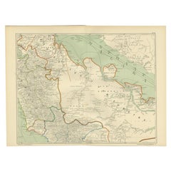
Antique Map of the Sunda Islands Sumatra, Java, Malay Peninsula & Borneo (1739)
By Isaak Tirion
Located in Langweer, NL
Antique map titled 'Nieuwe kaart van de Sundasche Eilanden als Borneo, Sumatra en Groot Iava & c'. Detailed map of the Sunda Islands, Southeast Asia, extending from the tip of Cambod...
Category

Mid-18th Century Antique Benelux - Collectibles and Curiosities

Materials

Paper

Antique Map of the Region of Fréjus, France
Located in Langweer, NL
Title: "Golf de Fréjus" Description: This antique map, titled "Golf de Fréjus," is an original depiction of the region of Fréjus, France. It is part of the work "Le Petit Atlas Mari...
Category

Mid-18th Century Antique Benelux - Collectibles and Curiosities

Materials

Paper

Original Antique Map of the Region Between the Gulf of Lybia and the Red Sea
Located in Langweer, NL
Original antique map titled 'Aegyptus et Cyrene'. Detailed ancient map of the region between the Gulf of Lybia and the Red Sea, with marvelous detail along the Mediterranean Coastline and the Nile, Egypt. This map originates from 'Philippi Cluveri Introductionis in universam geographiam (..)' by P. Clüver. Published 1729. Philipp Clüver was an Early Modern German geographer and historian. Cluver's Geography was one of the most enduring works of the 17th & 18th Centuries, issued by several different publishers with many different sets of maps...
Category

Early 18th Century Antique Benelux - Collectibles and Curiosities

Materials

Paper

Original Antique Map Showing the Mountain Ranges in Asia and Europe, 1849
Located in Langweer, NL
Antique map titled 'Bergketten in Asien und Eüropa'. Original antique map showing the mountain ranges in Asia and Europe. In outline color with inset maps of Java, Luzon, and Reguain...
Category

1840s Antique Benelux - Collectibles and Curiosities

Materials

Paper

Original Antique Map of the Bay and Rocks of Petatlan, Mexico, 1749
Located in Langweer, NL
Antique map titled 'Baye et Rochers de Petaplan (..) - De Baay en de Rotsen van Petaplan (..)'. Original antique map of the bay and rocks of Petatlan, Mexico. This map originates...
Category

1740s Antique Benelux - Collectibles and Curiosities

Materials

Paper

Original Copper Engraving of Koroni 'or Corone', Greece, 1688
Located in Langweer, NL
Antique print titled 'Das Aussehen der Stadt und Vestung Coron von der Seit des Auffgang'. Copper engraving of Koroni (or Corone), Greece. This print originates from 'Ruhm-belorb...
Category

1680s Antique Benelux - Collectibles and Curiosities

Materials

Paper

Antique Map of a Bay on the Coast of Chile, South America, c.1749
Located in Langweer, NL
Antique map titled 'Plan van een Baai en Haven aan de Kust van Chili (..) - Plan d'une Baye de la Côte du Chili (..)'. Original antique map of a bay on the coast of Chile discovered ...
Category

18th Century Antique Benelux - Collectibles and Curiosities

Materials

Paper

Empire's Crossroads: An 1882 Map of Turkey in Asia by Blackie & Son
Located in Langweer, NL
This map, titled "Turkey in Asia," is another detailed illustration from the 1882 atlas by Blackie & Son. It showcases the vastness of the Asian territories of the Ottoman Empire, sp...
Category

1880s Antique Benelux - Collectibles and Curiosities

Materials

Paper

Antique Map of Italy and Greece by H. Kiepert, circa 1870
By Heinrich Kiepert
Located in Langweer, NL
Antique map titled 'Italiae pars media'. This map originates from 'Atlas Antiquus. Zwölf Karten zur Alten Geschichte' by H. Kiepert. Published in Berlin, circa 187.
Category

Late 19th Century Antique Benelux - Collectibles and Curiosities

Materials

Paper

Antique Print of Various Island in French Polynesia, circa 1774
Located in Langweer, NL
Two antique maps on one sheet titled 'Havre d'Ohamaneno a Ulietea' and Havre d'Oopoa a Ulietea'. Also with German subtitles. The upper image depicts Ohamaneno (Vaiaau) Harbour Raiatea (Ulietea) - Leeward Islands...
Category

18th Century Antique Benelux - Collectibles and Curiosities

Materials

Paper

Mid-20th Century Decorative German Suitcase Set
Located in Delft, NL
Mid 20th Century decorative German suitcase set A German suitcase set from the 1950s and 1960s, flown with the Royal Dutch Airlines, SAS, Tee, among ot...
Category

Mid-20th Century German Benelux - Collectibles and Curiosities

Materials

Leather

Attractive Detailed Authentic Map Showing Bavaria, Germany and Austria, c.1740
Located in Langweer, NL
Antique map titled 'Nieuwe Kaart van de Beyersche en Oostenryksche Kreits (..).' Attractive detailed map showing Bavaria, Germany and Austria. Source unknown, to be determined. Ar...
Category

18th Century Antique Benelux - Collectibles and Curiosities

Materials

Paper

Important and Scarce Antique Map of Asia from Jesuit Sources, C.1713
Located in Langweer, NL
Antique map titled 'L'Asie selon les nouvelles observations de Messrs de l'Academie des Sciences etc'. The main focus of this important and scarce map of Asia is the delineation of the northeast part of the continent from Jesuit sources. The northeast coast is severely truncated with the discoveries of Nicolas Witsen shown, and the partial coastlines of Jesso and Compagnies Land are depicted to the north of Japan. Inset in the North Pacific is a map of that same region based on the information from Father Martino Martini. It shows Jesso connected to the mainland with a narrow strait between it and a huge Compagnies Land. An inset below, taken from Father Ferdinand Verbiest, illustrates the road between Peking and Kirin and Nincrita. Father Verbiest's world map of 1674, which he compiled for the Chinese, subsequently led to the Jesuits obtaining a commission to make a comprehensive topographical...
Category

18th Century Antique Benelux - Collectibles and Curiosities

Materials

Paper

Detailed Regional Map of the Gulf of Bengal and the Lower Ganges River, ca.1750
Located in Langweer, NL
Title of this original and rare antique map: Nouvelle Carte Du Royaume De Bengale Mapmaker: Jacques-Nicolas Bellin (1703-1772). He was among the most important mapmakers of the eighteenth century. In 1721, at only the age of 18, he was appointed Hydrographer to the French Navy. In August 1741, he became the first Ingénieur de la Marine of the Dépôt des cartes...
Category

1750s Antique Benelux - Collectibles and Curiosities

Materials

Paper

Mid-19th Century Decorative Map of Asia with Cultural and Natural Vignettes
Located in Langweer, NL
John Tallis & Company, known for their decorative mid-19th-century maps, created this map of Asia. These maps were distinctive for their elaborate borders and detailed vignettes. The...
Category

1850s Antique Benelux - Collectibles and Curiosities

Materials

Paper

Antique Map of the Middle East by Mortier, 1700
Located in Langweer, NL
Antique map titled 'Carte de la Situation du Paradis Terrestre (..)'. Detailed map of the Holy Land and the Middle East, centered on the Garden of Eden and including a large Cyprus. ...
Category

18th Century Antique Benelux - Collectibles and Curiosities

Materials

Paper

Mediterranean Tapestry: A 19th Century Map of the Mediterranean Shores, 1882
Located in Langweer, NL
This map, titled "The Shores of the Mediterranean," is part of the 1882 atlas by Blackie & Son, and it portrays the coastal regions that surround the Mediterranean Sea. It is a detailed representation of the diverse and historically rich countries that share the Mediterranean coastline, spanning from the Strait of Gibraltar in the west to the Levantine Sea in the east, and from the southern shores of Europe down to the northern coastlines of Africa. The map is a vivid document of the time, with each country along the Mediterranean basin meticulously outlined. The northern coast includes the southern parts of Europe, featuring Spain...
Category

1880s Antique Benelux - Collectibles and Curiosities

Materials

Paper

19th Century Noble Gilt wooden Family photo Frame, American History
Located in Delft, NL
19th Century Noble Gilt wooden Family photo Frame, American History A gilded wooden family portrait frame with the Calhoun/Colquhoun family coat of arms. This portrait frame probably ended up in the Netherlands through the marriage of the American Julia Johnson Calhoun (1884-1970) in 1914 to Mr. Justinus Egbertus Hendericus baron van Nagell (1882-1963). The list contains three portrait photos of presumably members of the Calhoun family. The American statesman John Caldwell Calhoun (1782-1850) descended from a Scottish noble family with the name Colquhoun, who settled in the United States in the 18th century and achieved great prestige there. He started his career as a lawyer, married the daughter of an influential senator and was elected to the House of Representatives. After serving as Secretary of War, he became Vice President under President John Quincy Adams from 1825-1829 and then served a second term under President Andrew Jackson. This makes him one of only two American vice presidents to have served under two different presidents. His grandson, John Caldwell Calhoun (1843-1918), was a successful American businessman, landowner and managing director of the Baltimore Coal Mining and Railway Company. He married Linnie Adams, second cousin of US Vice President Richard Johnson. Their only daughter, Julia Johnson Calhoun (1884-1970), made her debut in New York and met mr. Justinus Egbertus Hendericus baron van Nagell (1882-1963), who was attached to the Dutch legation in Washington in diplomatic service. He descended from an old noble family from Westphalia, whose ancestor was first mentioned in 1385. In the 16th century, an ancestor settled in the Netherlands and in 1814 the family was included in the Dutch nobility with the title of baron. He grew up at Schaffelaar Castle in Barneveld and his father was mayor in this castle and he was also Grand Commander of the Knightly German Order. At the end of the 19th century, a real boom in marriages of wealthy American heirs to European nobility started. It was the 'Gilded Age', described in e.g., the books of Edith Wharton, in which millions of dollars crossed the Atlantic as a dowry. New money and European nobility bonded. One of the most famous marriages was that of Consuelo Vanderbilt to the English Duke of Marlborough. The Vanderbilt millions repaired the roof of Blenheim Palace and the gardens here were recreated in the French style. It prompted a visitor to remark: “American money has its use after all.” The Van Nagell-Calhoun wedding became a real social event in the winter of 1914 at the start of the nightlife season – one newspaper ran the headline GAYETIES OF WINTER SOCIAL SEASON BEGIN THIS WEEK – and newspapers detailed all the details. The bridal staff included the Dutch Count Van Rechteren Limpurg and as witness for the groom was Jonkheer De Beaufort, who was secretary of the Dutch legation in Washington. Baron Van Nagell had a glorious career in the diplomatic service, which over the years took him from Beijing to Washington and St Petersburg. Here he experienced the Russian Revolution in Saint Petersburg in 1917 up close. One evening he was sitting with company at a table in a restaurant. A waiter brought the bill to a group of Russian communists next to them. The bill did not like this, whereupon the waiter was shot dead. After Saint Petersburg, London, Bucharest, and Stockholm followed, where he finally became envoy extraordinary and minister plenipotentiary. The couple had three children: one daughter was born stillless and the only son and heir died in 1944 as a res. -2nd lieutenant pilot in the Royal Air Force over France. A second daughter married a jonkheer Clifford Kocq van Breugel...
Category

19th Century North American Antique Benelux - Collectibles and Curiosities

Materials

Fruitwood

Loudun and Mirebeau: A Cartographic Masterpiece of 17th Century France by Blaeu
Located in Langweer, NL
Cartography, 17th century. Willem (1571-1638) and Joan Blaeu (1596-1673), Theatrum Orbis Terrarum sive Atlas Novus..., 1635. Figure: Loudonois. Laudunum (Loudun); Mirebalais (Mirebea...
Category

1650s Antique Benelux - Collectibles and Curiosities

Materials

Paper

Combat of Men with Lions in front of the Great Mogul and three more, 1725
Located in Langweer, NL
Plate: 'Magnifique parure des Elephans lors qu'on les presente au Grand Mogol. - Combat des hommes avec les lions devant le Grand Mogol. - Lachete des officiers de guerre punie par l...
Category

18th Century Antique Benelux - Collectibles and Curiosities

Materials

Paper

Antique Map of the Netherlands by Guicciardini, 1612
Located in Langweer, NL
Antique map titled 'Belgicarum Provinciarum Nova Descriptio'. Beautiful old map of the Netherlands. With decorative cartouche including the coat...
Category

17th Century Antique Benelux - Collectibles and Curiosities

Materials

Paper

Old Engraving of French Visiting Tomari, a Village in Far East Russia, 1797
Located in Langweer, NL
Plate: 'Costumes des Habitants de la Baie de Langle.' (Costumes of the inhabitants of Langle Bay, Russia). Tomari (Russian: ??????) is a coastal town and the administrative cente...
Category

1790s Antique Benelux - Collectibles and Curiosities

Materials

Paper

Antique Map of France by Bowen, c.1790
Located in Langweer, NL
Antique map titled 'France from the best Authorities'. Original antique map of France. Engraved for Barlow's General history of Europe. Published circa 1790. Artists and Engraver...
Category

18th Century Antique Benelux - Collectibles and Curiosities

Materials

Paper

Old Original Antique Map of the Sunda Islands of Indonesia, 1756
Located in Langweer, NL
Title: Isles De La Sonde. Attractive old decorative map of the Isles de la Sonde, Borneo, Sumatra, Java and Malacca ( Malaysia) with the Straits of Malacca. Penang is spelled as P...
Category

1750s Antique Benelux - Collectibles and Curiosities

Materials

Paper

Antique Map of the Main Comoro Islands by Van Schley, 1749
By Jakob van der Schley
Located in Langweer, NL
Antique map titled ‘Carte des Isles de Comore (..) - Kaart van de Eilanden Komoro (..)’. Original antique map of the main Comoro Islands or Comoros including Comore, Mohéli, Anjouan ...
Category

18th Century Antique Benelux - Collectibles and Curiosities

Materials

Paper

Antique Map of the Russian Empire in Europe, ca.1780
Located in Langweer, NL
Description: Antique map titled 'Bowles's New Pocket Map of the Russian Empire in Europe, Comprehending the West Part of the Empire in Asia' Large and detai...
Category

1780s Antique Benelux - Collectibles and Curiosities

Materials

Paper

Original Antique Map of the Virgin Islands with Insets of Caribbean Isles, 1787
Located in Langweer, NL
Antique map titled 'Supplément pour les Isles Antilles (..)'. Original old map of the Virgin Islands, with insets of Barbuda, St. Kits, Antigua, Dominica, St. Lucia, Barbados, St. Vi...
Category

Late 18th Century Antique Benelux - Collectibles and Curiosities

Materials

Paper

Cortesi's Masterpiece: A Comprehensive and Authoritative Map of Uruguay, 1903
Located in Langweer, NL
Antique map titled 'Mapa de la Republica Oriental del Uruguay'. Large and detailed folding map of Uruguay. This monumental map depicts all of Uruguay with unprecedented accuracy and detail. Impressively, it serves the multiple roles of being an advanced topographic, economic and political map, as well as being a meticulous sea chart of the Rio de la Plata and the adjacent waters of the Atlantic. The republic's 20 departments are defined in various colors, while a legend, 'Referencias' identifies symbols representing the locations of departmental capitals, town, roads, railways, public schools and lighthouses, amongst other details. Every single river and stream is delineated and named and the ridges of hills are delicately expressed. The map features four insets, including a large map of the capital, Montevideo, as well as maps of Colonia, Maldonado and Punta del Este and the Island of Flores. The hydrographical information provided is truly profound, and renders the map fit for use in maritime commerce. In 1901, the Uruguayan House of Representatives commissioned the geographer Saturnino Cortesi to employ the most progressive geographical sources, both military and civilian, to devise an authoritative national map of the republic. Cortesi clearly had access to a vast archive of topographical surveys...
Category

Early 20th Century Benelux - Collectibles and Curiosities

Materials

Paper

Antique Map of North Africa and South Africa by Black, 1854
Located in Langweer, NL
Antique map titled 'Africa north part - Africa south part'. Old map of Africa showing the region of Morocco, Algeria and South Africa. This map orginates from 'General Atlas Of The W...
Category

19th Century Antique Benelux - Collectibles and Curiosities

Materials

Paper

Original Antique Map of England and Wales
Located in Langweer, NL
Antique map titled 'A New and Correct Map of England and Wales from the Latest and Best Improvements'. Original antique map of England and Wales. Printed by Alex Hogg, London for George Henry Millar's 'New, Complete and Universal System...
Category

Late 18th Century Antique Benelux - Collectibles and Curiosities

Materials

Paper

Original Antique Map of The Austrian Empire, 1882
Located in Langweer, NL
Step into the past with an original Antique Map of The Austrian Empire from the esteemed 'Comprehensive Atlas and Geography of the World,' meticulously crafted in 1882. This intricat...
Category

1880s Antique Benelux - Collectibles and Curiosities

Materials

Paper

Antique Map of Old European Russia, 1846
Located in Langweer, NL
Antique map titled 'Russia in Europe'. Old map of European Russia. This map originates from 'A New Universal Atlas Containing Maps of the various Em...
Category

19th Century Antique Benelux - Collectibles and Curiosities

Materials

Paper

Old Antique Print of the City of Groningen, The Netherlands, by Münster, c.1600
By Sebastian Münster
Located in Langweer, NL
Antique print titled 'Groeninga'. View of the city of Groningen, the Netherlands. This map originates from 'Cosmographia' published by Münster. Artists and Engravers: Sebastian Münster...
Category

16th Century Antique Benelux - Collectibles and Curiosities

Materials

Paper

Old Map of the French Department of Eure-et-loir, France
By Victor Levasseur
Located in Langweer, NL
Antique map titled 'Dépt. d'Eure et Loir'. Map of the French department of Eure-et-Loir, France. This area is home to the famous Chartres Cathedral....
Category

Mid-19th Century Antique Benelux - Collectibles and Curiosities

Materials

Paper

Read More

Medal-Worthy Memorabilia from Epic Past Olympic Games

Get into the games! These items celebrate the events, athletes, host countries and sporting spirit.

Ahoy! You’ve Never Seen a Collection of Sailor Art and Kitsch Quite Like This

French trendsetter and serial collector Daniel Rozensztroch tells us about his obsession with objects related to seafaring men.

Pamela Shamshiri Shares the Secrets behind Her First-Ever Book and Its Effortlessly Cool Interiors

The sought-after designer worked with the team at Hoffman Creative to produce a monograph that beautifully showcases some of Studio Shamshiri's most inspiring projects.

Moroccan Artworks and Objects Take Center Stage in an Extraordinary Villa in Tangier

Italian writer and collector Umberto Pasti opens the doors to his remarkable cave of wonders in North Africa.

Montecito Has Drawn Royalty and Celebrities, and These Homes Are Proof of Its Allure

Hollywood A-listers, ex-pat aristocrats and art collectors and style setters of all stripes appreciate the allure of the coastal California hamlet — much on our minds after recent winter floods.

Whaam! Blam! Pow! — a New Book on Pop Art Packs a Punch

Publishing house Assouline and writer Julie Belcove have teamed up to trace the history of the genre, from Roy Lichtenstein, Andy Warhol and Yayoi Kusama to Mickalene Thomas and Jeff Koons.

The Sparkling Legacy of Tiffany & Co. Explained, One Jewel at a Time

A gorgeous new book celebrates — and memorializes — the iconic jeweler’s rich heritage.

What Makes a Gem-Encrusted Chess Set Worth $4 Million?

The world’s most opulent chess set, weighing in at 513 carats, is literally fit for a king and queen.
Recently Viewed

View All