Continental Europe Maps
to
4,203
5,113
5,466
195
5,112
1
2
2
2
1
2,804
1,990
318
1
179
12
1
68
3
3
3
2
3
1
5,094
17
10
10
7
377
131
80
76
42
5,113
5,113
5,113
104
59
20
14
13
Item Ships From: Continental Europe
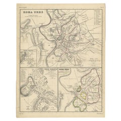
Detailed Original Antique Map of the Region of Rome in Italy, c.1870
By Heinrich Kiepert
Located in Langweer, NL
Antique map titled 'Roma Urbs'. Old map of Italy, it shows three inset maps of the region of Rome. This map originates from 'Atlas Antiquus, twaalf k...
Category
19th Century Antique Continental Europe Maps
Materials
Paper
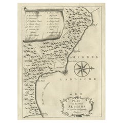
Old Map of Algiers, with Surrounding Cities and the Bay of Algiers, 1773
Located in Langweer, NL
Antique print titled 'Plan van de Stad Algiers'.
Old map of Algiers, also depicting surrounding cities and the Bay of Algiers. Originates from the first Dutch editon of an interest...
Category
1770s Antique Continental Europe Maps
Materials
Paper
$342 Sale Price
20% Off
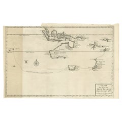
Early Map of Australasia, Marking The Route of Abel Tasman in 1642 'Publ. 1726'
Located in Langweer, NL
Description: Antique map titled 'Kaart der Reyse van Abel Tasman volgens syn eygen opstel'. Rare and early map of Australasia, marking the route of Abel Tasman's voyage from Mauritius to Batavia in 1642, on which he discovered Tasmania and New Zealand and proved that Australia was not part of the Great Southern...
Category
1720s Antique Continental Europe Maps
Materials
Paper
$8,090 Sale Price
20% Off
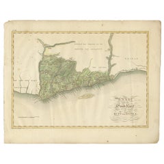
Antique Map of the Dutch Gold Coast in Africa by Van den Bosch '1818'
Located in Langweer, NL
Antique map titled 'Kaart van de Goud-Kust of Kust van Guina'. A rare and attractive early 19th century Dutch map of the Dutch Gold Coast. The Dutch Gold Co...
Category
Early 19th Century Antique Continental Europe Maps
Materials
Paper
$1,142 Sale Price
20% Off
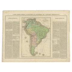
Antique Map of South America by Buchon, 1825
Located in Langweer, NL
Antique map titled 'Carte de l'Amérique méridionale'. Map of South America with attractive topography, surrounded on three sides by text on the history, geography, and economy of the...
Category
19th Century Antique Continental Europe Maps
Materials
Paper
$130 Sale Price
20% Off
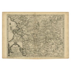
Antique Map of Overijssel by Van der Aa, c.1715
Located in Langweer, NL
Antique map titled 'L'Over-Issel'. This map depicts the Dutch province Overijssel. This map originates from 'Nouvel Atlas, très exact et fort commode pour toutes sortes de personnes,...
Category
18th Century Antique Continental Europe Maps
Materials
Paper
$180 Sale Price
20% Off
Map of Carmarthenshire 1844 – Carmarthen Llandeilo Llanelli Laugharne Llandovery
Located in Langweer, NL
Title: Old Map of Carmarthenshire by Samuel Lewis 1844 – Carmarthen Llandeilo Llanelli Laugharne Llandovery
Description: This detailed 1844 map of Carmarthenshire was drawn and engraved for Samuel Lewis’ Topographical Dictionary of Wales. It highlights major towns such as Carmarthen, Llandeilo, Llanelli, Laugharne, and Llandovery. The county's roads, rivers, and hilly terrain are finely engraved and shaded, while original hand coloring outlines the administrative divisions. The map includes a compass rose and a reference to the seven unions within the county.
Condition:
The map is in very good antique condition with minimal age toning and wide clean margins. The engraving is crisp and the hand coloring remains bright and accurate. There are no tears or major defects.
Framing suggestions:
A cream or soft beige acid-free mat will complement the aged paper and hand coloring. Frame in dark wood, antique gold, or a muted black to highlight the historical character. Use UV-protective glass to preserve the colors. Suitable for traditional interiors, libraries, or as a heritage gift.
Keywords:
Carmarthenshire map 1844 Samuel Lewis antique...
Category
1840s Antique Continental Europe Maps
Materials
Paper
$228 Sale Price
20% Off
Old Map of Carnarvonshire 1844 – Caernarfon Bangor Pwllheli Beaumaris Bay
Located in Langweer, NL
Title: Old Map of Carnarvonshire by Samuel Lewis 1844 – Caernarfon Bangor Pwllheli Beaumaris Bay
Description: This antique map of Carnarvonshire was published in 1844 for Samuel Lewis’ Topographical Dictionary of Wales. It features major towns and landmarks including Caernarfon, Bangor, Pwllheli, and the scenic Beaumaris Bay. The map shows shaded terrain, rivers, and coastal outlines, with hand-colored borders dividing the county’s various unions. A decorative compass rose and a reference key add historical detail and charm.
Condition:
The map is in very good condition with some light age toning and clean margins. The engraved lines are sharp and the original hand coloring remains bright and clear. There are no visible tears or major imperfections.
Framing suggestions:
Use an ivory, cream, or light tan acid-free mat to complement the aged paper and colored borders. Choose a frame in dark wood, black with a soft finish, or antique gold to enhance the historical appeal. UV-protective glass is recommended. A striking piece for a study, hallway, or as a gift for those with North Welsh heritage or an interest in vintage maps.
Keywords:
Carnarvonshire map 1844 Samuel Lewis antique...
Category
1840s Antique Continental Europe Maps
Materials
Paper
$228 Sale Price
20% Off
Antique Map of Batavia, Nowadays Jakarta, the Capital of Indonesia, 1782
Located in Langweer, NL
Antique map Batavia titled 'Batavia zo als het was in den Jaare 1731'. Old map of the city of Batavia (Jakarta) in Indonesia. Originates from 'Batavia, de Hoofdstad van Neerlands O. ...
Category
18th Century Antique Continental Europe Maps
Materials
Paper
$904 Sale Price
20% Off
Antique Print of the Tiber River in Rome, Italy, 1704
Located in Langweer, NL
Antique print titled 'Insulae Tiberinae et Pontis Senatorii Vestigia'. This original antique print shows a view of the Tiber River in Rome with the Bridge 'Ponte dei Senatori'. Above more images of Rome. Originates from 'Beschryving van Oud en Nieuw Rome. Verdeelt in drie Deelen. In 't Fransch beschreven door den Heer Francois Desseine. En in 't Nederduitsch vertaalt.', by Francois Desseine and published by Francois Halma in 1704, first published in French in 1690. Copies of this work are rarely complete as the maps and engravings are of high quality matching the work of Piranesi.
Artists and Engravers: Jan Goeree (1670-1731) was a Dutch engraver and poet. He was the son of the Middelburg bookseller Willem Goeree. Born in Middelburg, but soon they moved to Amsterdam. Initially he focussed on painting, assumably a student of Gerard de Lairesse...
Category
18th Century Antique Continental Europe Maps
Materials
Paper
Nice Colourful Antique Map of the Rivers and Mountains of Europe c.1870
By Heinrich Kiepert
Located in Langweer, NL
Antique map titled 'Fluss und Gebirgs Karte von Mittel-Europa'. Old map of the European continent depicting the European mountains and rivers. This map originates from 'H. Kiepert's ...
Category
19th Century Antique Continental Europe Maps
Materials
Paper
$228 Sale Price
20% Off
Antique Map of the North Pole by Fullarton, 1856
Located in Langweer, NL
Antique map titled 'The Arctic Regions showing the North-West Passage of Captain R. McClure'. Old map of the North Pole, displaying the Northwest Passage di...
Category
19th Century Antique Continental Europe Maps
Materials
Paper
$120 Sale Price
20% Off
Vintage Cartographic Collection Set of India Explored - W. G. Blackie's 1859
Located in Langweer, NL
Antique map titled 'India'. Original antique map of India with inset maps of Pegu, the Tenasserim Provinces, straits settlements. This map originate...
Category
Mid-19th Century Antique Continental Europe Maps
Materials
Paper
$380 Sale Price / set
20% Off
Antique Map of Germany by French Cartographer Lapie, 1842
Located in Langweer, NL
Antique map titled 'Carte d'Allemagne (..)'. Map of Germany. This map originates from 'Atlas universel de géographie ancienne et moderne (..)' by Pierre M. Lapie and Alexandre E. Lap...
Category
19th Century Antique Continental Europe Maps
Materials
Paper
$247 Sale Price
20% Off
Old Map of the Namibia and South Africa Coasts & Inset of Saldanha Bay, ca.1700
Located in Langweer, NL
Antique map titled 'Carte particuliere des Costes de l'Afrique'.
Map of the coasts of Namibia and South Africa. With an inset map of Saldanha Bay.
Artists and Engravers: Publ...
Category
Early 1700s Antique Continental Europe Maps
Materials
Paper
$609 Sale Price
20% Off
Antique Map of Cayenne and Cassepouri, French Guinea, South America, c.1730
Located in Langweer, NL
Antique map titled 'A Map of the Island Cayenne (..)’. A set of interesting copper engravings of Cayenne and Cassepouri, French Guinea, South America, and Martinique in the West Indies. The map of Cayenne, home of Cayenne pepper, has a key of symbols identifying the sugar works, petty plantations, indian carbet or village, woody country and palmetto trees. The plan of Fort Lewis, Cayenne also has a lettered key including; A. the fort on a pretty high hill...
Category
18th Century Antique Continental Europe Maps
Materials
Paper
$361 Sale Price
20% Off
Old Color Engraving of Blaeu's first Map of Brazil, North Oriented to the Right
By Willem Blaeu
Located in Langweer, NL
Antique map titled 'Novus Brasiliae Typus'. Fine old color example of Blaeu's first map of Brazil, with north oriented to the right. Includes inset map of Baya de todos Santos, elaborate cartouche, 2 compass roses and richly embellished vignettes of native Brazilian life and animals.
The interior of the map includes vignettes of indigenous animals and native scenes, including cannibalism. Inset within a decorative border is a small map of "Baya de todos Sanctos". In the sea are monsters, a galleon and two compass roses. The large title cartouche features a male and female Brazilian, both of whom are shown naked.
Willem Janszoon Blaeu (1571-1638) was a prominent Dutch geographer and publisher. Born the son of a herring merchant, Blaeu chose not fish but mathematics and astronomy for his focus. He studied with the famous Danish astronomer Tycho Brahe...
Category
Mid-17th Century Antique Continental Europe Maps
Materials
Paper
$1,284 Sale Price
40% Off
Antique Map of Central and East Java by Van den Bosch, 1818
Located in Langweer, NL
Antique map titled 'Kaart van de Keizers en Sultans Landen benevens de Strand Regentschappen op het Eiland Java'. Map of three central and easterly provinces of the island of Java. O...
Category
Early 19th Century Antique Continental Europe Maps
Materials
Paper
$1,142 Sale Price
20% Off
Old Print Depicting Various Utensils of Tongatabu, Site of Tonga's Capital, 1836
Located in Langweer, NL
Antique print titled 'Tonga-Tabu'.
Tongatapu is the main island of the Kingdom of Tonga and site of Tonga’s capital, Nuku?alofa. It is located in Tonga's southern island group, t...
Category
1830s Antique Continental Europe Maps
Materials
Paper
$304 Sale Price
20% Off
Old Map of the Philippines and Part of Indonesia 'Spice Islands', 1744
Located in Langweer, NL
Antique map titled 'Nieuwe Kaart van de Filippynsche, Ladrones, Moluccos of Specery Eilanden, als mede Celebes etc'.
Old map of the Philippines and part of Indonesia. Originates ...
Category
1740s Antique Continental Europe Maps
Materials
Paper
$628 Sale Price
20% Off
Chart of the Coast of Cochinchina' and 'Plan of Pulo Condor', Vietnam, 1778
Located in Langweer, NL
Antique map titled 'A Chart of a part of the Coast of Cochinchina' and 'Plan of Pulo Condor'.
Two maps on one sheet. The upper map shows part of the coast of Cochinchina from Cha...
Category
1770s Antique Continental Europe Maps
Materials
Paper
$513 Sale Price
20% Off
Striking Antique Map of Cayenne in French Guyana, South America, ca.1760
Located in Langweer, NL
Description: Antique map titled 'Land-kaart van het Eiland en de Volkplanting van Cayenne aan de Kust van Zuid-Amerika'.
Striking map of the island and settlement of Cayenne in F...
Category
1760s Antique Continental Europe Maps
Materials
Paper
$1,284 Sale Price
20% Off
Antique Map of the Main Comoro Islands by Van Schley, 1749
By Jakob van der Schley
Located in Langweer, NL
Antique map titled ‘Carte des Isles de Comore (..) - Kaart van de Eilanden Komoro (..)’. Original antique map of the main Comoro Islands or Comoros including Comore, Mohéli, Anjouan ...
Category
18th Century Antique Continental Europe Maps
Materials
Paper
$104 Sale Price
20% Off
Antique Map of the Dutch Province of Noord-Holland, 1883
Located in Langweer, NL
Antique map titled 'Noord-Holland'. Map of Noord-Holland, a province of the Netherlands. This map originates from 'Atlas van Nederland volgens de nieuwe spelregels' by J. Kuyper. Art...
Category
19th Century Antique Continental Europe Maps
Materials
Paper
$128 Sale Price
20% Off
Old Print with a View of the Cape of Good Hope and Table Bay, South Africa, 1750
Located in Langweer, NL
Antique print titled 'Gezigt van de Kaap de Goede-Hoop'.
Old print with a view of the Cape of Good Hope and Table Bay. Engraved by J. van Schley for a Du...
Category
1750s Antique Continental Europe Maps
Materials
Paper
$180 Sale Price
20% Off
Scarce Antique Map of Lake Toba and Silindoeng on Sumatra, Indonesia, c.1875
Located in Langweer, NL
Antique map titled 'Kaart van het Toba-Meer en het landschap Silindoeng.'
This scarce map shows Lake Toba and Silindoeng on the Indonesian island of Sumatra. Originates from 'Tij...
Category
19th Century Antique Continental Europe Maps
Materials
Paper
$171 Sale Price
20% Off
Antique Map of the Bay of Terney by La Pérouse, 1797
Located in Langweer, NL
Antique map titled 'Plan de la Baie de Ternai'. Old map of the north eastern coast of Russia. This map originates from 'Atlas du voyage de La Perouse'. Arti...
Category
18th Century Antique Continental Europe Maps
Materials
Paper
$145 Sale Price
20% Off
Antique Print of Loch Achray, a Lake near Callander in Stirling, Scotland, c1860
Located in Langweer, NL
Antique print titled 'Loch Achray'. Original antique print with a view of Loch Achray, a small freshwater loch 11 km (6.8 mi) west of Callander in Stirling...
Category
19th Century Antique Continental Europe Maps
Materials
Paper
$266 Sale Price
20% Off
Antique Map of Africa by Delamarche, 1806
Located in Langweer, NL
Antique map titled 'L'Afrique'.
Decorative map of Africa by Robert de Vaugondy, revised and published by Delamarche. Source unknown, to be determined.
Artists and Engravers: Charl...
Category
19th Century Antique Continental Europe Maps
Materials
Paper
$256 Sale Price
20% Off
Antique Map of the Port of Acapulco in Mexico, 1749
Located in Langweer, NL
Antique map titled 'Plan van de Haven van Acapulco (..) - Plan du Port d'Acapulco (..)'. Original antique map of the Port of Acapulco on the coast of Mexico in the Southern Sea, at 1...
Category
18th Century Antique Continental Europe Maps
Materials
Paper
Antique Print of Mary Queen of Scots' Cabinet by Gibb, 1890
Located in Langweer, NL
Antique print titled 'Mary Queen of Scots' Cabinet'. Chromolithographic plate originating from 'The Royal House of Stuart. Illustrated By a Series ...
Category
19th Century Antique Continental Europe Maps
Materials
Paper
$80 Sale Price
20% Off
Antique Map of the Gulf of Tomini by Winkler Prins, 1878
Located in Langweer, NL
Antique map titled 'Kaart van de Golf van Tomini of Gorontalo.' (Map of the Gulf of Tomini or Gorontalo.) This map shows the Gulf of Tomini near the Island of Sulawesi, Indonesia. Wi...
Category
19th Century Antique Continental Europe Maps
Materials
Paper
$176 Sale Price
20% Off
Antique Print of Longford Castle, South of Salisbury, Wiltshire, England, 1766
Located in Langweer, NL
Antique print titled 'Longford Castle the Seat of the Earl of Radnor in Wiltshire'.
Large engraving of Longford Castle, Wiltshire. Source unknown, to be determined. Artists and Engravers: Engraved by Miller.
Longford Castle stands on the banks of the River Avon...
Category
18th Century Antique Continental Europe Maps
Materials
Paper
$723 Sale Price
20% Off
Old Map of Java, Indonesia by Stemler, 1875
By Stemler
Located in Langweer, NL
Antique map titled 'Hoofddriehoeken - Java en madoera.' (Main triangles measured by the Geographical Service in the Dutch-Indies on Java and Madoera.) This scarce map shows the Indon...
Category
19th Century Antique Continental Europe Maps
Materials
Paper
$66 Sale Price
20% Off
Antique Engraving of Kirby Hall Near Gretton, Northamptonshire, England c.1770
Located in Langweer, NL
Antique print titled 'Principal Front of Kirby Hall'.
Kirby Hall is an Elizabethan country house, located near Gretton, Northamptonshire, England. The nearest main town is Corby. One of the great Elizabethan houses of England, Kirby Hall was built for Sir Humphrey Stafford of Blatherwick, beginning in 1570. In 1575 the property was purchased by Sir Christopher Hatton of Holdenby,[1] Lord Chancellor to Queen Elizabeth I. It is a leading and early example of the Elizabethan prodigy house. Construction on the building began in 1570, based on the designs in French architectural pattern books and expanded in the Classical style over the course of the following decades. The house is now in a semi-ruined state with many parts roof-less although the Great Hall and state rooms remain intact. The gardens, with their elaborate "cutwork" design, complete with statues and urns, have been recently restored.
Anne of Denmark stayed at Kirby on 9 August 1605 while King James stayed at Rockingham Castle. King James stayed for three days in August 1616. During a royal progress Esmé Stewart, 3rd Duke of Lennox died at Kirby of the "spotted ague" on 30 July 1624.
The building and gardens are owned by the Earl of Winchilsea and are managed by English Heritage.
Kirby Hall has been used as a filming location in many productions. These include the following; an episode (6. Protest and Communication) of Kenneth Clark...
Category
18th Century Antique Continental Europe Maps
Materials
Paper
$523 Sale Price
20% Off
Old Original Engraving of Prussia on the Southeast Coast of the Baltic Sea, 1632
Located in Langweer, NL
Description: Antique map titled 'Prussia'.
Original map of Prussia, a historically prominent German state that originated in 1525 with a duchy centered on the region of Prussia o...
Category
1630s Antique Continental Europe Maps
Materials
Paper
$428 Sale Price
20% Off
Antique Miniature Map of the Western Hemisphere, with California as an Island
Located in Langweer, NL
Antique miniature map titled 'Nouveau Continent avec plusieurs Isles et Mers'. Decorative map of the Western Hemisphere, published by Alain Manesson Mallet. The map shows California as an Island...
Category
Late 17th Century Antique Continental Europe Maps
Materials
Paper
$418 Sale Price
20% Off
Hand Colored Antique Map of the Department of Cher, France
By Victor Levasseur
Located in Langweer, NL
Antique map titled 'Dépt. du Cher'. Map of the French department of Cher, France. This area of France is known for its production of Selles Sur Cher, a goats-milk cheese. The whole i...
Category
Mid-19th Century Antique Continental Europe Maps
Materials
Paper
$323 Sale Price
20% Off
Antique Map of the Region of the Nile River by Bartholomew, 1922
Located in Langweer, NL
Antique map of Africa titled 'Egypt and the Nile'. Old map of Africa depicting Egypt, the Nile river and surroundings. This map originates from 'The Times' ...
Category
20th Century Continental Europe Maps
Materials
Paper
$90 Sale Price
20% Off
Antique Bird's-Eye Plan of Tutecoryn (Tuticorin or Thoothukudi), India, 1672
Located in Langweer, NL
Antique map, titled: 'Tutecoryn.'
Bird's-eye plan of map of Tutecoryn (Tuticorin or Thoothukudi), India. This map originates from 'Naauwkeurige Beschryvinge van Malabar en Choroman...
Category
1670s Antique Continental Europe Maps
Materials
Paper
$342 Sale Price
20% Off
Antique Map of Brazil by Wyld, '1845'
Located in Langweer, NL
Antique map titled 'Empire of Brazil'. Original antique map of Brazil. This map originates from 'An Atlas of the World, Comprehending Separate Ma...
Category
Mid-19th Century Antique Continental Europe Maps
Materials
Paper
$237 Sale Price
20% Off
Antique Map of the Siege of Breda, City in the Netherlands by Blaeu, 1649
Located in Langweer, NL
Antique map titled 'Breda obsessa et expugnata a Celsissimo Frederico Henrico'.
Old map of the city of Breda, the Netherlands. It shows the Siege of Breda in 1637. Originates fro...
Category
17th Century Antique Continental Europe Maps
Materials
Paper
$799 Sale Price
20% Off
Antique Map of France under the Reign of Louis XIII by Zannoni, 1765
Located in Langweer, NL
Antique map France titled 'Tableau de la France sous Louis XIII (..)'.
Beautiful old map of France. This map originates from 'Atlas Historique de la France Ancienne et Moderne' b...
Category
18th Century Antique Continental Europe Maps
Materials
Paper
$147 Sale Price
20% Off
Antique Map of South America by Finlayson, 1822
Located in Langweer, NL
Antique map titled 'Geographical, Statistical and Historical Map of the United Provinces of South America'. This map depicts part of South America (including part of Brazil and Chili...
Category
19th Century Antique Continental Europe Maps
Materials
Paper
$255 Sale Price
20% Off
Antique Physical Chart of the Pacific Ocean by Johnston, '1850'
Located in Langweer, NL
Antique map titled 'Physical Chart of the Pacific Ocean showing the currents and temperature of the ocean'. Original antique chart of the Pacific Ocean. This map originates from 'The...
Category
Mid-19th Century Antique Continental Europe Maps
Materials
Paper
$190 Sale Price
20% Off
German Antique Map of Southeastern Australia, 1904
Located in Langweer, NL
This large antique map is taken from; 'Andrees Allgemeiner Handatlas in 126 Haupt-Und 139 Nebenkarten', Bielefeld; Leipzig: Velhagen & Klasing 1899. Andrees Allgemeiner Handatlas was...
Category
20th Century Continental Europe Maps
Materials
Paper
$71 Sale Price
20% Off
Antique Map of the Peter the Great Gulf by Reclus, 1881
Located in Langweer, NL
Antique map titled 'Le Golfe de Pierre-Le-Grand.' This map shows the Peter The Great Gulf in the Sea of Japan adjoining the coast of Russia's Primorski...
Category
19th Century Antique Continental Europe Maps
Materials
Paper
$84 Sale Price
20% Off
Antique Map of the Empire of China by Bonne, c.1780
By Rigobert Bonne
Located in Langweer, NL
Antique map titled 'Carte de L'Empire de la Chine.' Decorative map of the Empire of China, depicting China, Corea ( Korea ), Japan, Tonquin and the Philippine island Lucon. Source un...
Category
18th Century Antique Continental Europe Maps
Materials
Paper
$618 Sale Price
20% Off
Antique Map of Africa and Arabia with Inset Map of Ethiopia and Eritrea, 1845
Located in Langweer, NL
Antique map titled 'Mittel- und Nord-Africa (östl. Theil) und Arabien'. This map depicts North and Central Africa and Arabia with an inset map of Habesch (Ethiopia and Eritrea).
Ar...
Category
19th Century Antique Continental Europe Maps
Materials
Paper
$209 Sale Price
20% Off
Old Map of the Dutch Provinces of Friesland and Groningen, The Netherlands, 1604
Located in Langweer, NL
Antique print, titled: 'Frisiae Occidentalis.'
Handsome map of the Dutch Provinces of Friesland and Groningen. Embellished with strapwork title-car...
Category
Early 1600s Antique Continental Europe Maps
Materials
Paper
$1,094 Sale Price
20% Off
Rare Small Map of Sumatra, Java, Borneo, Macassar, Madura, Bali, 1614
Located in Langweer, NL
One of the first maps of the Indonesia islands of Java, Bali, Sumbawa etc. in early days of the Dutch Indies. Also showing Banten, Jakarta (Jacatra), Indr...
Category
Early 17th Century Antique Continental Europe Maps
Materials
Paper
$713 Sale Price
20% Off
Antique Map of India and Southeast Asia by Sanson '1654'
Located in Langweer, NL
Antique map titled 'Partie Meridionale de l'Inde'. Early map of India and Southeast Asia. The map shows most of modern India, Bangladesh and Burma, the whole of Sri Lanka, Thailand, ...
Category
Mid-17th Century Antique Continental Europe Maps
Materials
Paper
$1,142 Sale Price
20% Off
École Nationale – French Architectural Lithograph from La Brique, Chipiez c.1900
Located in Langweer, NL
École Nationale – French Architectural Lithograph from La Brique, Chipiez, c.1900
Elegant antique architectural lithograph showing the detailed elevation of the Pavillon de l’Escali...
Category
20th Century French Continental Europe Maps
Materials
Paper
Antique Print of the Bolshoi Theatre in Saint Petersburg, Russia, ca.1810
Located in Langweer, NL
Description: Antique print titled 'The Stone Theatre at St. Petgersbourg'. View ofthe Bolshoi Theatre in Saint Petersburg, Russia. In 1886 the building was declared unsafe and, at th...
Category
1810s Antique Continental Europe Maps
Materials
Paper
$228 Sale Price / item
20% Off
Antique Map of Oceania by Balbi '1847'
Located in Langweer, NL
Antique map titled 'Océanie'. Original antique map of Oceania. This map originates from 'Abrégé de Géographie (..)' by Adrien Balbi. Published 1847.
Category
Mid-19th Century Antique Continental Europe Maps
Materials
Paper
$142 Sale Price
20% Off
Antique Map of China and Japan by Tardieu, 1821
Located in Langweer, NL
Antique map titled 'Carte de la Chine et du Japon'. Detailed map of China, showing Korea, Japan and Taiwan. This map originates from 'L'histoire général des voyages' by J.F. de la Harpe.
Category
Early 19th Century Antique Continental Europe Maps
Materials
Paper
$690 Sale Price
20% Off
Antique Map of Sweden and Norway by W. G. Blackie, 1859
Located in Langweer, NL
Antique map titled 'Sweden and Norway'. Original antique map of Sweden and Norway. This map originates from ‘The Imperial Atlas of Modern Geography’. Published by W. G. Blackie, 1859.
Category
Mid-19th Century Antique Continental Europe Maps
Materials
Paper
$237 Sale Price
20% Off
Antique Map of Russia in Europe by Petri, c.1873
Located in Langweer, NL
Antique map titled 'Rusland in Europa'. Old map depicting Russia in Europe. This map originates from 'School-Atlas van alle Deelen der Aarde'. Artists and Engravers: Published by O. ...
Category
19th Century Antique Continental Europe Maps
Materials
Paper
$92 Sale Price
20% Off
Antique Print of the Neptune Fountain of Versailles, Paris, France, 1776
Located in Langweer, NL
Antique print titled 'Partie Centrale du Bassin de Neptune a Versailles'. Copper engraving showing parts of the Neptune fountain of Versailles, France...
Category
18th Century Antique Continental Europe Maps
Materials
Paper
$323 Sale Price
20% Off
Original Antique Map of the Channel Islands, Incl. Decorative Vignettes, 1851
Located in Langweer, NL
Antique map titled ‘Channel Islands’.
Includes decorative vignettes titled St. Peters Port, Castle Cornet, Druidical altar near Lancresse, Mont Orgueil Castle and Jersey. Originates from 'The Illustrated Atlas, And Modern History Of The World Geographical, Political, Commercial & Statistical, Edited By R. Montgomery Martin'. Published; John Tallis London, New York, Edinburgh & Dublin. 1851. Drawn and Engraved by J. Rapkin.
Artists and engravers: John Tallis (1817-1876) was a British map...
Category
1850s Antique Continental Europe Maps
Materials
Paper
$428 Sale Price
20% Off
Recently Viewed
View AllMore Ways To Browse
Vintage Industrial Bins
Vintage Liquor Labels
Vintage Utensil Holders
Vintage Wicker Wine Bottles
Vintage Wrought Iron Fire Screen
Viso Porcelain
Wall Mount Water Fountains
Wedding Cabinets and Armoires
Wedgwood Green Jasperware
Wedgwood Portrait
West German Pot
White Ceramic Garden Stool
White Ironstone China
White Lacquer Bar Cart
Woman With Water Jug
Wooden Chest 1800
Wooden Tea Cart
Worcester Jug
