Netherlands - More Furniture and Collectibles

to
4,903
7,310
30,871
28,189
7,113
162
35
339
113
55
47
33
21
20
17
17
14
10
7
6
5
3
2
2
3,190
2,582
1,341
197
487
430
157
104
15
64
45
18
112
142
102
24
12
5,803
774
610
222
172
1,751
460
418
229
165
7,310
7,212
7,258
104
59
28
20
18
Item Ships From: Netherlands
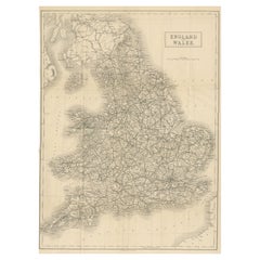
Antique Folding Map of England and Wales
Located in Langweer, NL
Antique map titled 'England and Wales'. Original folding map of England and Wales. Publishes by A. & C. Black, circa 1890.
Category

Late 19th Century Antique Netherlands - More Furniture and Collectibles

Materials

Paper

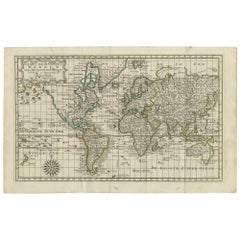
Antique Map of the World on Mercator's Projection, 1788
Located in Langweer, NL
Antique map titled 'Kaart van de Geheele Wereld (..)'. Uncommon small world map on Mercator's projection. Nice detail of the islands throughout the wor...
Category

Late 18th Century Antique Netherlands - More Furniture and Collectibles

Materials

Paper

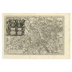
Antique Map of the Region of Cologne and Liege by Scherer, 1699
Located in Langweer, NL
Antique map titled 'Archpiescopatus Coloniensis (..) Episcopatus Leodiensis (..).' Detailed uncommon map of the Archbishopric of Cologne and the Bishopric of Liege/Luik. Source unkno...
Category

17th Century Antique Netherlands - More Furniture and Collectibles

Materials

Paper

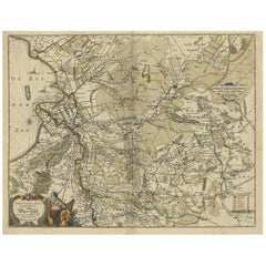
Attractive Original Map of the Province of Overijssel, the Netherlands, Ca.1700
Located in Langweer, NL
Antique print, titled: 'Transisalania Provincia vulgo Over-yssel.' Attractive original handcoloured map of the province of Overijssel, The Netherlands. With beautiful title cartouc...
Category

Early 1700s Antique Netherlands - More Furniture and Collectibles

Materials

Paper

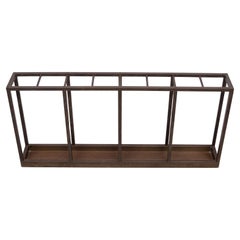
Art deco Brass Umbrella and walking stick stand 1930s Holland
By Gispen Culemborg
Located in Den Haag, NL
Very nice large handmade Brass umbrella stand . Can be hang on the wall . Beautiful crafted Copper dripping tray . Fits almost every interior .Looking great in your hallway .
Category

1930s Dutch Art Deco Vintage Netherlands - More Furniture and Collectibles

Materials

Brass

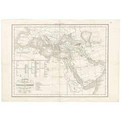
Géographie des Hébreux – Tableau de la Dispersion des Enfants de Noé, 1837
Located in Langweer, NL
Géographie des Hébreux – Tableau de la Dispersion des Enfants de Noé, 1837 This antique map, titled Géographie des Hébreux ou Tableau de la Dispersion des ...
Category

Mid-19th Century French Antique Netherlands - More Furniture and Collectibles

Materials

Paper

Turkey in Asia – Antique Ottoman Empire Map by John Tallis, ca. 1851
Located in Langweer, NL
Turkey in Asia – Antique Ottoman Empire Map by John Tallis, ca. 1851 This decorative 19th-century map titled "Turkey in Asia" was published by John Tallis & Company around 1851. Eng...
Category

Mid-19th Century English Antique Netherlands - More Furniture and Collectibles

Materials

Paper

Antique Print of 'The Adoration of the Magi' Made after Fabriano 'c.1890'
Located in Langweer, NL
Antique print titled 'The Adoration of the Magi'. Original antique print on chine collé, made after the painting by Gentile da Fabriano. Source unknown, to be determined. Published c...
Category

Late 19th Century Antique Netherlands - More Furniture and Collectibles

Materials

Paper

Pl. XX Villa Mon Caprice, Chabat, c.1900
Located in Langweer, NL
Antique print titled 'Villa mon Caprice Villers-Sur-Mer. Mr. E. Macé, Architecte'. This print depicts the design of a building in France. Originates from 'La Brique et La Terre Cuite...
Category

20th Century Netherlands - More Furniture and Collectibles

Materials

Paper

Antique Map of the Sunda Islands by Tirion 'c.1760'
Located in Langweer, NL
Antique map titled 'Nuova Carta delle Isole di Sunda come Borneo, Sumatra e Iava Grande'. Detailed map of the Sunda Islands, Southeast Asia, extending from the tip of Cambodia to Jav...
Category

Mid-18th Century Antique Netherlands - More Furniture and Collectibles

Materials

Paper

Antique Map of Prussia and Mecklenburg by W. G. Blackie, 1859
Located in Langweer, NL
Antique map titled 'Prussia and Mecklenburg'. Original antique map of Prussia and Mecklenburg with inset map of East Prussia. This map originates from ‘Th...
Category

Mid-19th Century Antique Netherlands - More Furniture and Collectibles

Materials

Paper

Antique Map of the Strait of Malacca, Malay Peninsula & Dutch Indies, c.1670
Located in Langweer, NL
Antique map titled 'Indiae Orientalis, nec non Insularum Adiacentium Nova Descriptio.' Map of Southeast Asia. The map centers on the Strait of Malacca and Malay Peninsula. It ext...
Category

1670s Antique Netherlands - More Furniture and Collectibles

Materials

Paper

Antique Bible Plan of Ancient Jerusalem, 1743
Located in Langweer, NL
This plan originates from ‘Biblia Sacra, dat is, de H. Schriftuer van het Oude, en het Nieuwe Testament, naer de laetste Roomsche keure der gemeine Latijnsche overzettinge, in nederd...
Category

Mid-18th Century Antique Netherlands - More Furniture and Collectibles

Materials

Paper

Imperium Romanum: A Detailed Map of the Roman Empire in its Zenith, 1880
Located in Langweer, NL
This original antique map, titled "IMPERIVM ROMANVM", is a detailed depiction of the Roman Empire at the height of its power. The main map encompasses the vast expanse of the Roman territories, stretching from the British Isles in the northwest to the deserts of Arabia and the northern fringes of Africa in the southeast. **Key Features of the Map:** 1. **Territorial Colors**: The map uses different colors to distinguish the various provinces of the Roman Empire. These color-coded areas are to represent the administrative divisions within the Empire. 2. **Topography**: It shows a considerable amount of topographical detail, with mountain ranges, rivers, and bodies of water such as the Mediterranean Sea, prominently displayed. 3. **Cities and Settlements**: Cities are marked, with symbols indicative of their size or importance. Major cities such as Rome, Constantinople, Alexandria, and Carthage are highlighted. 4. **Road Networks**: There appear to be lines connecting various cities and towns, which could represent the famous Roman road network that facilitated trade and military movements. 5. **Latin Text...
Category

1880s Antique Netherlands - More Furniture and Collectibles

Materials

Paper

Original Antique Map of Hungary and Transylvania 'Modern Day Romania', C.1710
Located in Langweer, NL
Antique map titled 'Hungary and Transilvania'. Original antique map of Hungary and Transylvania (modern day Romania), centered on Budapest. Artists and Engravers: Herman Moll ...
Category

1710s Antique Netherlands - More Furniture and Collectibles

Materials

Paper

Original Antique Map of the United Kingdom and Ireland, Published in 1875
Located in Langweer, NL
Antique map titled 'Iles Britanniques ou Royaume-Uni de la Grande Bretagne (..)'. Large map of the United Kingdom and Ireland. This map originates from...
Category

Late 19th Century French Antique Netherlands - More Furniture and Collectibles

Materials

Paper

Roman Italy and Provinces: A Cartographic Snapshot, 1880
Located in Langweer, NL
The map titled "ITALIA, Gallia Cisalpina, Sicilia, Sardinia, Corsica" focuses on Italy and its surrounding regions during Roman times. It offers a detailed depiction of the Italian peninsula, the Po Valley (Gallia Cisalpina), and the islands of Sicily, Sardinia, and Corsica. Produced as part of the "Spruner-Menke Atlas Antiquus" by Karl Spruner von Merz and edited by Theodorus Menke, this map reflects the 19th-century European scholarship on ancient geography and history. The period represented is likely during the Roman Republic or early Roman Empire, suggested by the level of detail in regions like Latium and Campania, which were central to Roman culture and power. This era was marked by Roman expansion and consolidation of the Italian peninsula, as well as the Punic Wars, which led to Roman dominance over the Mediterranean. What makes this map interesting is its: 1. **Rich Detail**: The map delineates the intricate network of Roman roads, cities, and colonies, showing the infrastructure that facilitated Roman administration and control. 2. **Strategic Locations**: It identifies strategic locations like harbors and passes, crucial for trade and military campaigns. 3. **Geographic Accuracy**: It reflects the geographical knowledge of the time, with an accurate representation of the topography that shaped the development of these regions. 4. **Cultural and Historical Sites**: Insets of important sites like Syracuse offer a closer look at places of historical significance. 5. **Educational Purpose**: The map was designed to aid in the study of Roman history, providing a visual tool for understanding the ancient world...
Category

1880s Antique Netherlands - More Furniture and Collectibles

Materials

Paper

Antique Map of the Province of Friesland, The Netherlands, c.1760
Located in Langweer, NL
Antique map titled 'Frisiae Dominium vernacule Friesland, verdeeld in de Hoofd-deelen van Oostergoo, Westergoo en Sevenwolden, Als ook der XI Steden Zynde noch onderscheiden in XXX G...
Category

18th Century Antique Netherlands - More Furniture and Collectibles

Materials

Paper

Antique Map of Westfalia, Germany by Mercator/Hondius, circa '1620'
Located in Langweer, NL
Antique map titled 'Westfalia cum dioecelsi Bremensi'. Original antique map of Germany. Published by Mercator/Hondius, circa '1620' 17th Century antique detailled map of Westphali...
Category

16th Century Antique Netherlands - More Furniture and Collectibles

Materials

Paper

Goberg , Hugo Berger Wrought Iron Bookends, Germany, circa 1910
By Goberg
Located in Delft, NL
Goberg , Hugo Berger wrought iron bookends, Germany, circa 1910. The Goberg brand is derived from the name of the maker Hugo Berger and had a workshop i...
Category

Early 20th Century German Netherlands - More Furniture and Collectibles

Materials

Wrought Iron

Antique Map of Batavia, Semarang and Surabaya by Wolters 'circa 1910'
Located in Langweer, NL
Antique map titled 'Plattegronden van Steden op Java'. Old map with plans of Batavia (Jakarta), Semarang and Surabaya (Soerabaja)'. Published by J.B. Wolters.
Category

20th Century Netherlands - More Furniture and Collectibles

Materials

Paper

Gerrit Rietveld, designer and architect
By Gerrit Rietveld
Located in Waddinxveen, ZH
Gerrit Rietveld (1888 - 1964) was a Dutch designer and architect. This booklet gives an interesting insight of his life and struggles he had as an architect. The text is in Dutch,...
Category

Late 20th Century Dutch Mid-Century Modern Netherlands - More Furniture and Collectibles

Materials

Paper

Italian 19th Century male waistcoat and female top
Located in Delft, NL
Italian 19th Century male waistcoat and female top A 19th Century (ca 1845) Italian set of a male waistcoat and a female top. Both upholstery is made of silk and embroidered with m...
Category

Mid-19th Century Italian Antique Netherlands - More Furniture and Collectibles

Materials

Silk

Antique Map of South America by Migeon '1880'
By J. Migeon
Located in Langweer, NL
Antique map titled 'Amérique Méridionale'. Old map of South America. With an inset map of the Galapagos Islands and decorative vignettes. This map...
Category

Late 19th Century French Antique Netherlands - More Furniture and Collectibles

Materials

Paper

Old Engraving of the Trarbach Battle in Rhineland-Palatinate, Germany, c.1710
Located in Langweer, NL
Rare antique print titled 'Plan de la Ville et Chateau Traarbach (..)'. Battle plan of Trarbach, Rhineland-Palatinate, Germany. Published circa 1710 b...
Category

1710s Antique Netherlands - More Furniture and Collectibles

Materials

Paper

Beautiful Rare Antique Map of the Holy Land, 1648
Located in Langweer, NL
Antique map Holy Land titled 'Perigrinatie ofte Veertich-Iarige Reyse, der kinderen Israels uyt Egipten, door de Roode-Zee; mitsgaders de Woestyne tot int Beloofde Landt Canaan, : met groote vlyt uyt verscheryden auctoren by een gestelt, uyt de H. Schrift gecorigeert, ende int licht gegeven'. Beautiful and rare antique map of the Holy Land...
Category

1640s Antique Netherlands - More Furniture and Collectibles

Materials

Paper

Antique Print of Generals of the Dutch/Belgian Army 1855-1860, Published in 1900
Located in Langweer, NL
Antique print, titled: 'Generaal. Generale Staf 1855-1860.' - This plate shows Generals of the Dutch/Belgian army 1855-1860. From ´De uniformen van de Nederlansche Zee- en Landmacht hier te lande en in de kolonien, naar aquarellen of teekeningen van J. Hoynck van Papendrecht, W.C. Staring en J.P. de Veer´. Published in The Netherlands 1900. Artists and Engravers: Made by 'P. W. van de Weyer' after 'J. Hoynck van Papendrecht'. Jan Hoynck van Papendrecht (1858 - 1933) was a Dutch painter and illustrator, famed for his military art. In 1900, the famous book The Uniforms of the Dutch Navy...
Category

Early 1900s Antique Netherlands - More Furniture and Collectibles

Materials

Paper

Old Colourful View of the Tunnel Near Liverpool on the Manchester Railway, c1832
Located in Langweer, NL
Antique print titled 'Galeria subterranea'. Antique print of the inside of the tunnel built near Liverpool on the Liverpool and Manchester Railway. This print originates from 'Colo...
Category

1830s Antique Netherlands - More Furniture and Collectibles

Materials

Paper

1802 German Map of Kashmir and Surrounding Regions by Weimar, Based on Gentil
Located in Langweer, NL
Title: 1802 German Map of Kashmir and Surrounding Regions by Weimar, Based on Gentil Description: This rare and finely detailed antique map, titled Charte von Kaschemir, was pub...
Category

Early 1800s Antique Netherlands - More Furniture and Collectibles

Materials

Paper

Antique Dutch Silver Purse Mount by van der Ree, Schoonhoven, dated 1921
Located in Delft, NL
Antique Dutch Silver Purse Mount by van der Ree, Schoonhoven, dated 1921 An antique purse mount with chain with a typical Dutch scenes. One one side people at table with music instr...
Category

Early 20th Century Dutch Netherlands - More Furniture and Collectibles

Materials

Silver

Antique Map of China, 1874
Located in Langweer, NL
Antique map titled 'China'. Detailed map of China originates from Blackie's 'The Comprehensive Atlas & Geography of the World'. Artists and Engravers: ...
Category

19th Century Antique Netherlands - More Furniture and Collectibles

Materials

Paper

Antique Map of China, 1874
$237 Sale Price
20% Off
Antique Map of the Duchy of Lüneburg, Lower Saxony, Germany
Located in Langweer, NL
Antique map titled 'Ducatus Luneburgensis (..)'. Map of the Duchy of Lüneburg in Lower Saxony, Germany. Published by J. Janssonius, circa 1664. Jan Janssonius (also known as Johann ...
Category

Mid-17th Century Antique Netherlands - More Furniture and Collectibles

Materials

Paper

Antique Map of New Jersey
Located in Langweer, NL
Antique map titled 'Colton's New Jersey'. This rare hand colored map of New Jersey is a copper plate engraving dating to 1855. Produced by the import...
Category

Mid-19th Century Antique Netherlands - More Furniture and Collectibles

Materials

Paper

Antique Map of New Jersey
$189 Sale Price
20% Off
Antique Decorative Coloured Map Marocco, Algeria and Tunis, 1882
Located in Langweer, NL
The maps is from the 1882 atlas by Blackie & Son and offers a detailed view of the North African regions as understood in the late 19th century. **Map of Morocco, Algeria, and Tun...
Category

1880s Antique Netherlands - More Furniture and Collectibles

Materials

Paper

Superb Antique Map of the Province of Gelderland, the Netherlands, ca.1575
Located in Langweer, NL
Antique map titled 'Gelriae, Cliviae, Finitimorumque Locorum Verissima Descriptio Christiano Schrot. Auctore'. This superb map is Ortelius' first plate covering Gelderland. It is b...
Category

16th Century Antique Netherlands - More Furniture and Collectibles

Materials

Paper

Large Map of Russian Discoveries in Siberia, Alaska & the Bering Strait, 1784
Located in Langweer, NL
1784 Russian Discoveries in Siberia, Alaska & the Bering Strait - Gerhard Friedrich Muller "Nouvelle Carte des Decouvertes Faites par des Vaisseaux Russiens Aux Cotes Inconnues de L'Amerique Septentrionale avec Les Pais Adiacents" is a seminal map by Gerhard Friedrich Muller, showcasing Russian discoveries in Siberia, Alaska, and the Bering Strait region. Originally published in 1754, this map served as a direct counter to Guillaume de L'Isle's speculative "fantasy" map of the same area, which prominently featured the fictitious Mer de l'Ouest (Sea of the West). This edition, published in 1784 by the Imperial Academy of Sciences in St. Petersburg, reflects the substantial geographic knowledge gained through Russian explorations, particularly the voyages of Vitus Bering. It accurately depicts the northern Pacific coasts, focusing on Siberia, the Aleutian Islands, and the Alaskan coast. The hand-coloring remains vibrant, emphasizing key geographic details, and a richly decorated rococo cartouche adorns the upper right, indicating the map's origins. This map is a significant artifact, illustrating the progression of cartographic accuracy and the influence of Russian expeditions in shaping the early knowledge of the North Pacific and Arctic regions. The 1784 edition of Gerhard Friedrich Muller's map features the routes of key Russian voyages that explored the North Pacific, specifically those related to the exploration of Siberia, Alaska, and the Bering Strait. These include: 1. Vitus Bering's Voyages (1728 and 1741) - The map shows routes of Vitus Bering, a Danish explorer in the Russian Navy, who led two important expeditions: - During his first Kamchatka Expedition (1728), Bering navigated through what is now known as the Bering Strait, proving that Siberia and Alaska were separated by a sea. - His second Kamchatka Expedition (1741) extended further eastward to Alaska. This journey greatly expanded European knowledge of the northern Pacific and confirmed Alaska as part of the North American continent. 2. Aleksei Chirikov's Route (1741) - As part of the second Kamchatka Expedition, Aleksei Chirikov, who was Bering's second-in-command, led a separate ship and reached the Alaskan coast, discovering the southeastern parts of Alaska and providing further detailed knowledge of the area. 3. Russian Navigators in the Aleutian Islands - The map also shows the exploration routes in and around the Aleutian Islands, which were instrumental for Russian fur...
Category

1780s Antique Netherlands - More Furniture and Collectibles

Materials

Paper

1750 Bellin Map of the Red River (Tonkin River) and Hanoi, Vietnam
Located in Langweer, NL
Title: 1750 Bellin Map of the Red River and Hanoi, Vietnam Description: This finely engraved eighteenth-century French map, titled Carte du Cours de la Riviere de Tunquin, was created by the renowned cartographer Jacques-Nicolas Bellin and published in 1750. It depicts the course of the Red River, historically referred to as the Tonkin River, from Hanoi, labeled as Cacho, Ville Capitale du Tunquin, to the Gulf of Tonkin, labeled as Baye de Tunquin. Bellin’s work was based on navigational surveys by an English explorer, as stated in the title, reflecting the growing European interest in Southeast Asia during the early colonial period. The Red River Delta was a crucial region for trade and agriculture, forming the backbone of Vietnam’s economic and cultural history. The river originates in China and flows through northern Vietnam, passing through Hanoi before emptying into the Gulf of Tonkin. This map captures the strategic importance of the river, as it served as a major trade route for goods and a point of interest for European navigators, merchants, and missionaries seeking access to Indochina. The map includes numerous geographical details. Hanoi is prominently labeled as the capital of Tonkin, a historical term used by Europeans to describe northern Vietnam. The surrounding settlements, islands, and tributaries are carefully marked, illustrating the intricate network of waterways that characterized the region. Notable features include Île de la Potterie, referring to a location known for ceramic production, and various sandbanks and fortified locations along the river. A decorative compass rose is placed in the upper left corner, reinforcing the map’s navigational purpose. The scale of measurement is provided in French leagues, labeled as Grandes Lieues...
Category

1750s Antique Netherlands - More Furniture and Collectibles

Materials

Paper

Antique Map of Italy and Greece by H. Kiepert, circa 1870
By Heinrich Kiepert
Located in Langweer, NL
Antique map titled 'Italiae pars media'. This map originates from 'Atlas Antiquus. Zwölf Karten zur Alten Geschichte' by H. Kiepert. Published in Berlin, circa 187.
Category

Late 19th Century Antique Netherlands - More Furniture and Collectibles

Materials

Paper

EST1966 Art04 Pink Throwpillow Sleeve
By EST1966 by CHANTAL KEIZER
Located in AMSTERDAM, NL
Chantal Keizer painted a number of art pieces and transferred them to fabric in a limited Art collection. Of each work a maximum of 50 cushions are available worldwide. The Art collection contains 9 different pieces. The pillow has a luxurious look and feel. High quality product. Material and size: 100% polyster } sleeve 50-50 cm. We send the cushion cover without inner filling. you can purchase a down inner filling on request. Chantal Keizer is an experienced designer in the field of interior textiles and wallpapers. She lives in Amsterdam in the Netherlands. EST1966 by Chantal Keizer is her interior brand. She offers several collections. The Botanic collection...
Category

2010s Dutch Modern Netherlands - More Furniture and Collectibles

Materials

Polyester

W.H. Gispen for Gispen, Museum Piece Unique Cradle Black Wood Chrome, circa 1930
By Willem H. Gispen, Gispen Culemborg
Located in Amsterdam IJMuiden, NL
This item is part of the private collection of Casey Godrie and is situated in his private house. Ask him for competitive shipping quotes. His incredible Dune Villa, Amsterdam Beach...
Category

1930s Dutch Mid-Century Modern Vintage Netherlands - More Furniture and Collectibles

Materials

Metal, Chrome

Antique Map of the Basin of the Mediterranean by Johnston '1909'
Located in Langweer, NL
Antique map titled 'Basin of the Mediterranean'. Original antique map of the basin of the Mediterranean. With inset maps of the Strait of Gibraltar, Morocco, Maltese Islands, Valetta...
Category

Early 20th Century Netherlands - More Furniture and Collectibles

Materials

Paper

A Gothic chess set made in cast clay
Located in Delft, NL
A Gothic chess set made in cast clay A Gothic chess set with a conversion of a standing wall, which lifts the Chess board. The wall pieces and figures are made of casting clay. The ...
Category

Late 20th Century European Netherlands - More Furniture and Collectibles

Materials

Clay

Antique Mercator Projection World Map by Petri, c.1873
Located in Langweer, NL
Antique world map titled 'Wereldkaart naar Mercator's Projectie'. Old map of the world. This map originates from 'School-Atlas van alle Deelen der Aarde'. Artists and engravers: ...
Category

19th Century Antique Netherlands - More Furniture and Collectibles

Materials

Paper

Granada 1902: A Cartographic Exploration of Andalusia's Mountainous Province
Located in Langweer, NL
This original antique map depicts the province of Granada, part of the autonomous community of Andalusia in southern Spain, as of 1902. The map features several important details: I...
Category

Early 1900s Antique Netherlands - More Furniture and Collectibles

Materials

Paper

Antique Map of New Zealand by Arrowsmith '1844'
Located in Langweer, NL
Antique map titled 'Map of the colony of New Zealand from official documents'. A scarce map of New Zealand. First issued in the 1830s, this state sh...
Category

Mid-19th Century Antique Netherlands - More Furniture and Collectibles

Materials

Paper

Antique 1882 Map of Venezuela, Colombia (New Granada), and Ecuador
Located in Langweer, NL
Title: 1882 Map of Venezuela, Colombia (New Granada), and Ecuador This map from 1882 provides a detailed representation of Venezuela, the United States of Colombia (historically ref...
Category

1880s Antique Netherlands - More Furniture and Collectibles

Materials

Paper

Original Antique Map of the East Indies (Indonesia) by Janssonius, c.1644
By Johannes Janssonius
Located in Langweer, NL
Antique map titled 'India quae Orientalis dicitur, et Insulae adiacentes'. Old map of the East Indies and Southeast Asia showing the area between India in the West and parts of Japan...
Category

17th Century Antique Netherlands - More Furniture and Collectibles

Materials

Paper

Antique Print of a Design for The Great Temple in Eastbury Park, England, 1725
Located in Langweer, NL
Antique print titled 'Plan and Elevation of the great Temple in the garden at Eastbury'. Design for Eastbury Park, England. This print originates from 'Vitruvius Britannicus' by ...
Category

18th Century Antique Netherlands - More Furniture and Collectibles

Materials

Paper

Original Antique Map of the South Part of Italy with an Inset of Malta, 1882
Located in Langweer, NL
Embark on a captivating journey through the southern part of Italy with an original Antique Map from the esteemed 'Comprehensive Atlas and Geography of the World,' meticulously craft...
Category

1880s Antique Netherlands - More Furniture and Collectibles

Materials

Paper

Antique Map of the Gironde, part of the Dordogne and the Garonne, France
Located in Langweer, NL
Antique map titled 'Cours de la riviere de Gironde et parties de la Dordogne et de la Garonne depuis Bourdeaux jusqu'au banc de Bey'. Original old map of the Gironde, part of the Dor...
Category

Mid-18th Century Antique Netherlands - More Furniture and Collectibles

Materials

Paper

Ancient Crossroads: Albania to Assyria in Antiquity, Published in 1880
Located in Langweer, NL
The map titled "ALBANIA, IBERIA, COLCHIS, ARMENIA, MESOPOTAMIA, BABYLONIA, ASSYRIA" portrays the ancient regions that would encompass parts of modern-day Eastern Turkey, Armenia, Aze...
Category

1880s Antique Netherlands - More Furniture and Collectibles

Materials

Paper

Authentic Map of the Coast from Cape Formosa to the Dony River, Africa, 1732
Located in Langweer, NL
Antique map titled 'The New Correct Mapp of Calbar River vulgarly call'd Calabar (..)'. An interesting map of the coast from Cape Formosa to the Dony River stated on the map to be ...
Category

1730s Antique Netherlands - More Furniture and Collectibles

Materials

Paper

Antique & Stunning Set of Three Gothic Savonarola Dante Armchairs w. Red Seat
Located in Lisse, NL
Unique, top quality hand carved and highly decorative antique set of 3, 19th Century curule armchairs in red velvet – Renaissance Revival Elegance. This elegant set of three matchin...
Category

19th Century European Gothic Revival Antique Netherlands - More Furniture and Collectibles

Materials

Brass

Antique Map of Asia by Johnston '1909'
Located in Langweer, NL
Antique map titled 'Asia'. Depicting China, Japan, Indonesia, India, Arabia and more. This map originates from the ‘Royal Atlas of Modern Geography’. Published by W. & A.K. Johnston,...
Category

Early 20th Century Netherlands - More Furniture and Collectibles

Materials

Paper

Antique Map of Ukraine, Bulgaria, Romania, Servia & Surroundings by N. Visscher
Located in Langweer, NL
Antique map titled 'Exactissima Tabula qua tam Danubii Fluvii Pars Inferior, a Belgrado Urbe usq ad ejus ostia, et minores in eum influentes, Fluvii quam Regiones adjacentes, ut Tran...
Category

Early 18th Century Antique Netherlands - More Furniture and Collectibles

Materials

Paper

Extremely Rare Map of The land of Eso or Hokkaido in Japan, 1725
Located in Langweer, NL
Plate 46: 'Le Pais d' Eso.' (The land of Eso / Hokkaido in Japan.) Extremely rare in this edition. This plate originates from the very scarse: 'La Galerie Agreable du Monde (..). T...
Category

18th Century Antique Netherlands - More Furniture and Collectibles

Materials

Paper

Steiff collection Cats, Germany, Mid 20th Century
By Steiff
Located in Delft, NL
Steiff collection Cats, Germany, Mid 20th Century Five cats, 4 of which are filled with straw. Two Tom-cats (1, the smallest is right hind leg defective) Black with arched back. 17 ...
Category

Mid-20th Century German Netherlands - More Furniture and Collectibles

Materials

Fabric

Antique Map of the Netherlands in 1808 by Mees, 1857
Located in Langweer, NL
Antique map titled 'Noord-Nederland in 1808. Het Koningrijk Holland na het tractaat van Fontainebleau van 11 november 1807'. Map of the Netherlands in 1808. This map originates from ...
Category

19th Century Antique Netherlands - More Furniture and Collectibles

Materials

Paper

Early 20th Century Bookends - Rambervilliers - Glazed Stoneware - Seals
By Rambervilliers
Located in Casteren, Noord-Brabant
A rare and sculptural pair of early 20th-century bookends from the celebrated French ceramics studio Grès de Rambervilliers, featuring stylized seal figures in an iridescent, high-gl...
Category

1920s French Art Deco Vintage Netherlands - More Furniture and Collectibles

Materials

Ceramic

19th Century Agate spinner watch key and wax seal stamp
Located in Delft, NL
19th Century Agate spinner watch key and wax seal stamp A 19th Century pocket watch key with Agate. The center is hinged to enable the inlaid cut Aga...
Category

Early 19th Century European Antique Netherlands - More Furniture and Collectibles

Materials

Agate, Brass

Read More

Medal-Worthy Memorabilia from Epic Past Olympic Games

Get into the games! These items celebrate the events, athletes, host countries and sporting spirit.

Ahoy! You’ve Never Seen a Collection of Sailor Art and Kitsch Quite Like This

French trendsetter and serial collector Daniel Rozensztroch tells us about his obsession with objects related to seafaring men.

39 Incredible Swimming Pools

It's hard to resist the allure of a beautiful pool. So, go ahead and daydream about whiling away your summer in paradise.

Pamela Shamshiri Shares the Secrets behind Her First-Ever Book and Its Effortlessly Cool Interiors

The sought-after designer worked with the team at Hoffman Creative to produce a monograph that beautifully showcases some of Studio Shamshiri's most inspiring projects.

Moroccan Artworks and Objects Take Center Stage in an Extraordinary Villa in Tangier

Italian writer and collector Umberto Pasti opens the doors to his remarkable cave of wonders in North Africa.

Montecito Has Drawn Royalty and Celebrities, and These Homes Are Proof of Its Allure

Hollywood A-listers, ex-pat aristocrats and art collectors and style setters of all stripes appreciate the allure of the coastal California hamlet — much on our minds after recent winter floods.

Whaam! Blam! Pow! — a New Book on Pop Art Packs a Punch

Publishing house Assouline and writer Julie Belcove have teamed up to trace the history of the genre, from Roy Lichtenstein, Andy Warhol and Yayoi Kusama to Mickalene Thomas and Jeff Koons.

What Makes a Gem-Encrusted Chess Set Worth $4 Million?

The world’s most opulent chess set, weighing in at 513 carats, is literally fit for a king and queen.
Recently Viewed

View All