Netherlands Maps
to
4,202
5,075
5,466
195
5,074
1
2,798
1,969
307
1
179
6
68
3
3
3
2
5,069
8
6
2
1
341
113
80
73
36
5,075
5,075
5,075
104
59
20
14
13
Item Ships From: Netherlands
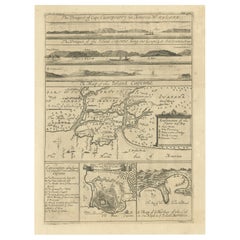
Antique Map of Cayenne and Cassepouri, French Guinea, South America, c.1730
Located in Langweer, NL
Antique map titled 'A Map of the Island Cayenne (..)’. A set of interesting copper engravings of Cayenne and Cassepouri, French Guinea, South America, and Martinique in the West Indies. The map of Cayenne, home of Cayenne pepper, has a key of symbols identifying the sugar works, petty plantations, indian carbet or village, woody country and palmetto trees. The plan of Fort Lewis, Cayenne also has a lettered key including; A. the fort on a pretty high hill...
Category
18th Century Antique Netherlands Maps
Materials
Paper
$361 Sale Price
20% Off
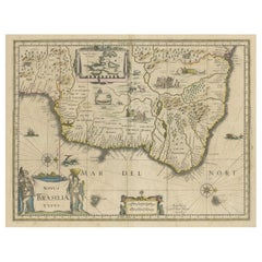
Old Color Engraving of Blaeu's first Map of Brazil, North Oriented to the Right
By Willem Blaeu
Located in Langweer, NL
Antique map titled 'Novus Brasiliae Typus'. Fine old color example of Blaeu's first map of Brazil, with north oriented to the right. Includes inset map of Baya de todos Santos, elaborate cartouche, 2 compass roses and richly embellished vignettes of native Brazilian life and animals.
The interior of the map includes vignettes of indigenous animals and native scenes, including cannibalism. Inset within a decorative border is a small map of "Baya de todos Sanctos". In the sea are monsters, a galleon and two compass roses. The large title cartouche features a male and female Brazilian, both of whom are shown naked.
Willem Janszoon Blaeu (1571-1638) was a prominent Dutch geographer and publisher. Born the son of a herring merchant, Blaeu chose not fish but mathematics and astronomy for his focus. He studied with the famous Danish astronomer Tycho Brahe...
Category
Mid-17th Century Antique Netherlands Maps
Materials
Paper
$1,284 Sale Price
40% Off
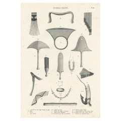
Old Print Depicting Various Utensils of Tongatabu, Site of Tonga's Capital, 1836
Located in Langweer, NL
Antique print titled 'Tonga-Tabu'.
Tongatapu is the main island of the Kingdom of Tonga and site of Tonga’s capital, Nuku?alofa. It is located in Tonga's southern island group, t...
Category
1830s Antique Netherlands Maps
Materials
Paper
$304 Sale Price
20% Off
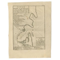
Antique Map of the Port of Acapulco in Mexico, 1749
Located in Langweer, NL
Antique map titled 'Plan van de Haven van Acapulco (..) - Plan du Port d'Acapulco (..)'. Original antique map of the Port of Acapulco on the coast of Mexico in the Southern Sea, at 1...
Category
18th Century Antique Netherlands Maps
Materials
Paper
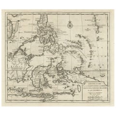
Old Map of the Philippines and Part of Indonesia 'Spice Islands', 1744
Located in Langweer, NL
Antique map titled 'Nieuwe Kaart van de Filippynsche, Ladrones, Moluccos of Specery Eilanden, als mede Celebes etc'.
Old map of the Philippines and part of Indonesia. Originates ...
Category
1740s Antique Netherlands Maps
Materials
Paper
$627 Sale Price
20% Off
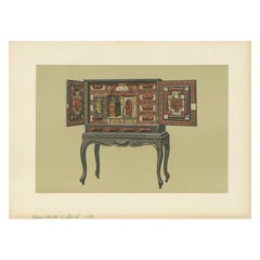
Antique Print of Mary Queen of Scots' Cabinet by Gibb, 1890
Located in Langweer, NL
Antique print titled 'Mary Queen of Scots' Cabinet'. Chromolithographic plate originating from 'The Royal House of Stuart. Illustrated By a Series ...
Category
19th Century Antique Netherlands Maps
Materials
Paper
$80 Sale Price
20% Off
Chart of the Coast of Cochinchina' and 'Plan of Pulo Condor', Vietnam, 1778
Located in Langweer, NL
Antique map titled 'A Chart of a part of the Coast of Cochinchina' and 'Plan of Pulo Condor'.
Two maps on one sheet. The upper map shows part of the coast of Cochinchina from Cha...
Category
1770s Antique Netherlands Maps
Materials
Paper
$513 Sale Price
20% Off
Old Map of Java, Indonesia by Stemler, 1875
By Stemler
Located in Langweer, NL
Antique map titled 'Hoofddriehoeken - Java en madoera.' (Main triangles measured by the Geographical Service in the Dutch-Indies on Java and Madoera.) This scarce map shows the Indon...
Category
19th Century Antique Netherlands Maps
Materials
Paper
$66 Sale Price
20% Off
Antique Print of Longford Castle, South of Salisbury, Wiltshire, England, 1766
Located in Langweer, NL
Antique print titled 'Longford Castle the Seat of the Earl of Radnor in Wiltshire'.
Large engraving of Longford Castle, Wiltshire. Source unknown, to be determined. Artists and Engravers: Engraved by Miller.
Longford Castle stands on the banks of the River Avon...
Category
18th Century Antique Netherlands Maps
Materials
Paper
$723 Sale Price
20% Off
Striking Antique Map of Cayenne in French Guyana, South America, ca.1760
Located in Langweer, NL
Description: Antique map titled 'Land-kaart van het Eiland en de Volkplanting van Cayenne aan de Kust van Zuid-Amerika'.
Striking map of the island and settlement of Cayenne in F...
Category
1760s Antique Netherlands Maps
Materials
Paper
$1,284 Sale Price
20% Off
Antique Map of the Main Comoro Islands by Van Schley, 1749
By Jakob van der Schley
Located in Langweer, NL
Antique map titled ‘Carte des Isles de Comore (..) - Kaart van de Eilanden Komoro (..)’. Original antique map of the main Comoro Islands or Comoros including Comore, Mohéli, Anjouan ...
Category
18th Century Antique Netherlands Maps
Materials
Paper
$104 Sale Price
20% Off
Antique Map of the Dutch Province of Noord-Holland, 1883
Located in Langweer, NL
Antique map titled 'Noord-Holland'. Map of Noord-Holland, a province of the Netherlands. This map originates from 'Atlas van Nederland volgens de nieuwe spelregels' by J. Kuyper. Art...
Category
19th Century Antique Netherlands Maps
Materials
Paper
$128 Sale Price
20% Off
Old Print with a View of the Cape of Good Hope and Table Bay, South Africa, 1750
Located in Langweer, NL
Antique print titled 'Gezigt van de Kaap de Goede-Hoop'.
Old print with a view of the Cape of Good Hope and Table Bay. Engraved by J. van Schley for a Du...
Category
1750s Antique Netherlands Maps
Materials
Paper
$180 Sale Price
20% Off
Scarce Antique Map of Lake Toba and Silindoeng on Sumatra, Indonesia, c.1875
Located in Langweer, NL
Antique map titled 'Kaart van het Toba-Meer en het landschap Silindoeng.'
This scarce map shows Lake Toba and Silindoeng on the Indonesian island of Sumatra. Originates from 'Tij...
Category
19th Century Antique Netherlands Maps
Materials
Paper
$171 Sale Price
20% Off
Antique Map of the Bay of Terney by La Pérouse, 1797
Located in Langweer, NL
Antique map titled 'Plan de la Baie de Ternai'. Old map of the north eastern coast of Russia. This map originates from 'Atlas du voyage de La Perouse'. Arti...
Category
18th Century Antique Netherlands Maps
Materials
Paper
$145 Sale Price
20% Off
Antique Print of Loch Achray, a Lake near Callander in Stirling, Scotland, c1860
Located in Langweer, NL
Antique print titled 'Loch Achray'. Original antique print with a view of Loch Achray, a small freshwater loch 11 km (6.8 mi) west of Callander in Stirling...
Category
19th Century Antique Netherlands Maps
Materials
Paper
$266 Sale Price
20% Off
Antique Map of Africa by Delamarche, 1806
Located in Langweer, NL
Antique map titled 'L'Afrique'.
Decorative map of Africa by Robert de Vaugondy, revised and published by Delamarche. Source unknown, to be determined.
Artists and Engravers: Charl...
Category
19th Century Antique Netherlands Maps
Materials
Paper
$256 Sale Price
20% Off
Antique Map of the Gulf of Tomini by Winkler Prins, 1878
Located in Langweer, NL
Antique map titled 'Kaart van de Golf van Tomini of Gorontalo.' (Map of the Gulf of Tomini or Gorontalo.) This map shows the Gulf of Tomini near the Island of Sulawesi, Indonesia. Wi...
Category
19th Century Antique Netherlands Maps
Materials
Paper
$176 Sale Price
20% Off
Antique Map of the Siege of Breda, City in the Netherlands by Blaeu, 1649
Located in Langweer, NL
Antique map titled 'Breda obsessa et expugnata a Celsissimo Frederico Henrico'.
Old map of the city of Breda, the Netherlands. It shows the Siege of Breda in 1637. Originates fro...
Category
17th Century Antique Netherlands Maps
Materials
Paper
$799 Sale Price
20% Off
Antique Map of France under the Reign of Louis XIII by Zannoni, 1765
Located in Langweer, NL
Antique map France titled 'Tableau de la France sous Louis XIII (..)'.
Beautiful old map of France. This map originates from 'Atlas Historique de la France Ancienne et Moderne' b...
Category
18th Century Antique Netherlands Maps
Materials
Paper
$147 Sale Price
20% Off
Antique Physical Chart of the Pacific Ocean by Johnston, '1850'
Located in Langweer, NL
Antique map titled 'Physical Chart of the Pacific Ocean showing the currents and temperature of the ocean'. Original antique chart of the Pacific Ocean. This map originates from 'The...
Category
Mid-19th Century Antique Netherlands Maps
Materials
Paper
$190 Sale Price
20% Off
Antique Engraving of Kirby Hall Near Gretton, Northamptonshire, England c.1770
Located in Langweer, NL
Antique print titled 'Principal Front of Kirby Hall'.
Kirby Hall is an Elizabethan country house, located near Gretton, Northamptonshire, England. The nearest main town is Corby. One of the great Elizabethan houses of England, Kirby Hall was built for Sir Humphrey Stafford of Blatherwick, beginning in 1570. In 1575 the property was purchased by Sir Christopher Hatton of Holdenby,[1] Lord Chancellor to Queen Elizabeth I. It is a leading and early example of the Elizabethan prodigy house. Construction on the building began in 1570, based on the designs in French architectural pattern books and expanded in the Classical style over the course of the following decades. The house is now in a semi-ruined state with many parts roof-less although the Great Hall and state rooms remain intact. The gardens, with their elaborate "cutwork" design, complete with statues and urns, have been recently restored.
Anne of Denmark stayed at Kirby on 9 August 1605 while King James stayed at Rockingham Castle. King James stayed for three days in August 1616. During a royal progress Esmé Stewart, 3rd Duke of Lennox died at Kirby of the "spotted ague" on 30 July 1624.
The building and gardens are owned by the Earl of Winchilsea and are managed by English Heritage.
Kirby Hall has been used as a filming location in many productions. These include the following; an episode (6. Protest and Communication) of Kenneth Clark...
Category
18th Century Antique Netherlands Maps
Materials
Paper
$523 Sale Price
20% Off
Old Original Engraving of Prussia on the Southeast Coast of the Baltic Sea, 1632
Located in Langweer, NL
Description: Antique map titled 'Prussia'.
Original map of Prussia, a historically prominent German state that originated in 1525 with a duchy centered on the region of Prussia o...
Category
1630s Antique Netherlands Maps
Materials
Paper
$428 Sale Price
20% Off
Antique Miniature Map of the Western Hemisphere, with California as an Island
Located in Langweer, NL
Antique miniature map titled 'Nouveau Continent avec plusieurs Isles et Mers'. Decorative map of the Western Hemisphere, published by Alain Manesson Mallet. The map shows California as an Island...
Category
Late 17th Century Antique Netherlands Maps
Materials
Paper
$418 Sale Price
20% Off
Hand Colored Antique Map of the Department of Cher, France
By Victor Levasseur
Located in Langweer, NL
Antique map titled 'Dépt. du Cher'. Map of the French department of Cher, France. This area of France is known for its production of Selles Sur Cher, a goats-milk cheese. The whole i...
Category
Mid-19th Century Antique Netherlands Maps
Materials
Paper
$323 Sale Price
20% Off
Antique Map of the Peter the Great Gulf by Reclus, 1881
Located in Langweer, NL
Antique map titled 'Le Golfe de Pierre-Le-Grand.' This map shows the Peter The Great Gulf in the Sea of Japan adjoining the coast of Russia's Primorski...
Category
19th Century Antique Netherlands Maps
Materials
Paper
$84 Sale Price
20% Off
Antique Map of the Region of the Nile River by Bartholomew, 1922
Located in Langweer, NL
Antique map of Africa titled 'Egypt and the Nile'. Old map of Africa depicting Egypt, the Nile river and surroundings. This map originates from 'The Times' ...
Category
20th Century Netherlands Maps
Materials
Paper
$90 Sale Price
20% Off
Antique Bird's-Eye Plan of Tutecoryn (Tuticorin or Thoothukudi), India, 1672
Located in Langweer, NL
Antique map, titled: 'Tutecoryn.'
Bird's-eye plan of map of Tutecoryn (Tuticorin or Thoothukudi), India. This map originates from 'Naauwkeurige Beschryvinge van Malabar en Choroman...
Category
1670s Antique Netherlands Maps
Materials
Paper
$342 Sale Price
20% Off
Antique Map of Brazil by Wyld, '1845'
Located in Langweer, NL
Antique map titled 'Empire of Brazil'. Original antique map of Brazil. This map originates from 'An Atlas of the World, Comprehending Separate Ma...
Category
Mid-19th Century Antique Netherlands Maps
Materials
Paper
$237 Sale Price
20% Off
Antique Map of South America by Finlayson, 1822
Located in Langweer, NL
Antique map titled 'Geographical, Statistical and Historical Map of the United Provinces of South America'. This map depicts part of South America (including part of Brazil and Chili...
Category
19th Century Antique Netherlands Maps
Materials
Paper
$254 Sale Price
20% Off
German Antique Map of Southeastern Australia, 1904
Located in Langweer, NL
This large antique map is taken from; 'Andrees Allgemeiner Handatlas in 126 Haupt-Und 139 Nebenkarten', Bielefeld; Leipzig: Velhagen & Klasing 1899. Andrees Allgemeiner Handatlas was...
Category
20th Century Netherlands Maps
Materials
Paper
$71 Sale Price
20% Off
Antique Map of Oceania by Balbi '1847'
Located in Langweer, NL
Antique map titled 'Océanie'. Original antique map of Oceania. This map originates from 'Abrégé de Géographie (..)' by Adrien Balbi. Published 1847.
Category
Mid-19th Century Antique Netherlands Maps
Materials
Paper
$142 Sale Price
20% Off
Antique Map of the Empire of China by Bonne, c.1780
By Rigobert Bonne
Located in Langweer, NL
Antique map titled 'Carte de L'Empire de la Chine.' Decorative map of the Empire of China, depicting China, Corea ( Korea ), Japan, Tonquin and the Philippine island Lucon. Source un...
Category
18th Century Antique Netherlands Maps
Materials
Paper
$618 Sale Price
20% Off
Antique Map of Africa and Arabia with Inset Map of Ethiopia and Eritrea, 1845
Located in Langweer, NL
Antique map titled 'Mittel- und Nord-Africa (östl. Theil) und Arabien'. This map depicts North and Central Africa and Arabia with an inset map of Habesch (Ethiopia and Eritrea).
Ar...
Category
19th Century Antique Netherlands Maps
Materials
Paper
$209 Sale Price
20% Off
Old Map of the Dutch Provinces of Friesland and Groningen, The Netherlands, 1604
Located in Langweer, NL
Antique print, titled: 'Frisiae Occidentalis.'
Handsome map of the Dutch Provinces of Friesland and Groningen. Embellished with strapwork title-car...
Category
Early 1600s Antique Netherlands Maps
Materials
Paper
$1,094 Sale Price
20% Off
Original Antique Map of the Channel Islands, Incl. Decorative Vignettes, 1851
Located in Langweer, NL
Antique map titled ‘Channel Islands’.
Includes decorative vignettes titled St. Peters Port, Castle Cornet, Druidical altar near Lancresse, Mont Orgueil Castle and Jersey. Originates from 'The Illustrated Atlas, And Modern History Of The World Geographical, Political, Commercial & Statistical, Edited By R. Montgomery Martin'. Published; John Tallis London, New York, Edinburgh & Dublin. 1851. Drawn and Engraved by J. Rapkin.
Artists and engravers: John Tallis (1817-1876) was a British map...
Category
1850s Antique Netherlands Maps
Materials
Paper
$428 Sale Price
20% Off
Antique Map of India and Southeast Asia by Sanson '1654'
Located in Langweer, NL
Antique map titled 'Partie Meridionale de l'Inde'. Early map of India and Southeast Asia. The map shows most of modern India, Bangladesh and Burma, the whole of Sri Lanka, Thailand, ...
Category
Mid-17th Century Antique Netherlands Maps
Materials
Paper
$1,141 Sale Price
20% Off
Rare Small Map of Sumatra, Java, Borneo, Macassar, Madura, Bali, 1614
Located in Langweer, NL
One of the first maps of the Indonesia islands of Java, Bali, Sumbawa etc. in early days of the Dutch Indies. Also showing Banten, Jakarta (Jacatra), Indr...
Category
Early 17th Century Antique Netherlands Maps
Materials
Paper
$713 Sale Price
20% Off
Antique Map of Ambelau and Buru Island, Maluku or Moluccas in Indonesia, 1726
Located in Langweer, NL
Antique map titled 'Boero - Amblauw (..).' Detailed map of the Island Ambelau and Buru, Maluku Islands, Indonesia, by Francois Valentyn. With an inset of the lake on the Buru mountai...
Category
18th Century Antique Netherlands Maps
Materials
Paper
$352 Sale Price
20% Off
École Nationale – French Architectural Lithograph from La Brique, Chipiez c.1900
Located in Langweer, NL
École Nationale – French Architectural Lithograph from La Brique, Chipiez, c.1900
Elegant antique architectural lithograph showing the detailed elevation of the Pavillon de l’Escali...
Category
20th Century French Netherlands Maps
Materials
Paper
Antique Print of the Bolshoi Theatre in Saint Petersburg, Russia, ca.1810
Located in Langweer, NL
Description: Antique print titled 'The Stone Theatre at St. Petgersbourg'. View ofthe Bolshoi Theatre in Saint Petersburg, Russia. In 1886 the building was declared unsafe and, at th...
Category
1810s Antique Netherlands Maps
Materials
Paper
$228 Sale Price / item
20% Off
Antique Map of China and Japan by Tardieu, 1821
Located in Langweer, NL
Antique map titled 'Carte de la Chine et du Japon'. Detailed map of China, showing Korea, Japan and Taiwan. This map originates from 'L'histoire général des voyages' by J.F. de la Harpe.
Category
Early 19th Century Antique Netherlands Maps
Materials
Paper
$689 Sale Price
20% Off
Antique Map of Sweden and Norway by W. G. Blackie, 1859
Located in Langweer, NL
Antique map titled 'Sweden and Norway'. Original antique map of Sweden and Norway. This map originates from ‘The Imperial Atlas of Modern Geography’. Published by W. G. Blackie, 1859.
Category
Mid-19th Century Antique Netherlands Maps
Materials
Paper
$237 Sale Price
20% Off
Antique Map of Russia in Europe by Petri, c.1873
Located in Langweer, NL
Antique map titled 'Rusland in Europa'. Old map depicting Russia in Europe. This map originates from 'School-Atlas van alle Deelen der Aarde'. Artists and Engravers: Published by O. ...
Category
19th Century Antique Netherlands Maps
Materials
Paper
$92 Sale Price
20% Off
Pl. 8 Antique Print of Various Garden Temples by Le Rouge, c.1785
Located in Langweer, NL
Antique print titled 'Divers petits Temples pour les Jardins Anglais'. Copper engraving showing various temples for English gardens. This print originat...
Category
18th Century Antique Netherlands Maps
Materials
Paper
Antique Print of the Neptune Fountain of Versailles, Paris, France, 1776
Located in Langweer, NL
Antique print titled 'Partie Centrale du Bassin de Neptune a Versailles'. Copper engraving showing parts of the Neptune fountain of Versailles, France...
Category
18th Century Antique Netherlands Maps
Materials
Paper
$323 Sale Price
20% Off
Original Antique Map Showing the Mountain Ranges in Asia and Europe, 1849
Located in Langweer, NL
Antique map titled 'Bergketten in Asien und Eüropa'. Original antique map showing the mountain ranges in Asia and Europe. In outline color with inset maps of Java, Luzon, and Reguain...
Category
1840s Antique Netherlands Maps
Materials
Paper
$266 Sale Price
20% Off
Antique Map of the North Sea From the English Channel to Norway & Sweden, 1746
Located in Langweer, NL
Antique map titled 'A correct Chart of the German Ocean from the North of Scotland to the Start Point, on the Coast of Great Britain; and from So. Bygden on ye coast of Norway, to C....
Category
1740s Antique Netherlands Maps
Materials
Paper
$466 Sale Price
20% Off
Old Antique Map of the Banda Islands (Southeast), Indonesia & Northern Australia
By F. Valentijn
Located in Langweer, NL
Original antique map titled 'Kaart van de Zuyd-Ooster Eylanden van Banda'. Important map of the seas and islands surrounding the Banda Islands, Indonesia, extending south to northern Australia, east to Papua New Guinea and north to Ceram. Published 1724-1726 by Joannes van Braam...
Category
Early 18th Century Antique Netherlands Maps
Materials
Paper
$732 Sale Price
20% Off
Rare Original Miniature Map of Papua New Guinea and the Salomon Islands, 1600
Located in Langweer, NL
Very handsome original old coloured copper engraving of Papua and the Solomon Island. Title of the map 'Descriptio Novae Guneae et Inss. Salom.
On the reverse text in Latin.
Ve...
Category
Early 1600s Antique Netherlands Maps
Materials
Paper
$513 Sale Price
20% Off
Antique Map of Cities in the Region of Hubei in China, 1758
Located in Langweer, NL
Antique map titled 'Plans de Quelques villes de la province de Hou-Quang.' Three plans of cities in a region named Hou-Quang (currently Hubei). While these maps by Van Schley after B...
Category
18th Century Antique Netherlands Maps
Materials
Paper
$304 Sale Price
20% Off
Architectural Print of French Villa de la Hutte A Deauville by Chabat, c.1900
Located in Langweer, NL
Antique print titled 'Villa de la Hutte A Deauville, Mr. E. Saintin Architecte'. This print depicts the design of a building in France. Originates from 'La Brique et La Terre Cuite' ...
Category
20th Century Netherlands Maps
Materials
Paper
La Brique Architectural Print – Parisian Stables on Avenue Raphaël, c.1900
Located in Langweer, NL
La Brique Architectural Print – Parisian Stables on Avenue Raphaël, c.1900
This finely detailed architectural lithograph presents the elegant design of Écuries Avenue Raphaël Paris,...
Category
20th Century French Netherlands Maps
Materials
Paper
Antique Map of Part of Russia, c.1740
Located in Langweer, NL
Antique map titled 'Ienisensis Provinicia cum adjacentibus Toboliensis & Irkutensis'. Old map of part of Russia including the city of Tobolsk and others. Source unknown, to be determ...
Category
18th Century Antique Netherlands Maps
Materials
Paper
$130 Sale Price
20% Off
Antique Map of the Austrian Empire by W. G. Blackie, 1859
Located in Langweer, NL
Antique map titled 'The Austrian Empire'. Original antique map of the Austrian Empire with inset map of Montenegro. This map originates from ‘The Imperial Atlas of Modern Geography’....
Category
Mid-19th Century Antique Netherlands Maps
Materials
Paper
$208 Sale Price
30% Off
Antique Map of Polynesia with Details of Many Islands, 1840
Located in Langweer, NL
Antique map titled 'Polynesia or Islands in the Pacific Ocean'.
This map depicts various islands including the Lousiade Archipelago, Tahiti, Pitcairn Island, Juan Fernandez, The lo...
Category
19th Century Antique Netherlands Maps
Materials
Paper
Antique Map of North and South Africa by Johnston, 1882
Located in Langweer, NL
Two antique maps on one sheet titled 'N.W. Africa, Marocco, Algeria & Tunis' and 'Southern Africa, comprising Cape Colony, Natal & c'.
This map originates from 'The Royal Atlas of ...
Category
19th Century Antique Netherlands Maps
Materials
Paper
Heliograph of Tin Mining in Tronoh, Perak and Tambun in Sabah, Malaysia, 1907
Located in Langweer, NL
Three views of the Mining Industry in Malaysia around 1907.
1. Lankshuts at Tronoh, Perak
2. Puddling Machinery, Tambun in Sabah
3. Shaking Machinery at Red Hill
This helio...
Category
Early 1900s Antique Netherlands Maps
Materials
Paper
$618 Sale Price
20% Off
Antique Map of the Region of Liege by Coronelli, 1690
By Vincenzo Coronelli
Located in Langweer, NL
Antique map titled 'Vescovato di Liege (..)'. Map of the Belgium area centered on Liege and the course of Meuse/Maas River. Also depicts the cities of Maastricht, Namur and Tienen. O...
Category
17th Century Antique Netherlands Maps
Materials
Paper
$437 Sale Price
20% Off
Antique Print Showing Remnants of Constantine I the Great's Baths, Rome, 1704
Located in Langweer, NL
Antique print, titled: 'De Overblyfzels der Badstoven van Konstantyn den Grooten' - This original old antique print shows the remnants of Constantine I the Great's baths in Rome, Ita...
Category
18th Century Antique Netherlands Maps
Materials
Paper
Recently Viewed
View AllMore Ways To Browse
Flemish Cabinets 17th Century
Fox Figurine
Fox Hunt Plate
French Art Deco Rosewood Buffet
French Bulldog Gold
French Louis Xvi Enfilade
French Provincial Antique Dresser
French Provincial Furniture Antique Dresser
French Zinc Bar
Frog Figurine
Georgian Mahogany Longcase Clock
German Folding Trolley
Glass And Brass Fireplace Screen
Glass Nude Woman Sculpture
Glass Parrots
Glass Poodle
Gothic Corbel
Granite Pagoda
