Collectibles and Curiosities on Sale

to
5,462
1,390
6,860
43
42
353
168
91
80
66
50
41
40
35
27
24
17
15
10
8
7
5
3
2,707
2,346
1,807
85
540
699
288
113
30
79
124
69
147
129
89
64
29
4,950
1,190
604
280
236
1,284
505
456
279
260
6,945
6,941
6,941
104
55
21
18
13
Sale Items
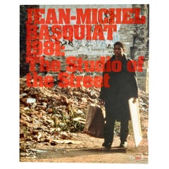
Jean-Michel Basquiat: 1981. The Studio of the Street (exhibition catalog)
By (after) Jean-Michel Basquiat
Located in Brooklyn, NY
Jean-Michel Basquiat: 1981. The Studio of the Street: A scare, beautifully illustrated, hardcover 2007 exhibition catalogue published on the occasion of: Jean-Michel Basquiat: 1981. ...
Category

Vintage 1980s Books

Materials

Paper

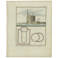
Antique Print of the Fortress at the Nile 'Damietta, Egypt' by C. Niebuhr, 1774
Located in Langweer, NL
Antique print titled 'Castelle an dem Ausflus des Nîls nicht weit von Damiât'. Translated: 'Fort at the estuary of the Nile near Damietta, Egypt'. This print originates from 'Reisebe...
Category

Antique Late 18th Century Maps

Materials

Paper

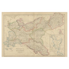
Antique Map of Prussia and Mecklenburg by W. G. Blackie, 1859
Located in Langweer, NL
Antique map titled 'Prussia and Mecklenburg'. Original antique map of Prussia and Mecklenburg with inset map of East Prussia. This map originates from ‘Th...
Category

Antique Mid-19th Century Maps

Materials

Paper

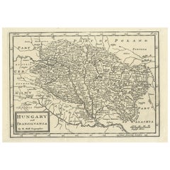
Original Antique Map of Hungary and Transylvania 'Modern Day Romania', C.1710
Located in Langweer, NL
Antique map titled 'Hungary and Transilvania'. Original antique map of Hungary and Transylvania (modern day Romania), centered on Budapest. Artists and Engravers: Herman Moll ...
Category

Antique 1710s Maps

Materials

Paper

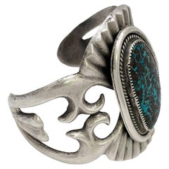
Mid-century Sterling Silver Navajo Cuff Bracelet w/ Bisbee Blue Turquoise Stone
Located in Van Nuys, CA
Original sand-cast Navajo sterling silver cuff bracelet features a stunning Bisbee Blue turquoise stone centerpiece. Bisbee Blue is from copper mines located in the vicinity of Bisbe...
Category

Vintage 1960s American Mid-Century Modern Collectible Jewelry

Materials

Silver

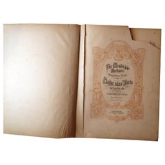
Melodic Elegance: Antique German Sheet Music Book - Early 20th Century, 2C06
Located in Bordeaux, FR
Immerse yourself in the rich musical legacy with our Antique German Sheet Music Book from the beginning of the 20th century. Published in Leipzig by C.F. Peters, this edition feature...
Category

20th Century Toys and Dolls

Materials

Porcelain

Old Map of Glamorganshire by Lewis 1844 – Swansea Cardiff Merthyr Tydfil Neath
Located in Langweer, NL
Title: Old Map of Glamorganshire by Samuel Lewis 1844 – Swansea Cardiff Merthyr Tydfil Neath Description: This detailed map of Glamorganshire was published in 1844 for Samuel Lewis’ Topographical Dictionary of Wales. It showcases major towns such as Swansea, Cardiff, Merthyr Tydfil, Neath, and Bridgend. The map features original hand coloring that outlines the county borders and includes shaded topographical elements to show the landscape. A decorative compass rose and a reference to the seven unions add both style and historical context. Condition: The map is in good antique condition with minor age toning and clean margins. The engraving remains sharp and the original colors are clear and unfaded. No major damage or repairs are visible. Framing suggestions: Use a soft cream or ivory acid-free mat to match the natural tone of the paper. Choose a dark wood, antique gold, or black frame with a soft patina to enhance the historical feel. UV-protective glass is recommended to preserve the colors. This map is ideal for a home office, study, or as a thoughtful gift for those with Welsh heritage. Keywords: Glamorganshire map 1844 Samuel Lewis antique...
Category

Antique 1840s Maps

Materials

Paper

Antique Print of the Melville House in Fife, Scotland, 1725
Located in Langweer, NL
Antique print titled 'The Elevation of Melvin House in the Shire of Fyfe (..)'. Old engraving of Melville House in Fife, Scotland. This print originates from 'Vitruvius Britannic...
Category

Antique 18th Century Prints

Materials

Paper

Antique Decorative Coloured Map Marocco, Algeria and Tunis, 1882
Located in Langweer, NL
The maps is from the 1882 atlas by Blackie & Son and offers a detailed view of the North African regions as understood in the late 19th century. **Map of Morocco, Algeria, and Tun...
Category

Antique 1880s Maps

Materials

Paper

Antique Map of the Province of Friesland, The Netherlands, c.1760
Located in Langweer, NL
Antique map titled 'Frisiae Dominium vernacule Friesland, verdeeld in de Hoofd-deelen van Oostergoo, Westergoo en Sevenwolden, Als ook der XI Steden Zynde noch onderscheiden in XXX G...
Category

Antique 18th Century Maps

Materials

Paper

Detailed Antique Map of Hungary and Transylvania by Tirion, 1753
Located in Langweer, NL
Title: Nieuwe Kaart van’t Koninkryk Hongaryen en Zevenbergen by Isaak Tirion, 1753 – Antique Map of Hungary and Transylvania Description: This is an antique 1753 map titled *Nieuwe Kaart van’t Koninkryk Hongaryen en Zevenbergen*, created by the notable Dutch cartographer and publisher Isaak Tirion. The map showcases the Kingdom of Hungary and the region of Transylvania (referred to as "Zevenbergen") as they appeared in the mid-18th century. Tirion’s maps are well-known for their clarity, precision, and attention to geographic detail, making them highly sought after by collectors of antique maps. This map provides a detailed view of Hungary and Transylvania, including borders, towns, cities, rivers, and mountain ranges. It was created using the latest discoveries and updates of the time and reflects the political landscape of the region, which was part of the Habsburg Empire during a period of territorial changes and consolidations. The map’s borders are highlighted with color to distinguish different regions, and significant cities such as Buda, Pest, and Debrecen are clearly labeled. Isaak Tirion was one of the most prominent Dutch publishers of the 18th century, particularly known for his *Nieuwe en Beknopte Hand-Atlas* (New and Concise Hand Atlas) series, which included a wide range of maps of Europe and beyond. His works were appreciated for their cartographic accuracy and artistic quality. This map is a valuable piece for collectors interested in 18th-century European maps, particularly those that highlight Central Europe, Hungary, Transylvania, and the Habsburg Empire. It is a fine example of the craftsmanship of Isaak Tirion and offers insight into the historical geography of the region. Condition: Excellent for its age, with finely preserved hand-coloring and wide margins. Slight edge wear typical of maps from this period. Effective keywords that may help attract collectors or enthusiasts interested in historical maps of Hungary, Transylvania, and Central Europe: - Antique map of Hungary - Historical map of Transylvania - 18th-century map of Central Europe - Habsburg Empire map - Isaak Tirion map - Nieuwe Kaart van’t Koninkryk Hongaryen en Zevenbergen - Kingdom of Hungary map...
Category

Antique 1750s Maps

Materials

Paper

Géographie des Hébreux – Tableau de la Dispersion des Enfants de Noé, 1837
Located in Langweer, NL
Géographie des Hébreux – Tableau de la Dispersion des Enfants de Noé, 1837 This antique map, titled Géographie des Hébreux ou Tableau de la Dispersion des ...
Category

Antique Mid-19th Century French Maps

Materials

Paper

Original Antique Map of the United Kingdom and Ireland, Published in 1875
Located in Langweer, NL
Antique map titled 'Iles Britanniques ou Royaume-Uni de la Grande Bretagne (..)'. Large map of the United Kingdom and Ireland. This map originates from...
Category

Antique Late 19th Century French Maps

Materials

Paper

Late 19th Century Iraqi Silver Hanukkah Lamp
Located in New York, NY
Unique silver Hanukkah lamp, Iraq, circa 1880. On four feet, a handmade silver tray with nine candle holders for eight days of Hanukkah, and one for t...
Category

Antique Late 19th Century Iraqi Religious Items

Materials

Silver

Antique Map of Westfalia, Germany by Mercator/Hondius, circa '1620'
Located in Langweer, NL
Antique map titled 'Westfalia cum dioecelsi Bremensi'. Original antique map of Germany. Published by Mercator/Hondius, circa '1620' 17th Century antique detailled map of Westphali...
Category

Antique 16th Century Maps

Materials

Paper

Mid-19th Century Polish Brass Hanukkah Lamp
Located in New York, NY
Cast brass Hanukkah lamp, Poland, circa 1860. "Bench" style Hanukkah lamp, fronted with oil fonts. The backplate is cast with lions, a crown, and...
Category

Antique Mid-19th Century Polish Religious Items

Materials

Brass

Old Map of Radnorshire 1844 – Presteigne Rhayader Knighton Llandrindod Wells
Located in Langweer, NL
Old Map of Radnorshire by Samuel Lewis 1844 – Presteigne Rhayader Knighton Llandrindod Wells Description: This original 1844 map of Radnorshire was engraved for Samuel Lewis’ Topographical Dictionary of Wales. It features key locations such as Presteigne, Rhayader, Knighton, Llandrindod Wells, and New Radnor. Hand-colored borders outline the county’s administrative divisions, and the map includes topographical shading, roads, rivers, and a decorative compass rose. A union reference key is clearly listed in the lower left. Condition: The map is in good condition with light toning and wide margins. The engraved lines remain crisp and the hand coloring is clear and unfaded. No tears or stains are present, with only minor age-related marks on the edges. Framing suggestions: Pair with an acid-free mat in cream or soft beige to match the aged tone of the paper. A dark wood or antique gold frame will enhance the historical feel. UV-protective glass is recommended. This piece is ideal for framing in a study, office, or heritage-themed space. Keywords: Radnorshire map 1844 Samuel Lewis antique...
Category

Antique 1840s Maps

Materials

Paper

Antique Map of the Duchy of Lüneburg, Lower Saxony, Germany
Located in Langweer, NL
Antique map titled 'Ducatus Luneburgensis (..)'. Map of the Duchy of Lüneburg in Lower Saxony, Germany. Published by J. Janssonius, circa 1664. Jan Janssonius (also known as Johann ...
Category

Antique Mid-17th Century Maps

Materials

Paper

Granada 1902: A Cartographic Exploration of Andalusia's Mountainous Province
Located in Langweer, NL
This original antique map depicts the province of Granada, part of the autonomous community of Andalusia in southern Spain, as of 1902. The map features several important details: I...
Category

Antique Early 1900s Maps

Materials

Paper

Early 20th Century Israeli Iron and Enamel Street Sign
Located in New York, NY
Three languages iron and enamel street sign, circa 1920. The sign was made to Honor Bezalel who was the chief artisan of the Tabernacle and was in charge of building the Ark of the Covenant...
Category

Early 20th Century Historical Memorabilia

Materials

Enamel, Iron

Antique Map of the Philippines and Guam by Scherer, circa 1702
Located in Langweer, NL
Antique map titled 'Nova et Vera Exhibitio Geographica Insularum Marianarum (..)'. Rare and very attractive map of the Mariana Islands, Philippines, Ko...
Category

Antique Early 18th Century Maps

Materials

Paper

1851 Tallis Map of China with Tibet, Formosa, and Burma – Engraved by J. Rapkin
Located in Langweer, NL
Title: 1851 Tallis Map of China with Tibet, Formosa, and Burma – Engraved by J. Rapkin Description: This is a finely engraved and delicately hand-colored map of China, published a...
Category

Antique 1850s Maps

Materials

Paper

Old Engraving of the Trarbach Battle in Rhineland-Palatinate, Germany, c.1710
Located in Langweer, NL
Rare antique print titled 'Plan de la Ville et Chateau Traarbach (..)'. Battle plan of Trarbach, Rhineland-Palatinate, Germany. Published circa 1710 b...
Category

Antique 1710s Maps

Materials

Paper

Beautiful Rare Antique Map of the Holy Land, 1648
Located in Langweer, NL
Antique map Holy Land titled 'Perigrinatie ofte Veertich-Iarige Reyse, der kinderen Israels uyt Egipten, door de Roode-Zee; mitsgaders de Woestyne tot int Beloofde Landt Canaan, : met groote vlyt uyt verscheryden auctoren by een gestelt, uyt de H. Schrift gecorigeert, ende int licht gegeven'. Beautiful and rare antique map of the Holy Land...
Category

Antique 1640s Maps

Materials

Paper

Antique Map of New Jersey
Located in Langweer, NL
Antique map titled 'Colton's New Jersey'. This rare hand colored map of New Jersey is a copper plate engraving dating to 1855. Produced by the import...
Category

Antique Mid-19th Century Maps

Materials

Paper

Antique Map of New Jersey
$191 Sale Price
20% Off
Antique Print of Generals of the Dutch/Belgian Army 1855-1860, Published in 1900
Located in Langweer, NL
Antique print, titled: 'Generaal. Generale Staf 1855-1860.' - This plate shows Generals of the Dutch/Belgian army 1855-1860. From ´De uniformen van de Nederlansche Zee- en Landmacht hier te lande en in de kolonien, naar aquarellen of teekeningen van J. Hoynck van Papendrecht, W.C. Staring en J.P. de Veer´. Published in The Netherlands 1900. Artists and Engravers: Made by 'P. W. van de Weyer' after 'J. Hoynck van Papendrecht'. Jan Hoynck van Papendrecht (1858 - 1933) was a Dutch painter and illustrator, famed for his military art. In 1900, the famous book The Uniforms of the Dutch Navy...
Category

Antique Early 1900s Prints

Materials

Paper

Map of Liverpool and Birkenhead by Bartholomew, circa 1880, with Key Buildings
Located in Langweer, NL
Map of Liverpool and Birkenhead by J. Bartholomew, circa 1880, with key buildings Detailed city plan titled 'Liverpool and Birkenhead with the surrounding districts', drawn by J. Ba...
Category

Antique 1880s Maps

Materials

Paper

SUDRE Austrian Art Deco 1925 Barman Mechanical Cigarette Dispenser Striker
By Raymond Sudre
Located in Miami, FL
Mechanical cigarette dispenser barman designed by Sudre. This is a fabulous and very rare piece of tobacciana, created in Austria by Sudre for Ro...
Category

Vintage 1920s Austrian Art Deco Tobacco Accessories

Materials

Stainless Steel

1930s Dunhill "Globetrotter" Crocodile Leather Wrapped Sports Lift Arm Lighter
By Dunhill
Located in Van Nuys, CA
Art Deco "Globetrotter" Sports Petrol Lighter by Dunhill. The lighter is wrapped in Crocodile Leather with rhodium-plated trim. The Art Deco design blends streamlined contours with g...
Category

Vintage 1930s English Art Deco Tobacco Accessories

Materials

Chrome

Ancient Crossroads: Albania to Assyria in Antiquity, Published in 1880
Located in Langweer, NL
The map titled "ALBANIA, IBERIA, COLCHIS, ARMENIA, MESOPOTAMIA, BABYLONIA, ASSYRIA" portrays the ancient regions that would encompass parts of modern-day Eastern Turkey, Armenia, Aze...
Category

Antique 1880s Maps

Materials

Paper

Old Colourful View of the Tunnel Near Liverpool on the Manchester Railway, c1832
Located in Langweer, NL
Antique print titled 'Galeria subterranea'. Antique print of the inside of the tunnel built near Liverpool on the Liverpool and Manchester Railway. This print originates from 'Colo...
Category

Antique 1830s Prints

Materials

Paper

Antique Map of China, 1874
Located in Langweer, NL
Antique map titled 'China'. Detailed map of China originates from Blackie's 'The Comprehensive Atlas & Geography of the World'. Artists and Engravers: ...
Category

Antique 19th Century Maps

Materials

Paper

Antique Map of China, 1874
$238 Sale Price
20% Off
Southwest Genuine Skookum Native American Women Dolls - Set of 4 from 1930s
By Skookum
Located in Oklahoma City, OK
A set of four genuine Skookum dolls. Made with leather, real hair, wool, and fabric, these Native American dolls were the original American Girl....
Category

Vintage 1930s American Native American Toys and Dolls

Materials

Fabric, Wool

Original Antique Map of the South Part of Italy with an Inset of Malta, 1882
Located in Langweer, NL
Embark on a captivating journey through the southern part of Italy with an original Antique Map from the esteemed 'Comprehensive Atlas and Geography of the World,' meticulously craft...
Category

Antique 1880s Maps

Materials

Paper

Antique Lorgnettes Pendant Spectacles in Silver by Georg Unite & Sons Birmingham
By George Unite & Sons
Located in Esbjerg, DK
Hand engraved pair of lorgnettes - hand-held compact spectacles in the shape of a necklace pendant. Made by Birmingham silversmithy Georg Unite and Sons circa 1880-1915. Fully hallma...
Category

Early 20th Century English Victorian Collectible Jewelry

Materials

Silver

Hans Hansen Vintage Claw Ring in Sterling Silver by Allan Scharff
By Hans Hansen
Located in Esbjerg, DK
Brutalist/modern claw-shaped. ring designed by Allan Scharff and crafted at Hans Hansen Silversmithy in Kolding Denmark. Early version from the late 1970s....
Category

Vintage 1970s Danish Brutalist Collectible Jewelry

Materials

Sterling Silver

Map of Samoa or Schiffer-Inseln (Navigator Islands) - 19th Century German Map
Located in Langweer, NL
Map of Samoa or Schiffer-Inseln (Navigator Islands) - 19th Century German Map This detailed 19th-century map of the Samoa Islands, also known as the Navigator Islands (Schiffer-In...
Category

Antique 1890s Maps

Materials

Paper

Superb Antique Map of the Province of Gelderland, the Netherlands, ca.1575
Located in Langweer, NL
Antique map titled 'Gelriae, Cliviae, Finitimorumque Locorum Verissima Descriptio Christiano Schrot. Auctore'. This superb map is Ortelius' first plate covering Gelderland. It is b...
Category

Antique 16th Century Maps

Materials

Paper

UAM Union des Artistes Modernes Petits Meubles de Grands Noms (Book)
Located in North Yorkshire, GB
This is a very scarce and beautiful catalogue of an exhibition which took place in October and November 1994 at Galerie de Vos. The UAM (The French Union of Modern Artists) was a movement made up of French Decorative Artists which flourished in the 1930s, 1940s and 1950s. The members were some of the great names of the 20th century's designers and decorators and included - Rose Adler, Pierre Chareau, Eileen Gray, Rene Herbst, Francis Jourdain, Le Corbusier & Jenneret, Robert Mallet-Stevens, Gustave...
Category

20th Century Books

Materials

Paper

Antique Map of the Netherlands in 1798 by Mees, 1851
Located in Langweer, NL
Antique map titled 'Noord-Nederland in 1798. De Bataafsche Republiek verdeeld in departementen en ringen'. Map of the Netherlands in 1798. This map originates from 'Historische Atlas...
Category

Antique 19th Century Maps

Materials

Paper

1908 Burlington Arts Club Catalogue: Faience of Persia & Near East, 27 Plates
Located in Langweer, NL
Burlington Fine Arts Club: Exhibition of the Faience of Persia and the Nearer East. Published: London, 1908 Printed by Chiswick Press This exquisite and rare folio volume showca...
Category

Antique Early 1900s Books

Materials

Paper

Pipe Holder in Patinated Bronze, Green, Gold Color by Walter Bosse, Usa, 1960
By Walter Bosse
Located in Auribeau sur Siagne, FR
It is a pipe holder, in patinated bronze in green and gold color. This pipe holder was made in USA in the 1960s by Walter Bosse It is in good condition, and is easily placed on a pie...
Category

Vintage 1960s Austrian Art Deco Tobacco Accessories

Materials

Bronze

Old Map Showing Info Related to the Ottoman Wars including Conflict Dates, c1690
Located in Langweer, NL
"Corso del Danubio da Vienna Sui a Vicopoli, e Paesi Adiacenti - Northwestern Sheet", Coronelli, Vincenzo Maria Subject: Central Europe, Danube River Period: 1690 (circa) Publicatio...
Category

Antique 1690s Italian Maps

Materials

Paper

Antique Mercator Projection World Map by Petri, c.1873
Located in Langweer, NL
Antique world map titled 'Wereldkaart naar Mercator's Projectie'. Old map of the world. This map originates from 'School-Atlas van alle Deelen der Aarde'. Artists and engravers: ...
Category

Antique 19th Century Maps

Materials

Paper

Antique Map of the Gironde, part of the Dordogne and the Garonne, France
Located in Langweer, NL
Antique map titled 'Cours de la riviere de Gironde et parties de la Dordogne et de la Garonne depuis Bourdeaux jusqu'au banc de Bey'. Original old map of the Gironde, part of the Dor...
Category

Antique Mid-18th Century Maps

Materials

Paper

Hand-Colored Map of West India Islands: St. Christopher's, St. Lucia and Nevis
Located in Langweer, NL
This map, titled "West India Islands," was published by John Thomson & Co. in 1821 as part of *Thomson's New General Atlas.* The map offers detailed depictions of three key islands i...
Category

Antique 1820s Maps

Materials

Paper

Antique Map of the Basin of the Mediterranean by Johnston '1909'
Located in Langweer, NL
Antique map titled 'Basin of the Mediterranean'. Original antique map of the basin of the Mediterranean. With inset maps of the Strait of Gibraltar, Morocco, Maltese Islands, Valetta...
Category

Early 20th Century Maps

Materials

Paper

Mid-20th Century Israeli Brass Hanukkah Lamp
Located in New York, NY
Cast brass Hanukkah lamp, Israel, circa 1950. Covered with beautiful original green patina, bearing in gold Hebrew letters the word: "Israel" under the o...
Category

Mid-20th Century Israeli Religious Items

Materials

Brass

18th Century Polish Brass Hanukkah Lamp
Located in New York, NY
The backplate is cast and pierced with a central two-handled vase of flowers, flanked by fully formed birds with their heads turned outward. The side panels fitted with two servant lights, fronted by a row of eight oil fonts. Scholars theorize that these Polish Chanukah Lamps that bear two servant lights (as opposed to the singular servant light normally found on a Chanukah Lamp), served a purpose, having been used on one of the days that Chanukah fell on the Sabbath, as Sabbath Candlesticks. For another example, see page 296 of the book “Five Centuries of Hanukkah Lamps...
Category

Antique Mid-18th Century Polish Religious Items

Materials

Brass

Antique Map of New Zealand by Arrowsmith '1844'
Located in Langweer, NL
Antique map titled 'Map of the colony of New Zealand from official documents'. A scarce map of New Zealand. First issued in the 1830s, this state sh...
Category

Antique Mid-19th Century Maps

Materials

Paper

Original Antique Map of the East Indies (Indonesia) by Janssonius, c.1644
By Johannes Janssonius
Located in Langweer, NL
Antique map titled 'India quae Orientalis dicitur, et Insulae adiacentes'. Old map of the East Indies and Southeast Asia showing the area between India in the West and parts of Japan...
Category

Antique 17th Century Maps

Materials

Paper

Antique Print of Harlingen, Stavoren and Sneek in Friesland, 1680
Located in Langweer, NL
Antique print titled 'Harlingen, Staveren, Sneck'. Views of the cities of Harlingen, Stavoren and Sneek, Friesland, the Netherlands. This print originates from 'Thooneel der Steden e...
Category

Antique 17th Century Prints

Materials

Paper

Antique Map of Italy and Greece by H. Kiepert, circa 1870
By Heinrich Kiepert
Located in Langweer, NL
Antique map titled 'Italiae pars media'. This map originates from 'Atlas Antiquus. Zwölf Karten zur Alten Geschichte' by H. Kiepert. Published in Berlin, circa 187.
Category

Antique Late 19th Century Maps

Materials

Paper

Longines 10K Gold-Filled Hexagonal Case Manual Watch w/ Crocodile Leather Band
By Longines
Located in Van Nuys, CA
This 1960s Longines 10K Gold-Filled hexagonal case watch showcases exceptional craftsmanship, highlighted by its elegant gold-filled case. This Swiss-made watch features a sub-second...
Category

Vintage 1970s American Mid-Century Modern Collectible Jewelry

Materials

Gold Plate

Antique Print of a Design for The Great Temple in Eastbury Park, England, 1725
Located in Langweer, NL
Antique print titled 'Plan and Elevation of the great Temple in the garden at Eastbury'. Design for Eastbury Park, England. This print originates from 'Vitruvius Britannicus' by ...
Category

Antique 18th Century Prints

Materials

Paper

Art Deco Pin Brooch Dove in Sterling Silver
Located in Esbjerg, DK
A stylized pin brooch in the shape of a dove. A classic symbol of love and peace. It is executed in 925/1000 sterling silver. Unknown Scandinavian maker circa 1930. Inscribed 925 to ...
Category

Vintage 1930s Scandinavian Art Deco Collectible Jewelry

Materials

Sterling Silver

Authentic Map of the Coast from Cape Formosa to the Dony River, Africa, 1732
Located in Langweer, NL
Antique map titled 'The New Correct Mapp of Calbar River vulgarly call'd Calabar (..)'. An interesting map of the coast from Cape Formosa to the Dony River stated on the map to be ...
Category

Antique 1730s Maps

Materials

Paper

Antique Map of the Holy Land, with vignette of the Garden of Eden
Located in Langweer, NL
Antique map titled 'Hondius his Map of Paradise'. Beautiful map of the region bounded by the Holy Land. Syria, Mesopotamia, Chaldea and part of Arabia. W...
Category

Antique Mid-17th Century Maps

Materials

Paper

Cartographic Elegance of Touraine: A 17th-Century Map Showing French Heritage
Located in Langweer, NL
"Ducatus Turonensis - Touraine," is a original antique historical map of the Touraine region, which is located in the heart of France, centered...
Category

Antique 1630s Maps

Materials

Paper

Antique Articulating Teddy Bear Driving Wagon Platform Pull Toy Americana
Located in Dayton, OH
Antique wheeled platform articulating pull toy featuring a teddy bear stuffed animal seated in a red white and blue wagon with arms that move up and down a...
Category

Early 20th Century American Classical Toys and Dolls

Materials

Mohair, Hardwood

Read More

Medal-Worthy Memorabilia from Epic Past Olympic Games

Get into the games! These items celebrate the events, athletes, host countries and sporting spirit.

Ahoy! You’ve Never Seen a Collection of Sailor Art and Kitsch Quite Like This

French trendsetter and serial collector Daniel Rozensztroch tells us about his obsession with objects related to seafaring men.

Pamela Shamshiri Shares the Secrets behind Her First-Ever Book and Its Effortlessly Cool Interiors

The sought-after designer worked with the team at Hoffman Creative to produce a monograph that beautifully showcases some of Studio Shamshiri's most inspiring projects.

Moroccan Artworks and Objects Take Center Stage in an Extraordinary Villa in Tangier

Italian writer and collector Umberto Pasti opens the doors to his remarkable cave of wonders in North Africa.

Montecito Has Drawn Royalty and Celebrities, and These Homes Are Proof of Its Allure

Hollywood A-listers, ex-pat aristocrats and art collectors and style setters of all stripes appreciate the allure of the coastal California hamlet — much on our minds after recent winter floods.

Whaam! Blam! Pow! — a New Book on Pop Art Packs a Punch

Publishing house Assouline and writer Julie Belcove have teamed up to trace the history of the genre, from Roy Lichtenstein, Andy Warhol and Yayoi Kusama to Mickalene Thomas and Jeff Koons.

What Makes a Gem-Encrusted Chess Set Worth $4 Million?

The world’s most opulent chess set, weighing in at 513 carats, is literally fit for a king and queen.

Tauba Auerbach’s Geometric Pop-Up Book Is Mighty Rare, Thanks to a Hurricane

This sculptural art book has an epic backstory of its own.
Recently Viewed

View All