Items Similar to Antique Map of the Netherlands in 1798 by Mees, 1851
Want more images or videos?
Request additional images or videos from the seller
1 of 5
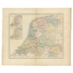
Antique Map of the Netherlands in 1798 by Mees, 1851
About the Item
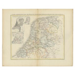
Antique map titled 'Noord-Nederland in 1798. De Bataafsche Republiek verdeeld in departementen en ringen'. Map of the Netherlands in 1798. This map originates from 'Historische Atlas van Noord-Nederland'.
Artists and Engravers: Author: G. Mees. Published by Van der Meer & Verbruggen.
Condition: Good, general age-related toning. Original folding line. Minor wear, blank verso. Includes descriptive text in green wrapper.
Date: 1851
Overall size: 55.5 x 47 cm.
Image size: 43 x 36 cm.
We sell original antique maps to collectors, historians, educators and interior decorators all over the world. Our collection includes a wide range of authentic antique maps from the 16th to the 20th centuries. Buying and collecting antique maps is a tradition that goes back hundreds of years. Antique maps have proved a richly rewarding investment over the past decade, thanks to a growing appreciation of their unique historical appeal. Today the decorative qualities of antique maps are widely recognized by interior designers who appreciate their beauty and design flexibility. Depending on the individual map, presentation, and context, a rare or antique map can be modern, traditional, abstract, figurative, serious or whimsical. We offer a wide range of authentic antique maps for any budget.
- Dimensions:Height: 18.51 in (47 cm)Width: 21.86 in (55.5 cm)Depth: 0 in (0.01 mm)
- Materials and Techniques:
- Period:
- Date of Manufacture:1851
- Condition:
- Seller Location:Langweer, NL
- Reference Number:
About the Seller
5.0
Platinum Seller
These expertly vetted sellers are 1stDibs' most experienced sellers and are rated highest by our customers.
Established in 2009
1stDibs seller since 2017
1,946 sales on 1stDibs
Typical response time: <1 hour
- ShippingRetrieving quote...Ships From: Langweer, Netherlands
- Return PolicyA return for this item may be initiated within 14 days of delivery.
More From This SellerView All
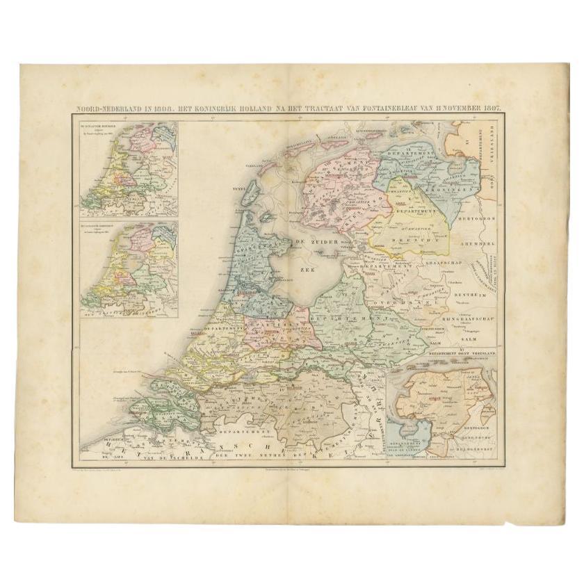
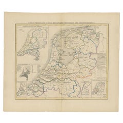
- Antique Map of the Netherlands in 1808 by Mees, 1857Located in Langweer, NLAntique map titled 'Noord-Nederland in 1808. Het Koningrijk Holland na het tractaat van Fontainebleau van 11 november 1807'. Map of the Netherlands in 1808. This map originates from ...Category
Antique 19th Century Maps
MaterialsPaper
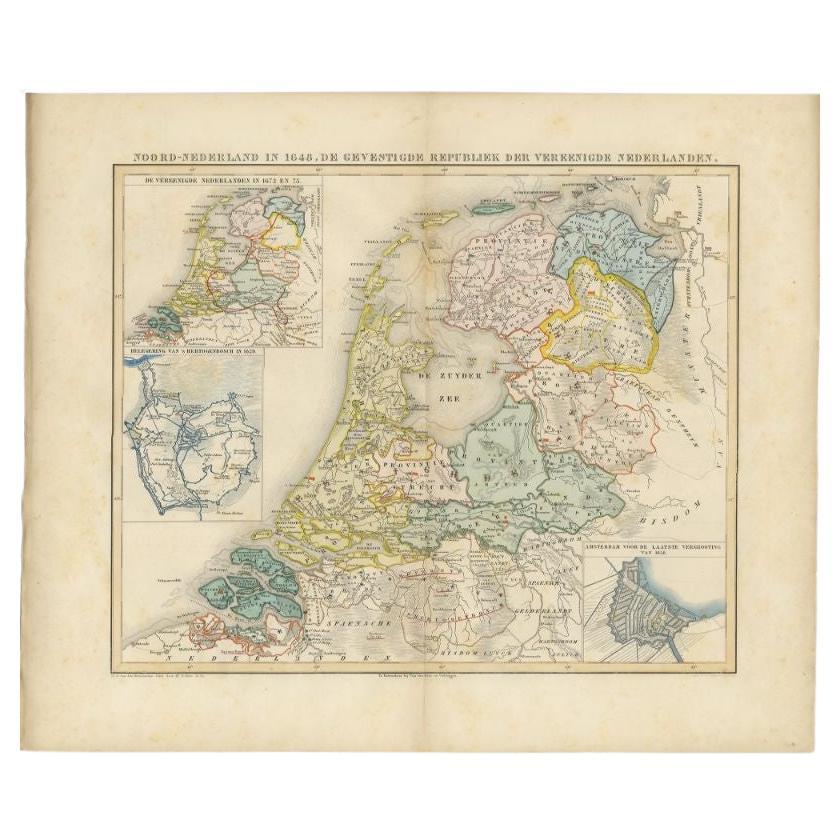
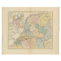
- Antique Map of the Netherlands in 1648 by Mees, 1855Located in Langweer, NLAntique map titled 'Noord-Nederland in 1648. De gevestigde Republiek der Vereenigde Nederlanden'. Map of the Netherlands in 1648. This map originates from 'Historische Atlas van Noor...Category
Antique 19th Century Maps
MaterialsPaper
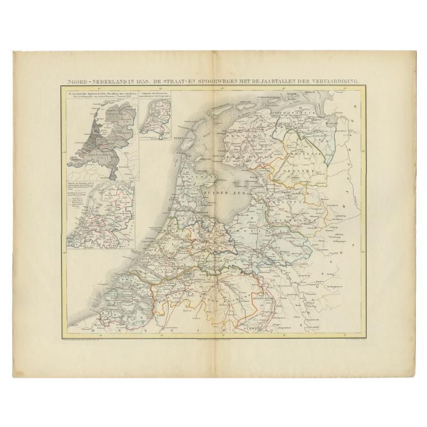
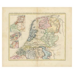
- Antique Map of the Netherlands in 1859 by Mees, 1861Located in Langweer, NLAntique map titled 'Noord-Nederland in 1859. De Straat- en Spoorwegen met de jaartallen der vervaardiging'. Map of the Netherlands in 1859. This map originates from 'Historische Atla...Category
Antique 19th Century Maps
MaterialsPaper
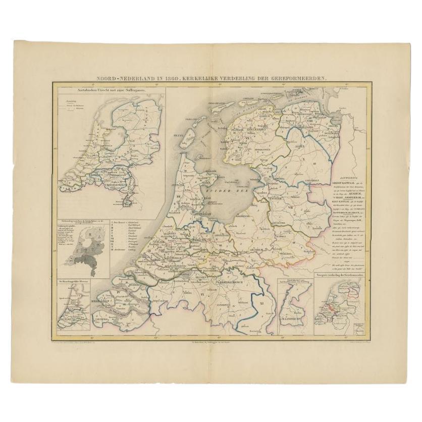
- Antique Map of the Netherlands in 1860 by Mees, 1862Located in Langweer, NLAntique map titled 'Noord-Nederland in 1860. Kerkelijke verdeeling der Gereformeerden'. Map of the Netherlands in 1860. This map originates from 'Historische Atlas van Noord-Nederlan...Category
Antique 19th Century Maps
MaterialsPaper
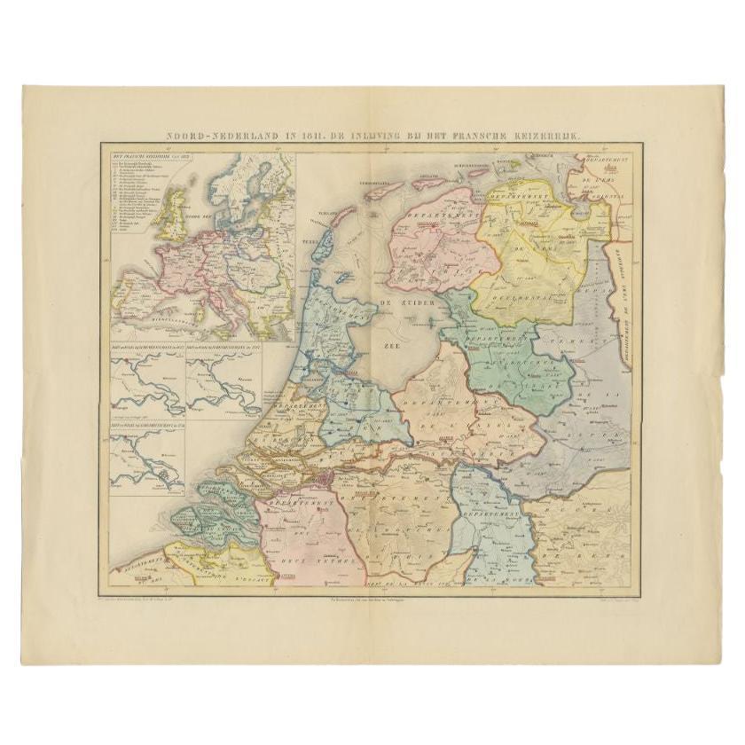
- Antique Map of the Netherlands in 1811 by Mees, 1858Located in Langweer, NLAntique map titled 'Noord-Nederland in 1811. De inlijving bij het Fransche Keizerrijk'. Map of the Netherlands in 1811. This map originates from 'Historische Atlas van Noord-Nederlan...Category
Antique 19th Century Maps
MaterialsPaper
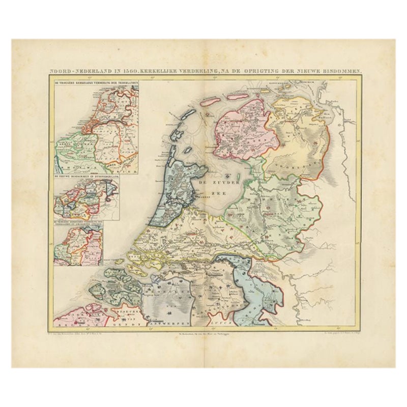
- Antique Map of the Netherlands in 1560 by Mees, 1853Located in Langweer, NLAntique map titled 'Noord-Nederland in 1560. Kerkelijke verdeeling, na de oprigting der nieuwe bisdommen'. Map of the Netherlands in 1560. This map originates from 'Historische Atlas...Category
Antique 19th Century Maps
MaterialsPaper
You May Also Like
- Original Antique Map of The Netherlands, Engraved by Barlow, Dated 1807Located in St Annes, LancashireGreat map of Netherlands Copper-plate engraving by Barlow Published by Brightly & Kinnersly, Bungay, Suffolk. Dated 1807 Unframed.Category
Antique Early 1800s English Maps
MaterialsPaper
- "San Francisco, Upper California” 1851 Antique Map of San FranciscoLocated in Colorado Springs, COThis is a pictorial lettersheet view of the city and harbor of San Francisco. This lithograph was printed on grey wove paper, across a double sheet, by famed lithographers Britton & ...Category
Antique 1850s American Prints
MaterialsPaper
- Original Antique Map of The Netherlands, Sherwood, Neely & Jones, Dated 1809Located in St Annes, LancashireGreat map of The Netherlands Copper-plate engraving by Cooper Published by Sherwood, Neely & Jones. Dated 1809 Unframed.Category
Antique Early 1800s English Maps
MaterialsPaper
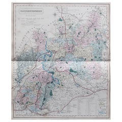
- Original Antique English County Map, Somerset. J & C Walker, 1851Located in St Annes, LancashireGreat map of Somerset Original colour By J & C Walker Published by Longman, Rees, Orme, Brown & Co. 1851 Unframed.Category
Antique 1850s English Other Maps
MaterialsPaper
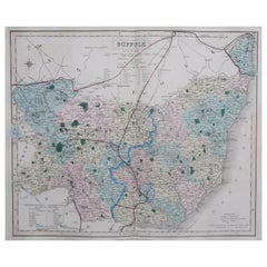
- Original Antique English County Map, Suffolk, J & C Walker, 1851Located in St Annes, LancashireGreat map of Suffolk Original colour By J & C Walker Published by Longman, Rees, Orme, Brown & Co. 1851 Unframed.Category
Antique 1850s English Other Maps
MaterialsPaper
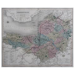
- Original Antique English County Map, Gloucestershire, J & C Walker, 1851Located in St Annes, LancashireGreat map of Gloucestershire Original colour By J & C Walker Published by Longman, Rees, Orme, Brown & Co. 1851 Unframed.Category
Antique 1850s English Other Maps
MaterialsPaper


Recently Viewed
View AllMore Ways To Browse
Antique Architecture Plan
Seven Fold
Antique Map Series
Antique Street Maps
Scottish Fold
Antique Doctors Office Furniture
Antique Prints Of A Cross
Atlas Furniture Company
Antique Map Set
Balinese Wood
Portuguese 16th
Atlas Book
Set Of Antique Maps
Pirate Furniture
Antique In Philippines
Victorian Book Ends
Railroad Collectibles
Denmark Maps