Maps on Sale
to
4,214
18
4,237
1
3
2
2
1
1
1
1
2,337
1,668
232
1
130
12
1
67
1
3
4
2
4,228
10
8
7
7
138
38
35
32
27
4,238
4,238
4,238
104
56
18
13
11
Sale Items
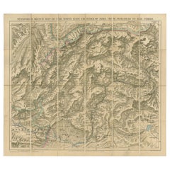
Antique Map of the North-West Frontier by Stanford, 1895
By E. Stanford
Located in Langweer, NL
Antique map titled 'Stanford's Sketch Map of the North West Frontier of India from Peshawar to the Pamirs'. Linen backed folding map of the North-West Frontier of India from Peshawar...
Category
Antique Late 19th Century Maps
Materials
Linen, Paper
$853 Sale Price
20% Off
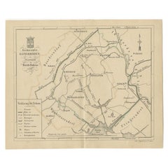
Antique Map of The Dutch Township Rauwerderhem, 1861
Located in Langweer, NL
Antique map titled 'Gemeente Rauwerderhem'. Old map depicting the Rauwerderhem township including cities and villages like Deersum, Poppingawier, Rauwerd and Irnsum. This map orginat...
Category
Antique 19th Century Maps
Materials
Paper
$113 Sale Price
20% Off
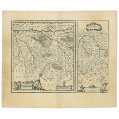
Antique Map of the Region of Loudun and Mirebeau by Janssonius, c.1650
By Johannes Janssonius
Located in Langweer, NL
Antique map 'Loudunois Laudunum - Mirebalais'. Decorative map of the region of Loudun and Mirebeau, France. It shows the city of Moncontour, Loudun, Mirebeau and more.
Artists ...
Category
Antique 17th Century Maps
Materials
Paper
$344 Sale Price
20% Off
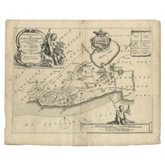
Antique Map of the Region of Gaasterland, Friesland, The Netherlands, 1664
Located in Langweer, NL
Antique map titled 'De Grietenie van Gaesterlandt (..)'. Map of the region of Gaasterland in Friesland, the Netherlands. This region includes the villages of Balk, Sloten, Wyckel and...
Category
Antique 17th Century Maps
Materials
Paper
$113 Sale Price
20% Off
Antique Map of Overijssel by Colom, 1635
Located in Langweer, NL
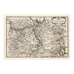
Antique map titled 'Ditio Trans-Isulana'. Original antique map of the province of Overijssel, the Netherlands. This map originates from 'Vyerige Colom verthonende de 17 Nederlandsche...
Category
Antique 17th Century Maps
Materials
Paper
$208 Sale Price
20% Off
Antique Print of the Waterfall of Saint-Leu in France, 1776
Located in Langweer, NL
Antique print titled 'Vue de la deuxieme cascade de St. Leu'. Copper engraving showing the waterfall of Saint-Leu. This print originates from 'Jardins Anglo-Chinois à la Mode' by Geo...
Category
Antique 18th Century Prints
Materials
Paper
$303 Sale Price
20% Off
Antique Map of Bantam, Jakarta and Cirebon by Van den Bosch '1818'
Located in Langweer, NL
Antique map titled 'Kaart van het Ryk van Bantam, Jacatra, Cheribon op het Eiland Java'. Rare and attractive map of the three most easterly provinces of Java (Bantam, Jakarta and Cir...
Category
Antique Early 19th Century Maps
Materials
Paper
$1,137 Sale Price
20% Off
Antique Map of Friesland by Guicciardini, 1613
Located in Langweer, NL
Antique map titled 'Frisia Occidenta.' (Map of the province of Friesland, the Netherlands.) This original old antique print / plate originates from the scarse French edition of 'Desc...
Category
Antique 17th Century Maps
Materials
Paper
$265 Sale Price
20% Off
Antique Print of the City of Nangan in Fujian, China, 1668
Located in Langweer, NL
Antique print China titled 'Nangan'. Old print depicting a view on the city of Nangan with its ramparts and a Pagoda. This print originates from the Latin edition of Nieuhof's work t...
Category
Antique 17th Century Prints
Materials
Paper
$379 Sale Price
20% Off
Interesting Map of the Thousand Islands in the Bay of Batavia 'Jakarta', ca.1740
Located in Langweer, NL
A single unfolded page border colored engraved map, printed no. 107 in top corner. This same map is found as plate 107 in Atlas Universelle aus dem Jahre 1787 by Philippe de Pretot b...
Category
Antique 1740s Maps
Materials
Paper
$322 Sale Price
20% Off
Antique Map of the Coast of North and East Asia by Diderot, 1751
By Denis Diderot
Located in Langweer, NL
Map 3: 'Nouvelle Representation des Cotes Nord et Est de L'Asie'. (New map of the coast of North and East Asia.) Three maps on one sheet. Depicting three maps centered on mainland Ch...
Category
Antique 18th Century Maps
Materials
Paper
$208 Sale Price
20% Off
Pl. 4 Antique Print of a French Garden Summer House by Schübler, c.1724
Located in Langweer, NL
Antique print titled 'Ein Frantzösches Sommer Haus zu Ende eines Lust Gartens (..)'. Copper engraving showing a French garden summer house. This print originates from a series of gar...
Category
Antique 18th Century Prints
Materials
Paper
$88 Sale Price
20% Off
Antique Print of the Gardens at Cape of Good Hope by Van Schley, 1756
Located in Langweer, NL
Antique print titled 'Jardin de la Compagnie au Cap de Bonne Esperance, Compagnies Tuyn aan de Kaap de Goede Hoop'. This print depicts the Gardens at Cape of Good Hope (VOC). This pr...
Category
Antique 18th Century Prints
Materials
Paper
$156 Sale Price
20% Off
Map of West Germany Incl Regions Wurtemberg, Bavaria, Hanover, Etc, c.1850
Located in Langweer, NL
Antique map titled '(Deutschland) Germany, Western States'.
Map of West Germany depicting many regions including Wurtemberg, Bavaria, Hanover and others. This map originates from...
Category
Antique 1850s Maps
Materials
Paper
$265 Sale Price
20% Off
Rare Print of the Pearl Bastion of Castle Batavia in the Dutch East Indies, 1770
Located in Langweer, NL
Antique print titled 'Prospect von der Bastion Perl langst der Courtine des Castells Batavia / Vue de la Bastion Perl de Batavie.' View of the Parel Bastion (Pearl Bastion) of Castle...
Category
Antique 18th Century Prints
Materials
Paper
$502 Sale Price
20% Off
Antique Print of a Cave in Saint-leu-taverny in France C.1785
Located in Langweer, NL
Antique print titled 'Vüe dessinée dans l'intérieur de la Grotte de St. Leu Taverni'. Copper engraving showing a cave in Saint-Leu-Taverny. This print originates from 'Jardins Anglo-...
Category
Antique 18th Century Prints
Materials
Paper
$322 Sale Price
20% Off
Antique Map of South America by Cadell & Davies, 1803
Located in Langweer, NL
Antique map South America titled 'South America'. Antique map of South America published by Cadell & Davies, 1803. Artists and Engravers: Pub...
Category
Antique 19th Century Maps
Materials
Paper
$113 Sale Price
20% Off
Pl. 5 Antique Print of a Garden Pavilion by Schübler, c.1724
Located in Langweer, NL
Antique print titled 'Ein ansehliches neu Invertirtes Lust und Somer Haus (..)'. Copper engraving showing a garden pavilion. This print originates from...
Category
Antique 18th Century Prints
Materials
Paper
$88 Sale Price
20% Off
Decorative Original Antique Panoramic View of Atjeh on Sumatra, Indonesia, 1756
Located in Langweer, NL
Antique print titled 'Achem - Atsjien'.
Decorative panoramic view of Atjeh on Sumatra, Indonesia. On this engraving a pagode like building is visible in the background. In the fo...
Category
Antique 1750s Maps
Materials
Paper
$312 Sale Price
20% Off
Antique Map of Asia by Guthrie, 1787
Located in Langweer, NL
Antique map titled 'Asia from the best Authorities'. Old map of the Asian continent. This map originates from 'A New Geographical, Historical and Commercial Grammar; and Present State of the several Kingdoms of the World' 10th ed. by W. Guthrie.
Artists and Engravers: Published by Ch.Dilly; GGJ...
Category
Antique 18th Century Maps
Materials
Paper
$137 Sale Price
20% Off
Antique Map of Part of Southern Asia by Bonne, c.1780
Located in Langweer, NL
Antique map titled 'Carte de la Partie Superieure de l'Inde en deca du Gange. Comprise entre la Cote du Concan et celle d'Orixa, avec l'Empire du Mogol, le Bengale, le R. d'Asham, pa...
Category
Antique 18th Century Maps
Materials
Paper
$118 Sale Price
20% Off
Decorative Antique Map of the Quercy Region in France, 1657
Located in Langweer, NL
Antique map of France titled 'Quercy olim Cadurcium'.
Decorative map of the Quercy region. Quercy is a former province of France located in the country's southwest, bounded on th...
Category
Antique 1650s Maps
Materials
Paper
$530 Sale Price
20% Off
Antique Map of Northern Italy by J. Tallis, circa 1851
Located in Langweer, NL
A highly decorative mid-19th century map of Northern Italy which was drawn and engraved by John Rapkin (vignettes by A. H. Wray & J. B. Allen) and published in John Tallis & co.'s Th...
Category
Antique Mid-19th Century Maps
Materials
Paper
$170 Sale Price
47% Off
Antique Map of Africa by Levasseur 'c.1840'
Located in Langweer, NL
Antique map titled 'Afrique'. Original antique map of Africa. Decorative map of the continent surrounded by allegorical vignettes. Engraved by Raimond Bonheur, father of the famous F...
Category
Antique Mid-19th Century Maps
Materials
Paper
$474 Sale Price
20% Off
Antique Map of the Kingdom of Bohemia by Keizer & de Lat, 1788
Located in Langweer, NL
Antique map titled 't Koninkryk Bohemen (..)'. Uncommon original antique map of the Kingdom of Bohemia. This map originates from 'Nieuwe Natuur- Geschied- en Handelkundige Zak- en Re...
Category
Antique Late 18th Century Maps
Materials
Paper
$331 Sale Price
20% Off
Antique Map of Southeast Asia by Dussy, 1778
Located in Langweer, NL
"Antique map titled 'Indostan presqu'isles de l'Inde, Chine, Tartarie Independante.' - A map of Asia: Hindustan, India and China. This map originates from 'Nouvel Atlas Portatif dest...
Category
Antique 18th Century Maps
Materials
Paper
$208 Sale Price
20% Off
Antique Map of the Distribution of Air and Rain by Reynolds, 1843
Located in Langweer, NL
Two antique world maps on one sheet. The upper map shows the distribution of the currents of air and variable winds over the world. The lower meteorological map shows the distributio...
Category
Antique 19th Century Maps
Materials
Paper
$169 Sale Price
20% Off
Antique Map of Italy and Corse in Ancient Times, 1848
Located in Langweer, NL
Antique map titled 'Italia Superior et Corsica'.
Old map of northern Italy and Corse originating from 'Orbis Terrarum Antiquus in usum Scholarum'. Artists and Engravers: Publishe...
Category
Antique 19th Century Maps
Materials
Paper
$246 Sale Price
20% Off
Antique Map of Australasia by Lowry, 1852
Located in Langweer, NL
Antique map titled 'Australasia'. Original map of Australasia. This map originates from 'Lowry's Table Atlas constructed and engraved from the most recent Authorities' by J.W. Lowry....
Category
Antique Mid-19th Century Maps
Materials
Paper
$94 Sale Price
20% Off
Antique Map of Sweden and Norway by Migeon, 1880
Located in Langweer, NL
Antique map titled 'Suède et Norvége'. Old map of Sweden and Norway. With decorative vignette of Stockholm. This map originates from 'Géographie Universe...
Category
Antique 19th Century Maps
Materials
Paper
$104 Sale Price
20% Off
Pl. 494 Antique Print of Ship Structures by Archibald, c.1810
Located in Langweer, NL
Antique print titled 'Plate CCCCXCIV Ship-Building'. Old print depicting various ship building structures. This print originates from 'Encyclopedia Britannica'. Artists and Engravers...
Category
Antique 19th Century Prints
Materials
Paper
$55 Sale Price
20% Off
Rare Authentic Engraved Map of Large Part of Indonesia by Stavorinus, 1779
Located in Langweer, NL
Antique map titled 'Carte de la Navigation de Batavia a Amboina'. Rare chart of Indonesia including Borneo, Java, Celebes, Ceram and more. This map originates from 'Voyage par le Cap...
Category
Antique 18th Century Maps
Materials
Paper
$700 Sale Price
20% Off
Antique Map of France under the Reign of Charles VII by Zannoni, 1765
Located in Langweer, NL
Antique map France titled 'La France sous le Règne de Charles VII (..)'.
Beautiful old map of France. This map originates from 'Atlas Historique de la ...
Category
Antique 18th Century Maps
Materials
Paper
$150 Sale Price
20% Off
Map of Southeast Asia, Extending from India to Tibet & Japan to New Guinea, 1640
Located in Langweer, NL
Antique map titled 'India quae Orientalis dicitur et Insulae adiacentes'.
Map of Southeast Asia, extending from India to Tibet to Japan to New Guinea. This map is one of the firs...
Category
Antique 1640s Maps
Materials
Paper
$2,512 Sale Price
20% Off
Antique Map of the Region of Vermandois and Cappelle, France by Janssonius, 1657
By Johannes Janssonius
Located in Langweer, NL
Antique map of France titled 'Descriptio Veromanduorum - Gouvernement de la Cappelle'. Two detailed maps of France on one sheet.
The Vermandois map is centered on the Oyse and So...
Category
Antique 17th Century Maps
Materials
Paper
$635 Sale Price
20% Off
Antique Map of the City of Enkhuizen by Guicciardini, 1625
Located in Langweer, NL
Antique map titled 'Die Stadt Enchuijsen, La ville denchuijsen'. Map of Enkhuizen, Noord-Holland, The Netherlands. Oiginates from the 1625 edition of 'Discrittione di tutti i Paesi B...
Category
Antique 17th Century Maps
Materials
Paper
$289 Sale Price
20% Off
Antique Map of the Islands of Macian and Bacian by De Bry, 1619
Located in Langweer, NL
Antique map titled 'Delineatio Insularum Macian et Bacian'. Depicts the islands Macian and Bacian. Originates from 'Americae pars Undecima (..) by J.T. de Bry, 1619.
Artists and E...
Category
Antique 17th Century Maps
Materials
Paper
$180 Sale Price
20% Off
Antique Map of the Maluku Islands by Van der Aa, 1714
By Pieter Van Der Aa
Located in Langweer, NL
Antique Map Moluccas titled 'Les Isles Moluques'. Rare map of the Spice Islands made after a map engraved by Pieter van den Keere and published in the 1628 edition of the Mercator At...
Category
Antique 18th Century Maps
Materials
Paper
$188 Sale Price
20% Off
Antique Map of Sumatra by Tardieu, 1811
Located in Langweer, NL
Antique map Sumatra titled 'Partie de l'Isle Sumatra'. Part of the Island of Sumatra, where the English settlement of the Bay of Sellabar near Bencoute can...
Category
Antique 19th Century Maps
Materials
Paper
$222 Sale Price
20% Off
Pl. 40 Antique Print of Charlottenborg Palace, c.1790
Located in Langweer, NL
Antique print titled 'Facade du Château de Charlottenbourg'. Architecture print of Charlottenborg Palace, a large town mansion located on the corner of Kongens Nytorv and Nyhavn in C...
Category
Antique 18th Century Prints
Materials
Paper
$113 Sale Price
20% Off
Antique Map of Turkey with Cyprus and Greece Islands by N. Sanson, circa 1652
Located in Langweer, NL
Antique map of Turkey, Anatolie with Cyprus and the Greece islands. Attractive scrolled title cartouche to top right corner. Blank verso.
Category
Antique Mid-17th Century Maps
Materials
Paper
Large Antique Map of Asia The Royal Atlas of Modern Geography by Johnston, 1882
Located in Langweer, NL
Antique map titled 'Asia'. Old map of the Asian continent. This map originates from 'The Royal Atlas of Modern Geography, Exhibiting, in a Series of Entirely Original and Authentic M...
Category
Antique 19th Century Maps
Materials
Paper
$274 Sale Price
20% Off
Antique Map of the Rhineland and Lotharingen by Tirion, c.1740
By Isaak Tirion
Located in Langweer, NL
Antique map titled 'Nieuwe Kaart van de Opper en Neder Rhynse Kreits nevens het Hertogdom Lotharingen.' Attractive detailed map showing the Rheinland (Rhineland) and Lotharingen, Ger...
Category
Antique 18th Century Maps
Materials
Paper
$258 Sale Price
20% Off
Antique Map of the Expedition of Govert Knol by Van Schley, 1765
By Jakob van der Schley
Located in Langweer, NL
Antique map titled 'Plan de l' expédition de Mr. le Commiss. re Govert Knol, forti de Soerabaja, pour aller recévoir Pangerang Depati Anom. / Aftékening der Expeditie van de H. r Commiss. is Govert Knol , uyt Soerabaya , tot afhaalinge van Pangerang Depati Anom'. Map showing the expedition...
Category
Antique 18th Century Maps
Materials
Paper
$113 Sale Price
20% Off
Antique Print of the Church of Leiden by Van Mieris, 1784
Located in Langweer, NL
Antique print titled 'Platte grond en opstal van de Nieuw Gefundeerde kerk, in de Waard te Leyden, van de z. zijde te zien'. Old engraving of the church of Leiden, the Netherlands. It shows a view and floorplan. This print originates from 'Beschryving der Stad Leyden (..)' by F. van Mieris...
Category
Antique 18th Century Prints
Materials
Paper
$84 Sale Price
20% Off
Antique Map of Brazil by Levasseur '1875'
Located in Langweer, NL
Antique map titled 'Carte du Brésil'. Large map of Brazil, with small fold out. This map originates from 'Atlas de Géographie Moderne Physique et Politiq...
Category
Antique Late 19th Century Maps
Materials
Paper
$379 Sale Price
20% Off
Antique Map of South America Depicting Guayana, c.1780
Located in Langweer, NL
Antique map titled 'La Guyane Francopise avec partie de la Guyane Hollandoise: suivant les Operations et les Cartes recentes des Ingenieurs-Geographes Francois'. Antique map of South...
Category
Antique 18th Century Maps
Materials
Paper
$331 Sale Price
20% Off
Cortesi's Masterpiece: A Comprehensive and Authoritative Map of Uruguay, 1903
Located in Langweer, NL
Antique map titled 'Mapa de la Republica Oriental del Uruguay'. Large and detailed folding map of Uruguay. This monumental map depicts all of Uruguay with unprecedented accuracy and detail. Impressively, it serves the multiple roles of being an advanced topographic, economic and political map, as well as being a meticulous sea chart of the Rio de la Plata and the adjacent waters of the Atlantic. The republic's 20 departments are defined in various colors, while a legend, 'Referencias' identifies symbols representing the locations of departmental capitals, town, roads, railways, public schools and lighthouses, amongst other details. Every single river and stream is delineated and named and the ridges of hills are delicately expressed. The map features four insets, including a large map of the capital, Montevideo, as well as maps of Colonia, Maldonado and Punta del Este and the Island of Flores. The hydrographical information provided is truly profound, and renders the map fit for use in maritime commerce.
In 1901, the Uruguayan House of Representatives commissioned the geographer Saturnino Cortesi to employ the most progressive geographical sources, both military and civilian, to devise an authoritative national map of the republic. Cortesi clearly had access to a vast archive of topographical surveys...
Category
Early 20th Century Maps
Materials
Paper
$5,215 Sale Price
20% Off
Antique Map of South America by Keizer & de Lat, 1788
Located in Langweer, NL
Antique map titled 'Kaartje van het Zuider-Deel van America'. Uncommon original antique map of South America. This map originates from 'Nieuwe Natuur- Geschied- en Handelkundige Zak-...
Category
Antique Late 18th Century Maps
Materials
Paper
$379 Sale Price
20% Off
Antique Map of the Routes of Jean-françois de Galaup to Asia, 1787
Located in Langweer, NL
Antique map titled 'Suite de la Route des Vaisseaux Francois'. Antique map of the routes of Jean-François de Galaup to Asia (Jakarta, Indonesia). This map originates from 'World atla...
Category
Antique 18th Century Maps
Materials
Paper
$322 Sale Price
20% Off
Antique French Map of Java, Indonesia by Chatelain, '1719'
Located in Langweer, NL
Antique map titled 'Carte de l'Ile de Java: Partie Occidentale, Partie Orientale, Dressee tout Nouvellement Sur Les Memoires Les Plus Exacts (..)'. This beautiful map of Java (Indone...
Category
Antique Early 18th Century Maps
Materials
Paper
$2,654 Sale Price
20% Off
Colorful and Decorative Miniature Map of India, Ceylon by Bertius 1616
Located in Langweer, NL
Old 17th century miniature antique map of India - Ceylon from the 1616 edition of Jadocus Hondius Atlas by Petrus Bertius. Original copperplate engraving with hand coloring.
Carto...
Category
Antique 17th Century Maps
Materials
Paper
$369 Sale Price
20% Off
Antique Map of the Artois Region 'France' by F. de Wit, circa 1680
Located in Langweer, NL
Antique map titled 'Tabula Comitatus Artesiae emendata'. Large map of the Artois region, France. Published by F. de Wit, circa 1680.
Category
Antique Late 17th Century Maps
Materials
Paper
$511 Sale Price
25% Off
Detailed Original Antique Map of Thuringia, Germany by J. Janssonius, ca.1650
Located in Langweer, NL
Antique map titled 'Thuringiae Nova Descriptio.' Detailed map of Thuringia, Germany by J. Janssonius. With one cartouche, coat-of-arms and a mileage scale. With Erfurt in the centre....
Category
Antique 1650s Maps
Materials
Paper
$635 Sale Price
20% Off
Antique Map of the Region of Soissons in France, 1737
Located in Langweer, NL
Untitled map of the region of Soissons, France. This map originates from 'Nieuw en beknopt Kaart-Boekje vertoonende de XVII. Nederlandse Provintien (..)'.
Artists and Engravers: A...
Category
Antique 18th Century Maps
Materials
Paper
$121 Sale Price
20% Off
Antique Map of the Region of Perce and Blois by Janssonius, 1657
By Johannes Janssonius
Located in Langweer, NL
Antique map of France titled 'Perchensis Comitatus - Comitatus Blesensis'. Decorative map of Perce region and the region of Blois. This map originates from 'Atlas Novus, Sive Theatru...
Category
Antique 17th Century Maps
Materials
Paper
$325 Sale Price
20% Off
Paviljoen der Stad Amsterdam, Emrik & Binger, 1885
Located in Langweer, NL
Antique Print 'Paviljoen der Stad Amsterdam.' (Pavillion of the city of Amsterdam.) This plate shows the Pavilion of Amsterdam on the World Exhibition of 1883 in Amsterdam. Published...
Category
Antique 19th Century Prints
Materials
Paper
$55 Sale Price
20% Off
Antique Map of the Northern Portion of the Philippines by J.N. Bellin, 1764
Located in Langweer, NL
Detailed map of the Northern portion of the Philippines, extending from Batanes and Babuyanes to Mindonoro and Masbate, and centered on Luzon. One of the most detailed maps of the pe...
Category
Antique Mid-18th Century Maps
Materials
Paper
$260 Sale Price
16% Off
Antique Map of Oberlausitz by Homann Erben, '1746'
Located in Langweer, NL
Antique map titled 'Geographische Verzeichnung des Budissinischen Creises (..) - Carte du Cercle de Budissin (..)'. Copper engraved map of Oberlausitz, a historical region of Saxony ...
Category
Antique Mid-18th Century Maps
Materials
Paper
$426 Sale Price
20% Off
Antique Print of the Rhine River, Leiden, The Netherlands, c.1800
Located in Langweer, NL
Antique print titled 'Rhyn gesigt langs de Tuynen by de Hoogewoerts Poort'. Old print depicting with a view on the Rhine river, the Netherlands. This print...
Category
Antique 18th Century Prints
Materials
Paper
$161 Sale Price
20% Off
Recently Viewed
View AllMore Ways To Browse
Statutes And Sculptures
Swedish Gustavian Glass Cabinet
Swiss Chalet Chairs
Tea Cup Art Nouveau
Tea Cup Holder
Teak Buddha
Teak Gentlemans
Thomasville Hollywood Regency
Thomire Clock
Three Legged Vessel
Three Tier Serving Trays
Tibet Earring
Tibetan Antique Cabinet
Tiffany And Co China
Tiffany Blue Rims
Tiffany Sterling Ice Tea Spoons
Torchiere Sculpture
Tortoise Christian Dior
