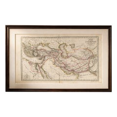
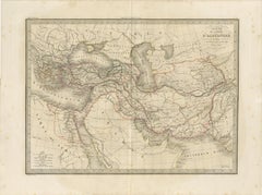
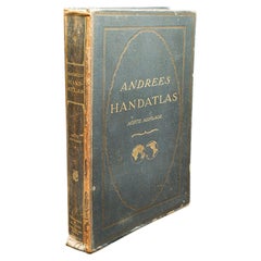
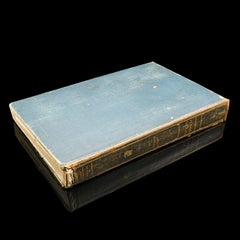
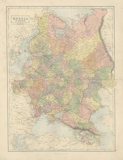
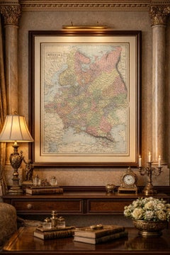
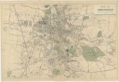
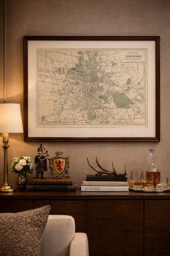
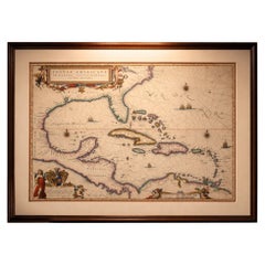
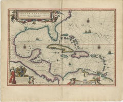
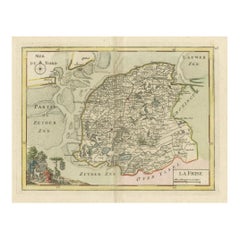
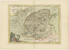
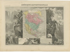
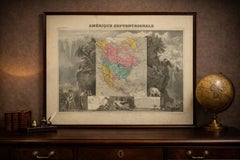
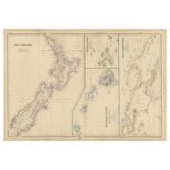
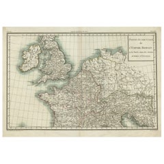
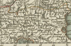
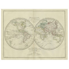
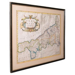
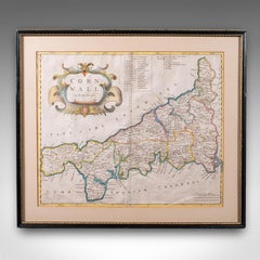
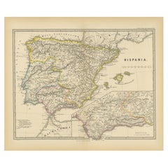
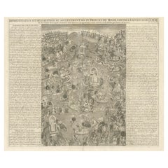
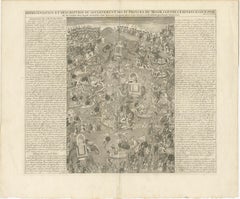
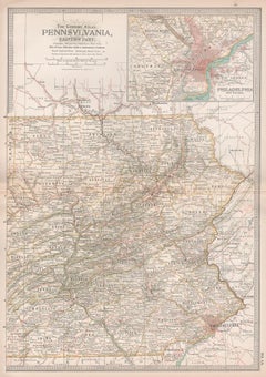
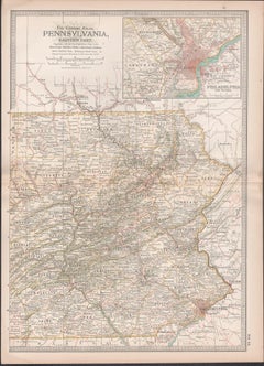
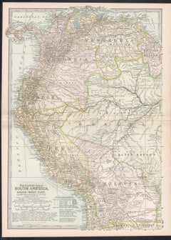
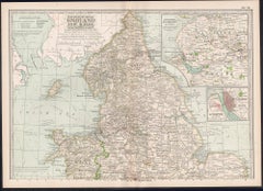
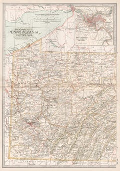
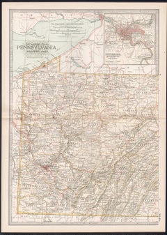
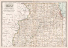
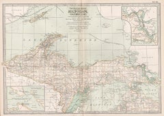
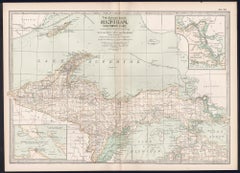
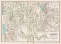
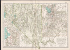
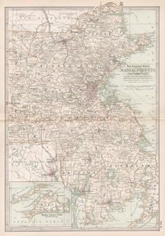
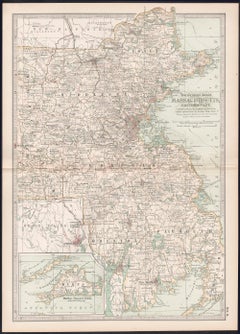
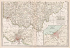
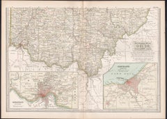
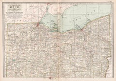
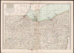
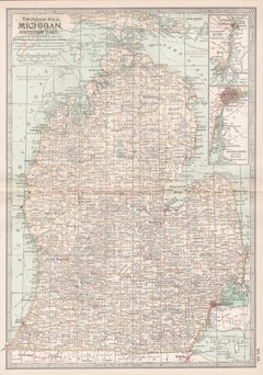
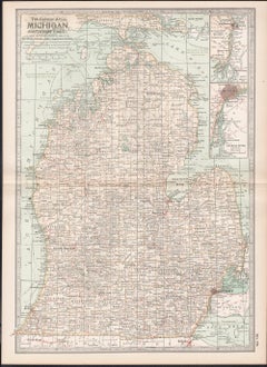
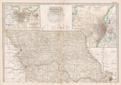
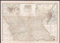
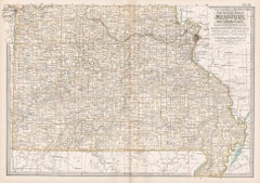
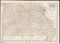
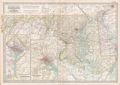
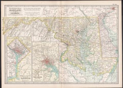
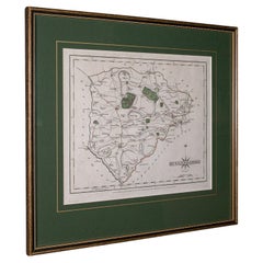
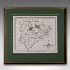
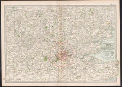
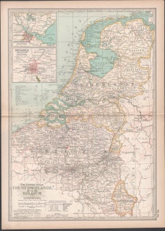
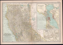
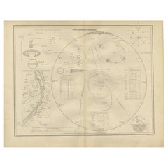
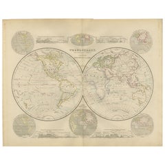
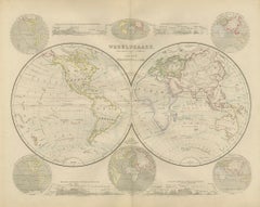
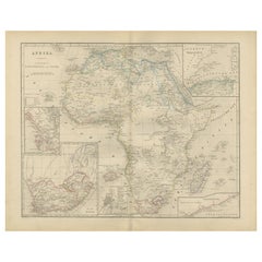
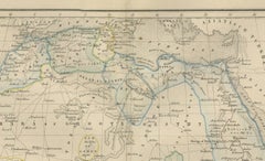
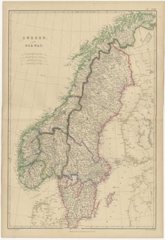
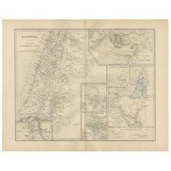
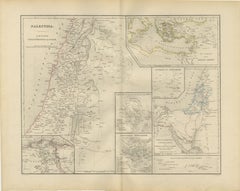
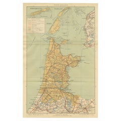
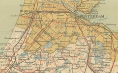
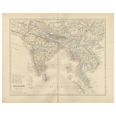
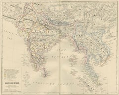
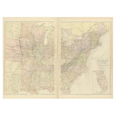
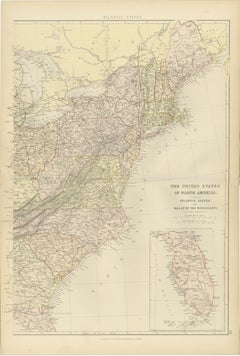
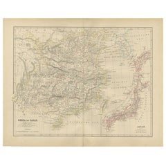
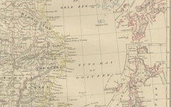
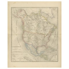
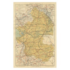
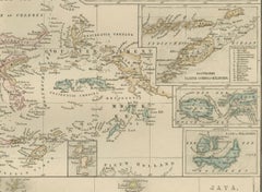
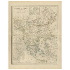
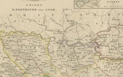
Antique Alexander the Great Map, Persia India Asia, French Atlas 1838
Located in Langweer, NL
Antique Alexander the Great Map, Persia India Asia, French Atlas 1838 Description: This finely
Early 19th Century French Antique Atlases
Paper
Antique Alexander the Great Map, Persia India Asia, French Atlas 1838
Located in Langweer, NL
Antique Alexander the Great Map, Persia India Asia, French Atlas 1838 Description: This finely
Paper
Antique Andrees Handatlas, German Cartography Book, Maps, Atlas, Reference, 1924
Located in Hele, Devon, GB
This is a large volume antique copy of Andrees' Handatlas. A German, bound chromolithography atlas
Paper
Antique Map Russia in Europe, Bartholomew for Black’s General Atlas - 1884
Located in Langweer, NL
Antique Map Russia in Europe, Bartholomew for Black’s General Atlas 1884 Description: This
Paper
Cheltenham Urban Plan, Bacon’s New Large Scale Ordnance Atlas Map, 1885
Located in Langweer, NL
Cheltenham Urban Plan 1885, Bacon’s New Large Scale Ordnance Atlas Map A finely engraved antique
Paper
Important Blaeu Caribbean Map, West Indies, Decorative Atlas Chart, c.1642
Located in Langweer, NL
An important and Highly Decorative Blaeu Caribbean Map, West Indies, Antique Atlas Chart, c1642
Paper
$278Sale Price|20% Off
Map of Friesland (La Frise), from "Atlas Nouveau Portatif" (1756)
Located in Langweer, NL
Title: Map of Friesland (La Frise), from "Atlas Nouveau Portatif" (1756) This is an 18th-century
Paper
Antique Map North America, Texas Republic, Decorative Levasseur Atlas, c.1845
Located in Langweer, NL
Paris circa 1842–1845 as part of the Atlas Universel Illustré. The map presents the continent during a
Paper
The Atlas of Botany - Frontispiece - Lithograph by Vincenzo Tenore - 1870s
Located in Roma, IT
Illustrazione di Piante Notevoli di ogni famiglia" (Atlas of popular botany or illustration of notable plants of
Lithograph
Antique German Botanical Atlas Plates, Tafel 17–18, Lilies & Irises, 1885
Located in Langweer, NL
Antique German Botanical Atlas Plates, Tafel 17–18, Lilies & Irises, 1885 Description: A refined
Paper
Antique German Botanical Atlas Plates, Tafel 15–16, Bulb Flowers, 1885
Located in Langweer, NL
Antique German Botanical Atlas Plates, Tafel 15–16, Bulb Flowers, 1885 Description: A beautifully
Paper
Antique Palm Tree Botanical Print, Exotic Tropical Plate, German Atlas 1885
Located in Langweer, NL
Antique Palm Tree Botanical Print, Exotic Tropical Plate, German Atlas 1885 An impressive original
Paper
Antique German Botanical Atlas Plates, Tafel 13–14, Ferns & Conifers, 1885
Located in Langweer, NL
Antique German Botanical Atlas Plates, Tafel 13–14, Ferns & Conifers, 1885 Description: A
Paper
New Zealand, Antique Map, Pacific Islands, Sandwich Islands, Blackie Atlas 1860
Located in Langweer, NL
New Zealand, Antique Map, Pacific Islands, Sandwich Islands, Blackie Atlas 1860 Description: This
Paper
Pair of Monumental Figural Supports Columns Representing Atlas or Hercules
Located in Antwerp, BE
Two carved of oak columns or pedestals, each of a muscular male figure, representing Atlas or
Wood
$508Sale Price|20% Off
Physical & Political Map of Switzerland: Late 18th Century - Mentelle Atlas
Located in Langweer, NL
:** - **Atlas Title:** Nouvel Atlas Universel de Géographie Ancienne et Moderne - **Purpose:** For the Nouvelle
Paper
$422Sale Price|20% Off
Western Roman Empire Map: British Isles & Gaul - 1802 Tardieu Atlas
Located in Langweer, NL
Anciens d'Après d'Anville" Publication Details: - **Atlas Title:** Nouvel Atlas Universel de Géographie
Paper
$441Sale Price|20% Off
World Map in Two Hemispheres: Eastern & Western - 1802 Tardieu Atlas
Located in Langweer, NL
Antique Map with Title: "Mappemonde en Deux Hémisphères" Publication Details: - **Atlas Title
Paper
Antique Framed Cornwall Map, English, Atlas Cartography, Robert Morden, C.1700
Located in Hele, Devon, GB
This is an antique framed map of Cornwall. An English, atlas engraving of cartographic interest By
Glass, Paper
$354Sale Price|20% Off
Ancient Iberia: Hispania Map from Spruner-Menke Atlas Antiquus, 1880
Located in Langweer, NL
original antique map from the "Spruner-Menke Atlas Antiquus," a 19th-century historical atlas. The maker of
Paper
$470Sale Price|20% Off
Mughal Princes’ Revolt – Battle Engraving by Chatelain, Atlas Historique 1718
Located in Langweer, NL
Mughal Princes’ Revolt – Battle Scene Engraving by Chatelain, Atlas Historique 1718 This dramatic
Paper
Pennsylvania, Eastern Part. USA. Century Atlas state antique vintage map
Located in Melbourne, Victoria
'The Century Atlas. Pennsylvania, Eastern Part.' Original antique map, 1903. Central fold as
Lithograph
Pair Greek Atlas Figurative Bronze Lamps by Edward F. Caldwell
Located in New York, NY
Pair of bronze and white marble figures of the Greek god, Atlas, by E.F. Caldwell, with finely
Marble, Bronze
South America, North-West Part. Century Atlas antique vintage map
Located in Melbourne, Victoria
'The Century Atlas. South America, North-West Part' Original antique map, 1903. Central fold as
Lithograph
England and Wales, Northern Part. Century Atlas antique vintage map
Located in Melbourne, Victoria
'The Century Atlas. England and Wales, Northern Part' Original antique map, 1903. Central fold as
Lithograph
Pennsylvania, Western Part. USA Century Atlas state antique vintage map
Located in Melbourne, Victoria
'The Century Atlas. Pennsylvania, Western Part' Original antique map, 1903. Central fold as
Lithograph
Illinois, Northern Part. USA. Century Atlas state antique vintage map
Located in Melbourne, Victoria
'The Century Atlas. Illinois, Northern Part' Original antique map, 1903. Central fold as issued
Lithograph
Michigan, Northern Part. USA. Century Atlas state antique vintage map
Located in Melbourne, Victoria
'The Century Atlas. Michigan, Northern Part' Original antique map, 1903. Central fold as issued
Lithograph
Nevada and Utah. USA. Century Atlas state antique vintage map
Located in Melbourne, Victoria
'The Century Atlas. Nevada and Utah' Original antique map, 1903. Central fold as issued. Map name
Lithograph
Massachusetts, Eastern Part. USA. Century Atlas state antique vintage map
Located in Melbourne, Victoria
'The Century Atlas. Massachusetts, Eastern Part' Original antique map, 1903. Central fold as
Lithograph
Ohio, Southern Part. USA. Century Atlas state antique vintage map
Located in Melbourne, Victoria
'The Century Atlas. Ohio, Southern Part' Original antique map, 1903. Central fold as issued. Map
Lithograph
Ohio, Northern Part. USA. Century Atlas state antique vintage map
Located in Melbourne, Victoria
'The Century Atlas. Ohio, Northern Part' Original antique map, 1903. Central fold as issued. Map
Lithograph
Michigan, Southern Part. USA. Century Atlas state antique vintage map
Located in Melbourne, Victoria
'The Century Atlas. Michigan, Southern Part.' Original antique map, 1903. Central fold as issued
Lithograph
Missouri. Northern Part. USA. Century Atlas state antique vintage map
Located in Melbourne, Victoria
'The Century Atlas. Missouri. Northern Part.' Original antique map, 1903. Central fold as issued
Lithograph
Missouri. Southern Part. USA. Century Atlas state antique vintage map
Located in Melbourne, Victoria
'The Century Atlas. Missouri. Southern Part.' Original antique map, 1903. Central fold as issued
Lithograph
Maryland and Delaware. USA. Century Atlas state antique vintage map
Located in Melbourne, Victoria
'The Century Atlas. Maryland and Delaware.' Original antique map, 1903. Central fold as issued
Lithograph
Antique County Map, Rutlandshire, Framed Atlas Cartography, John Cary, Georgian
Located in Hele, Devon, GB
This is an antique county map of Rutlandshire. An English, framed atlas engraving of cartographic
Glass, Wood, Paper
Vicinity of London, England, United Kingdom. Century Atlas antique map
Located in Melbourne, Victoria
'The Century Atlas. Vicinity of London, England, United Kingdom.' Original antique map, 1903
Lithograph
The Netherlands (Holland), Belgium and Luxemburg. Century Atlas antique map
Located in Melbourne, Victoria
'The Century Atlas. The Netherlands (Holland), Belgium and Luxemburg.' Original antique map, 1903
Lithograph
Russia, Western and Southern Part. Century Atlas antique vintage map
Located in Melbourne, Victoria
'The Century Atlas. Russia, Western and Southern Part' Original antique map, 1903. Inset map
Lithograph
19th Century (mid) Italian Grand Tour Sculpture Atlas Holding The Earth
Located in Scottsdale, AZ
19th Century (mid) Italian Grand Tour Sculpture Atlas Holding The Earth Beautiful piece purchased
Brass, Bronze
California, Northern Part. USA Century Atlas state antique vintage map
Located in Melbourne, Victoria
'The Century Atlas. California, Northern Part' Inset maps of 'Yosemite Valley' and 'San Francisco
Lithograph
Northern Italian Carved Wood & Gessoed Atlas with Celestial Globe Circa 1800
Located in Palm Springs, CA
Rare late 18th–early 19th century carved wooden figure of Atlas supporting a celestial sphere
Wood
The Solar System – Astronomical Lithograph - The Nieuwe Hand-Atlas, Leiden 1876
Located in Langweer, NL
The Solar System – Astronomical Lithograph from the Nieuwe Hand-Atlas, Leiden 1876 This detailed
Paper
Double Hemisphere World Map from the Nieuwe Hand-Atlas, Leiden 1876
Located in Langweer, NL
Title: Double Hemisphere World Map from the Nieuwe Hand-Atlas, Leiden 1876 Description: This 19th
Paper
Africa Map with Egypt & South Africa Insets – Nieuwe Hand-Atlas, 1876
Located in Langweer, NL
Africa Map with Egypt & South Africa Insets – Nieuwe Hand-Atlas, 1876 This 19th-century map
Paper
Sweden and Norway, Antique Map, Scandinavian Geography, Blackie Atlas, 1859
Located in Langweer, NL
Sweden and Norway, Antique Map, Scandinavian Geography, Blackie Atlas Description: This original
Paper
Palestine & Holy Land Map with Jerusalem Insets – Nieuwe Hand-Atlas, 1876
Located in Langweer, NL
Palestine & Holy Land Map with Jerusalem Insets – Nieuwe Hand-Atlas, 1876 This detailed 19th
Paper
Antique Dutch Map – Province of Noord-Holland from Sleeswijk Atlas, 1914
Located in Langweer, NL
Antique Map of Noord-Holland – Sleeswijk Atlas, 1914 This finely detailed antique map of Noord
Paper
British India Map with Burma & Ceylon – Nieuwe Hand-Atlas, Leiden 1876
Located in Langweer, NL
British India Map with Burma & Ceylon – Nieuwe Hand-Atlas, Leiden 1876 This finely engraved 19th
Paper
1882 Blackie Atlas Maps: Atlantic States and Mississippi Valley Compilation
Located in Langweer, NL
These two maps from the 1882 Blackie Atlas provide a detailed view of the eastern half of the
Paper
Pair of Regency Gilt and Patinated Bronze Atlas Figural Candelabra
By Messenger & Phipson
Located in Essex, MA
Pair of Regency or William IV figural candelabra in form of Atlas and a globe. Six arms issuing
Bronze
China and Japan Map with Korea – Nieuwe Hand-Atlas, Leiden 1876
Located in Langweer, NL
China and Japan Map with Korea – Nieuwe Hand-Atlas, Leiden 1876 This finely engraved 19th-century
Paper
North America Map with USA, Canada & Mexico – Nieuwe Hand-Atlas, 1876
Located in Langweer, NL
North America Map with USA, Canada & Mexico – Nieuwe Hand-Atlas, 1876 This finely engraved 19th
Paper
Rare Antique Map of Drenthe & Overijssel – Sleeswijk Atlas of Provinces, 1914
Located in Langweer, NL
Antique Map of Drenthe & Overijssel – Sleeswijk Atlas, 1914 Description: This antique map of
Paper
Antique Map of Scotland with Counties and Islands – Black’s Atlas, 1884
Located in Langweer, NL
: Antique Map of Scotland with Counties and Islands – Black’s Atlas, 1884 Description: This finely engraved
Paper
Netherlands East Indies Map with Java Inset – Nieuwe Hand-Atlas, 1876
Located in Langweer, NL
Netherlands East Indies Map with Java Inset – Nieuwe Hand-Atlas, 1876 This impressive 19th-century
Paper
Balkans & Ottoman Europe Map with Athens Inset – Nieuwe Hand-Atlas, 1876
Located in Langweer, NL
Balkans & Ottoman Europe Map with Athens Inset – Nieuwe Hand-Atlas, 1876 This impressive 19th
Paper