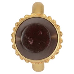
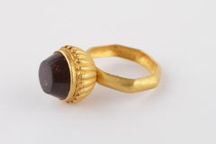
An Early and Rare Byzantine Finger-Ring with High Calyx-Shaped Bezel
Located in London, GB
A comparable example was unearthed in a late 5th century hoard at Istria, Romania, potentially deposited by Goths. Additional instances are housed in the Musée de Cluny, the Musée d’...
Category
15th Century and Earlier Turkish Antique Romanian
Materials
Gold