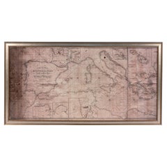
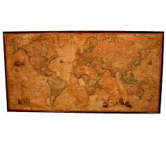
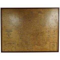
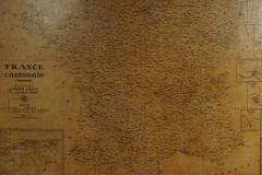
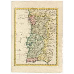
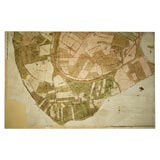
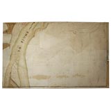
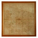
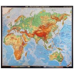
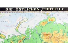
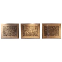
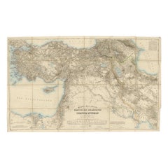
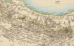
Large Wall Maps

to
15
56
43
98
2
13
2
2
1
1
1
1
1
1
21
32
44
2
11
25
4
3
1
4
1
4
7
1
1
71
25
21
11
10
61
19
18
18
12
100
100
100
2
2
1
1
1
Sort By
Florida and Virginia: A 17th Century Hand-colored Map by Hondius after Mercator

Florida and Virginia: A 17th Century Hand-colored Map by Hondius after Mercator

By Gerard Mercator

Located in Alamo, CA

Hondius contributed many of his own important cartographic innovations, including the introduction of the decorative map border and the development of the 17th century large Dutch wa...

Category

Antique Early 17th Century Dutch Maps

Materials

Paper

Large Map of London
Large Map of London

Large Map of London

Located in Gloucestershire, GB

Late Georgian/possibly early Victorian fine copy of the first large great map of London, Westminster and river Thames. The map was first produced in 1560 by Ralph Agas a famous map a...

Category

Antique 16th Century English Early Victorian Prints

Large Framed Map of the Mediterranean

Large Framed Map of the Mediterranean

Located in Queens, NY

Large map/chart chart of The Mediterranean and the Grecian Archipelago showing Italy, Sardinia, Corsica, part of France, etc. in a black frame

Category

Mid-20th Century American Mid-Century Modern Paintings

Large World School Map, 1950s

Large World School Map, 1950s

Located in Meulebeke, BE

Planishere politique Vintage school wall card. The school poster is in a good vintage condition with types of old -age signs that you can see from the product images.

Category

Vintage 1950s Belgian Mid-Century Modern Prints

Materials

Canvas, Wood, Paper

Large English Map of Europe, Circa 1920

Large English Map of Europe, Circa 1920

Located in Los Angeles, CA

A Large Framed Map of Europe from the London Geographical Institute. Displaying a curvilinear design with wonderful earth and sea tones, it is framed in a contrasting dark oak-staine...

Category

Early 20th Century English Prints

Large Format Map of Orange County, CA 2007

Large Format Map of Orange County, CA 2007

Located in Alhambra, CA

Killer Large Format Map of Orange County CA. Two panels 90” h x 45” wide. Amazing detail. Good vintage condition. 2007 Landiscor.

Category

21st Century and Contemporary American Post-Modern Posters

Materials

Paper

Oklahoma City Map in Large Frame, 1977

Oklahoma City Map in Large Frame, 1977

Located in Oklahoma City, OK

Beautiful framed map of Oklahoma City. Frame is a white chalk and map dates to 1977.

Category

Mid-20th Century American Mid-Century Modern Decorative Art

Materials

Glass, Wood, Paper

Large University Chart “Physical Map of Ireland” by Bacon

Large University Chart “Physical Map of Ireland” by Bacon

Located in Godshill, Isle of Wight

Large University Chart “Physical Map of Ireland” by Bacon W&A K Johnston’s Charts of Physical Maps By G W Bacon, This is colorful Physical map of Ireland, it is large lithograp...

Category

Early 20th Century International Style Posters

Materials

Linen

Large Vintage School Map Anemone Jung Koch Quentell 117cm

Large Vintage School Map Anemone Jung Koch Quentell 117cm

By Jung Koch Quentell 1

Located in Poperinge, BE

Beautiful large vintage school map, school poster about the 'anemone nemorosa', botany, paper on linen, by Jung Koch Quentell, 1960s-70s. Educational poster, which is also very deco...

Category

Vintage 1960s German Posters

Materials

Canvas, Wood, Paper

19th Century London Postal Map of Large Scale - Framed

19th Century London Postal Map of Large Scale - Framed

Located in Kinderhook, NY

Wonderfully graphic and acurately detailed last quarter 19th century postal map of London, United Kingdom, published by Kelly & Co. Ltd. Post Office Directory Office, 182, 183 & 184,...

Category

Antique 19th Century British Prints

Materials

Paper, Acrylic, Wood

Large Vintage France Map, Continental, Historical Cartography, Late 20th Century

Large Vintage France Map, Continental, Historical Cartography, Late 20th Century

Located in Hele, Devon, GB

This is a large vintage map of France. A Continental, framed example of historical cartography, dating to the late 20th century, circa 1970. Fascinating map of France and the island...

Category

Late 20th Century European Mid-Century Modern Prints

Materials

Glass, Wood, Paper

Large Articulated Brass Marine Map reading light

Large Articulated Brass Marine Map reading light

Located in Peekskill, NY

This is a substantial lamp. It extends almost 4 foot long and is solid brass. The lamp housing and wall box are heavy cast parts. The shades screw directly into the cast lamp housing...

Category

20th Century English Wall Lights and Sconces

Materials

Brass

Large Antique Folding Map of the Township of Winterswijk, The Netherlands, c1920

Large Antique Folding Map of the Township of Winterswijk, The Netherlands, c1920

Located in Langweer, NL

Antique map titled 'Gemeente Winterswijk'. Large format folding map of the township of Winterswijk, the Netherlands. Published circa 1920. Artists and Engravers: Anonymous. Co...

Category

20th Century Prints

Materials

Paper

Large Original Vintage Illustrated Map Poster Palestine in the Time of Christ

Large Original Vintage Illustrated Map Poster Palestine in the Time of Christ

Located in London, GB

Original vintage illustrated map poster of Palestine in the time of Christ featuring a map of the old and new testament of the Bible from The way to and with Christ by Fr M Bellarmin...

Category

Vintage 1930s Dutch Posters

Materials

Paper

A Large Early 20th Century World Map in Wood Frame

A Large Early 20th Century World Map in Wood Frame

Located in Palm Beach, FL

A Large Early 20th Century World Map in Wood Frame

Category

Early 20th Century French Decorative Art

Materials

Paper, Wood

Large "Map of the World" Tiled Panel by Harris Strong

Large "Map of the World" Tiled Panel by Harris Strong

Located in Philadelphia, PA

Harris Strong was, indisputably, the most ambitious and important tile craftsman that America produced in the post-World War II era. First in the Bronx and later in Maine, he superv...

Category

Vintage 1950s American Decorative Art

Materials

Wood

Extra Large Midcentury School Map of Mexico by Haack Painke Kooyman

Extra Large Midcentury School Map of Mexico by Haack Painke Kooyman

Located in Mexico City, CDMX

We offer this extra large midcentury school map of Mexico by Haack Painke Kooyman, circa 1960. This vintage item remains fully functional, but it shows sign of age through scuffs, di...

Category

Vintage 1960s German Mid-Century Modern Decorative Art

Materials

Canvas

Stunning Large Lapis Lazuli Prescious Stones World Map with Time Zone Clocks

Stunning Large Lapis Lazuli Prescious Stones World Map with Time Zone Clocks

Located in West Sussex, Pulborough

Wimbledon-Furniture Wimbledon-Furniture is delighted to offer for sale this stunning Lapis Lazuli precious stones map of the world with time zone clocks Please note the deliver...

Category

21st Century and Contemporary English Modern Wall Clocks

Materials

Lapis Lazuli

Set of 3 Antique Map of the 'Low Countries' by a. Barbey

Set of 3 Antique Map of the 'Low Countries' by a. Barbey

Located in Langweer, NL

Part of a larger wall map of the 'Low Countries' consisting of four sheets.

Category

Antique Late 17th Century Maps

Materials

Paper

Large Antique Two-Part Wall Art World Wall Map

Large Antique Two-Part Wall Art World Wall Map

Located in Las Vegas, NV

Large world map behind glass makes a unique wall art decoration.

Category

Mid-20th Century Mid-Century Modern Maps

Materials

Glass

Large French Paris Metro Map 1947

Large French Paris Metro Map 1947

Located in Stockholm, SE

A large French map of the Parisian Metro from the mid-20th century. Showing a nicely worn appearance, a great piece for framing. The map depicts the metro and bus lines in Paris. Mad...

Category

Vintage 1940s French Mid-Century Modern Prints

Materials

Wood, Paper

Large Africa School Map, circa 1950

Large Africa School Map, circa 1950

Located in Meulebeke, BE

Geographical vintage school wall card Africa. The school poster is in a good vintage condition with types of old -age signs that you can see from the product images.

Category

Vintage 1950s German Mid-Century Modern Posters

Materials

Canvas, Wood, Paper

Antique Map of Portugal and a large lithograph of a Lady near the Water

Antique Map of Portugal and a large lithograph of a Lady near the Water

Located in Langweer, NL

*Listing created on request* 1) Antique map of Portugal. Along the Atlantic coast, this map reaches from Villagarcia and San Tomas in the north all the way south to Cap S. Vencent a...

Category

Antique Mid-18th Century Prints

Materials

Paper

Abraham Ortelius Map of Greece Hand Colored Engraving Circa 1579

Abraham Ortelius Map of Greece Hand Colored Engraving Circa 1579

By Abraham Ortelius

Located in Atlanta, GA

In 1564 he published his first map, a large and ambitious world wall map. The inspiration for this map may well have been Gastaldi's large world map.

Category

Antique 16th Century British Decorative Art

Materials

Paper

Large World Population Wall Map in German by Denoyer-Geppert

Large World Population Wall Map in German by Denoyer-Geppert

By Denoyer-Geppert

Located in Alhambra, CA

This 1960s German wall map depicts "Bevolkerung Der Erde" or Population of the Earth." The four graphs represent (from left to right, top to bottom) "Population Density," "Religion,"...

Category

Vintage 1960s German Mid-Century Modern Maps

Materials

Steel

Large Metal and Brass World Globe Map Wall Sculpture, Spain 1970s

Large Metal and Brass World Globe Map Wall Sculpture, Spain 1970s

Located in L'Escala, ES

Beautiful and rare large metal and brass world globe map wall sculpture manufactured in Spain in 1970s.

Category

Mid-20th Century Spanish Wall-mounted Sculptures

Materials

Metal, Brass

Large Map Panels
Large Map Panels

Large Map Panels

Sold|$12,000

Large Map Panels

Located in New York, NY

3 large map panels, which together depict Italian countryside and Po River. Panels sold individually or as a set.

Category

Antique 19th Century Italian Drawings

Large Map Panel
Large Map Panel

Large Map Panel

Sold|$4,000

Large Map Panel

Located in New York, NY

1 large map panel, which depicts part of the Italian countryside and Po River.

Category

Italian Decorative Art

large framed world map

large framed world map

Located in Los Angeles, CA

vintage framed philips new commerical map of the world, nautical cylindrical map projection, 1958. a smaller paint smudge on lower right of map to view our complete inventory c...

Category

20th Century American Prints

Materials

Wood

Very large midcentury marquetry map

Very large midcentury marquetry map

Located in Los Angeles, CA

Exceptional wall panel map of the United States dated 1964. Each state is made from it's typical wood. Could also be used as table top

Category

Vintage 1960s Decorative Art

Materials

Wood

Extra Large State of Connecticut Framed Map

Extra Large State of Connecticut Framed Map

Located in New York City, NY

State of Connecticut Large Framed Map Dated 1893, Reprinted 1927

Category

Antique 19th Century American Prints

Materials

Paper, Glass

Large 19th Century map of London and surroundings

Large 19th Century map of London and surroundings

Located in Los Angeles, CA

Stylish circular map of London with large properties and their owners highlighted. New framing

Category

Antique 19th Century British Prints

Materials

Paper, Wood

Extra Large Vintage German Schoolhouse Map Mounted on Board

Extra Large Vintage German Schoolhouse Map Mounted on Board

Located in Austin, TX

An extra-large sized vintage schoolhouse map showing the continents of Africa, Asia, Europe and Australia.

Category

Mid-20th Century German Posters

Materials

Canvas

Set of Three Large Copperplate Engravings of Maps of Paris, France, 19th Century

Set of Three Large Copperplate Engravings of Maps of Paris, France, 19th Century

Located in San Antonio, TX

Wonderful set of three large format copperplate engravings of Paris maps from the 19th century and possibly earlier. These engravings have been newly framed.

Category

Antique 19th Century French Neoclassical Prints

Materials

Paper

Large 1936 Philco Radio Advertising  Display Map of the World

Large 1936 Philco Radio Advertising Display Map of the World

Located in Great Barrington, MA

A very colorful silk screen and/or hand painted hanging scroll advertisement for the Philco Radio Corp. from the pre TV age.
I suppose it was used in a retail store as part of...

Category

Vintage 1930s American Decorative Art

Vintage Brass World Map by Curtis Jere

Vintage Brass World Map by Curtis Jere

By Curtis Jeré

Located in Hudson, NY

An unusual large wall mounted two piece world map by Curtis Jere.

Category

Vintage 1960s American Wall-mounted Sculptures

Mid-Century Modern Italian Illustrated Food and Liquor Map, 1949, Large Version

Mid-Century Modern Italian Illustrated Food and Liquor Map, 1949, Large Version

Located in New York, NY

This is an Italian Mid-Century Modern period advertising poster for Galbani Products. It is an exquisitely crafted poster that features a beautifully detailed and playful map of Ital...

Category

Mid-20th Century Italian Mid-Century Modern Posters

  • 1
Get Updated with New Arrivals
Save "Large Wall Maps", and we’ll notify you when there are new listings in this category.

Large Wall Maps For Sale on 1stDibs

An assortment of large wall maps is available at 1stDibs. Each of these unique large wall maps was constructed with extraordinary care, often using paper, fabric and wood. Large wall maps have long been popular, with older editions for sale from the 18th Century and newer versions made as recently as the 21st Century. Large wall maps are generally popular furniture pieces, but Mid-Century Modern, Modern and Folk Art styles are often sought at 1stDibs. Air France produced beautiful large wall maps that are worth considering.

How Much are Large Wall Maps?

Prices for large wall maps can differ depending upon size, time period and other attributes — at 1stDibs, large wall maps begin at $320 and can go as high as $9,500, while the average can fetch as much as $1,398.