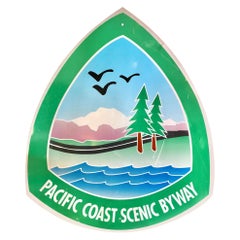
Large Pacific Coast Scenic Highway Sign
Located in Los Angeles, CA
Large vintage Pacific Coast Highway sign reading "Pacific Coast Scenic Byway." Green sign that
Category
1970s American Pacific Coast Vintage
Materials
Steel
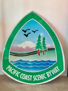
Large Pacific Coast Scenic Highway Sign
Located in Los Angeles, CA
Large vintage Pacific Coast Highway sign reading "Pacific Coast Scenic Byway." Green sign that
Steel
$780Sale Price|20% Off
H 16 in W 19.25 in D 0.75 in
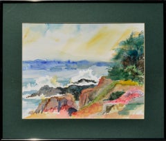
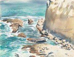
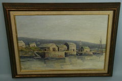
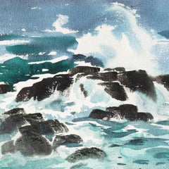
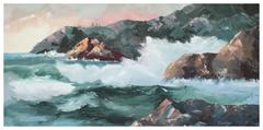
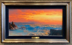
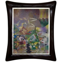
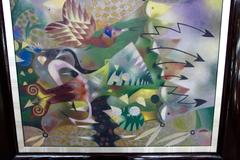
Pacific Coast in Spring - Watercolor Landscape
Located in Soquel, CA
Pacific Coast in Spring - Watercolor Landscape Vibrant watercolor of Pacific coastal waters
Watercolor, Laid Paper
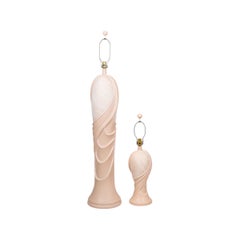
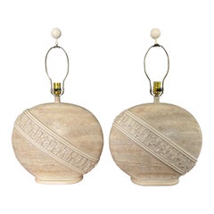
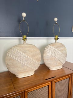
Postmodern Sculptural Lamps by Pacific Coast - a Pair
Located in Bradenton, FL
A pair of postmodern lamps by Pacific Coast dated 1991. Postmodern sculptural style vases in peach
Ceramic
$880Sale Price|20% Off
H 23 in W 29 in D 1 in
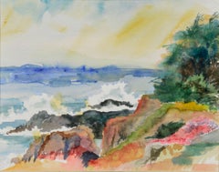
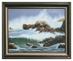
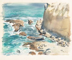
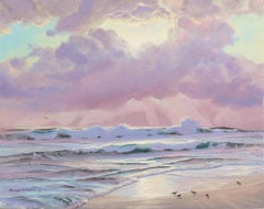
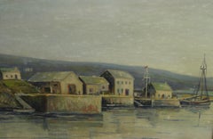
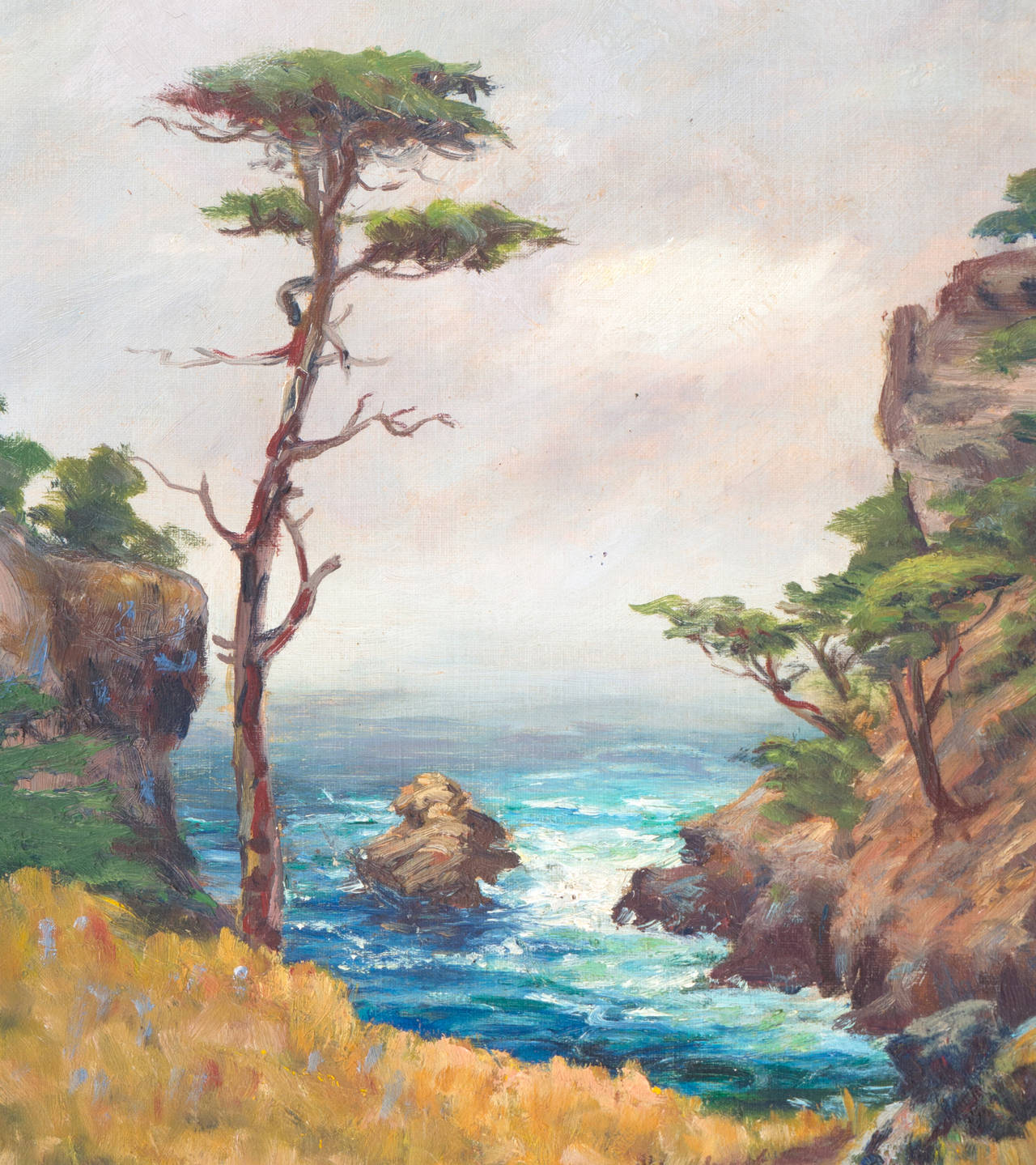
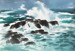
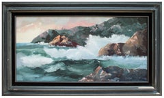
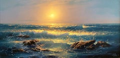
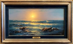
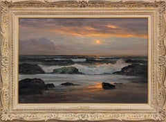
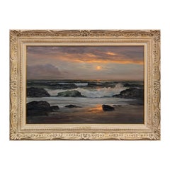
Crashing Barrel Waves, Mid Century Pacific Coast Seascape
Located in Soquel, CA
Crashing Barrel Waves, Mid Century Pacific Coast Seascape Dynamic mid-century seascape of Pacific
Canvas, Oil
Postmodern Oval Tessellated Stone Lamps by Pacific Coast Lighting
Located in W Allenhurst, NJ
Pair of Pacific Coast Lighting, Mactan stone-style plaster round table lamps, designed with
Plaster
$1,800
H 15.5 in W 20.13 in
'Pacific Coast', California Post-Impressionist, Modernism, San Francisco
By Michel Kady
Located in Santa Cruz, CA
a coastal scene with figures walking beside the Pacific Ocean beneath imposing cliffs. This listed
Paper, Watercolor
$2,750
H 24 in W 30 in D 0.75 in
'Pacific Coast Sunset', Art Institute of Chicago, Mendocino, California Artist
Located in Santa Cruz, CA
1988. A lyrical and light-filled seascape showing a view of the Pacific Ocean with the sun breaking
Canvas, Oil


$2,400
H 12 in W 16 in
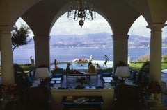
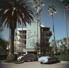
Acapulco Villa, Estate Edition, Landscape Photograph on the Pacific Coast
By Slim Aarons
Located in Los Angeles, CA
This midcentury landscape photograph, captured by society photographer Slim Aarons, features Las Brisas Residencias, home of Eustaquio Escandon in Acapulco, where Henry Kissinger spe...
Lambda


$3,600
H 20 in W 24 in
Acapulco Villa, Estate Edition, Landscape Photograph on the Pacific Coast
By Slim Aarons
Located in Los Angeles, CA
This midcentury landscape photograph, captured by society photographer Slim Aarons, features Las Brisas Residencias, home of Eustaquio Escandon in Acapulco, where Henry Kissinger spe...
Lambda

$4,200
H 30 in W 40 in
Acapulco Villa, Estate Edition, Landscape Photograph on the Pacific Coast
By Slim Aarons
Located in Los Angeles, CA
This midcentury landscape photograph, captured by society photographer Slim Aarons, features Las Brisas Residencias, home of Eustaquio Escandon in Acapulco, where Henry Kissinger spe...
Lambda


$3,000
H 16 in W 20 in
Acapulco Villa, Estate Edition, Landscape Photograph on the Pacific Coast
By Slim Aarons
Located in Los Angeles, CA
This midcentury landscape photograph, captured by society photographer Slim Aarons, features Las Brisas Residencias, home of Eustaquio Escandon in Acapulco, where Henry Kissinger spe...
Lambda

$3,900
H 20 in W 30 in
Acapulco Villa, Estate Edition, Landscape Photograph on the Pacific Coast
By Slim Aarons
Located in Los Angeles, CA
This midcentury landscape photograph, captured by society photographer Slim Aarons, features Las Brisas Residencias, home of Eustaquio Escandon in Acapulco, where Henry Kissinger spe...
Lambda


$5,400
H 40 in W 60 in
Acapulco Villa, Estate Edition, Landscape Photograph on the Pacific Coast
By Slim Aarons
Located in Los Angeles, CA
This midcentury landscape photograph, captured by society photographer Slim Aarons, features Las Brisas Residencias, home of Eustaquio Escandon in Acapulco, where Henry Kissinger spe...
Lambda
$300
H 14 in W 21 in D 1 in
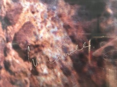
Antique American Pacific Coast Maritime Village Seascape by M. Stiefel 1940
Located in Douglas Manor, NY
#5-3453 A marine village seascape painting,oil on artist board displayed in a wood frame.Signed lower left by M.Stiefel
Oil
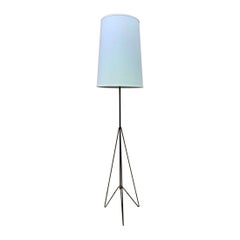
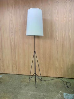
1950s Canadian Mid Century West Coast Modern Floor Lamp
Located in Victoria, BC
New to our collection, this stunning architectural floor lamp hails from the Pacific coast of
Iron
$3,500
H 16 in W 12 in D 0.25 in
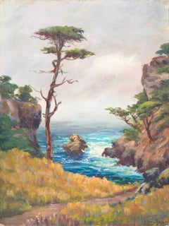
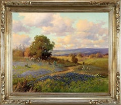
'Carmel Coast', California Plein Air Impressionist oil, Oakland Museum, Stanford
By Francis Harvey Cutting
Located in Santa Cruz, CA
Pacific coast near Carmel, California.
Oil, Board, Canvas
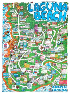
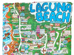
Original Laguna Beach, South Laguna fun map poster, 1998
Located in Spokane, WA
Towne Graphics. Features: -Vintage 1998 fun map of Laguna Beach -Shows Pacific Coast Highway and side
Offset

$45
H 10.25 in W 10.25 in D 1 in
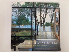
Northwest Style: Interior Design and Architecture in the Pacific Northwest Hardc
Located in Moreno Valley, CA
its lush forests, rugged coast, and long rainy season, the Pacific Coast has spawned a style that is
Paper
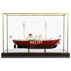
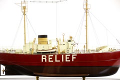
Lightship "Relief" of Oakland, California
Located in Norwell, MA
lightships on the Pacific coast. She was retired from service in 1975 and decommissioned the following year
$1,400Sale Price|20% Off
H 11 in W 14 in
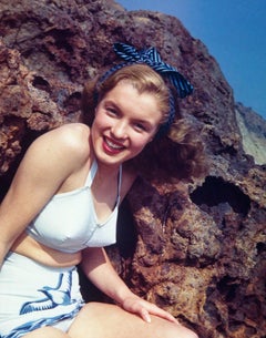
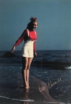
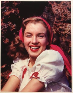
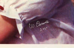
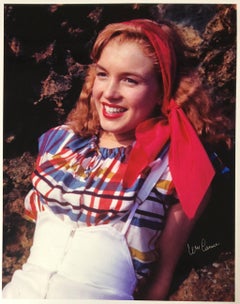
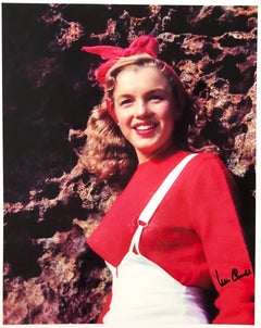
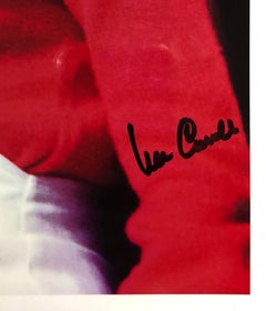
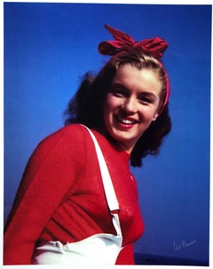
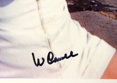
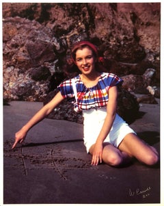
William Carroll, "Norma Jeane #27, " original photograph, hand signed
By William Carroll
Located in Chatsworth, CA
Rock in Santa Monica off of the Pacific Coast Highway. This image is from Norma Jeane's first paid
Photographic Paper
$2,200
H 14.5 in W 21.5 in D 0.01 in
'Coastal Breakers', Mid-century California, American Watercolor Society, CWS
By Arthur Irwin Riley
Located in Santa Cruz, CA
water on California's Northern Pacific coast. Art Riley first studied at the Art Center School in Los
Paper, Watercolor
Price Upon Request
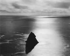
Northern California Coast, Pacific Ocean
By Chip Hooper
Located in Carmel-by-the-Sea, CA
Pacific. The artist passed away in March, 2016 so prices and availability is subject to change without
Silver Gelatin
$1,950
H 5 in W 7 in
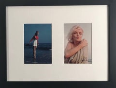
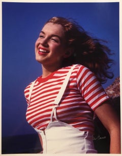
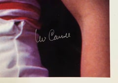
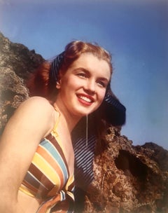
Bill Carroll/George Barris, "First and Last Diptych, " original photographs
By William Carroll
Located in Chatsworth, CA
the Pacific Coast Highway at Castle Rock in 1945, which was the first photo-shoot in which Marilyn
Photographic Paper
$2,360Sale Price|32% Off
H 27 in W 21 in
William Carroll, "Norma Jeane #26, " original photograph, hand signed
By William Carroll
Located in Chatsworth, CA
Rock in Santa Monica off of the Pacific Coast Highway. This image is from Norma Jeane's first paid
Photographic Paper
$1,032Sale Price|70% Off
H 14 in W 11 in
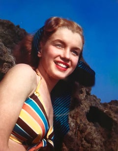
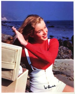
William Carroll, "Norma Jeane #21", original photograph
By William Carroll
Located in Chatsworth, CA
the Pacific Coast Highway, just north of Santa Monica, CA. This was the first photo-shoot in which
Photographic Paper
$1,260Sale Price|64% Off
H 14 in W 11 in
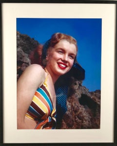
William Carroll, "Norma Jeane #17", original photograph
By William Carroll
Located in Chatsworth, CA
the Pacific Coast Highway, just north of Santa Monica, CA. This was the first photo-shoot in which
Photographic Film
Norma Jeane #22
By William Carroll
Located in Chatsworth, CA
were taken on the beach off the Pacific Coast Highway, just north of Santa Monica, CA. This was the
Photographic Paper

$2,500
H 17.25 in W 30.75 in
William Carroll, Norma Jeane Triptych, original photograph
By William Carroll
Located in Chatsworth, CA
series were taken on the beach off the Pacific Coast Highway, just north of Santa Monica, CA. This was
Photographic Paper
$7,500
H 72 in W 60 in D 2.5 in
'Nancy in the Clouds', San Francisco, CCAC, SFMoMA, Oakland & Seattle Art Museum
Located in Santa Cruz, CA
2007 “New American Painting" In Print Exhibition, 2007 Pacific Coast Edition “Round Three” New
Canvas, Oil
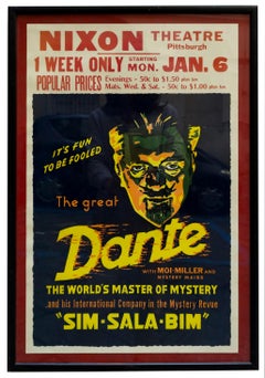
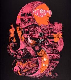
SIM SALA BIM - Lithographic poster of Dante the Great, 1970s
Located in Napoli, IT
della sua morte alla convention combinata della Society of American Magicians e della Pacific Coast
Paper, Lithograph
$1,260Sale Price|28% Off
H 14 in W 11 in
Bill Carroll , Norma Jeane #15 (Marilyn Monroe), hand signed
By William Carroll
Located in Chatsworth, CA
were taken on the beach off the Pacific Coast Highway, just north of Santa Monica, CA. This was the
Photographic Paper
Norma Jeane #13
By William Carroll
Located in Chatsworth, CA
were taken on the beach off the Pacific Coast Highway, just north of Santa Monica, CA. This was the
Photographic Paper
Norma Jeane #11
By William Carroll
Located in Chatsworth, CA
were taken on the beach off the Pacific Coast Highway, just north of Santa Monica, CA. This was the
Photographic Paper
Norma Jeane #23
By William Carroll
Located in Chatsworth, CA
were taken on the beach off the Pacific Coast Highway, just north of Santa Monica, CA. This was the
Photographic Paper
$1,635
H 37.41 in W 24.41 in D 0.04 in
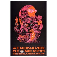
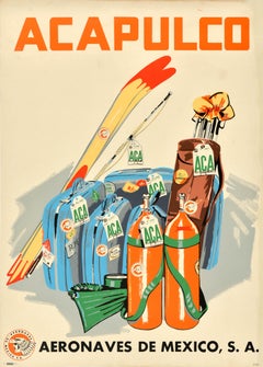
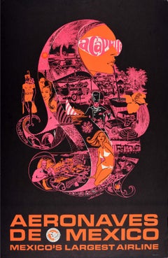
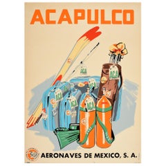
Original Vintage Airline Travel Poster Acapulco Aeronaves De Mexico Psychedelic
Located in London, GB
Acapulco is located on the Pacific coast near the Sierra Madre del Sur mountains becoming popular with
Paper
$889Sale Price|44% Off
H 33 in W 5 in D 5 in
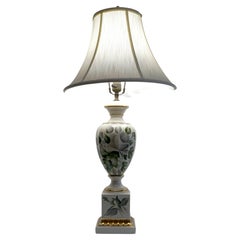
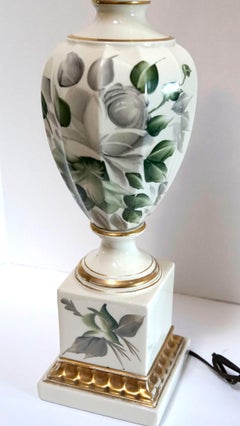
Vintage Signed Ivory White Porcelain and Gilt Hand Painted Table Lamp
Located in Lomita, CA
purchased at a Pacific Coast Highway antique store in the South Bay that was a neighborhood fixture for
Porcelain

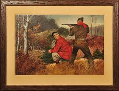
Hunters
By Amos Sewell
Located in Fort Washington, PA
and down the Pacific Coast, sketching and etching. In 1931, in the middle of the Depression, he
Oil, Board
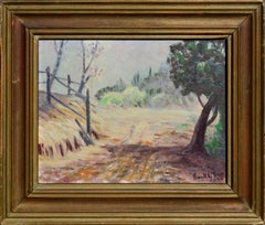
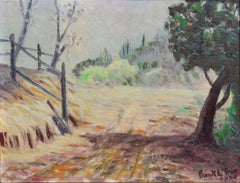
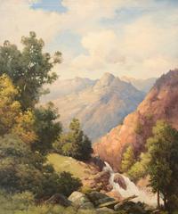
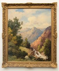
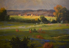
Mid-Century Country Lane Landscape
By Frank Leslie True
Located in Soquel, CA
. During this period he painted in the western states of the Pacific Coast, New Mexico, Utah, and Arizona
Masonite, Oil
$950
H 18 in W 24 in D 0.75 in
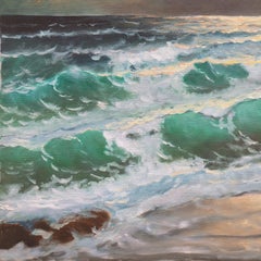
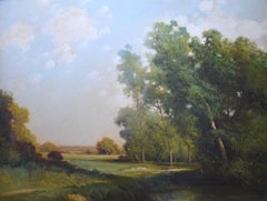
'Sunset Breakers, Rocky Coast'. Pacific Ocean Beach, Seascape, Cypress Trees
Located in Santa Cruz, CA
American School coastal landscape showing a view of breakers crashing in towards a rocky coast with
Canvas, Oil
$595
H 14.5 in W 3.5 in D 3.5 in
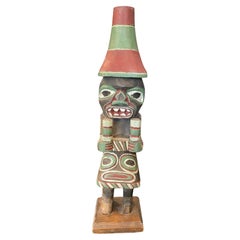
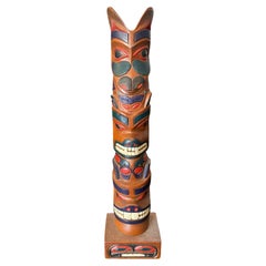
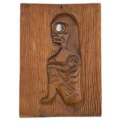
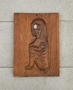
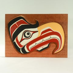
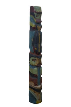
Pacific Northwest Coast Indigenous Native American Signed Wood Carved Totem Pole
Located in Studio City, CA
A beautifully designed, wonderfully carved Pacific Northwest Coast First Nation Native American
Wood, Paint
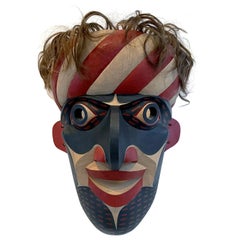
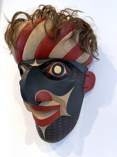
Carved Tribal Mask from Pacific Northwest Coast by David Frankel
Located in Atlanta, GA
A striking carved and painted mask in the tradition of the Native Indian tribes from Pacific
Natural Fiber, Wood
$595
H 17.75 in W 4.25 in D 3.5 in
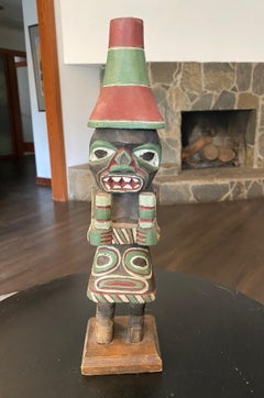
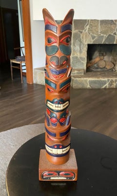
Pacific Northwest Coast Indigenous Native American Signed Wood Carved Totem Pole
Located in Studio City, CA
A beautifully designed, wonderfully carved Pacific Northwest Coast First Nation Native American
Wood, Paint
$2,280Sale Price|20% Off
H 34 in W 20 in D 0.5 in
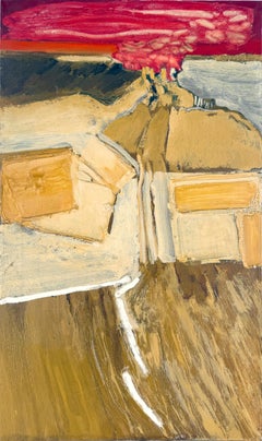
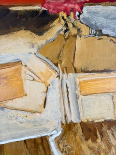
"February 21st - Red" Abstract Expressionist Landscape by William Morehouse
Located in Soquel, CA
Legion of Honor 1951; First Pacific Coast Biennial Exhibition, Santa Barbara Museum of Art & California
Canvas, Oil, Stretcher Bars
$3,817
H 16 in W 20 in D 0.1 in
Beverly Hills Hotel, 1957 - Sunset Boulevard Hollywood California Landscape
By Slim Aarons
Located in Brighton, GB
Street in downtown Los Angeles to the Pacific Coast Highway in the Pacific Palisades. Slim Aarons
Photographic Paper, C Print, Color, Digital
$576Sale Price|53% Off
H 15.63 in W 11.25 in D 0.75 in
Ron Aleck Carved Wood Plaque, Pacific North West Coast, 20th Century
Located in San Juan Capistrano, CA
Ron Aleck Wood Carving Plaque, Pacific North West Coast, 20th Century. Signed to the back.
Wood
$1,480Sale Price|20% Off
H 22 in W 37 in D 2 in
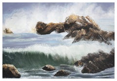
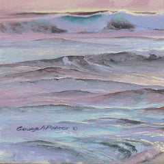
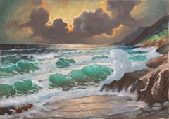
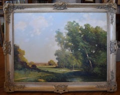
Big Sur Coast, Vintage 1970s Panoramic Pacific Seascape by John Zaccheo
By John Zaccheo
Located in Soquel, CA
Big Sur Coast, Vintage 1970s Panoramic Pacific Seascape by John Zaccheo Gorgeous vintage oil
Canvas, Oil

Man Leading Horse
By Amos Sewell
Located in Fort Washington, PA
of trips up and down the Pacific Coast, sketching and etching. In 1931, in the middle of the
Gouache
$895
H 10.63 in W 15.38 in D 1 in
Vintage Pacific Northwest Coast Native Wooden Hawk Carving by William Wasden Jr
Located in Philadelphia, PA
A fine vintage Pacific Northwest Native wooden carving. The carving in the form of an hawk with
Wood
$4,136Sale Price|44% Off
H 54.5 in W 63.5 in D 0.5 in
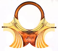
Yellow Totem Abstract New Age Surreal Sculpture by Mickey Kane
Located in Soquel, CA
Illinois and grew up in Sacramento, CA. Kane moved to the Pacific Coast and worked on mixed media panels
Plywood, Acrylic Polymer, Acrylic
$2,936Sale Price|60% Off
H 47.5 in W 58 in D 0.5 in
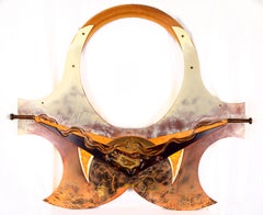
Scarab Totem Abstract New Age Surreal Sculpture by Mickey Kane
Located in Soquel, CA
and grew up in Sacramento, CA. Kane moved to the Pacific Coast and worked on mixed media panels
Plywood, Acrylic Polymer, Acrylic
$16,500
H 36.5 in W 38.25 in D 3.75 in
California Coastal Landscape by Rod Goebel (American 1946-1993)
By Rod Goebel
Located in Dallas, TX
SPRING LIGHT, American West / California rocky Pacific coast oil on canvas landscape picture by
Canvas
$3,500
H 12.75 in W 20 in D 0.13 in
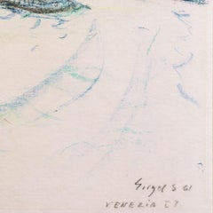
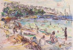
'Venice', Post-Impressionist Woman Artist, Salon d'Automne, Paris, France, SFMA
By Irma Engel Grabhorn
Located in Santa Cruz, CA
Hughes: Crocker Art Museum, Sheridan Books 2002, Vol. 1, p. 352; Who's Who on the Pacific Coast; SF
Paper, Crayon

$5,250Sale Price|30% Off
H 28 in W 22 in D 0.75 in
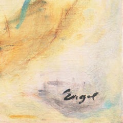
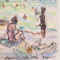
'Summer Flowers', Paris, Salon d'Automne, Post-Impressionist California Artist
By Irma Engel Grabhorn
Located in Santa Cruz, CA
2002, Vol. 1, p. 352; Who's Who on the Pacific Coast; SF Chronicle, 5-6-1991; et al.
Canvas, Oil
$3,040Sale Price|20% Off
H 49 in W 22 in D 2.5 in
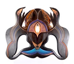
Abstract Asymmetric Totem New Age Surreal Sculpture by Mickey Kane
Located in Soquel, CA
grew up in Sacramento, CA. Kane moved to the Pacific Coast and worked on mixed media panels - which he
Plywood, Acrylic Polymer, Acrylic
$5,250Sale Price|30% Off
H 12 in W 17.75 in
'The Cote d'Azur', Paris, Salon d'Automne, Post-Impressionist California Artist
By Irma Engel Grabhorn
Located in Santa Cruz, CA
Hughes: Crocker Art Museum, Sheridan Books 2002, Vol. 1, p. 352; Who's Who on the Pacific Coast; SF
Paper, Oil Pastel, Ink
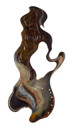
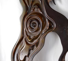
"Internal Release" Abstract Relief Sculpture
Located in Soquel, CA
Pacific Coast and worked on mixed media panels - which he would refer to as a “Totem” – and detailed
Resin, Found Objects, Acrylic, Wood Panel, Handmade Paper
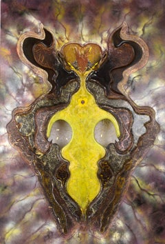
$5,540
H 72 in W 48 in D 0.5 in
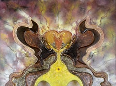
"The Clever Sentimentalist" Surrealist Relief Sculpture
Located in Soquel, CA
) was born in Illinois and grew up in Sacramento, CA. Kane moved to the Pacific Coast and worked on
Wire
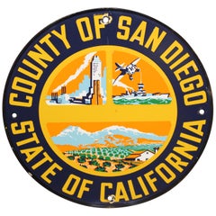
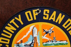
San Diego County California Truck Door Porcelain Sign
Located in Orange, CA
San Diego is a city on the Pacific coast of California known for its beaches, parks and warm
Porcelain
Unavailable
H 82 in W 50 in D 22.25 in
Silver Leaf, Armoire, Tall Chest, Cabinet, Handcrafted, Bruce Andrews Design
By Bruce Andrews Design
Located in Evans, GA
one at a time by our Thomasville factory. Our woodworkers who use Pacific Coast maple to showcase the
Nickel, Silver Leaf
Unavailable
H 37.8 in W 27.17 in
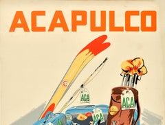
Original Vintage Travel Poster Acapulco Aeronaves De Mexico Diving Golf Waterski
Located in London, GB
summer and winter sports during a holiday at the popular beach resort of Acapulco on the Pacific coast
Paper
Unavailable
H 18 in W 24 in
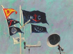
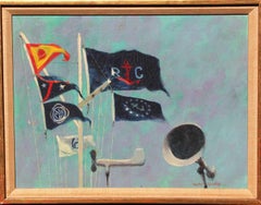
Mission Bay Yacht Club Flag Staff, Oil on Canvas, American, 1960
By Henry Koehler
Located in NEW YORK, NY
signed, titled, dated 1960 and inscribed PACIFIC COAST YACHTING ASSO. REGATTA/ SAN DIEGO, CAL./ AUG. 28
Canvas, Oil

Unavailable
H 37.41 in W 24.41 in
Original Vintage Airline Travel Poster Acapulco Aeronaves De Mexico Psychedelic
Located in London, GB
Acapulco is located on the Pacific coast near the Sierra Madre del Sur mountains becoming popular with
Paper

Unavailable
H 20 in W 16 in
Natalie Wood in Coat for "The Great Race" Globe Photos Fine Art Print
Located in Las Vegas, NV
/Pacific Coast News. This is a limited edition fine art C-Print, hand numbered out of an edition of 125
Archival Ink, Archival Paper, C Print, Archival Pigment
Natalie Wood "The Great Race" Globe Photos Fine Art Print
Located in Las Vegas, NV
/Pacific Coast News. This is a limited edition fine art C-Print, hand numbered out of an edition of 125
Archival Ink, Archival Paper, C Print, Archival Pigment
South Pacific Shell
Located in Rome, IT
South Asian Clam Shell of Tridacna Gigas, This clam was found off the South Pacific Ocean from the
Unavailable
H 108 in W 21.5 in D 10 in
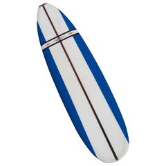
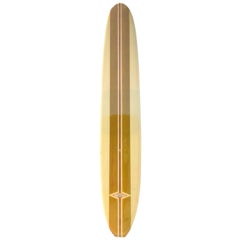
Jacobs Surfboard Fully Restored, Blue, White and Red, Early 1960s
By Hap Jacobs
Located in Los Angeles, CA
these well designed, lighter, faster boards. In 1960 Jacobs opened his first store along Pacific Coast
Fiberglass, Foam, Paint, Wood
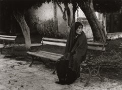
Manuel Carrillo, Untitled, Mexico. C. 1960-70s.
By Manuel Carrillo
Located in Santa Fe, NM
the interior, as well as in his very favorite and magnificent spot on the Mexican Pacific coast
Silver Gelatin
Manuel Carrillo, Untitled, Mexico. C. 1960-70s.
By Manuel Carrillo
Located in Santa Fe, NM
favorite and magnificent spot on the Mexican Pacific coast, Zihuatanejo. As a young man of 16 and speaking
Silver Gelatin
Manuel Carrillo, Untitled, Mexico. C. 1960-70s.
By Manuel Carrillo
Located in Santa Fe, NM
favorite and magnificent spot on the Mexican Pacific coast, Zihuatanejo. As a young man of 16 and speaking
Silver Gelatin
Unavailable
H 8 in W 10.25 in D 0.1 in
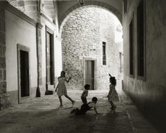
Manuel Carrillo, Untitled, Mexico. C. 1960-70s. (kids playing in archway)
By Manuel Carrillo
Located in Santa Fe, NM
magnificent spot on the Mexican Pacific coast, Zihuatanejo. As a young man of 16 and speaking no English
Silver Gelatin

Unavailable
H 8 in W 7 in D 0.1 in
Untitled, Mexico. C. 1960-70s. (description, woman with child in serape)
By Manuel Carrillo
Located in Santa Fe, NM
magnificent spot on the Mexican Pacific coast, Zihuatanejo. As a young man of 16 and speaking no English
Silver Gelatin
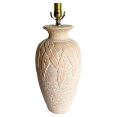
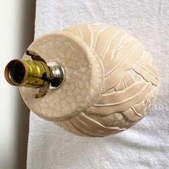
Postmodern Peach Ceramic Lamp by Pacific Coast Lighting
Located in Delray Beach, FL
Exceptional vintage postmodern ceramic table lamp by pacific coast lighting. Features a fact as tic
Ceramic
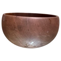
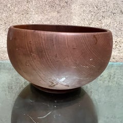
1960s Pacific Coast Myrtlewood Bowl Coos Bay, Oregon
By Dansk
Located in Chula Vista, CA
1960s MCM Pacific Coast Myrtlewood Bowl from Coos Bay, Oregon maker stamped House of Myrtlewood
Wood
Sold
H 19.5 in W 8.5 in D 8.5 in
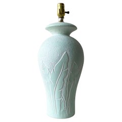
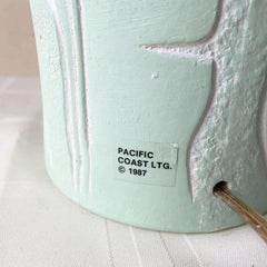
Postmodern Mint Green Banana Leaf Ceramic Table Lamp by Pacific Coast Lighting
Located in Delray Beach, FL
Amazing Postmodern ceramic table lamp by Pacific Coast Lighting. Features a mint green finish with
Ceramic
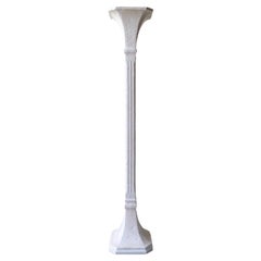
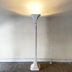
Art Deco White Plaster Torchiere Floor Lamp
Located in Delray Beach, FL
Exceptional plaster torchiere lamp. Square body and top with a white finish. By pacific coast
Ceramic
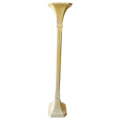
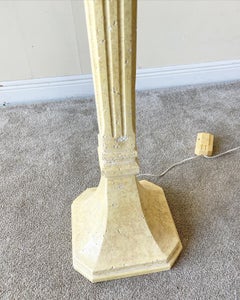
Art Deco Plaster Torchiere Floor Lamp
Located in Delray Beach, FL
Exceptional plaster torchiere lamp. Square bad and top, finished with a light yellow. By pacific
Plaster
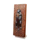

Otter
Located in Greenwich, CT
. From an important Northern Pacific Coast collection. ca 1940
Wood
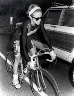

Vintage Madonna Photograph, Malibu California "PCH" (Los Angeles)
Located in NEW YORK, NY
Vintage Madonna Photograph Madonna cycling on PCH (Pacific Coast Highway) A dynamic, vintage
Silver Gelatin
Sold
H 8.88 in W 8.88 in D 1 in
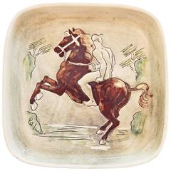
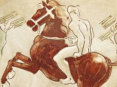
"Rider in the Surf, " Highly Rare Mid-Century Ceramic Piece, Laguna Beach
By Pat and Covey Stewart
Located in Philadelphia, PA
nude male figure riding a rearing horse along the rocky Pacific coast. The decoration of this dish was
Clay
Sold
H 35 in W 44 in D 1.5 in
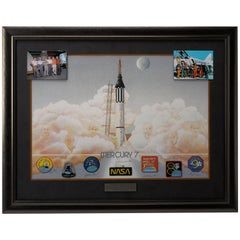
Mercury 7 Lithograph, Signed by 6 of the 7 Original Astronauts and Betty Grissom
Located in Colorado Springs, CO
issued by Pacific Coast Gallery circa 1990. Signed boldly at bottom: "Alan Shepard", "Betty Grissom
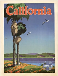
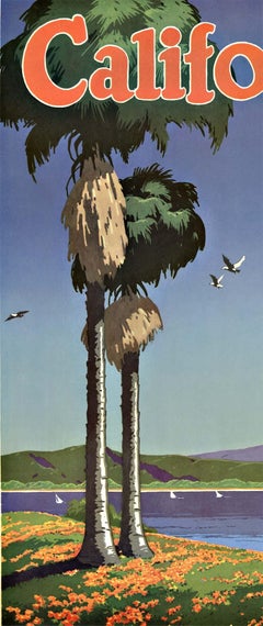
California Santa Fe original vintage railroad poster
Located in Spokane, WA
California. The Pacific coast featuring palm trees and seagulls flying and green mountains that come down
Offset
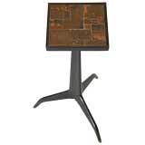

Edward Wormley for Dunbar side table inset with Natzler tiles
By Edward Wormley
Located in Chicago, IL
architecture at the turn of the century as Greene and Greene on the Pacific coast,' Mr. Wormley observes in
Walnut

Sold
H 37.8 in W 27.56 in D 0.04 in
Original Vintage Travel Poster Acapulco Diving Golf Sport Aeronaves De Mexico
Located in London, GB
sports during a holiday at the popular beach resort of Acapulco on the Pacific coast near the Sierra
Paper


Sold
H 37.8 in W 27.17 in D 0.04 in
Original Vintage Travel Poster Acapulco Aeronaves De Mexico Diving Golf Waterski
Located in London, GB
summer and winter sports during a holiday at the popular beach resort of Acapulco on the Pacific coast
Paper
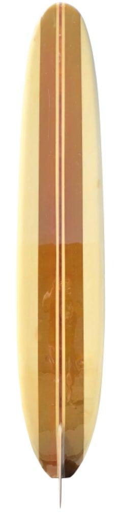
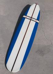
Vintage 1960s Jacobs Longboard Surfboard
By Hap Jacobs
Located in Haleiwa, HI
Pacific Coast Highway in Hermosa Beach. It was then that Jacobs developed his iconic red-diamond logo
Fiberglass, Foam, Softwood
Sold
H 36 in W 36 in
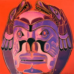
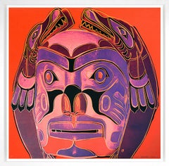
Northwest Coast Mask, from Cowboys and Indians, Unique Trial Proof, 1986
By Andy Warhol
Located in Palo Alto, CA
, stretching along the Pacific Coast north of California, has existed for several thousand years. Andy Warhol’s
Screen
Sold
H 16.75 in W 2.25 in D 1.75 in
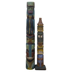
2 Hudson Bay Pacific Northwest Coast Native American Totem Pole Sculptures
Located in Dayton, OH
Mid to early 20th century hand carved and painted Pacific Northwest Native American folk art totem
Hardwood
Sold
H 16.5 in W 18.5 in D 1.25 in
John Thomas Blue and Orange Still Life Signed Modern Oil Painting on Canvas 1958
By John Thomas
Located in Keego Harbor, MI
Museum, Kansas (1957); Pacific Coast Biennial – Santa Barbara Museum of Art, San Francisco Legion of
Canvas
World Friendship Monument, c.1991
Located in Pasadena, CA
½-ton boulder that had fallen onto the Pacific Coast Highway in Malibu. In 1979, he sold it to an
Bronze
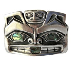
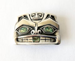
Pacific Northwest Native American Sterling Silver Abalone Mask Money Clip
Located in Palm Springs, CA
Native American Pacific northwest coast sterling silver mask money clip accented with abalone eyes
Sterling Silver
Sold
H 32.5 in W 27.5 in D 4 in
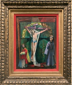
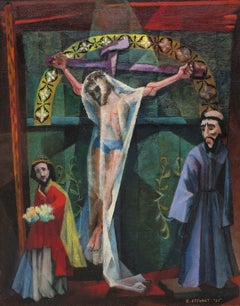
Trampas Altar, 1950s Figurative Devotional Oil Painting by Charles Stewart
By Charles Stewart, 1922-2011
Located in Denver, CO
dirt road along the Pacific coast and found themselves in the small farming village of Todos Santos and
Oil, Canvas
Sold
H 18 in W 30 in D 2 in
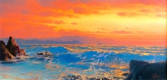
"The Opalesence" Seascape Ocean AMAZINGLY BEAUTIFUL Image 12 x 24
Located in San Antonio, TX
the past 46 years he has lived and painted scenes of the entire Pacific coast from Baja to the Inland
Oil
California Bear Flag Made in 1969 for the 200th Anniversary
Located in York County, PA
an explorer named Juan Rodríguez Cabrillo visited the Pacific Coast. Cabrill laid claim in the name
Silk
Sold
H 35.83 in W 24.22 in D 0.04 in
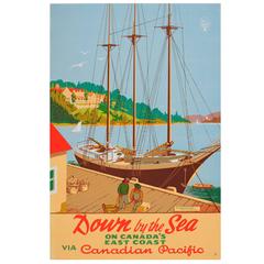
Original Vintage Canadian Pacific Poster - Down by the Sea - Digby Pines Hotel
Located in London, GB
Original vintage travel advertising poster “Down by the Sea on Canada's East Coast via Canadian
Paper
Sold
H 18 in W 30 in D 2 in
"Capriccio In Sea Minor" Seascape Ocean AMAZINGLY BEAUTIFUL Image 12 x 24
Located in San Antonio, TX
the past 46 years he has lived and painted scenes of the entire Pacific coast from Baja to the Inland
Oil
Limpia Creek
By Robert W. Wood
Located in Denver, CO
1952. The following year, Wood was in a near fatal car accident on the Pacific Coast Highway. An
Oil

Dressing Room
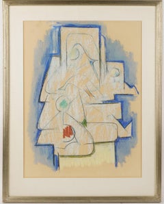
Located in Los Angeles, CA
, California: Second Pacific Coast Biennial, purchase award, September 10 – October 13 1961 Santa Barbara
Oil Pastel

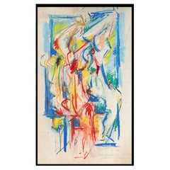
The Studio
Located in Los Angeles, CA
, California: Second Pacific Coast Biennial, purchase award, September 10 – October 13 1961 Santa Barbara
Pastel
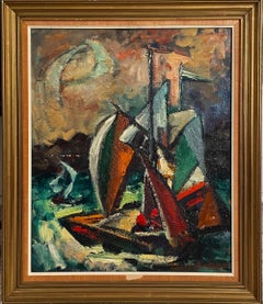
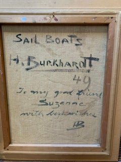
Sail Boats
By Hans Burkhardt
Located in Los Angeles, CA
Madison Square Garden, New York: Art: USA. Santa Barbara Museum of Art, California: Second Pacific Coast
Canvas, Oil
Leonel Maciel Whimsical Painting
By Leonel Maciel
Located in Palm Springs, CA
municipality of Petatlán, Guerrero on Mexico’s Pacific coast. He was born to a farm working family, in a palapa
Paint
Sold
H 33.25 in W 45.25 in D 1.75 in
"Laguna Moonlight" Early Impressionist Landscape of Laguna Beach, California
Located in Houston, TX
. The following year, Wood was hit by a car on Pacific Coast Highway and nearly died. His friend and
Canvas, Oil

Sold
H 34 in W 39 in D 3 in
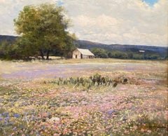
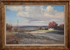
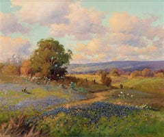
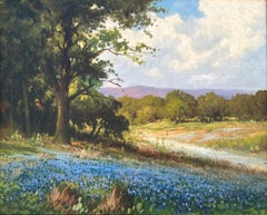
"SPRING MIX" TEXAS HILL COUNTRY WILDFLOWERS IMAGE: 25 X 30
By Robert William Wood
Located in San Antonio, TX
a car on Pacific Coast Highway and nearly died. His friend and amateur artist Caryl Price helped him
Oil

Sold
H 31 in W 39 in D 3 in
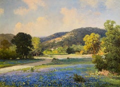
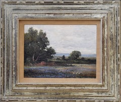
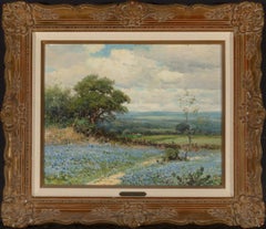
"PATH THROUGH THE BLUE" BLUEBONNET TEXAS HILL COUNTRY IMAGE: 23 X 31 CIRCA 1940S
By Robert William Wood
Located in San Antonio, TX
a car on Pacific Coast Highway and nearly died. His friend and amateur artist Caryl Price helped him
Oil

Sold
H 33 in W 44 in D 3 in
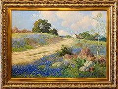
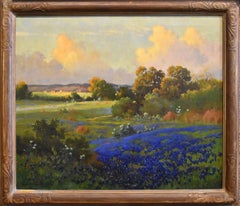
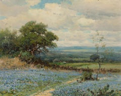
"AROUND THE BEND" TEXAS HILL COUNTRY BLUEBONNET IMAGE SIZE 26 X 36 Circa 1940
By Robert William Wood
Located in San Antonio, TX
a car on Pacific Coast Highway and nearly died. His friend and amateur artist Caryl Price helped him
Oil
Sold
H 33 in W 38 in D 4 in
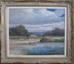
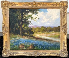
"Boerne Texas" Bluebonnets Texas Hill Country Ranch
By Robert William Wood
Located in San Antonio, TX
a car on Pacific Coast Highway and nearly died. His friend and amateur artist Caryl Price helped him
Oil

"Boerne Hills" Texas Hill Countruy
By Robert William Wood
Located in San Antonio, TX
estranged and they were divorced in 1952. The following year, Wood was hit by a car on Pacific Coast Highway
Oil
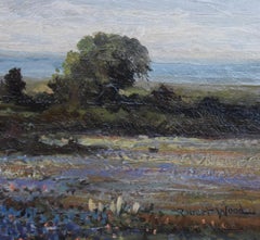
"Texas Bluebonnets" Hill Country Lanscape
By Robert William Wood
Located in San Antonio, TX
a car on Pacific Coast Highway and nearly died. His friend and amateur artist Caryl Price helped him
Oil

Sold
H 31 in W 43 in D 4 in
"Freedom" Texas Hill Country Ranch Landscape
By Robert William Wood
Located in San Antonio, TX
. The following year, Wood was hit by a car on Pacific Coast Highway and nearly died. His friend and
Oil
Sold
H 22 in W 26 in D 4 in
"Bluebonnets" Texas Hill Country Ranch Bluebonnet
By Robert William Wood
Located in San Antonio, TX
a car on Pacific Coast Highway and nearly died. His friend and amateur artist Caryl Price helped him
Oil
Sold
H 25 in W 30 in D 3 in
"Splash of Blue" Circa 1930s Bluebonnet Robert Wood (1889-1979) Original frame
Located in San Antonio, TX
a car on Pacific Coast Highway and nearly died. His friend and amateur artist Caryl Price helped him
Oil
Sold
H 30 in W 40 in D 3 in
"Hill Country Dream" Texas Hill Country 30 x 40 CIRCA 1940
Located in San Antonio, TX
a car on Pacific Coast Highway and nearly died. His friend and amateur artist Caryl Price helped him
Oil
Sold
H 32 in W 38 in D 3 in
"TEXAS HILL COUNTRY TRAIL" BLUEBONNET IMAGE: 25 X 30 FRAME: 32 X 38 CIRCA 1942
Located in San Antonio, TX
a car on Pacific Coast Highway and nearly died. His friend and amateur artist Caryl Price helped him
Oil
Sold
H 24 in W 28 in D 3 in
"BLUEBONNET HILLS" IMAGE: 16 X 20 FRAME: 24 X 28 CIRCA 1940S
Located in San Antonio, TX
. The following year, Wood was hit by a car on Pacific Coast Highway and nearly died. His friend and
Oil
"Bluebonnets Texas Hill Country"
Located in San Antonio, TX
. The following year, Wood was hit by a car on Pacific Coast Highway and nearly died. His friend and
Oil
$230,794Sale Price|33% Off
H 51.19 in W 55.12 in D 201.58 in
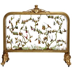
Rare Victorian Firescreen with Taxidermy Hummingbirds by Henry Ward
By Henry Ward
Located in Amsterdam, NL
England, third quarter of the 19th century On two scrolling foliate feet with casters, above which a rectangular two-side glazed frame, with on top a two-sided shield with initial...
Other
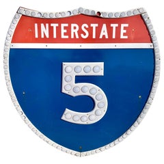
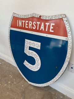
Los Angeles 5 Freeway Shield
Located in Los Angeles, CA
Vintage Los Angeles freeway shield from the 5 freeway in Los Angeles. Interstate 5 runs from the Tijuana/California border all the way up to the Canadian border near Blaine, Washingt...
Steel
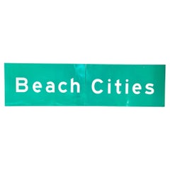
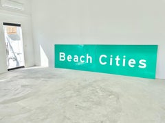
Los Angeles Freeway Sign 'Beach Cities"
Located in Los Angeles, CA
Monumental Los Angeles freeway sign from the 90s. Beach Cities sign showing people which way to Manhattan Beach, Redondo Beach and other cities. Reflective material. In great conditi...
Aluminum