Matthew Seutter
to
2
1
3
3
3
1
1
3
3
3
6
12,916
3,848
2,382
2,237
Creator: Matthew Seutter
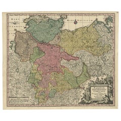
Antique Map of Northern Germany by M. Seutter, circa 1730
By Matthew Seutter
Located in Langweer, NL
Antique map titled 'Saxoniae Inferioris Circulus'. Old map of the northern part of Germany by M. Seutter. Covering the area of Lower Saxony, Mecklenburg-Vorpommern and Schleswig-Hols...
Category
Mid-18th Century Antique Matthew Seutter
Materials
Paper
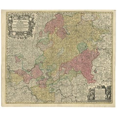
Hand-Colored Antique Map of part of Germany by M. Seutter, c. 1730
By Matthew Seutter
Located in Langweer, NL
Antique map titled 'Mappa Circuli Rhenani Superioris (..). Original map with hand coloring of part of Germany. It includes the region of Kassel, Göttingen, Eisenach, Schweinfurt, Wer...
Category
Mid-18th Century Antique Matthew Seutter
Materials
Paper
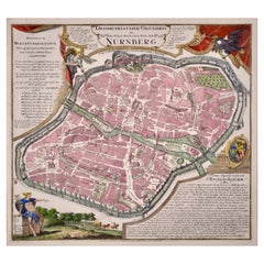
City View of Nuremberg, Germany: An 18th Century Hand-Colored Map by M. Seutter
By Matthew Seutter
Located in Alamo, CA
An 18th century hand-colored city view of Nuremburg, Germany entitled "Geometrischer Grundris der des Heiligen Römischen Reichs Freyen Stadt Nürnberg" by Matthaus Seutter from his "A...
Category
Mid-18th Century German Antique Matthew Seutter
Materials
Paper
Related Items
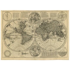
Mid-18th Century Antique World Map by R. & J. Wetstein, Netherlands
Located in Langweer, NL
Antique world map titled 'De Werelt Caart'.
A scarce and richly detailed double hemisphere world map that was probably based on an earlier work by Cornelis Dankerts. This map has t...
Category
Mid-18th Century Dutch Antique Matthew Seutter
Materials
Paper
$3,022
H 15.52 in W 21.26 in D 0.02 in
Antique Map of Principality of Monaco
By Antonio Vallardi Editore
Located in Alessandria, Piemonte
ST/619 - "Old Geographical Atlas of Italy - Topographic map of ex-Principality of Monaco" -
ediz Vallardi - Milano -
A somewhat special edition ---
Category
Late 19th Century Italian Other Antique Matthew Seutter
Materials
Paper
Framed 1839 Hand Colored Map of the United States
Located in Stamford, CT
Framed hand colored map of the United States of America from 1839. Newly framed in a giltwood frame.
Category
1830s American American Classical Antique Matthew Seutter
Materials
Giltwood, Paper, Glass
Antique Albertus Seba Pair 18th Century Hand-Colored Engravings Butterfly
By Albertus Seba 1
Located in Washington, DC
Rare pair of original hand-colored prints from Sir Albertus Seba's cabinet of natural curiosities. Prints come from published volumes in Amste...
Category
Mid-18th Century Dutch Antique Matthew Seutter
Materials
Paper
$700 / set
H 26 in W 12.5 in D 0.3 in
Original Antique Map of Ancient Greece, Achaia, Corinth, 1786
Located in St Annes, Lancashire
Great map of Ancient Greece. Showing the region of Thessaly, including Mount Olympus
Drawn by J.D. Barbie Du Bocage
Copper plate engraving by P.F Tardieu
Original hand color...
Category
1780s French Other Antique Matthew Seutter
Materials
Paper
Original Antique Map of the American State of California ( Northern Part ), 1903
Located in St Annes, Lancashire
Antique map of California ( Northern part )
Published By A & C Black. 1903
Original colour
Good condition
Unframed.
Free shipping
Category
Early 1900s English Antique Matthew Seutter
Materials
Paper
$49
H 11.5 in W 16.25 in D 0.07 in
Antique Map of Greece by Seutter or Lotter, 'c.1740'
Located in Langweer, NL
Antique map titled 'Graecia pars Septentrionalis'. Original antique map of Greece, uncommon. Signed cum Gratia et Privil. S.R.I. Vicariatus (..)'. Published by Seutter or Lotter, cir...
Category
Mid-18th Century Antique Matthew Seutter
Materials
Paper
$667 Sale Price
35% Off
H 20.28 in W 25.6 in D 0.02 in
Original Antique Map of the American State of Michigan ( Northern Part ), 1903
Located in St Annes, Lancashire
Antique map of Michigan ( Northern part )
Published By A & C Black. 1903
Original colour
Good condition
Unframed.
Free shipping
Category
Early 1900s English Antique Matthew Seutter
Materials
Paper
$49
H 11.5 in W 16.25 in D 0.07 in
Original Antique Map of the American State of California ( Southern Part ), 1903
Located in St Annes, Lancashire
Antique map of California ( Southern part )
Published By A & C Black. 1903
Original colour
Good condition
Unframed.
Free shipping
Category
Early 1900s English Antique Matthew Seutter
Materials
Paper
$49
H 11.5 in W 16.25 in D 0.07 in
Original Hand-colored Antique Map of Denmark by S. Neele, 1790
Located in Langweer, NL
Antique very decorative engraving of Denmark engraved by S. Neele. Published in November 1790 by John Trusler. Tape on verso.
Category
Late 18th Century Antique Matthew Seutter
Materials
Paper
Hand Colored Map of Nantucket by Austin Strong (1881 - 1952), circa 1921
Located in Nantucket, MA
Map of Nantucket by Austin Strong (1881 - 1952), circa 1921, an original print on paper whimsical map of Nantucket Island by Robert Louis Stevenson's step- grandson, noted stage set ...
Category
1920s American Folk Art Vintage Matthew Seutter
Materials
Paper
$2,800
H 17 in W 19.63 in D 0.63 in
Antique 1700 Map of Spain by Nicolas de Fer, Early 18th Century
Located in Langweer, NL
Antique map of Spain and Portugal with a title cartouche. Nicolas de Fer was the youngest son of the Paris printer and publisher Antoine de Fer. At the ...
Category
Early 18th Century French Antique Matthew Seutter
Materials
Paper
Matthew Seutter furniture for sale on 1stDibs.
Matthew Seutter furniture are available for sale on 1stDibs. These distinctive items are frequently made of paper and are designed with extraordinary care. There are many options to choose from in our collection of Matthew Seutter furniture, although brown editions of this piece are particularly popular. Many of the original furniture by Matthew Seutter were created in the Baroque style in europe during the 18th century and earlier. If you’re looking for additional options, many customers also consider furniture by Matthäus Merian the Elder, John Speed, and Basilius Besler. Prices for Matthew Seutter furniture can differ depending upon size, time period and other attributes — on 1stDibs, these items begin at $486 and can go as high as $1,875, while a piece like these, on average, fetch $562.


