Maps
to
4,251
5,436
241
5,682
3
76
35
18
13
6
5
5
4
4
3
1
1
2,976
2,230
476
3
290
34
10
126
9
37
9
2
5
4
3
3
5,595
122
55
34
32
724
332
218
148
140
5,685
5,685
5,685
104
63
28
24
16
Maps For Sale
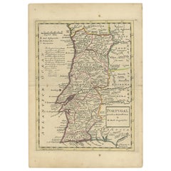
Antique Map of Portugal by Moll, 1727
Located in Langweer, NL
Antique map Portugal titled 'Portugal Agreeable to Modern History'. Detailed map of Portugal showing major routes, waterways, arch bishoprics, bis...
Category
18th Century Antique Maps
Materials
Paper
$184 Sale Price
20% Off
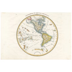
Antique Map of the Western Hemisphere by Lapie, France, circa 1830
Located in Langweer, NL
Antique Map of the Western Hemisphere by Lapie, France, circa 1830
This beautifully engraved and delicately hand-colored map, titled Hémisphère du Nouveau Continent (Ouest), depict...
Category
1830s Antique Maps
Materials
Paper
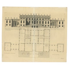
Antique Print of Bramham Park by Campbell, 1725
Located in Langweer, NL
Antique print titled 'The Elevation of Braman Park (..)'. Old engraving of Bramham Park in Bramham. This print originates from 'Vitruvius Britannicus' by Colen Campbell. Artists and ...
Category
18th Century Antique Maps
Materials
Paper
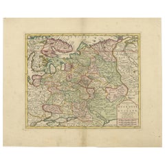
Original Antique Map of Muscovy or Russia by Isaak Tirion, Amsterdam circa 1740
Located in Langweer, NL
Map of Muscovy or Russia by Isaak Tirion, Amsterdam circa 1740
Description:
This beautifully engraved and delicately hand-colored map titled "Nieuwe Kaart van Muskovië of Rusland" w...
Category
Mid-18th Century Dutch Antique Maps
Materials
Paper
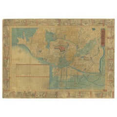
1885 Shinsen Tokyo Zenzu: Rare Meiji-Era Map of Tokyo by Sakai Kinzaburo
Located in Langweer, NL
Title: Detailed Edo Period Map of Tokyo (Edo), Featuring Neighborhoods and Landmarks
This beautifully detailed patina rich map, titled "Shinsen Tokyo Zenzu" (Newly Selected Complete...
Category
1880s Antique Maps
Materials
Paper
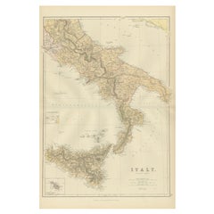
Original Antique Map of the South Part of Italy with an Inset of Malta, 1882
Located in Langweer, NL
Embark on a captivating journey through the southern part of Italy with an original Antique Map from the esteemed 'Comprehensive Atlas and Geography of the World,' meticulously craft...
Category
1880s Antique Maps
Materials
Paper
$195 Sale Price
20% Off
Map of Corsica France with Ajaccio and Napoleon Portraits, 19th Century
Located in Langweer, NL
Map of Corsica France with Ajaccio and Napoleon Portraits, 19th Century
Description:
This finely engraved 19th-century map of Corsica, the Mediterranean island region of France, was...
Category
Mid-19th Century French Antique Maps
Materials
Paper
Map of the Electorate of Bavaria, Incl Lake Constance, by Jesuit Scherer, c.1700
Located in Langweer, NL
Antique map titled 'Electorat Bavariae.' Map of the Electorate of Bavaria by the Jesuit Heinrich Scherer. The lower map shows the Lake Constance. Source unknown, to be determined.
...
Category
Early 1700s Antique Maps
Materials
Paper
$577 Sale Price
20% Off
Antique Hand-Colored Map of Western Russia and Ukraine, c.1680
Located in Langweer, NL
Description: Antique map titled 'Novissima et Accuratissima Totius Russiae vulgo Muscoviae Tabula'.
Antique map of Western Russia and Ukraine, published by Justus Danckerts. The ma...
Category
1680s Antique Maps
Materials
Paper
$699 Sale Price
20% Off
Antique Coastal Map of West Sumatra 'Indonesia' by J. Mannevillette, 1745
Located in Langweer, NL
Antique map titled 'Carte de la côte occidentale de l'isle Sumatra depuis la ligne équinoctiale jusqu'au détroit de la Sonde'. Beautiful coastal map of We...
Category
Mid-18th Century Antique Maps
Materials
Paper
$461 Sale Price
20% Off
Map of Cher France with Bourges, Sancerre Vineyards and Engraved Vignettes, 1850
Located in Langweer, NL
Map of Charente-Inférieure France with La Rochelle and Coastal Vineyards, 19th c
Description:
This decorative 19th-century map of the former department of Charente-Inférieure, now k...
Category
Mid-19th Century French Antique Maps
Materials
Paper
Antique Map of the British Isles by H. Chatelain, 1719
Located in Langweer, NL
Beautiful hand colored large format map of the British Isles, with large insets of the Eastern and Western Hemispheres and the coats of arms for Engl...
Category
Early 18th Century Antique Maps
Materials
Paper
$699 Sale Price
20% Off
Antique Decorative Coloured Map Marocco, Algeria and Tunis, 1882
Located in Langweer, NL
The maps is from the 1882 atlas by Blackie & Son and offers a detailed view of the North African regions as understood in the late 19th century.
**Map of Morocco, Algeria, and Tun...
Category
1880s Antique Maps
Materials
Paper
$233 Sale Price
20% Off
Vintage Swedish Topographic School Map of European Alps, Made in Sweden 1922
Located in Los Angeles, CA
Vintage Swedish Topographic School map of European Alps, Made in Sweden 1922
This vintage Swedish school map is so unique and a great example of why t...
Category
1920s Swedish Vintage Maps
Materials
Linen, Wood, Paper
Antique Map of the Holy Land, showing the travels of Abraham, Isaac and Jacob
Located in Langweer, NL
Antique map titled 'Tabula Itineraria Patriarcharum Abrahami, Isaaci et Iacobi'. Decorative regional map of the Holy Land, showing the travels of Abraham, Isaac and Jacob. Published ...
Category
Mid-17th Century Antique Maps
Materials
Paper
$522 Sale Price
20% Off
Antique Map of Spain and Portugal, 1882
Located in Langweer, NL
"Antique map titled 'Spain & Portugal'.
Old map of Spain and Portugal. This map originates from 'The Royal Atlas of Modern Geography, Exhibiting, in a S...
Category
19th Century Antique Maps
Materials
Paper
$214 Sale Price
20% Off
Map of Côtes-du-Nord France with Saint-Brieuc and Brittany Coastline, c.1850
Located in Langweer, NL
Map of Côtes-du-Nord France with Saint-Brieuc and Brittany Coastline, 19th c
Description:
This elegant 19th-century map of Côtes-du-Nord, the historic name for what is now known as ...
Category
Mid-19th Century French Antique Maps
Materials
Paper
Bonne Map of Philippines, Formosa, Siam, Indochina & South China, 1780
Located in Langweer, NL
Bonne Map of Philippines, Formosa, Siam, Indochina & South China, 1780
Les Isles Philippines, celle de Formose, le Sud de la Chine, les Royaumes de Tunkin, de Cochinchine, de Cambog...
Category
1780s Antique Maps
Materials
Paper
$270 Sale Price
20% Off
Antique Miniature Map of the Turkish Empire by Bertius '1618'
Located in Langweer, NL
Antique miniature map titled 'Turcicum Imperium'. Rare miniature map of the Turkish Empire. This map originates from 'Tabularum Geographicarum Contractarum Libri septem (..)' by P. B...
Category
Early 17th Century Antique Maps
Materials
Paper
$699 Sale Price
20% Off
Ancient Crossroads: Albania to Assyria in Antiquity, Published in 1880
Located in Langweer, NL
The map titled "ALBANIA, IBERIA, COLCHIS, ARMENIA, MESOPOTAMIA, BABYLONIA, ASSYRIA" portrays the ancient regions that would encompass parts of modern-day Eastern Turkey, Armenia, Aze...
Category
1880s Antique Maps
Materials
Paper
$344 Sale Price
20% Off
Ancient Babylon with The Tower of Babel According to Herodotus & Kircherus, 1730
Located in Langweer, NL
Antique print titled 'Platte Grond van de Stad Babilon, volgens Herodotus en A. Kircherus'.
This original antique print shows a view of ancient Babylon with the tower of Babel...
Category
1730s Antique Maps
Materials
Paper
$447 Sale Price
20% Off
Original 17th-Century Antique Map of Henan (Honan) Province, China – by Blaeu
Located in Langweer, NL
17th-Century Antique Map of Henan Province, China – "Honan" by Blaeu, with Detailed Cartography and Artistic Cartouches
Description: This exceptional 17th-century map of Henan Province, historically referred to as "Honan," was created by Johannes Blaeu and published in 1655 as part of the *Novus Atlas Sinensis*. Henan, located in central China, is known as the cradle of Chinese...
Category
1650s Antique Maps
Materials
Paper
Antique Map of Monroe County 'Ohio' by Titus '1871'
Located in Langweer, NL
Antique map titled 'Monroe'. Original antique map of Monroe, Ohio. This map originates from 'Atlas of Preble County Ohio' by C.O. Titus. Published 1871.
Category
Late 19th Century Antique Maps
Materials
Paper
$233 Sale Price
20% Off
Antique Map of Peru by van der Aa, 'circa 1720'
Located in Langweer, NL
Antique map titled 'Le Perou, Grand Pays de l Amerique Meridionale (..)'. Decorative map of Peru including portions of Ecuador and northern Chile and Boliv...
Category
Early 18th Century Antique Maps
Materials
Paper
$699 Sale Price
20% Off
Map of East Frisian Islands & Northwestern Tip of Germany, Ostfriesland, c.1595
Located in Langweer, NL
Antique map titled 'Frisia Orientalis'. Beautiful map of east Frisian islands and the northwestern tip of Germany, Ostfriesland. With people in local costumes. Ornamented inset of the Eems estuary. Based on a manuscript map...
Category
16th Century Antique Maps
Materials
Paper
$1,631 Sale Price
20% Off
L'isle De La Martinique Caribbean Copper Engraving Original Handcoloring, 1704
Located in Langweer, NL
The original hand-colored map titled "Isle de la Martinique," published in 1704 and part of De Fer's Atlas Curieux, is a cartographic masterpiece offering an intricate portrayal of t...
Category
Late 19th Century Antique Maps
Materials
Paper
$689 Sale Price
20% Off
Antique Map of the World by A. Vuillemin, 1854
Located in Langweer, NL
This map originates from ‘Atlas National de la France Illustré’. Published by A. Combette, Paris, 1854.
Category
Mid-19th Century Antique Maps
Materials
Paper
$327 Sale Price
25% Off
Venetian Trade Routes in the Levant – Antique Map by Pieter van der Aa, ca.1720
Located in Langweer, NL
Venetian Trade Routes in the Levant – Antique Map by Pieter van der Aa, Early 18th Century
This finely engraved map, published by Pieter van der Aa in Leiden, provides a detailed d...
Category
1720s Antique Maps
Materials
Paper
Terrestrial Globe in Lithographed Paper and Cast Iron, J.Lebègue & Cie – Late 19
By J. Lebegue & Cie
Located in HÉRIC, FR
19th-century globe by J. Lebègue & Cie. This globe features a sturdy mount and a cast iron tripod base decorated with mascarons and ending in claw feet. The sphere is covered with li...
Category
19th Century French Antique Maps
Materials
Iron
Extremely Large Hand-Drawn Manuscript Map of Surinam, 1830, History of Slavery
Located in Amsterdam, NL
A unique large hand-drawn map of Surinam by Albrecht Helmut Hiemcke (German, 1760-1839)
?
'Colonie Surinaame', 1830
A large hand-drawn and coloured map of the colony of Suri...
Category
Mid-19th Century Surinamer Antique Maps
Materials
Paper
Antique Map of Germany, the Netherlands, Bohemia, Bavaria and Switzerland, 1785
Located in Langweer, NL
Antique map titled 'Germany and the Netherlands from the latest authorities'. Depicts Germany, the Netherlands and the surrounding region including Bohemia, Bavaria, and Switzerland....
Category
18th Century Antique Maps
Materials
Paper
$130 Sale Price
20% Off
Large Original Antique Map of Madeira. 1894
Located in St Annes, Lancashire
Superb Antique map of Madeira
Published Edward Stanford, Charing Cross, London 1894
Original colour
Good condition
Unframed.
Free shipping
Category
1890s English Antique Maps
Materials
Paper
Antique Map of Peru, Ecuador and Bolivia by Lapie, 1842
Located in Langweer, NL
Antique map titled 'Carte du Perou et du Haut Perou'. Map of Peru, Ecuador and Bolivia. This map originates from 'Atlas universel de géographie ancienne et...
Category
19th Century Antique Maps
Materials
Paper
$222 Sale Price
20% Off
Old Print of a Peasant of Hermannstadt 'Sibiu', Transylvania, 1804
Located in Langweer, NL
Old print of a peasant of the neighbourhood of Hermannstadt (Sibiu), Transylvania.
This print originates from 'The Costume of the Hereditary States of the House of Austria' by William Miller.
Artists and Engravers: Engraved by William Ellis.
Category
Early 1800s Antique Maps
Materials
Paper
$242 Sale Price
20% Off
Important and Scarce Antique Map of Asia from Jesuit Sources, C.1713
Located in Langweer, NL
Antique map titled 'L'Asie selon les nouvelles observations de Messrs de l'Academie des Sciences etc'. The main focus of this important and scarce map of Asia is the delineation of the northeast part of the continent from Jesuit sources. The northeast coast is severely truncated with the discoveries of Nicolas Witsen shown, and the partial coastlines of Jesso and Compagnies Land are depicted to the north of Japan. Inset in the North Pacific is a map of that same region based on the information from Father Martino Martini. It shows Jesso connected to the mainland with a narrow strait between it and a huge Compagnies Land. An inset below, taken from Father Ferdinand Verbiest, illustrates the road between Peking and Kirin and Nincrita. Father Verbiest's world map of 1674, which he compiled for the Chinese, subsequently led to the Jesuits obtaining a commission to make a comprehensive topographical...
Category
18th Century Antique Maps
Materials
Paper
$3,262 Sale Price
20% Off
Old Map of Ancient Times covering Egypt Towards Arabia and India to Java, c.1660
Located in Langweer, NL
Description: Antique map titled 'Erythraei Sive Rubri Maris Periplus olim ab arriano descriptus nunc vero ab abrah ortelio ex eodem delineatus'. Map of the Indian Ocean, or Erythraea...
Category
1660s Antique Maps
Materials
Paper
$1,025 Sale Price
20% Off
1782 Map of the East Indies – India, Siam, Philippines, Java, Borneo, Ganges
Located in Langweer, NL
1782 Bayly Map of the East Indies – India, Siam, Philippines, Java, Borneo, Ganges
This finely engraved and vibrantly hand-colored map titled 'A New Map of the East Indies' was dr...
Category
1780s Antique Maps
Materials
Paper
$307 Sale Price
20% Off
Vintage Globe on Regency Pedestal Stand
Located in Pasadena, TX
This is a nice vintage globe. It sits on a pedestal tripod base. The base is constructed in a regency style. This globe comes from the office of Roger Rolke of Shell Oil Co.
A nice ...
Category
20th Century American Maps
Materials
Wood
Antique Map of the Region of Charolais by Janssonius, 1657
Located in Langweer, NL
Antique map 'Les environs de L'Estang de Longpendu, comprenant une grande partie du Comté de Charolois'. Decorative map of the Charolais region. This map originates from 'Atlas Novus...
Category
Mid-17th Century Antique Maps
Materials
Paper
$489 Sale Price
20% Off
French Pavillon de la Grande Tuilerie, Chabat, Architectural Print, c.1900
Located in Langweer, NL
Antique print titled 'Pavillon de la Grande Tuilerie de Bourgogne (de Montghanin) Exposition Universelle de 1889, Mrs. Wulliam et Farge Architectes'. This print depicts the design of...
Category
20th Century Maps
Materials
Paper
Antique Map of the Mediterranean Sea and Surroundings by Keizer & de Lat, 1788
Located in Langweer, NL
Antique map titled 't Wester Deel van de Middelandse Zee (..)'. Uncommon original antique map of the Mediterranean Sea and surroundings. This map originates from 'Nieuwe Natuur- Gesc...
Category
Late 18th Century Antique Maps
Materials
Paper
$326 Sale Price
20% Off
Antique Map of the Middle East by Mortier, 1700
Located in Langweer, NL
Antique map titled 'Carte de la Situation du Paradis Terrestre (..)'. Detailed map of the Holy Land and the Middle East, centered on the Garden of Eden and including a large Cyprus. ...
Category
18th Century Antique Maps
Materials
Paper
$223 Sale Price
20% Off
Antique Map of the World on Mercator Projection by Anson, 1749
Located in Langweer, NL
Antique map titled 'Nieuwe Wereld Kaart waar in de Reizen van den Hr. Anson rondsom de Wereld'. Original antique map of the world on Mercator'...
Category
18th Century Antique Maps
Materials
Paper
$428 Sale Price
25% Off
Striking Antique Map Centered on the Malay Peninsula
Located in Langweer, NL
Antique map titled 'D'Indiaanze Landschappen Zeen en Eylanden, van Couchin af tot in de Moluccos (...)'. Striking map of the region from the Philippines and Formosa to India and the ...
Category
Early 18th Century Antique Maps
Materials
Paper
$1,118 Sale Price
20% Off
Old Antique Map of the East Indies and Southeast Asia, ca.1644
Located in Langweer, NL
Antique map titled 'India quae Orientalis dicitur, et Insulae adiacentes'.
Old map of the East Indies and Southeast Asia showing the area between India in the West and parts of Japan, the Marianas and New Guinea/Australia in the East. This map is dedicated to D. Christophorus Thisius by Henricus...
Category
1640s Antique Maps
Materials
Paper
$2,470 Sale Price
20% Off
Old Map of South East Asia Showing the Malay Archipelago, incl Borneo etc, 1922
Located in Langweer, NL
Antique map of South East Asia titled 'Malay Archipelago'.
Old map of South East Asia depicting the Malay Archipelago including Sumatra, Java...
Category
1920s Vintage Maps
Materials
Paper
$177 Sale Price
20% Off
Java and Bali with Borneo Coast – 18th Century French Colonial Map
Located in Langweer, NL
Java and Bali with Borneo Coast – 18th Century French Colonial Map
This original copperplate engraved map titled "Deuxième Carte des Isles de la Sonde" offers a rare and valuable 18...
Category
Mid-18th Century French Antique Maps
Materials
Paper
1585 Mercator Map of Ireland, Entitled "Irlandiae Regnvm, " Hand Colored Ric0006
Located in Norton, MA
1585 Mercator map of Ireland, entitled
"Irlandiae Regnvm."
Hand Colored
Description: Published in Amsterdam by Mercator/Hondius ca. 1585.
Artists and Engravers: 1585 Mercator map of Ireland, entitled "Irlandiae Regnvm." Copperplate engraving on verge type hand laid paper with watermark. Description: Published in Amsterdam by Mercator/Hondius ca. 1585.Artists and Engravers: Mercator was born in Rupelmonde in Flanders and studied in Louvain under Gemma Frisius, Dutch writer, astronomer and mathematician. The excellence of his work brought him the patronage of Charles V, but in spite of his favor with the Emperor he was caught up in the persecution of Lutheran protestants and charged with heresy, fortunately without serious consequences. No doubt the fear of further persecution influenced his move in 1552 to Duisburg, where he continued the production of maps, globes and instruments. Mercator's sons and grandsons, were all cartographers and made their contributions in various ways to his atlas. Rumold, in particular, was responsible for the complete edition in 1595. The map plates...
Category
16th Century Dutch Antique Maps
Materials
Paper
Map of the Persian Empire circa 1750 by Tirion – Hand-Colored Dutch Map
Located in Langweer, NL
Map of the Persian Empire circa 1750 by Tirion – Hand-Colored Dutch Map
This finely detailed antique map titled "Nieuwe Kaart van 't Ryk van Persie" (New Map of the Empire of Persia...
Category
1750s Dutch Antique Maps
Materials
Paper
Rare Old Map of the British Solomon Islands Protectorate, 1925
Located in Langweer, NL
Antique map titled 'British Solomon Islands Protectorate'.
Old map of the British Solomon Islands Protectorate.
Artists and Engravers: Published by Waterlow & Sons, London & D...
Category
1920s Vintage Maps
Materials
Paper
$251 Sale Price
20% Off
Antique Engraved Map of Hungary and Transylvania or Romania, c.1710
Located in Langweer, NL
Antique map titled 'Hungary and Transilvania'. Original antique map of Hungary and Transylvania (modern day Romania), centered on Budapest. Artists and ...
Category
18th Century Antique Maps
Materials
Paper
$261 Sale Price
20% Off
Antique Map of the Coast of China by Bellin, 1752
Located in Langweer, NL
Antique map titled 'Carte des Costes de Cochinchine, Tunquin et Partie de celles de Chine'. Detailed map of the region from the Cambodia River to Macao, along the coast of China.
...
Category
18th Century Antique Maps
Materials
Paper
$102 Sale Price
20% Off
Original Antique Plan of the Fortress of Charedsch in Persia or Iran, ca.1780
Located in Langweer, NL
Antique map, titled: 'Plan de la Citadelle de la Ville de Charedsch.'
Plan of the fortress of Charedsch, Iran / Persia. This original antique print originates from 'Reize naar Ar...
Category
1780s Antique Maps
Materials
Paper
$298 Sale Price
20% Off
Map of Drôme France with Valence and Rhône Valley Wine Region, 19th Century
Located in Langweer, NL
Map of Drôme France with Valence and Rhône Valley Wine Region, 19th Century
Description:
This beautifully engraved 19th-century map of the Drôme department in southeastern France wa...
Category
Mid-19th Century French Antique Maps
Materials
Paper
1865 Chart of the Islands of Madeira
Located in Norwell, MA
Rare James Imray chart from 1865 titled "Chart of the Islands of Madeira, Porto Santo and Dezerea" drawn from the survey made by Captain Ate Vidal Royal Navy, London. Published by Ja...
Category
1860s European Antique Maps
Materials
Paper
Antique Map of Boulogne-sur-Mer by Bellin '1764'
Located in Langweer, NL
Antique map titled 'Plan de la Ville de Boulogne'. Original antique map of Boulogne-sur-Mer, France. This map originates from 'Le petit atlas maritime: recueil de cartes et plans des...
Category
Mid-18th Century Antique Maps
Materials
Paper
$139 Sale Price
20% Off
Map of Batavia’s Surroundings with Early Reference to Jakarta, Indonesia, c.1770
Located in Langweer, NL
Map of Batavia’s Surroundings with Early Reference to Jakarta, circa 1770
Description:
This finely engraved map titled "Carte des Environs de Batavia" offers a compelling and histor...
Category
Late 18th Century Dutch Antique Maps
Materials
Paper
British Island Group Map 1695 – Morden’s Smaller Islands of the British Ocean
Located in Langweer, NL
British Island Group Map 1695 – Morden’s Smaller Islands of the British Ocean
This rare and decorative late 17th-century map titled "The Smaller Islands in the British Ocean" was en...
Category
Late 17th Century English Antique Maps
Materials
Paper
Beautiful 17th Century Map of Paris and Isle de France by Templeux, c.1650
Located in Langweer, NL
Map of Isle de France by D. de Templeux, ca. 1650, Hand-Colored and Decorative
This richly detailed antique map titled *Le Gouvernement de L'Isle de France* was engraved by Daniel d...
Category
1650s Antique Maps
Materials
Paper
Old Original Map of Russia in Europe, 1849
Located in Langweer, NL
Antique map titled 'Russia in Europe'.
Old map of Russia in Europe. This map originates from 'Sharpe's Corresponding Atlas (..)' by J. Sharpe.
Artists and Engravers: Published by Chapman and Hall.
Category
1840s Antique Maps
Materials
Paper
$167 Sale Price
20% Off
Recently Viewed
View AllMore Ways To Browse
Antique Wellington Chests
Antonio Cassi Ramelli
Archimede Seguso Birds
Art Deco Coasters
Art Deco Footballer
Art Deco Music Cabinet
Art Deco Waterfall Bedroom Furniture
Art Deco Waterfall Bedroom
Art Deco Whisky
Art Foulard
Art Nouveau Sunflower
Arts And Crafts Silver Coffee Pot
Asian Pink Bowl
Avesn Vase
Baccarat Carafe
Bakelite Bird
Bakelite Cocktail Picks
Bamboo Ikebana Vase
