Paper Maps
to
4,214
5,457
176
5,635
3
54
29
14
9
9
5
1
1
1
1
1
1
2,955
2,241
439
3
282
23
5
126
8
35
7
2
3
3
2
5,638
127
59
35
32
800
307
225
215
144
5,638
5,638
5,638
104
58
28
21
15
Material: Paper
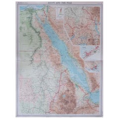
Large Original Vintage Map of Egypt, circa 1920
Located in St Annes, Lancashire
Great map of Egypt
Unframed
Original color
By John Bartholomew and Co. Edinburgh Geographical Institute
Published, circa 1920
Free shipping.
Category
1920s British Vintage Paper Maps
Materials
Paper
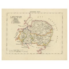
Antique 1830 Map of Eastern England with Suffolk, Norfolk Cambridge, Huntingdon
Located in Langweer, NL
Title: Antique 1830 Map of Eastern England with Suffolk, Norfolk, Cambridge, and Huntingdon
Description: This 1830 German-language map, titled Britisches Reich – A. Kon: England,...
Category
1830s Antique Paper Maps
Materials
Paper
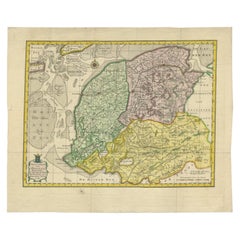
Antique Map of Friesland by Van Krevelt, 1787
Located in Langweer, NL
Antique map titled 'Nieuwe Kaart van Friesland behoorende tot het Vaderlandsch Woordenboek van Jacobus Kok'. Original antique map of the province of Friesland, the Netherlands. This ...
Category
18th Century Antique Paper Maps
Materials
Paper
$438 Sale Price
20% Off
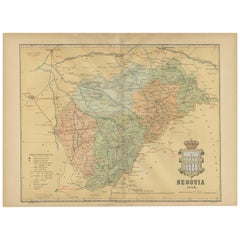
Topographical and Administrative Cartography of Segovia in Spain, 1902
Located in Langweer, NL
An original old map of the province of Segovia from the year 1902. Segovia is a historic area located in the central part of Spain, northwest of Madrid. Known for its rich history, a...
Category
Early 1900s Antique Paper Maps
Materials
Paper
$276 Sale Price
20% Off
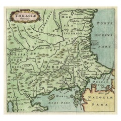
Charming Miniature Map of Thrace or Thrake in Southeast Europe, 1685
Located in Langweer, NL
Antique map titled 'Thraciae Descriptio.'
Charming miniature map of Thrace, from the pocket atlas 'Introductionis in Universam Geographiam tam Veterem quam novam .. Acessit P. Be...
Category
1680s Antique Paper Maps
Materials
Paper
$315 Sale Price
20% Off
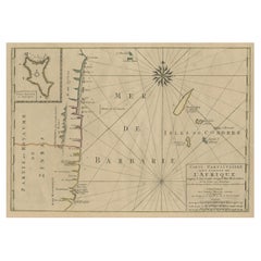
Map of the Mozambique and Tanzania Coast & Inset Map of Anjouan Island, ca.1700
Located in Langweer, NL
Antique map titled 'Carte particuliere des Costes de l'Afrique'.
Depicts the coasts of Mozambique and Tanzania. With an inset map of Anjouan Island.
Artists and engravers: Pub...
Category
Early 1700s Antique Paper Maps
Materials
Paper
$611 Sale Price
20% Off
Old Decorative Map of the West African Coast & St. Thomae Island, c.1600
Located in Langweer, NL
Antique map titled 'Guineae Nova Descriptio.'
This very decorative map shows the West African coast from Senegal (the 'Rio Senega' is the Senegal River) to Cape Lopez on the Gulf...
Category
Early 1600s Antique Paper Maps
Materials
Paper
$1,384 Sale Price
20% Off
Map of Sevilla Province, 1901: A Depiction of The Spanish Cultural Heartland
Located in Langweer, NL
The print for sale here depicts a historical map of the province of Sevilla (Seville) from the year 1901. Sevilla is located in the southern part of Spain and is part of the autonomo...
Category
Early 1900s Antique Paper Maps
Materials
Paper
$267 Sale Price
30% Off
Antique Map of Gelderland, Largest Province of The Netherlands, c.1870
Located in Langweer, NL
Antique map titled 'De Provincie Gelderland'.
Map of the province of Gelderland, the Netherlands. This map originates from 'F. C. Brugsma's Atlas van het Koninkrijk der Nederland...
Category
19th Century Antique Paper Maps
Materials
Paper
$105 Sale Price
20% Off
Early Woodcut Map of Swabia and Bavaria in Germany, 1628
Located in Langweer, NL
Title: Early Woodcut Map of Swabia and Bavaria, 16th Century
This early woodcut map titled "Schwaben und Bayernlande / Darbey auch begreiffen der Oenwaldt / Nordgaw / etc." provides...
Category
1620s Antique Paper Maps
Materials
Paper
Antique Map of Northern India, Bengal, and Surrounding Regions by Tardieu, 1802
Located in Langweer, NL
This is an original antique map titled "Inde, Indostan Bengale &c. et Partie Septentrionale de la Presqu'isle en deça du Gange," depicting the northern part of the Indian subcontinen...
Category
Early 1800s Antique Paper Maps
Materials
Paper
$420 Sale Price
20% Off
Large Antique Map of Egypt and the Nile Delta by Wyld, 1854
Located in Langweer, NL
Antique map titled 'Lower Egypt and the adjacent desert, with a part of Palestine to which has been addes the nomenclature of the Roman age by L.S. de la Rochette'. Map of Egypt and ...
Category
19th Century Antique Paper Maps
Materials
Paper
$961 Sale Price
30% Off
The Principality of Dombes: A 17th-Century Cartographic Jewel by Jan Jansson
Located in Langweer, NL
The text on the map "La principaute de Dombes; J. van den Eynde sculpit.; La Principavte de Dombes" indicates that it is a map of the principality of Dombes, engraved by J. van den E...
Category
1630s Antique Paper Maps
Materials
Paper
$534 Sale Price
20% Off
Huesca 1901: A Geographic Overview of Aragon's Northern Frontier in Spain
Located in Langweer, NL
The map provided is of the province of Huesca, located in the northeastern part of Spain, within the autonomous community of Aragon, as of the year 1901. Here are some of the key fea...
Category
Early 1900s Antique Paper Maps
Materials
Paper
$305 Sale Price
20% Off
Antique Map of the City of Goch by Blaeu, 1649
Located in Langweer, NL
Antique map titled 'Gochum vernacule Goch'. Old map of the city of Goch, Germany. This map originates from 'Novum Ac Magnum Theatrum Urbium Belgicæ Liberæ ac Foederatæ' by J. Blaeu. ...
Category
17th Century Antique Paper Maps
Materials
Paper
$404 Sale Price
20% Off
Antique Map of Victoria, or Port Phillip in Australia, ca. 1850
Located in Langweer, NL
This antique map, measuring approximately 12.7 x 10.0 inches, showcases Victoria, specifically centered around Melbourne, Australia. Crafted by John Tallis around 1850, this map is p...
Category
Mid-19th Century European Antique Paper Maps
Materials
Paper
$680 Sale Price
20% Off
Large Original Vintage Map of S.E Asia, with a Vignette of Singapore
Located in St Annes, Lancashire
Great map of South East Asia
Original color. Good condition
Published by Alexander Gross
Unframed.
Category
1920s English Vintage Paper Maps
Materials
Paper
Antique Map of Africa by Homann Heirs, '1804'
Located in Langweer, NL
Antique map titled 'Charte von Africa'. Large, original antique map of Africa by Franz Ludwig Güssefeld. Published by Homann Heirs, 1804.
Category
Early 19th Century Antique Paper Maps
Materials
Paper
$1,432 Sale Price
20% Off
Original Antique Map of the Province of Utrecht, the Netherlands, ca.1720
Located in Langweer, NL
Antique map titled ‘Tabula Nova Provinciae Ultrajectinae (..)’.
Original antique map of the province of Utrecht, the Netherlands. It shows the region of Amsterdam, Utrecht, Gouda, ...
Category
1720s Antique Paper Maps
Materials
Paper
$754 Sale Price
20% Off
Original Antique Map of the American State of Nevada, 1889
Located in St Annes, Lancashire
Great map of Nevada
Drawn and Engraved by W. & A.K. Johnston
Published By A & C Black, Edinburgh.
Original colour
Unframed.
Category
1880s Scottish Victorian Antique Paper Maps
Materials
Paper
Original Old Map Northeast India, incl Part of Himalayas and China, 1853
Located in Langweer, NL
Antique map titled 'India X'.
Old map of the the northeast region of India, including part of Himalayas and China. Great detail of landforms, rivers and water bodies, cities, towns...
Category
1850s Antique Paper Maps
Materials
Paper
$181 Sale Price
20% Off
Senex Map of Castile, Leon & La Mancha in The Spanish Heartland, 1714
Located in Langweer, NL
This antique map, titled "A Map of Old & New Castile from the Observations of Rodrigo Mendes Silva and others," depicts the regions of Old Castile and New Castile in Spain, along with the Kingdom of Leon, Estremadura, La Mancha, among others. The map dates back to the early 18th century, a period marked by significant political shifts and territorial changes in Europe, particularly illustrated by the War of the Spanish Succession (1701–1714) that reshaped Spain’s governance and regional boundaries.
The map itself was published in 1714 by John Senex, a prominent English mapmaker, surveyor, globemaker, and geographer of the early eighteenth century. He was apprenticed as a young man to bookseller Robert Clavell and collaborated with notable mapmakers such as Jeremiah Seller and Charles Price. In 1728, Senex's contributions to geography and mapping were recognized when he was elected a Fellow of the Royal Society, an exceptional honor for a mapmaker, underlining his significant role as the Society's engraver and a publisher of maps by Edmund Halley and other notable figures.
John Senex is renowned for his English Atlas, first published in the same year as this map, 1714, and continued to be printed until the 1760s. Following his death in 1740, his widow Mary Senex managed the business until 1755. Afterward, the stock passed to William Herbert and Robert Sayer for maps, and to James Ferguson for globes.
The map serves not just as a geographical record but also as a historical document, reflecting the territorial divisions significant to Spain's political and economic structure at the time. The focus on Old and New Castile underscores their importance during a transformative era in Spanish history.
Here are some potentially significant places and features of this map:
1. **Old Castile (Castilla la Vieja)**: Historically significant as part of the former Kingdom of Castile, this region includes major cities such as Burgos and Valladolid. These cities could be popular search...
Category
Early 18th Century Antique Paper Maps
Materials
Paper
$468 Sale Price
20% Off
Antique Map of Europe by Levasseur, '1875'
Located in Langweer, NL
Antique map titled 'Carte générale de l'Europe'. Large map of Europe. This map originates from 'Atlas de Géographie Moderne Physique et Politique' by A. Levasseur. Published 1875.
Category
Late 19th Century Antique Paper Maps
Materials
Paper
$358 Sale Price
40% Off
Original Antique Map of Martinique Island In The West Indies by Bonne, circa1780
Located in Langweer, NL
Antique map titled 'Carte de l'Isle de la Martinique Colonie Francoise dans les Isles Antilles'. Detailed map of the French Island of Martinique.
Many towns and harbours, anchor pl...
Category
18th Century Antique Paper Maps
Materials
Paper
$353 Sale Price
20% Off
1847 Amerique Septentrionale Framed Map
Located in Stamford, CT
1847 Amerique Septentrionale Framed Map Illustrated by Raimond Bonheur. As found framed condition.
Category
1840s American American Classical Antique Paper Maps
Materials
Glass, Wood, Paper
Large Original Antique Map of The South of Italy. John Dower, 1861
Located in St Annes, Lancashire
Great map of the South of Italy
Lithograph engraving by John Dower
Original colour
Published, 1861
Unframed
Good condition
Free shipping
Category
1860s English Victorian Antique Paper Maps
Materials
Paper
Antique Map of the Holy Land, Showing the Location of the Various Tribes
Located in Langweer, NL
Antique map titled 'Judaea seu Terra Sancta quae Hebraeorum sive Israelitarum (..)'. Map of The Holy Land, showing the location of the various tribes, in two kingdoms, Judah and Isra...
Category
Early 18th Century Antique Paper Maps
Materials
Paper
$1,146 Sale Price
20% Off
Original Copper Engraving of Koroni 'or Corone', Greece, 1688
Located in Langweer, NL
Antique print titled 'Das Aussehen der Stadt und Vestung Coron von der Seit des Auffgang'.
Copper engraving of Koroni (or Corone), Greece. This print originates from 'Ruhm-belorb...
Category
1680s Antique Paper Maps
Materials
Paper
$248 Sale Price
20% Off
Antique Map of the United States by Balbi '1847'
Located in Langweer, NL
Antique map titled 'Etats-Unis'. Original antique map of the United States. This map originates from 'Abrégé de Géographie (..)' by Ad...
Category
Mid-19th Century Antique Paper Maps
Materials
Paper
$191 Sale Price
20% Off
Antique Map of Cordes Bay, Port Famine, Woods Bay and Surroundings
Located in Langweer, NL
Antique map titled 'Baye et Havre de Cordes (..)'. Four maps on the one sheet of; Cordes Bay, Port Famine, Woods Bay, Port Gallant, Fortescue Bay, Chile based on the voyage of John B...
Category
Late 18th Century Antique Paper Maps
Materials
Paper
$315 Sale Price
20% Off
Beira Alta: A Cartographic Journey Through Portugal's Heartland in 1903
Located in Langweer, NL
The uploaded image is a historical map of the Beira Alta region in Portugal. The map is detailed, showing the topography, hydrography, and transportation networks of the region, incl...
Category
Early 1900s Antique Paper Maps
Materials
Paper
$276 Sale Price
20% Off
Levant in Antiquity: Lands of Phoenicia, Judea, and Neighboring Kingdoms, 1880
Located in Langweer, NL
The map is titled "PHOENICE, COELESYRIA, IDUMAEA, JUDAEA MACCABAEORUM TEMPORE," which translates to "Phoenicia, Coele-Syria, Idumea, Judea at the Time of the Maccabees."
This origi...
Category
1880s Antique Paper Maps
Materials
Paper
$353 Sale Price
20% Off
Antique Map of the City of Assen in The Netherlands, 1865
Located in Langweer, NL
Drenthe - Gemeente Assen. (no 2, Stad). These scarse detailed maps of Dutch Towns originate from the 'Gemeente-atlas' of Jacob Kuyper. This atlas of all towns in the Netherlands was ...
Category
19th Century Antique Paper Maps
Materials
Paper
$276 Sale Price
20% Off
Panoramic Engraved View of the Town of Longvek 'or Lavek' in Cambodia, ca.1726
Located in Langweer, NL
Description: Antique print titled 'Eauweck, Hooft Stad van Cambodia'. Decorative panoramic view of the town of Longvek (or Lavek) in Cambodia. It was the second capital city during t...
Category
1720s Antique Paper Maps
Materials
Paper
$811 Sale Price
20% Off
Antique Map of the World in two sheets, 1852
Located in Langweer, NL
Antique map titled 'The World on Mercator's Projection'. Two individual sheets of the world. This map originates from 'Lowry's table Atlas constructed and engraved from the most rece...
Category
Mid-19th Century Antique Paper Maps
Materials
Paper
$238 Sale Price / set
20% Off
Antique Map of Indochina, the Malaysian Peninsula and Northern Sumatra
Located in Langweer, NL
Antique map titled 'Nieuwe Kaart van India over de Ganges of van Malakka, Siam, Cambodia, Chiampa, Kochinchina, Laos, Pegu, Ava, enz'. Original old map of Indochina, the Malaysian Pe...
Category
Mid-18th Century Antique Paper Maps
Materials
Paper
$611 Sale Price
20% Off
Antique 1830 Map of Leinster, Ireland with Dublin, Kilkenny, Wexford and Kildare
Located in Langweer, NL
Title: Antique 1830 Map of Leinster, Ireland with Dublin, Kilkenny, Wexford, and Kildare
Description: This 1830 German-language map, titled Britisches Reich – C. Kon: Ireland, f...
Category
1830s Antique Paper Maps
Materials
Paper
1718 Holy Land Map - Twelve Tribes, Six Provinces, Hand-Colored, Antique Map
Located in Langweer, NL
Title: Terra Sancta in XII olim Tribus nunc VI Provincias Dispertita
Cartographer: Christoph Weigel the Elder (1654–1725)
Publisher: Johann Ernst Adelbulner
Publication Locatio...
Category
1710s Antique Paper Maps
Materials
Paper
Large Original Antique Map of The Bahamas. 1894
Located in St Annes, Lancashire
Superb Antique map of The Bahamas
Published Edward Stanford, Charing Cross, London 1894
Original colour
Good condition
Unframed.
Free shipping
Category
1890s English Antique Paper Maps
Materials
Paper
Rare Original Antique Ptolemy Map of Ceylon, Present Day Sri Lanka
Located in Langweer, NL
Original antique map titled 'Tab XII Asiae Taprobanam (..)'. For this map of Toprobana (Sri Lanka), Ptolemy drew on the accounts of travelers and sailors and though the information was secondhand and often inaccurate, it represented the most advanced account of the world's geography at that time. This map depicts the island with the typical misconceptions of the period with the enlarged island straddling the Equator and nearly divided by a ridge of mountains. A small part of India is incorrectly shown in the northeast corner of the map and a spurious coastline labeled Gangem fills the upper right corner. The stipple engraved sea contains an oriental ship...
Category
Late 17th Century Antique Paper Maps
Materials
Paper
$735 Sale Price
20% Off
Original Old Map with Many Details Around Manilla in the Philippine Islands
By F. Valentijn
Located in Langweer, NL
Original antique map titled 'Carte du Canal des Iles Philippines (..) - Kaart van het Kanaal in de Filippynsche Eilanden (..)'. Striking and highly detailed chart of the Islands of the Philippines. Shows Islands, bays, reefs, soundings tracks of the Manila Galleon route, etc. Published 1724-1726 by Joannes van Braam...
Category
Early 18th Century Antique Paper Maps
Materials
Paper
$1,050 Sale Price
20% Off
Detailed Antique Map of Britain, Wales and the Coast of Ireland
Located in Langweer, NL
Antique map titled 'Carta d'Inghilterra e del Principato di Galles'. Detailed map of Britain, Wales and the coast of Ireland with a list of counties. This map originates from 'Nuovo ...
Category
Mid-19th Century Antique Paper Maps
Materials
Paper
$248 Sale Price
20% Off
Large 1750 Map of the Kingdoms of Spain and Portugal by Robert de Vaugondy
Located in Langweer, NL
1750 Map of the Kingdoms of Spain and Portugal by Robert de Vaugondy
Description:
This map, titled *"Royaumes d'Espagne et de Portugal,"* was created in 1750 by the esteemed French ...
Category
Mid-18th Century Antique Paper Maps
Materials
Paper
$620 Sale Price
20% Off
Antique Map of France by Balbi '1847'
Located in Langweer, NL
Antique map titled 'France'. Original antique map of France. This map originates from 'Abrégé de Géographie (..)' by Adrien Balbi. Published 1847.
Category
Mid-19th Century Antique Paper Maps
Materials
Paper
$119 Sale Price
20% Off
Antique Map of Victoria ‘Australia’ by J. Tallis, circa 1855
Located in Langweer, NL
A highly decorative and finely engraved mid-19th century map of Victoria, Australia which appeared in John Tallis & co.'s The Illustrated Atlas (London...
Category
Mid-19th Century Antique Paper Maps
Materials
Paper
$286 Sale Price
20% Off
Rare Antique Map of Southwestern Europe and West Africa by V.M. Coronelli, 1692
Located in Langweer, NL
Antique Globe Gore: Southwestern Europe and West Africa by Vincenzo Coronelli
This exquisite, hand-colored globe gore by Vincenzo Coronelli, one of the most renowned 17th-century cartographers, represents Southwestern Europe and West Africa. A segment of Coronelli's monumental 42-inch terrestrial globe, this gore is a remarkable example of the artistry and geographical knowledge of the late 1600s. Covering France, the Iberian Peninsula, and all of Africa west of a line extending from Algeria to the Bight of Benin, it also includes the Canary Islands and Madeira.
Coronelli’s globe gores are celebrated for their exceptional engraving and accuracy, and this piece is no exception. The coastline of Africa is depicted with remarkable precision for its time, reflecting the latest geographical knowledge of European explorers. In contrast, the interior of Africa—still a mystery to European mapmakers—features mythical elements such as fantastical mountain ranges and exotic fauna. Giraffes, elephants, lions, and mysterious giant birds populate the landscape, offering a glimpse into the imagination and curiosity of the era. One notable detail is the Gambia...
Category
Late 17th Century Antique Paper Maps
Materials
Paper
$2,340 Sale Price
20% Off
Original Antique Map of the American State of Idaho & Wyoming, 1903
Located in St Annes, Lancashire
Antique map of Idaho and Wyoming
Published By A & C Black. 1903
Original colour
Good condition
Unframed.
Free shipping
Category
Early 1900s English Antique Paper Maps
Materials
Paper
Antique Map of the Brazil Railway Company, '1912'
Located in Langweer, NL
Antique map titled 'Brazil Railway Company'. This folding map is attached to the booklet titled 'The Brazil Railway Company'. It is a memorandum by A. H. A. Knox-Little, who was the ...
Category
Early 20th Century Paper Maps
Materials
Paper
$143 Sale Price
20% Off
Antique Print of Hakodate from Snow Peak in Japan, 1856
Located in Langweer, NL
Antique print titled ‘View of Hakodadi from Snow Peak’. View of Hakodate, a city and port located in Oshima Subprefecture, Hokkaido, Japan. This print origin...
Category
19th Century Antique Paper Maps
Materials
Paper
$210 Sale Price
20% Off
17th-Century Map of the Latin Patriarchate of Jerusalem by Melchior Tavernier
Located in Langweer, NL
Title: 17th-Century Map of the Latin Patriarchate of Jerusalem by Melchior Tavernier
Description: This rare 17th-century map by Melchior Tavernier illustrates the geographical ext...
Category
1640s Antique Paper Maps
Materials
Paper
Pl. X Villa au Vésinet, Chabat, c.1900
Located in Langweer, NL
Antique print titled 'Villa au Vésinet (Seine et Oise) Mr. Héret Architecte'. This print depicts the design of a villa in France. Originates from 'La Brique et La Terre Cuite' by P. ...
Category
20th Century Paper Maps
Materials
Paper
$114 Sale Price
20% Off
Antique Map of Asia Minor including part of the Greek Archipelago and Cyprus
Located in Langweer, NL
Antique map titled 'Chersonesi quae hodie Natolia Descriptio'. Decorative, smaller map of Asia Minor including part of the Greek Archipelago and Cyprus. The drape-style title cartouc...
Category
Mid-18th Century Antique Paper Maps
Materials
Paper
$324 Sale Price
20% Off
Antique Map of South America, c.1840
Located in Langweer, NL
Antique map titled 'South America'. Original, antique map depicting South America. With outline coloring. Source unknown, to be determined. Artists and Engravers: Anonymous.
Artist:...
Category
19th Century Antique Paper Maps
Materials
Paper
$69 Sale Price
20% Off
Antique Map of the Adriatic Sea and the Balkan by J. Janssonius, circa 1650
Located in Langweer, NL
Striking large-scale map of the Greater Balkans. Decorated with two large-scale cartouches, one showing two swordsman at odds with one another and the other ...
Category
Mid-17th Century Antique Paper Maps
Materials
Paper
$907 Sale Price
20% Off
Antique Map of South Africa by Wyld '1845'
Located in Langweer, NL
Antique map titled 'South Africa'. Original antique map of South Africa.
This decorative original old map originates from 'An Atlas of th...
Category
Mid-19th Century Antique Paper Maps
Materials
Paper
$191 Sale Price
20% Off
Antique Print of the House of Roger Hudson by Campbell, 1725
Located in Langweer, NL
Antique print titled 'The Elevation of Roger Hudson Esqr. his house at Sunbury (..)'. Old engraving of the house of Roger Hudson in Sunbury. This print originates from 'Vitruvius Bri...
Category
18th Century Antique Paper Maps
Materials
Paper
Antique Map of Eastern Seram, Part of the Maluku Island in East Indonesia, 1726
Located in Langweer, NL
Antique map titled 'De Landvoogdy van Amboina met de elf onderhoorige Eylanden.' Detailed map of the eastern part of Seram in Indonesia, part of the Maluku islands. Map of the southe...
Category
18th Century Antique Paper Maps
Materials
Paper
$429 Sale Price
20% Off
Antique Town Plan of Emden ‘Germany’ by Braun & Hogenberg, 1597
Located in Langweer, NL
Antique map titled 'Embdena (..)'. Old, antique bird's-eye view plan of Emden, Germany. This bird's-eye view from the southwest over the Dollart shows Emden, which developed from a trading settlement in the 7th/8th centuries into a city as late as late 14th century. In 1494 it was granted staple rights, and in 1536 the harbour was extended. In the mid-16th century Emden's port was thought to have the most ships in Europe. Its population then was about 5,000, rising to 15,000 by the end of the 16th century. The Ems flowed directly under the city walls, but its course was changed in the 17th century by the construction of a canal. Emden has canals within its city limits, a typical feature of Dutch towns, which also enabled the extension of the harbour. Emden's first herring company was founded in 1553, and in 1595 Emden was created a Free Imperial City under the protection of Holland.
Published by Braun...
Category
16th Century Antique Paper Maps
Materials
Paper
Antique Map of Asia Minor, Region of the Nile and Region of the City of Carthage
Located in Langweer, NL
Three antique maps on one sheet titled 'Natoliae quae olim Asia Minor [with] Aegypti recentior descriptio [with] Carthaginis Celeberrimisinus Typus'. The first map covers Asia Minor,...
Category
16th Century Antique Paper Maps
Materials
Paper
$477 Sale Price
20% Off
Original Antique Map of Brasil, Published in the 16th Century, 1561
Located in Langweer, NL
This important Ruscelli map of Brazil, from his work La Geografia di Claudio Tolomeo Alessandrino, is one of the earliest obtainable modern maps of the re...
Category
1660s Antique Paper Maps
Materials
Paper
$525 Sale Price
20% Off
Recently Viewed
View AllMore Ways To Browse
Antique Wellington Chests
Antonio Cassi Ramelli
Archimede Seguso Birds
Art Deco Coasters
Art Deco Footballer
Art Deco Music Cabinet
Art Deco Waterfall Bedroom Furniture
Art Deco Waterfall Bedroom
Art Deco Whisky
Art Foulard
Art Nouveau Sunflower
Arts And Crafts Silver Coffee Pot
Asian Pink Bowl
Avesn Vase
Baccarat Carafe
Bakelite Bird
Bakelite Cocktail Picks
Bamboo Ikebana Vase
