Paper Maps
to
4,216
5,457
176
5,635
3
54
29
14
9
9
5
1
1
1
1
1
1
2,955
2,241
439
3
282
23
5
126
8
35
7
2
3
3
2
5,638
127
59
35
32
796
306
224
214
144
5,638
5,638
5,638
104
58
28
21
15
Material: Paper
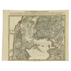
Antique Map of the Northern Part of the Netherlands by Jaeger, 1784
Located in Langweer, NL
Antique print, titled: 'Carte topographique d'Allemagne contenant une partie des Provinces Unies, savoir la province de Friesland occidentale : une partie d'Overyssel, de Gueldre, d'...
Category
18th Century Antique Paper Maps
Materials
Paper
$191 Sale Price
20% Off
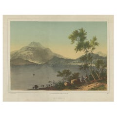
Antique Print of Loch Achray, a Lake near Callander in Stirling, Scotland, c1860
Located in Langweer, NL
Antique print titled 'Loch Achray'. Original antique print with a view of Loch Achray, a small freshwater loch 11 km (6.8 mi) west of Callander in Stirling...
Category
19th Century Antique Paper Maps
Materials
Paper
$267 Sale Price
20% Off
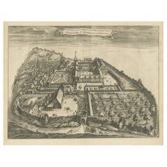
Original Antique Print of the Benedictine Abbey of Gembloux, Belgium, ca.1660
Located in Langweer, NL
Antique print titled 'Celebrrima et Antiquissima Cemblacensis Oppidi Abbatia Ordinis S. Benedicti in Gallo-Brabantia'.
Original antique print of the Benedictine Abbey of Gembloux...
Category
1660s Antique Paper Maps
Materials
Paper
$725 Sale Price
20% Off
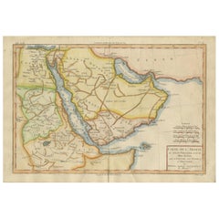
Antique Map of the Arabian Peninsula by Bonne 'c.1780'
Located in Langweer, NL
Antique map titled 'Carte de l'Arabie, du Golfe Persique, et de la Mer Rouge (..)'. Original antique map of the Arabian Peninsula, including the horn...
Category
Late 18th Century Antique Paper Maps
Materials
Paper
$477 Sale Price
20% Off
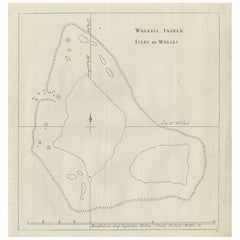
Antique Map of the Wallis and Futuna Islands, French Overseas Territory, 1778
Located in Langweer, NL
Antique map titled 'Walliss Inseln, Isles de Wallis'. Old map of the Wallis and Futuna Islands, officially Territory of the Wallis and Futuna Islands, French overseas territory. The ...
Category
18th Century Antique Paper Maps
Materials
Paper
$276 Sale Price
20% Off
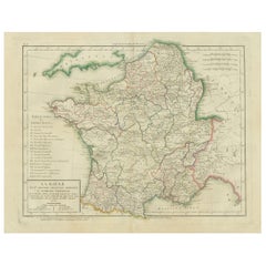
Map of Ancient Gaul & Roman Provinces: Early 19th Century - 1802 Tardieu Atlas
Located in Langweer, NL
### Antique Map Description
**Title:** La Gaule et Ses Grandes Dignités Romaines au Temps des Empereurs
**Publication Details:**
- **Atlas Title:** Nouvel Atlas Universel de Géogra...
Category
Early 1800s Antique Paper Maps
Materials
Paper
Large Original Antique Map of Utah, USA, 1894
Located in St Annes, Lancashire
Fabulous map of Utah
Original color
By Rand, McNally & Co.
Published, 1894
Unframed
Free shipping.
Category
1890s American Antique Paper Maps
Materials
Paper
Original Antique City Plan of Buffalo, New York, USA, circa 1900
Located in St Annes, Lancashire
Fabulous colorful map of Buffalo
Original color
By Rand, McNally & Co.
Published, circa 1900
Unframed
Minor edge tears
Free shipping.
Category
1890s American Antique Paper Maps
Materials
Paper
Old Map of Piton de la Fournaise, a Shield Volcano on Eastern Réunion Island
Located in Langweer, NL
Antique map titled 'Partie Orientale de l'Ile de Mascareigne'. This map shows the region of the Piton de la Fournaise, a Shield Volcano on Eastern Réunion Island...
Category
Early 19th Century Antique Paper Maps
Materials
Paper
$620 Sale Price
20% Off
Antique Map of French Colonies – La France, 19th Century
Located in Langweer, NL
Title: Antique Map of French Colonies – La France, 19th Century
Description: This antique 19th-century map, titled La France, presents a detailed depiction of France’s overseas c...
Category
1870s Antique Paper Maps
Materials
Paper
Large Original Vintage Map of Spain, circa 1920
Located in St Annes, Lancashire
Great map of Spain
Original color.
Good condition
Published by Alexander Gross
Unframed.
Category
1920s English Vintage Paper Maps
Materials
Paper
Territorium Francofurtens – Moses Pitt’s 17th-Century Map of Frankfurt
Located in Langweer, NL
Title: Territorium Francofurtens – Moses Pitt’s 17th-Century Map of Frankfurt
Description:
This rare 17th-century map, titled Territorium Francofurtens, was published by Moses ...
Category
1690s Antique Paper Maps
Materials
Paper
Antique Map of Northern Germany and the Netherlands – circa 1806
Located in Langweer, NL
Title: Antique Map of Northern Germany and the Netherlands – circa 1806
Description: This finely engraved antique map, titled L'Allemagne 1re Feuille, depicts the northern regions...
Category
Early 1800s Antique Paper Maps
Materials
Paper
Antique Map of China and Japan by A.K. Johnston, 1865
Located in Langweer, NL
Antique map titled 'China and Japan'. Depicting Eastern China, the Islands of Japan and more. This map originates from the ‘Royal Atlas of Modern Geography’ by Alexander Keith Johnst...
Category
Mid-19th Century Antique Paper Maps
Materials
Paper
$286 Sale Price
20% Off
Barados and St Christopher or St Kitts and Nevis Islands in the Caribbean, 1748
Located in Langweer, NL
This original map, a copperplate engraving by Le Rouge, presents two significant areas in the Caribbean. Titled "Isle St. Christophle une des Antilles aux anglois" and "La Barbade. d...
Category
Mid-18th Century Antique Paper Maps
Materials
Paper
$343 Sale Price
20% Off
Antique Map of Illinois by Johnson, 1872
Located in Langweer, NL
Antique map titled 'Johnson's Illinois'. Original map of Illinois. This map originates from 'Johnson's New Illustrated Family Atlas of the World' by A....
Category
Late 19th Century Antique Paper Maps
Materials
Paper
$238 Sale Price
20% Off
Antique View of Syracuse, Sicily, Italy, 1837
Located in Langweer, NL
Antique print titled 'Syracus'. View of Syracuse, Sicily, Italy. Originates from 'Meyers Universum'.
Artists and Engravers: Joseph Meyer (May 9, 1796 - June 27, 1856) was a Germa...
Category
1830s Antique Paper Maps
Materials
Paper
Antique Print of the Pass of Pancorbo in Spain, 1840
Located in Langweer, NL
Antique print titled 'Der Pass von Pancorvo in Spanien'. View of the Pass of Pancorbo, Spain. Originates from 'Meyers Universum'.
The Battle of Pancorbo was a battle that took pl...
Category
19th Century Antique Paper Maps
Materials
Paper
$114 Sale Price
20% Off
Cuenca 1901: A Historical Cartographic Detailing of High Plains and Mountains
Located in Langweer, NL
The original antique map displays the province of Cuenca, located in the autonomous community of Castilla-La Mancha in central Spain, as of 1901. Here are some of its features:
It i...
Category
Early 1900s Antique Paper Maps
Materials
Paper
$276 Sale Price
20% Off
Original Hand-Colored Antique Print of Various Apples, 1758
Located in Langweer, NL
Antique print depicting apple variaties including the Rode Wijn-Appel, Geele Soete Silverling, Bellefleur, Oranje Appel, Bruindeling, Witte Renet, Groene Renet, Wildjes Appel (Reinet...
Category
18th Century Antique Paper Maps
Materials
Paper
$180 Sale Price
20% Off
Pl. 65 Antique Print of Decorative Art in the Renaissance Period by Racinet, 1869
Located in Langweer, NL
Old print of decorative art in the Renaissance period. This print originates from 'L'Ornement polychrome'. A beautiful work containing about 2000 patterns of all the styles of Art ol...
Category
19th Century Antique Paper Maps
Materials
Paper
Antique Map of France, Spain and Portugal by Johnson, 1872
Located in Langweer, NL
Antique map titled 'Johnson's France (..)'. Original map showing France, Spain and Portugal. With inset maps of Corsica and Gibraltar Rock. This map ori...
Category
Late 19th Century Antique Paper Maps
Materials
Paper
$238 Sale Price
20% Off
Antique Map of Germany by Walker, 1820
By R. Walker
Located in Langweer, NL
Antique map Germany titled 'Map of Germany as defined by the Peace of Paris'. Detailed antique map of Germany.
Artists and Engravers: Engrav...
Category
19th Century Antique Paper Maps
Materials
Paper
$62 Sale Price
20% Off
Antique Miniature Map of the Old World and France by Mallet, circa 1683
Located in Langweer, NL
Antique map titled 'Planisphere du Monde - France'. Two miniature maps on one sheet. The upper map shows a hemisphere of the Old World. The lower map shows France. This map originate...
Category
Late 17th Century Antique Paper Maps
Materials
Paper
$167 Sale Price
20% Off
Antique Map showing Isotherm Lines throughout the World by Johnston '1850'
Located in Langweer, NL
Antique map titled 'Humboldt's System of Isothermal Lines'. Original antique map showing isotherm lines throughout the world. This map originates from 'The Physical Atlas of Natural ...
Category
Mid-19th Century Antique Paper Maps
Materials
Paper
$191 Sale Price
20% Off
Large Antique Map of England Hand Colored by Counties
Located in Langweer, NL
Antique map titled 'A New Map of England from the latest Authorities'. Large map of England, hand colored by counties. Published by John Cary, 1821.
John Cary (1755-1835) was a B...
Category
Early 19th Century Antique Paper Maps
Materials
Paper
$515 Sale Price
20% Off
Pl. XII Villa a Houlgate, Chabat, c.1900
Located in Langweer, NL
Antique print titled 'Villa a Houlgate Mr. E. Papinot Architecte'. This print depicts the design of a villa in France. Originates from 'La Brique et La Terre Cuite' by P. Chabat. Art...
Category
20th Century Paper Maps
Materials
Paper
$119 Sale Price
20% Off
Natives from Pegu, the Moluccan Islands, Penequais Indians and St Thomas, c.1605
Located in Langweer, NL
Antique print titled 'Provincie Pegu incola (..) - Incola ex Insulis Moluco (..) - Penequais familiae (..)'.
Old print showing various figures including a man from Pegu, a man fr...
Category
Early 1600s Antique Paper Maps
Materials
Paper
$343 Sale Price
20% Off
Antique Sea Chart of Hudson Bay and Arctic Canada by Van Keulen, circa 1681
Located in Langweer, NL
Antique map titled 'Pascaarte vande Noorderzee Custen van America (..)'. Sea chart of Hudson Bay and Arctic Canada. Compass roses, loxodromic lines, and ships decorate the oceans and...
Category
Late 17th Century Antique Paper Maps
Materials
Paper
Albacete, Spain - 1902: A Cartographic Depiction of Landscape and Infrastructure
Located in Langweer, NL
Albacete, Spain - 1902: A Cartographic Depiction of Landscape and Infrastructure
An original and historical map of the province of Albacete, dated 1902, from the "Atlas Geográfico I...
Category
Early 1900s Antique Paper Maps
Materials
Paper
$276 Sale Price
20% Off
Antique Map of Peloponnesus, Greece by Pierre Antoine Tardieu, 1797
Located in Langweer, NL
This antique map, titled "Carte Ancienne d'Allemagne," represents ancient Germany and surrounding regions. It was published by the well-known Parisian mapmakers and publishers Jean-Baptiste-Louis Clouet and Alexandre Aimé Vuillemin in the late 18th century, specifically in 1787.
The map covers the extensive geographical area of ancient Germany, highlighting various tribes and regions known at the time. Key features include:
1. **Geographical Boundaries**: The map outlines the territorial extents of ancient Germany, bordered by Gallia (France) to the west, Sarmatia (parts of Eastern Europe) to the east, and the Italian regions to the south. The northern boundary reaches the Oceanus Germanicus (North Sea) and the Sarmatian Sea (Baltic Sea).
2. **Tribal Regions**: It details numerous ancient Germanic...
Category
1790s Antique Paper Maps
Materials
Paper
$324 Sale Price
20% Off
Historical Map Depicting the Continent of Asia, 1882
Located in Langweer, NL
This 1882 map presents a meticulously detailed representation of the continent of Asia, a testament to the cartographic skills of the era. Published as a...
Category
1880s Antique Paper Maps
Materials
Paper
$275 Sale Price
30% Off
Antique Map of Boulogne-sur-Mer by Bellin '1764'
Located in Langweer, NL
Antique map titled 'Plan de la Ville de Boulogne'. Original antique map of Boulogne-sur-Mer, France. This map originates from 'Le petit atlas maritime: recueil de cartes et plans des...
Category
Mid-18th Century Antique Paper Maps
Materials
Paper
$143 Sale Price
20% Off
1882 Map of Queensland, New South Wales, and Victoria with Detailed Features
Located in Langweer, NL
This 1882 map of Queensland, New South Wales, and Victoria, published by Blackie and Son as part of the 'Comprehensive Atlas and Geography of the World,' provides a detailed depictio...
Category
1880s Antique Paper Maps
Materials
Paper
Old Antique Map of the Province of Friesland, the Netherlands, c.1580
Located in Langweer, NL
Antique map titled 'Frisia Occidentalis'. Old map of the province of Friesland, the Netherlands. This map is also known as the 'Pauwenkaart' ('peacock map'), referring to the peacock next to the inset map. Based on a manuscript map...
Category
16th Century Antique Paper Maps
Materials
Paper
$907 Sale Price
20% Off
Burgos 1902: Geographic Map of Castile's Historic Heartland in Spain
Located in Langweer, NL
The map of the province of Burgos in the autonomous community of Castile and León in Spain, dated 1902. It includes the following features:
The map highlights the varied terrain wit...
Category
Early 1900s Antique Paper Maps
Materials
Paper
$276 Sale Price
20% Off
Large Lithograph of Princess Marie of Orleans, Duchess of Württember, 1844
Located in Langweer, NL
Antique print titled 'S.A.R. Madame Marie d'Orléans, Duchesse Alexandre de Wurtemberg'.
Large lithograph of Princess Marie of Orleans, Duchess of Württemberg with her son, Philip...
Category
1840s Antique Paper Maps
Materials
Paper
$706 Sale Price
20% Off
Antique Map of the Region of Gujarat and Cutch in India, 1833
Located in Langweer, NL
Antique map titled 'India V'. Old steel engraved map of the region of Gujarat and Cutch showing great detail.
Artists and Engravers: Engraved by J. & C. Walker. Published under the...
Category
19th Century Antique Paper Maps
Materials
Paper
$276 Sale Price
20% Off
Antique Map of the Cambrai Region by Pitt, circa 1680
Located in Langweer, NL
Antique map titled 'Archiepiscopatus Cameracensis - Archevesche de Cambray'. Decorative map of the Cambrai region of France. This map originates from 'The English Atlas' by Moses Pit...
Category
Late 17th Century Antique Paper Maps
Materials
Paper
$573 Sale Price
20% Off
Old Map of Indian Ocean & Sumatra, Java, Borneo, India, Arabia, Africa, c.1783
Located in Langweer, NL
Antique map titled 'Carte des Declinaisons et Inclinaisons de L'Aiguille Aimantée redigée d'après la table des observations Magnetiques faites par les Voyageurs depuis l'Année 1775'....
Category
1780s Antique Paper Maps
Materials
Paper
$1,337 Sale Price
20% Off
17th-Century Original Antique Map of Guangxi Province, China – Qvangsii by Blaeu
Located in Langweer, NL
Title: Antique 17th-Century Map of Guangxi Province, China – "Qvangsii" by Blaeu, Richly Illustrated and Colored
Description: This fascinating 17th-century map of Guangxi Province, historically referred to as "Qvangsii," was crafted by Johannes Blaeu and published in 1655 as part of the *Novus Atlas Sinensis*. Blaeu’s atlas, created in collaboration with Jesuit missionary Martino Martini, introduced European audiences to the geography of China in an unprecedented way. Guangxi Province, known for its striking karst landscapes and important historical trade routes, is depicted here in remarkable detail.
The map highlights the province’s topography, including mountain ranges, rivers, and towns, all meticulously engraved and labeled in Latin. It also captures key trade connections and cultural significance, as Guangxi historically served as a bridge between China and Southeast Asia. The decorative cartouche at the top left is adorned with figures in traditional Chinese costumes, symbolizing the cultural richness of the region and adding artistic elegance to the map.
This map was engraved using the copperplate technique, known for its ability to produce fine, detailed lines. The hand-coloring further enhances the visual impact, clearly distinguishing territorial divisions and natural features. Blaeu’s reputation for both accuracy and artistry is evident in this piece, making it a collector’s item of historical and aesthetic significance.
Guangxi Province, historically referred to as "Qvangsii," is renowned for its breathtaking natural beauty, unique karst landscapes, and cultural diversity. It is famous for its dramatic limestone formations, verdant hills, and picturesque rivers, making it one of the most visually striking regions in China. Guangxi has historically been a significant trade corridor between China and Southeast Asia, contributing to its cultural and economic importance. It is also home to various ethnic minority groups, including the Zhuang, Miao, and Dong, whose traditions and festivals enrich the region's cultural tapestry.
Important places in Guangxi include Guilin, known for its iconic karst mountains and the Li River, which has inspired poets and artists for centuries. Yangshuo, a town near Guilin, is celebrated for its stunning natural scenery and outdoor activities. Nanning, the provincial capital, is an important economic and cultural hub. The Longji Rice Terraces, also known as the Dragon’s Backbone, are an engineering marvel and a popular tourist destination. Beihai, a coastal city, is known for its silver beaches and maritime trade history.
Keywords for this map include 17th-century China map, Guangxi Province, Qvangsii map, antique Chinese maps...
Category
1650s Antique Paper Maps
Materials
Paper
Navarra in Cartographic Detail: A 1902 Map of the Crossroads of Northern Spain
Located in Langweer, NL
The original antique map for sale shows the Spanish province of Navarra as it was in 1902. Here's a brief description and a potential title for the map:
Description:
- The map detai...
Category
Early 1900s Antique Paper Maps
Materials
Paper
$324 Sale Price
20% Off
Map of Duchy of Brabant Centered on Fortress of Louvain or Leuven, Belgium, 1720
Located in Langweer, NL
Antique map titled 'Ducatus Brabantiae Nova Tabula in qua Lovanii Bruxellarum March S. Impreii Sylvae Ducis et Merchliniae Dominia.'
This fully engraved copperplate map...
Category
1720s Antique Paper Maps
Materials
Paper
$936 Sale Price
20% Off
Antique Map of the Region of Bouchain and Cambrai by Visscher 'circa 1680'
Located in Langweer, NL
Antique map titled 'Carte Nouvelle des Environs de Bouchain & Cambray'. Uncommon map of the region of Bouchain and Cambrai (Cambray, France) showing the camps of two armies.
Category
Late 17th Century Antique Paper Maps
Materials
Paper
$477 Sale Price
20% Off
Antique Map of Friesland 'The Netherlands' by B. Schotanus, 1664
By B. Schotanus
Located in Langweer, NL
Hand-colored map of the Dutch province Friesland. Also shows the Wadden islands Vlieland, Terschelling and Ameland and a part of Schiermonnikoog. With a decorative cartouche with two...
Category
Late 17th Century Antique Paper Maps
Materials
Paper
$1,599 Sale Price
9% Off
Original Old Bird's-Eye View Plan of Sint-Winoksbergen or Bergen in France, 1649
Located in Langweer, NL
Antique map titled 'Berga Sti Winoci.' - Bird's-eye view plan of Sint-Winoksbergen in France, with key to locations and coats of arms. Text in Dutch on verso. This plan originates from the famous city Atlas: 'Toneel der Steeden' published by Joan Blaeu...
Category
1640s Antique Paper Maps
Materials
Paper
$1,384 Sale Price
20% Off
Antique Map of the Region of Elbogen & Eger, Czech Republic & Hungary, 1742
Located in Langweer, NL
Antique map titled 'Repraesentatio Geographica Circuli Egerani, nec non Elnbogensis : in quo simul viae Egeranae in Thermas Carolinas distincta delineatio conspicitur (..)'.
Orig...
Category
1740s Antique Paper Maps
Materials
Paper
$515 Sale Price
20% Off
Johannes Janssonius' 17th-Century Map of the Duchy of Bremen in Germany
Located in Langweer, NL
The map titled "Ducatus olim Episcopatus Bremensis et ostiorum Albis et Visurgis Fluviorum novissima Descriptio" by Johannes Janssonius provides a rich historical and geographical il...
Category
1650s Antique Paper Maps
Materials
Paper
$735 Sale Price
20% Off
Antique Map of Northern Asia by Mallet, 1719
Located in Langweer, NL
Antique map titled 'Das Mitternächtige Theil des Alten Asien'. This sheet of five miniature maps describes the northern part of Asia in classical times, perhaps circa 150 AD. At the top, an overview map shows the main regions and territories, which are pictured in more detail below. From left to right, the four maps below depict Scythia east of the Imaus (Pamir) Mountains, Serica, Sychia west of the Pamir mountains, and Sarmatia, the last of which borders the Black Sea. Originates from Alain Manesson Mallet's 'Description de l 'Univers' (German edition). Artists and Engravers: Alain Manesson Mallet (1630-1706) was a French cartographer and engineer. He started his career as a soldier in the army of Louis XIV, became a Sergeant-Major in the artillery and an Inspector of Fortifications. He also served under the King of Portugal, before returning to France, and his appointment to the court of Louis XIV. His military engineering and mathematical background led to his position teaching mathematics at court. His major publications were Description de L'Univers (1683) in 5 volumes, and Les Travaux de Mars ou l'Art de la Guerre (1684) in 3 volumes. His Description de L'Universe contains a wide variety of information, including star maps...
Category
18th Century Antique Paper Maps
Materials
Paper
$92 Sale Price
20% Off
Antique Map of Islands in the Mediterranean by Bowen, 'c.1760'
Located in Langweer, NL
Antique map titled 'Particular Draughts of some of the chief African Islands (..)'. Eight small maps on one sheet including 'Islands of Malta Goze & Cuming, An Accurate Chart of Cape de Verde Islands…, Island of St Helena.., Island of Madera, Island of Teneriffe, The Bay of Agoa…, The Dutch Fort at the Cape of Good Hope…, A Draught of Table Bay...
Category
Mid-18th Century Antique Paper Maps
Materials
Paper
$477 Sale Price
20% Off
Ávila in a Historical Map of 1902: A Geographic and Administrative Overview
Located in Langweer, NL
The map is of the province of Ávila, one of the provinces of the autonomous community of Castile and León in Spain, and it is dated from 1902. The map illustrates several geographic ...
Category
Early 1900s Antique Paper Maps
Materials
Paper
$276 Sale Price
20% Off
Antique Map of the Region of Dölitzsch by Schreiber, 1749
By Schreiber
Located in Langweer, NL
Antique map titled 'Die Aemter Doelitsch, Bitterfeld und Zörbig'. Map of the region of Dölitzsch, Germany. This map originates from 'Atlas Selectus von allen Konigreichen und Landern...
Category
18th Century Antique Paper Maps
Materials
Paper
$88 Sale Price
20% Off
Antique Map of the Kingdom of Hungary and Transylvania, circa 1780
Located in Langweer, NL
Antique Map of the Kingdom of Hungary and Surrounding Regions by S. Robert, circa 1780
This beautifully engraved map titled Royaume de Hongrie, Principauté de Transilvanie, Esclavon...
Category
Late 18th Century French Antique Paper Maps
Materials
Paper
Old Dutch Map of the City of Carthage and the Bay of Carthage, 1773
Located in Langweer, NL
Antique print titled 'Kaart van de Legging van het Oude Karthago'. Old map of the city of Carthage and the Bay of Carthage. It was the center or capital city of the ancient Carthagin...
Category
1770s Antique Paper Maps
Materials
Paper
$305 Sale Price
20% Off
Decorative Bird's-Eye View Plan of Ieper or Ypres in Belgium, 1649
Located in Langweer, NL
Antique print, titled: 'Ypra.'
Bird's-eye view plan of Ieper / Ypres in Belgium. With key to locations and coats of arms. Text in Latin on verso. This plan originates from the famous city Atlas: 'Toneel der Steeden' published by Joan Blaeu...
Category
1640s Antique Paper Maps
Materials
Paper
$1,384 Sale Price
20% Off
Antique Map of Menorca / Minorca by Homann Heirs '1757'
Located in Langweer, NL
Antique map titled 'Carte Topographique de l'Isle Minorque'. Scarce decorative map of Menorca (or Minorca), with two gorgeous views of Mahon and Fort St. Phillipe at the bottom. Publ...
Category
Mid-18th Century Antique Paper Maps
Materials
Paper
$764 Sale Price
20% Off
Large Antique Map of the Lower Nile Valley Including Egypt and Nubia, 1842
Located in Langweer, NL
Antique map titled 'Carte de l'Égypte, de la Nubie, de l'Abissinie'. Map of Egypt, covering the lower Nile valley including Egypt and Nubia. This map o...
Category
19th Century Antique Paper Maps
Materials
Paper
$429 Sale Price
20% Off
Antique Map of Kerguelens Island Coast by Cook, 1784
By James Cook
Located in Langweer, NL
Antique print titled 'Kerguelen's Land (..)'. Antique map of Kerguelens island coast, known today as the Desolation islands. Originates from 'A Voyage to the Pacific Ocean: Undertaken, by the Command of His Majesty, for Making Discoveries in the Northern Hemisphere (..)' published in Dublin.
Artists and Engravers: James Cook...
Category
18th Century Antique Paper Maps
Materials
Paper
$322 Sale Price
25% Off
Île-de-France Map, including Paris - Hand-Colored Engraving by F. De Wit c. 1688
Located in Langweer, NL
Title: Hand-Colored 17th-Century Map of Île-de-France by Frederik De Wit c. 1688
Description: This striking map, "Le Gouvernement de l’Isle de France," showcases the Île-de-France r...
Category
1680s Antique Paper Maps
Materials
Paper
Antique Map of the Pyrenees Orientales 'France' by V. Levasseur, 1854
Located in Langweer, NL
Antique map titled 'Dépt. des Pyréneés Orles'. Map of the French department of Pyrenees Orientales, France. This area is a well-known wine producing region. A wide variety of wines c...
Category
Mid-19th Century Antique Paper Maps
Materials
Paper
$191 Sale Price
20% Off
Recently Viewed
View AllMore Ways To Browse
Antique Wellington Chests
Antonio Cassi Ramelli
Archimede Seguso Birds
Art Deco Coasters
Art Deco Footballer
Art Deco Music Cabinet
Art Deco Waterfall Bedroom Furniture
Art Deco Waterfall Bedroom
Art Deco Whisky
Art Foulard
Art Nouveau Sunflower
Arts And Crafts Silver Coffee Pot
Asian Pink Bowl
Avesn Vase
Baccarat Carafe
Bakelite Bird
Bakelite Cocktail Picks
Bamboo Ikebana Vase
