18th Century and Earlier Maps
to
2,337
2,904
64
2,971
26
12
1
1
2,971
2,281
474
3
290
34
10
126
10
37
9
2
5
4
3
3
2,957
30
20
3
3
350
115
92
81
52
2,971
2,971
2,971
59
21
13
12
12
Period: 18th Century and Earlier
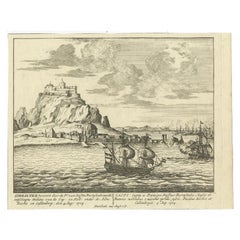
Antique Print of Gibraltar, c.1720
Located in Langweer, NL
Antique print titled 'Gibraltar verovert door de Pr. van Hessen Darmstadt (..)'. Copper engraving of the capture of the fortified town of Gibraltar in 1704 during the War of the Span...
Category
Antique 18th Century and Earlier Maps
Materials
Paper
$417 Sale Price
20% Off
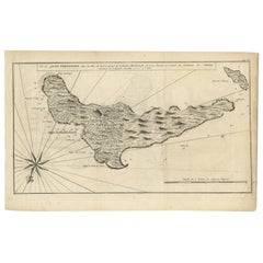
Antique Map of Juan Fernandez, Chile, c.1740
Located in Langweer, NL
Antique map titled 'l'Ile de Juan Fernandes dans la Mer du Sud (..)'.
This map depicts Juan Fernandez Island in the Southern Sea. Source unknown, to be determined.
Artists and En...
Category
Antique 18th Century and Earlier Maps
Materials
Paper
$180 Sale Price
20% Off
Antique Map of the Rhine centered on Cologne, Germany, with original coloring
Located in Langweer, NL
Antique map titled 'Archiepsiscopatus et Electoratus Coloniensis (..)'. Original antique map of the Rhine river, centered on Cologne, Germany. The Rhine River cuts across this map fr...
Category
Antique 18th Century and Earlier Maps
Materials
Paper
$512 Sale Price
20% Off
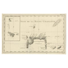
Antique Map of the Santa Cruz Islands with Inset of Carteret and Gower Islands
Located in Langweer, NL
Antique map titled 'Isles de la Reine Charlotte (..)'. A detailed chart of the Santa Cruz islands, to the north of the New Hebrides, with Carteret's track in "Swallow"; including an ...
Category
Antique 18th Century and Earlier Maps
Materials
Paper
$284 Sale Price
20% Off
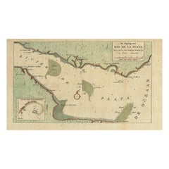
Rare Antique Map of the Rio De La Plata, Buenos Ayres, Brazil, ca.1760
Located in Langweer, NL
Description: Antique map titled 'De Ingang van Rio de la Plata, Waar aan de Stad Buenos Ayres ligt, in Zuid-Amerika'. A map showing the Rio de la Plata es...
Category
Antique 18th Century and Earlier Maps
Materials
Paper
$450 Sale Price
20% Off
Original Hand-Colored Antique Regional Map of Switzerland, 1753
Located in Langweer, NL
Antique map Switzerland titled 'Territorium Reipublicae liberae Helveticae Scaphusiensis (..)'. Regional map of Switzerland.
Artists and En...
Category
Antique 18th Century and Earlier Maps
Materials
Paper
$559 Sale Price
20% Off
Antique Map of Madagascar by N. Sanson, circa 1680
Located in Langweer, NL
Antique map titled 'Isle de Madagascar ou de St. Laurens. Tiree de Sanutu &c'. Antique map of Madagascar, first published by Sanson in 1657. Sanson n...
Category
Antique 18th Century and Earlier Maps
Materials
Paper
$237 Sale Price
20% Off
Map of Languedoc-Roussillon and Provence in France and Piedmont in Italy, c1680
Located in Langweer, NL
Title: Antique map titled 'La basse Partie du Gouvernement de Languedoc, environne des Frontiers des Gouverns de Provence, de Dauphine de Lyonnais et de Guienne et Gascogne ; Les Fro...
Category
Antique 18th Century and Earlier Maps
Materials
Paper
$2,607 Sale Price
20% Off
Antique Map of Guadeloupe, Island in the Caribbean, c.1757
Located in Langweer, NL
Antique map titled 'Carte de L'Isle de la Guadeloupe'.
A very decorative map of Guadeloupe in the Caribbean, adorned with rhumb lines, fleur-de-lys, and two decorative rococo-style...
Category
Antique 18th Century and Earlier Maps
Materials
Paper
$625 Sale Price
20% Off
Antique Print of the City of Ten-Tchoo-Foo, China, 1796
Located in Langweer, NL
Antique print titled 'View of the City of Ten-Tchoo-Foo from the Anchorage of the Hindostan in the Strait of Mi-a-Tau Bearing South-West'. Together on a sheet with 'Cape Maccartney and Cape Gower'.
The top two views depict coastal profile views of local islands named after important people in the Embassy, including Macartney, Staunton, and Gower. Below, a view of the city of Ten-Tchoo-Foo taken from aboard the Hindostan, one of the ships on the mission. These land approach views appeared in the account of George Macartney's travels to China, published by George Nicol. Macartney was Britain's first envoy to China, and was tasked with convincing Emperor Qianlong to ease restrictions on trade between Great Britain and China by allowing the British to have a permanent embassy in the country. Sir George Staunton prepared the official report, 'An Authentic Account of an Embassy from the King of Great Britain to the Emperor of China', which included charts and views based on manuscript sketches and drawings by Sir John Barrow...
Category
Antique 18th Century and Earlier Maps
Materials
Paper
$654 Sale Price
20% Off
Old Map of Prussia, Embellished with a Large Cartouche and Compass Rose, ca.1680
Located in Langweer, NL
Antique map titled 'Prussiae nova Tabula'.
Later edition of Blaeu's map of Prussia, embellished with a large cartouche and compass rose. Prussia was a historically prominent Germ...
Category
Antique 18th Century and Earlier Maps
Materials
Paper
$530 Sale Price
20% Off
Antique Map of the City of Leeuwarden by Priorato, 1673
Located in Langweer, NL
Antique map titled 'Leverden'. This map depicts the city of Leeuwarden (Friesland, The Netherlands). This original antique print originates from 'Teatro del Belgio (…)', published in...
Category
Antique 18th Century and Earlier Maps
Materials
Paper
$113 Sale Price
20% Off
Antique Map of the Coast of Guinea from, Cape Apollonia to the Volta River
Located in Langweer, NL
Antique map titled 'Suite de la Coste de Guinée (..) - Vervolg van de Kust van Guinée (..)'. Decorative map of the coast of Guinea from, Cape Apollonia to the Volta River. Engraved b...
Category
Antique 18th Century and Earlier Maps
Materials
Paper
$341 Sale Price
20% Off
Antique Map of Mozambique and Cape of Good Hope with Kingdom Monomotapa, 1780
Located in Langweer, NL
Antique map titled 'Carte Du Canal De Mozambique.' The main map, on the right, covers from the Cape of Good Hope north as far as Zanzibar and modern day Kenya, focusing on the gold r...
Category
Antique 18th Century and Earlier Maps
Materials
Paper
$497 Sale Price
20% Off
Antique Map of Switzerland by Homann Heirs, c.1732
Located in Langweer, NL
Antique map titled 'Potentissimae Helvetiorum Reipublicae (..)'. Beautiful detailed map of Switzerland, showing the 13 cantons. The large title cartouche showing 13 coat of arms of t...
Category
Antique 18th Century and Earlier Maps
Materials
Paper
$372 Sale Price
20% Off
Original Engraved Antique Map of the World, Colorful and Decorative, C.1780
Located in Langweer, NL
Antique map titled 'Mappemonde en Deux Hemispheres ou l'on a Indique les Nouvelles Decouvertes' - This handsome double hemisphere map presents a ...
Category
Antique 18th Century and Earlier Maps
Materials
Paper
$445 Sale Price
20% Off
Antique Decorative French Map of Java, Indonesia, 1718
Located in Langweer, NL
Antique map of Java titled 'Carte de l'Ile de Java: Partie Occidentale, Partie Orientale, Dressee tout Nouvellement (..)'.
Decorative large format map...
Category
Antique 18th Century and Earlier Maps
Materials
Paper
$2,512 Sale Price
20% Off
Antique Map of India and the Gulf of Bengal by Mallet, c.1686
Located in Langweer, NL
Antique map titled ?Partie Orientale de la Terre Ferme de l'Inde Moderne. Small map of India and the Gulf of Bengal. This map originates from a German edition of 'Description de l' Univers'.
Artists and Engravers: Alain Manesson Mallet (1630-1706) was a French cartographer and engineer. He started his career as a soldier in the army of Louis XIV, became a Sergeant-Major in the artillery and an Inspector of Fortifications. He also served under the King of Portugal, before returning to France, and his appointment to the court of Louis XIV. His military engineering and mathematical background led to his position teaching mathematics at court. His 'Description de L'Universe' contains a wide variety of information, including star maps...
Category
Antique 18th Century and Earlier Maps
Materials
Paper
$331 Sale Price
20% Off
Map of Northern India and Pakistan 'Mogol', Showing Kabul, Delhi Etc., 1758
Located in Langweer, NL
Antique map titled 'Mogol'.
Map of Northern India and Pakistan ('Mogol'), showing Kabul, Delhi and surroundings. This map originates from 'Kort begrip der Oude en Nieuwe Staatkun...
Category
Antique 18th Century and Earlier Maps
Materials
Paper
$350 Sale Price
20% Off
Leicestershire – Antique Map of Leicester by Richard Blome, Britannia 1673
Located in Langweer, NL
Leicestershire – Antique Map of Leicester by Richard Blome, Britannia 1673
This original antique map titled A Mapp of the Country of Leicester presents a detailed and decorative dep...
Category
English Antique 18th Century and Earlier Maps
Materials
Paper
$417 Sale Price
20% Off
Antique Map of the Region of Fulda by Homann, c.1730
Located in Langweer, NL
Antique map titled 'S.R.I. Principatus Fuldensis in Buchonia'. Rare edition of the large JB Homann map of the principality of Fulda, Germany.
Artists and Engravers: Johann Baptist...
Category
Antique 18th Century and Earlier Maps
Materials
Paper
$184 Sale Price
20% Off
Antique Plan of Emden in Germany by Guicciardini, 1612
Located in Langweer, NL
Antique map Emden titled 'Civitas Embda, eo modo situata cum essit controversia inter ipsam et suum Comitem anno'. Small plan of the city of Emden, Germany, Also depicted is part of ...
Category
Antique 18th Century and Earlier Maps
Materials
Paper
$360 Sale Price
20% Off
Antique Optica Print of Amsterdam from the Old Rampart, Netherlands, C.1760
Located in Langweer, NL
Antique print titled 'A view of Amsterdam tacken from the Old Rampart'. Beautiful view of Amsterdam, the Netherlands. This is an optical print, also called 'vue optique' or 'vue d'op...
Category
Antique 18th Century and Earlier Maps
Materials
Paper
$417 Sale Price
20% Off
Antique Map of the City of Zwolle by Guicciardini, 1613
Located in Langweer, NL
Antique map titled 'Swolla'. Map of the city of Zwolle, the Netherlands. This map originates from the 1613 edition of 'Discrittione di tutti i Paesi Bassi', by L. Guicciardini, publi...
Category
Antique 18th Century and Earlier Maps
Materials
Paper
$203 Sale Price
20% Off
Miniature Map of England and Wales with Hand Coloring
Located in Langweer, NL
Antique map titled 'England and Wales'. An attractive miniature map of England and Wales enhanced with hand coloring. Originates from Cary's 'Traveller'...
Category
Antique 18th Century and Earlier Maps
Materials
Paper
$246 Sale Price
20% Off
Antique Map of Delfland by Cruquius, 1712
Located in Langweer, NL
Map no. 25 of a large wall map of Delfland, The Netherlands. The map covers the region of Polder Berkel. To the right, coat of arms of 'De Staten van Ho...
Category
Antique 18th Century and Earlier Maps
Materials
Paper
$701 Sale Price
20% Off
Antique Map of Asia Minor with Cyprus, Syria and Turkey and the Black Sea, 1747
Located in Langweer, NL
Antique map Middle East titled 'A New and accurate map of Anatolia or Asia Minor, with Syria and such other provinces of the Turkish Empire (.....
Category
Antique 18th Century and Earlier Maps
Materials
Paper
$426 Sale Price
20% Off
Antique Plan of Batavia and the Castle in the Dutch East Indies, 1763
Located in Langweer, NL
Antique map titled 'Grundriss von der Stadt und dem Schlosse Batavia.' Plan of the city and the castle of Batavia in the Dutch East Indies / Indonesia. From 'Algemeine Welthistorie (...
Category
Antique 18th Century and Earlier Maps
Materials
Paper
$369 Sale Price
20% Off
Antique Map of the City of Kampen by Guicciardini, 1613
Located in Langweer, NL
Antique map titled 'Urbis Campensis (..)'. Plan of the city of Kampen, the Netherlands. This map originates from the 1613 edition of 'Discrittione di tutti i Paesi Bassi', by L. Guic...
Category
Antique 18th Century and Earlier Maps
Materials
Paper
Antique Map of the South Part of Great Britain by Tirion, c.1750
By Isaak Tirion
Located in Langweer, NL
Antique map titled 'Nieuwe Kaart van 'T Zuider Gedeelte van Groot Britannie behelzende Het Koningryk Engeland (..).'
Attractive map showing the south part of Great Britain; the K...
Category
Antique 18th Century and Earlier Maps
Materials
Paper
$426 Sale Price
20% Off
Original Hand-Colored Antique Map of Gelderland and Utrecht in the Netherlands
Located in Langweer, NL
Antique map titled 'Ducatus Geldriae novissima descriptio'. Detailed map of Gelderland, a province in the Netherlands. Two coats of arms, one with scale. Ships on ‘De Zuyderzee’. Pub...
Category
Antique 18th Century and Earlier Maps
Materials
Paper
$711 Sale Price
50% Off
Antique Map of the City of Leeuwarden by Bast, 1603
Located in Langweer, NL
Antique map titled 'Leeuwerden de hooft stadt van Frislant. Leoverdia Metropolis Frisiae (…) 1603.' Very rare plan of Leeuwarden, Friesland, The Netherlands. With several carouches a...
Category
Antique 18th Century and Earlier Maps
Materials
Paper
$2,583 Sale Price
20% Off
Antique Map of the Region of Zeitz in Germany, 1749
By Schreiber
Located in Langweer, NL
Antique map titled 'Das Stifft Zeitz (..)'. Map of the region of Zeitz, Germany. Zeitz is a town in the Burgenlandkreis district, in Saxony-Anhalt, Germany. It is situated on the riv...
Category
Antique 18th Century and Earlier Maps
Materials
Paper
$312 Sale Price
20% Off
Antique Print of Various Island in French Polynesia, circa 1774
Located in Langweer, NL
Two antique maps on one sheet titled 'Havre d'Ohamaneno a Ulietea' and Havre d'Oopoa a Ulietea'. Also with German subtitles. The upper image depicts Ohamaneno (Vaiaau) Harbour Raiatea (Ulietea) - Leeward Islands...
Category
Antique 18th Century and Earlier Maps
Materials
Paper
$227 Sale Price
20% Off
Original Antique Map of the Maluku Islands or Moluccas
Located in Langweer, NL
Antique map titled 'Carte Particuliere des Isles Moluques - Byzondere Kaart der Molukze Eylanden'. This map depicts the islands of Herij, Ternate, Tidor, Pottebackers, Timor, Machian...
Category
Antique 18th Century and Earlier Maps
Materials
Paper
$180 Sale Price
20% Off
Antique Map of the Wadden Islands, 1792
Located in Langweer, NL
Antique map titled 'Der Vlie Strom'. Map of the Wadden islands with Vlieland in the middle (The Netherlands). This map originates from 'Schauplatz der fünf Theile der Welt' published...
Category
Antique 18th Century and Earlier Maps
Materials
Paper
$331 Sale Price
20% Off
Original Antique Map of the Bay and the Island of Arguin, Mauritania, 1747
Located in Langweer, NL
Antique map titled ’Plan de la Baye et Isle d'Arguim (..) - Oppervlakte van de Baai en 't Eiland van Arguin (..)'.
Original antique map of the bay and the island of Arguin. This ...
Category
Antique 18th Century and Earlier Maps
Materials
Paper
$246 Sale Price
20% Off
Rare Print of the Governor-General's Residence in Batavia 'Jakarta', Indonesia
Located in Langweer, NL
Antique print titled 'Ein Prospect Sr. Hoch-Edelheit des Herrn Gen: Gouverneurs Hoff und Wohnhausses in dem Castel Batavia wie dasselbe von innen anzusehen'. Old print with a view of the Governor...
Category
Antique 18th Century and Earlier Maps
Materials
Paper
$616 Sale Price
20% Off
Detailed Original Antique Map of Turkey in Europe, circa 1740
Located in Langweer, NL
Antique map Turkish Empire tilted 'Turky in Europe'. Beautiful, small antique map depicting modern-day Greece and surroundings. Source unknown, to be determined.
Artists and Engra...
Category
Antique 18th Century and Earlier Maps
Materials
Paper
$322 Sale Price
20% Off
Antique Print of Zihuatanejo and the harbour of Acapulco in South America, 1749
Located in Langweer, NL
Antique print titled 'Vue de l'entree de Chequetan ou Seguataneo, restant au N.E. a la distance de 5 milles.' 'Vue de l'entree du port d'Acapulco.' View of Zihuatanejo and the harbou...
Category
Antique 18th Century and Earlier Maps
Materials
Paper
$208 Sale Price
20% Off
Antique Print of Capital Batavia in the Dutch East Indies 'Indonesia', C.1752
Located in Langweer, NL
Antique print Indonesia titled 'Vue Du Chateau De Batavia - Perspectief van het kasteel Batavia'. View of the Castle of Batavia, seen from the sugar warehouse. Originates from Antoin...
Category
Antique 18th Century and Earlier Maps
Materials
Paper
$341 Sale Price
20% Off
Antique Map of France at the End of the Reign of Jean II by Zannoni, 1765
Located in Langweer, NL
Antique map France titled 'La France sous la fin du Regne de Jean II (..)'. Beautiful old map of France. This map originates from 'Atlas Historique de la France Ancienne et Moderne' ...
Category
Antique 18th Century and Earlier Maps
Materials
Paper
$150 Sale Price
20% Off
Engraving of Alejandro Selkirk Island, Juan Fernández-archipel, Chile, 1749
Located in Langweer, NL
Antique print titled 'Vue de la cote du N. E. de Masa-Fuero' - 'Vue de la cote occidentale de Masa-Fuero a la distance de quatre milles.' Views of Alejandro Selkirk Island...
Category
Antique 18th Century and Earlier Maps
Materials
Paper
$208 Sale Price
20% Off
Antique Print of a Section of the Kew Gardens, London, England, c.1785
Located in Langweer, NL
Antique print titled 'Coupe sur la longueur d'une partie de la Galerie des Antiques dans les jardins de Kew'.
Copper engraving showing a section of the Royal Botanic...
Category
Antique 18th Century and Earlier Maps
Materials
Paper
$341 Sale Price
20% Off
Rhine Splendor: Antique Map of the Lower Rhine Region, circa 1680
Located in Langweer, NL
The antique map titled 'Novissima et Accuratissima Archiepiscopatus et Electoratus Coloniensis Ducatuum Iuliancensis et Montensis et Meursiae Comitatus' is a handsome and detailed ma...
Category
Antique 18th Century and Earlier Maps
Materials
Paper
$910 Sale Price
20% Off
Old Engraving of Batavia 'Jakarta, Indonesia' with Map and Harbour View, 1750
Located in Langweer, NL
Antique map titled 'Carte des environs de Batavia '. French map of the Batavia area (Jakarta) in Indonesia. With cartouche, scale and compass rose. Published circa 1750.
The map i...
Category
Antique 18th Century and Earlier Maps
Materials
Paper
$521 Sale Price
20% Off
Old Map of Region Champagne-Ardenne with Reims, Troyes & Épernay in France, 1759
Located in Langweer, NL
Antique map titled 'Tabula Geographica Campaniae (..).'
Detailed map of the Champagne region in France by J. B. Homann, covering the region Champagne-Ardenne with Reims, Troyes a...
Category
Antique 18th Century and Earlier Maps
Materials
Paper
$696 Sale Price
30% Off
Antique Map of the Cape Verde Islands and Part of Senegal, West Africa, 1690
Located in Langweer, NL
Antique map titled 'Bocche del Fivme Negro et Isole di Capo Verde'. Beautiful double-page map of the Cape Verde Islands and part of the coast of Senegal, with large decorative cartou...
Category
Italian Antique 18th Century and Earlier Maps
Materials
Paper
Cemetery on Amsterdam Island, French Territory in the Indian Ocean, ca.1785
Located in Langweer, NL
Antique print titled 'Begraafplaats op het eiland Amsterdam'.
Engraved view of a local cemetery on Amsterdam Island, a small French territory in the southern Indian Ocean. Origin...
Category
Antique 18th Century and Earlier Maps
Materials
Paper
$274 Sale Price
20% Off
Antique Map of the Islands Within the Queen Charlotte's Islands
Located in Langweer, NL
Antique map titled 'Cote Septentrional de la plus grande des Isles de la Reine Charlotte (..)'. Map and coastal view of the islands within the Queen Charlotte's Islands (Santa Cruz I...
Category
Antique 18th Century and Earlier Maps
Materials
Paper
$312 Sale Price
20% Off
Original Antique Hand- Map of Africa by Allard '1697'
Located in Langweer, NL
Antique map titled 'Novissima et Perfectissima Africae (..)'. Beautiful large map of Africa. This is the 3rd state of the map, with climate notation add...
Category
Antique 18th Century and Earlier Maps
Materials
Paper
$1,155 Sale Price
35% Off
Antique Print with Views of Sir Charles Saunders Island and Other Islands, 1774
Located in Langweer, NL
Explore the captivating world of the 18th century with this exquisite antique print titled 'Isles de Sir Charles Saunder Latitude (...)'. I A journey through time as you delve into t...
Category
Antique 18th Century and Earlier Maps
Materials
Paper
$303 Sale Price
20% Off
Antique Frontispiece of an Old Dutch Book Depicting Globe Makers, 1717
Located in Langweer, NL
Antique frontispiece titled 'Iets voor Allen'. This print originates from 'Iets voor Allen, zijnde een Verhandeling en Verbeelding Van allerhande Standen, Studien, Konsten, Wetenscha...
Category
Antique 18th Century and Earlier Maps
Materials
Paper
Antique Map of Sumatra, Indonesia 'c.1780'
Located in Langweer, NL
Antique map titled 'Neue Karte von der Insel Sumatra'. Extremely rare map of Sumatra, Indonesia. Published circa 1780.
Category
Antique 18th Century and Earlier Maps
Materials
Paper
$2,489 Sale Price
40% Off
Engraving of Idols of Secotam Village in Virginia 'or now North Carolina', 1721
Located in Langweer, NL
Two religious images on one plate. Upper image 'Kiwasa idole des Virginiens'.
Kiwasa, this Idol is placed in the temple of the town of Secotam, as the keeper of the king's dead c...
Category
Antique 18th Century and Earlier Maps
Materials
Paper
$417 Sale Price
20% Off
Antique Map of the City of Workum by Blaeu, 1649
Located in Langweer, NL
Antique map titled 'Worckum'. Old map of the city of Workum, Friesland. Originates from J. Blaeu's 'Town Book'.
Artists and Engravers: Joan Blaeu (23 September 1596 - 28 May 1673...
Category
Antique 18th Century and Earlier Maps
Materials
Paper
$123 Sale Price
20% Off
Original Copper-Engraving of Westergo, Part of Friesland, the Netherlands, 1744
Located in Langweer, NL
Antique map titled 'Westergo'.
Original antique map of Westergo, part of the province of Friesland, the Netherlands. Published 1744.
Artists and engravers: Isaak Tirion (1705 ...
Category
Antique 18th Century and Earlier Maps
Materials
Paper
$606 Sale Price
20% Off
Antique Map of the Mughal Empire by Van der Aa, C.1725
Located in Langweer, NL
Antique map titled 'Royaume de Grand Mogol (..).' This map shows the extend of the Mughal Empire, which includes northern India, from Golconda to Afghanistan and eastwards to Bengal....
Category
Antique 18th Century and Earlier Maps
Materials
Paper
Antique Map of England, Also Showing Calais
Located in Langweer, NL
Antique map titled 'Carte de l'Angleterre pour le Voyage dans les trois Royaumes'. Original old map of England, also showing Calais. This map originates from 'Voyage dans les trois r...
Category
Antique 18th Century and Earlier Maps
Materials
Paper
$132 Sale Price
20% Off
Antique Print with Charts of York's Bay and Surroundings
Located in Langweer, NL
Antique map titled 'Côte depuis la Baye d'York (..)'. Charts of York's Bay, Haven of the Three Islands, St. David's Bay, and Elizabeth's Bay.
Published in an edition of John Hawk...
Category
Antique 18th Century and Earlier Maps
Materials
Paper
$417 Sale Price
20% Off
