19th Century Maps
to
1,668
2,203
75
2,281
72
9
9
4
2
2
1
1
2,971
2,281
474
3
290
34
10
126
10
37
9
2
5
4
3
3
2,243
71
33
13
11
356
175
107
106
102
2,281
2,281
2,281
104
23
9
8
7
Period: 19th Century
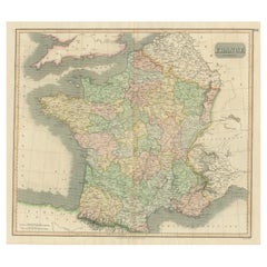
Large Antique Map of France with Original Hand Coloring
Located in Langweer, NL
Antique map titled 'France in Provinces'. Beautiful antique map of France. Drawn and engraved for John Thomson's 'New General Atlas' published circa 1814.
Category
Antique 19th Century Maps
Materials
Paper
$417 Sale Price
20% Off
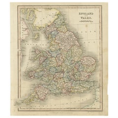
Antique Map of England and Wales, Also Showing the English Channel
Located in Langweer, NL
Antique map titled 'England and Wales'. Original antique map of England and Wales. Drawn and engraved by J. Dower. Originates from 'A General Descriptive Atlas Of The Earth, Containi...
Category
Antique 19th Century Maps
Materials
Paper
$142 Sale Price
20% Off
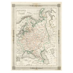
Antique Map of Russia in Europe, with Frame Style Border
Located in Langweer, NL
Antique map titled 'Russie d'Europe'. Attractive map of Russia in Europe, covers the European portions of Russia from the Arctic Sea south to the Black Sea and Caspian Sea. This map ...
Category
Antique 19th Century Maps
Materials
Paper
$123 Sale Price
20% Off
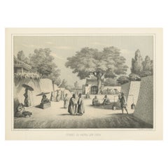
Original Antique Print of a Street Scene in Naha, Okinawa in Japan, 1856
Located in Langweer, NL
Antique print titled ‘Street in Napha Lew-Chew'.
Antique print of a street scene in Naha, the capital city of the Okinawa Prefecture, Japan. Okinawa used to be called Great Lew C...
Category
Antique 19th Century Maps
Materials
Paper
$227 Sale Price
20% Off
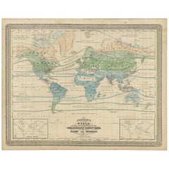
Antique Map of the World Showing the Distribution of Plants and Minerals, 1872
Located in Langweer, NL
Antique map titled 'Johnson's World showing the distribution of the Characteristic Forest Trees (..)'. Original world map showing the distribution o...
Category
Antique 19th Century Maps
Materials
Paper
$189 Sale Price
20% Off
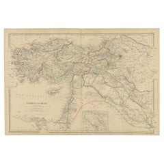
Old Map of Turkey in Asia with Mosul Environs and Assyrian Ruins Inset , 1859
Located in Langweer, NL
Turkey in Asia – Antique Map by W\.G. Blackie, 1859, with Inset of Assyrian Ruins
This finely detailed antique map titled *Turkey in Asia* is an original engraving from W\.G. Blacki...
Category
English Antique 19th Century Maps
Materials
Paper
Large Antique County Map of Warwickshire, England
Located in Langweer, NL
Antique map titled 'A Map of Warwickshire from the best Authorities'. Original old county map of Warwickshire, England. Engraved by John Cary. Originates from 'New British Atlas' by ...
Category
Antique 19th Century Maps
Materials
Paper
$237 Sale Price
20% Off
German Antique Map of Australia and Polynesia, c.1870
Located in Langweer, NL
Antique map titled 'Inseln des Grossen Oceans, Australien und Polynesien'. Old map of Australia and Polynesia. This map originates from 'H. Kiepert's Kleiner Atlas der Neueren Geogra...
Category
Antique 19th Century Maps
Materials
Paper
$142 Sale Price
20% Off
Antique Map of Rome and Athens by Perthes, 1848
Located in Langweer, NL
Antique map titled 'Roma Vetus, Athenae, Urbs, Campus Trojae'. Old map of Rome, Athens and surroundings originating from 'Orbis Terrarum Antiquus in usum S...
Category
Antique 19th Century Maps
Materials
Paper
$93 Sale Price
20% Off
Antique Map of the Barbary Coast by Lapie, 1842
Located in Langweer, NL
Antique map titled 'Carte de la Barbarie contenant l'Empire de Maroc (..)'. Map of the Barbary Coast. This map originates from 'Atlas universel de géographie ancienne et moderne (..)...
Category
Antique 19th Century Maps
Materials
Paper
$231 Sale Price
20% Off
French Antique Map of Northern Africa and Libya, c.1840
Located in Langweer, NL
Antique map titled 'Marok, Alger et Tunis - Etat de Tripoli'. Map of Northern Africa and Libya. This map originates from 'Le globe Atlas classique Universel de géographie ancienne et...
Category
Antique 19th Century Maps
Materials
Paper
Antique Geological Map of the World by Johnston '1850'
Located in Langweer, NL
Antique map titled 'The Geological Structure of the Globe'. Original antique geological map of the world. This map originates from 'The Physica...
Category
Antique 19th Century Maps
Materials
Paper
$284 Sale Price
20% Off
Decorative Antique Map of the Malay Archipelago or East Indies Island, 1851
Located in Langweer, NL
Antique map Indonesia titled 'Malay Archipelago, or East India Islands'. With vignettes of Victoria Mount, New Guinea, Nativaes of New Guinea an...
Category
Antique 19th Century Maps
Materials
Paper
$1,043 Sale Price
20% Off
Antique Map of Italy with an Inset of Rome, 1812
Located in Langweer, NL
Antique map titled 'Italie Ancienne'.
Old map of ancient Italy, with an inset map of the region of Rome. This map originates from 'Atlas Supplementaire du Precis de la Geographie...
Category
Antique 19th Century Maps
Materials
Paper
$151 Sale Price
20% Off
Antique Map of Russia in Asia by Tallis, c.1851
Located in Langweer, NL
Antique map titled 'Russia in Asia'. Map of Russia in Asia. Showing vignettes of a polar hunting scene, Skorskarskoi Pagost, Troitsk and Kamchatkan Dogs. Originates from 'The Illustrated Atlas, And Modern History Of The World Geographical, Political, Commercial & Statistical, Edited By R. Montgomery Martin'. Published; John Tallis London, New York, Edinburgh & Dublin. 1851. Drawn and Engraved by J. Rapkin. Artists and Engravers: John Tallis (1817-1876) was a British map...
Category
Antique 19th Century Maps
Materials
Paper
Antique Map of Denmark with Insets of Iceland and the Faroe Islands, c.1873
Located in Langweer, NL
Antique map titled 'Denemarken, Sleeswijk-Holstein en Lauenburg'. Old map depicting Denmark, with inset maps of Iceland and the Faroe Islands. This map originates from 'School-Atlas ...
Category
Antique 19th Century Maps
Materials
Paper
$151 Sale Price
20% Off
Beautiful Lithograph of The Vulcano Gunung Lamongan, Java, Indonesia, c.1853
Located in Langweer, NL
Antique print titled 'G. Lamongan'. Beautiful lithograph of Gunung Lamongan. Gunung Lamongan or Mount Lamongan (1,651m - 5, 417 ft) is a small stratovolcano located between the massi...
Category
Antique 19th Century Maps
Materials
Paper
$398 Sale Price
20% Off
Antique Print of Ribbons of King James VI by Gibb, 1890
Located in Langweer, NL
Antique print titled 'Leading Strings of King James VI'. Chromolithographic plate originating from 'The Royal House of Stuart. Illustrated By a Series of Fort...
Category
Antique 19th Century Maps
Materials
Paper
$80 Sale Price
20% Off
Small Antique World Map in Decorative Old Hand-Colouring, circa 1840
Located in Langweer, NL
Antique map titled 'Wereld Kaart'. Small and very decorative double hemisphere world map. Source unknown, to be determined. Published c.1840.
Artists and Engravers: Daniel Veelwaa...
Category
Antique 19th Century Maps
Materials
Paper
$208 Sale Price
20% Off
Antique Map Showing the Ocean Currents and Temperature of Air, '1872'
Located in Langweer, NL
Two maps on one sheet titled 'Johnson's Oceans Currents (..)' and 'Johnson's World showing the Distribution of the Temperature of the Air'. Original world map...
Category
Antique 19th Century Maps
Materials
Paper
$331 Sale Price
20% Off
Antique Map of Northern India 'British Indies', C.1880
Located in Langweer, NL
Plate 56 : 'Britsch-Indie, Noord.' (British Indies, North). This lithographed map originates from: 'Wereld-atlas voor Kantoor en Huiskamer' (transl: World Atlas for the office and li...
Category
Antique 19th Century Maps
Materials
Paper
$61 Sale Price
20% Off
French Antique Map of India with an Inset of Pondicherry, 1835
Located in Langweer, NL
Antique map India titled 'Presqu'ile de l'Inde en de ca du Gange'. Miniature map depicting India with an inset map of Pondicherry (Puducherry). This ...
Category
Antique 19th Century Maps
Materials
Paper
$151 Sale Price
20% Off
Antique Print of the Landing at Tanna Island by Cook, 1803
Located in Langweer, NL
Antique print New Hebrides titled 'Landing op het Eiland Tanna, een van de Nieuwe Hebriden'. Antique print depicting the landing at one of the islands of the New Hebrides, Vanuatu. O...
Category
Antique 19th Century Maps
Materials
Paper
$512 Sale Price
20% Off
Antique Map of North Africa and South Africa by Black, 1854
Located in Langweer, NL
Antique map titled 'Africa north part - Africa south part'. Old map of Africa showing the region of Morocco, Algeria and South Africa. This map orginates from 'General Atlas Of The W...
Category
Antique 19th Century Maps
Materials
Paper
$104 Sale Price
20% Off
Antique Map of France from an Old Dutch School Atlas, 1852
Located in Langweer, NL
Antique map titled 'Frankrijk'. Map of France. This map originates from 'School-Atlas van alle deelen der Aarde' by Otto Petri. Artists and Engravers: Published by A. Baedeker (Otto ...
Category
Antique 19th Century Maps
Materials
Paper
$113 Sale Price
20% Off
Hand Colored Antique Map of the Department of L'aisne, France
Located in Langweer, NL
Antique map titled 'Dépt. de l'Aisne'. Map of the French department of l'Aisne, France. The whole is surrounded by elaborate decorative engravings designed to illustrate both the nat...
Category
Antique 19th Century Maps
Materials
Paper
$322 Sale Price
20% Off
Antique Map of France by Migeon, 1880
Located in Langweer, NL
Antique map titled 'France Physique'. Old map of France. This map originates from 'Géographie Universelle Atlas-Migeon' by J. Migeon.
Artists and Engravers: Published by J. Migeon...
Category
Antique 19th Century Maps
Materials
Paper
$123 Sale Price
20% Off
1850 Old French Map Depicting the Entire Earth's Surface Divided into Two Parts
Located in Milan, IT
Geographical map depicting the entire earth's surface divided into two parts that correspond to the two hemispheres or globes, the map deals with the earth in general. Detailed expla...
Category
French Antique 19th Century Maps
Materials
Glass, Wood, Paper
Antique Map of South America by Buchon, 1825
Located in Langweer, NL
Antique map titled 'Carte de l'Amérique méridionale'. Map of South America with attractive topography, surrounded on three sides by text on the history, geography, and economy of the...
Category
Antique 19th Century Maps
Materials
Paper
$130 Sale Price
20% Off
Antique Map of Europe by Levasseur 'c.1840'
Located in Langweer, NL
Antique map titled 'Europe'. Original antique map of Europe. Decorative map of the continent surrounded by allegorical vignettes. Engraved by Raimond Bonheur, father of the famous Fr...
Category
Antique 19th Century Maps
Materials
Paper
$474 Sale Price
20% Off
Antique Map of the North Pole by Fullarton, 1856
Located in Langweer, NL
Antique map titled 'The Arctic Regions showing the North-West Passage of Captain R. McClure'. Old map of the North Pole, displaying the Northwest Passage di...
Category
Antique 19th Century Maps
Materials
Paper
$120 Sale Price
20% Off
Antique Map of Lot et Garonne ‘France’ by V. Levasseur, 1854
Located in Langweer, NL
Antique map titled 'Dépt. de Lot et Garonne'. Map of the French department of Lot et Garonne, France. This area of France is known for its production of Buzet wines and Cabécou d’Ant...
Category
Antique 19th Century Maps
Materials
Paper
$170 Sale Price
20% Off
Nice Colourful Antique Map of the Rivers and Mountains of Europe c.1870
Located in Langweer, NL
Antique map titled 'Fluss und Gebirgs Karte von Mittel-Europa'. Old map of the European continent depicting the European mountains and rivers. This map originates from 'H. Kiepert's ...
Category
Antique 19th Century Maps
Materials
Paper
$227 Sale Price
20% Off
Original Antique Map of the Dutch East Indies, Nowadays Indonesia, ca.1840
Located in Langweer, NL
Original antique map of the East Indies including Borneo, Celebes, Java, Sumatra and surrounding islands. Published circa 1840.
Artists and Engravers: Engraved by J. & C. Walker....
Category
Antique 19th Century Maps
Materials
Paper
$227 Sale Price
20% Off
Antique Costume Print of a Slovake from the Region of Košice, ca 1880
Located in Langweer, NL
Antique costume print titled 'Slovake aus der Gegend von Kaschau'. Old print showing a Slovake from the area of Košice. This print originates from 'Blätter für Kostümkunde'. The Slov...
Category
Antique 19th Century Maps
Materials
Paper
$208 Sale Price
20% Off
Antique Print of Bucha in Germany, c.1840
Located in Langweer, NL
Antique print titled 'Bucha, vom Kirchberge aufgenommen'. View of Bucha, Germany. Source unknown, to be determined.
Artists and Engravers: Published by Renner & Ketzschau.
Cond...
Category
Antique 19th Century Maps
Materials
Paper
$85 Sale Price
20% Off
Antique Print of Mary Queen of Scots' Cabinet by Gibb, 1890
Located in Langweer, NL
Antique print titled 'Mary Queen of Scots' Cabinet'. Chromolithographic plate originating from 'The Royal House of Stuart. Illustrated By a Series ...
Category
Antique 19th Century Maps
Materials
Paper
$80 Sale Price
20% Off
Antique Map of the Peter the Great Gulf by Reclus, 1881
Located in Langweer, NL
Antique map titled 'Le Golfe de Pierre-Le-Grand.' This map shows the Peter The Great Gulf in the Sea of Japan adjoining the coast of Russia's Primorski...
Category
Antique 19th Century Maps
Materials
Paper
$84 Sale Price
20% Off
Antique Map of South America by Finlayson, 1822
Located in Langweer, NL
Antique map titled 'Geographical, Statistical and Historical Map of the United Provinces of South America'. This map depicts part of South America (including part of Brazil and Chili...
Category
Antique 19th Century Maps
Materials
Paper
$254 Sale Price
20% Off
Antique Map of the World by D'Urville '1853'
Located in Langweer, NL
Antique map titled 'Voyage Autour du Monde'. Original map of the world. This map originates from volume 1 of 'Voyage Autour du Monde' by Comte-Amiral Dumont D'Urville.
Category
Antique 19th Century Maps
Materials
Paper
$284 Sale Price
20% Off
Antique Map of Russia in Europe by Petri, c.1873
Located in Langweer, NL
Antique map titled 'Rusland in Europa'. Old map depicting Russia in Europe. This map originates from 'School-Atlas van alle Deelen der Aarde'. Artists and Engravers: Published by O. ...
Category
Antique 19th Century Maps
Materials
Paper
$91 Sale Price
20% Off
Antique Map of Germany by French Cartographer Lapie, 1842
Located in Langweer, NL
Antique map titled 'Carte d'Allemagne (..)'. Map of Germany. This map originates from 'Atlas universel de géographie ancienne et moderne (..)' by Pierre M. Lapie and Alexandre E. Lap...
Category
Antique 19th Century Maps
Materials
Paper
$246 Sale Price
20% Off
Old Print Depicting Various Utensils of Tongatabu, Site of Tonga's Capital, 1836
Located in Langweer, NL
Antique print titled 'Tonga-Tabu'.
Tongatapu is the main island of the Kingdom of Tonga and site of Tonga’s capital, Nuku?alofa. It is located in Tonga's southern island group, t...
Category
Antique 19th Century Maps
Materials
Paper
$303 Sale Price
20% Off
Antique Map of North and South Africa by Johnston, 1882
Located in Langweer, NL
Two antique maps on one sheet titled 'N.W. Africa, Marocco, Algeria & Tunis' and 'Southern Africa, comprising Cape Colony, Natal & c'.
This map originates from 'The Royal Atlas of ...
Category
Antique 19th Century Maps
Materials
Paper
Antique Map of Polynesia with Details of Many Islands, 1840
Located in Langweer, NL
Antique map titled 'Polynesia or Islands in the Pacific Ocean'.
This map depicts various islands including the Lousiade Archipelago, Tahiti, Pitcairn Island, Juan Fernandez, The lo...
Category
Antique 19th Century Maps
Materials
Paper
Antique Map of the Black Sea and Surroundings by Sharpe, 1849
Located in Langweer, NL
Antique map titled 'Russia on the Euxine'. Old map of the Black Sea and the surrounding (Russia). This map originates from 'Sharpe's Corresponding Atlas (..)' by J. Sharpe. Artists and Engravers: Published by Chapman and Hall...
Category
Antique 19th Century Maps
Materials
Paper
$90 Sale Price
20% Off
Antique Map of the Province of Zeeland by Veelwaard, C.1840
Located in Langweer, NL
Antique map titled 'Kaart van Zeeland (..).' Uncommon map showing the province of Zeeland in the Netherlands. Source unkown, to be determined. Published circa 1840.
Artists and E...
Category
Antique 19th Century Maps
Materials
Paper
$118 Sale Price
20% Off
Antique Map of the Dutch Province of Noord-Holland, 1883
Located in Langweer, NL
Antique map titled 'Noord-Holland'. Map of Noord-Holland, a province of the Netherlands. This map originates from 'Atlas van Nederland volgens de nieuwe spelregels' by J. Kuyper. Art...
Category
Antique 19th Century Maps
Materials
Paper
$128 Sale Price
20% Off
Scarce Antique Map of Lake Toba and Silindoeng on Sumatra, Indonesia, c.1875
Located in Langweer, NL
Antique map titled 'Kaart van het Toba-Meer en het landschap Silindoeng.'
This scarce map shows Lake Toba and Silindoeng on the Indonesian island of Sumatra. Originates from 'Tij...
Category
Antique 19th Century Maps
Materials
Paper
$170 Sale Price
20% Off
Antique Map of the Coast of Northwest Africa by Dien, 1820
Located in Langweer, NL
Antique map Africa titled 'Partie Occidentale de l'Ancien Continent, depuis Lisbonne jusquá la Riviere de Sierra Leona'. Detailed map of Coastal Nor...
Category
Antique 19th Century Maps
Materials
Paper
$116 Sale Price
20% Off
Original Antique Map of the Channel Islands, Incl. Decorative Vignettes, 1851
Located in Langweer, NL
Antique map titled ‘Channel Islands’.
Includes decorative vignettes titled St. Peters Port, Castle Cornet, Druidical altar near Lancresse, Mont Orgueil Castle and Jersey. Originates from 'The Illustrated Atlas, And Modern History Of The World Geographical, Political, Commercial & Statistical, Edited By R. Montgomery Martin'. Published; John Tallis London, New York, Edinburgh & Dublin. 1851. Drawn and Engraved by J. Rapkin.
Artists and engravers: John Tallis (1817-1876) was a British map...
Category
Antique 19th Century Maps
Materials
Paper
$426 Sale Price
20% Off
Antique Map of the Netherlands in 1530 by Mees, 1852
Located in Langweer, NL
Antique map titled 'Noord-Nederland in 1530. De laatste tijden der Grafelijke Regering'. Map of the Netherlands in 1530. This map originates from 'Historische Atlas van Noord-Nederla...
Category
Antique 19th Century Maps
Materials
Paper
$121 Sale Price
20% Off
Vintage Cartographic Collection Set of India Explored - W. G. Blackie's 1859
Located in Langweer, NL
Antique map titled 'India'. Original antique map of India with inset maps of Pegu, the Tenasserim Provinces, straits settlements. This map originate...
Category
Antique 19th Century Maps
Materials
Paper
$379 Sale Price / set
20% Off
Hand Colored Antique Map of the Department of Cher, France
Located in Langweer, NL
Antique map titled 'Dépt. du Cher'. Map of the French department of Cher, France. This area of France is known for its production of Selles Sur Cher, a goats-milk cheese. The whole i...
Category
Antique 19th Century Maps
Materials
Paper
$322 Sale Price
20% Off
Old Map of Java, Indonesia by Stemler, 1875
By Stemler
Located in Langweer, NL
Antique map titled 'Hoofddriehoeken - Java en madoera.' (Main triangles measured by the Geographical Service in the Dutch-Indies on Java and Madoera.) This scarce map shows the Indon...
Category
Antique 19th Century Maps
Materials
Paper
$66 Sale Price
20% Off
Antique Map of Africa by Delamarche, 1806
Located in Langweer, NL
Antique map titled 'L'Afrique'.
Decorative map of Africa by Robert de Vaugondy, revised and published by Delamarche. Source unknown, to be determined.
Artists and Engravers: Charl...
Category
Antique 19th Century Maps
Materials
Paper
$256 Sale Price
20% Off
Antique Print of the Bolshoi Theatre in Saint Petersburg, Russia, ca.1810
Located in Langweer, NL
Description: Antique print titled 'The Stone Theatre at St. Petgersbourg'. View ofthe Bolshoi Theatre in Saint Petersburg, Russia. In 1886 the building was declared unsafe and, at th...
Category
Antique 19th Century Maps
Materials
Paper
$227 Sale Price / item
20% Off
Antique Print of Warriors from Ombai Island, Alor, Archipel, Indonesia, ca.1845
Located in Langweer, NL
Antique print titled 'Bewohner von Ombai, Habitans de l'isle de Ombai'.
This print depicts natives from Ombai, Indonesia. Originates from 'Naturgeschichte und Abbildungen des Men...
Category
Antique 19th Century Maps
Materials
Paper
$322 Sale Price
20% Off
Rare Antique Print of a Park in Utrecht, The Netherlands, c.1860
Located in Langweer, NL
Antique print Utrecht titled 'Gezigt in het Plantsoen op de Malie-Barrière te zien'. Old tinted lithograph depicting a park of Utrecht. This print orginates from ' Een Cahier Gezigte...
Category
Antique 19th Century Maps
Materials
Paper
$218 Sale Price
20% Off
Antique Map of Oceania by Balbi '1847'
Located in Langweer, NL
Antique map titled 'Océanie'. Original antique map of Oceania. This map originates from 'Abrégé de Géographie (..)' by Adrien Balbi. Published 1847.
Category
Antique 19th Century Maps
Materials
Paper
$142 Sale Price
20% Off
