19th Century Maps
to
1,667
2,202
75
2,280
71
9
9
4
2
2
1
1
2,970
2,280
474
3
290
34
10
126
10
37
9
2
5
4
3
3
2,242
70
32
13
11
358
175
108
106
102
2,280
2,280
2,280
104
23
9
8
7
Period: 19th Century
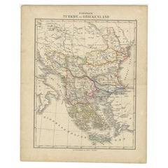
Antique Map of Turkey and Greece by Petri, c.1873
Located in Langweer, NL
Antique map titled 'Europisch Turkije en Griekenland'. Old map depicting Turkey in Europe and Greece. This map originates from 'School-Atlas van alle Deelen der Aarde'.
Artists and...
Category
Antique 19th Century Maps
Materials
Paper
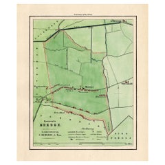
Antique Map of the Township of Meeden in Groningen, the Netherlands, 1862
Located in Langweer, NL
Groningen: Gemeente Meeden. These scarse detailed maps of Dutch Towns originate from the 'Gemeente atlas van de Provincie Groningen in 62 kaarten.' by C. Fehse. This atlas of all tow...
Category
Antique 19th Century Maps
Materials
Paper
$171 Sale Price
20% Off
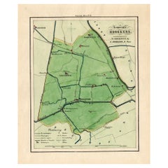
Antique Map of the Township of Hoogkerk in Groningen, The Netherlands, 1862
Located in Langweer, NL
Groningen: Gemeente Dorkwerd-Hoogkerk-Leegkerk-Vinkhuizen. These scarse detailed maps of Dutch Towns originate from the 'Gemeente atlas van de Provincie Groningen in 62 kaarten.' by ...
Category
Antique 19th Century Maps
Materials
Paper
$171 Sale Price
20% Off
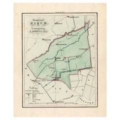
Antique Map of the Township of Marum in Groningen, The Netherlands, 1862
Located in Langweer, NL
Groningen: Gemeente Marum-Noordwijk-NuiS. These scarse detailed maps of Dutch Towns originate from the 'Gemeente atlas van de Provincie Groningen in 62 kaarten.' by C. Fehse. This at...
Category
Antique 19th Century Maps
Materials
Paper
$171 Sale Price
20% Off
Antique Map of the Township of Gieten in the Netherlands, 1865
Located in Langweer, NL
Drenthe: Gemeente Gieten, Gieterveen, De Hilte. These scarse detailed maps of Dutch Towns originate from the 'Gemeente-atlas' of Jacob Kuyper. This atlas of all towns in the Netherla...
Category
Antique 19th Century Maps
Materials
Paper
$181 Sale Price
20% Off
Antique Map of the Township of Oosterhesselen in the Netherlands, 1865
Located in Langweer, NL
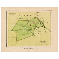
Drenthe: Gemeente Oosterhesselen, Zwinderen. These scarse detailed maps of Dutch Towns originate from the 'Gemeente-atlas' of Jacob Kuyper. This atlas of all towns in the Netherlands...
Category
Antique 19th Century Maps
Materials
Paper
$181 Sale Price
20% Off
Antique Map of the Township of Sleen in the Netherlands, 1865
Located in Langweer, NL
Drenthe: Gemeente Sleen, Emmerzand, Venoord. These scarse detailed maps of Dutch Towns originate from the 'Gemeente-atlas' of Jacob Kuyper. This atlas of all towns in the Netherlands...
Category
Antique 19th Century Maps
Materials
Paper
$133 Sale Price
20% Off
Antique Map of the Township of Roden, Drenthe, in the Netherlands, 1865
Located in Langweer, NL
Drenthe: Gemeente Roden, Roderwolde, Lieveren, Steenbergen, Ter Heijl. These scarse detailed maps of Dutch Towns originate from the 'Gemeente-atlas' of Jacob Kuyper. This atlas of al...
Category
Antique 19th Century Maps
Materials
Paper
$181 Sale Price
20% Off
Antique Map of the Township of Norg in Drenthe, the Netherlands, 1865
Located in Langweer, NL
Drenthe: Gemeente Norg, Fen, Langeloo, Veenhuizen, Norgervaart. These scarse detailed maps of Dutch Towns originate from the 'Gemeente-atlas' of Jacob Kuyper. This atlas of all towns...
Category
Antique 19th Century Maps
Materials
Paper
$181 Sale Price
20% Off
Antique Map of the Township of Rolde, Drenthe, the Netherlands, 1865
Located in Langweer, NL
Drenthe: Gemeente Rolde, Balloo, Grolloo, Schoonlo. These scarse detailed maps of Dutch Towns originate from the 'Gemeente-atlas' of Jacob Kuyper. This atlas of all towns in the Neth...
Category
Antique 19th Century Maps
Materials
Paper
$181 Sale Price
20% Off
Antique Map of the Township of Ruinen, Drenthe in the Netherlands, circa 1865
Located in Langweer, NL
Drenthe: Gemeente Ruinen, Ansen, Bultinge, Oostering. These scarse detailed maps of Dutch Towns originate from the 'Gemeente-atlas' of Jacob Kuyper. This atlas of all towns in the Ne...
Category
Antique 19th Century Maps
Materials
Paper
$190 Sale Price
20% Off
Antique Map of the Township of Vledder, Drenthe in the Netherlands, 1865
Located in Langweer, NL
Drenthe: Gemeente Vledder, Doldersum, Nijensleek. These scarse detailed maps of Dutch Towns originate from the 'Gemeente-atlas' of Jacob Kuyper. This atlas of all towns in the Nether...
Category
Antique 19th Century Maps
Materials
Paper
$181 Sale Price
20% Off
Antique Map of the Township of De Wijk, Drenthe in the Netherlands, 1865
Located in Langweer, NL
Drenthe: Gemeente De Wijk, Broekhuizen, Koekange. These scarse detailed maps of Dutch Towns originate from the 'Gemeente-atlas' of Jacob Kuyper. This atlas of all towns in the Nether...
Category
Antique 19th Century Maps
Materials
Paper
$181 Sale Price
20% Off
Antique Plan of the Battle of Abensberg in Germany
Located in Langweer, NL
Antique battle map titled 'Battle of Abensberg 20 April 1809'. Plan of the Battle of Abensberg, fought on 20 April 1809 between a Franco-German force under ...
Category
Antique 19th Century Maps
Materials
Paper
$133 Sale Price
20% Off
Four Antique Battle Plans of Echmühl, Hohenlinden, Abensberg and Marengo, 1852
Located in Langweer, NL
Set of 4 antique battle plans. Included are:
1) Battle of Hohenlinden 3d. December 1800
2) Battle of Echmühl 22. April 1809
3) Battle of Arensberg 20. Ap...
Category
Antique 19th Century Maps
Materials
Paper
$228 Sale Price / set
20% Off
Antique Map of South Italy, illustrating the Invasion of Naples in, 1806
Located in Langweer, NL
Antique battle map titled 'Map of South Italy, to illustrate the invasion of Naples in 1806 etc'. Map of South Italy illustrating the invasion of Naples. Wi...
Category
Antique 19th Century Maps
Materials
Paper
$181 Sale Price
20% Off
Antique Physical Chart of the Indian Ocean by Johnston, 1850
Located in Langweer, NL
Antique map titled 'Physical Chart of the Indian Ocean'. This map shows the temperature of the water, currents of the air and ocean, direction of the wind, districts of hurricanes, t...
Category
Antique 19th Century Maps
Materials
Paper
$123 Sale Price
20% Off
Antique County Map, Middlesex, English, Framed, Litho, Cartography, Victorian
Located in Hele, Devon, GB
This is an antique lithography map of Middlesex. An English, framed atlas engraving of cartographic interest, dating to the mid 19th century and later.
Superb lithography of Middle...
Category
British Victorian Antique 19th Century Maps
Materials
Paper
Antique Map of the Strait of Le Maire by Cook, 1803
Located in Langweer, NL
Antique map titled 'Kaart van de Good Success Baai in de Straat van Le Maire (..)'. Antique map of the Strait of Le Maire between Terra Fuego and Staten Island. On top, various coast...
Category
Antique 19th Century Maps
Materials
Paper
$600 Sale Price
20% Off
Old German Map of Northern America with Attractive Hand Colouring, 1864
Located in Langweer, NL
Interesting German map of Northern America in a handsome coloring.
Genuine antique hand colored map of North America, with handsome detail, in German detai...
Category
Antique 19th Century Maps
Materials
Paper
$343 Sale Price
20% Off
Antique Map of Turkey in Asia by Johnston, 1882
Located in Langweer, NL
Antique map titled 'Turkey in Asia (Asia Minor) and Transcaucasia'. Old map of Turkey in Asia (Asia Minor). This map originates from 'The Royal Atlas of Modern Geography, Exhibiting,...
Category
Antique 19th Century Maps
Materials
Paper
$371 Sale Price
20% Off
Antique Map of the United Kingdom and Ireland, 1852
Located in Langweer, NL
Antique map titled 'Groot-Brittanje en Ierland'. Map of the United Kingdom and Ireland. This map originates from 'School-Atlas van alle deelen der Aarde' by Otto Petri.
Artists a...
Category
Antique 19th Century Maps
Materials
Paper
$123 Sale Price
20% Off
Steel Engraved Map of Ancient Britain
Located in Langweer, NL
Antique map titled 'Angleterre Ancienne'. Original old map of Ancient Britain. Source unknown, to be determined. Published circa 1880.
Category
Antique 19th Century Maps
Materials
Paper
$114 Sale Price
20% Off
Original Antique Map of England with Outline Coloring
Located in Langweer, NL
Antique map titled 'Angleterre'. Original old map of England with outline coloring. Source unknown, to be determined. Published circa 1830.
Category
Antique 19th Century Maps
Materials
Paper
$247 Sale Price
20% Off
Antique Map of England and Wales with Roman Numerals
Located in Langweer, NL
Untitled original antique map of England and Wales. Drawn & Engraved for Cobbetts 'Geographical Dictionary of England & Wales'. Published by William Cobbett, 1832.
Category
Antique 19th Century Maps
Materials
Paper
$114 Sale Price
20% Off
Lithographed Antique Map of England and Wales
Located in Langweer, NL
Original antique map titled 'Map XXIII England & Wales'. Lithographed map of England and Wales. Published by Fisk & See, circa 1890.
Category
Antique 19th Century Maps
Materials
Paper
$181 Sale Price
20% Off
Small Steel Engraved Map of England
Located in Langweer, NL
Antique map titled 'England'. Original steel engraved map of England. Drawn by A. Arrowsmith, engraved by S. Hall. Published 1829 by Longman & Co, London.
Category
Antique 19th Century Maps
Materials
Paper
$123 Sale Price
20% Off
Antique Map of Turkey in Asia, with Frame Style Border
Located in Langweer, NL
Antique map titled 'Asie Ottomane ou Turquie d'Asie'. Attractive map of Turkey in Asia. The map covers the Asian territories claimed by the Turkish Ottoman Empire c.1850 from the Bla...
Category
Antique 19th Century Maps
Materials
Paper
$158 Sale Price
30% Off
Antique Map of the British Isles and Part of the Coast of France
Located in Langweer, NL
Antique map titled 'Carte Particuliere l'Angleterre (..)'. Original antique map of the British Isles and part of the coast of France. It shows England and part of Wales. Published by...
Category
Antique 19th Century Maps
Materials
Paper
$219 Sale Price
20% Off
Antique Map of England with Inset Maps of the Region of Liverpool and London
Located in Langweer, NL
Antique map titled 'England'. Original antique map of England, with two inset maps of the region of Liverpool and London. This map originates from Tanner's 'Universal Atlas'. Publish...
Category
Antique 19th Century Maps
Materials
Paper
$362 Sale Price
20% Off
Large Antique County Map of Warwickshire, England, with Hand Coloring
Located in Langweer, NL
Antique map titled 'A Map of Warwickshire from the best Authorities'. Original old county map of Warwickshire, England. Engraved by John Cary. Originates from 'New British Atlas' by ...
Category
Antique 19th Century Maps
Materials
Paper
$238 Sale Price
20% Off
Large Antique County Map of South Wales, England
Located in Langweer, NL
Antique map titled 'A Map of South Wales from the best Authorities'. Original old county map of South Wales, England. Engraved by John Cary. Originates from 'New British Atlas' by Jo...
Category
Antique 19th Century Maps
Materials
Paper
$171 Sale Price
20% Off
Detailed Antique Map of a Portion of Borneo and Sulawesi in Indonesia, c.1825
Located in Langweer, NL
Antique map titled 'Partie de l'Ile de Bornéo'. Map of a portion of Borneo, primarily the Southern part of the Island, the Strait of Macassar and the Staffinaff Islands. Originates f...
Category
Antique 19th Century Maps
Materials
Paper
$514 Sale Price
20% Off
Large Antique Map of the west coast of Celebes, Sulawesi, Indonesia
Located in Langweer, NL
Original antique map titled 'Kaart der Westkust van Celebes van Makasser tot Laijkan'. This large map shows the west coast of Celebes, Sulawesi, Indonesia. It covers the region of Makassar to Cikoang. Inset map of the coast of Selat (Strait) Makassar, also showing the Dutch Fort Rotterdam, to day Fort Ujung Pandang. With historical traces dating back to the Kingdom of Gowa from the 16th century to colonization by the Dutch, this Fort has silently witnessed many episodes in Makassar’s history, playing a most essential role in its development. Originally called Benteng or Fort Jumpandang or Ujung Pandang, the huge complex was first built in 1545 in the era of Imanrigau Daeng Bonto Karaeng Lakiung or Karaeng Tunipalangga Ulaweng, the tenth King of Gowa. Initially, the fort was made from a mixture of Stone and burnt clay, and took the shape of a typical square Portuguese architectural...
Category
Antique 19th Century Maps
Materials
Paper
$409 Sale Price
53% Off
Hand Colored Antique Map of the Department of L'Yonne, France
Located in Langweer, NL
Antique map titled 'Dept. de l'Yonne'. Map of the French department of L'Yonne, France. L'Yonne is of France's premier Burgundy wine region and produces some of the worlds finest red...
Category
Antique 19th Century Maps
Materials
Paper
$324 Sale Price
20% Off
Hand Colored Antique Map of the Department of L'allier, France
Located in Langweer, NL
Antique map titled 'Dept. De L'Allier'. Map of the French department of l'Allier, France. This area of France is known for its production of Saint-Pourçain wine. It is also one of th...
Category
Antique 19th Century Maps
Materials
Paper
$324 Sale Price
20% Off
Hand Colored Antique Map of the Department of Indre, France
Located in Langweer, NL
Antique map titled 'Dept. de l'Indre'. Map of the French department of Indre, France. Part of the Loire Valley wine region, this area is known for its production of Chinon wines, typically red, and production of Pouligny-Saint-Pierre, goats'-milk cheese. It is also the birthplace of the great philosopher Rene Descartes...
Category
Antique 19th Century Maps
Materials
Paper
$324 Sale Price
20% Off
Hand Colored Antique Map of the Department of Tarn Et Garonne, France
Located in Langweer, NL
Antique map titled 'Dépt. de Tarn et Garonne'. map of the French department of Tarn et Garonne, France. This map is centered around the city of Moissac, which is known for its fine d...
Category
Antique 19th Century Maps
Materials
Paper
$324 Sale Price
20% Off
Hand Colored Antique Map of the Department of Creuse, France
Located in Langweer, NL
Antique map titled 'Dépt. de la Creuse'. Map of the French department of Creuse, France. This region is well known for its apple cider made from Limousin apples and its international...
Category
Antique 19th Century Maps
Materials
Paper
$324 Sale Price
20% Off
Old Map of the French Department of L'ain, France
Located in Langweer, NL
Antique map titled 'Dépt. de l'Ain'. Map of the French department of l'Ain, France. This area of France is known for its Bugey wines, which are generally aromatic and white. It is also known for its fine blue cheese...
Category
Antique 19th Century Maps
Materials
Paper
$324 Sale Price
20% Off
Hand Colored Antique Map of the Department of Tarn, France, circa 1852
Located in Langweer, NL
Antique map titled 'Dépt. du Tarn'. Map of the French department of Tarn, France. This area produces a variety of traditional wines, including Cahors, Mauzac, Loin de l’Oeil and Onde...
Category
Antique 19th Century Maps
Materials
Paper
$324 Sale Price
20% Off
Old Map of the French Department of Loir-et-cher, France
Located in Langweer, NL
Antique map titled 'Dépt. de Loir et Cher'. Map of the French department Loir-et-Cher, France. This area is mainly known for its production of Selles-sur-Cher, a fine goats-milk chee...
Category
Antique 19th Century Maps
Materials
Paper
$324 Sale Price
20% Off
Hand Colored Antique Map of the department of Loiret, France
Located in Langweer, NL
Antique map titled 'Dépt. du Loiret'. Map of the French department of Loiret, France. Surrounding the city of Orleans, Loiret is considered the heart of France and is a registered Unesco World Heritage Site. This area of France is also part of the Loire Valley wine region, and is especially known for its production of Pinot Noirs...
Category
Antique 19th Century Maps
Materials
Paper
$324 Sale Price
20% Off
Hand Colored Antique Map of the Department of Basses-Alpes, France
Located in Langweer, NL
Antique map titled 'Dépt. de l'Aube'. Map of the French department of Basses-Alpes, France. The whole is surrounded by elaborate decorative engravings designed to illustrate both the...
Category
Antique 19th Century Maps
Materials
Paper
$324 Sale Price
20% Off
Hand Colored Antique Map of the department of Aveyron, France
Located in Langweer, NL
Antique map titled 'Dépt. de l'Aveyron'. Map of the French department of Aveyron, France. This area of France, centered on Rodez, is famous for its production of Roquefort, a flavorful ewe's milk blue...
Category
Antique 19th Century Maps
Materials
Paper
$324 Sale Price
20% Off
Hand Colored Antique Map of the department of Somme, France
Located in Langweer, NL
Antique map titled 'Dépt de la Somme'. Map of the French department of Somme, France. This area is home to the region of Picardy, which produces Maroilles, a popular French cheese. T...
Category
Antique 19th Century Maps
Materials
Paper
$324 Sale Price
20% Off
Antique Map with Hand Coloring of North America and the West Indies
Located in Langweer, NL
Original antique map titled 'Nord-America'. Old map of North America and the West Indies.
This map originates from Stielers Handatlas, published circa 1879. Stielers Handatlas (a...
Category
Antique 19th Century Maps
Materials
Paper
$554 Sale Price
25% Off
Decorative Hand-Colored French Map of the English Channel, 1827
Located in Langweer, NL
Antique map titled 'Carte et Coupe du Canal de la Manche'. Original antique map of the English Channel. Relief shown by hachures; depths by isolines. Profile...
Category
Antique 19th Century Maps
Materials
Paper
$514 Sale Price
20% Off
Antique Map of the Region of Berar and Rewah in India, 1832
Located in Langweer, NL
Antique map titled 'India VII'. Old steel engraved map of part of India including the Rajah of Berar, the Rajah of Rewah and British Territory.
Artists and Engravers: Engraved by...
Category
Antique 19th Century Maps
Materials
Paper
$276 Sale Price
20% Off
Antique Print of a Poeloe Sari and Karang Sari Mountain, West Java, Indonesia
Located in Langweer, NL
Antique print titled 'Gezigt op het meer Dano en de Bergen Karang en Poeloe-Sari - Vue du lac Dano et des monts Karang et Poeloe-Sari'. Lithograph on chine collé with a view of Lake ...
Category
Antique 19th Century Maps
Materials
Paper
$371 Sale Price
20% Off
Antique Print of Gibraltar, Spanish Colony in Europe 1858
Located in Langweer, NL
Antique print titled 'Gibraltar from the Sea'. Original antique print with a view of Gibraltar. This print originates from 'The History Of The War With Russia: Giving Full Details Of...
Category
Antique 19th Century Maps
Materials
Paper
$133 Sale Price
20% Off
Decorative Antique Print of a Park in Utrecht, The Netherlands, c.1860
Located in Langweer, NL
Antique print Utrecht titled 'Gezigt in het Plantsoen op de Malie-Barrière te zien'. Old tinted lithograph depicting a park of Utrecht. This print orginates from ' Een Cahier Gezigte...
Category
Antique 19th Century Maps
Materials
Paper
$219 Sale Price
20% Off
Antique Print of Inhabitants of Tonga Tabu, C.1836
Located in Langweer, NL
Antique print titled 'Tonga-Tabu'. Old print depicting various inhabitants of Tonga Tabu. This print originates from 'Entdeckungs, Reise der Franzosischen Corvette Astrolabe Unternomen auf Befehl Konig Karls...
Category
Antique 19th Century Maps
Materials
Paper
$324 Sale Price
8% Off
Antique County Map, Staffordshire, English, Framed Litho, Cartography, Victorian
Located in Hele, Devon, GB
This is an antique lithography map of Staffordshire. An English, framed atlas engraving of cartographic interest, dating to the mid 19th century and later.
Superb lithography of St...
Category
British Victorian Antique 19th Century Maps
Materials
Glass, Wood, Paper
1890 "Map of Oregon, Kansas, California, and the Territories" by S. A. Mitchell
Located in Colorado Springs, CO
Presented is an 1890 map "Map of Oregon, Kansas, California, and the Territories" by S. A. Mitchell Jr. The map was issued in the atlas “Mitchell's New Intermediate Geography” publis...
Category
American Victorian Antique 19th Century Maps
Materials
Paper
French Geographical, Statistical and Historical Map of Pensylvania, 1825
Located in Langweer, NL
Title: Carte geographique, statistique et historique de la Pensylvanie.
Beautiful Hand-Colored 1825 French Map of Pennsylvania, with a List of Prominent Rivers, Descriptions of Mountains, Climate and Government as well as a list of Colonial and post-American Revolution Governors
Produced by: J. Carez in Paris. (1825)
Hand colored engraved map. Relief shown by hachures. Text and tables at sides and bottom. Prime meridians: Washington and Paris.
A very interesting 1825 French hand-colored map of Pennsylvania from Lucas' 1822 map, which breaks down county populations by Whites and Free Blacks. "Carte Geographique, Statistique et Historique de la Pensylvanie" Originally published in 1822 by Carey and Lea and then revised and republished in 1825 by J. A. C. Buchon (1791-1846 ) in a French edition entitled Atlas Geographique des Deux Ameriques, printed by J. Carez. Fielding Lucas, Jr. (1781-1854), a Baltimore mapmaker and publisher, drew the map. original hand-coloring.
Shown on the map are parts of Maryland, Delaware, New York and New jersey. Printed on the same page as the map is geographical, statistical, and historical information about Pennsylvania, such as descriptions of the state's important rivers, a list of Governors since its founding as well as important French and Indian...
Category
Antique 19th Century Maps
Materials
Paper
$457 Sale Price
20% Off
Antique Print of the Village of Lemmer by Demonchy, c.1860
By Andre Demonchy
Located in Langweer, NL
Antique print titled 'Vue de Lemmer près du Texel en Hollande'. View of the village of Lemmer, Friesland, The Netherlands. Source unknown, to be determined.
Artists and Engravers:...
Category
Antique 19th Century Maps
Materials
Paper
Antique Print of the Tomb of Mu-Muï in Tonga, c.1836
Located in Langweer, NL
Antique print titled 'Grab des Mu-Muï' and 'Wohnung der Tamaha im Dorfe Mua'. Old print with two views, the upper image depicts the tomb of Mu-Muï. The lower image depicts a residenc...
Category
Antique 19th Century Maps
Materials
Paper
Original Hand-Colored Antique Map of the County of Hereford in England, 1804
Located in Langweer, NL
Antique county map of Herefordshire first published c.1800. Villages, towns, and cities illustrated Avenbury, Ashpurton, Kineton, and Bromyard.
...
Category
Antique 19th Century Maps
Materials
Paper
$309 Sale Price
20% Off
Bhor Ghat a Mountain Passage Between Karjat & Khandala, Maharashtra, India, 1883
Located in Langweer, NL
Plate: 'Bhor Ghat, 'Rampe du Chemin de fer, pres de Khandala'. This plate shows the Bhor Ghat a mountain passage located between Karjat and Khandala in Maharashtra, India. This plate...
Category
Antique 19th Century Maps
Materials
Paper
$114 Sale Price
20% Off
